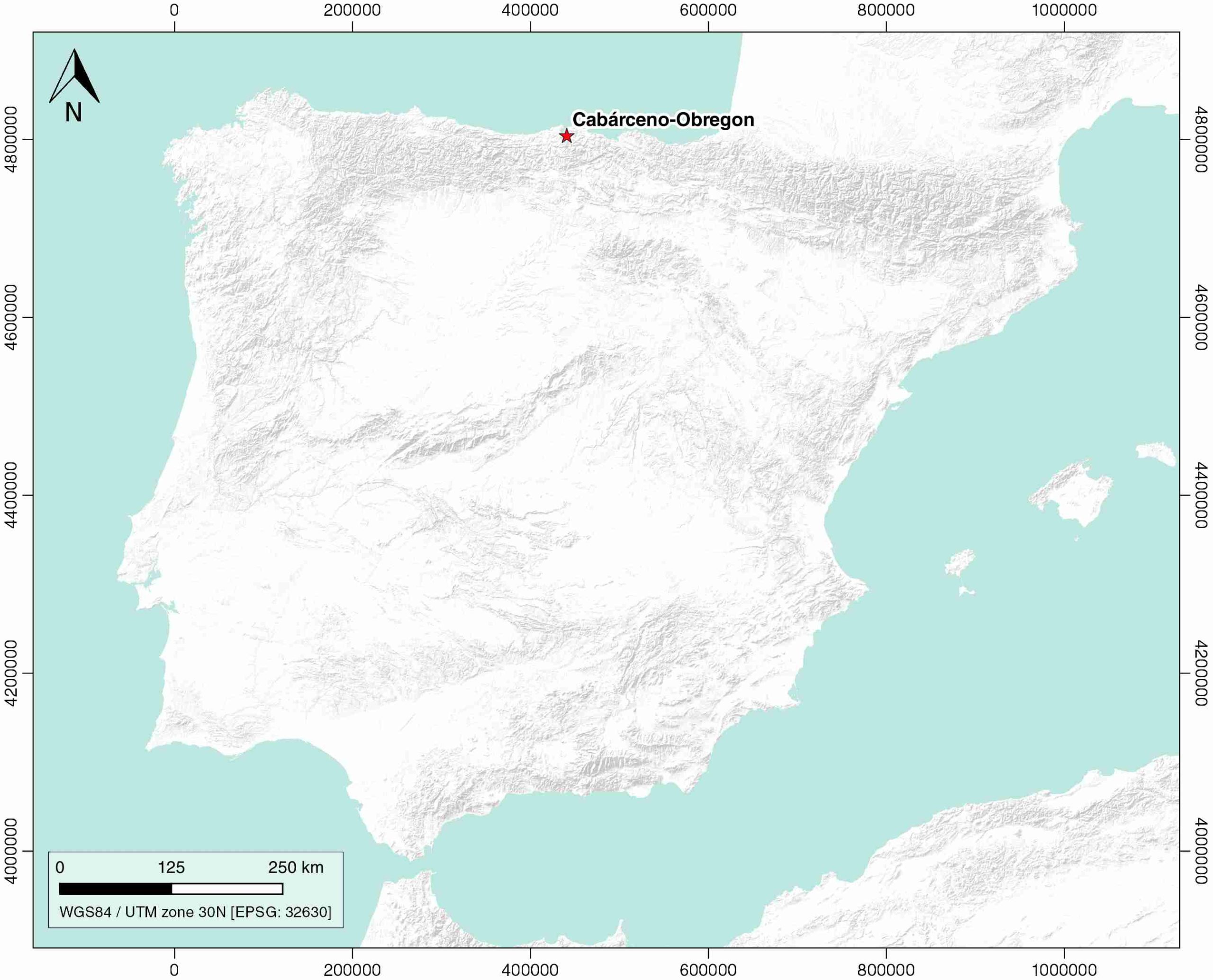
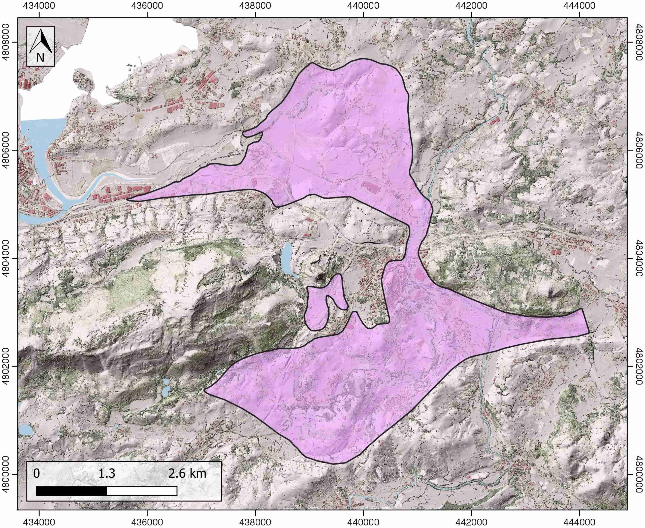
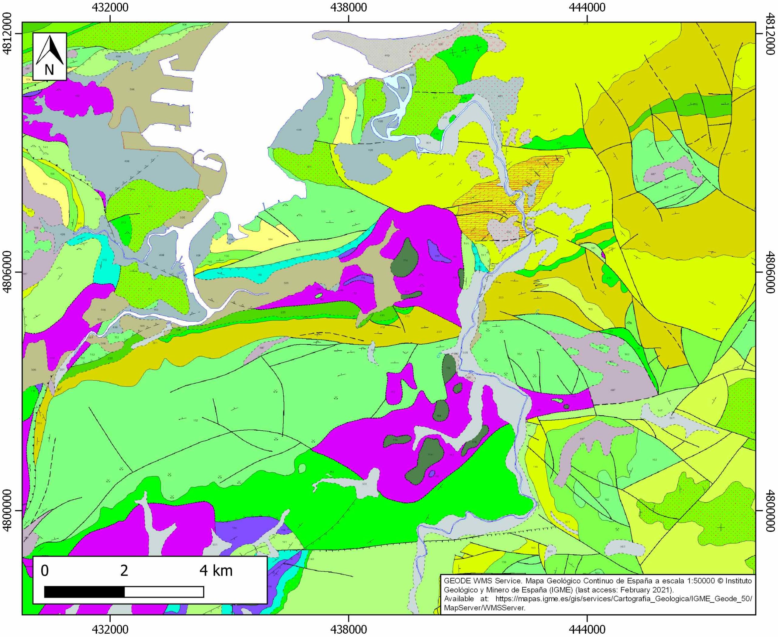
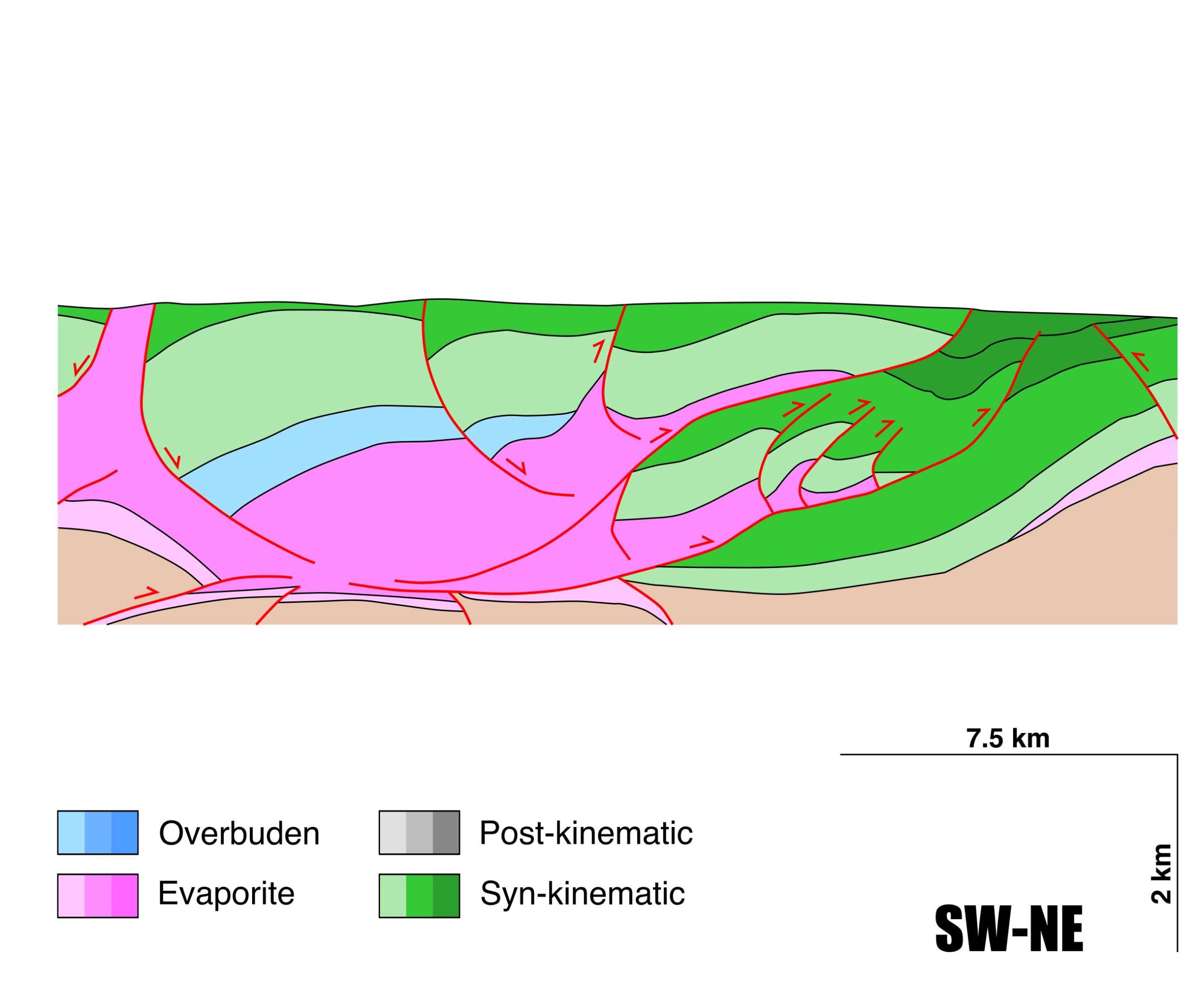
Cabárceno-Obregon
ID #035
General Information
| Structure type | Evaporite Diapir |
| Deformed/Undeformed | Deformed |
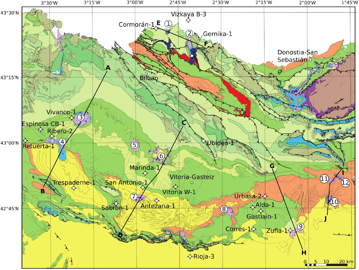
| Geological Setting | Basque-Cantabrian Basin, Cantabrian Block |
| Outcropping/buried | Outcropping |
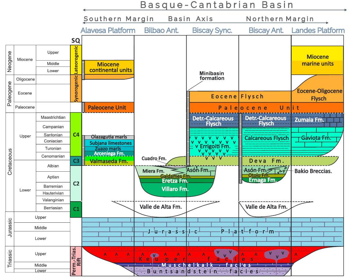
| Evaporite unit/s name | Keuper facies |
| Evaporite unit/s age | Carnian-Rhaetian (Upper Triassic) |
| Evaporite unit/s origin | Marine |
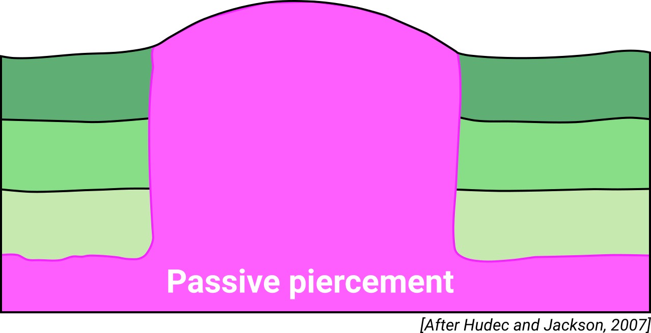
| Classif. (Hudec and Jackson, 2009) | Passive piercement |
| Classif. (Jackson and Talbot, 1986) | Salt roller |
| Age of evaporite flow or deformation (when deformed) | Lower Cretaceous, Oligocene to Miocene |
| Other comments | North dipping listric faults acted during the Lower Cretaceous extension, creating salt rollers and rafts above the Triassic evaporite layer. |
Generic Data
| Unique ID | 35 |
| Name | Cabárceno-Obregon |
| Structure type | Evaporite diapir |
| Deformed/Undeformed | Deformed |
| Buried/Outcropping | Outcropping |
| Geological setting | Basque-Cantabrian Basin |
| Geological Regional Setting | Cantabrian Block |
| Evaporite unit/s name | Keuper facies |
| Evaporite unit/s age | Carnian-Rhaetian (Upper Triassic) |
| Evaporite unit/s era | Mesozoic |
| Evaporite unit/s origin | Marine |
| Evaporite unit/s composition | Gypsum-Halite-Anhydrite-Claystone-Ophites |
| Post-kinematic unit/s (or post-evaporite units when evaporites are undeformed) | Quaternary (alluvial and colluvial detrital deposits) |
| Post-kinematic unit/s age (or post-evaporite units when evaporites are undeformed) | Pleistocene-Holocene |
| Classification (Hudec and Jackson, 2009) | Passive piercement |
| Classification (Jackson and Talbot, 1986) | Salt roller |
| Mining activity? | Y |
| Mining activity start | Roman Empire |
| Mining activity end | |
| Mining galleries? | |
| Mining products | Limestone (other uses) |
| Mining sub-products | |
| Evaporite flow? | Y |
| Age of evaporite flow | Neocomian – Albian (early stage) and Oligocene – Miocene (late stage) |
| Flow or deformation triggering mechanisms | Mesozoic extensional regime in the Basque–Cantabrian Basin (listric faults and salt tectonics, early stage) and Tertiary compression (reverse faulting, reactivated salt diapirism and N-vergent salt sheets by low-angle trusting) |
| Flow-linked structures? | Y |
| Halokinetic structures | Normal high-angle faults / joints / thickness variations / progressive unconformities |
| Post-evaporite and pre-kinematic unit/s (overbuden) | Lower-Middle Jurassic (dolomitic brecchias, limestones and marls) |
| Syn-kinematic unit/s | Late Jurassic – Berriasian (Purbeck facies, shallow marine clastics, clays and marls) / Valanginian – Barremian (Weald facies, limestones, clays and sandstones) / Aptian – Albian (limestones, marls, sandstones and lutites) / Oligocene – Miocene (sandstones and conglomerates) |
| Available seismic profiles | STC84-16 / STC3 / STC18 / STC4 / STC84-13 / STC4-P / STC-16 / STC84-12 / STC84-16 / STC84-11 / STC3 / STC4 / STC84-13 / STC18 / |
| Available boreholes | GAJANO-1 / GAJANO-2 / GAJANO-3 / OLLAS-1 |
| Additional comments | North dipping listric faults acted during the Lower Cretaceous extension, creating salt rollers and rafts above the Triassic evaporite layer. |
Mining Data
| UNIQUE_ID | 35 |
| Minning exploitations within <2km? | Y |
| Historical/Active | Active |
| Exploitation name #1 | EL CASTILLO |
| Exploitation ID (Spanish National Mining Cadastre) #1 | 41975 |
| Municipality #1 | Medio Cudeyo |
| Province #1 | CANTABRIA |
| Company #1 | MANUEL GOMEZ LLOREDA, S.A |
| Main minning Products #1 | Limestone (other uses) |
| Exploitation name #2 | TEJERA DE NAVAS DEL TURUJAL |
| Exploitation ID (Spanish National Mining Cadastre) #2 | 21276/91 |
| Municipality #2 | Cabezón de la Sal |
| Province #2 | CANTABRIA |
| Company #2 | RECICLADOS DE CABEZON S.L. |
| Main minning Products #2 | Claystone |
| Exploitation name #3 | |
| Exploitation ID (Spanish National Mining Cadastre) #3 | |
| Municipality #3 | |
| Province #3 | |
| Company #3 | |
| Main minning Products #3 |
Quantitative Data
| UNIQUE_ID | 35 |
| Outcropping area (km2) | 18.69883 |
| Horizontal intersection area (km2) (when buried) | Not buried |
| Depth of intersection area (km2) (when buried) | Not buried |
| Max. Width (Km) | 6.7 |
| Max. Length (Km) | 7 |
| Max. Evaporites thickness (km) | 1.8 |
| Max. Deformation age (Ma) | 140 |
| Min. Deformation age (Ma) | 12 |
| Deformation stages | 2 |
Reference Data
| UNIQUE_ID | 35 |
| Section source | Cámara, P., 2017. Salt and Strike-Slip Tectonics as Main Drivers in the Structural Evolution of the Basque-Cantabrian Basin, Spain. In Permo-Triassic Salt Provinces of Europe, North Africa and the Atlantic Margins (pp. 371-393). Elsevier. [link] |
| Well / Borehole availability #1 | Cámara, P., 2017. Salt and Strike-Slip Tectonics as Main Drivers in the Structural Evolution of the Basque-Cantabrian Basin, Spain. In Permo-Triassic Salt Provinces of Europe, North Africa and the Atlantic Margins (pp. 371-393). Elsevier. [link] |
| Well / Borehole availability #2 | n.a. |
| Available data (Stratigraphy) #1 | Cámara, P., 2017. Salt and Strike-Slip Tectonics as Main Drivers in the Structural Evolution of the Basque-Cantabrian Basin, Spain. In Permo-Triassic Salt Provinces of Europe, North Africa and the Atlantic Margins (pp. 371-393). Elsevier. [link] |
| Available data (Stratigraphy) #2 | Cámara, P., 2020. Inverted turtle salt anticlines in the eastern basque-cantabrian basin, Spain. Marine and Petroleum Geology, 104358. [link] |
| Available data (Stratigraphy) #3 | Pujalte, V., 1982. La evolución paleogeográfica de la cuenca ‘Wealdense’de Cantabria. Cuadernos de Geología Ibérica, 8, 65-83. [link] |
| Available data (Stratigraphy) #4 | Pujalte, V., 1976. Posibilidad de una nueva división estratigráfica de los sedimentos no marinos del Jurásico superior y Cretácico inferior, en la provincia de Santander. Boletín Geológico Minero, 57, 101–118. |
| Available data (Stratigraphy) #5 | Pedrera, A., García‐Senz, J., Ayala, C., Ruiz‐Constán, A., Rodríguez‐Fernández, L. R., Robador, A., González Menéndez, L., 2017. Reconstruction of the exhumed mantle across the North Iberian Margin by crustal‐scale 3‐D gravity inversion and geological cross section. Tectonics, 36, 3155-3177. [link] |
| Available data (Stratigraphy) #6 | de las Heras, J. G., de Vega, J. A. R., 1999. Dissolution Mining and environmental Effects in Polanco (Cantabria – Spain). – In (Fernández Rubio, R., ed.): Mine, Water & Environment II. – p. 807-814. [link] |
| Regional Stratigraphy | Pedrera, A., García‐Senz, J., Ayala, C., Ruiz‐Constán, A., Rodríguez‐Fernández, L. R., Robador, A., González Menéndez, L., 2017. Reconstruction of the exhumed mantle across the North Iberian Margin by crustal‐scale 3‐D gravity inversion and geological cross section. Tectonics, 36, 3155-3177. [link] |
| Seismic data availability #1 | n.a. |
| Seismic data availability #2 | n.a. |
| Seismic data availability #3 | n.a. |
| Available data (Structure) #1 | Cámara, P., 2017. Salt and Strike-Slip Tectonics as Main Drivers in the Structural Evolution of the Basque-Cantabrian Basin, Spain. In Permo-Triassic Salt Provinces of Europe, North Africa and the Atlantic Margins (pp. 371-393). Elsevier. [link] |
| Available data (Structure) #2 | Pedrera, A., García‐Senz, J., Ayala, C., Ruiz‐Constán, A., Rodríguez‐Fernández, L. R., Robador, A., González Menéndez, L., 2017. Reconstruction of the exhumed mantle across the North Iberian Margin by crustal‐scale 3‐D gravity inversion and geological cross section. Tectonics, 36, 3155-3177. [link] |
| Available data (Structure) #3 | Pujalte, V., 1982. La evolución paleogeográfica de la cuenca ‘Wealdense’de Cantabria. Cuadernos de Geología Ibérica, 8, 65-83. [link] |
| Available data (Structure) #4 | n.a. |
| Available data (Structure) #5 | n.a. |
| Available data (Structure) #6 | n.a. |
| Available data (Analogue modelling) #1 | n.a. |
| Available data (Analogue modelling) #2 | n.a. |
| Available data (Analogue modelling) #3 | n.a. |
| Available data (Gravimetry – Tomography) #1 | Ayala, C., Bohoyo, F., Maestro, A., Reguera, M. I., Torne, M., Rubio, F., Fernández, M., García-Lobón, J. L., 2016. Updated Bouguer anomalies of the Iberian Peninsula: a new perspective to interpret the regional geology. Journal of Maps, 12(5), 1089-1092. [link] |
| Available data (Gravimetry – Tomography) #2 | n.a. |
| Available data (Gravimetry – Tomography) #3 | n.a. |
| Available data (Geochemistry) #1 | Béziat, D., Joron, J.L., Monchoux, P., Treuil, M., Walgenwitz, F., 1991. Geodynamic implications of geochemical data for the Pyrenean ophites (Spain-France). Chemical Geology, 89, 243-262. [link] |
| Available data (Geochemistry) #2 | Iribar, V., Ábalos, B. 2011. The geochemical and isotopic record of evaporite recycling in spas and salterns of the Basque Cantabrian basin, Spain. Applied geochemistry, 26, 1315-1329. [link] |
| Available data (Geochemistry) #3 | Ortí, F., García-Veigas, J., Rossell, L., Jurado, M. J., Utrilla, R., 1996. Formaciones salinas de las cuencas triásicas en la Península Ibérica: Caracterización Petrológica y Geoquímica. Cuadernos de Geología Ibérica, 20, 13-35. [link] |
| Available data (Geochemistry) #4 | de las Heras, J. G., de Vega, J. A. R., 1999. Dissolution Mining and environmental Effects in Polanco (Cantabria – Spain). – In (Fernández Rubio, R., ed.): Mine, Water & Environment II. – p. 807-814. [link] |
| Available data (Petrophysics) #1 | Llamas, B., Castañeda, M. C., Laín, C., Pous, J., 2017. Study of the Basque–Cantabrian basin as a suitable region for the implementation of an energy storage system based on compressed air energy storage (CAES). Environmental Earth Sciences, 76(5), 204. [link] |
| Available data (Petrophysics) #2 | Soto, R., Beamud, E., Roca, E., Carola, E., Almar, Y., 2017. Distinguishing the effect of diapir growth on magnetic fabrics of syn-diapiric overburden rocks: Basque-Cantabrian basin, Northern Spain. Terra Nova 29, 191-201. [link] |
| IGME Geological Map (MAGNA50) Sheet number | 35-Santander. [link] |
| Other Maps #1 (source) | Perona, J., 2016. Mineralizaciones de Pb-Zn asociadas a los diapiros de Murguía y Orduña (Cuenca Vasco-Cantábrica) [PhD thesis]: Barcelona, Universitat de Barcelona, 281 pp. [link] |
| Other Maps #2 (source) | Poprawski, Y., Basile, C., 2018. Long-lasting diapir growth history in the Basque-Cantabrian basin (Northern Spain): a review. Conference poster, Advances in Salt Tectonics: Observations, Applications, and Perspective: In Honor of Martin P.A. Jackson. [link] |
| Other related references #1 | García-Codrón, J. C., 1989. Los lapiaces de agujas de Peña Cabarga (Cantabria): génesis y significado de una forma original. Cuadernos de Investigación Geográfica, 15, 17-28. [link] |
| Other related references #2 | Sanz, T., Lago, M., Gil, A., Galé, C., Ramajo, J., Ubide, T., Pocoví, A., Tierz, P., Larrea, P., 2013. The Upper Triassic alkaline magmatism in the NW Iberian Chain (Spain). Journal of Iberian Geology, 39, 202-222. [link] |
| Other related references #3 | Kennedy, W. J., and Bilotte, M., 2014. Cenomanian ammonites from Santander (Cantabria) and Sopeira (Aragón, southcentral Pyrenees), northern Spain. Treballs del Museu de Geologia de Barcelona, 20, 21–32. [link] |
| Other related references #4 | Martín-Chivelet, J., López-Gómez, J., Aguado, R., Arias, C., Arribas, J., Arribas, M. E., … , Casas-Sainz, A., 2019. The Late Jurassic–Early Cretaceous Rifting. In (Quesada C., Oliveira J., eds.): The Geology of Iberia: A Geodynamic Approach. Regional Geology Reviews. Springer, Cham. [link] |
Well and Seismic Data
| UNIQUE_ID | 35 |
| Seismic survey name #1 | 7B3-STC84 |
| Across structure? #1 | Y |
| Seismic profile ID (IGME) #1 | 9088 |
| Seismic profile code #1 | 13660 |
| Seismic profile name #1 | STC84-16 |
| Seismic survey year #1 | 1984 |
| Data repository #1 | SIGEOF Data Catalogue (Section available under request). ©Instituto Geológico y Minero de España (IGME). https://info.igme.es/SIGEOF/ |
| Length (km) #1 | 21.93 |
| Seismic survey name #2 | 7B3-STC |
| Across structure? #2 | Y |
| Seismic profile ID (IGME) #2 | 9080 |
| Seismic profile code #2 | 13652 |
| Seismic profile name #2 | STC3 |
| Seismic survey year #2 | 1981 |
| Data repository #2 | SIGEOF Data Catalogue (Section available under request). ©Instituto Geológico y Minero de España (IGME). https://info.igme.es/SIGEOF/ |
| Length (km) #2 | 12.32 |
| Seismic survey name #3 | 7B3-STC |
| Across structure? #3 | Y |
| Seismic profile ID (IGME) #3 | 9081 |
| Seismic profile code #3 | 13653 |
| Seismic profile name #3 | STC18 |
| Seismic survey year #3 | 1981 |
| Data repository #3 | SIGEOF Data Catalogue (Section available under request). ©Instituto Geológico y Minero de España (IGME). https://info.igme.es/SIGEOF/ |
| Length (km) #3 | 16.97 |
| Seismic survey name #4 | 7B3-STC4 |
| Across structure? #4 | Y |
| Seismic profile ID (IGME) #4 | 9085 |
| Seismic profile code #4 | 13657 |
| Seismic profile name #4 | STC4 |
| Seismic survey year #4 | 1981 |
| Data repository #4 | SIGEOF Data Catalogue (Section available under request). ©Instituto Geológico y Minero de España (IGME). https://info.igme.es/SIGEOF/ |
| Length (km) #4 | 23.79 |
| Seismic survey name #5 | 7B3-STC84 |
| Across structure? #5 | Y |
| Seismic profile ID (IGME) #5 | 9090 |
| Seismic profile code #5 | 13662 |
| Seismic profile name #5 | STC84-13 |
| Seismic survey year #5 | 1984 |
| Data repository #5 | SIGEOF Data Catalogue (Section available under request). ©Instituto Geológico y Minero de España (IGME). https://info.igme.es/SIGEOF/ |
| Length (km) #5 | 13.60 |
| Seismic survey name #6 | 7B3-STC |
| Across structure? #6 | N (within 3km) |
| Seismic profile ID (IGME) #6 | 9079 |
| Seismic profile code #6 | 13651 |
| Seismic profile name #6 | STC4-P |
| Seismic survey year #6 | 1981 |
| Data repository #6 | SIGEOF Data Catalogue (Section available under request). ©Instituto Geológico y Minero de España (IGME). https://info.igme.es/SIGEOF/ |
| Length (km) #6 | 29.63 |
| Seismic survey name #7 | 7B2-STC |
| Across structure? #7 | N (within 3km) |
| Seismic profile ID (IGME) #7 | 9062 |
| Seismic profile code #7 | 13634 |
| Seismic profile name #7 | STC-16 |
| Seismic survey year #7 | 1981 |
| Data repository #7 | SIGEOF Data Catalogue (Section available under request). ©Instituto Geológico y Minero de España (IGME). https://info.igme.es/SIGEOF/ |
| Length (km) #7 | 75.75 |
| Seismic survey name #8 | 7B3-STC84 |
| Across structure? #8 | N (within 3km) |
| Seismic profile ID (IGME) #8 | 9091 |
| Seismic profile code #8 | 13663 |
| Seismic profile name #8 | STC84-12 |
| Seismic survey year #8 | 1984 |
| Data repository #8 | SIGEOF Data Catalogue (Section available under request). ©Instituto Geológico y Minero de España (IGME). https://info.igme.es/SIGEOF/ |
| Length (km) #8 | 17.17 |
| Seismic survey name #9 | 7B3-STC84 |
| Across structure? #9 | N (within 3km) |
| Seismic profile ID (IGME) #9 | 9088 |
| Seismic profile code #9 | 13660 |
| Seismic profile name #9 | STC84-16 |
| Seismic survey year #9 | 1984 |
| Data repository #9 | SIGEOF Data Catalogue (Section available under request). ©Instituto Geológico y Minero de España (IGME). https://info.igme.es/SIGEOF/ |
| Length (km) #9 | 21.93 |
| Seismic survey name #10 | 7B3-STC84 |
| Across structure? #10 | N (within 3km) |
| Seismic profile ID (IGME) #10 | 9092 |
| Seismic profile code #10 | 13664 |
| Seismic profile name #10 | STC84-11 |
| Seismic survey year #10 | 1984 |
| Data repository #10 | SIGEOF Data Catalogue (Section available under request). ©Instituto Geológico y Minero de España (IGME). https://info.igme.es/SIGEOF/ |
| Length (km) #10 | 21.62 |
| Seismic survey name #11 | 7B3-STC |
| Across structure? #11 | N (within 3km) |
| Seismic profile ID (IGME) #11 | 9080 |
| Seismic profile code #11 | 13652 |
| Seismic profile name #11 | STC3 |
| Seismic survey year #11 | 1981 |
| Data repository #11 | SIGEOF Data Catalogue (Section available under request). ©Instituto Geológico y Minero de España (IGME). https://info.igme.es/SIGEOF/ |
| Length (km) #11 | 12.32 |
| Seismic survey name #12 | 7B3-STC4 |
| Across structure? #12 | N (within 3km) |
| Seismic profile ID (IGME) #12 | 9085 |
| Seismic profile code #12 | 13657 |
| Seismic profile name #12 | STC4 |
| Seismic survey year #12 | 1981 |
| Data repository #12 | SIGEOF Data Catalogue (Section available under request). ©Instituto Geológico y Minero de España (IGME). https://info.igme.es/SIGEOF/ |
| Length (km) #12 | 23.79 |
| Seismic survey name #13 | 7B3-STC84 |
| Across structure? #13 | N (within 3km) |
| Seismic profile ID (IGME) #13 | 9090 |
| Seismic profile code #13 | 13662 |
| Seismic profile name #13 | STC84-13 |
| Seismic survey year #13 | 1984 |
| Data repository #13 | SIGEOF Data Catalogue (Section available under request). ©Instituto Geológico y Minero de España (IGME). https://info.igme.es/SIGEOF/ |
| Length (km) #13 | 13.60 |
| Seismic survey name #14 | 7B3-STC |
| Across structure? #14 | N (within 3km) |
| Seismic profile ID (IGME) #14 | 9081 |
| Seismic profile code #14 | 13653 |
| Seismic profile name #14 | STC18 |
| Seismic survey year #14 | 1981 |
| Data repository #14 | SIGEOF Data Catalogue (Section available under request). ©Instituto Geológico y Minero de España (IGME). https://info.igme.es/SIGEOF/ |
| Length (km) #14 | 16.97 |
| Seismic survey name #15 | |
| Across structure? #15 | |
| Seismic profile ID (IGME) #15 | |
| Seismic profile code #15 | |
| Seismic profile name #15 | |
| Seismic survey year #15 | |
| Data repository #15 | |
| Length (km) #15 | |
| Seismic survey name #16 | |
| Across structure? #16 | |
| Seismic profile ID (IGME) #16 | |
| Seismic profile code #16 | |
| Seismic profile name #16 | |
| Seismic survey year #16 | |
| Data repository #16 | |
| Length (km) #16 | |
| Seismic survey name #17 | |
| Across structure? #17 | |
| Seismic profile ID (IGME) #17 | |
| Seismic profile code #17 | |
| Seismic profile name #17 | |
| Seismic survey year #17 | |
| Data repository #17 | |
| Length (km) #17 | |
| Seismic survey name #18 | |
| Across structure? #18 | |
| Seismic profile ID (IGME) #18 | |
| Seismic profile code #18 | |
| Seismic profile name #18 | |
| Seismic survey year #18 | |
| Data repository #18 | |
| Length (km) #18 | |
| Seismic survey name #19 | |
| Across structure? #19 | |
| Seismic profile ID (IGME) #19 | |
| Seismic profile code #19 | |
| Seismic profile name #19 | |
| Seismic survey year #19 | |
| Data repository #19 | |
| Length (km) #19 | |
| Seismic survey name #20 | |
| Across structure? #20 | |
| Seismic profile ID (IGME) #20 | |
| Seismic profile code #20 | |
| Seismic profile name #20 | |
| Seismic survey year #20 | |
| Data repository #20 | |
| Length (km) #20 | |
| Seismic survey name #21 | |
| Across structure? #21 | |
| Seismic profile ID (IGME) #21 | |
| Seismic profile code #21 | |
| Seismic profile name #21 | |
| Seismic survey year #21 | |
| Data repository #21 | |
| Length (km) #21 | |
| Borehole name #1 | GAJANO-1 |
| Company #1 | IGME |
| Traget #1 | GYPSUM |
| Across structure? #1 | Y |
| Borehole name #2 | GAJANO-2 |
| Company #2 | IGME |
| Traget #2 | GYPSUM |
| Across structure? #2 | Y |
| Borehole name #3 | GAJANO-3 |
| Company #3 | IGME |
| Traget #3 | GYPSUM |
| Across structure? #3 | Y |
| Borehole name #4 | OLLAS-1 |
| Company #4 | IGME |
| Traget #4 | BASE METALS |
| Across structure? #4 | N (within 5 km) |
| Borehole name #5 | |
| Company #5 | |
| Traget #5 | |
| Across structure? #5 | |
| Borehole name #6 | |
| Company #6 | |
| Traget #6 | |
| Across structure? #6 | |
| Borehole name #7 | |
| Company #7 | |
| Traget #7 | |
| Across structure? #7 | |
| Borehole name #8 | |
| Company #8 | |
| Traget #8 | |
| Across structure? #8 | |
| Borehole name #9 | |
| Company #9 | |
| Traget #9 | |
| Across structure? #9 | |
| Borehole name #10 | |
| Company #10 | |
| Traget #10 | |
| Across structure? #10 | |
| Borehole name #11 | |
| Company #11 | |
| Traget #11 | |
| Across structure? #11 | |
| Borehole name #12 | |
| Company #12 | |
| Traget #12 | |
| Across structure? #12 | |
| Borehole name #13 | |
| Company #13 | |
| Traget #13 | |
| Across structure? #13 | |
| Borehole name #14 | |
| Company #14 | |
| Traget #14 | |
| Across structure? #14 | |
| Borehole name #15 | |
| Company #15 | |
| Traget #15 | |
| Across structure? #15 |
Geographical Data (EPSG:4326 - WGS 84)
| UNIQUE_ID | 35 |
| X Centroid (Structure shape) | -3.742561 |
| Y Centroid (Structure shape) | -3.742561 |
| Xmin (Structure shape) | -3.795051 |
| Xmax (Structure shape) | -3.689048 |
| Ymin (Structure shape) | 43.352100 |
| Ymax (Structure shape) | 43.419736 |
| Xmin seismic line #1 | -3.780938 |
| Xmax seismic line #1 | -3.511197 |
| Ymin seismic line #1 | 43.404253 |
| Ymax seismic line #1 | 43.417104 |
| Xmin seismic line #2 | -3.768330 |
| Xmax seismic line #2 | -3.745639 |
| Ymin seismic line #2 | 43.326362 |
| Ymax seismic line #2 | 43.435674 |
| Xmin seismic line #3 | -3.702496 |
| Xmax seismic line #3 | -3.684365 |
| Ymin seismic line #3 | 43.326545 |
| Ymax seismic line #3 | 43.478552 |
| Xmin seismic line #4 | -3.764553 |
| Xmax seismic line #4 | -3.475085 |
| Ymin seismic line #4 | 43.379730 |
| Ymax seismic line #4 | 43.391190 |
| Xmin seismic line #5 | -3.725920 |
| Xmax seismic line #5 | -3.718099 |
| Ymin seismic line #5 | 43.338082 |
| Ymax seismic line #5 | 43.460272 |
| Xmin seismic line #6 | -4.107119 |
| Xmax seismic line #6 | -3.743163 |
| Ymin seismic line #6 | 43.369100 |
| Ymax seismic line #6 | 43.390044 |
| Xmin seismic line #7 | -4.427405 |
| Xmax seismic line #7 | -3.495399 |
| Ymin seismic line #7 | 43.333136 |
| Ymax seismic line #7 | 43.358067 |
| Xmin seismic line #8 | -3.673973 |
| Xmax seismic line #8 | -3.650813 |
| Ymin seismic line #8 | 43.330963 |
| Ymax seismic line #8 | 43.484396 |
| Xmin seismic line #9 | -3.780938 |
| Xmax seismic line #9 | -3.511197 |
| Ymin seismic line #9 | 43.404253 |
| Ymax seismic line #9 | 43.417104 |
| Xmin seismic line #10 | -3.779088 |
| Xmax seismic line #10 | -3.512766 |
| Ymin seismic line #10 | 43.425706 |
| Ymax seismic line #10 | 43.434875 |
| Xmin seismic line #11 | -3.768330 |
| Xmax seismic line #11 | -3.745639 |
| Ymin seismic line #11 | 43.326362 |
| Ymax seismic line #11 | 43.435674 |
| Xmin seismic line #12 | -3.764553 |
| Xmax seismic line #12 | -3.475085 |
| Ymin seismic line #12 | 43.379730 |
| Ymax seismic line #12 | 43.391190 |
| Xmin seismic line #13 | -3.725920 |
| Xmax seismic line #13 | -3.718099 |
| Ymin seismic line #13 | 43.338082 |
| Ymax seismic line #13 | 43.460272 |
| Xmin seismic line #14 | -3.702496 |
| Xmax seismic line #14 | -3.684365 |
| Ymin seismic line #14 | 43.326545 |
| Ymax seismic line #14 | 43.478552 |
| Xmin seismic line #15 | |
| Xmax seismic line #15 | |
| Ymin seismic line #15 | |
| Ymax seismic line #15 | |
| Xmin seismic line #16 | |
| Xmax seismic line #16 | |
| Ymin seismic line #16 | |
| Ymax seismic line #16 | |
| Xmin seismic line #17 | |
| Xmax seismic line #17 | |
| Ymin seismic line #17 | |
| Ymax seismic line #17 | |
| Xmin seismic line #18 | |
| Xmax seismic line #18 | |
| Ymin seismic line #18 | |
| Ymax seismic line #18 | |
| Xmin seismic line #19 | |
| Xmax seismic line #19 | |
| Ymin seismic line #19 | |
| Ymax seismic line #19 | |
| Xmin seismic line #20 | |
| Xmax seismic line #20 | |
| Ymin seismic line #20 | |
| Ymax seismic line #20 | |
| Xmin seismic line #21 | |
| Xmax seismic line #21 | |
| Ymin seismic line #21 | |
| Ymax seismic line #21 | |
| X borehole #1 | -3.754066 |
| Y borehole #1 | 43.412500 |
| X borehole #2 | -3.750399 |
| Y borehole #2 | 43.415676 |
| X borehole #3 | -3.746606 |
| Y borehole #3 | 43.408497 |
| X borehole #4 | -3.840034 |
| Y borehole #4 | 43.367878 |
| X borehole #5 | |
| Y borehole #5 | |
| X borehole #6 | |
| Y borehole #6 | |
| X borehole #7 | |
| Y borehole #7 | |
| X borehole #8 | |
| Y borehole #8 | |
| X borehole #9 | |
| Y borehole #9 | |
| X borehole #10 | |
| Y borehole #10 | |
| X borehole #11 | |
| Y borehole #11 | |
| X borehole #12 | |
| Y borehole #12 | |
| X borehole #13 | |
| Y borehole #13 | |
| X borehole #14 | |
| Y borehole #14 | |
| X borehole #15 | |
| Y borehole #15 |

