General Information
| Structure type | Evaporite Diapir |
| Deformed/Undeformed | Deformed |
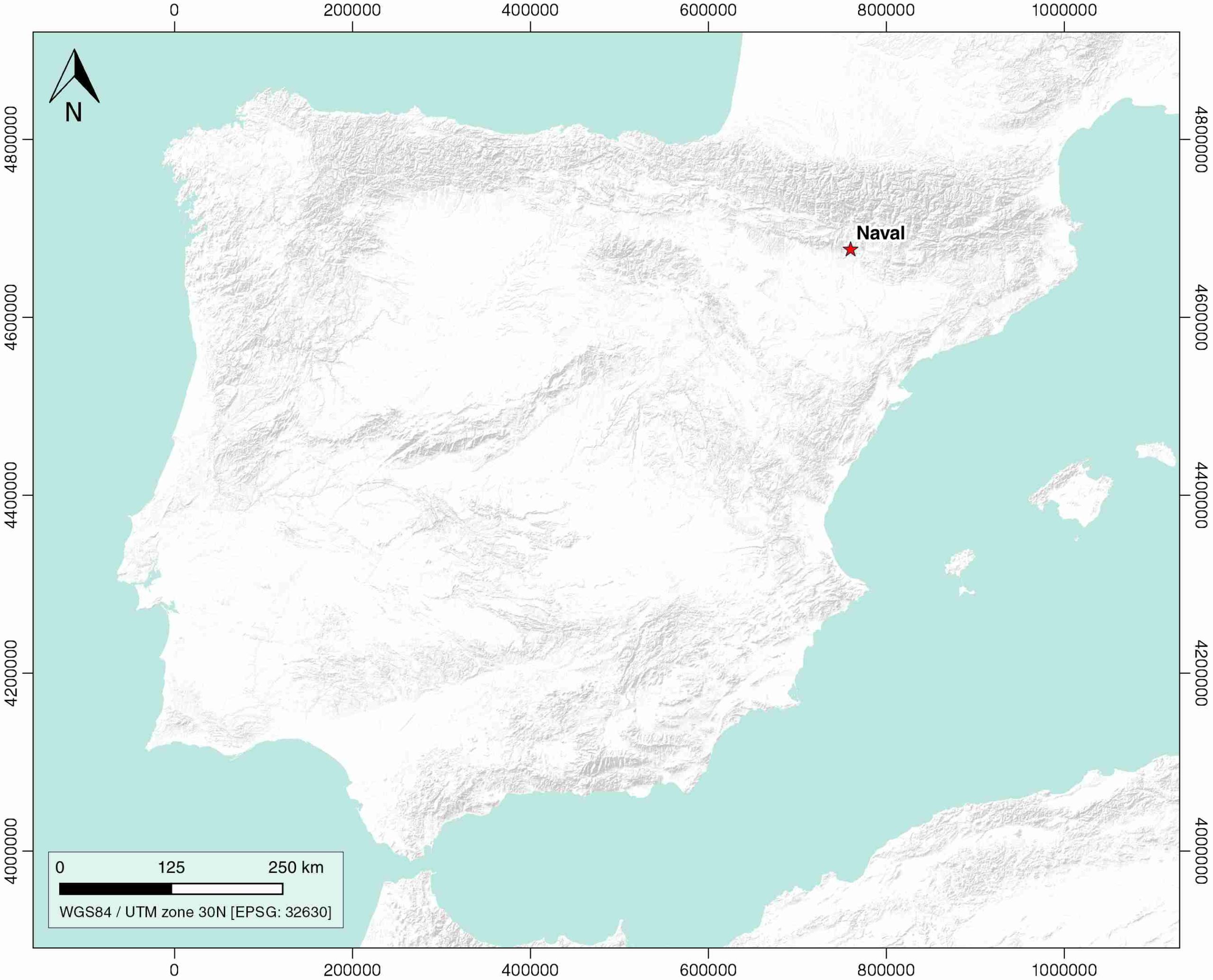
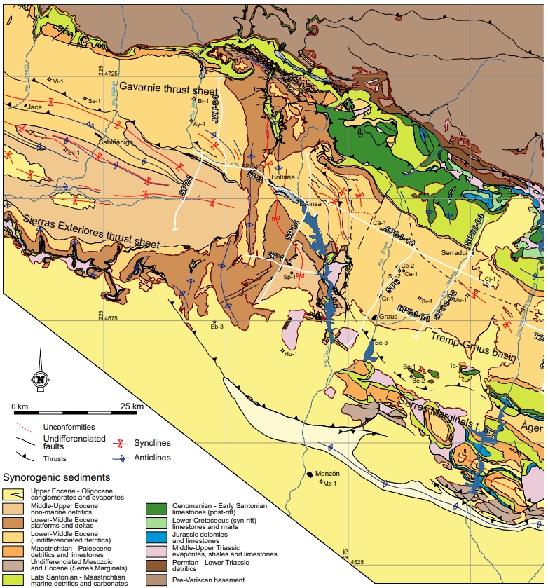
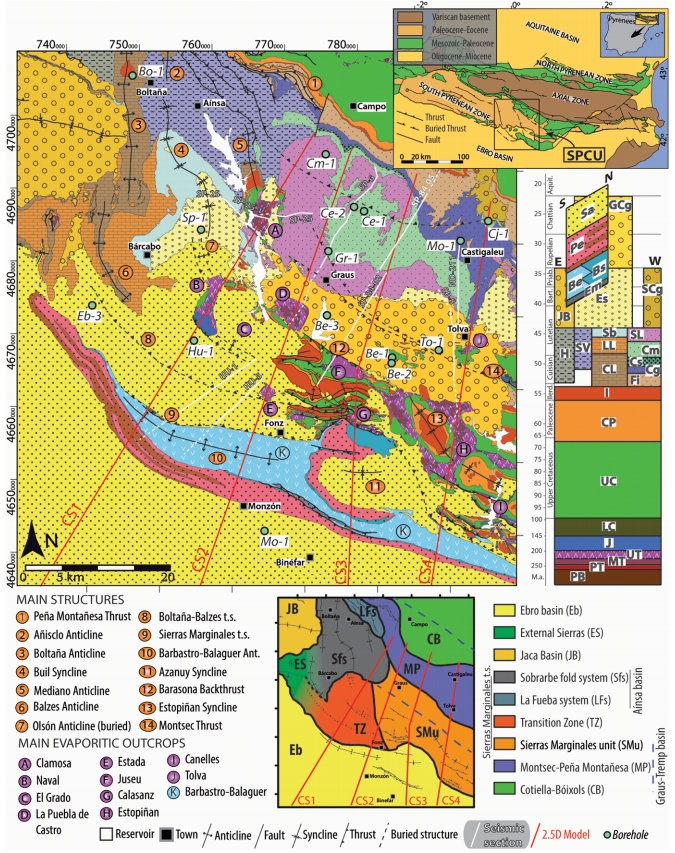
| Geological Setting | South Pyrenees Central Unit (Sierras Marginales; Boltaña-Balzes thrust sheet), Southern Pyrenees |
| Outcropping/buried | Outcropping |
| Evaporite unit/s name | El Pont de Suert Fm. |
| Evaporite unit/s age | Upper Anisian and Carnian-Rhaetian (Middle-Upper Triassic) |
| Evaporite unit/s origin | Marine |
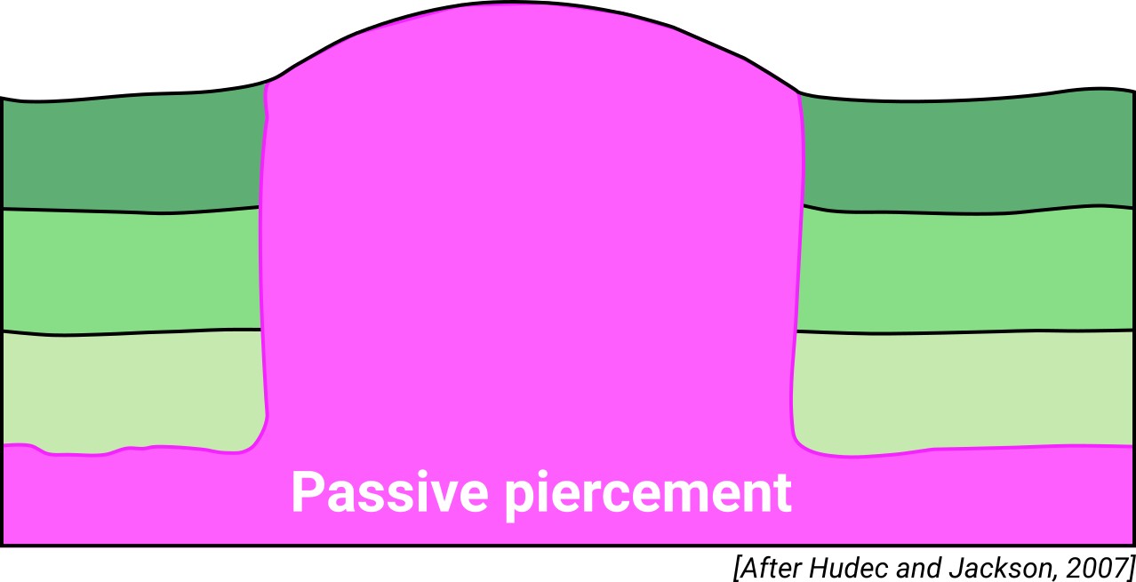
| Classif. (Hudec and Jackson, 2009) | Passive piercement |
| Classif. (Jackson and Talbot, 1986) | Salt wall |
| Age of evaporite flow or deformation (when deformed) | Eocene, Oligocene to Miocene |
| Other comments | Evaporite extrusion favoured by local cover weakening caused by differential displacements of thrust sheets and enhanced by the presence of an evaporite-cored hanging-wall anticline (see i.e. Santolaria et al., 2014). |
Generic Data
| Unique ID | 69 |
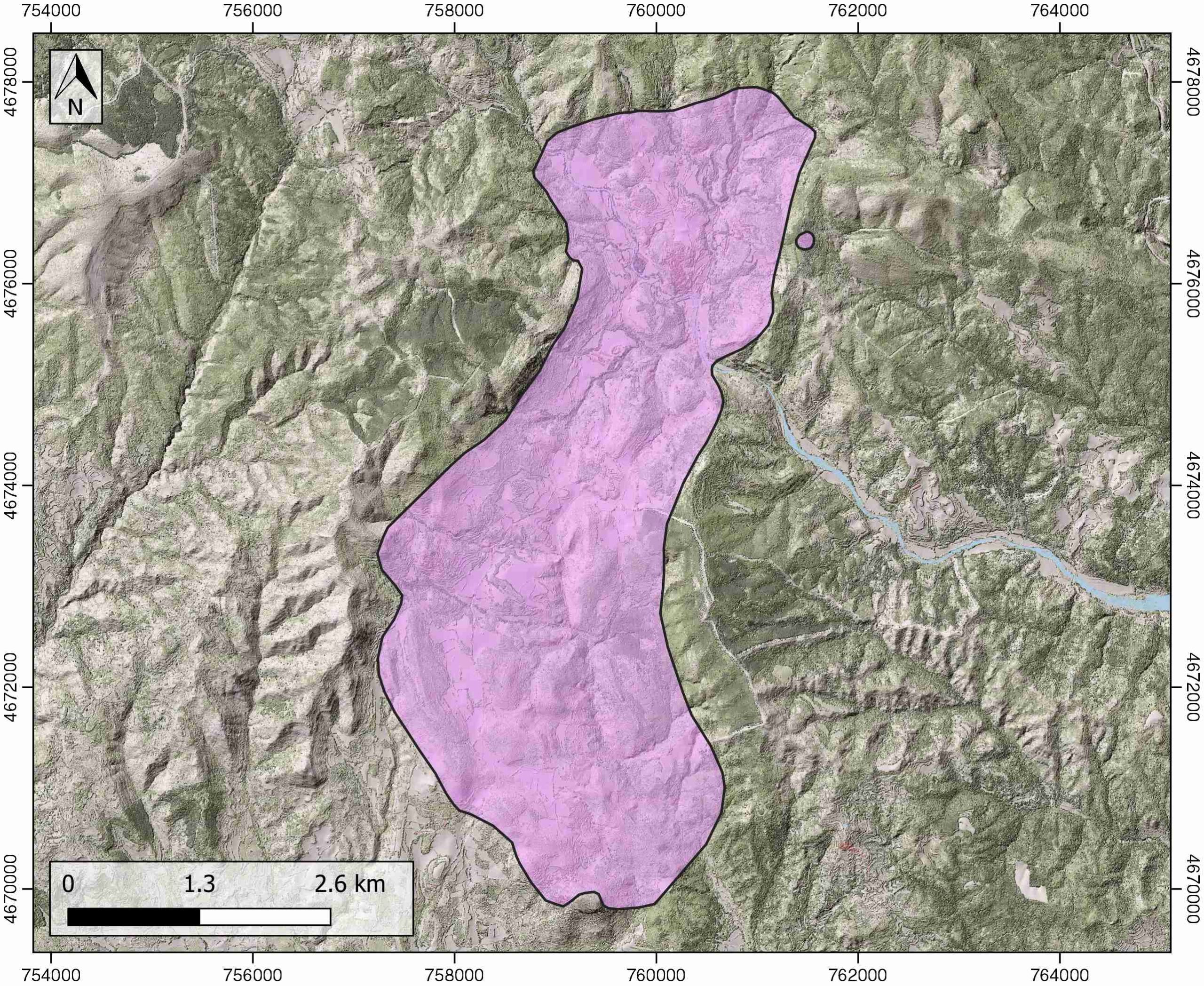
| Name | Naval |
| Structure type | Evaporite diapir |
| Deformed/Undeformed | Deformed |
| Buried/Outcropping | Outcropping |
| Geological setting | Southern Pyrenees |
| Geological Regional Setting | South Pyrenees Central Unit (Sierras Marginales; Boltaña-Balzes thrust sheet) |
| Evaporite unit/s name | El Pont de Suert Fm. (Middle Muschelkalk and Keuper Facies) |
| Evaporite unit/s age | Upper Anisian and Carnian-Rhaetian (Middle-Upper Triassic) |
| Evaporite unit/s era | Mesozoic |
| Evaporite unit/s origin | Marine |
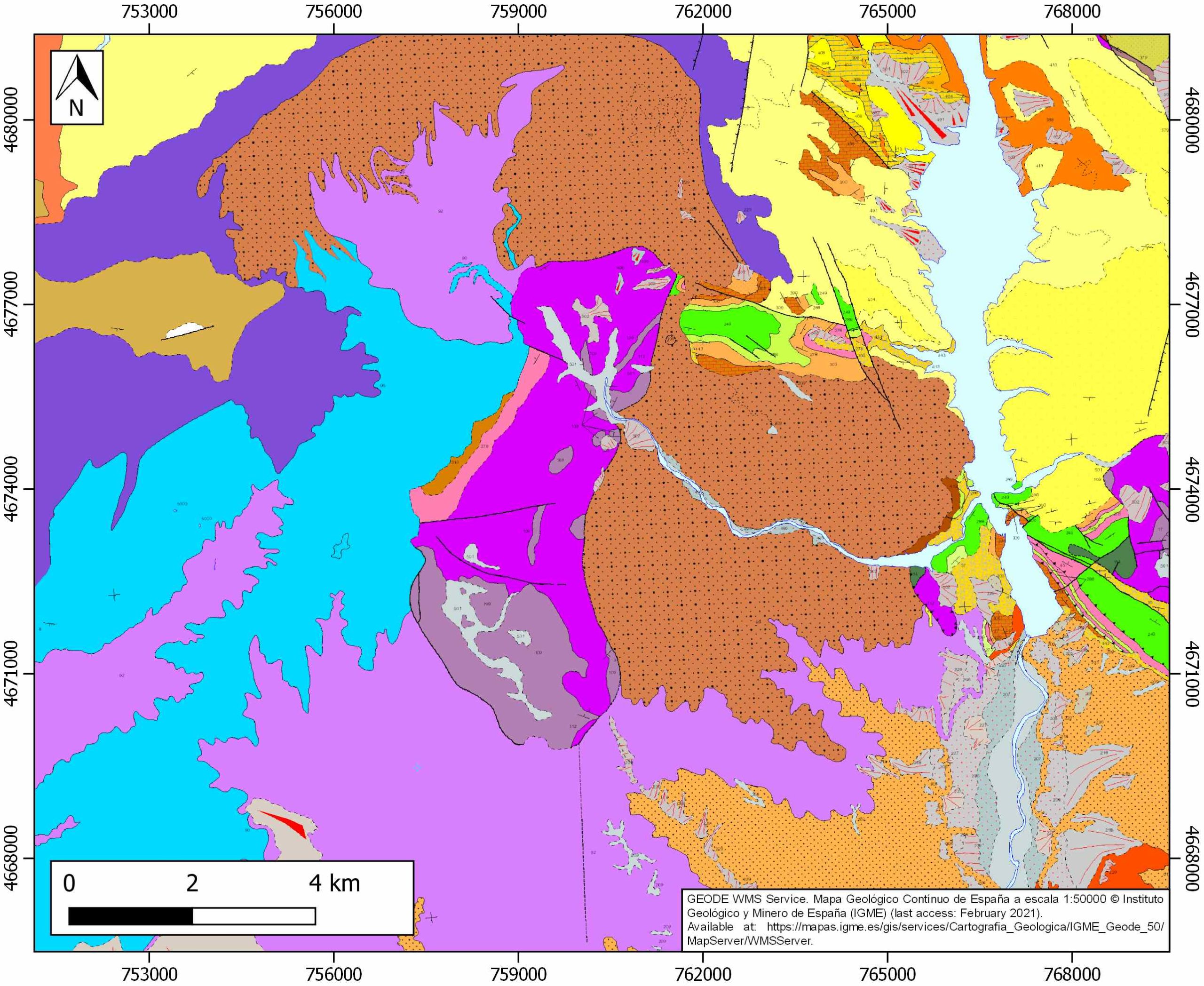
| Evaporite unit/s composition | Shale-Gypsum-Anhydrite-Ophites |
| Post-kinematic unit/s (or post-evaporite units when evaporites are undeformed) | Quaternary (alluvial and colluvial detrital deposits) |
| Post-kinematic unit/s age (or post-evaporite units when evaporites are undeformed) | Pleistocene-Holocene |
| Classification (Hudec and Jackson, 2009) | Passive piercement |
| Classification (Jackson and Talbot, 1986) | Salt wall |
| Mining activity? | N |
| Mining activity start | |
| Mining activity end | |
| Mining galleries? | |
| Mining products | |
| Mining sub-products | |
| Evaporite flow? | Y |
| Age of evaporite flow | Lutetian-Priabonian (early stage) ; Late Oligocene-Early Miocene (late stage) |
| Flow or deformation triggering mechanisms | Translation–rotation of the western end of the Sierras Marginales thrust sheet (early stage) and compression (late stage) |
| Flow-linked structures? | Y |
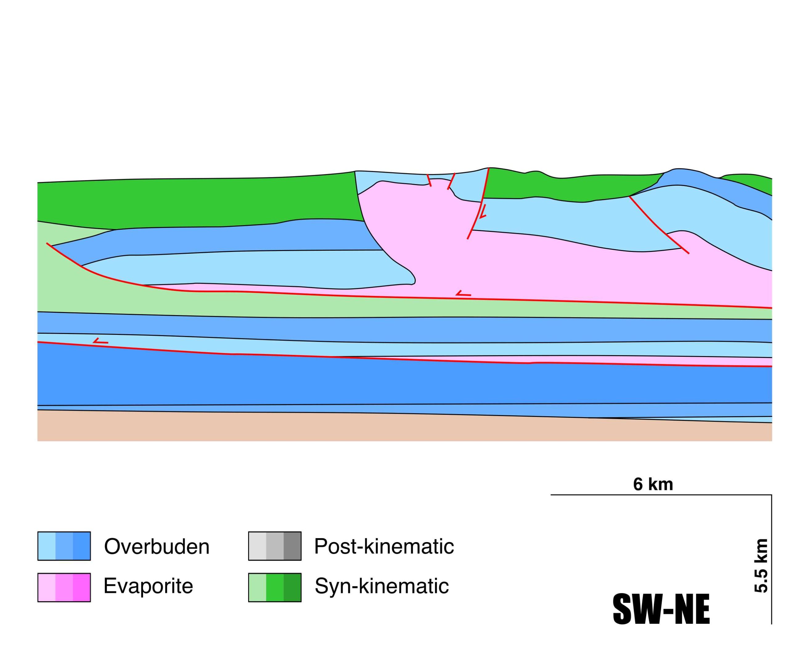
| Halokinetic structures | Progressive unconformities / Normal faults / Thickness variations |
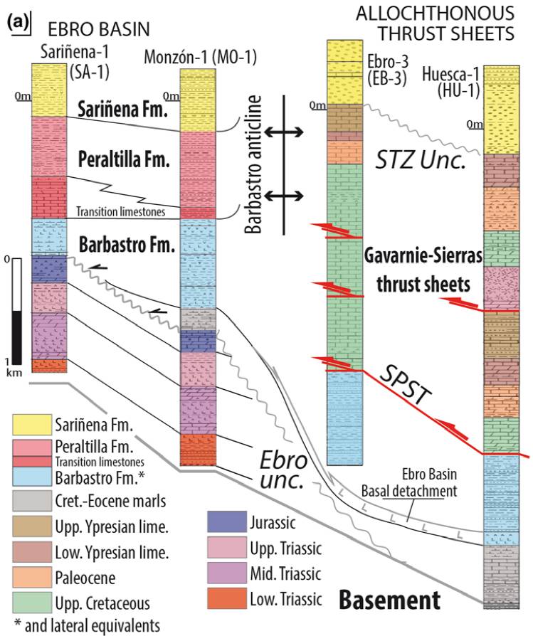
| Post-evaporite and pre-kinematic unit/s (overbuden) | Lower Jurassic (limestones, dolostones and shales) ; Upper Santonian-Maastrichtian (calcarenites and limestones) ; Maastrichian-Paleocene (Garumn Facies, carbonates and shales) ; Palaeocene-Lower Eocene (shallow marines carbonates) ; Upper Eocene-Oligocene (evaporites and detrital deposits) |
| Syn-kinematic unit/s | Lutetian-Early Priabonian (marlstones, mudstones, limestones, sandstones) ; Late Oligocene-Early Miocene (alluvial fan conglomerates) |
| Available seismic profiles | HU-21 / HU-10 / HU-13 / SP-54 / SP-54 / ND-96 / HU-28 / SP-54 / HU-22 / HU-10 / HU-26 / HU-21 / SP-54 / HU-28 / HU-19 / SP-54 / SP-54 / SP-54 / ND-96 / HU-13 / |
| Available boreholes | |
| Additional comments | Evaporite extrusion favoured by local cover weakening caused by differential displacements of thrust sheets and enhanced by the presence of an evaporite-cored hanging-wall anticline (see Santolaria et a., 2014) |
Mining Data
| UNIQUE_ID | 69 |
| Minning exploitations within <2km? | N |
| Historical/Active | |
| Exploitation name #1 | |
| Exploitation ID (Spanish National Mining Cadastre) #1 | |
| Municipality #1 | |
| Province #1 | |
| Company #1 | |
| Main minning Products #1 | |
| Exploitation name #2 | |
| Exploitation ID (Spanish National Mining Cadastre) #2 | |
| Municipality #2 | |
| Province #2 | |
| Company #2 | |
| Main minning Products #2 | |
| Exploitation name #3 | |
| Exploitation ID (Spanish National Mining Cadastre) #3 | |
| Municipality #3 | |
| Province #3 | |
| Company #3 | |
| Main minning Products #3 |
Quantitative Data
| UNIQUE_ID | 69 |
| Outcropping area (km2) | 18.8354 |
| Horizontal intersection area (km2) (when buried) | Not buried |
| Depth of intersection area (km2) (when buried) | Not buried |
| Max. Width (Km) | 8.32071147 |
| Max. Length (Km) | 3.79292571 |
| Max. Evaporites thickness (km) | 2.9 |
| Max. Deformation age (Ma) | 47 |
| Min. Deformation age (Ma) | 20 |
| Deformation stages | 2 |
Reference Data
| UNIQUE_ID | 69 |
| Section source | Santolaria, P., Casas-Sainz, A. M., Soto, R., Pinto, V., Casas, A., 2014. The Naval diapir (Southern Pyrenees): Geometry of a salt wall associated with thrusting at an oblique ramp. Tectonophysics, 637, 30-44. [link] |
| Well / Borehole availability #1 | Muñoz, J. A., Mencos, J., Roca, E., Carrera, N., Gratacós, O., Ferrer, O., Fernández, O., 2018. The structure of the South-Central-Pyrenean fold and thrust belt as constrained by subsurface data. Geologica Acta, 16(4), 439-460. [link] |
| Well / Borehole availability #2 | Cámara, P., Flinch, J. F., 2017. The southern Pyrenees: a salt-based fold-and-thrust belt. In Permo-Triassic Salt Provinces of Europe, North Africa and the Atlantic Margins (pp. 395-415). Elsevier. [link] |
| Available data (Stratigraphy) #1 | Salvany, J. M., Bastida, J., 2004. Análisis litoestratigráfico del Keuper surpirenaico central. Revista de la Sociedad Geológica de España, 17(1), 3-26. [link] |
| Available data (Stratigraphy) #2 | Barnolas, A., Gil-Peña, I., 2001. Ejemplos de relleno sedimentario multiepisódico en una cuenca de antepaís fragmentada: La Cuenca Surpirenaica. Boletín Geológico y Minero, 112(3), 17-38. [link] |
| Available data (Stratigraphy) #3 | Cámara, P., Flinch, J. F., 2017. The southern Pyrenees: a salt-based fold-and-thrust belt. In Permo-Triassic Salt Provinces of Europe, North Africa and the Atlantic Margins (pp. 395-415). Elsevier. [link] |
| Available data (Stratigraphy) #4 | Santolaria, P., Luzon, A., Casas, A. M., Soto, R., 2015. Coupling far and near tectonic signals in syn-orogenic sediments: the Olvena growth strata (Sierras Marginales, southern Pyrenees). Geologica Acta, 13(4), 297-308. [link] |
| Available data (Stratigraphy) #5 | Muñoz, J. A., Mencos, J., Roca, E., Carrera, N., Gratacós, O., Ferrer, O., Fernández, O., 2018. The structure of the South-Central-Pyrenean fold and thrust belt as constrained by subsurface data. Geologica Acta, 16(4), 439-460. [link] |
| Available data (Stratigraphy) #6 | Martín-Chivelet, J., López-Gómez, J., Aguado, R., Arias, C., Arribas, J., Arribas, M. E., … , Casas-Sainz, A., 2019. The Late Jurassic–Early Cretaceous Rifting. In (Quesada C., Oliveira J., eds.): The Geology of Iberia: A Geodynamic Approach. Regional Geology Reviews. Springer, Cham. [link] |
| Regional Stratigraphy | Santolaria, P., Ayala, C., Pueyo, E. L., Rubio, F. M., Soto, R., Calvín, P., …, Casas‐Sainz, A. M., 2020. Structural and geophysical characterization of the western termination of the South Pyrenean triangle zone. Tectonics, 39(8), e2019TC005891. [link] |
| Seismic data availability #1 | Santolaria, P., Casas-Sainz, A. M., Soto, R., Pinto, V., Casas, A., 2014. The Naval diapir (Southern Pyrenees): Geometry of a salt wall associated with thrusting at an oblique ramp. Tectonophysics, 637, 30-44. [link] |
| Seismic data availability #2 | Cámara, P., Flinch, J. F., 2017. The southern Pyrenees: a salt-based fold-and-thrust belt. In Permo-Triassic Salt Provinces of Europe, North Africa and the Atlantic Margins (pp. 395-415). Elsevier. [link] |
| Seismic data availability #3 | Santolaria, P., Casas-Sainz, A. M., Soto, R., Casas, A., 2017. Gravity modelling to assess salt tectonics in the western end of the South Pyrenean Central Unit. Journal of the Geological Society, 174(2), 269-288. [link] |
| Available data (Structure) #1 | Santolaria, P., Casas-Sainz, A. M., Soto, R., Pinto, V., Casas, A., 2014. The Naval diapir (Southern Pyrenees): Geometry of a salt wall associated with thrusting at an oblique ramp. Tectonophysics, 637, 30-44. [link] |
| Available data (Structure) #2 | Santolaria, P., Luzon, A., Casas, A. M., Soto, R., 2015. Coupling far and near tectonic signals in syn-orogenic sediments: the Olvena growth strata (Sierras Marginales, southern Pyrenees). Geologica Acta, 13(4), 297-308. [link] |
| Available data (Structure) #3 | Santolaria, P., Casas-Sainz, A. M., Soto, R., Casas, A., 2017. Gravity modelling to assess salt tectonics in the western end of the South Pyrenean Central Unit. Journal of the Geological Society, 174(2), 269-288. [link] |
| Available data (Structure) #4 | Cámara, P., Flinch, J. F., 2017. The southern Pyrenees: a salt-based fold-and-thrust belt. In Permo-Triassic Salt Provinces of Europe, North Africa and the Atlantic Margins (pp. 395-415). Elsevier. [link] |
| Available data (Structure) #5 | Fernández, O., Muñoz, J. A., Arbués, P., Falivene, O., 2012. 3D structure and evolution of an oblique system of relaying folds: the Ainsa basin (Spanish Pyrenees). Journal of the Geological Society, 169(5), 545-559. [link] |
| Available data (Structure) #6 | Muñoz, J. A., Mencos, J., Roca, E., Carrera, N., Gratacós, O., Ferrer, O., Fernández, O., 2018. The structure of the South-Central-Pyrenean fold and thrust belt as constrained by subsurface data. Geologica Acta, 16(4), 439-460. [link] |
| Available data (Analogue modelling) #1 | n.a. |
| Available data (Analogue modelling) #2 | n.a. |
| Available data (Analogue modelling) #3 | n.a. |
| Available data (Gravimetry – Tomography) #1 | Santolaria, P., Casas-Sainz, A. M., Soto, R., Pinto, V., Casas, A., 2014. The Naval diapir (Southern Pyrenees): Geometry of a salt wall associated with thrusting at an oblique ramp. Tectonophysics, 637, 30-44. [link] |
| Available data (Gravimetry – Tomography) #2 | Santolaria, P., Casas-Sainz, A. M., Soto, R., Casas, A., 2017. Gravity modelling to assess salt tectonics in the western end of the South Pyrenean Central Unit. Journal of the Geological Society, 174(2), 269-288. [link] |
| Available data (Gravimetry – Tomography) #3 | Casas, A., Santolaria, P., Rivero, L., Casas-Sainz, A., Himi, M., Pinto, V., Sendrós, A., 2016. The gravity method: new challenges for delineation diapiric structures in north-east Spain. First Break, 34(8). [link] |
| Available data (Geochemistry) #1 | Salvany, J. M., Bastida, J., 2004. Análisis litoestratigráfico del Keuper surpirenaico central. Revista de la Sociedad Geológica de España, 17(1), 3-26. [link] |
| Available data (Geochemistry) #2 | n.a. |
| Available data (Geochemistry) #3 | n.a. |
| Available data (Geochemistry) #4 | n.a. |
| Available data (Petrophysics) #1 | Santolaria, P., Casas, A. M., Soto, R., 2015. Anisotropy of magnetic susceptibility as a proxy to assess internal deformation in diapirs: case study of the Naval salt wall (Southern Pyrenees). Geophysical Journal International, 202(2), 1207-1222. [link] |
| Available data (Petrophysics) #2 | Santolaria, P., Casas-Sainz, A. M., Soto, R., Casas, A., 2017. Gravity modelling to assess salt tectonics in the western end of the South Pyrenean Central Unit. Journal of the Geological Society, 174(2), 269-288. [link] |
| IGME Geological Map (MAGNA50) Sheet number | 249-Alquézar. [link] |
| Other Maps #1 (source) | Muñoz, J. A., Mencos, J., Roca, E., Carrera, N., Gratacós, O., Ferrer, O., Fernández, O., 2018. The structure of the South-Central-Pyrenean fold and thrust belt as constrained by subsurface data. Geologica Acta, 16(4), 439-460. [link] |
| Other Maps #2 (source) | Santolaria, P., Casas-Sainz, A. M., Soto, R., Casas, A., 2017. Gravity modelling to assess salt tectonics in the western end of the South Pyrenean Central Unit. Journal of the Geological Society, 174(2), 269-288. [link] |
| Other related references #1 | Balaguer, J. F., Casas-Sainz, A. M., 2016. Estructura de la terminación occidental del cabalgamiento del Montsec (Pirineos Centrales). Revista de la Sociedad Geológica de España, 29(2), 39-56. [link] |
| Other related references #2 | Garrido, H. M., Morer, E. P., Cardona, M. A., Aguado, A. L., Urcia, B. O., Peña, B. M., 2000. Actividad tectónica registrada en los depósitos terciarios del frente meridional del Pirineo central. Revista de la Sociedad Geológica de España, 13(2), 279-300. [link] |
| Other related references #3 | n.a. |
| Other related references #4 | n.a. |
Well and Seismic Data
| UNIQUE_ID | 69 |
| Seismic survey name #1 | 10D1-HU |
| Across structure? #1 | Y |
| Seismic profile ID (IGME) #1 | 10076 |
| Seismic profile code #1 | 14649 |
| Seismic profile name #1 | HU-21 |
| Seismic survey year #1 | 1979 |
| Data repository #1 | SIGEOF Data Catalogue (Section available under request). ©Instituto Geológico y Minero de España (IGME). https://info.igme.es/SIGEOF/ |
| Length (km) #1 | 11.12 |
| Seismic survey name #2 | 10D1-HU |
| Across structure? #2 | Y |
| Seismic profile ID (IGME) #2 | 10088 |
| Seismic profile code #2 | 14661 |
| Seismic profile name #2 | HU-10 |
| Seismic survey year #2 | 1979 |
| Data repository #2 | SIGEOF Data Catalogue (Section available under request). ©Instituto Geológico y Minero de España (IGME). https://info.igme.es/SIGEOF/ |
| Length (km) #2 | 13.01 |
| Seismic survey name #3 | 10D1-HU |
| Across structure? #3 | Y |
| Seismic profile ID (IGME) #3 | 10084 |
| Seismic profile code #3 | 14657 |
| Seismic profile name #3 | HU-13 |
| Seismic survey year #3 | 1979 |
| Data repository #3 | SIGEOF Data Catalogue (Private access section). ©Instituto Geológico y Minero de España (IGME). https://info.igme.es/SIGEOF/ |
| Length (km) #3 | 9.54 |
| Seismic survey name #4 | 0116A80U |
| Across structure? #4 | Y |
| Seismic profile ID (IGME) #4 | 5552 |
| Seismic profile code #4 | 8454 |
| Seismic profile name #4 | SP-54 |
| Seismic survey year #4 | 1980 |
| Data repository #4 | SIGEOF Data Catalogue (Private access section). ©Instituto Geológico y Minero de España (IGME). https://info.igme.es/SIGEOF/ |
| Length (km) #4 | 10.19 |
| Seismic survey name #5 | 0116A80G |
| Across structure? #5 | Y |
| Seismic profile ID (IGME) #5 | 5390 |
| Seismic profile code #5 | 7758 |
| Seismic profile name #5 | SP-54 |
| Seismic survey year #5 | 1980 |
| Data repository #5 | SIGEOF Data Catalogue (Private access section). ©Instituto Geológico y Minero de España (IGME). https://info.igme.es/SIGEOF/ |
| Length (km) #5 | 10.41 |
| Seismic survey name #6 | 11D-ST-151 |
| Across structure? #6 | Y |
| Seismic profile ID (IGME) #6 | 14102 |
| Seismic profile code #6 | 18837 |
| Seismic profile name #6 | ND-96 |
| Seismic survey year #6 | 1963 |
| Data repository #6 | SIGEOF Data Catalogue (Private access section). ©Instituto Geológico y Minero de España (IGME). https://info.igme.es/SIGEOF/ |
| Length (km) #6 | 45.70 |
| Seismic survey name #7 | 10D1-HU |
| Across structure? #7 | Y |
| Seismic profile ID (IGME) #7 | 10071 |
| Seismic profile code #7 | 14644 |
| Seismic profile name #7 | HU-28 |
| Seismic survey year #7 | 1979 |
| Data repository #7 | SIGEOF Data Catalogue (Section available under request). ©Instituto Geológico y Minero de España (IGME). https://info.igme.es/SIGEOF/ |
| Length (km) #7 | 9.59 |
| Seismic survey name #8 | 10D1-SP |
| Across structure? #8 | Y |
| Seismic profile ID (IGME) #8 | 15452 |
| Seismic profile code #8 | 20192 |
| Seismic profile name #8 | SP-54 |
| Seismic survey year #8 | 1979 |
| Data repository #8 | SIGEOF Data Catalogue (Section available under request). ©Instituto Geológico y Minero de España (IGME). https://info.igme.es/SIGEOF/ |
| Length (km) #8 | 9.63 |
| Seismic survey name #9 | 10D1-HU |
| Across structure? #9 | N (within 3km) |
| Seismic profile ID (IGME) #9 | 10074 |
| Seismic profile code #9 | 14647 |
| Seismic profile name #9 | HU-22 |
| Seismic survey year #9 | 1979 |
| Data repository #9 | SIGEOF Data Catalogue (Section available under request). ©Instituto Geológico y Minero de España (IGME). https://info.igme.es/SIGEOF/ |
| Length (km) #9 | 8.90 |
| Seismic survey name #10 | 10D1-HU |
| Across structure? #10 | N (within 3km) |
| Seismic profile ID (IGME) #10 | 10088 |
| Seismic profile code #10 | 14661 |
| Seismic profile name #10 | HU-10 |
| Seismic survey year #10 | 1979 |
| Data repository #10 | SIGEOF Data Catalogue (Section available under request). ©Instituto Geológico y Minero de España (IGME). https://info.igme.es/SIGEOF/ |
| Length (km) #10 | 13.01 |
| Seismic survey name #11 | 10D1-HU |
| Across structure? #11 | N (within 3km) |
| Seismic profile ID (IGME) #11 | 10073 |
| Seismic profile code #11 | 14646 |
| Seismic profile name #11 | HU-26 |
| Seismic survey year #11 | 1979 |
| Data repository #11 | SIGEOF Data Catalogue (Section available under request). ©Instituto Geológico y Minero de España (IGME). https://info.igme.es/SIGEOF/ |
| Length (km) #11 | 12.56 |
| Seismic survey name #12 | 10D1-HU |
| Across structure? #12 | N (within 3km) |
| Seismic profile ID (IGME) #12 | 10076 |
| Seismic profile code #12 | 14649 |
| Seismic profile name #12 | HU-21 |
| Seismic survey year #12 | 1979 |
| Data repository #12 | SIGEOF Data Catalogue (Section available under request). ©Instituto Geológico y Minero de España (IGME). https://info.igme.es/SIGEOF/ |
| Length (km) #12 | 11.12 |
| Seismic survey name #13 | 10D1-SP |
| Across structure? #13 | N (within 3km) |
| Seismic profile ID (IGME) #13 | 15452 |
| Seismic profile code #13 | 20192 |
| Seismic profile name #13 | SP-54 |
| Seismic survey year #13 | 1979 |
| Data repository #13 | SIGEOF Data Catalogue (Section available under request). ©Instituto Geológico y Minero de España (IGME). https://info.igme.es/SIGEOF/ |
| Length (km) #13 | 9.63 |
| Seismic survey name #14 | 10D1-HU |
| Across structure? #14 | N (within 3km) |
| Seismic profile ID (IGME) #14 | 10071 |
| Seismic profile code #14 | 14644 |
| Seismic profile name #14 | HU-28 |
| Seismic survey year #14 | 1979 |
| Data repository #14 | SIGEOF Data Catalogue (Section available under request). ©Instituto Geológico y Minero de España (IGME). https://info.igme.es/SIGEOF/ |
| Length (km) #14 | 9.59 |
| Seismic survey name #15 | 10D1-HU |
| Across structure? #15 | N (within 3km) |
| Seismic profile ID (IGME) #15 | 10079 |
| Seismic profile code #15 | 14652 |
| Seismic profile name #15 | HU-19 |
| Seismic survey year #15 | 1979 |
| Data repository #15 | SIGEOF Data Catalogue (Section available under request). ©Instituto Geológico y Minero de España (IGME). https://info.igme.es/SIGEOF/ |
| Length (km) #15 | 9.82 |
| Seismic survey name #16 | 0116A80G |
| Across structure? #16 | N (within 3km) |
| Seismic profile ID (IGME) #16 | 5390 |
| Seismic profile code #16 | 7758 |
| Seismic profile name #16 | SP-54 |
| Seismic survey year #16 | 1980 |
| Data repository #16 | SIGEOF Data Catalogue (Private access section). ©Instituto Geológico y Minero de España (IGME). https://info.igme.es/SIGEOF/ |
| Length (km) #16 | 10.41 |
| Seismic survey name #17 | 0116A80U |
| Across structure? #17 | N (within 3km) |
| Seismic profile ID (IGME) #17 | 5552 |
| Seismic profile code #17 | 8454 |
| Seismic profile name #17 | SP-54 |
| Seismic survey year #17 | 1980 |
| Data repository #17 | SIGEOF Data Catalogue (Private access section). ©Instituto Geológico y Minero de España (IGME). https://info.igme.es/SIGEOF/ |
| Length (km) #17 | 10.19 |
| Seismic survey name #18 | 0116A80S |
| Across structure? #18 | N (within 3km) |
| Seismic profile ID (IGME) #18 | 5519 |
| Seismic profile code #18 | 8421 |
| Seismic profile name #18 | SP-54 |
| Seismic survey year #18 | 1980 |
| Data repository #18 | SIGEOF Data Catalogue (Private access section). ©Instituto Geológico y Minero de España (IGME). https://info.igme.es/SIGEOF/ |
| Length (km) #18 | 9.17 |
| Seismic survey name #19 | 11D-ST-151 |
| Across structure? #19 | N (within 3km) |
| Seismic profile ID (IGME) #19 | 14102 |
| Seismic profile code #19 | 18837 |
| Seismic profile name #19 | ND-96 |
| Seismic survey year #19 | 1963 |
| Data repository #19 | SIGEOF Data Catalogue (Private access section). ©Instituto Geológico y Minero de España (IGME). https://info.igme.es/SIGEOF/ |
| Length (km) #19 | 45.70 |
| Seismic survey name #20 | 10D1-HU |
| Across structure? #20 | N (within 3km) |
| Seismic profile ID (IGME) #20 | 10084 |
| Seismic profile code #20 | 14657 |
| Seismic profile name #20 | HU-13 |
| Seismic survey year #20 | 1979 |
| Data repository #20 | SIGEOF Data Catalogue (Private access section). ©Instituto Geológico y Minero de España (IGME). https://info.igme.es/SIGEOF/ |
| Length (km) #20 | 9.54 |
| Seismic survey name #21 | |
| Across structure? #21 | |
| Seismic profile ID (IGME) #21 | |
| Seismic profile code #21 | |
| Seismic profile name #21 | |
| Seismic survey year #21 | |
| Data repository #21 | |
| Length (km) #21 | |
| Borehole name #1 | |
| Company #1 | |
| Traget #1 | |
| Across structure? #1 | |
| Borehole name #2 | |
| Company #2 | |
| Traget #2 | |
| Across structure? #2 | |
| Borehole name #3 | |
| Company #3 | |
| Traget #3 | |
| Across structure? #3 | |
| Borehole name #4 | |
| Company #4 | |
| Traget #4 | |
| Across structure? #4 | |
| Borehole name #5 | |
| Company #5 | |
| Traget #5 | |
| Across structure? #5 | |
| Borehole name #6 | |
| Company #6 | |
| Traget #6 | |
| Across structure? #6 | |
| Borehole name #7 | |
| Company #7 | |
| Traget #7 | |
| Across structure? #7 | |
| Borehole name #8 | |
| Company #8 | |
| Traget #8 | |
| Across structure? #8 | |
| Borehole name #9 | |
| Company #9 | |
| Traget #9 | |
| Across structure? #9 | |
| Borehole name #10 | |
| Company #10 | |
| Traget #10 | |
| Across structure? #10 | |
| Borehole name #11 | |
| Company #11 | |
| Traget #11 | |
| Across structure? #11 | |
| Borehole name #12 | |
| Company #12 | |
| Traget #12 | |
| Across structure? #12 | |
| Borehole name #13 | |
| Company #13 | |
| Traget #13 | |
| Across structure? #13 | |
| Borehole name #14 | |
| Company #14 | |
| Traget #14 | |
| Across structure? #14 | |
| Borehole name #15 | |
| Company #15 | |
| Traget #15 | |
| Across structure? #15 |
Geographical Data (EPSG:4326 - WGS 84)
| UNIQUE_ID | 69 |
| X Centroid (Structure shape) | 0.140468 |
| Y Centroid (Structure shape) | 0.140468 |
| Xmin (Structure shape) | 0.113774 |
| Xmax (Structure shape) | 0.168523 |
| Ymin (Structure shape) | 42.137288 |
| Ymax (Structure shape) | 42.210138 |
| Xmin seismic line #1 | 0.025968 |
| Xmax seismic line #1 | 0.143358 |
| Ymin seismic line #1 | 42.117078 |
| Ymax seismic line #1 | 42.164364 |
| Xmin seismic line #2 | 0.028976 |
| Xmax seismic line #2 | 0.166876 |
| Ymin seismic line #2 | 42.097709 |
| Ymax seismic line #2 | 42.153208 |
| Xmin seismic line #3 | 0.114289 |
| Xmax seismic line #3 | 0.168257 |
| Ymin seismic line #3 | 42.106686 |
| Ymax seismic line #3 | 42.175129 |
| Xmin seismic line #4 | 0.136927 |
| Xmax seismic line #4 | 0.152177 |
| Ymin seismic line #4 | 42.204389 |
| Ymax seismic line #4 | 42.292557 |
| Xmin seismic line #5 | 0.136843 |
| Xmax seismic line #5 | 0.152177 |
| Ymin seismic line #5 | 42.204389 |
| Ymax seismic line #5 | 42.292557 |
| Xmin seismic line #6 | 0.116899 |
| Xmax seismic line #6 | 0.193859 |
| Ymin seismic line #6 | 42.008977 |
| Ymax seismic line #6 | 42.385975 |
| Xmin seismic line #7 | 0.056969 |
| Xmax seismic line #7 | 0.158081 |
| Ymin seismic line #7 | 42.141217 |
| Ymax seismic line #7 | 42.183410 |
| Xmin seismic line #8 | 0.132703 |
| Xmax seismic line #8 | 0.145023 |
| Ymin seismic line #8 | 42.204021 |
| Ymax seismic line #8 | 42.288755 |
| Xmin seismic line #9 | 0.080275 |
| Xmax seismic line #9 | 0.177562 |
| Ymin seismic line #9 | 42.097116 |
| Ymax seismic line #9 | 42.130967 |
| Xmin seismic line #10 | 0.028976 |
| Xmax seismic line #10 | 0.166876 |
| Ymin seismic line #10 | 42.097709 |
| Ymax seismic line #10 | 42.153208 |
| Xmin seismic line #11 | 0.135383 |
| Xmax seismic line #11 | 0.195862 |
| Ymin seismic line #11 | 42.030340 |
| Ymax seismic line #11 | 42.134020 |
| Xmin seismic line #12 | 0.025968 |
| Xmax seismic line #12 | 0.143358 |
| Ymin seismic line #12 | 42.117078 |
| Ymax seismic line #12 | 42.164364 |
| Xmin seismic line #13 | 0.132703 |
| Xmax seismic line #13 | 0.145023 |
| Ymin seismic line #13 | 42.204021 |
| Ymax seismic line #13 | 42.288755 |
| Xmin seismic line #14 | 0.056969 |
| Xmax seismic line #14 | 0.158081 |
| Ymin seismic line #14 | 42.141217 |
| Ymax seismic line #14 | 42.183410 |
| Xmin seismic line #15 | 0.075377 |
| Xmax seismic line #15 | 0.127942 |
| Ymin seismic line #15 | 42.086361 |
| Ymax seismic line #15 | 42.165516 |
| Xmin seismic line #16 | 0.136843 |
| Xmax seismic line #16 | 0.152177 |
| Ymin seismic line #16 | 42.204389 |
| Ymax seismic line #16 | 42.292557 |
| Xmin seismic line #17 | 0.136927 |
| Xmax seismic line #17 | 0.152177 |
| Ymin seismic line #17 | 42.204389 |
| Ymax seismic line #17 | 42.292557 |
| Xmin seismic line #18 | 0.136204 |
| Xmax seismic line #18 | 0.152455 |
| Ymin seismic line #18 | 42.209444 |
| Ymax seismic line #18 | 42.287834 |
| Xmin seismic line #19 | 0.116899 |
| Xmax seismic line #19 | 0.193859 |
| Ymin seismic line #19 | 42.008977 |
| Ymax seismic line #19 | 42.385975 |
| Xmin seismic line #20 | 0.114289 |
| Xmax seismic line #20 | 0.168257 |
| Ymin seismic line #20 | 42.106686 |
| Ymax seismic line #20 | 42.175129 |
| Xmin seismic line #21 | |
| Xmax seismic line #21 | |
| Ymin seismic line #21 | |
| Ymax seismic line #21 | |
| X borehole #1 | |
| Y borehole #1 | |
| X borehole #2 | |
| Y borehole #2 | |
| X borehole #3 | |
| Y borehole #3 | |
| X borehole #4 | |
| Y borehole #4 | |
| X borehole #5 | |
| Y borehole #5 | |
| X borehole #6 | |
| Y borehole #6 | |
| X borehole #7 | |
| Y borehole #7 | |
| X borehole #8 | |
| Y borehole #8 | |
| X borehole #9 | |
| Y borehole #9 | |
| X borehole #10 | |
| Y borehole #10 | |
| X borehole #11 | |
| Y borehole #11 | |
| X borehole #12 | |
| Y borehole #12 | |
| X borehole #13 | |
| Y borehole #13 | |
| X borehole #14 | |
| Y borehole #14 | |
| X borehole #15 | |
| Y borehole #15 |

