General Information
| Structure type | Evaporite body |
| Deformed/Undeformed | Deformed |
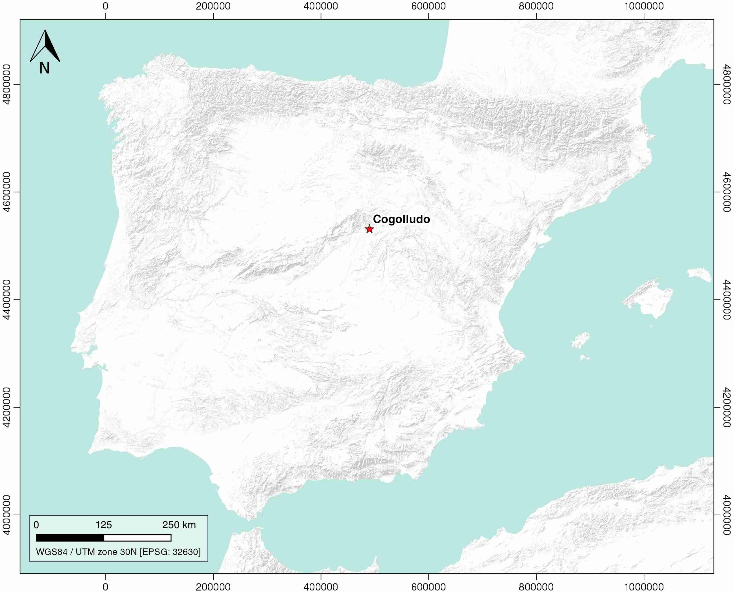
| Geological Setting | Madrid Sub-Basin, Tagus Basin |
| Outcropping/buried | Outcropping |
| Evaporite unit/s name | Jadraque and Cogolludo Gypsum Units |
| Evaporite unit/s age | Late Cretaceous-Middle Eocene |
| Evaporite unit/s origin | Continental |
| Classif. (Hudec and Jackson, 2009) | No diapirism |
| Classif. (Jackson and Talbot, 1986) | No diapirism |
| Age of evaporite flow or deformation (when deformed) | Oligocene to Miocene |
| Other comments | Outcrops correspond to faukt-propagation folds of the (buried) Cogolludo back-thrust system. Thickness of evaporite layers remain constant during thrusting and subsequent folding, according to the seismic data (see de Vicente and Muñoz-Martín, 2013). |
Generic Data
| Unique ID | 116 |
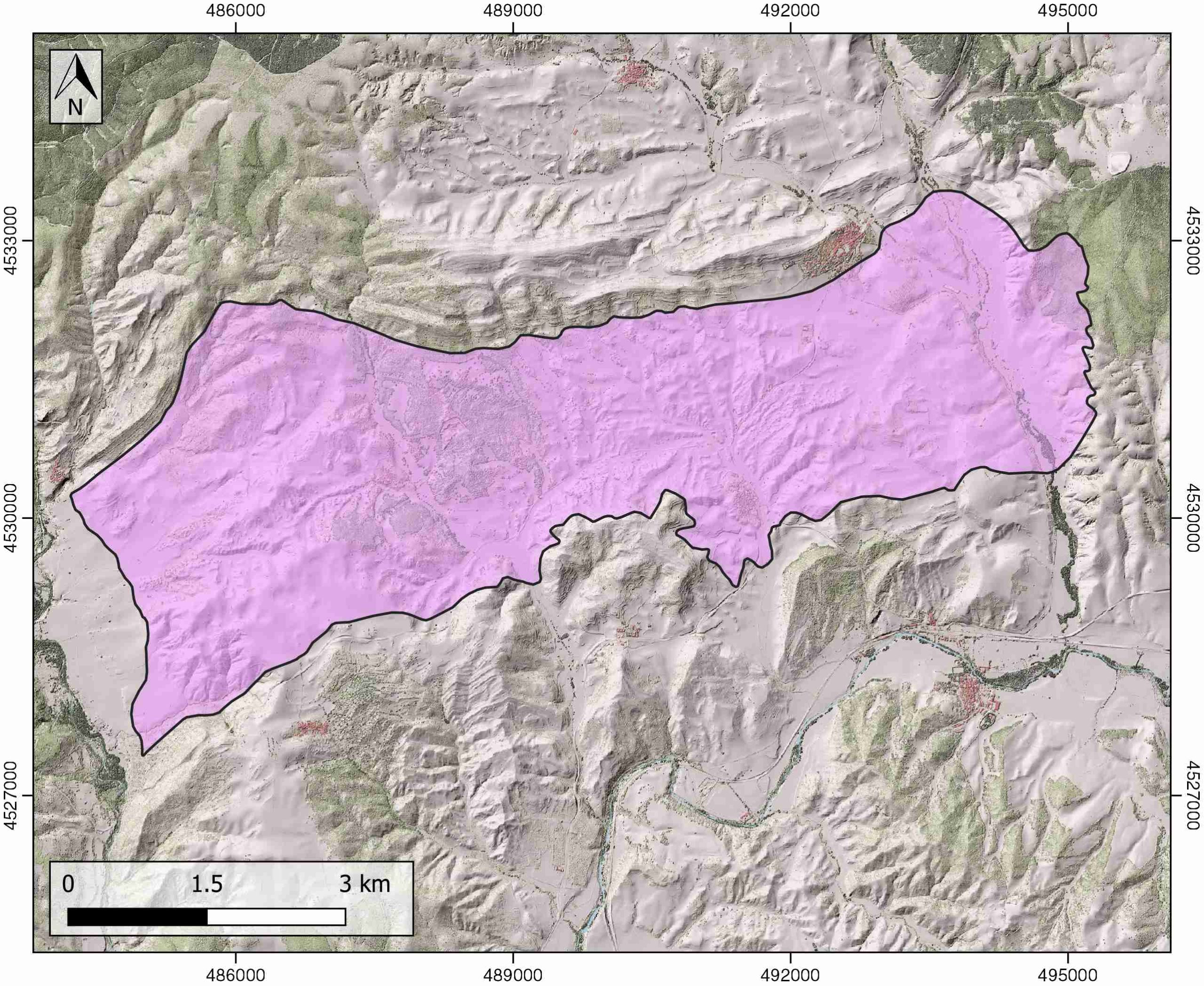
| Name | Cogolludo |
| Structure type | Evaporite body |
| Deformed/Undeformed | Undeformed |
| Buried/Outcropping | Outcropping |
| Geological setting | Tagus Basin |
| Geological Regional Setting | Madrid Basin |
| Evaporite unit/s name | Jadraque–Cogolludo Gypsum Unit |
| Evaporite unit/s age | Late Cretaceous-Middle Eocene |
| Evaporite unit/s era | Mesozoic-Cenozoic |
| Evaporite unit/s origin | Continental (lacustrine) |
| Evaporite unit/s composition | Gypsum – Sandstone |
| Post-kinematic unit/s (or post-evaporite units when evaporites are undeformed) | Middle Miocene (shales, marlstones, limestones and gravels) ; Late Miocene (limestones) ; Quaternary (alluvial and colluvial detrital deposits) |
| Post-kinematic unit/s age (or post-evaporite units when evaporites are undeformed) | Mid Miocene-Holocene |
| Classification (Hudec and Jackson, 2009) | No diapirism |
| Classification (Jackson and Talbot, 1986) | No diapirism |
| Mining activity? | Y |
| Mining activity start | |
| Mining activity end | Active |
| Mining galleries? | Y |
| Mining products | Gypsum |
| Mining sub-products | |
| Evaporite flow? | Y |
| Age of evaporite flow | Oligocene-Early Miocene |
| Flow or deformation triggering mechanisms | Compression related to tectonic stresses transmitted from the active northern (Pyrenean) border |
| Flow-linked structures? | Y |
| Halokinetic structures | Syncline-Anticline folding / Progreessive unconformities / thrust faults |
| Post-evaporite and pre-kinematic unit/s (overbuden) | Eocene (marlstones, sandstones and limestones) ; Late Eocene (limestones and marlstones) |
| Syn-kinematic unit/s | Oligocene (shales, sandstones and conglomerates) ; Early Miocene (conglomerates and calcareous brecchias) |
| Available seismic profiles | HU-7 / HU-8 / HU-14 / HU-20 / HU-7 / HU-14 / HU-6 / HU-8 / |
| Available boreholes | |
| Additional comments | Outcrops correspond to faukt-propagation folds of the (buried) Cogolludo back-thrust system. Thickness of evaporite layers remain constant during thrusting and subsequent folding, according to the seismic data (see de Vicente and Muñoz-Martín, 2013) |
Mining Data
| UNIQUE_ID | 116 |
| Minning exploitations within <2km? | Y |
| Historical/Active | Active |
| Exploitation name #1 | SANTA MARINA |
| Exploitation ID (Spanish National Mining Cadastre) #1 | 2144-20 |
| Municipality #1 | Cogolludo |
| Province #1 | GUADALAJARA |
| Company #1 | MINERA ALCARREÑA, S.L. |
| Main minning Products #1 | Gypsum |
| Exploitation name #2 | |
| Exploitation ID (Spanish National Mining Cadastre) #2 | |
| Municipality #2 | |
| Province #2 | |
| Company #2 | |
| Main minning Products #2 | |
| Exploitation name #3 | |
| Exploitation ID (Spanish National Mining Cadastre) #3 | |
| Municipality #3 | |
| Province #3 | |
| Company #3 | |
| Main minning Products #3 |
Quantitative Data
| UNIQUE_ID | 116 |
| Outcropping area (km2) | 30.19971 |
| Horizontal intersection area (km2) (when buried) | Not buried |
| Depth of intersection area (km2) (when buried) | Not buried |
| Max. Width (Km) | 11.4 |
| Max. Length (Km) | 4.7 |
| Max. Evaporites thickness (km) | 1.3 |
| Max. Deformation age (Ma) | 32 |
| Min. Deformation age (Ma) | 20 |
| Deformation stages | 1 |
Reference Data
| UNIQUE_ID | 116 |
| Section source | De Vicente, G., Muñoz-Martín, A., 2013. The Madrid Basin and the Central System: A tectonostratigraphic analysis from 2D seismic lines. Tectonophysics, 602, 259-285. [link] |
| Well / Borehole availability #1 | De Vicente, G., Muñoz-Martín, A., 2013. The Madrid Basin and the Central System: A tectonostratigraphic analysis from 2D seismic lines. Tectonophysics, 602, 259-285. [link] |
| Well / Borehole availability #2 | n.a. |
| Available data (Stratigraphy) #1 | De Vicente, G., Muñoz-Martín, A., 2013. The Madrid Basin and the Central System: A tectonostratigraphic analysis from 2D seismic lines. Tectonophysics, 602, 259-285. [link] |
| Available data (Stratigraphy) #2 | Cañaveras, J. C., Calvo, J. P., Ordóñez, S., Muñoz-Cervera, M. C., & Sánchez-Moral, S., 2020. Tectono-Sedimentary Evolution of the Madrid Basin (Spain) during the Late Miocene: Data from Paleokarst Profiles in Diagenetically-Complex Continental Carbonates. Geosciences, 10(11), 433. [link] |
| Available data (Stratigraphy) #3 | Calvo, J. P., Jones, B. F., Bustillo, M., Fort, R., Zarza, A. A., Kendall, C., 1995. Sedimentology and geochemistry of carbonates from lacustrine sequences in the Madrid Basin, central Spain. Chemical Geology, 123(1-4), 173-191. [link] |
| Available data (Stratigraphy) #4 | Perez-Jiménez, J. L., Bustillo, M., Alonso-Zarza, A. M., 2004. Neoformaciones y reemplazamientos en depósitos palustres de la Unidad Intermedia (NE de la Cuenca de Madrid). Geotemas, 6, 108-110. [link] |
| Available data (Stratigraphy) #5 | Alonso-Gavilán, G., Armenteros, I., 2004. Cuenca del Duero. In: Vera, J.A. (Ed.), Geología de España. Sociedad Geológica de España-Instituto Geológico y Minero de España, pp. 550–556. [link] |
| Available data (Stratigraphy) #6 | n.a. |
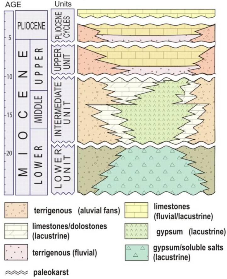
| Regional Stratigraphy | Cañaveras, J. C., Calvo, J. P., Ordóñez, S., Muñoz-Cervera, M. C., Sánchez-Moral, S., 2020. Tectono-Sedimentary Evolution of the Madrid Basin (Spain) during the Late Miocene: Data from Paleokarst Profiles in Diagenetically-Complex Continental Carbonates. Geosciences, 10(11), 433. [link] |
| Seismic data availability #1 | De Vicente, G., Muñoz-Martín, A., 2013. The Madrid Basin and the Central System: A tectonostratigraphic analysis from 2D seismic lines. Tectonophysics, 602, 259-285. [link] |
| Seismic data availability #2 | n.a. |
| Seismic data availability #3 | n.a. |
| Available data (Structure) #1 | De Vicente, G., Muñoz-Martín, A., 2013. The Madrid Basin and the Central System: A tectonostratigraphic analysis from 2D seismic lines. Tectonophysics, 602, 259-285. [link] |
| Available data (Structure) #2 | Olaiz-Campos, A., Mantilla-Pimiento, A. M., Muñoz-Martin, A., De Vicente, G., 2015. Structural Achitecture of the Madrid Basin from 3D Gravity Inversion. In 77th EAGE Conference and Exhibition 2015 (Vol. 2015, No. 1, pp. 1-5). European Association of Geoscientists & Engineers. [link] |
| Available data (Structure) #3 | De Vicente, G., González-Casado, J. M., Mu oz-Martin, A., Giner, J., Rodríguez-Pascua, M. A., 1995. Structure and Tertiary evolution of the Madrid Basin. World and Regional Geology, 263-267. [link] |
| Available data (Structure) #4 | n.a. |
| Available data (Structure) #5 | n.a. |
| Available data (Structure) #6 | n.a. |
| Available data (Analogue modelling) #1 | n.a. |
| Available data (Analogue modelling) #2 | n.a. |
| Available data (Analogue modelling) #3 | n.a. |
| Available data (Gravimetry – Tomography) #1 | De Vicente, G., Muñoz-Martín, A., 2013. The Madrid Basin and the Central System: A tectonostratigraphic analysis from 2D seismic lines. Tectonophysics, 602, 259-285. [link] |
| Available data (Gravimetry – Tomography) #2 | Ayala, C., Bohoyo, F., Maestro, A., Reguera, M. I., Torne, M., Rubio, F., Fernández, M., García-Lobón, J. L., 2016. Updated Bouguer anomalies of the Iberian Peninsula: a new perspective to interpret the regional geology. Journal of Maps, 12(5), 1089-1092. [link] |
| Available data (Gravimetry – Tomography) #3 | n.a. |
| Available data (Geochemistry) #1 | Calvo, J. P., Jones, B. F., Bustillo, M., Fort, R., Zarza, A. A., Kendall, C., 1995. Sedimentology and geochemistry of carbonates from lacustrine sequences in the Madrid Basin, central Spain. Chemical Geology, 123(1-4), 173-191. [link] |
| Available data (Geochemistry) #2 | Cañaveras, J. C., Calvo, J. P., Ordóñez, S., Muñoz-Cervera, M. C., & Sánchez-Moral, S., 2020. Tectono-Sedimentary Evolution of the Madrid Basin (Spain) during the Late Miocene: Data from Paleokarst Profiles in Diagenetically-Complex Continental Carbonates. Geosciences, 10(11), 433. [link] |
| Available data (Geochemistry) #3 | n.a. |
| Available data (Geochemistry) #4 | n.a. |
| Available data (Petrophysics) #1 | n.a. |
| Available data (Petrophysics) #2 | n.a. |
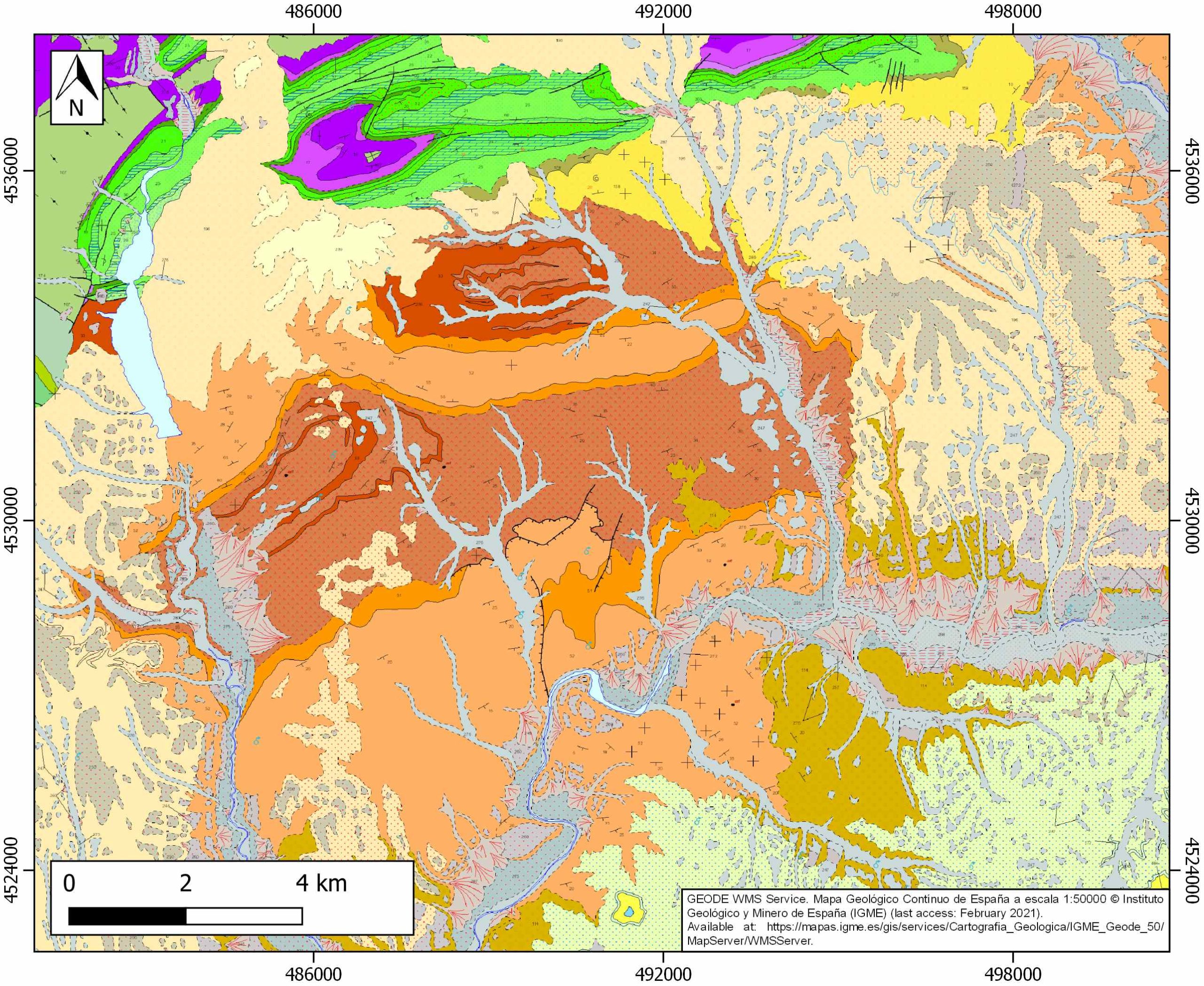
| IGME Geological Map (MAGNA50) Sheet number | 486-Jadraque. [link] |
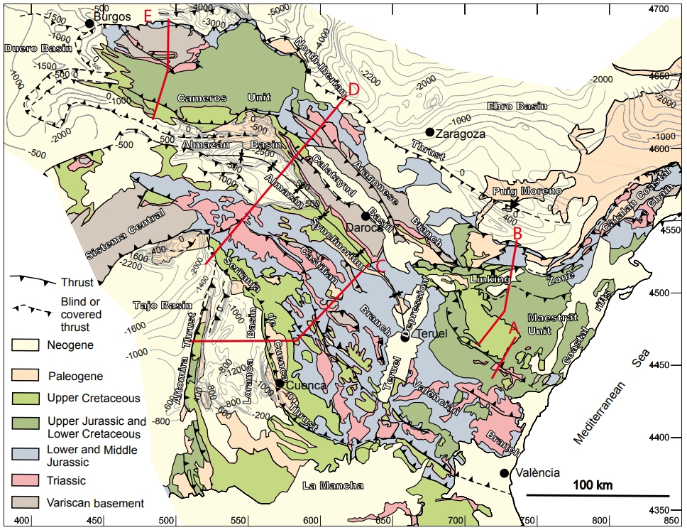
| Other Maps #1 (source) | Guimerà, J. J., 2018. Structure of an intraplate fold-and-thrust belt: The Iberian Chain. A synthesis. Geologica Acta, 16(4), 427-438. [link] |
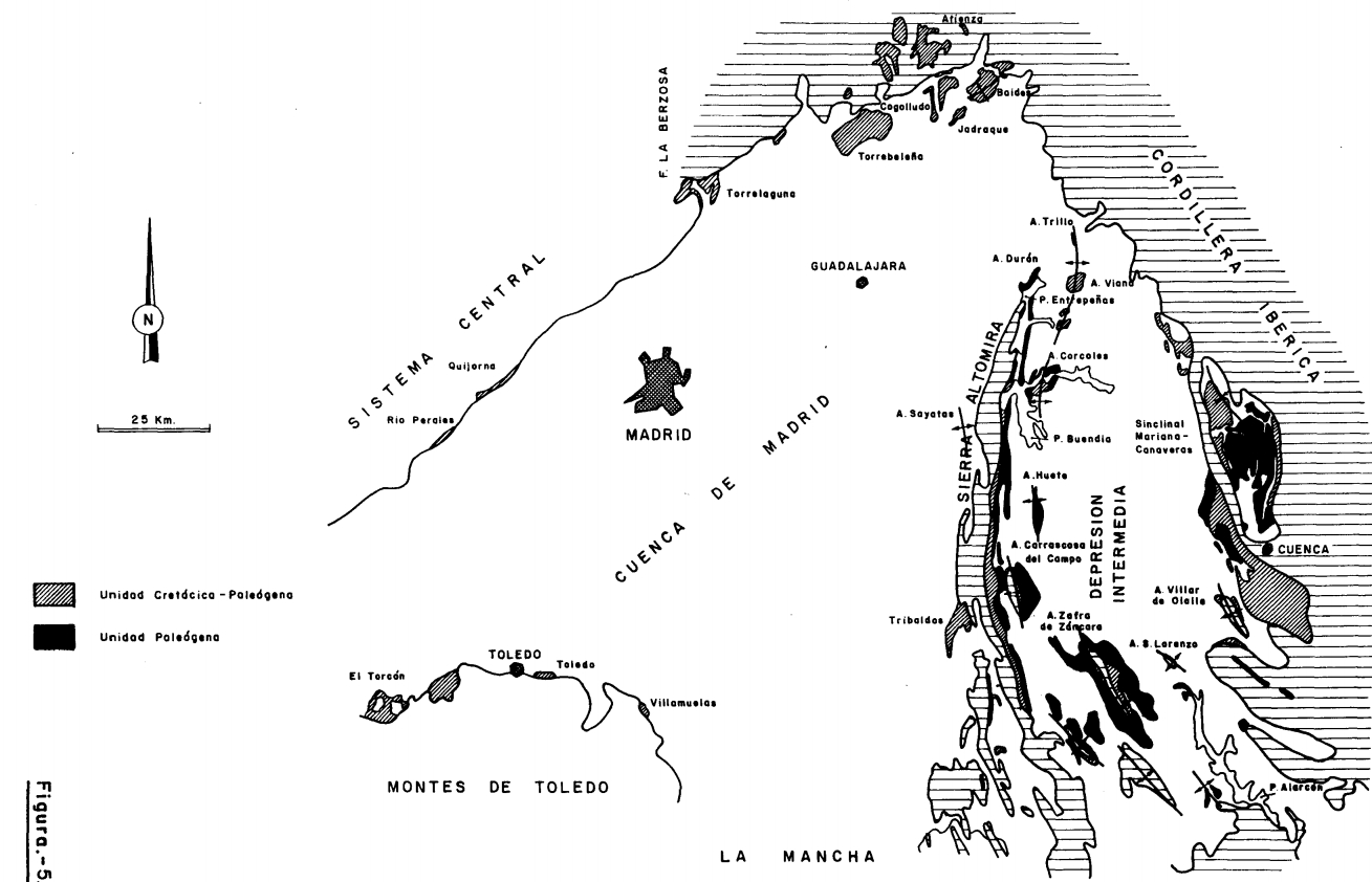
| Other Maps #2 (source) | Torres Pérez-Hidalgo, T. J., 1991. Síntesis de la estratigrafía y paleogeografía de los materiales del Cretácico terminal y Cenozoico de la Depresión Intermedia y de la Cuenca de Madrid. In: «Síntesis de los trabajos de investigación de uranio e hidrocarburos en la Depresión Intermedia y Cuenca de Madrid». Instituto Geológico y Minero de España, pp. 201-257. [link] |
| Other related references #1 | Pérez-Fernández, R., 2011. Plebejus hespericus (Rambur, 1840) en el centro de la Península Ibérica. Distribución geográfica, caracterización del hábitat, parasitoides y conservación (Lepidoptera: Lycaenidae). SHILAP Revista de lepidopterología, 39(156), 325-344. [link] |
| Other related references #2 | De Bruijne, C.H., 2001. Denudation, intraplate tectonics and far fields effects in central Spain [Ph. D. thesis]: Free Univ. Amsterdam, 164 pp. [link] |
| Other related references #3 | Muñoz-Martín, A., Herrero, M. J., Escavy, J. I., Arribas, M. E., Arribas, J., 2015. Relationships between Tectonic Activity and the Sedimentary infilling of the Cenozoic Madrid Basin: The Linking Area between the Spanish Central System and the Iberian Range. Field Trip Booklet: 77th EAGE Conference and Exhibition (June 2015): 33 pp. [link] |
| Other related references #4 | n.a. |
Well and Seismic Data
| UNIQUE_ID | 116 |
| Seismic survey name #1 | 7F-C001 |
| Across structure? #1 | Y |
| Seismic profile ID (IGME) #1 | 13029 |
| Seismic profile code #1 | 17747 |
| Seismic profile name #1 | HU-7 |
| Seismic survey year #1 | |
| Data repository #1 | SIGEOF Data Catalogue (Section available under request). ©Instituto Geológico y Minero de España (IGME). https://info.igme.es/SIGEOF/ |
| Length (km) #1 | 10.18 |
| Seismic survey name #2 | 7F-C001 |
| Across structure? #2 | Y |
| Seismic profile ID (IGME) #2 | 13028 |
| Seismic profile code #2 | 17746 |
| Seismic profile name #2 | HU-8 |
| Seismic survey year #2 | |
| Data repository #2 | SIGEOF Data Catalogue (Section available under request). ©Instituto Geológico y Minero de España (IGME). https://info.igme.es/SIGEOF/ |
| Length (km) #2 | 16.36 |
| Seismic survey name #3 | 7F-C001 |
| Across structure? #3 | Y |
| Seismic profile ID (IGME) #3 | 13043 |
| Seismic profile code #3 | 17761 |
| Seismic profile name #3 | HU-14 |
| Seismic survey year #3 | |
| Data repository #3 | SIGEOF Data Catalogue (Section available under request). ©Instituto Geológico y Minero de España (IGME). https://info.igme.es/SIGEOF/ |
| Length (km) #3 | 20.88 |
| Seismic survey name #4 | 7F-C001 |
| Across structure? #4 | N (within 3km) |
| Seismic profile ID (IGME) #4 | 13036 |
| Seismic profile code #4 | 17754 |
| Seismic profile name #4 | HU-20 |
| Seismic survey year #4 | |
| Data repository #4 | SIGEOF Data Catalogue (Section available under request). ©Instituto Geológico y Minero de España (IGME). https://info.igme.es/SIGEOF/ |
| Length (km) #4 | 14.43 |
| Seismic survey name #5 | 7F-C001 |
| Across structure? #5 | N (within 3km) |
| Seismic profile ID (IGME) #5 | 13029 |
| Seismic profile code #5 | 17747 |
| Seismic profile name #5 | HU-7 |
| Seismic survey year #5 | |
| Data repository #5 | SIGEOF Data Catalogue (Section available under request). ©Instituto Geológico y Minero de España (IGME). https://info.igme.es/SIGEOF/ |
| Length (km) #5 | 10.18 |
| Seismic survey name #6 | 7F-C001 |
| Across structure? #6 | N (within 3km) |
| Seismic profile ID (IGME) #6 | 13043 |
| Seismic profile code #6 | 17761 |
| Seismic profile name #6 | HU-14 |
| Seismic survey year #6 | |
| Data repository #6 | SIGEOF Data Catalogue (Section available under request). ©Instituto Geológico y Minero de España (IGME). https://info.igme.es/SIGEOF/ |
| Length (km) #6 | 20.88 |
| Seismic survey name #7 | 7F-C001 |
| Across structure? #7 | N (within 3km) |
| Seismic profile ID (IGME) #7 | 13030 |
| Seismic profile code #7 | 17748 |
| Seismic profile name #7 | HU-6 |
| Seismic survey year #7 | |
| Data repository #7 | SIGEOF Data Catalogue (Section available under request). ©Instituto Geológico y Minero de España (IGME). https://info.igme.es/SIGEOF/ |
| Length (km) #7 | 11.64 |
| Seismic survey name #8 | 7F-C001 |
| Across structure? #8 | N (within 3km) |
| Seismic profile ID (IGME) #8 | 13028 |
| Seismic profile code #8 | 17746 |
| Seismic profile name #8 | HU-8 |
| Seismic survey year #8 | |
| Data repository #8 | SIGEOF Data Catalogue (Section available under request). ©Instituto Geológico y Minero de España (IGME). https://info.igme.es/SIGEOF/ |
| Length (km) #8 | 16.36 |
| Seismic survey name #9 | |
| Across structure? #9 | |
| Seismic profile ID (IGME) #9 | |
| Seismic profile code #9 | |
| Seismic profile name #9 | |
| Seismic survey year #9 | |
| Data repository #9 | |
| Length (km) #9 | |
| Seismic survey name #10 | |
| Across structure? #10 | |
| Seismic profile ID (IGME) #10 | |
| Seismic profile code #10 | |
| Seismic profile name #10 | |
| Seismic survey year #10 | |
| Data repository #10 | |
| Length (km) #10 | |
| Seismic survey name #11 | |
| Across structure? #11 | |
| Seismic profile ID (IGME) #11 | |
| Seismic profile code #11 | |
| Seismic profile name #11 | |
| Seismic survey year #11 | |
| Data repository #11 | |
| Length (km) #11 | |
| Seismic survey name #12 | |
| Across structure? #12 | |
| Seismic profile ID (IGME) #12 | |
| Seismic profile code #12 | |
| Seismic profile name #12 | |
| Seismic survey year #12 | |
| Data repository #12 | |
| Length (km) #12 | |
| Seismic survey name #13 | |
| Across structure? #13 | |
| Seismic profile ID (IGME) #13 | |
| Seismic profile code #13 | |
| Seismic profile name #13 | |
| Seismic survey year #13 | |
| Data repository #13 | |
| Length (km) #13 | |
| Seismic survey name #14 | |
| Across structure? #14 | |
| Seismic profile ID (IGME) #14 | |
| Seismic profile code #14 | |
| Seismic profile name #14 | |
| Seismic survey year #14 | |
| Data repository #14 | |
| Length (km) #14 | |
| Seismic survey name #15 | |
| Across structure? #15 | |
| Seismic profile ID (IGME) #15 | |
| Seismic profile code #15 | |
| Seismic profile name #15 | |
| Seismic survey year #15 | |
| Data repository #15 | |
| Length (km) #15 | |
| Seismic survey name #16 | |
| Across structure? #16 | |
| Seismic profile ID (IGME) #16 | |
| Seismic profile code #16 | |
| Seismic profile name #16 | |
| Seismic survey year #16 | |
| Data repository #16 | |
| Length (km) #16 | |
| Seismic survey name #17 | |
| Across structure? #17 | |
| Seismic profile ID (IGME) #17 | |
| Seismic profile code #17 | |
| Seismic profile name #17 | |
| Seismic survey year #17 | |
| Data repository #17 | |
| Length (km) #17 | |
| Seismic survey name #18 | |
| Across structure? #18 | |
| Seismic profile ID (IGME) #18 | |
| Seismic profile code #18 | |
| Seismic profile name #18 | |
| Seismic survey year #18 | |
| Data repository #18 | |
| Length (km) #18 | |
| Seismic survey name #19 | |
| Across structure? #19 | |
| Seismic profile ID (IGME) #19 | |
| Seismic profile code #19 | |
| Seismic profile name #19 | |
| Seismic survey year #19 | |
| Data repository #19 | |
| Length (km) #19 | |
| Seismic survey name #20 | |
| Across structure? #20 | |
| Seismic profile ID (IGME) #20 | |
| Seismic profile code #20 | |
| Seismic profile name #20 | |
| Seismic survey year #20 | |
| Data repository #20 | |
| Length (km) #20 | |
| Seismic survey name #21 | |
| Across structure? #21 | |
| Seismic profile ID (IGME) #21 | |
| Seismic profile code #21 | |
| Seismic profile name #21 | |
| Seismic survey year #21 | |
| Data repository #21 | |
| Length (km) #21 | |
| Borehole name #1 | |
| Company #1 | |
| Traget #1 | |
| Across structure? #1 | |
| Borehole name #2 | |
| Company #2 | |
| Traget #2 | |
| Across structure? #2 | |
| Borehole name #3 | |
| Company #3 | |
| Traget #3 | |
| Across structure? #3 | |
| Borehole name #4 | |
| Company #4 | |
| Traget #4 | |
| Across structure? #4 | |
| Borehole name #5 | |
| Company #5 | |
| Traget #5 | |
| Across structure? #5 | |
| Borehole name #6 | |
| Company #6 | |
| Traget #6 | |
| Across structure? #6 | |
| Borehole name #7 | |
| Company #7 | |
| Traget #7 | |
| Across structure? #7 | |
| Borehole name #8 | |
| Company #8 | |
| Traget #8 | |
| Across structure? #8 | |
| Borehole name #9 | |
| Company #9 | |
| Traget #9 | |
| Across structure? #9 | |
| Borehole name #10 | |
| Company #10 | |
| Traget #10 | |
| Across structure? #10 | |
| Borehole name #11 | |
| Company #11 | |
| Traget #11 | |
| Across structure? #11 | |
| Borehole name #12 | |
| Company #12 | |
| Traget #12 | |
| Across structure? #12 | |
| Borehole name #13 | |
| Company #13 | |
| Traget #13 | |
| Across structure? #13 | |
| Borehole name #14 | |
| Company #14 | |
| Traget #14 | |
| Across structure? #14 | |
| Borehole name #15 | |
| Company #15 | |
| Traget #15 | |
| Across structure? #15 |
Geographical Data (EPSG:4326 - WGS 84)
| UNIQUE_ID | 116 |
| X Centroid (Structure shape) | -3.123361 |
| Y Centroid (Structure shape) | -3.123361 |
| Xmin (Structure shape) | -3.187497 |
| Xmax (Structure shape) | -3.055769 |
| Ymin (Structure shape) | 40.897796 |
| Ymax (Structure shape) | 40.952979 |
| Xmin seismic line #1 | -3.149174 |
| Xmax seismic line #1 | -3.057006 |
| Ymin seismic line #1 | 40.866454 |
| Ymax seismic line #1 | 40.925530 |
| Xmin seismic line #2 | -3.086760 |
| Xmax seismic line #2 | -3.050762 |
| Ymin seismic line #2 | 40.808587 |
| Ymax seismic line #2 | 40.952591 |
| Xmin seismic line #3 | -3.290489 |
| Xmax seismic line #3 | -3.067529 |
| Ymin seismic line #3 | 40.866104 |
| Ymax seismic line #3 | 40.946605 |
| Xmin seismic line #4 | -3.137809 |
| Xmax seismic line #4 | -3.023389 |
| Ymin seismic line #4 | 40.796163 |
| Ymax seismic line #4 | 40.891250 |
| Xmin seismic line #5 | -3.149174 |
| Xmax seismic line #5 | -3.057006 |
| Ymin seismic line #5 | 40.866454 |
| Ymax seismic line #5 | 40.925530 |
| Xmin seismic line #6 | -3.290489 |
| Xmax seismic line #6 | -3.067529 |
| Ymin seismic line #6 | 40.866104 |
| Ymax seismic line #6 | 40.946605 |
| Xmin seismic line #7 | -3.146676 |
| Xmax seismic line #7 | -3.113553 |
| Ymin seismic line #7 | 40.815577 |
| Ymax seismic line #7 | 40.916995 |
| Xmin seismic line #8 | -3.086760 |
| Xmax seismic line #8 | -3.050762 |
| Ymin seismic line #8 | 40.808587 |
| Ymax seismic line #8 | 40.952591 |
| Xmin seismic line #9 | |
| Xmax seismic line #9 | |
| Ymin seismic line #9 | |
| Ymax seismic line #9 | |
| Xmin seismic line #10 | |
| Xmax seismic line #10 | |
| Ymin seismic line #10 | |
| Ymax seismic line #10 | |
| Xmin seismic line #11 | |
| Xmax seismic line #11 | |
| Ymin seismic line #11 | |
| Ymax seismic line #11 | |
| Xmin seismic line #12 | |
| Xmax seismic line #12 | |
| Ymin seismic line #12 | |
| Ymax seismic line #12 | |
| Xmin seismic line #13 | |
| Xmax seismic line #13 | |
| Ymin seismic line #13 | |
| Ymax seismic line #13 | |
| Xmin seismic line #14 | |
| Xmax seismic line #14 | |
| Ymin seismic line #14 | |
| Ymax seismic line #14 | |
| Xmin seismic line #15 | |
| Xmax seismic line #15 | |
| Ymin seismic line #15 | |
| Ymax seismic line #15 | |
| Xmin seismic line #16 | |
| Xmax seismic line #16 | |
| Ymin seismic line #16 | |
| Ymax seismic line #16 | |
| Xmin seismic line #17 | |
| Xmax seismic line #17 | |
| Ymin seismic line #17 | |
| Ymax seismic line #17 | |
| Xmin seismic line #18 | |
| Xmax seismic line #18 | |
| Ymin seismic line #18 | |
| Ymax seismic line #18 | |
| Xmin seismic line #19 | |
| Xmax seismic line #19 | |
| Ymin seismic line #19 | |
| Ymax seismic line #19 | |
| Xmin seismic line #20 | |
| Xmax seismic line #20 | |
| Ymin seismic line #20 | |
| Ymax seismic line #20 | |
| Xmin seismic line #21 | |
| Xmax seismic line #21 | |
| Ymin seismic line #21 | |
| Ymax seismic line #21 | |
| X borehole #1 | |
| Y borehole #1 | |
| X borehole #2 | |
| Y borehole #2 | |
| X borehole #3 | |
| Y borehole #3 | |
| X borehole #4 | |
| Y borehole #4 | |
| X borehole #5 | |
| Y borehole #5 | |
| X borehole #6 | |
| Y borehole #6 | |
| X borehole #7 | |
| Y borehole #7 | |
| X borehole #8 | |
| Y borehole #8 | |
| X borehole #9 | |
| Y borehole #9 | |
| X borehole #10 | |
| Y borehole #10 | |
| X borehole #11 | |
| Y borehole #11 | |
| X borehole #12 | |
| Y borehole #12 | |
| X borehole #13 | |
| Y borehole #13 | |
| X borehole #14 | |
| Y borehole #14 | |
| X borehole #15 | |
| Y borehole #15 |

