General Information
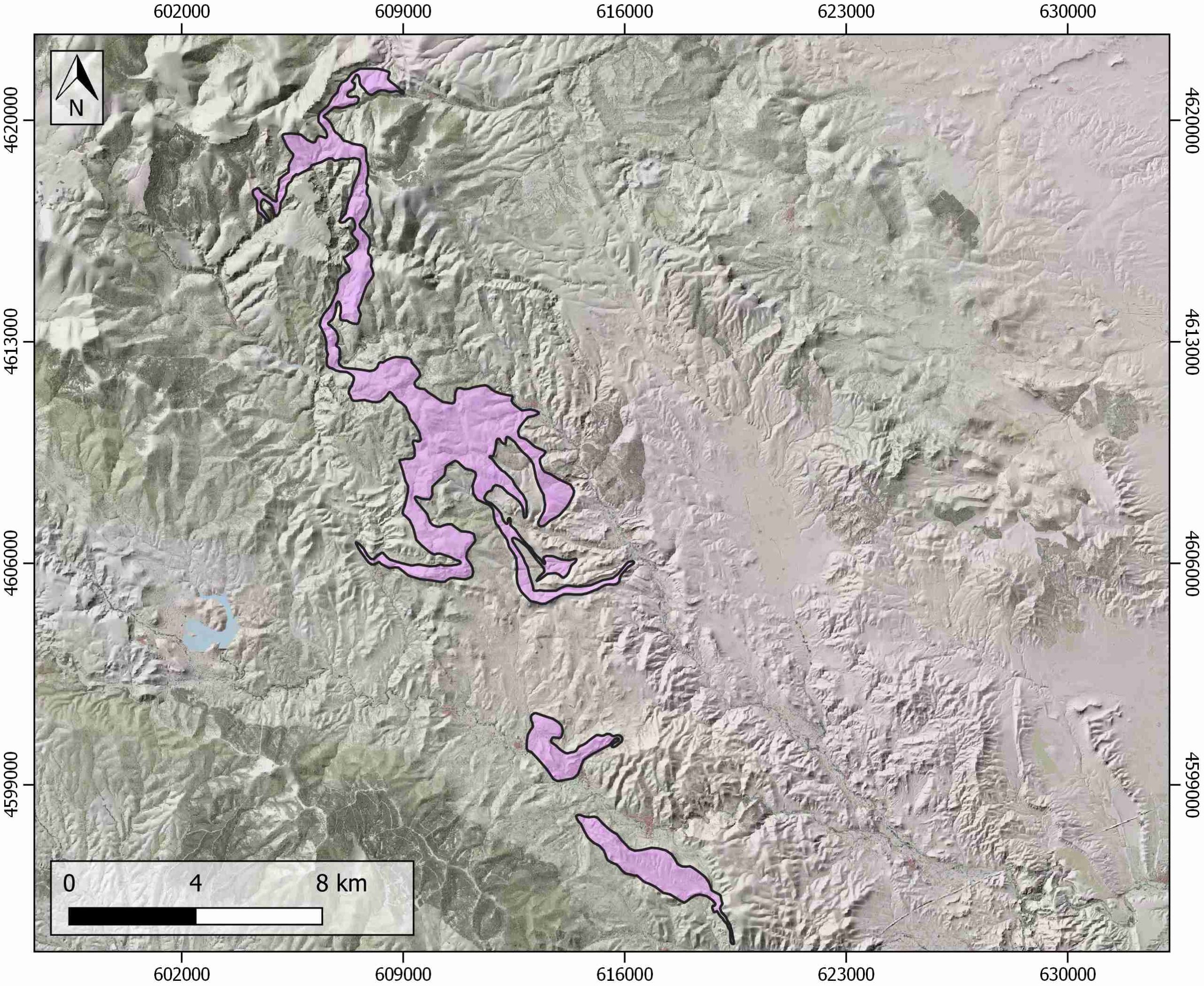
| Structure type | Evaporite body |
| Deformed/Undeformed | Deformed |
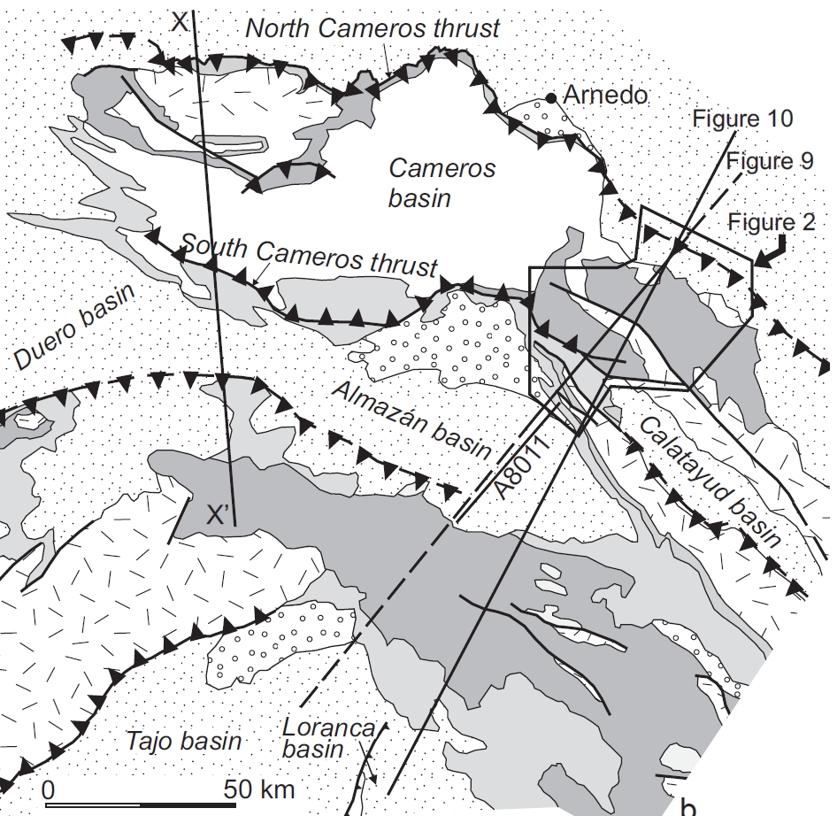
| Geological Setting | Aragonese branch, Iberian Range |
| Outcropping/buried | Outcropping |
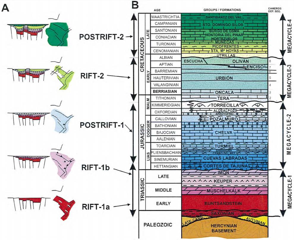
| Evaporite unit/s name | Keuper facies, Middle Muschelkalk facies |
| Evaporite unit/s age | Upper Anisian and Carnian-Rhaetian (Middle-Upper Triassic) |
| Evaporite unit/s origin | Marine |
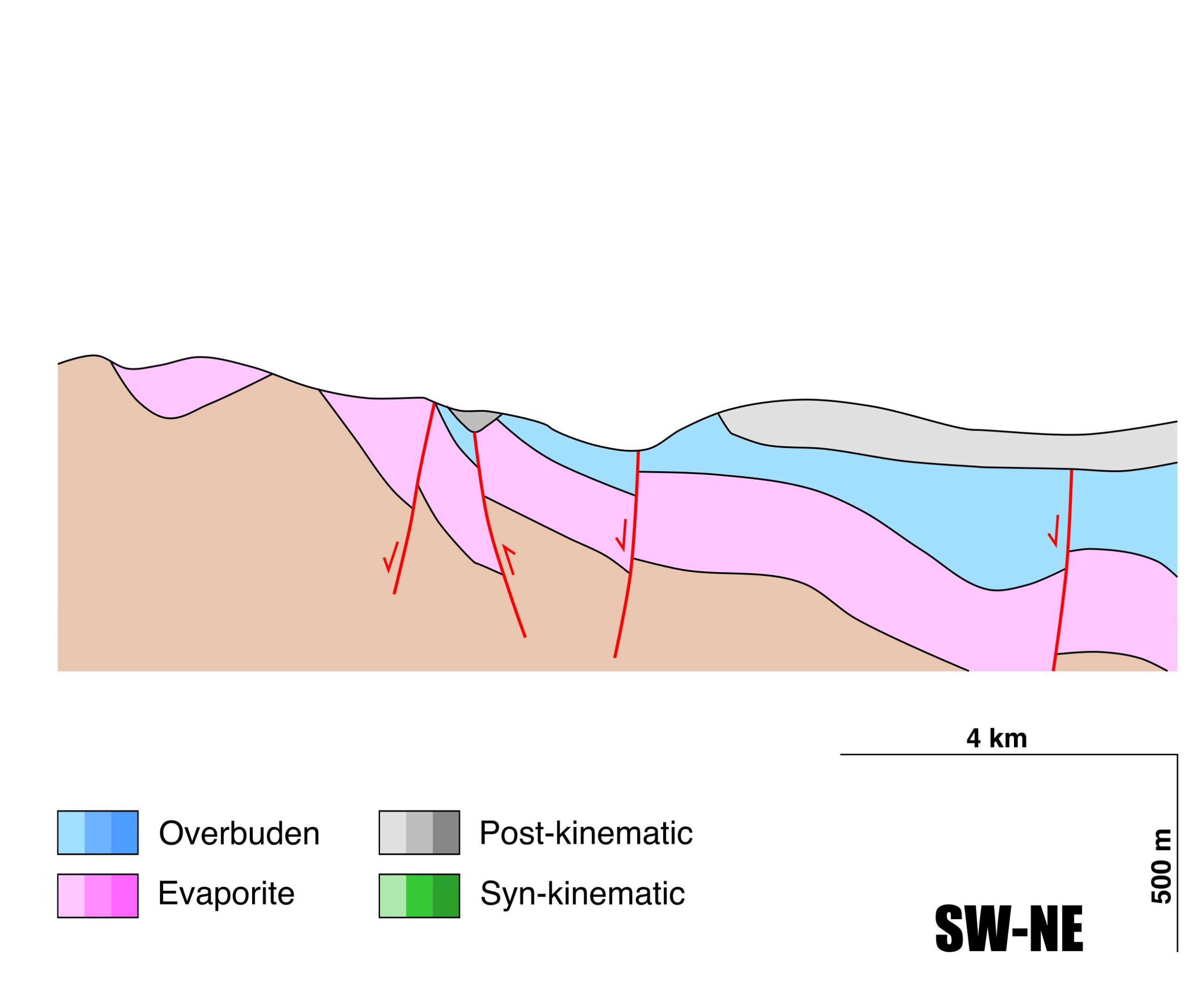
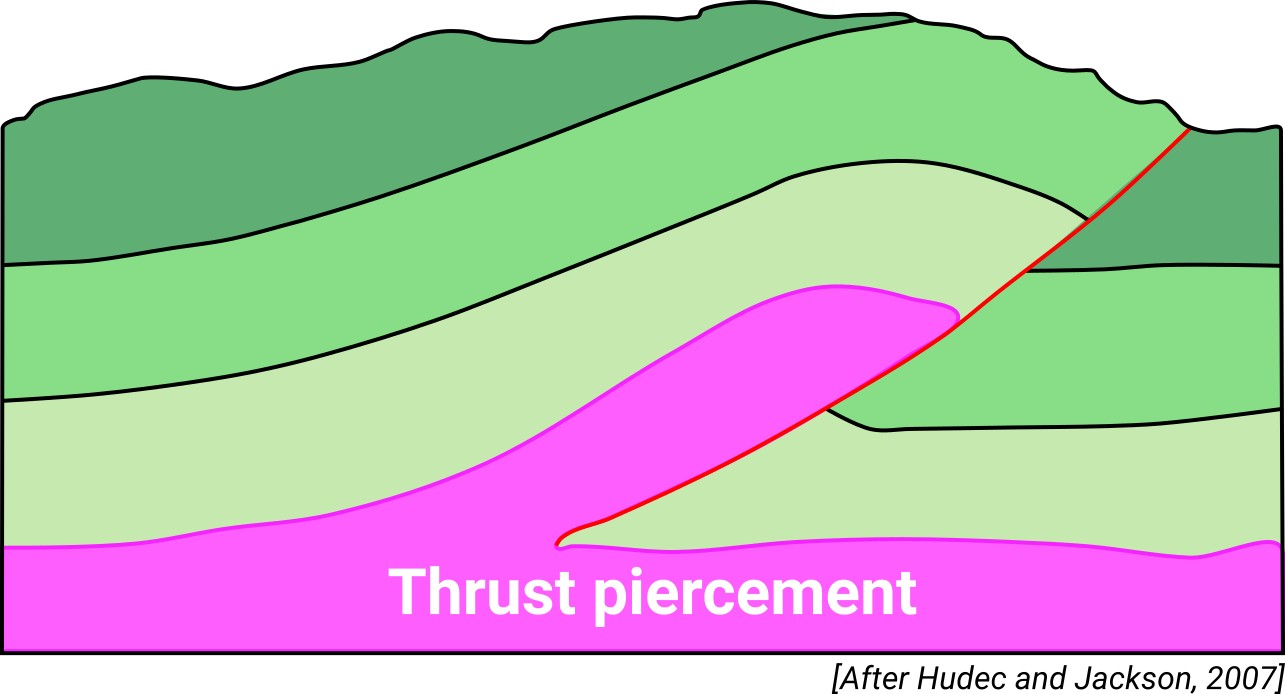
| Classif. (Hudec and Jackson, 2009) | Thrust piercement |
| Classif. (Jackson and Talbot, 1986) | |
| Age of evaporite flow or deformation (when deformed) | Eocene, Miocene |
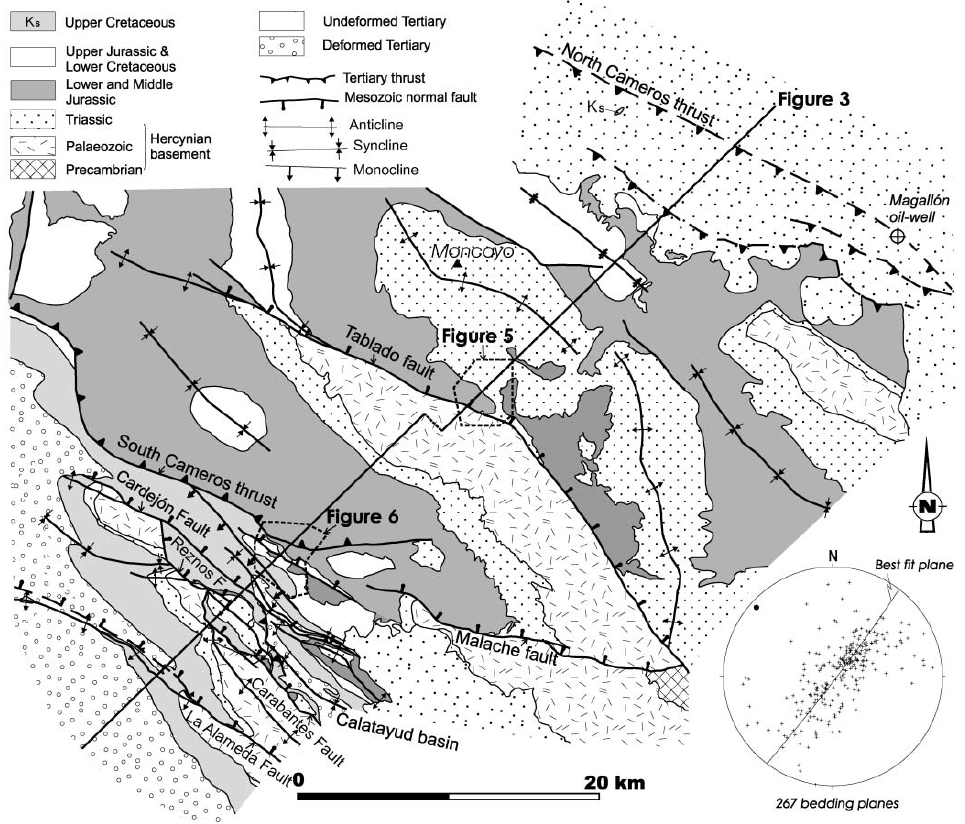
| Other comments | Triassic (Keuper) rocks in the hanging wall thrust onto Upper Cretaceous rocks in the footwall (see Guimerà et al., 2004). |
Generic Data
| Unique ID | 131 |
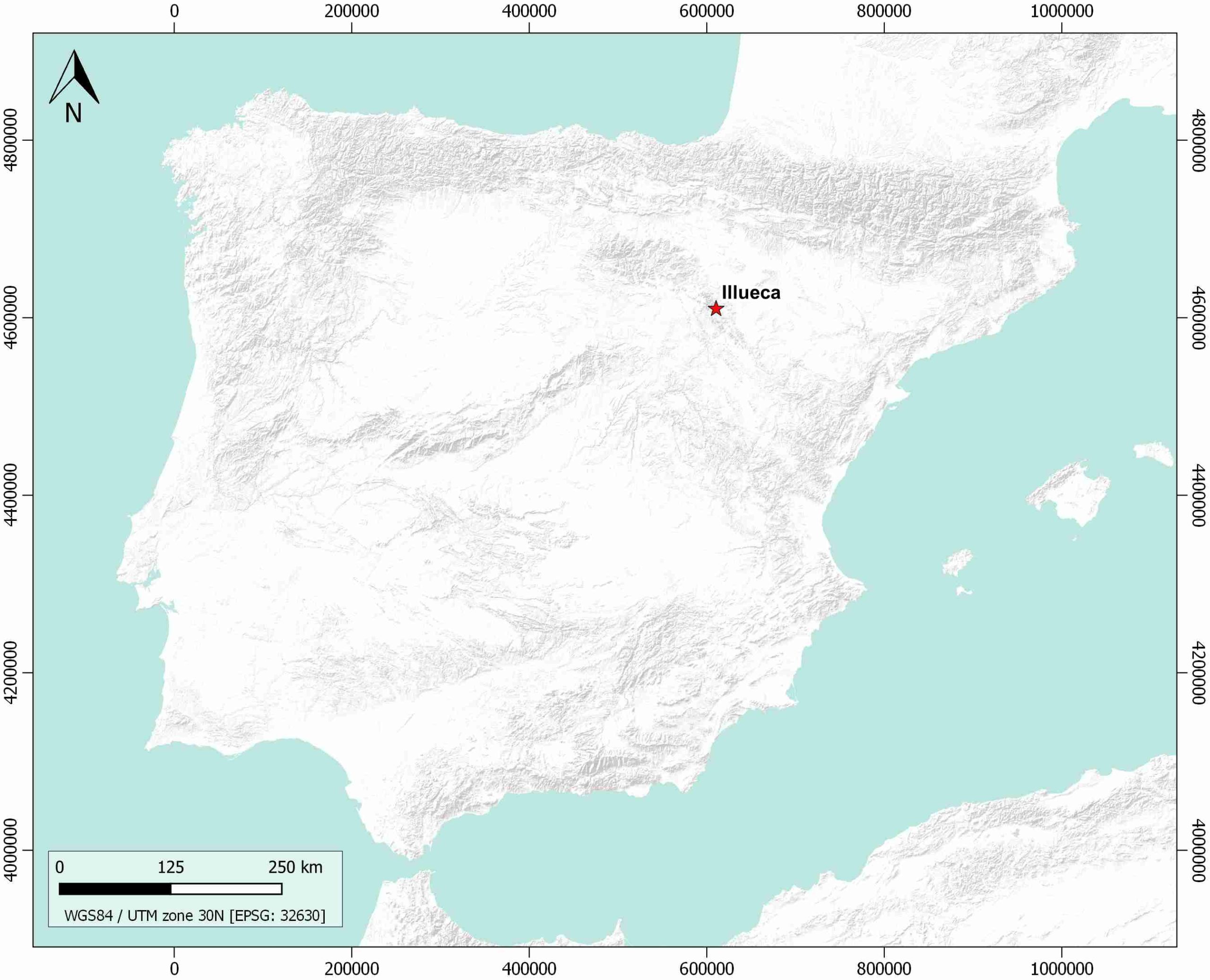
| Name | Illueca |
| Structure type | Evaporite body |
| Deformed/Undeformed | Deformed |
| Buried/Outcropping | Outcropping |
| Geological setting | Iberian Range |
| Geological Regional Setting | Aragonese Branch |
| Evaporite unit/s name | Middle Muschelkalk and Keuper Facies |
| Evaporite unit/s age | Upper Anisian and Carnian-Rhaetian (Middle-Upper Triassic) |
| Evaporite unit/s era | Mesozoic |
| Evaporite unit/s origin | Marine |
| Evaporite unit/s composition | Gypsum-Claystonestones-Limestones-Marlstoney Limestones |
| Post-kinematic unit/s (or post-evaporite units when evaporites are undeformed) | Upper Miocene (lacustrine limestones and marlstones) ; Pliocene (fluvial deposits) ; Quaternary (alluvial and colluvial detrital deposits) |
| Post-kinematic unit/s age (or post-evaporite units when evaporites are undeformed) | Upper Miocene-Holocene |
| Classification (Hudec and Jackson, 2009) | Thrust piercement |
| Classification (Jackson and Talbot, 1986) | |
| Mining activity? | Y |
| Mining activity start | – |
| Mining activity end | – |
| Mining galleries? | – |
| Mining products | Fe-oxides |
| Mining sub-products | – |
| Evaporite flow? | Y |
| Age of evaporite flow | Late Eocene-Miocene |
| Flow or deformation triggering mechanisms | Alpine compression |
| Flow-linked structures? | Y |
| Halokinetic structures | Fractures / Anticline-Syncline folding / Thrust faults |
| Post-evaporite and pre-kinematic unit/s (overbuden) | Upper Triassic-Lower Jurassic (Cortes de Tajuña and Imón Fms., dolostones, «carniolas» and limestones) ; Lower Jurassic-Middle Jurassic (limestones, marlstones, marly limestones) |
| Syn-kinematic unit/s | Lower-Middle Miocene (red mudstones, conglomerates, and sandstones) |
| Available seismic profiles | |
| Available boreholes | – |
| Additional comments | Triassic (Keuper) rocks in the hanging wall thrust onto Upper Cretaceous rocks in the footwall (see Guimerà et al., 2004) |
Mining Data
| UNIQUE_ID | 131 |
| Minning exploitations within <2km? | Y |
| Historical/Active | Active |
| Exploitation name #1 | SANTA ROSA |
| Exploitation ID (Spanish National Mining Cadastre) #1 | 2092 |
| Municipality #1 | Tierga |
| Province #1 | ZARAGOZA |
| Company #1 | PROMINDSA |
| Main minning Products #1 | Fe-oxides |
| Exploitation name #2 | SAN FELICES |
| Exploitation ID (Spanish National Mining Cadastre) #2 | 2821 |
| Municipality #2 | Morés |
| Province #2 | ZARAGOZA |
| Company #2 | DOLOMIAS DE ARAGON, S.L |
| Main minning Products #2 | Dolostone |
| Exploitation name #3 | |
| Exploitation ID (Spanish National Mining Cadastre) #3 | |
| Municipality #3 | |
| Province #3 | |
| Company #3 | |
| Main minning Products #3 |
Quantitative Data
| UNIQUE_ID | 131 |
| Outcropping area (km2) | 33.78671 |
| Horizontal intersection area (km2) (when buried) | Not buried |
| Depth of intersection area (km2) (when buried) | Not buried |
| Max. Width (Km) | 30.0818367 |
| Max. Length (Km) | 7.89758943 |
| Max. Evaporites thickness (km) | 0.2 |
| Max. Deformation age (Ma) | 40 |
| Min. Deformation age (Ma) | 15 |
| Deformation stages | 1 |
Reference Data
| UNIQUE_ID | 131 |
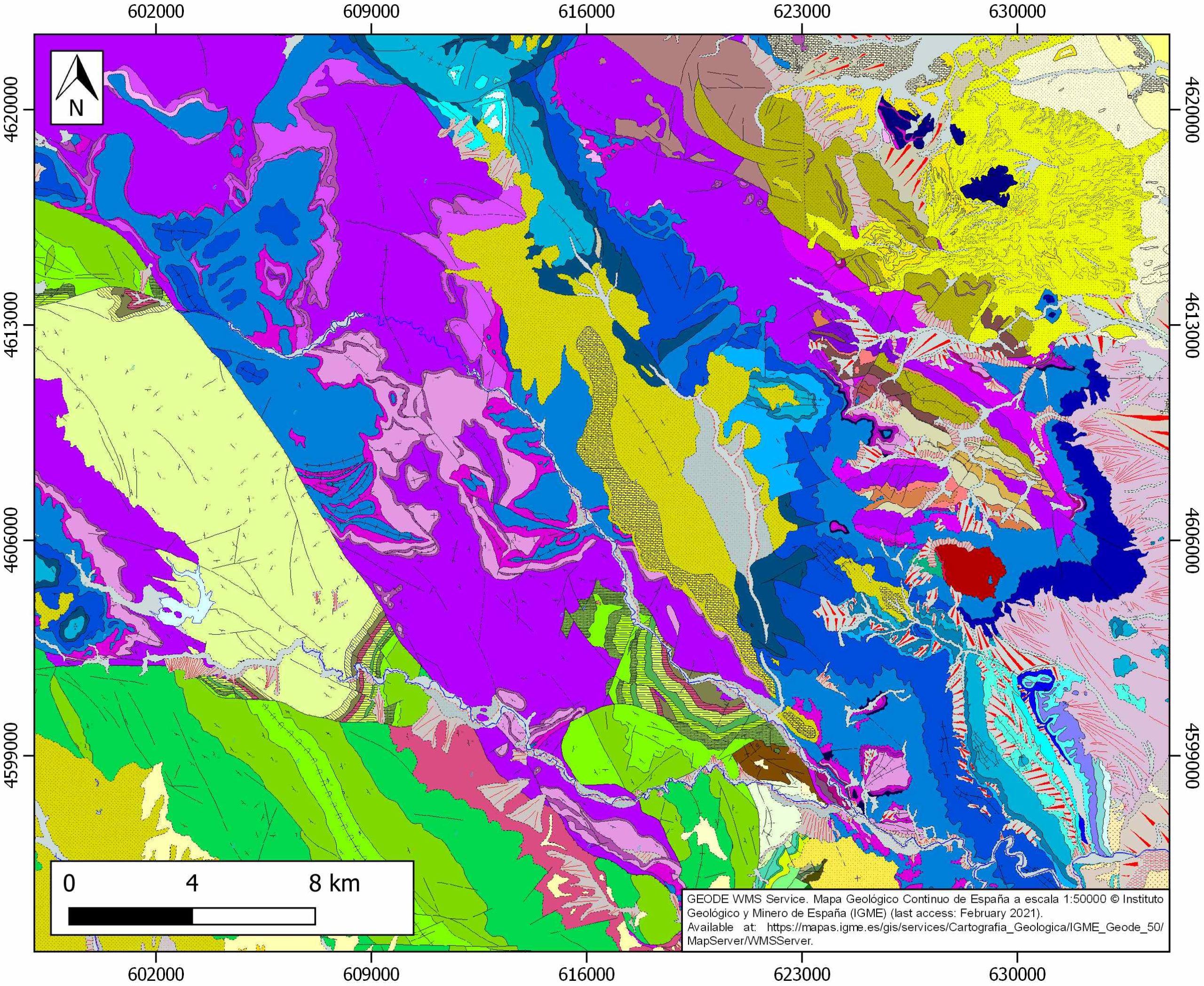
| Section source | IGME MAGNA 50. SHEET 381 (ILLUECA) |
| Well / Borehole availability #1 | Muñoz Recio, A., 1993. Análisis del Pérmico y Triásico en el subsuelo del tercio noroccidental de la Cordillera Ibérica y áreas adyacentes [Ph.D. Thesis]: Universidad Complutense de Madrid, 382pp. [link] |
| Well / Borehole availability #2 | Lanaja, J. M., R. Querol, A. Navarro, 1987. Contribución de la Exploración Petrolífera al Conocimiento de la Geología de España, pp. 1–465, Instituto Geológico y Minero de España, Madrid. [link] |
| Available data (Stratigraphy) #1 | Bueno, N. S., Abad, C. A., Imaz, A. G., 2019. Sedimentación fluvial y lacustre sintectónica ligada a un sinclinal de “buttressing” paralelo a una falla en el sector de Nigüella (NW Cordillera Ibérica). Estudios Geológicos, 75(1), 089. [link] |
| Available data (Stratigraphy) #2 | Guimerà, J., Mas, R., Alonso, Á., 2004. Intraplate deformation in the NW Iberian Chain: Mesozoic extension and Tertiary contractional inversion. Journal of the Geological Society, 161(2), 291-303. [link] |
| Available data (Stratigraphy) #3 | Arribas, J., 1985. Base litoestratigráfica de las facies Buntsandstein y Muschelkalk en la rama aragonesa de la Cordillera Ibérica (zona norte). Estudios Geológicos, 41(1-2), 47–58. [link] |
| Available data (Stratigraphy) #4 | Arche, A., López-Gómez, J., Marzo, M. Vargas H., 2004. The siliciclastic Permian-Triassic deposits in Central and Northeastern Iberian Peninsula (Iberian, Ebro and Catalan Basins): A proposal for correlation. Geologica Acta, 2(4), 305-320. [link] |
| Available data (Stratigraphy) #5 | Diez, J. B., Bourquin, S., Broutin, J., Ferrer, J., 2007. The Iberian Permian Triassic ‘Buntsandstein’of the Aragonian Branch of the Iberian range (Spain) in the West-European sequence stratigraphical framework: a combined palynological and sedimentological approach. Bulletin de la Société Géologique de France, 178(3), 179-195. [link] |
| Available data (Stratigraphy) #6 | n.a. |
| Regional Stratigraphy | Mas, R., Benito, M. I., Arribas, J., Serrano, A., Guimerà, J., Alonso, A., …, Trip, G. F., 2003. The Cameros Basin: From late Jurassic-early Cretaceous Extension to Tertiary contractional inversion-implications of hydrocarbon exploration. In AAPG International Conference and Exhibition (pp. 21-24). Geological Field Trip. [link] |
| Seismic data availability #1 | n.a. |
| Seismic data availability #2 | n.a. |
| Seismic data availability #3 | n.a. |
| Available data (Structure) #1 | Guimerà, J., Mas, R., Alonso, Á., 2004. Intraplate deformation in the NW Iberian Chain: Mesozoic extension and Tertiary contractional inversion. Journal of the Geological Society, 161(2), 291-303. [link] |
| Available data (Structure) #2 | Bueno, N. S., Abad, C. A., Imaz, A. G., 2019. Sedimentación fluvial y lacustre sintectónica ligada a un sinclinal de “buttressing” paralelo a una falla en el sector de Nigüella (NW Cordillera Ibérica). Estudios Geológicos, 75(1), 089. [link] |
| Available data (Structure) #3 | Guimerà, J., 2018. Structure of an intraplate fold-and-thrust belt: The Iberian Chain. A synthesis. Geologica Acta, 16(4), 427-438. [link] |
| Available data (Structure) #4 | Guimerà, J., Mas, R., Alonso, Á., 2004. Intraplate deformation in the NW Iberian Chain: Mesozoic extension and Tertiary contractional inversion. Journal of the Geological Society, 161(2), 291-303. [link] |
| Available data (Structure) #5 | Mas, R., Benito, M. I., Arribas, J., Serrano, A., Guimerà, J., Alonso, A., …, Trip, G. F., 2003. The Cameros Basin: From late Jurassic-early Cretaceous Extension to Tertiary contractional inversion-implications of hydrocarbon exploration. In AAPG International Conference and Exhibition (pp. 21-24). Geological Field Trip. [link] |
| Available data (Structure) #6 | n.a. |
| Available data (Analogue modelling) #1 | n.a. |
| Available data (Analogue modelling) #2 | n.a. |
| Available data (Analogue modelling) #3 | n.a. |
| Available data (Gravimetry – Tomography) #1 | Ayala, C., Bohoyo, F., Maestro, A., Reguera, M. I., Torne, M., Rubio, F., Fernández, M., García-Lobón, J. L., 2016. Updated Bouguer anomalies of the Iberian Peninsula: a new perspective to interpret the regional geology. Journal of Maps, 12(5), 1089-1092. [link] |
| Available data (Gravimetry – Tomography) #2 | n.a. |
| Available data (Gravimetry – Tomography) #3 | n.a. |
| Available data (Geochemistry) #1 | n.a. |
| Available data (Geochemistry) #2 | n.a. |
| Available data (Geochemistry) #3 | n.a. |
| Available data (Geochemistry) #4 | n.a. |
| Available data (Petrophysics) #1 | n.a. |
| Available data (Petrophysics) #2 | n.a. |
| IGME Geological Map (MAGNA50) Sheet number | 381-Illueca. [link] |
| Other Maps #1 (source) | Guimerà, J., Mas, R., Alonso, Á., 2004. Intraplate deformation in the NW Iberian Chain: Mesozoic extension and Tertiary contractional inversion. Journal of the Geological Society, 161(2), 291-303. [link] |
| Other Maps #2 (source) | Guimerà, J., Mas, R., Alonso, Á., 2004. Intraplate deformation in the NW Iberian Chain: Mesozoic extension and Tertiary contractional inversion. Journal of the Geological Society, 161(2), 291-303. [link] |
| Other related references #1 | Arribas M., Ochoa, M., Mas, J. R., González L., 2007. Sandstone petrofacies in the northwestern sector of the Iberian Basin. Journal of iberian geology, 33, 191-206. [link] |
| Other related references #2 | Casas Sainz, A. M., Calvin, P., Pueyo, Ó., Pocoví, A., Marcén, M., Simón, J. L., …, Revuelto, C., 2017. El embalse de Mularroya (Zaragoza): problemas geológicos de una obra en avanzado estado de construcción. Revista de la Sociedad Geológica de España, 30, 51-64. [link] |
| Other related references #3 | De Vicente, G., Vegas, R., Muñoz-Martín, A., Van Wees, J. D., Casas-Sáinz, A., Sopeña, A., …, Fernández-Lozano, J., 2009. Oblique strain partitioning and transpression on an inverted rift: The Castilian Branch of the Iberian Chain. Tectonophysics, 470(3-4), 224-242. [link] |
| Other related references #4 | Gand, G., De La Horra, R., Galán-Abellán, B., López-Gómez, J., Barrenechea, J. F., Arche, A., Benito, M. I., 2010. New ichnites from the Middle Triassic of the Iberian Ranges (Spain): paleoenvironmental and paleogeographical implications. Historical Biology, 22(1-3), 40-56. [link] |
Well and Seismic Data
| UNIQUE_ID | 131 |
| Seismic survey name #1 | |
| Across structure? #1 | |
| Seismic profile ID (IGME) #1 | |
| Seismic profile code #1 | |
| Seismic profile name #1 | |
| Seismic survey year #1 | |
| Data repository #1 | |
| Length (km) #1 | |
| Seismic survey name #2 | |
| Across structure? #2 | |
| Seismic profile ID (IGME) #2 | |
| Seismic profile code #2 | |
| Seismic profile name #2 | |
| Seismic survey year #2 | |
| Data repository #2 | |
| Length (km) #2 | |
| Seismic survey name #3 | |
| Across structure? #3 | |
| Seismic profile ID (IGME) #3 | |
| Seismic profile code #3 | |
| Seismic profile name #3 | |
| Seismic survey year #3 | |
| Data repository #3 | |
| Length (km) #3 | |
| Seismic survey name #4 | |
| Across structure? #4 | |
| Seismic profile ID (IGME) #4 | |
| Seismic profile code #4 | |
| Seismic profile name #4 | |
| Seismic survey year #4 | |
| Data repository #4 | |
| Length (km) #4 | |
| Seismic survey name #5 | |
| Across structure? #5 | |
| Seismic profile ID (IGME) #5 | |
| Seismic profile code #5 | |
| Seismic profile name #5 | |
| Seismic survey year #5 | |
| Data repository #5 | |
| Length (km) #5 | |
| Seismic survey name #6 | |
| Across structure? #6 | |
| Seismic profile ID (IGME) #6 | |
| Seismic profile code #6 | |
| Seismic profile name #6 | |
| Seismic survey year #6 | |
| Data repository #6 | |
| Length (km) #6 | |
| Seismic survey name #7 | |
| Across structure? #7 | |
| Seismic profile ID (IGME) #7 | |
| Seismic profile code #7 | |
| Seismic profile name #7 | |
| Seismic survey year #7 | |
| Data repository #7 | |
| Length (km) #7 | |
| Seismic survey name #8 | |
| Across structure? #8 | |
| Seismic profile ID (IGME) #8 | |
| Seismic profile code #8 | |
| Seismic profile name #8 | |
| Seismic survey year #8 | |
| Data repository #8 | |
| Length (km) #8 | |
| Seismic survey name #9 | |
| Across structure? #9 | |
| Seismic profile ID (IGME) #9 | |
| Seismic profile code #9 | |
| Seismic profile name #9 | |
| Seismic survey year #9 | |
| Data repository #9 | |
| Length (km) #9 | |
| Seismic survey name #10 | |
| Across structure? #10 | |
| Seismic profile ID (IGME) #10 | |
| Seismic profile code #10 | |
| Seismic profile name #10 | |
| Seismic survey year #10 | |
| Data repository #10 | |
| Length (km) #10 | |
| Seismic survey name #11 | |
| Across structure? #11 | |
| Seismic profile ID (IGME) #11 | |
| Seismic profile code #11 | |
| Seismic profile name #11 | |
| Seismic survey year #11 | |
| Data repository #11 | |
| Length (km) #11 | |
| Seismic survey name #12 | |
| Across structure? #12 | |
| Seismic profile ID (IGME) #12 | |
| Seismic profile code #12 | |
| Seismic profile name #12 | |
| Seismic survey year #12 | |
| Data repository #12 | |
| Length (km) #12 | |
| Seismic survey name #13 | |
| Across structure? #13 | |
| Seismic profile ID (IGME) #13 | |
| Seismic profile code #13 | |
| Seismic profile name #13 | |
| Seismic survey year #13 | |
| Data repository #13 | |
| Length (km) #13 | |
| Seismic survey name #14 | |
| Across structure? #14 | |
| Seismic profile ID (IGME) #14 | |
| Seismic profile code #14 | |
| Seismic profile name #14 | |
| Seismic survey year #14 | |
| Data repository #14 | |
| Length (km) #14 | |
| Seismic survey name #15 | |
| Across structure? #15 | |
| Seismic profile ID (IGME) #15 | |
| Seismic profile code #15 | |
| Seismic profile name #15 | |
| Seismic survey year #15 | |
| Data repository #15 | |
| Length (km) #15 | |
| Seismic survey name #16 | |
| Across structure? #16 | |
| Seismic profile ID (IGME) #16 | |
| Seismic profile code #16 | |
| Seismic profile name #16 | |
| Seismic survey year #16 | |
| Data repository #16 | |
| Length (km) #16 | |
| Seismic survey name #17 | |
| Across structure? #17 | |
| Seismic profile ID (IGME) #17 | |
| Seismic profile code #17 | |
| Seismic profile name #17 | |
| Seismic survey year #17 | |
| Data repository #17 | |
| Length (km) #17 | |
| Seismic survey name #18 | |
| Across structure? #18 | |
| Seismic profile ID (IGME) #18 | |
| Seismic profile code #18 | |
| Seismic profile name #18 | |
| Seismic survey year #18 | |
| Data repository #18 | |
| Length (km) #18 | |
| Seismic survey name #19 | |
| Across structure? #19 | |
| Seismic profile ID (IGME) #19 | |
| Seismic profile code #19 | |
| Seismic profile name #19 | |
| Seismic survey year #19 | |
| Data repository #19 | |
| Length (km) #19 | |
| Seismic survey name #20 | |
| Across structure? #20 | |
| Seismic profile ID (IGME) #20 | |
| Seismic profile code #20 | |
| Seismic profile name #20 | |
| Seismic survey year #20 | |
| Data repository #20 | |
| Length (km) #20 | |
| Seismic survey name #21 | |
| Across structure? #21 | |
| Seismic profile ID (IGME) #21 | |
| Seismic profile code #21 | |
| Seismic profile name #21 | |
| Seismic survey year #21 | |
| Data repository #21 | |
| Length (km) #21 | |
| Borehole name #1 | |
| Company #1 | |
| Traget #1 | |
| Across structure? #1 | |
| Borehole name #2 | |
| Company #2 | |
| Traget #2 | |
| Across structure? #2 | |
| Borehole name #3 | |
| Company #3 | |
| Traget #3 | |
| Across structure? #3 | |
| Borehole name #4 | |
| Company #4 | |
| Traget #4 | |
| Across structure? #4 | |
| Borehole name #5 | |
| Company #5 | |
| Traget #5 | |
| Across structure? #5 | |
| Borehole name #6 | |
| Company #6 | |
| Traget #6 | |
| Across structure? #6 | |
| Borehole name #7 | |
| Company #7 | |
| Traget #7 | |
| Across structure? #7 | |
| Borehole name #8 | |
| Company #8 | |
| Traget #8 | |
| Across structure? #8 | |
| Borehole name #9 | |
| Company #9 | |
| Traget #9 | |
| Across structure? #9 | |
| Borehole name #10 | |
| Company #10 | |
| Traget #10 | |
| Across structure? #10 | |
| Borehole name #11 | |
| Company #11 | |
| Traget #11 | |
| Across structure? #11 | |
| Borehole name #12 | |
| Company #12 | |
| Traget #12 | |
| Across structure? #12 | |
| Borehole name #13 | |
| Company #13 | |
| Traget #13 | |
| Across structure? #13 | |
| Borehole name #14 | |
| Company #14 | |
| Traget #14 | |
| Across structure? #14 | |
| Borehole name #15 | |
| Company #15 | |
| Traget #15 | |
| Across structure? #15 |
Geographical Data (EPSG:4326 - WGS 84)
| UNIQUE_ID | 131 |
| X Centroid (Structure shape) | -1.667787 |
| Y Centroid (Structure shape) | -1.667787 |
| Xmin (Structure shape) | -1.747041 |
| Xmax (Structure shape) | -1.568986 |
| Ymin (Structure shape) | 41.488384 |
| Ymax (Structure shape) | 41.739220 |
| Xmin seismic line #1 | |
| Xmax seismic line #1 | |
| Ymin seismic line #1 | |
| Ymax seismic line #1 | |
| Xmin seismic line #2 | |
| Xmax seismic line #2 | |
| Ymin seismic line #2 | |
| Ymax seismic line #2 | |
| Xmin seismic line #3 | |
| Xmax seismic line #3 | |
| Ymin seismic line #3 | |
| Ymax seismic line #3 | |
| Xmin seismic line #4 | |
| Xmax seismic line #4 | |
| Ymin seismic line #4 | |
| Ymax seismic line #4 | |
| Xmin seismic line #5 | |
| Xmax seismic line #5 | |
| Ymin seismic line #5 | |
| Ymax seismic line #5 | |
| Xmin seismic line #6 | |
| Xmax seismic line #6 | |
| Ymin seismic line #6 | |
| Ymax seismic line #6 | |
| Xmin seismic line #7 | |
| Xmax seismic line #7 | |
| Ymin seismic line #7 | |
| Ymax seismic line #7 | |
| Xmin seismic line #8 | |
| Xmax seismic line #8 | |
| Ymin seismic line #8 | |
| Ymax seismic line #8 | |
| Xmin seismic line #9 | |
| Xmax seismic line #9 | |
| Ymin seismic line #9 | |
| Ymax seismic line #9 | |
| Xmin seismic line #10 | |
| Xmax seismic line #10 | |
| Ymin seismic line #10 | |
| Ymax seismic line #10 | |
| Xmin seismic line #11 | |
| Xmax seismic line #11 | |
| Ymin seismic line #11 | |
| Ymax seismic line #11 | |
| Xmin seismic line #12 | |
| Xmax seismic line #12 | |
| Ymin seismic line #12 | |
| Ymax seismic line #12 | |
| Xmin seismic line #13 | |
| Xmax seismic line #13 | |
| Ymin seismic line #13 | |
| Ymax seismic line #13 | |
| Xmin seismic line #14 | |
| Xmax seismic line #14 | |
| Ymin seismic line #14 | |
| Ymax seismic line #14 | |
| Xmin seismic line #15 | |
| Xmax seismic line #15 | |
| Ymin seismic line #15 | |
| Ymax seismic line #15 | |
| Xmin seismic line #16 | |
| Xmax seismic line #16 | |
| Ymin seismic line #16 | |
| Ymax seismic line #16 | |
| Xmin seismic line #17 | |
| Xmax seismic line #17 | |
| Ymin seismic line #17 | |
| Ymax seismic line #17 | |
| Xmin seismic line #18 | |
| Xmax seismic line #18 | |
| Ymin seismic line #18 | |
| Ymax seismic line #18 | |
| Xmin seismic line #19 | |
| Xmax seismic line #19 | |
| Ymin seismic line #19 | |
| Ymax seismic line #19 | |
| Xmin seismic line #20 | |
| Xmax seismic line #20 | |
| Ymin seismic line #20 | |
| Ymax seismic line #20 | |
| Xmin seismic line #21 | |
| Xmax seismic line #21 | |
| Ymin seismic line #21 | |
| Ymax seismic line #21 | |
| X borehole #1 | |
| Y borehole #1 | |
| X borehole #2 | |
| Y borehole #2 | |
| X borehole #3 | |
| Y borehole #3 | |
| X borehole #4 | |
| Y borehole #4 | |
| X borehole #5 | |
| Y borehole #5 | |
| X borehole #6 | |
| Y borehole #6 | |
| X borehole #7 | |
| Y borehole #7 | |
| X borehole #8 | |
| Y borehole #8 | |
| X borehole #9 | |
| Y borehole #9 | |
| X borehole #10 | |
| Y borehole #10 | |
| X borehole #11 | |
| Y borehole #11 | |
| X borehole #12 | |
| Y borehole #12 | |
| X borehole #13 | |
| Y borehole #13 | |
| X borehole #14 | |
| Y borehole #14 | |
| X borehole #15 | |
| Y borehole #15 |

