General Information
| Structure type | Evaporite Diapir |
| Deformed/Undeformed | Deformed |
| Geological Setting | Betic system, Sub-Betic cordillera |
| Outcropping/buried | Outcropping |
| Evaporite unit/s name | Keuper facies |
| Evaporite unit/s age | Carnian-Rhaetian (Upper Triassic) |
| Evaporite unit/s origin | Marine |
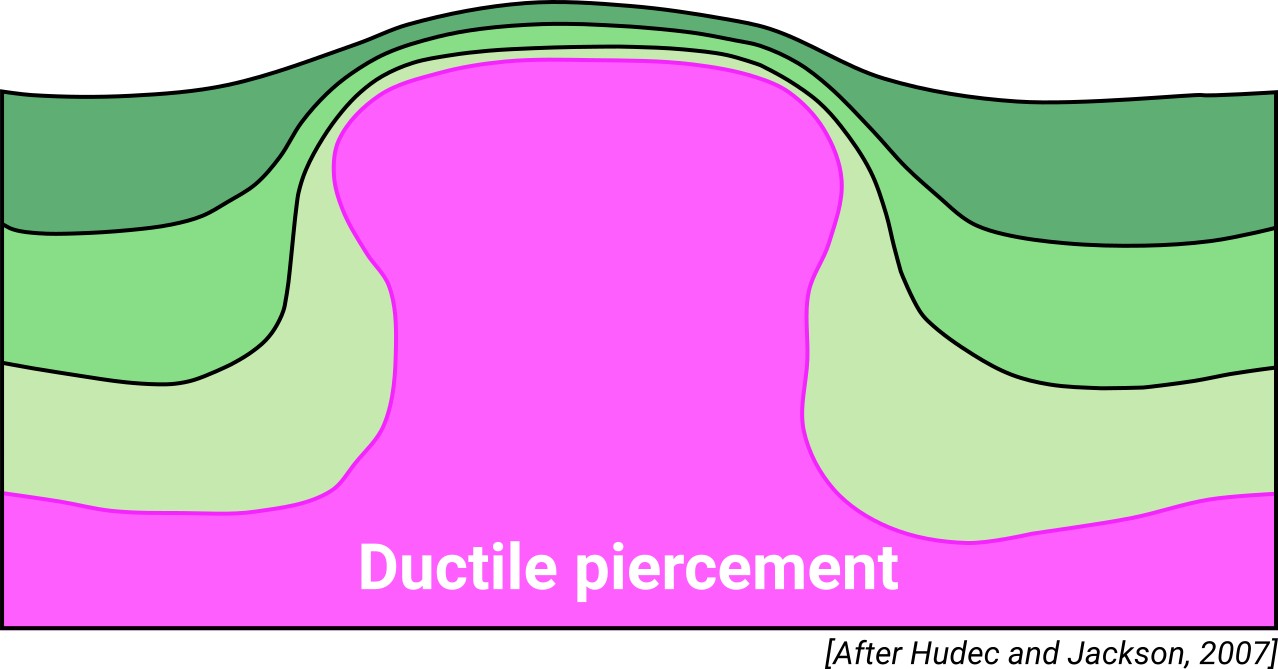
| Classif. (Hudec and Jackson, 2009) | Ductile piercement, Thrust piercement |
| Classif. (Jackson and Talbot, 1986) | Salt pillow |
| Age of evaporite flow or deformation (when deformed) | Lower Cretaceous, Quaternary / Active now(?), Upper Cretaceous |
| Other comments | Complex tectonics, Keuper materials reworked by Miocene gravitational landslides. |
Generic Data
| Unique ID | 103 |
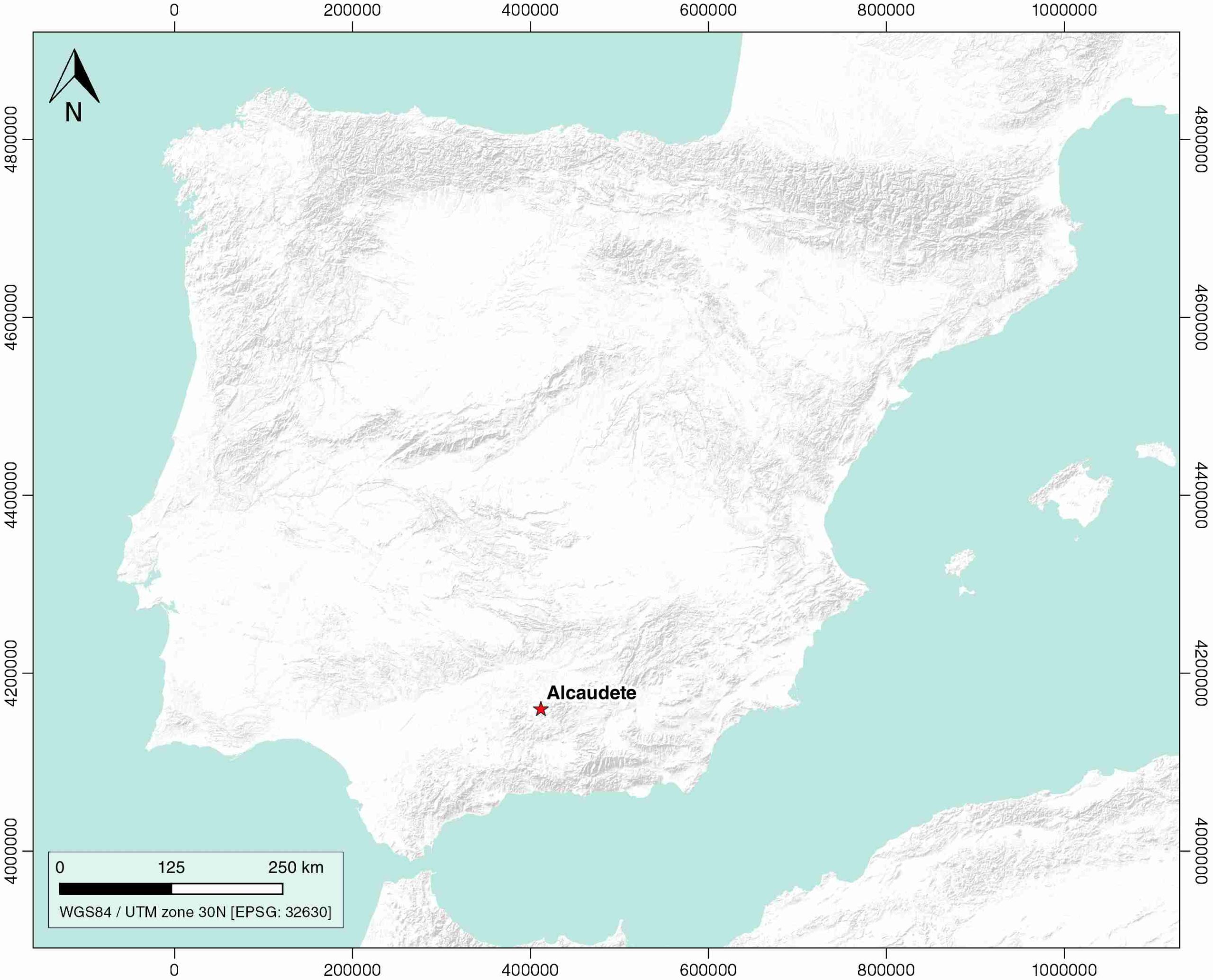
| Name | Alcaudete |
| Structure type | Evaporite diapir |
| Deformed/Undeformed | Deformed |
| Buried/Outcropping | Outcropping |
| Geological setting | Betic System |
| Geological Regional Setting | Sub-Betic Cordillera |
| Evaporite unit/s name | Keuper facies |
| Evaporite unit/s age | Carnian-Rhaetian (Upper Triassic) |
| Evaporite unit/s era | Mesozoic |
| Evaporite unit/s origin | Marine |
| Evaporite unit/s composition | Shale-Gypsum-Limestone-Dolostone |
| Post-kinematic unit/s (or post-evaporite units when evaporites are undeformed) | Palaeocene-Eocene (limestones and marly limestones) ; Oligocene-Burdigalian (white marlstones and bioclastic limestones) ; Middle-Upper Miocene (calcarenites, sandstones, conglomerates, breccias, white marlstones and limestones) ; Quaternary (alluvial and colluvial detrital deposits) |
| Post-kinematic unit/s age (or post-evaporite units when evaporites are undeformed) | Palaeocene-Holocene |
| Classification (Hudec and Jackson, 2009) | Thrust piercement / Ductile piercement |
| Classification (Jackson and Talbot, 1986) | Salt pillow |
| Mining activity? | Y |
| Mining activity start | |
| Mining activity end | Active |
| Mining galleries? | Y |
| Mining products | Gypsum |
| Mining sub-products | – |
| Evaporite flow? | Y |
| Age of evaporite flow | Cretaceous? Active now? |
| Flow or deformation triggering mechanisms | Traspressive-transtensive fractures (N95º to N130º) |
| Flow-linked structures? | Y |
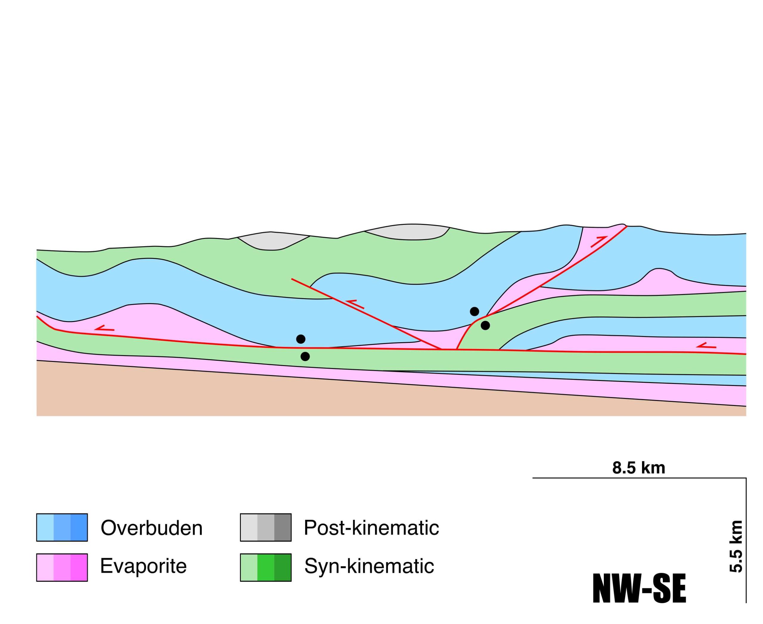
| Halokinetic structures | Thickness variations / progressive unconformities / thrust faults / overturned flanks / roll-over anticlines |
| Post-evaporite and pre-kinematic unit/s (overbuden) | Lower Jurassic (limestones, dolostones, marly limestones, marlstones) ; Middle Jurassic (limestones, oolitic limestones, marlstones, dolerites) ; Upper Jurassic (radiolaritic limestones, marlstones and breccias) |
| Syn-kinematic unit/s | Cretaceous (limestones, shales, marlstones, marly limestones, radiolaritic marlstones) |
| Available seismic profiles | CO-23 / CO-18 / S82-31 / CO-33 / S82-32 / RG-18 / RG-15 / CO-29 / CO-31 / CO-18 / CO-25 / CO-23 / CO-32 / CO-22 / |
| Available boreholes | S-VI-4-1 (ALCAUDETE) / S-VI-4-2 (ALCAUDETE) / FUENSANTA DE MARTOS-1 / CASTILLO DE LOCUBIN-2 / ALCAUDETE-6 / ALCAUDETE-5 (FUENTE PEÑA) / CASTILLO DE LOCUBIN-1 / ALCAUDETE-3 / ALCAUDETE-4 / ALCAUDETE-1 / ALCAUDETE-2 |
| Additional comments | Complex tectonics, Keuper materials reworked by Miocene gravitational landslides . |
Mining Data
| UNIQUE_ID | 103 |
| Minning exploitations within <2km? | Y |
| Historical/Active | Historical (not indexed in the Spanish National Minning Cadastre) |
| Exploitation name #1 | n.a. |
| Exploitation ID (Spanish National Mining Cadastre) #1 | n.a. |
| Municipality #1 | n.a. |
| Province #1 | n.a. |
| Company #1 | n.a. |
| Main minning Products #1 | Gypsum |
| Exploitation name #2 | |
| Exploitation ID (Spanish National Mining Cadastre) #2 | |
| Municipality #2 | |
| Province #2 | |
| Company #2 | |
| Main minning Products #2 | |
| Exploitation name #3 | |
| Exploitation ID (Spanish National Mining Cadastre) #3 | |
| Municipality #3 | |
| Province #3 | |
| Company #3 | |
| Main minning Products #3 |
Quantitative Data
| UNIQUE_ID | 103 |
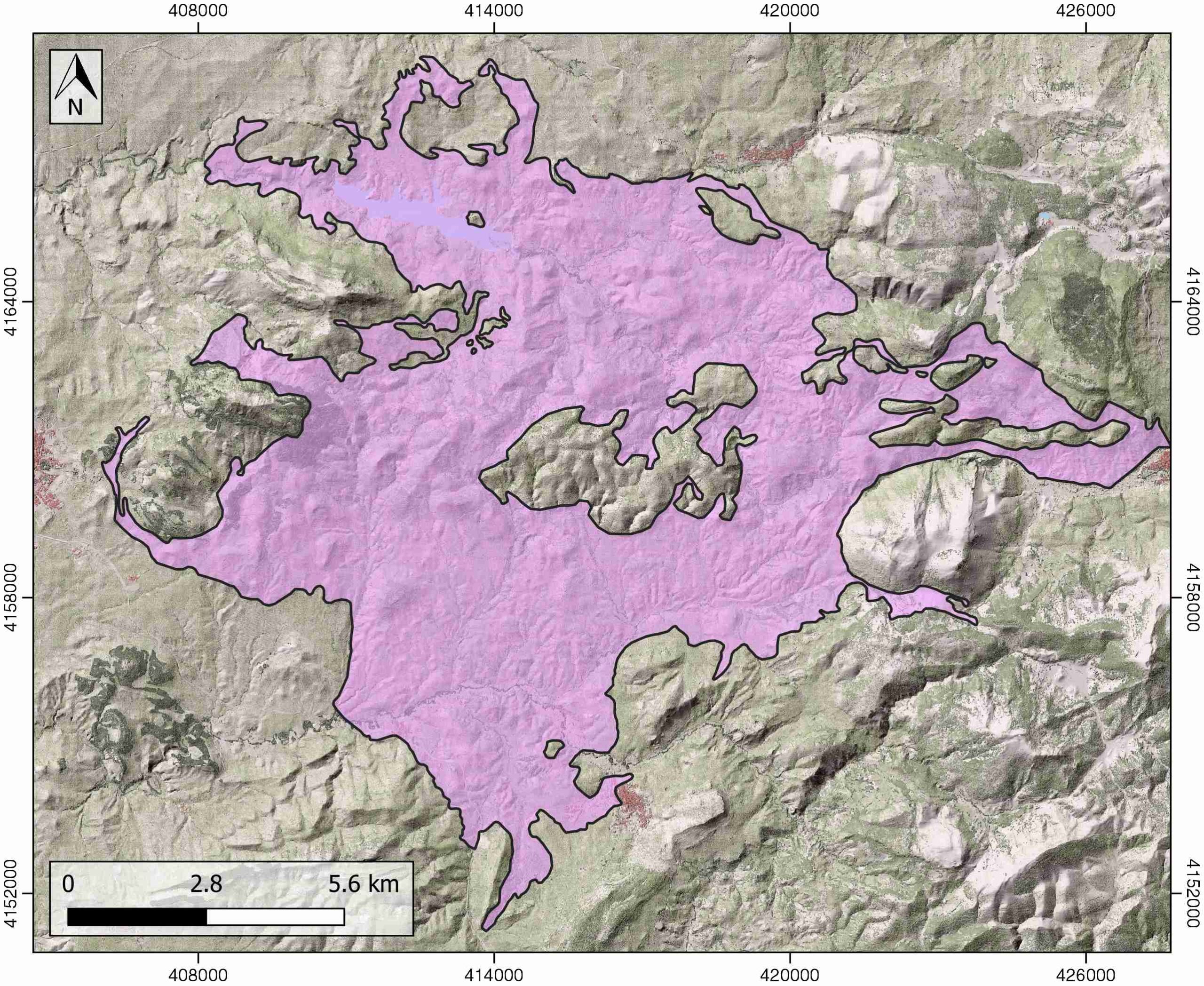
| Outcropping area (km2) | 124.75437 |
| Horizontal intersection area (km2) (when buried) | Not buried |
| Depth of intersection area (km2) (when buried) | Not buried |
| Max. Width (Km) | 17.131441 |
| Max. Length (Km) | 18.2544508 |
| Max. Evaporites thickness (km) | 0.4 |
| Max. Deformation age (Ma) | 145 |
| Min. Deformation age (Ma) | 66 |
| Deformation stages | 1? |
Reference Data
| UNIQUE_ID | 103 |
| Section source | Blankenship, C. L., 1992. Structure and palaeogeography of the External Betic Cordillera, southern Spain. Marine and Petroleum Geology, 9(3), 256-264. [link] |
| Well / Borehole availability #1 | Blankenship, C. L., 1992. Structure and palaeogeography of the External Betic Cordillera, southern Spain. Marine and Petroleum Geology, 9(3), 256-264. [link] |
| Well / Borehole availability #2 | n.a. |
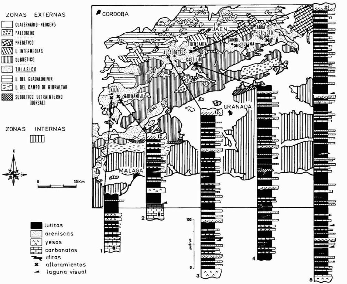
| Available data (Stratigraphy) #1 | Pérez-López, A., López Chicano, M., 1989. Estudio sedimentológico del Keuper inferior, a partir del análisis de facies, en el sector central de la Cordillera Bética. Algunas consideraciones paleogeográficas. Estudios Geológicos, 45, 375-385. [link] |
| Available data (Stratigraphy) #2 | Pérez-López, A. D., de Porta, N. S., Márquez, L., Aliaga, A. M., 1992. Caracterización Y Datación De Una Unidad Carbonática De Edad Norense (FM. Zamoranos) En El Trías De La Zona Subbética. Revista de la Sociedad Geológica de España, 5(2), 113-127. [link] |
| Available data (Stratigraphy) #3 | Berástegui, X., Banks, C. J., Puig, C., Taberner, C., Waltham, D., Fernández, M., 1998. Lateral diapiric emplacement of Triassic evaporites at the southern margin of the Guadalquivir Basin, Spain. Geological Society, London, Special Publications, 134(1), 49-68. [link] |
| Available data (Stratigraphy) #4 | Blankenship, C. L., 1992. Structure and palaeogeography of the External Betic Cordillera, southern Spain. Marine and Petroleum Geology, 9(3), 256-264. [link] |
| Available data (Stratigraphy) #5 | Lanaja, J. M., Querol, R., Navarro, A., 1987. Contribución de la exploración petrolífera al conocimiento de la geología de España. IGME. [link] |
| Available data (Stratigraphy) #6 | Flinch, J. F., Soto, J. I., 2017. Allochthonous Triassic and Salt Tectonic Processes in the Betic-Rif Orogenic Arc. In Permo-Triassic Salt Provinces of Europe, North Africa and the Atlantic Margins (pp. 417-446). Elsevier. [link] |
| Regional Stratigraphy | Pérez-López, A., López Chicano, M., 1989. Estudio sedimentológico del Keuper inferior, a partir del análisis de facies, en el sector central de la Cordillera Bética. Algunas consideraciones paleogeográficas. Estudios Geológicos, 45, 375-385. [link] |
| Seismic data availability #1 | Blankenship, C. L., 1992. Structure and palaeogeography of the External Betic Cordillera, southern Spain. Marine and Petroleum Geology, 9(3), 256-264. [link] |
| Seismic data availability #2 | Pérez‐Valera, F., Sánchez‐Gómez, M., Pérez‐López, A., Pérez‐Valera, L. A., 2017. An evaporite‐bearing accretionary complex in the northern front of the Betic‐Rif orogen. Tectonics, 36(6), 1006-1036. [link] |
| Seismic data availability #3 | n.a. |
| Available data (Structure) #1 | Blankenship, C. L., 1992. Structure and palaeogeography of the External Betic Cordillera, southern Spain. Marine and Petroleum Geology, 9(3), 256-264. [link] |
| Available data (Structure) #2 | Berástegui, X., Banks, C. J., Puig, C., Taberner, C., Waltham, D., Fernández, M., 1998. Lateral diapiric emplacement of Triassic evaporites at the southern margin of the Guadalquivir Basin, Spain. Geological Society, London, Special Publications, 134(1), 49-68. [link] |
| Available data (Structure) #3 | Pérez-López, A., Sanz de Galdeano, C., 1994. Tectónica de los materiales triásicos en el sector central de la Zona Subbética (Cordillera Bética). Revista de la Sociedad Geológica de España, 7, 143-153. [link] |
| Available data (Structure) #4 | Pérez‐Valera, F., Sánchez‐Gómez, M., Pérez‐López, A., Pérez‐Valera, L. A., 2017. An evaporite‐bearing accretionary complex in the northern front of the Betic‐Rif orogen. Tectonics, 36(6), 1006-1036. [link] |
| Available data (Structure) #5 | Lanaja, J. M., Querol, R., Navarro, A., 1987. Contribución de la exploración petrolífera al conocimiento de la geología de España. IGME. [link] |
| Available data (Structure) #6 | Flinch, J. F., Soto, J. I., 2017. Allochthonous Triassic and Salt Tectonic Processes in the Betic-Rif Orogenic Arc. In Permo-Triassic Salt Provinces of Europe, North Africa and the Atlantic Margins (pp. 417-446). Elsevier. [link] |
| Available data (Analogue modelling) #1 | n.a. |
| Available data (Analogue modelling) #2 | n.a. |
| Available data (Analogue modelling) #3 | n.a. |
| Available data (Gravimetry – Tomography) #1 | Garcia‐Castellanos, D., Fernandez, M., Torné, M., 2002. Modeling the evolution of the Guadalquivir foreland basin (southern Spain). Tectonics, 21(3), 9-1. [link] |
| Available data (Gravimetry – Tomography) #2 | Ayala, C., Bohoyo, F., Maestro, A., Reguera, M. I., Torne, M., Rubio, F., Fernández, M., García-Lobón, J. L., 2016. Updated Bouguer anomalies of the Iberian Peninsula: a new perspective to interpret the regional geology. Journal of Maps, 12(5), 1089-1092. [link] |
| Available data (Gravimetry – Tomography) #3 | n.a. |
| Available data (Geochemistry) #1 | n.a. |
| Available data (Geochemistry) #2 | n.a. |
| Available data (Geochemistry) #3 | n.a. |
| Available data (Geochemistry) #4 | n.a. |
| Available data (Petrophysics) #1 | n.a. |
| Available data (Petrophysics) #2 | n.a. |
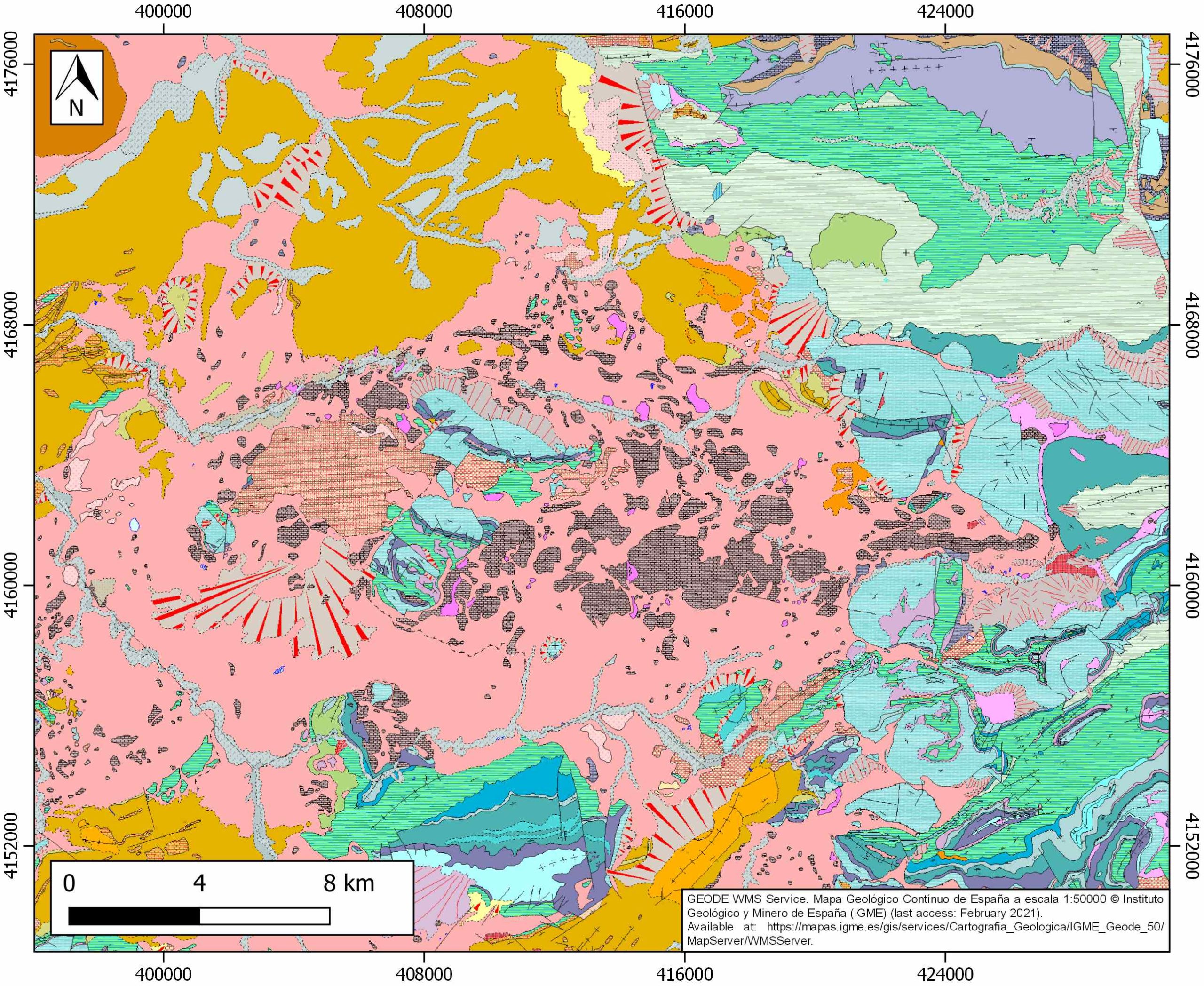
| IGME Geological Map (MAGNA50) Sheet number | 968-Alcaudete. [link] |
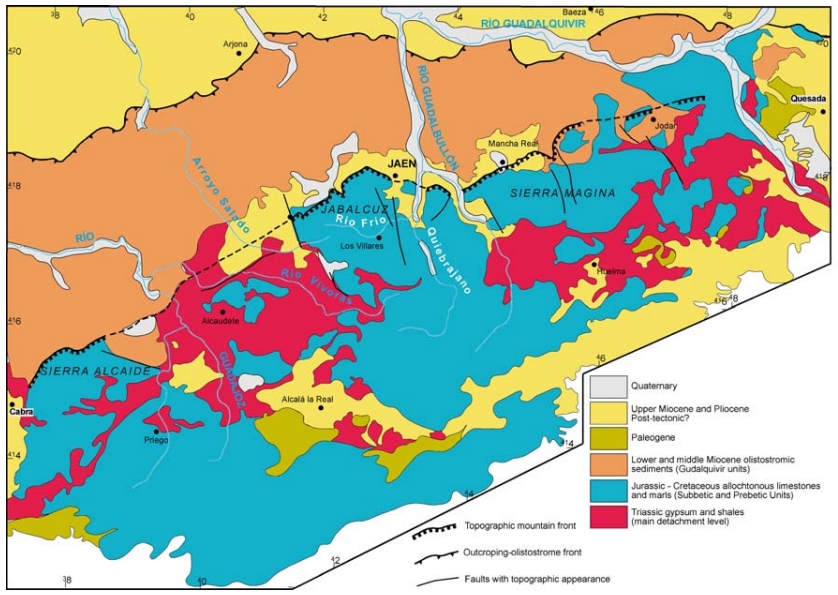
| Other Maps #1 (source) | Permanyer, A., Jorge, R., Baudino, R., Gibert, L., 2016. Organic-rich shales from internal Betic basins (SE Spain): potential source rocks analogs for the pre-Messinian Salt play in the western Mediterranean. Geologica Acta, 14(4), 443-460. [link] |
| Other Maps #2 (source) | Gómez, M. S., Medina, F. T., 2002. Actividad tectónica reciente en el borde sur de la depresión del Guadalquivir entre Cabra y Quesada (provincias de Jaén y Córdoba). Primer centenario del Observatorio de Cartuja [Unpublished report]. [link] |
| Other related references #1 | Simon, O. J., 1987. On the Triassic of the Betic Cordilleras (Southern Spain). Cuadernos de Geología Ibérica, 11, 385-402. [link] |
| Other related references #2 | Sissingh, W., 2008. Punctuated Neogene tectonics and stratigraphy of the African-Iberian plate-boundary zone: Concurrent development of Betic-Rif basins (southern Spain, northern Morocco). Netherlands Journal of Geosciences/Geologie en Mijnbouw, 87(4), 241-289. [link] |
| Other related references #3 | Fernandez, M., Berástegui, X., Puig, C., García-Castellanos, D., Jurado, M. J., Torné, M., Banks, C., 1998. Geophysical and geological constraints on the evolution of the Guadalquivir foreland basin, Spain. Geological Society, London, Special Publications, 134(1), 29-48. [link] |
| Other related references #4 |
Well and Seismic Data
| UNIQUE_ID | 103 |
| Seismic survey name #1 | 7J-ST-146 |
| Across structure? #1 | Y |
| Seismic profile ID (IGME) #1 | 13087 |
| Seismic profile code #1 | 17805 |
| Seismic profile name #1 | CO-23 |
| Seismic survey year #1 | 1968 |
| Data repository #1 | SIGEOF Data Catalogue (Private access section). ©Instituto Geológico y Minero de España (IGME). https://info.igme.es/SIGEOF/ |
| Length (km) #1 | 9.07 |
| Seismic survey name #2 | 6J-ST-160-I |
| Across structure? #2 | Y |
| Seismic profile ID (IGME) #2 | 12741 |
| Seismic profile code #2 | 17459 |
| Seismic profile name #2 | CO-18 |
| Seismic survey year #2 | 1968 |
| Data repository #2 | SIGEOF Data Catalogue (Private access section). ©Instituto Geológico y Minero de España (IGME). https://info.igme.es/SIGEOF/ |
| Length (km) #2 | 14.61 |
| Seismic survey name #3 | 7J3-S82 |
| Across structure? #3 | N (within 3km) |
| Seismic profile ID (IGME) #3 | 11169 |
| Seismic profile code #3 | 15818 |
| Seismic profile name #3 | S82-31 |
| Seismic survey year #3 | 1982 |
| Data repository #3 | SIGEOF Data Catalogue (Section available under request). ©Instituto Geológico y Minero de España (IGME). https://info.igme.es/SIGEOF/ |
| Length (km) #3 | 7.35 |
| Seismic survey name #4 | 7J-ST-146 |
| Across structure? #4 | N (within 3km) |
| Seismic profile ID (IGME) #4 | 13080 |
| Seismic profile code #4 | 17798 |
| Seismic profile name #4 | CO-33 |
| Seismic survey year #4 | 1968 |
| Data repository #4 | SIGEOF Data Catalogue (Section available under request). ©Instituto Geológico y Minero de España (IGME). https://info.igme.es/SIGEOF/ |
| Length (km) #4 | 3.46 |
| Seismic survey name #5 | 7J3-S82 |
| Across structure? #5 | N (within 3km) |
| Seismic profile ID (IGME) #5 | 11168 |
| Seismic profile code #5 | 15817 |
| Seismic profile name #5 | S82-32 |
| Seismic survey year #5 | 1982 |
| Data repository #5 | SIGEOF Data Catalogue (Section available under request). ©Instituto Geológico y Minero de España (IGME). https://info.igme.es/SIGEOF/ |
| Length (km) #5 | 11.78 |
| Seismic survey name #6 | 6K4-RG |
| Across structure? #6 | N (within 3km) |
| Seismic profile ID (IGME) #6 | 11442 |
| Seismic profile code #6 | 16095 |
| Seismic profile name #6 | RG-18 |
| Seismic survey year #6 | 1982 |
| Data repository #6 | SIGEOF Data Catalogue (Section available under request). ©Instituto Geológico y Minero de España (IGME). https://info.igme.es/SIGEOF/ |
| Length (km) #6 | 53.33 |
| Seismic survey name #7 | 6J2-RG |
| Across structure? #7 | N (within 3km) |
| Seismic profile ID (IGME) #7 | 11112 |
| Seismic profile code #7 | 15751 |
| Seismic profile name #7 | RG-15 |
| Seismic survey year #7 | 1982 |
| Data repository #7 | SIGEOF Data Catalogue (Section available under request). ©Instituto Geológico y Minero de España (IGME). https://info.igme.es/SIGEOF/ |
| Length (km) #7 | 37.05 |
| Seismic survey name #8 | 7J-ST-146 |
| Across structure? #8 | N (within 3km) |
| Seismic profile ID (IGME) #8 | 13084 |
| Seismic profile code #8 | 17802 |
| Seismic profile name #8 | CO-29 |
| Seismic survey year #8 | 1968 |
| Data repository #8 | SIGEOF Data Catalogue (Section available under request). ©Instituto Geológico y Minero de España (IGME). https://info.igme.es/SIGEOF/ |
| Length (km) #8 | 3.05 |
| Seismic survey name #9 | 7J-ST-146 |
| Across structure? #9 | N (within 3km) |
| Seismic profile ID (IGME) #9 | 13082 |
| Seismic profile code #9 | 17800 |
| Seismic profile name #9 | CO-31 |
| Seismic survey year #9 | 1968 |
| Data repository #9 | SIGEOF Data Catalogue (Private access section). ©Instituto Geológico y Minero de España (IGME). https://info.igme.es/SIGEOF/ |
| Length (km) #9 | 3.92 |
| Seismic survey name #10 | 6J-ST-160-I |
| Across structure? #10 | N (within 3km) |
| Seismic profile ID (IGME) #10 | 12741 |
| Seismic profile code #10 | 17459 |
| Seismic profile name #10 | CO-18 |
| Seismic survey year #10 | 1968 |
| Data repository #10 | SIGEOF Data Catalogue (Private access section). ©Instituto Geológico y Minero de España (IGME). https://info.igme.es/SIGEOF/ |
| Length (km) #10 | 14.61 |
| Seismic survey name #11 | 7J-ST-146 |
| Across structure? #11 | N (within 3km) |
| Seismic profile ID (IGME) #11 | 13085 |
| Seismic profile code #11 | 17803 |
| Seismic profile name #11 | CO-25 |
| Seismic survey year #11 | 1968 |
| Data repository #11 | SIGEOF Data Catalogue (Private access section). ©Instituto Geológico y Minero de España (IGME). https://info.igme.es/SIGEOF/ |
| Length (km) #11 | 10.71 |
| Seismic survey name #12 | 7J-ST-146 |
| Across structure? #12 | N (within 3km) |
| Seismic profile ID (IGME) #12 | 13087 |
| Seismic profile code #12 | 17805 |
| Seismic profile name #12 | CO-23 |
| Seismic survey year #12 | 1968 |
| Data repository #12 | SIGEOF Data Catalogue (Private access section). ©Instituto Geológico y Minero de España (IGME). https://info.igme.es/SIGEOF/ |
| Length (km) #12 | 9.07 |
| Seismic survey name #13 | 7J-ST-146 |
| Across structure? #13 | N (within 3km) |
| Seismic profile ID (IGME) #13 | 13081 |
| Seismic profile code #13 | 17799 |
| Seismic profile name #13 | CO-32 |
| Seismic survey year #13 | 1968 |
| Data repository #13 | SIGEOF Data Catalogue (Private access section). ©Instituto Geológico y Minero de España (IGME). https://info.igme.es/SIGEOF/ |
| Length (km) #13 | 2.56 |
| Seismic survey name #14 | 6J-ST-160-I |
| Across structure? #14 | N (within 3km) |
| Seismic profile ID (IGME) #14 | 12739 |
| Seismic profile code #14 | 17457 |
| Seismic profile name #14 | CO-22 |
| Seismic survey year #14 | 1968 |
| Data repository #14 | SIGEOF Data Catalogue (Private access section). ©Instituto Geológico y Minero de España (IGME). https://info.igme.es/SIGEOF/ |
| Length (km) #14 | 3.77 |
| Seismic survey name #15 | |
| Across structure? #15 | |
| Seismic profile ID (IGME) #15 | |
| Seismic profile code #15 | |
| Seismic profile name #15 | |
| Seismic survey year #15 | |
| Data repository #15 | |
| Length (km) #15 | |
| Seismic survey name #16 | |
| Across structure? #16 | |
| Seismic profile ID (IGME) #16 | |
| Seismic profile code #16 | |
| Seismic profile name #16 | |
| Seismic survey year #16 | |
| Data repository #16 | |
| Length (km) #16 | |
| Seismic survey name #17 | |
| Across structure? #17 | |
| Seismic profile ID (IGME) #17 | |
| Seismic profile code #17 | |
| Seismic profile name #17 | |
| Seismic survey year #17 | |
| Data repository #17 | |
| Length (km) #17 | |
| Seismic survey name #18 | |
| Across structure? #18 | |
| Seismic profile ID (IGME) #18 | |
| Seismic profile code #18 | |
| Seismic profile name #18 | |
| Seismic survey year #18 | |
| Data repository #18 | |
| Length (km) #18 | |
| Seismic survey name #19 | |
| Across structure? #19 | |
| Seismic profile ID (IGME) #19 | |
| Seismic profile code #19 | |
| Seismic profile name #19 | |
| Seismic survey year #19 | |
| Data repository #19 | |
| Length (km) #19 | |
| Seismic survey name #20 | |
| Across structure? #20 | |
| Seismic profile ID (IGME) #20 | |
| Seismic profile code #20 | |
| Seismic profile name #20 | |
| Seismic survey year #20 | |
| Data repository #20 | |
| Length (km) #20 | |
| Seismic survey name #21 | |
| Across structure? #21 | |
| Seismic profile ID (IGME) #21 | |
| Seismic profile code #21 | |
| Seismic profile name #21 | |
| Seismic survey year #21 | |
| Data repository #21 | |
| Length (km) #21 | |
| Borehole name #1 | S-VI-4-1 (ALCAUDETE) |
| Company #1 | ADARO |
| Traget #1 | GYPSUM |
| Across structure? #1 | N (within 5 km) |
| Borehole name #2 | S-VI-4-2 (ALCAUDETE) |
| Company #2 | ADARO |
| Traget #2 | GYPSUM |
| Across structure? #2 | N (within 5 km) |
| Borehole name #3 | FUENSANTA DE MARTOS-1 |
| Company #3 | SHELL/FINA |
| Traget #3 | HYDROCARBONS |
| Across structure? #3 | N (within 5 km) |
| Borehole name #4 | CASTILLO DE LOCUBIN-2 |
| Company #4 | TRAGSA |
| Traget #4 | HYDROGEOLOGY |
| Across structure? #4 | N (within 5 km) |
| Borehole name #5 | ALCAUDETE-6 |
| Company #5 | TRAGSA |
| Traget #5 | HYDROGEOLOGY |
| Across structure? #5 | N (within 5 km) |
| Borehole name #6 | ALCAUDETE-5 (FUENTE PEÑA) |
| Company #6 | TRAGSA |
| Traget #6 | HYDROGEOLOGY |
| Across structure? #6 | N (within 5 km) |
| Borehole name #7 | CASTILLO DE LOCUBIN-1 |
| Company #7 | TRAGSA |
| Traget #7 | HYDROGEOLOGY |
| Across structure? #7 | N (within 5 km) |
| Borehole name #8 | ALCAUDETE-3 |
| Company #8 | TRAGSA |
| Traget #8 | HYDROGEOLOGY |
| Across structure? #8 | N (within 5 km) |
| Borehole name #9 | ALCAUDETE-4 |
| Company #9 | TRAGSA |
| Traget #9 | HYDROGEOLOGY |
| Across structure? #9 | N (within 5 km) |
| Borehole name #10 | ALCAUDETE-1 |
| Company #10 | TRAGSA |
| Traget #10 | HYDROGEOLOGY |
| Across structure? #10 | N (within 5 km) |
| Borehole name #11 | ALCAUDETE-2 |
| Company #11 | TRAGSA |
| Traget #11 | HYDROGEOLOGY |
| Across structure? #11 | N (within 5 km) |
| Borehole name #12 | |
| Company #12 | |
| Traget #12 | |
| Across structure? #12 | |
| Borehole name #13 | |
| Company #13 | |
| Traget #13 | |
| Across structure? #13 | |
| Borehole name #14 | |
| Company #14 | |
| Traget #14 | |
| Across structure? #14 | |
| Borehole name #15 | |
| Company #15 | |
| Traget #15 | |
| Across structure? #15 |
Geographical Data (EPSG:4326 - WGS 84)
| UNIQUE_ID | 103 |
| X Centroid (Structure shape) | -3.957351 |
| Y Centroid (Structure shape) | -3.957351 |
| Xmin (Structure shape) | -4.064212 |
| Xmax (Structure shape) | -3.818574 |
| Ymin (Structure shape) | 37.504018 |
| Ymax (Structure shape) | 37.663753 |
| Xmin seismic line #1 | -4.091700 |
| Xmax seismic line #1 | -3.995543 |
| Ymin seismic line #1 | 37.602286 |
| Ymax seismic line #1 | 37.625039 |
| Xmin seismic line #2 | -4.073342 |
| Xmax seismic line #2 | -3.995909 |
| Ymin seismic line #2 | 37.539312 |
| Ymax seismic line #2 | 37.630698 |
| Xmin seismic line #3 | -3.810388 |
| Xmax seismic line #3 | -3.799245 |
| Ymin seismic line #3 | 37.559619 |
| Ymax seismic line #3 | 37.625230 |
| Xmin seismic line #4 | -3.945340 |
| Xmax seismic line #4 | -3.915413 |
| Ymin seismic line #4 | 37.644960 |
| Ymax seismic line #4 | 37.661193 |
| Xmin seismic line #5 | -3.893106 |
| Xmax seismic line #5 | -3.790948 |
| Ymin seismic line #5 | 37.607927 |
| Ymax seismic line #5 | 37.676085 |
| Xmin seismic line #6 | -4.535679 |
| Xmax seismic line #6 | -4.066452 |
| Ymin seismic line #6 | 37.360475 |
| Ymax seismic line #6 | 37.661567 |
| Xmin seismic line #7 | -4.384694 |
| Xmax seismic line #7 | -4.049169 |
| Ymin seismic line #7 | 37.612789 |
| Ymax seismic line #7 | 37.812204 |
| Xmin seismic line #8 | -3.945039 |
| Xmax seismic line #8 | -3.917992 |
| Ymin seismic line #8 | 37.661574 |
| Ymax seismic line #8 | 37.677597 |
| Xmin seismic line #9 | -3.953117 |
| Xmax seismic line #9 | -3.927014 |
| Ymin seismic line #9 | 37.681545 |
| Ymax seismic line #9 | 37.710010 |
| Xmin seismic line #10 | -4.073342 |
| Xmax seismic line #10 | -3.995909 |
| Ymin seismic line #10 | 37.539312 |
| Ymax seismic line #10 | 37.630698 |
| Xmin seismic line #11 | -3.841642 |
| Xmax seismic line #11 | -3.801887 |
| Ymin seismic line #11 | 37.597566 |
| Ymax seismic line #11 | 37.659113 |
| Xmin seismic line #12 | -4.091700 |
| Xmax seismic line #12 | -3.995543 |
| Ymin seismic line #12 | 37.602286 |
| Ymax seismic line #12 | 37.625039 |
| Xmin seismic line #13 | -3.953431 |
| Xmax seismic line #13 | -3.935663 |
| Ymin seismic line #13 | 37.663389 |
| Ymax seismic line #13 | 37.681291 |
| Xmin seismic line #14 | -4.118368 |
| Xmax seismic line #14 | -4.078818 |
| Ymin seismic line #14 | 37.593281 |
| Ymax seismic line #14 | 37.602581 |
| Xmin seismic line #15 | |
| Xmax seismic line #15 | |
| Ymin seismic line #15 | |
| Ymax seismic line #15 | |
| Xmin seismic line #16 | |
| Xmax seismic line #16 | |
| Ymin seismic line #16 | |
| Ymax seismic line #16 | |
| Xmin seismic line #17 | |
| Xmax seismic line #17 | |
| Ymin seismic line #17 | |
| Ymax seismic line #17 | |
| Xmin seismic line #18 | |
| Xmax seismic line #18 | |
| Ymin seismic line #18 | |
| Ymax seismic line #18 | |
| Xmin seismic line #19 | |
| Xmax seismic line #19 | |
| Ymin seismic line #19 | |
| Ymax seismic line #19 | |
| Xmin seismic line #20 | |
| Xmax seismic line #20 | |
| Ymin seismic line #20 | |
| Ymax seismic line #20 | |
| Xmin seismic line #21 | |
| Xmax seismic line #21 | |
| Ymin seismic line #21 | |
| Ymax seismic line #21 | |
| X borehole #1 | -4.063671 |
| Y borehole #1 | 37.625340 |
| X borehole #2 | -4.062841 |
| Y borehole #2 | 37.625889 |
| X borehole #3 | -3.880273 |
| Y borehole #3 | 37.671394 |
| X borehole #4 | -3.902000 |
| Y borehole #4 | 37.557024 |
| X borehole #5 | -4.026173 |
| Y borehole #5 | 37.595578 |
| X borehole #6 | -4.067835 |
| Y borehole #6 | 37.573396 |
| X borehole #7 | -3.936723 |
| Y borehole #7 | 37.525297 |
| X borehole #8 | -4.070339 |
| Y borehole #8 | 37.594825 |
| X borehole #9 | -4.074229 |
| Y borehole #9 | 37.577845 |
| X borehole #10 | -4.032000 |
| Y borehole #10 | 37.617248 |
| X borehole #11 | -4.097845 |
| Y borehole #11 | 37.595023 |
| X borehole #12 | |
| Y borehole #12 | |
| X borehole #13 | |
| Y borehole #13 | |
| X borehole #14 | |
| Y borehole #14 | |
| X borehole #15 | |
| Y borehole #15 |

