El Saucejo-Campillos
ID #115
General Information
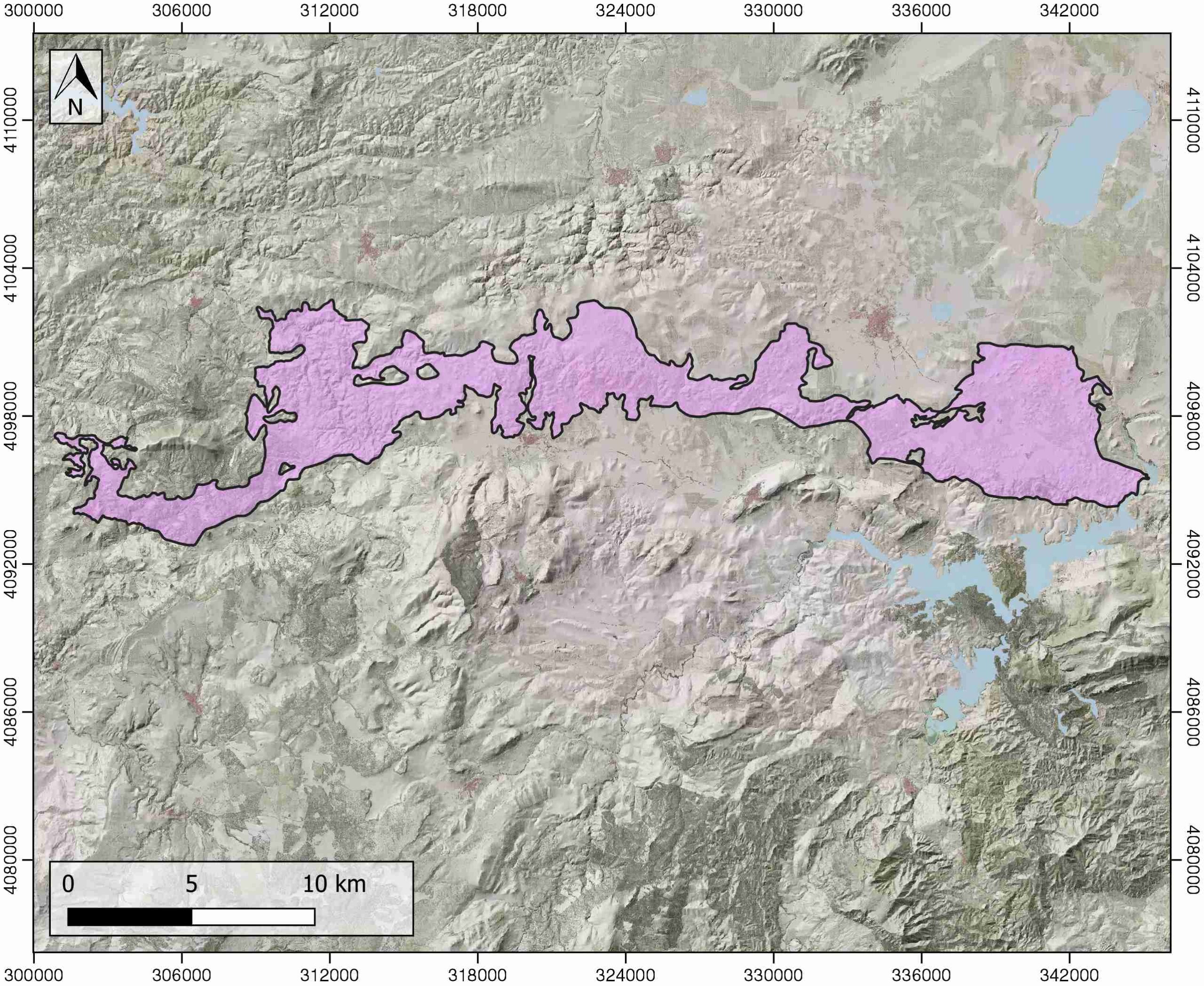
| Structure type | Allochthonous evaporite body |
| Deformed/Undeformed | Deformed |
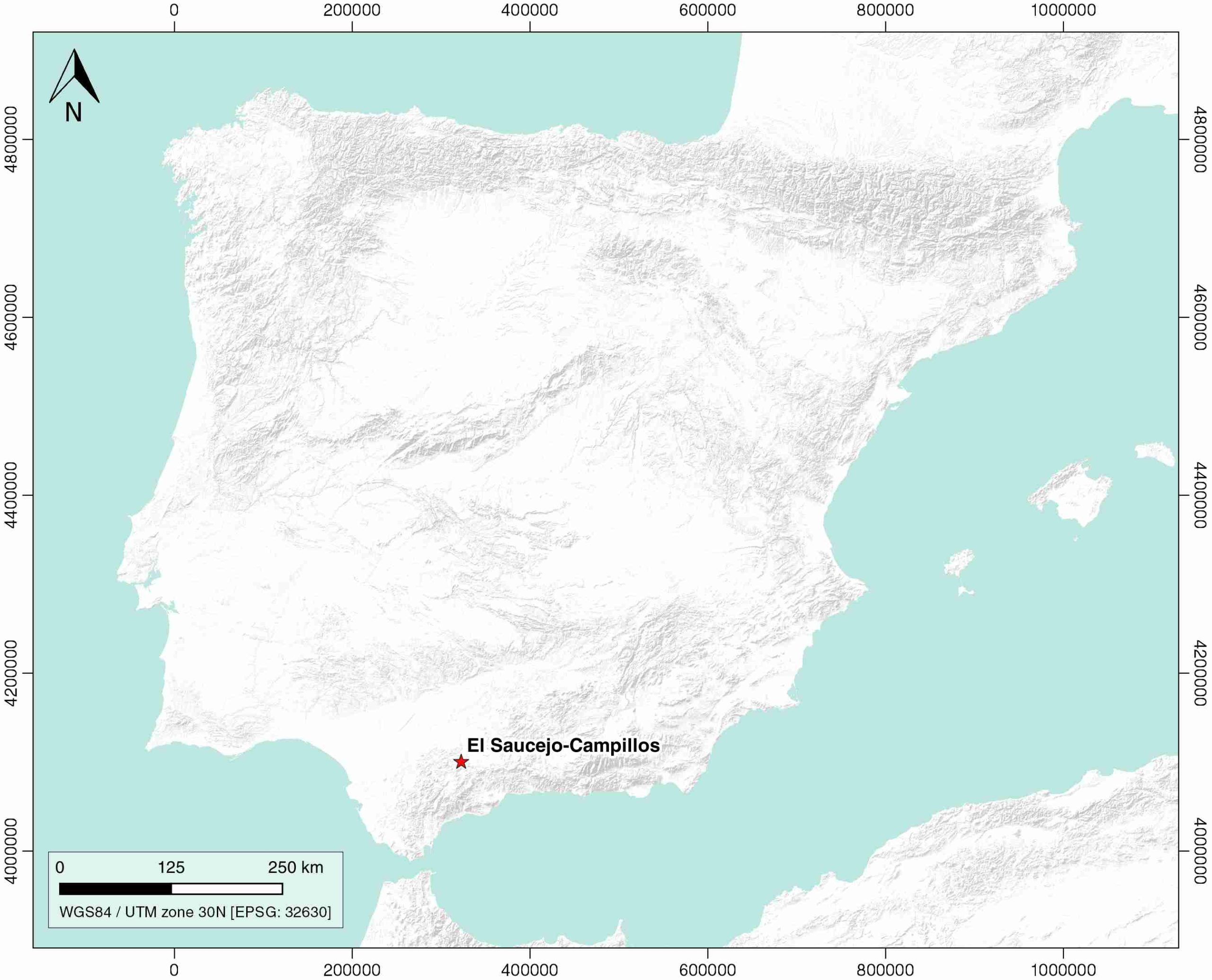
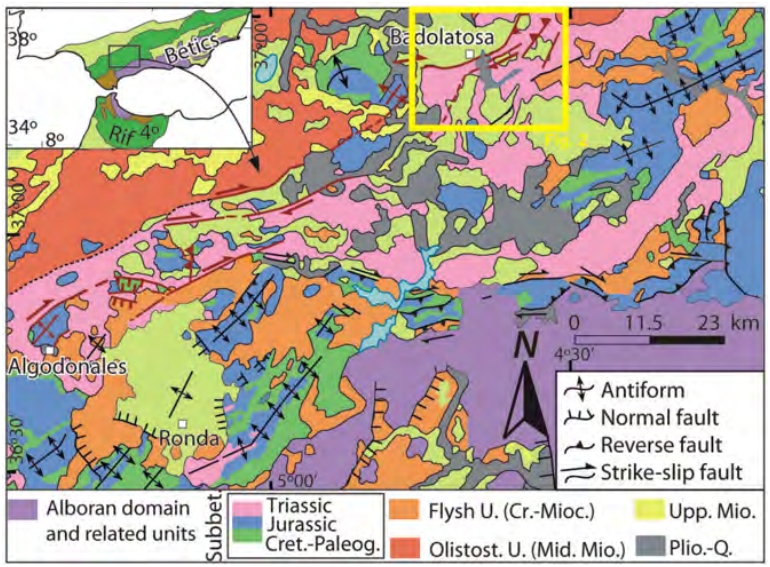
| Geological Setting | Betic system, Sub-Betic cordillera |
| Outcropping/buried | Outcropping |
| Evaporite unit/s name | Carcelén Anhydrite, Keuper facies |
| Evaporite unit/s age | Carnian-Rhaetian (Upper Triassic), Hettangian (Lower Jurassic) |
| Evaporite unit/s origin | Marine |
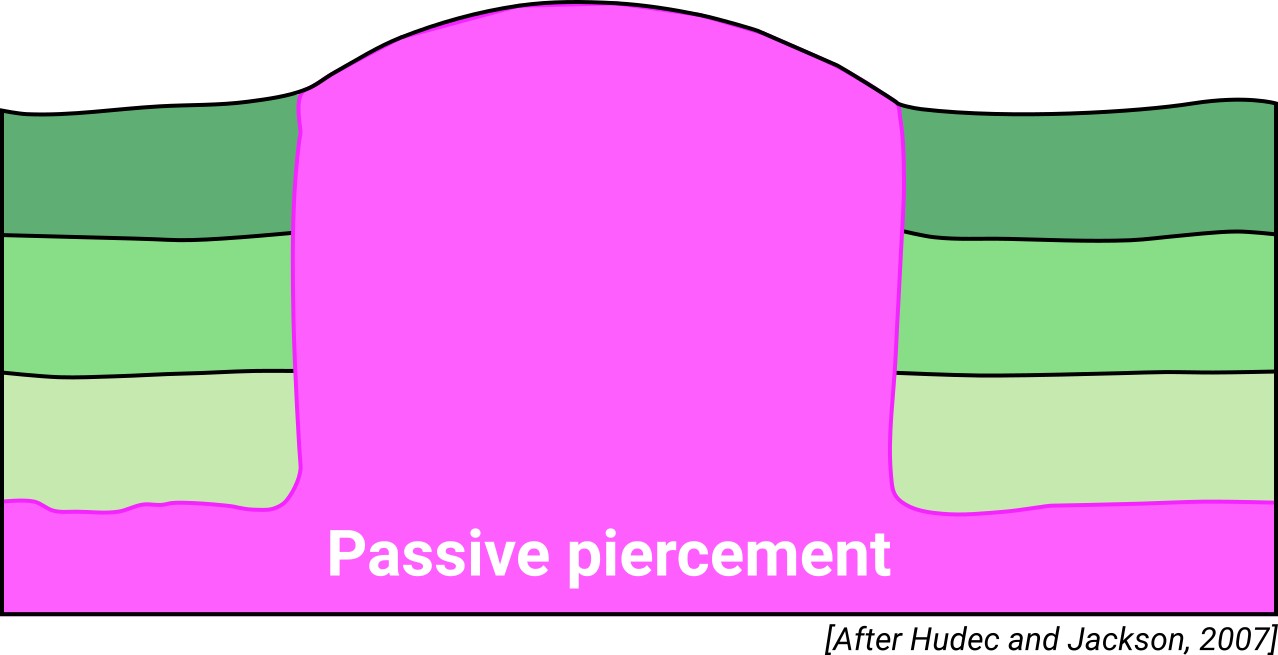
| Classif. (Hudec and Jackson, 2009) | Passive piercement |
| Classif. (Jackson and Talbot, 1986) | Detached diapir |
| Age of evaporite flow or deformation (when deformed) | Miocene, Oligocene to Miocene, Upper Cretaceous |
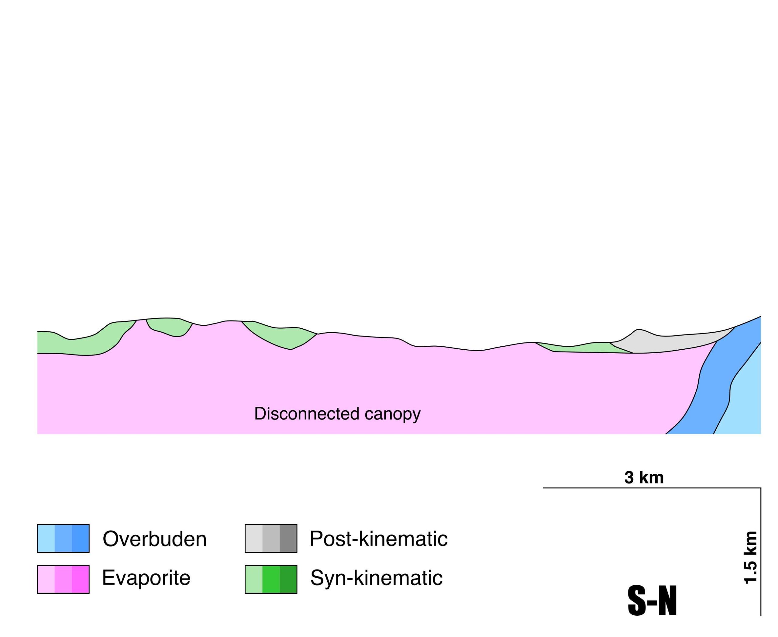
| Other comments | Complex tectonic evolution: (1) extensional regime, diapirs pierce the overlying sediments and the salt spreads parallel to the strata forming tongues, (2) compression, tongues are disconnected from the salt feeder constituting allochthonous sheets, (3) allochthonous sheets flow and give rise to the actual structure (see Flinch and Soto, 2017). |
Generic Data
| Unique ID | 115 |
| Name | El saucejo-Campillos |
| Structure type | Allochthonous evaporite body |
| Deformed/Undeformed | Deformed |
| Buried/Outcropping | Outcropping |
| Geological setting | Betic System |
| Geological Regional Setting | Sub-Betic Cordillera |
| Evaporite unit/s name | Keuper Facies and Carcelén Anhydrite |
| Evaporite unit/s age | Carnian-Hettangian (Upper Triassic-Lower Jurassic) |
| Evaporite unit/s era | Mesozoic |
| Evaporite unit/s origin | Marine |
| Evaporite unit/s composition | Shale-Gypsum-Sandstone-Halite-Anhydrite |
| Post-kinematic unit/s (or post-evaporite units when evaporites are undeformed) | Burdigalian (white marlstones) ; Tortonian-Messinian (marlstones and bioclastic sandstones) ; Pliocene (sandstones and conglomerates) ; Quaternary (alluvial and colluvial detrital deposits) |
| Post-kinematic unit/s age (or post-evaporite units when evaporites are undeformed) | Burdigalian-Holocene |
| Classification (Hudec and Jackson, 2009) | Passive piercement |
| Classification (Jackson and Talbot, 1986) | Detached diapir |
| Mining activity? | Y |
| Mining activity start | |
| Mining activity end | Active |
| Mining galleries? | Y |
| Mining products | Ophites |
| Mining sub-products | |
| Evaporite flow? | Y |
| Age of evaporite flow | Upper Cretaceous (piercing diapirism, early stage) ; Oligocene-Lower Miocene (canopy disconnection, intermediate stage) ; Upper Miocene (salt nappe imbrication and reworking, final stage) |
| Flow or deformation triggering mechanisms | Margin extension (early stage) ; Alpine compression (intermediate stage) ; Piggyback development in the Guadalquivir Allochthon (final stage) |
| Flow-linked structures? | Y |
| Halokinetic structures | Thickness variations / progressive unconformities / thrust faults / overturned flanks / roll-over anticlines / mini-basin development |
| Post-evaporite and pre-kinematic unit/s (overbuden) | Lower Jurassic (dolostones and marly limestones) ; Middle Jurassic (marlstones and marly limestones) ; Upper Jurassic (marly limestones and nodular limestones) ; Lower Cretaceous (limestones, marly limestones and marlstones) |
| Syn-kinematic unit/s | Upper Cretaceous (marlstones, marly limestones and marly shales) ; Oligocene-Miocene (turbiditic limestones and limestones) |
| Available seismic profiles | ILIHA X-F / S82A-8 |
| Available boreholes | S-VI-2-5 (PRUNA) / VENTA LA ROMERA / CORTIJO EL TENDEDERO-1 / CORTIJO EL TENDEDERO-2 / FUENTE DE PIEDRA-2 (LOS PIQUETES) / PILAS / SIERRA CAMORRA (SIERRA CARMONA-6) / MOLINO DE TORROX / MONTEMAYOR |
| Additional comments | Complex tectonic evolution: (1) extensional regime, diapirs pierce the overlying sediments and the salt spreads parallel to the strata forming tongues, (2) compression, tongues are disconnected from the salt feeder constituting allochthonous sheets, (3) allochthonous sheets flow and give rise to the actual structure (see Flinch and Soto, 2017). |
Mining Data
| UNIQUE_ID | 115 |
| Minning exploitations within <2km? | Y |
| Historical/Active | Active |
| Exploitation name #1 | NEGRITA |
| Exploitation ID (Spanish National Mining Cadastre) #1 | 215 |
| Municipality #1 | Antequera |
| Province #1 | MALAGA |
| Company #1 | OFITAS ANTEQUERANAS S.L. |
| Main minning Products #1 | Ophites |
| Exploitation name #2 | AMPLIACION A NEGRITA |
| Exploitation ID (Spanish National Mining Cadastre) #2 | 246 |
| Municipality #2 | Antequera |
| Province #2 | MALAGA |
| Company #2 | OFITAS ANTEQUERANAS S.L. |
| Main minning Products #2 | Limestone (other uses) |
| Exploitation name #3 | ATAULFO Y OTROS |
| Exploitation ID (Spanish National Mining Cadastre) #3 | 7182 |
| Municipality #3 | Pruna |
| Province #3 | SEVILLA |
| Company #3 | HERMANOS RUIZ DORANTES, S.L. |
| Main minning Products #3 | Gypsum |
Quantitative Data
| UNIQUE_ID | 115 |
| Outcropping area (km2) | 134.58022 |
| Horizontal intersection area (km2) (when buried) | Not buried |
| Depth of intersection area (km2) (when buried) | Not buried |
| Max. Width (Km) | 10.8288387 |
| Max. Length (Km) | 44.4014198 |
| Max. Evaporites thickness (km) | 1.2 |
| Max. Deformation age (Ma) | 95 |
| Min. Deformation age (Ma) | 10 |
| Deformation stages | 3 |
Reference Data
| UNIQUE_ID | 115 |
| Section source | Flinch, J. F., Soto, J. I., 2017. Allochthonous Triassic and Salt Tectonic Processes in the Betic-Rif Orogenic Arc. In Permo-Triassic Salt Provinces of Europe, North Africa and the Atlantic Margins (pp. 417-446). Elsevier. [link] |
| Well / Borehole availability #1 | n.a. |
| Well / Borehole availability #2 | n.a. |
| Available data (Stratigraphy) #1 | Flinch, J. F., Soto, J. I., 2017. Allochthonous Triassic and Salt Tectonic Processes in the Betic-Rif Orogenic Arc. In Permo-Triassic Salt Provinces of Europe, North Africa and the Atlantic Margins (pp. 417-446). Elsevier. [link] |
| Available data (Stratigraphy) #2 | del Olmo, W. M., 2019. El complejo olistostrómico del Mioceno de la Cuenca del Río Guadalquivir (SO de España). Revista de la Sociedad Geológica de España, 32(2), 3-16. [link] |
| Available data (Stratigraphy) #3 | Pérez-López, A. D., de Galdeano, C. S., 1994. Tectónica de los materiales triásicos en el sector central de la Zona Subbética (Cordillera Bética). Revista de la Sociedad Geológica de España, 7(1), 141-153. [link] |
| Available data (Stratigraphy) #4 | del Olmo, W. M., 2018. Episodios de deformación de la Cordillera Bética y su entorno próximo (España): problemas no resueltos. Revista de la Sociedad Geológica de España, 31(1), 49-66. [link] |
| Available data (Stratigraphy) #5 | Daudet, M., Mouthereau, F., Brichau, S., Crespo‐Blanc, A., Gautheron, C., Angrand, P., 2020. Tectono‐stratigraphic and thermal evolution of the western Betic flysch: implications for the geodynamics of South Iberian margin and Alboran Domain. Tectonics, 39(7), 6093. [link] |
| Available data (Stratigraphy) #6 | n.a. |
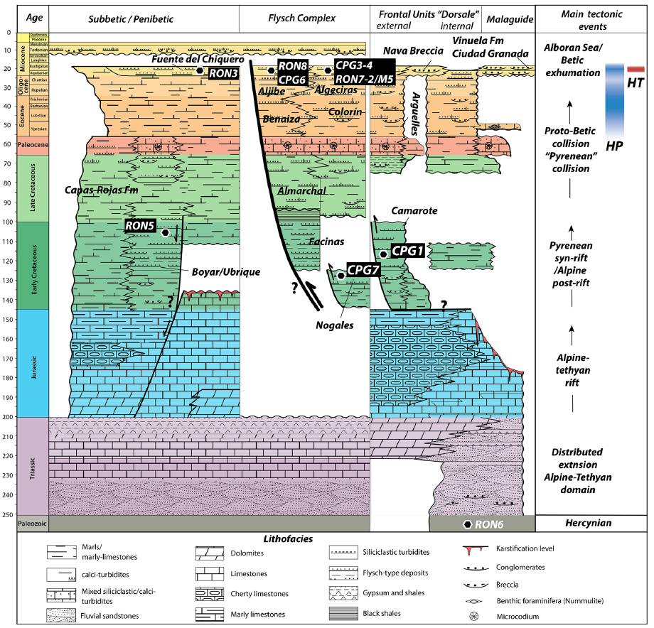
| Regional Stratigraphy | Daudet, M., Mouthereau, F., Brichau, S., Crespo‐Blanc, A., Gautheron, C., Angrand, P., 2020. Tectono‐stratigraphic and thermal evolution of the western Betic flysch: implications for the geodynamics of South Iberian margin and Alboran Domain. Tectonics, 39(7), 6093. [link] |
| Seismic data availability #1 | Diaz, J., Gallart Muset, J., Córdoba, D., Senos, L., Matias, L., Suriñach, E., …, Maguire, P., 2020. The ILIHA deep seismic sounding experiment (Iberian LIthosphere Heterogeneity and Anisotropy). DigitalCSIC – SEISDARE data repository. [link] |
| Seismic data availability #2 | n.a. |
| Seismic data availability #3 | n.a. |
| Available data (Structure) #1 | Flinch, J. F., Soto, J. I., 2017. Allochthonous Triassic and Salt Tectonic Processes in the Betic-Rif Orogenic Arc. In Permo-Triassic Salt Provinces of Europe, North Africa and the Atlantic Margins (pp. 417-446). Elsevier. [link] |
| Available data (Structure) #2 | Azpiroz, M. D., Almansa, R. A., Andrades, J. R. S., Bonilla, A. J., 2020. Shape preferred orientation of dolostone bodies of a Triassic broken formation at the western External Betics. Geogaceta, 67, 11-14. [link] |
| Available data (Structure) #3 | Flinch, J. F., Bally, A. W., Wu, S., 1996. Emplacement of a passive-margin evaporitic allochthon in the Betic Cordillera of Spain. Geology, 24(1), 67-70. [link] |
| Available data (Structure) #4 | Pérez-López, A., Sanz de Galdeano, C., 1994. Tectónica de los materiales triásicos en el sector central de la Zona Subbética (Cordillera Bética). Revista de la Sociedad Geológica de España, 7, 141–153. [link] |
| Available data (Structure) #5 | n.a. |
| Available data (Structure) #6 | n.a. |
| Available data (Analogue modelling) #1 | n.a. |
| Available data (Analogue modelling) #2 | n.a. |
| Available data (Analogue modelling) #3 | n.a. |
| Available data (Gravimetry – Tomography) #1 | Ayala, C., Bohoyo, F., Maestro, A., Reguera, M. I., Torne, M., Rubio, F., Fernández, M., García-Lobón, J. L., 2016. Updated Bouguer anomalies of the Iberian Peninsula: a new perspective to interpret the regional geology. Journal of Maps, 12(5), 1089-1092. [link] |
| Available data (Gravimetry – Tomography) #2 | n.a. |
| Available data (Gravimetry – Tomography) #3 | n.a. |
| Available data (Geochemistry) #1 | Calaforra, J.M., Pulido-Bosch, A., 1993. The hydrochemistry and morphology of the triassic gypsum in the Salinas-Fuente Camacho Area (Granada). In: Pulido-Bosch, A. (ed.) Some Spanish Karstic Aquifers. University of Granada, pp. 387–389, Granada. [link] |
| Available data (Geochemistry) #2 | Ortí, F., García-Veigas, J., Rossell, L., Jurado, M. J., Utrilla, R., 1996. Formaciones salinas de las cuencas triásicas en la Península Ibérica: Caracterización Petrológica y Geoquímica. Cuadernos de Geología Ibérica, 20, 13-35. [link] |
| Available data (Geochemistry) #3 | n.a. |
| Available data (Geochemistry) #4 | n.a. |
| Available data (Petrophysics) #1 | n.a. |
| Available data (Petrophysics) #2 | n.a. |
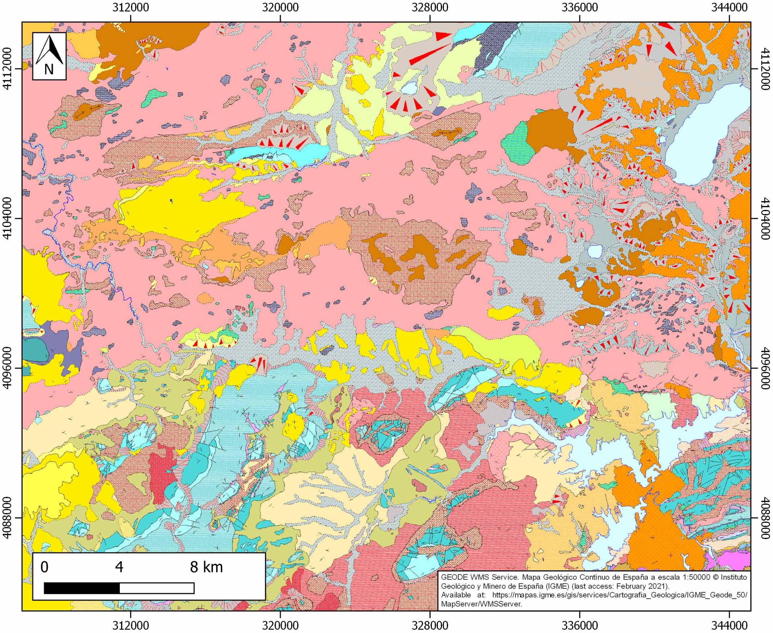
| IGME Geological Map (MAGNA50) Sheet number | 1022-Campillos. [link] and 1021-Morrón de la Frontera. [link] |
| Other Maps #1 (source) | Permanyer, A., Jorge, R., Baudino, R., Gibert, L., 2016. Organic-rich shales from internal Betic basins (SE Spain): potential source rocks analogs for the pre-Messinian Salt play in the western Mediterranean. Geologica Acta, 14(4), 443-460. [link] |
| Other Maps #2 (source) | Azpiroz, M. D., Almansa, R. A., Andrades, J. R. S., Bonilla, A. J., 2020. Shape preferred orientation of dolostone bodies of a Triassic broken formation at the western External Betics. Geogaceta, 67, 11-14. [link] |
| Other related references #1 | Pérez-Valera, F., Sánchez-Gómez, M., Pérez-López, A., 2020. Comentario al artículo «El complejo olistostrómico del Mioceno de la cuenca del río Guadalquivir (SO de España)”. Revista de la Sociedad Geológica de España, 33(2), 63-68. [link] |
| Other related references #2 | Carrasco, F., Durán, J.J., Calaforra, J.M., 2007. El Trías de Antequera. In: Durán, J.J. (ed) Atlas hidrogeológico de la provincia de Málaga. Instituto Geológico y Minero de España, Diputación de Málaga, pp. 206–210, Madrid. [link] |
| Other related references #3 | García, R., Jiménez Bonilla, A., Díaz-Azpiroz, M., Pérez Valera, F., Balanyá, J.C. and Expósito, I., 2016. Kinematics and geomorphology of the Algodonales – Badolatosa shear zone at the fold-and-thrust belt of the western Subbetics. Geo-Temas, 16, 547-550. [link] |
| Other related references #4 | Rodríguez-Estrella, T., 1983: Neotectónica relacionada con las estructuras diapíricas en el Sureste de la Península Ibérica.- Tecniterrae, 51, 14–30. [link] |
Well and Seismic Data
| UNIQUE_ID | 115 |
| Seismic survey name #1 | ILIHA X-F |
| Across structure? #1 | N (within 3km) (withiN (within 3km) 3km) |
| Seismic profile ID (IGME) #1 | n.a. |
| Seismic profile code #1 | n.a. |
| Seismic profile name #1 | n.a. |
| Seismic survey year #1 | n.a. |
| Data repository #1 | SeisDARE Database: https://digital.csic.es/handle/10261/101991 |
| Length (km) #1 | 642.79 |
| Seismic survey name #2 | 5J2-S82A |
| Across structure? #2 | N (within 3km) |
| Seismic profile ID (IGME) #2 | 11035 |
| Seismic profile code #2 | 15674 |
| Seismic profile name #2 | S82A-8 |
| Seismic survey year #2 | 1982 |
| Data repository #2 | SIGEOF Data Catalogue (Section available under request). ©Instituto Geológico y Minero de España (IGME). https://info.igme.es/SIGEOF/ |
| Length (km) #2 | 60.71 |
| Seismic survey name #3 | |
| Across structure? #3 | |
| Seismic profile ID (IGME) #3 | |
| Seismic profile code #3 | |
| Seismic profile name #3 | |
| Seismic survey year #3 | |
| Data repository #3 | |
| Length (km) #3 | |
| Seismic survey name #4 | |
| Across structure? #4 | |
| Seismic profile ID (IGME) #4 | |
| Seismic profile code #4 | |
| Seismic profile name #4 | |
| Seismic survey year #4 | |
| Data repository #4 | |
| Length (km) #4 | |
| Seismic survey name #5 | |
| Across structure? #5 | |
| Seismic profile ID (IGME) #5 | |
| Seismic profile code #5 | |
| Seismic profile name #5 | |
| Seismic survey year #5 | |
| Data repository #5 | |
| Length (km) #5 | |
| Seismic survey name #6 | |
| Across structure? #6 | |
| Seismic profile ID (IGME) #6 | |
| Seismic profile code #6 | |
| Seismic profile name #6 | |
| Seismic survey year #6 | |
| Data repository #6 | |
| Length (km) #6 | |
| Seismic survey name #7 | |
| Across structure? #7 | |
| Seismic profile ID (IGME) #7 | |
| Seismic profile code #7 | |
| Seismic profile name #7 | |
| Seismic survey year #7 | |
| Data repository #7 | |
| Length (km) #7 | |
| Seismic survey name #8 | |
| Across structure? #8 | |
| Seismic profile ID (IGME) #8 | |
| Seismic profile code #8 | |
| Seismic profile name #8 | |
| Seismic survey year #8 | |
| Data repository #8 | |
| Length (km) #8 | |
| Seismic survey name #9 | |
| Across structure? #9 | |
| Seismic profile ID (IGME) #9 | |
| Seismic profile code #9 | |
| Seismic profile name #9 | |
| Seismic survey year #9 | |
| Data repository #9 | |
| Length (km) #9 | |
| Seismic survey name #10 | |
| Across structure? #10 | |
| Seismic profile ID (IGME) #10 | |
| Seismic profile code #10 | |
| Seismic profile name #10 | |
| Seismic survey year #10 | |
| Data repository #10 | |
| Length (km) #10 | |
| Seismic survey name #11 | |
| Across structure? #11 | |
| Seismic profile ID (IGME) #11 | |
| Seismic profile code #11 | |
| Seismic profile name #11 | |
| Seismic survey year #11 | |
| Data repository #11 | |
| Length (km) #11 | |
| Seismic survey name #12 | |
| Across structure? #12 | |
| Seismic profile ID (IGME) #12 | |
| Seismic profile code #12 | |
| Seismic profile name #12 | |
| Seismic survey year #12 | |
| Data repository #12 | |
| Length (km) #12 | |
| Seismic survey name #13 | |
| Across structure? #13 | |
| Seismic profile ID (IGME) #13 | |
| Seismic profile code #13 | |
| Seismic profile name #13 | |
| Seismic survey year #13 | |
| Data repository #13 | |
| Length (km) #13 | |
| Seismic survey name #14 | |
| Across structure? #14 | |
| Seismic profile ID (IGME) #14 | |
| Seismic profile code #14 | |
| Seismic profile name #14 | |
| Seismic survey year #14 | |
| Data repository #14 | |
| Length (km) #14 | |
| Seismic survey name #15 | |
| Across structure? #15 | |
| Seismic profile ID (IGME) #15 | |
| Seismic profile code #15 | |
| Seismic profile name #15 | |
| Seismic survey year #15 | |
| Data repository #15 | |
| Length (km) #15 | |
| Seismic survey name #16 | |
| Across structure? #16 | |
| Seismic profile ID (IGME) #16 | |
| Seismic profile code #16 | |
| Seismic profile name #16 | |
| Seismic survey year #16 | |
| Data repository #16 | |
| Length (km) #16 | |
| Seismic survey name #17 | |
| Across structure? #17 | |
| Seismic profile ID (IGME) #17 | |
| Seismic profile code #17 | |
| Seismic profile name #17 | |
| Seismic survey year #17 | |
| Data repository #17 | |
| Length (km) #17 | |
| Seismic survey name #18 | |
| Across structure? #18 | |
| Seismic profile ID (IGME) #18 | |
| Seismic profile code #18 | |
| Seismic profile name #18 | |
| Seismic survey year #18 | |
| Data repository #18 | |
| Length (km) #18 | |
| Seismic survey name #19 | |
| Across structure? #19 | |
| Seismic profile ID (IGME) #19 | |
| Seismic profile code #19 | |
| Seismic profile name #19 | |
| Seismic survey year #19 | |
| Data repository #19 | |
| Length (km) #19 | |
| Seismic survey name #20 | |
| Across structure? #20 | |
| Seismic profile ID (IGME) #20 | |
| Seismic profile code #20 | |
| Seismic profile name #20 | |
| Seismic survey year #20 | |
| Data repository #20 | |
| Length (km) #20 | |
| Seismic survey name #21 | |
| Across structure? #21 | |
| Seismic profile ID (IGME) #21 | |
| Seismic profile code #21 | |
| Seismic profile name #21 | |
| Seismic survey year #21 | |
| Data repository #21 | |
| Length (km) #21 | |
| Borehole name #1 | S-VI-2-5 (PRUNA) |
| Company #1 | ADARO |
| Traget #1 | GYPSUM |
| Across structure? #1 | Y |
| Borehole name #2 | VENTA LA ROMERA |
| Company #2 | TRAGSA |
| Traget #2 | HYDROGEOLOGY |
| Across structure? #2 | N (within 5 km) |
| Borehole name #3 | CORTIJO EL TENDEDERO-1 |
| Company #3 | TRAGSA |
| Traget #3 | HYDROGEOLOGY |
| Across structure? #3 | N (within 5 km) |
| Borehole name #4 | CORTIJO EL TENDEDERO-2 |
| Company #4 | TRAGSA |
| Traget #4 | HYDROGEOLOGY |
| Across structure? #4 | N (within 5 km) |
| Borehole name #5 | FUENTE DE PIEDRA-2 (LOS PIQUETES) |
| Company #5 | IGME |
| Traget #5 | HYDROGEOLOGY |
| Across structure? #5 | N (within 5 km) |
| Borehole name #6 | PILAS |
| Company #6 | TRAGSA |
| Traget #6 | HYDROGEOLOGY |
| Across structure? #6 | N (within 5 km) |
| Borehole name #7 | SIERRA CAMORRA (SIERRA CARMONA-6) |
| Company #7 | TRAGSA |
| Traget #7 | HYDROGEOLOGY |
| Across structure? #7 | N (within 5 km) |
| Borehole name #8 | MOLINO DE TORROX |
| Company #8 | TRAGSA |
| Traget #8 | HYDROGEOLOGY |
| Across structure? #8 | N (within 5 km) |
| Borehole name #9 | MONTEMAYOR |
| Company #9 | TRAGSA |
| Traget #9 | HYDROGEOLOGY |
| Across structure? #9 | N (within 5 km) |
| Borehole name #10 | |
| Company #10 | |
| Traget #10 | |
| Across structure? #10 | |
| Borehole name #11 | |
| Company #11 | |
| Traget #11 | |
| Across structure? #11 | |
| Borehole name #12 | |
| Company #12 | |
| Traget #12 | |
| Across structure? #12 | |
| Borehole name #13 | |
| Company #13 | |
| Traget #13 | |
| Across structure? #13 | |
| Borehole name #14 | |
| Company #14 | |
| Traget #14 | |
| Across structure? #14 | |
| Borehole name #15 | |
| Company #15 | |
| Traget #15 | |
| Across structure? #15 |
Geographical Data (EPSG:4326 - WGS 84)
| UNIQUE_ID | 115 |
| X Centroid (Structure shape) | -4.976006 |
| Y Centroid (Structure shape) | -4.976006 |
| Xmin (Structure shape) | -5.238079 |
| Xmax (Structure shape) | -4.739279 |
| Ymin (Structure shape) | 36.960936 |
| Ymax (Structure shape) | 37.053712 |
| Xmin seismic line #1 | -8.768941 |
| Xmax seismic line #1 | -4.912826 |
| Ymin seismic line #1 | 36.528358 |
| Ymax seismic line #1 | 41.477141 |
| Xmin seismic line #2 | -5.557887 |
| Xmax seismic line #2 | -5.235818 |
| Ymin seismic line #2 | 36.989260 |
| Ymax seismic line #2 | 37.416755 |
| Xmin seismic line #3 | |
| Xmax seismic line #3 | |
| Ymin seismic line #3 | |
| Ymax seismic line #3 | |
| Xmin seismic line #4 | |
| Xmax seismic line #4 | |
| Ymin seismic line #4 | |
| Ymax seismic line #4 | |
| Xmin seismic line #5 | |
| Xmax seismic line #5 | |
| Ymin seismic line #5 | |
| Ymax seismic line #5 | |
| Xmin seismic line #6 | |
| Xmax seismic line #6 | |
| Ymin seismic line #6 | |
| Ymax seismic line #6 | |
| Xmin seismic line #7 | |
| Xmax seismic line #7 | |
| Ymin seismic line #7 | |
| Ymax seismic line #7 | |
| Xmin seismic line #8 | |
| Xmax seismic line #8 | |
| Ymin seismic line #8 | |
| Ymax seismic line #8 | |
| Xmin seismic line #9 | |
| Xmax seismic line #9 | |
| Ymin seismic line #9 | |
| Ymax seismic line #9 | |
| Xmin seismic line #10 | |
| Xmax seismic line #10 | |
| Ymin seismic line #10 | |
| Ymax seismic line #10 | |
| Xmin seismic line #11 | |
| Xmax seismic line #11 | |
| Ymin seismic line #11 | |
| Ymax seismic line #11 | |
| Xmin seismic line #12 | |
| Xmax seismic line #12 | |
| Ymin seismic line #12 | |
| Ymax seismic line #12 | |
| Xmin seismic line #13 | |
| Xmax seismic line #13 | |
| Ymin seismic line #13 | |
| Ymax seismic line #13 | |
| Xmin seismic line #14 | |
| Xmax seismic line #14 | |
| Ymin seismic line #14 | |
| Ymax seismic line #14 | |
| Xmin seismic line #15 | |
| Xmax seismic line #15 | |
| Ymin seismic line #15 | |
| Ymax seismic line #15 | |
| Xmin seismic line #16 | |
| Xmax seismic line #16 | |
| Ymin seismic line #16 | |
| Ymax seismic line #16 | |
| Xmin seismic line #17 | |
| Xmax seismic line #17 | |
| Ymin seismic line #17 | |
| Ymax seismic line #17 | |
| Xmin seismic line #18 | |
| Xmax seismic line #18 | |
| Ymin seismic line #18 | |
| Ymax seismic line #18 | |
| Xmin seismic line #19 | |
| Xmax seismic line #19 | |
| Ymin seismic line #19 | |
| Ymax seismic line #19 | |
| Xmin seismic line #20 | |
| Xmax seismic line #20 | |
| Ymin seismic line #20 | |
| Ymax seismic line #20 | |
| Xmin seismic line #21 | |
| Xmax seismic line #21 | |
| Ymin seismic line #21 | |
| Ymax seismic line #21 | |
| X borehole #1 | -5.178170 |
| Y borehole #1 | 36.972817 |
| X borehole #2 | -4.925660 |
| Y borehole #2 | 36.981112 |
| X borehole #3 | -4.861770 |
| Y borehole #3 | 36.972848 |
| X borehole #4 | -4.867331 |
| Y borehole #4 | 36.972851 |
| X borehole #5 | -4.781273 |
| Y borehole #5 | 37.081187 |
| X borehole #6 | -4.900664 |
| Y borehole #6 | 36.981155 |
| X borehole #7 | -4.925663 |
| Y borehole #7 | 36.983906 |
| X borehole #8 | -4.886768 |
| Y borehole #8 | 36.981196 |
| X borehole #9 | -4.765937 |
| Y borehole #9 | 37.020911 |
| X borehole #10 | |
| Y borehole #10 | |
| X borehole #11 | |
| Y borehole #11 | |
| X borehole #12 | |
| Y borehole #12 | |
| X borehole #13 | |
| Y borehole #13 | |
| X borehole #14 | |
| Y borehole #14 | |
| X borehole #15 | |
| Y borehole #15 |

