Íscar-Cuéllar
ID #140
General Information
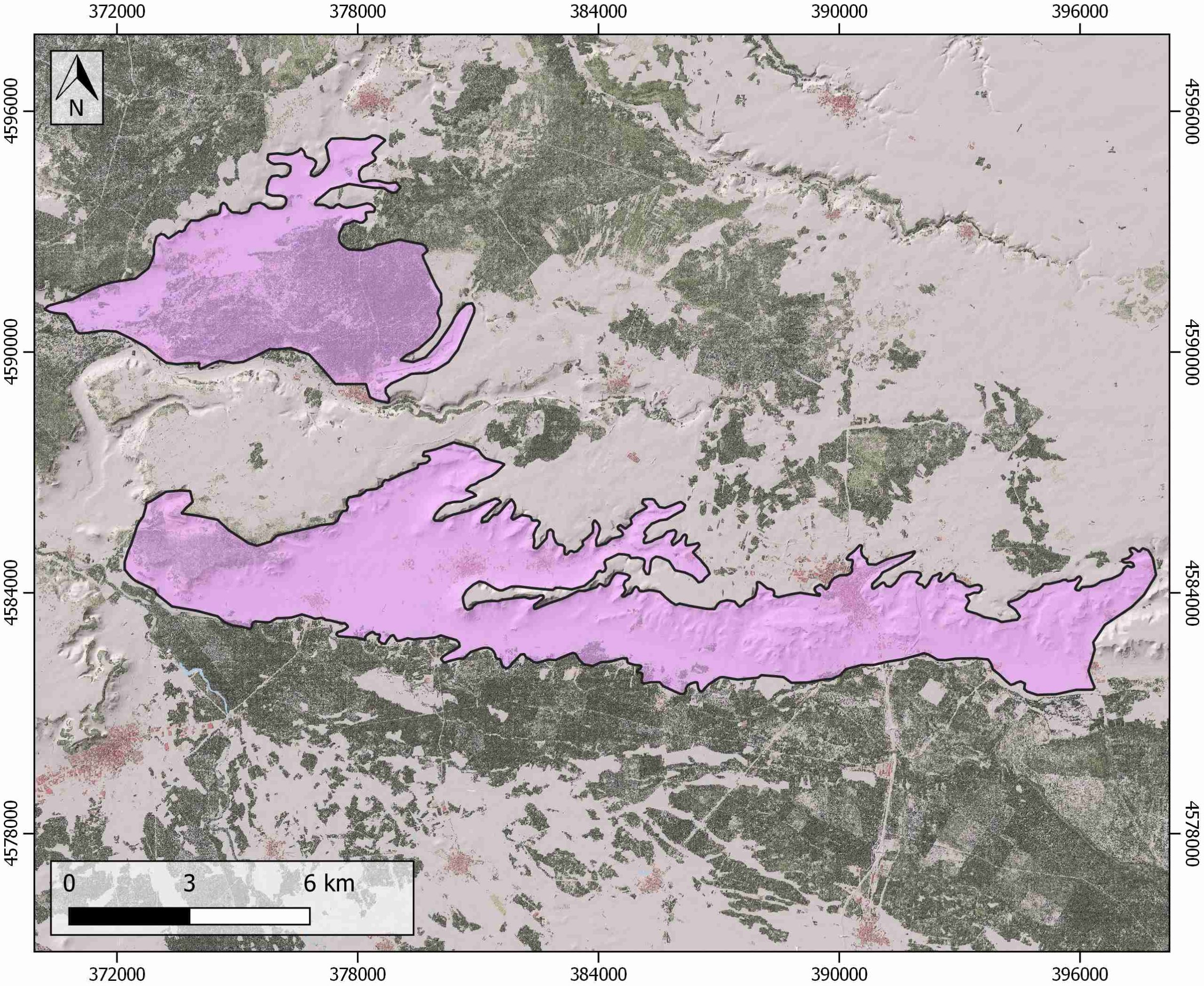
| Structure type | Evaporite body |
| Deformed/Undeformed | Undeformed |
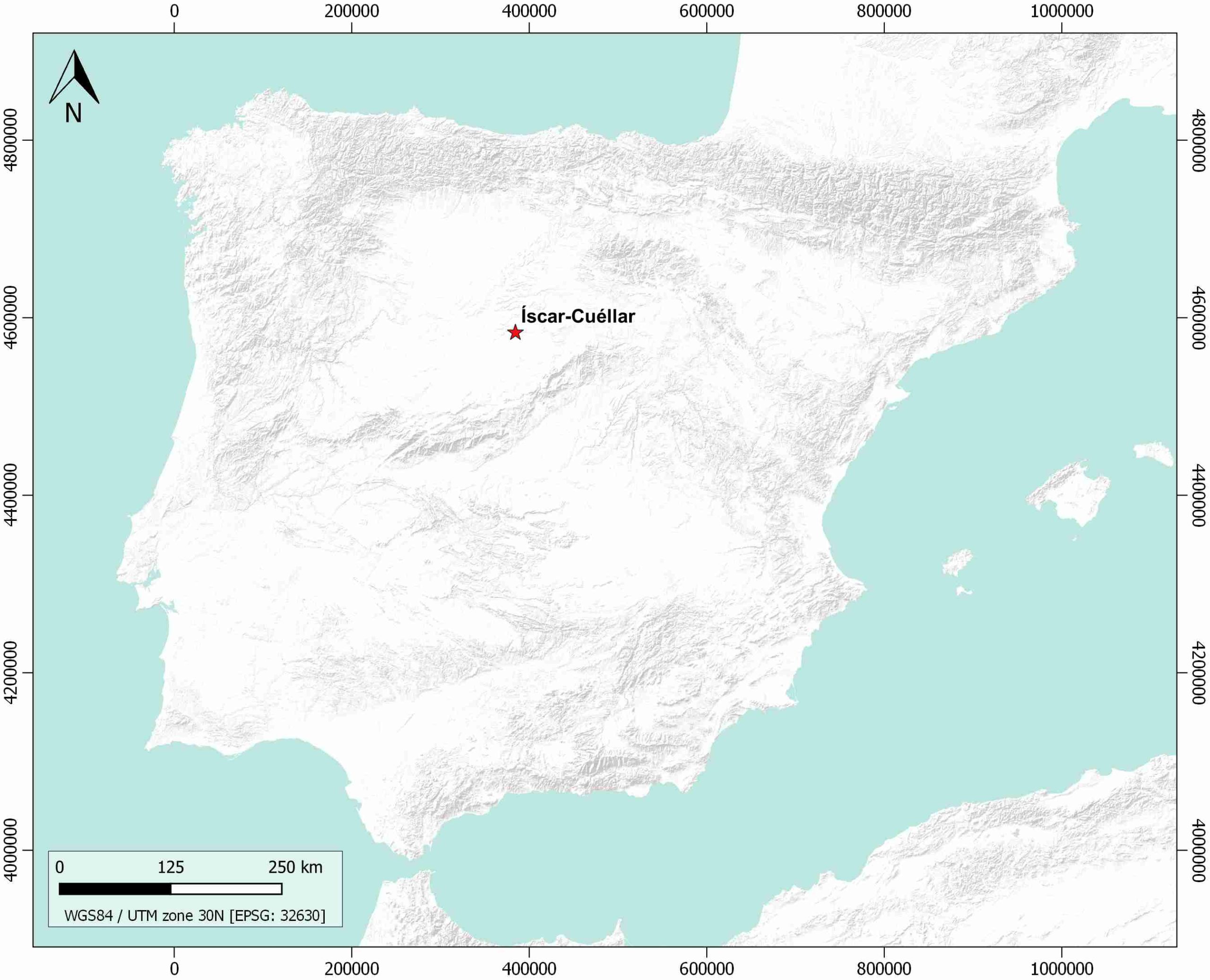
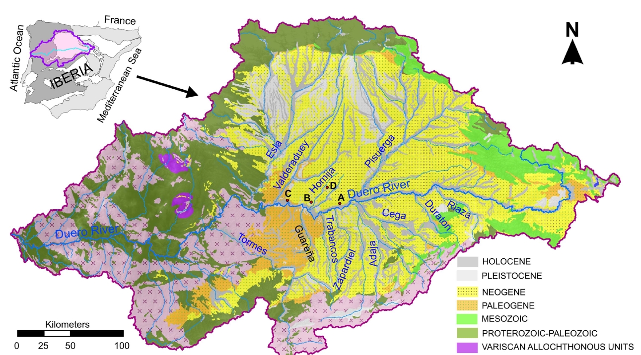
| Geological Setting | Duero Basin (Valladolid Sector) |
| Outcropping/buried | Outcropping |
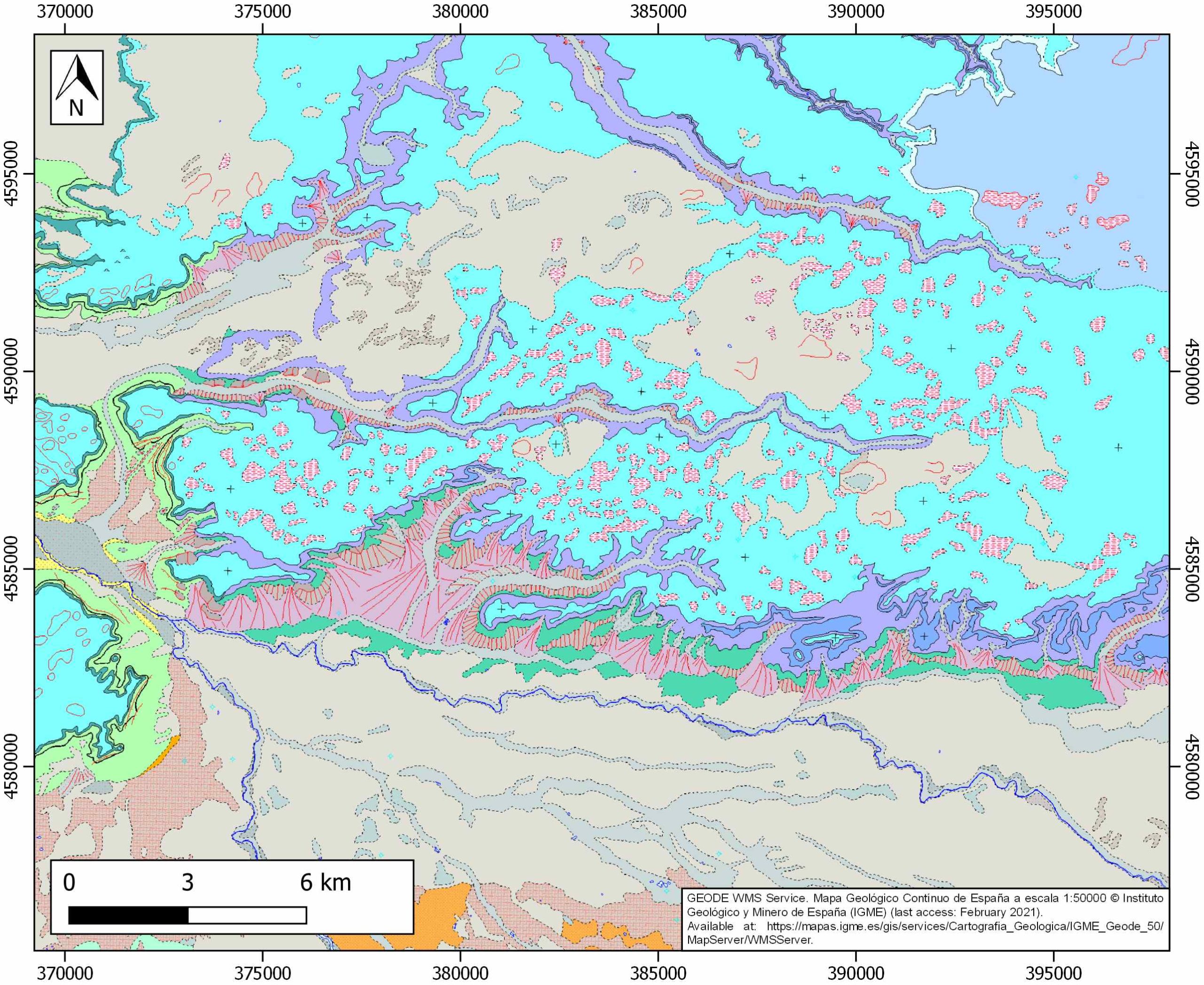
| Evaporite unit/s name | Cuestas Facies |
| Evaporite unit/s age | Middle Miocene |
| Evaporite unit/s origin | Continental |
| Classif. (Hudec and Jackson, 2009) | No diapirism |
| Classif. (Jackson and Talbot, 1986) | No diapirism |
| Age of evaporite flow or deformation (when deformed) | Undeformed |
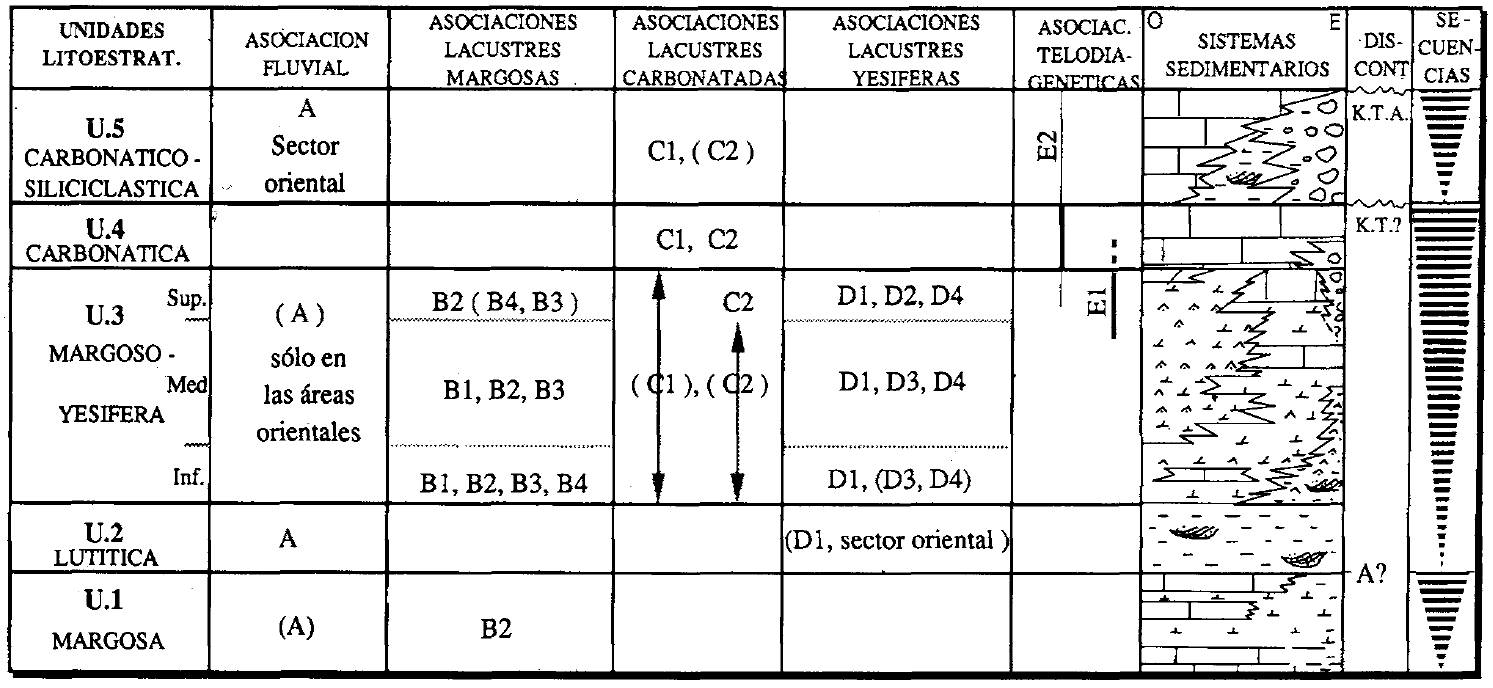
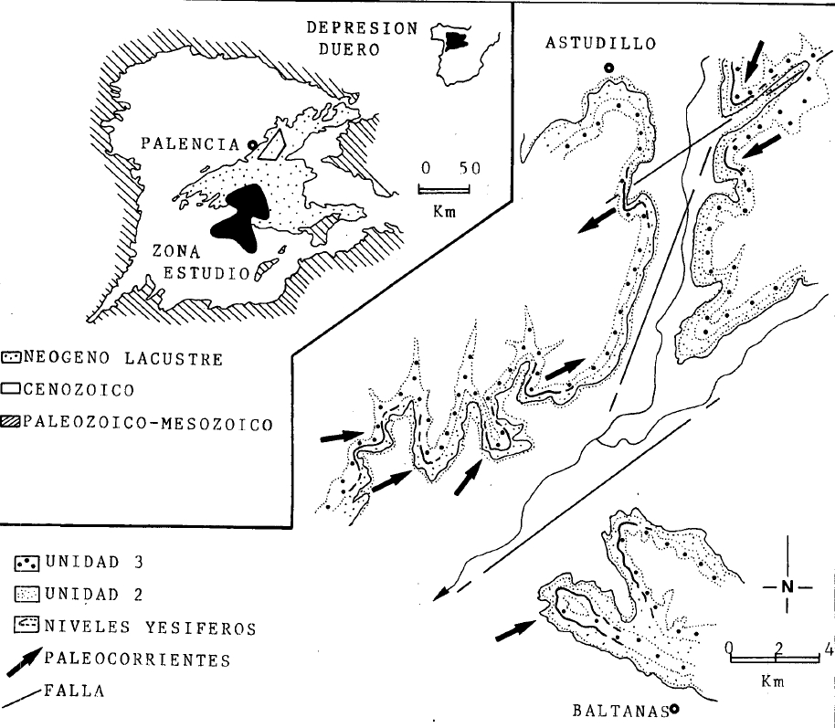
| Other comments | Formed under open to semi closed shallow lakes with moderate terrigenous influx. Synsedimentary fault tectonics, input of sediment and water and climate were the main controls of deposition. |
Generic Data
| Unique ID | 140 |
| Name | Íscar-Cuéllar |
| Structure type | Evaporite body |
| Deformed/Undeformed | Undeformed |
| Buried/Outcropping | Outcropping |
| Geological setting | Duero basin |
| Geological Regional Setting | Valladolid Sector |
| Evaporite unit/s name | Cuestas Facies |
| Evaporite unit/s age | Middle Miocene |
| Evaporite unit/s era | Cenozoic |
| Evaporite unit/s origin | Continental |
| Evaporite unit/s composition | Marlstone-Gypsum |
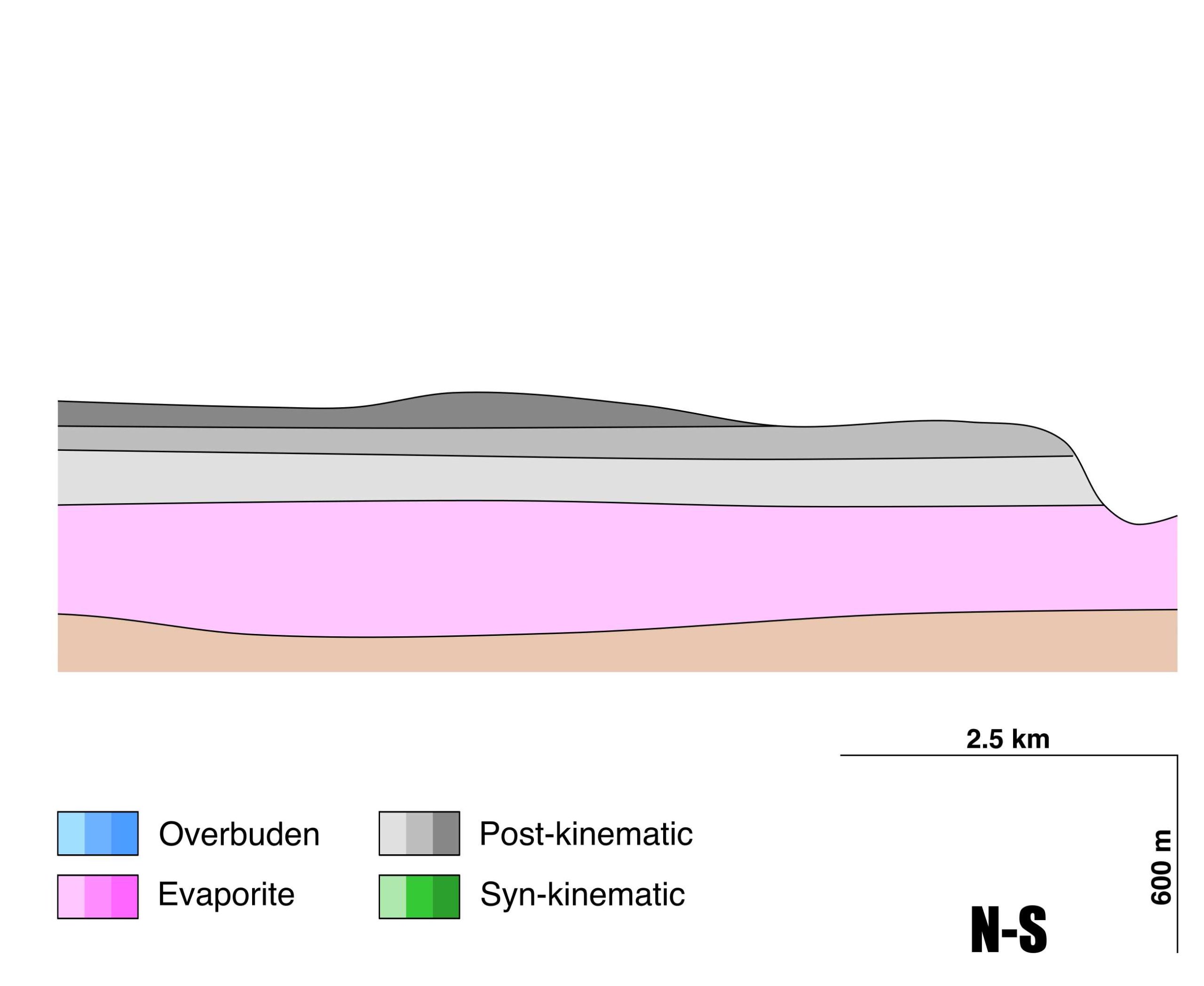
| Post-kinematic unit/s (or post-evaporite units when evaporites are undeformed) | Upper Miocene (Páramo Limestone Fm., limestones, dolostones and marlstones) ; Quaternary (alluvial and colluvial detrital deposits) |
| Post-kinematic unit/s age (or post-evaporite units when evaporites are undeformed) | Upper Miocene-Holocene |
| Classification (Hudec and Jackson, 2009) | No diapirism |
| Classification (Jackson and Talbot, 1986) | No diapirism |
| Mining activity? | Y |
| Mining activity start | |
| Mining activity end | Active |
| Mining galleries? | N |
| Mining products | Gypsum |
| Mining sub-products | |
| Evaporite flow? | N |
| Age of evaporite flow | – |
| Flow or deformation triggering mechanisms | – |
| Flow-linked structures? | – |
| Halokinetic structures | – |
| Post-evaporite and pre-kinematic unit/s (overbuden) | – |
| Syn-kinematic unit/s | – |
| Available seismic profiles | ILIHA D-A |
| Available boreholes | V-01-2 / V-01-3 / V-01-1 / VALLELADO-5 |
| Additional comments | Formed under open to semi closed shallow lakes with moderate terrigenous influx. Synsedimentary fault tectonics, input of sediment and water and climate were the main controls of deposition. |
Mining Data
| UNIQUE_ID | 140 |
| Minning exploitations within <2km? | Y |
| Historical/Active | Historical (not indexed in the Spanish National Minning Cadastre) |
| Exploitation name #1 | n.a. |
| Exploitation ID (Spanish National Mining Cadastre) #1 | n.a. |
| Municipality #1 | n.a. |
| Province #1 | n.a. |
| Company #1 | n.a. |
| Main minning Products #1 | Gypsum |
| Exploitation name #2 | |
| Exploitation ID (Spanish National Mining Cadastre) #2 | |
| Municipality #2 | |
| Province #2 | |
| Company #2 | |
| Main minning Products #2 | |
| Exploitation name #3 | |
| Exploitation ID (Spanish National Mining Cadastre) #3 | |
| Municipality #3 | |
| Province #3 | |
| Company #3 | |
| Main minning Products #3 |
Quantitative Data
| UNIQUE_ID | 140 |
| Outcropping area (km2) | 97.13622 |
| Horizontal intersection area (km2) (when buried) | Not buried |
| Depth of intersection area (km2) (when buried) | Not buried |
| Max. Width (Km) | 12.8 |
| Max. Length (Km) | 28.2 |
| Max. Evaporites thickness (km) | 0.4 |
| Max. Deformation age (Ma) | – |
| Min. Deformation age (Ma) | – |
| Deformation stages | 0 |
Reference Data
| UNIQUE_ID | 140 |
| Section source | IGME MAGNA 50. SHEET 401 (CUÉLLAR) |
| Well / Borehole availability #1 | n.a. |
| Well / Borehole availability #2 | n.a. |
| Available data (Stratigraphy) #1 | Armenteros, I., 1991. Contribución al conocimiento del Mioceno lacustre de la Cuenca terciaria del Duero (sector centro-oriental, Valladolid-Peñafiel-Sacramenia-Cuéllar). Acta geológica hispánica, 97-131. [link] |
| Available data (Stratigraphy) #2 | López, R. M. M., 1986. Sedimentología de los yesos del sector central de la Depresión del Duero. Acta geológica hispánica, 21(1), 35-44. [link] |
| Available data (Stratigraphy) #3 | Armenteros, I., 1991. Significado estratigráfico de dos alteraciones en el Mioceno superior de la Cuenca del Duero. Geogaceta, 10, 33-35. [link] |
| Available data (Stratigraphy) #4 | Santisteban Navarro, J. I., Mediavilla López, R. M., Martín Serrano, Á., Dabrio, C. J., 1996. The Duero Basin: a general overview. In Tertiary basins of Spain : the stratigraphic record of crustal kinematics / edited by Peter F. Friend and Cristino J. Dabrio. World and regional geology series . Cambridge University Press, Cambridge ; New York, pp. 183-187. [link] |
| Available data (Stratigraphy) #5 | Sahún, B., Gómez Fernández, J. J., Lillo, J., Olmo, P. D., 2004. Arsénico en aguas subterráneas e interacción agua-roca: un ejemplo en la cuenca terciaria del Duero (Castilla y León, España). Revista de la Sociedad Geológica de España, 17(1-2), 137-155. [link] |
| Available data (Stratigraphy) #6 | Sanz-Montero, M. E., Rodríguez-Aranda, J. P., del Cura, M. A. G., 2009. Bioinduced precipitation of barite and celestite in dolomite microbialites: examples from Miocene lacustrine sequences in the Madrid and Duero Basins, Spain. Sedimentary Geology, 222(1-2), 138-148. [link] |
| Regional Stratigraphy | Armenteros, I., 1991. Contribución al conocimiento del Mioceno lacustre de la Cuenca terciaria del Duero (sector centro-oriental, Valladolid-Peñafiel-Sacramenia-Cuéllar). Acta geológica hispánica, 97-131. [link] |
| Seismic data availability #1 | Diaz, J., Gallart Muset, J., Córdoba, D., Senos, L., Matias, L., Suriñach, E., …, Maguire, P., 2020. The ILIHA deep seismic sounding experiment (Iberian LIthosphere Heterogeneity and Anisotropy). DigitalCSIC – SEISDARE data repository. [link] |
| Seismic data availability #2 | n.a. |
| Seismic data availability #3 | n.a. |
| Available data (Structure) #1 | López, R. M. M., 1986. Sedimentología de los yesos del sector central de la Depresión del Duero. Acta geológica hispánica, 21(1), 35-44. [link] |
| Available data (Structure) #2 | Santisteban Navarro, J. I., Mediavilla López, R. M., Martín Serrano, Á., Dabrio, C. J., 1996. The Duero Basin: a general overview. In Tertiary basins of Spain : the stratigraphic record of crustal kinematics / edited by Peter F. Friend and Cristino J. Dabrio. World and regional geology series . Cambridge University Press, Cambridge ; New York, pp. 183-187. [link] |
| Available data (Structure) #3 | Yenes, M., Monterrubio, S., Nespereira, J., Santos, G., Fernández-Macarro, B., 2015. Large landslides induced by fluvial incision in the Cenozoic Duero Basin (Spain). Geomorphology, 246, 263-276. [link] |
| Available data (Structure) #4 | Granado, P., Ferrer García, J. O., Butillé, M., Muņoz, J. A., Roca i Abella, E., Ballesteros, J. C., …, González, P., 2012. Geometría 3d, Estructura y formación de la cuenca del Duero en el contexto geodinámico del orógeno pirenaico. Geo-Temas, 2012, vol. 13. [link] |
| Available data (Structure) #5 | n.a. |
| Available data (Structure) #6 | n.a. |
| Available data (Analogue modelling) #1 | n.a. |
| Available data (Analogue modelling) #2 | n.a. |
| Available data (Analogue modelling) #3 | n.a. |
| Available data (Gravimetry – Tomography) #1 | Ayala, C., Bohoyo, F., Maestro, A., Reguera, M. I., Torne, M., Rubio, F., Fernández, M., García-Lobón, J. L., 2016. Updated Bouguer anomalies of the Iberian Peninsula: a new perspective to interpret the regional geology. Journal of Maps, 12(5), 1089-1092. [link] |
| Available data (Gravimetry – Tomography) #2 | n.a. |
| Available data (Gravimetry – Tomography) #3 | n.a. |
| Available data (Geochemistry) #1 | Gómez, J. J., Lillo, J., Sahún, B., 2006. Naturally occurring arsenic in groundwater and identification of the geochemical sources in the Duero Cenozoic Basin, Spain. Environmental Geology, 50(8), 1151-1170. [link] |
| Available data (Geochemistry) #2 | Sahún, B., Gómez Fernández, J. J., Lillo, J., Olmo, P. D., 2004. Arsénico en aguas subterráneas e interacción agua-roca: un ejemplo en la cuenca terciaria del Duero (Castilla y León, España). Revista de la Sociedad Geológica de España, 17(1-2), 137-155. [link] |
| Available data (Geochemistry) #3 | n.a. |
| Available data (Geochemistry) #4 | n.a. |
| Available data (Petrophysics) #1 | n.a. |
| Available data (Petrophysics) #2 | n.a. |
| IGME Geological Map (MAGNA50) Sheet number | 401-Cuéllar. [link] |
| Other Maps #1 (source) | Antón, L., Muñoz-Martín, A., De Vicente, G., 2019. Quantifying the erosional impact of a continental-scale drainage capture in the Duero Basin, northwest Iberia. Quaternary Research, 91(2), 457-471. [link] |
| Other Maps #2 (source) | López, R. M. M., 1986. Sedimentología de los yesos del sector central de la Depresión del Duero. Acta geológica hispánica, 21(1), 35-44. [link] |
| Other related references #1 | Herrero, A., Alonso-Gavilán, G., Colmenero, J. R., 2010. Depositional sequences in a foreland basin (north-western domain of the continental Duero basin, Spain). Sedimentary geology, 223(3-4), 235-264. [link] |
| Other related references #2 | Huerta, P., Armenteros, I., 2005. Calcrete and palustrine assemblages on a distal alluvial-floodplain: a response to local subsidence (Miocene of the Duero basin, Spain). Sedimentary Geology, 177(3-4), 253-270. [link] |
| Other related references #3 | Sanz-Montero, M. E., Rodríguez-Aranda, J. P., Garcia Del Cura, M. A., 2008. Dolomite–silica stromatolites in Miocene lacustrine deposits from the Duero Basin, Spain: the role of organotemplates in the precipitation of dolomite. Sedimentology, 55(4), 729-750. [link] |
| Other related references #4 | n.a. |
Well and Seismic Data
| UNIQUE_ID | 140 |
| Seismic survey name #1 | ILIHA D-A |
| Across structure? #1 | Y |
| Seismic profile ID (IGME) #1 | n.a. |
| Seismic profile code #1 | n.a. |
| Seismic profile name #1 | n.a. |
| Seismic survey year #1 | n.a. |
| Data repository #1 | SeisDARE Database: https://digital.csic.es/handle/10261/101879 |
| Length (km) #1 | 842.09 |
| Seismic survey name #2 | |
| Across structure? #2 | |
| Seismic profile ID (IGME) #2 | |
| Seismic profile code #2 | |
| Seismic profile name #2 | |
| Seismic survey year #2 | |
| Data repository #2 | |
| Length (km) #2 | |
| Seismic survey name #3 | |
| Across structure? #3 | |
| Seismic profile ID (IGME) #3 | |
| Seismic profile code #3 | |
| Seismic profile name #3 | |
| Seismic survey year #3 | |
| Data repository #3 | |
| Length (km) #3 | |
| Seismic survey name #4 | |
| Across structure? #4 | |
| Seismic profile ID (IGME) #4 | |
| Seismic profile code #4 | |
| Seismic profile name #4 | |
| Seismic survey year #4 | |
| Data repository #4 | |
| Length (km) #4 | |
| Seismic survey name #5 | |
| Across structure? #5 | |
| Seismic profile ID (IGME) #5 | |
| Seismic profile code #5 | |
| Seismic profile name #5 | |
| Seismic survey year #5 | |
| Data repository #5 | |
| Length (km) #5 | |
| Seismic survey name #6 | |
| Across structure? #6 | |
| Seismic profile ID (IGME) #6 | |
| Seismic profile code #6 | |
| Seismic profile name #6 | |
| Seismic survey year #6 | |
| Data repository #6 | |
| Length (km) #6 | |
| Seismic survey name #7 | |
| Across structure? #7 | |
| Seismic profile ID (IGME) #7 | |
| Seismic profile code #7 | |
| Seismic profile name #7 | |
| Seismic survey year #7 | |
| Data repository #7 | |
| Length (km) #7 | |
| Seismic survey name #8 | |
| Across structure? #8 | |
| Seismic profile ID (IGME) #8 | |
| Seismic profile code #8 | |
| Seismic profile name #8 | |
| Seismic survey year #8 | |
| Data repository #8 | |
| Length (km) #8 | |
| Seismic survey name #9 | |
| Across structure? #9 | |
| Seismic profile ID (IGME) #9 | |
| Seismic profile code #9 | |
| Seismic profile name #9 | |
| Seismic survey year #9 | |
| Data repository #9 | |
| Length (km) #9 | |
| Seismic survey name #10 | |
| Across structure? #10 | |
| Seismic profile ID (IGME) #10 | |
| Seismic profile code #10 | |
| Seismic profile name #10 | |
| Seismic survey year #10 | |
| Data repository #10 | |
| Length (km) #10 | |
| Seismic survey name #11 | |
| Across structure? #11 | |
| Seismic profile ID (IGME) #11 | |
| Seismic profile code #11 | |
| Seismic profile name #11 | |
| Seismic survey year #11 | |
| Data repository #11 | |
| Length (km) #11 | |
| Seismic survey name #12 | |
| Across structure? #12 | |
| Seismic profile ID (IGME) #12 | |
| Seismic profile code #12 | |
| Seismic profile name #12 | |
| Seismic survey year #12 | |
| Data repository #12 | |
| Length (km) #12 | |
| Seismic survey name #13 | |
| Across structure? #13 | |
| Seismic profile ID (IGME) #13 | |
| Seismic profile code #13 | |
| Seismic profile name #13 | |
| Seismic survey year #13 | |
| Data repository #13 | |
| Length (km) #13 | |
| Seismic survey name #14 | |
| Across structure? #14 | |
| Seismic profile ID (IGME) #14 | |
| Seismic profile code #14 | |
| Seismic profile name #14 | |
| Seismic survey year #14 | |
| Data repository #14 | |
| Length (km) #14 | |
| Seismic survey name #15 | |
| Across structure? #15 | |
| Seismic profile ID (IGME) #15 | |
| Seismic profile code #15 | |
| Seismic profile name #15 | |
| Seismic survey year #15 | |
| Data repository #15 | |
| Length (km) #15 | |
| Seismic survey name #16 | |
| Across structure? #16 | |
| Seismic profile ID (IGME) #16 | |
| Seismic profile code #16 | |
| Seismic profile name #16 | |
| Seismic survey year #16 | |
| Data repository #16 | |
| Length (km) #16 | |
| Seismic survey name #17 | |
| Across structure? #17 | |
| Seismic profile ID (IGME) #17 | |
| Seismic profile code #17 | |
| Seismic profile name #17 | |
| Seismic survey year #17 | |
| Data repository #17 | |
| Length (km) #17 | |
| Seismic survey name #18 | |
| Across structure? #18 | |
| Seismic profile ID (IGME) #18 | |
| Seismic profile code #18 | |
| Seismic profile name #18 | |
| Seismic survey year #18 | |
| Data repository #18 | |
| Length (km) #18 | |
| Seismic survey name #19 | |
| Across structure? #19 | |
| Seismic profile ID (IGME) #19 | |
| Seismic profile code #19 | |
| Seismic profile name #19 | |
| Seismic survey year #19 | |
| Data repository #19 | |
| Length (km) #19 | |
| Seismic survey name #20 | |
| Across structure? #20 | |
| Seismic profile ID (IGME) #20 | |
| Seismic profile code #20 | |
| Seismic profile name #20 | |
| Seismic survey year #20 | |
| Data repository #20 | |
| Length (km) #20 | |
| Seismic survey name #21 | |
| Across structure? #21 | |
| Seismic profile ID (IGME) #21 | |
| Seismic profile code #21 | |
| Seismic profile name #21 | |
| Seismic survey year #21 | |
| Data repository #21 | |
| Length (km) #21 | |
| Borehole name #1 | V-01-2 |
| Company #1 | ADARO |
| Traget #1 | GYPSUM |
| Across structure? #1 | N (within 5 km) |
| Borehole name #2 | V-01-3 |
| Company #2 | ADARO |
| Traget #2 | GYPSUM |
| Across structure? #2 | N (within 5 km) |
| Borehole name #3 | V-01-1 |
| Company #3 | ADARO |
| Traget #3 | GYPSUM |
| Across structure? #3 | N (within 5 km) |
| Borehole name #4 | VALLELADO-5 |
| Company #4 | TRAGSA |
| Traget #4 | HYDROGEOLOGY |
| Across structure? #4 | N (within 5 km) |
| Borehole name #5 | |
| Company #5 | |
| Traget #5 | |
| Across structure? #5 | |
| Borehole name #6 | |
| Company #6 | |
| Traget #6 | |
| Across structure? #6 | |
| Borehole name #7 | |
| Company #7 | |
| Traget #7 | |
| Across structure? #7 | |
| Borehole name #8 | |
| Company #8 | |
| Traget #8 | |
| Across structure? #8 | |
| Borehole name #9 | |
| Company #9 | |
| Traget #9 | |
| Across structure? #9 | |
| Borehole name #10 | |
| Company #10 | |
| Traget #10 | |
| Across structure? #10 | |
| Borehole name #11 | |
| Company #11 | |
| Traget #11 | |
| Across structure? #11 | |
| Borehole name #12 | |
| Company #12 | |
| Traget #12 | |
| Across structure? #12 | |
| Borehole name #13 | |
| Company #13 | |
| Traget #13 | |
| Across structure? #13 | |
| Borehole name #14 | |
| Company #14 | |
| Traget #14 | |
| Across structure? #14 | |
| Borehole name #15 | |
| Company #15 | |
| Traget #15 | |
| Across structure? #15 |
Geographical Data (EPSG:4326 - WGS 84)
| UNIQUE_ID | 140 |
| X Centroid (Structure shape) | -4.418404 |
| Y Centroid (Structure shape) | -4.418404 |
| Xmin (Structure shape) | -4.554353 |
| Xmax (Structure shape) | -4.221518 |
| Ymin (Structure shape) | 41.376751 |
| Ymax (Structure shape) | 41.500951 |
| Xmin seismic line #1 | -8.066711 |
| Xmax seismic line #1 | -2.606201 |
| Ymin seismic line #1 | 37.071289 |
| Ymax seismic line #1 | 43.400696 |
| Xmin seismic line #2 | |
| Xmax seismic line #2 | |
| Ymin seismic line #2 | |
| Ymax seismic line #2 | |
| Xmin seismic line #3 | |
| Xmax seismic line #3 | |
| Ymin seismic line #3 | |
| Ymax seismic line #3 | |
| Xmin seismic line #4 | |
| Xmax seismic line #4 | |
| Ymin seismic line #4 | |
| Ymax seismic line #4 | |
| Xmin seismic line #5 | |
| Xmax seismic line #5 | |
| Ymin seismic line #5 | |
| Ymax seismic line #5 | |
| Xmin seismic line #6 | |
| Xmax seismic line #6 | |
| Ymin seismic line #6 | |
| Ymax seismic line #6 | |
| Xmin seismic line #7 | |
| Xmax seismic line #7 | |
| Ymin seismic line #7 | |
| Ymax seismic line #7 | |
| Xmin seismic line #8 | |
| Xmax seismic line #8 | |
| Ymin seismic line #8 | |
| Ymax seismic line #8 | |
| Xmin seismic line #9 | |
| Xmax seismic line #9 | |
| Ymin seismic line #9 | |
| Ymax seismic line #9 | |
| Xmin seismic line #10 | |
| Xmax seismic line #10 | |
| Ymin seismic line #10 | |
| Ymax seismic line #10 | |
| Xmin seismic line #11 | |
| Xmax seismic line #11 | |
| Ymin seismic line #11 | |
| Ymax seismic line #11 | |
| Xmin seismic line #12 | |
| Xmax seismic line #12 | |
| Ymin seismic line #12 | |
| Ymax seismic line #12 | |
| Xmin seismic line #13 | |
| Xmax seismic line #13 | |
| Ymin seismic line #13 | |
| Ymax seismic line #13 | |
| Xmin seismic line #14 | |
| Xmax seismic line #14 | |
| Ymin seismic line #14 | |
| Ymax seismic line #14 | |
| Xmin seismic line #15 | |
| Xmax seismic line #15 | |
| Ymin seismic line #15 | |
| Ymax seismic line #15 | |
| Xmin seismic line #16 | |
| Xmax seismic line #16 | |
| Ymin seismic line #16 | |
| Ymax seismic line #16 | |
| Xmin seismic line #17 | |
| Xmax seismic line #17 | |
| Ymin seismic line #17 | |
| Ymax seismic line #17 | |
| Xmin seismic line #18 | |
| Xmax seismic line #18 | |
| Ymin seismic line #18 | |
| Ymax seismic line #18 | |
| Xmin seismic line #19 | |
| Xmax seismic line #19 | |
| Ymin seismic line #19 | |
| Ymax seismic line #19 | |
| Xmin seismic line #20 | |
| Xmax seismic line #20 | |
| Ymin seismic line #20 | |
| Ymax seismic line #20 | |
| Xmin seismic line #21 | |
| Xmax seismic line #21 | |
| Ymin seismic line #21 | |
| Ymax seismic line #21 | |
| X borehole #1 | -4.523846 |
| Y borehole #1 | 41.421917 |
| X borehole #2 | -4.561906 |
| Y borehole #2 | 41.468585 |
| X borehole #3 | -4.559680 |
| Y borehole #3 | 41.364142 |
| X borehole #4 | -4.397303 |
| Y borehole #4 | 41.380144 |
| X borehole #5 | |
| Y borehole #5 | |
| X borehole #6 | |
| Y borehole #6 | |
| X borehole #7 | |
| Y borehole #7 | |
| X borehole #8 | |
| Y borehole #8 | |
| X borehole #9 | |
| Y borehole #9 | |
| X borehole #10 | |
| Y borehole #10 | |
| X borehole #11 | |
| Y borehole #11 | |
| X borehole #12 | |
| Y borehole #12 | |
| X borehole #13 | |
| Y borehole #13 | |
| X borehole #14 | |
| Y borehole #14 | |
| X borehole #15 | |
| Y borehole #15 |

