General Information
| Structure type | Evaporite Diapir |
| Deformed/Undeformed | Deformed |
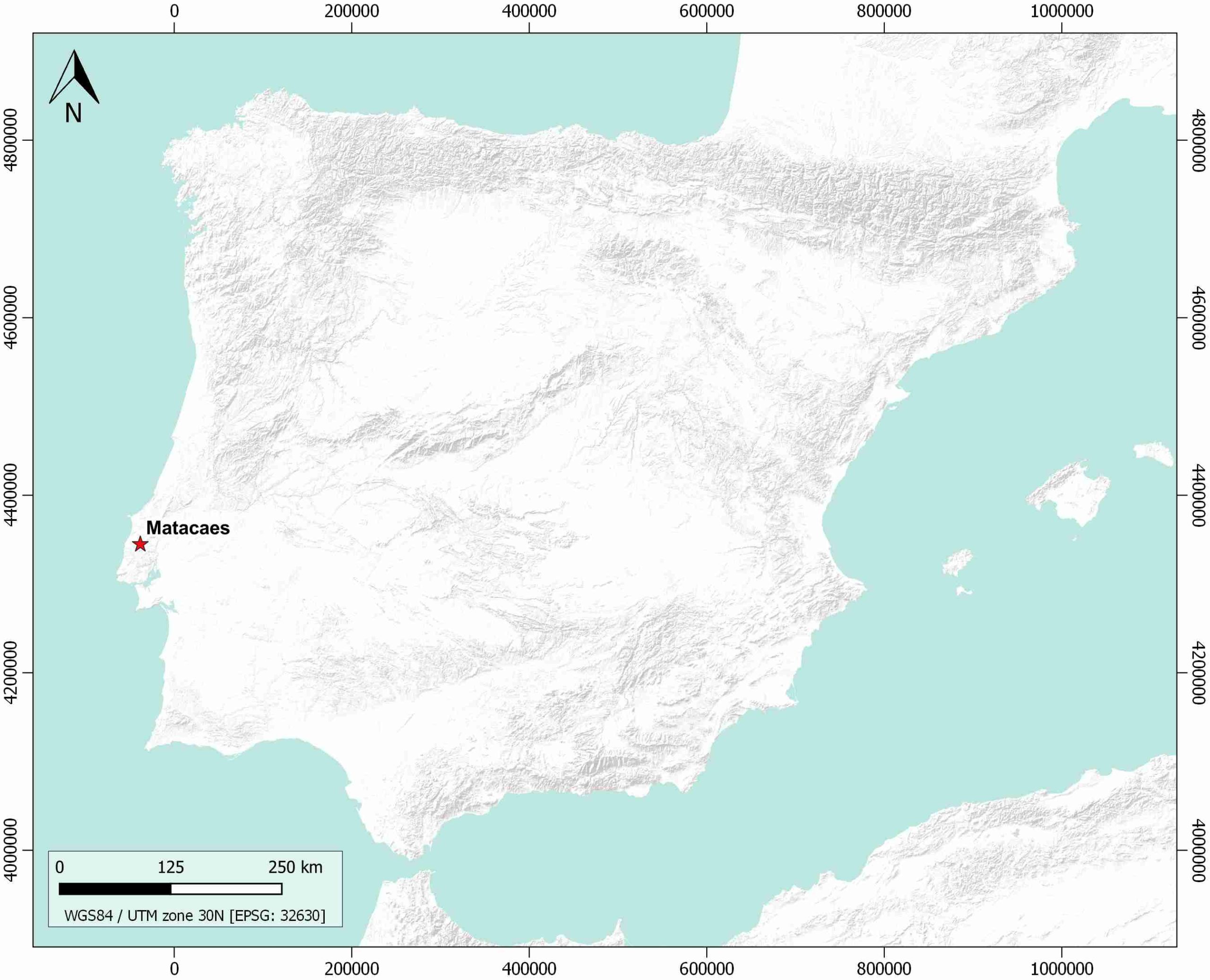
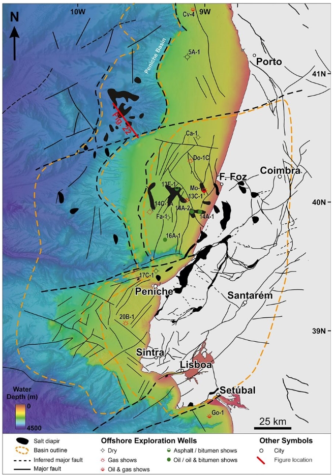
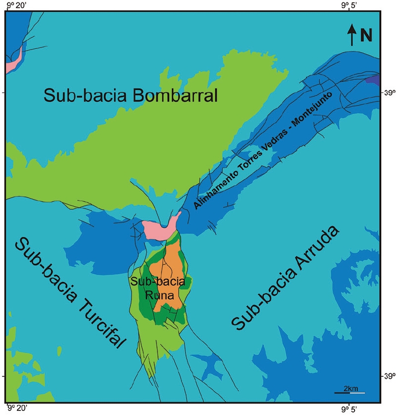
| Geological Setting | Central Domain, Lusitanian Basin |
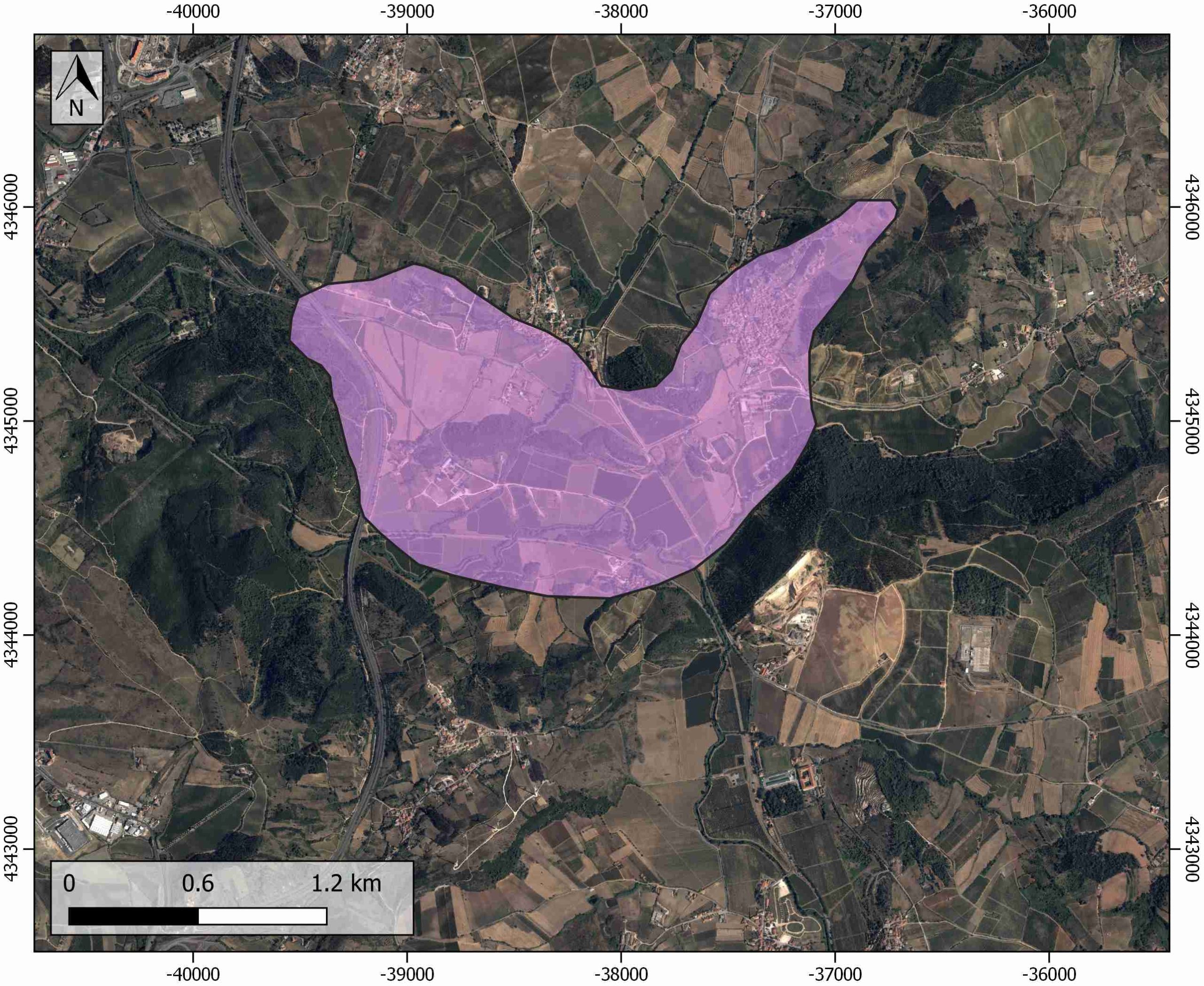
| Outcropping/buried | Outcropping |
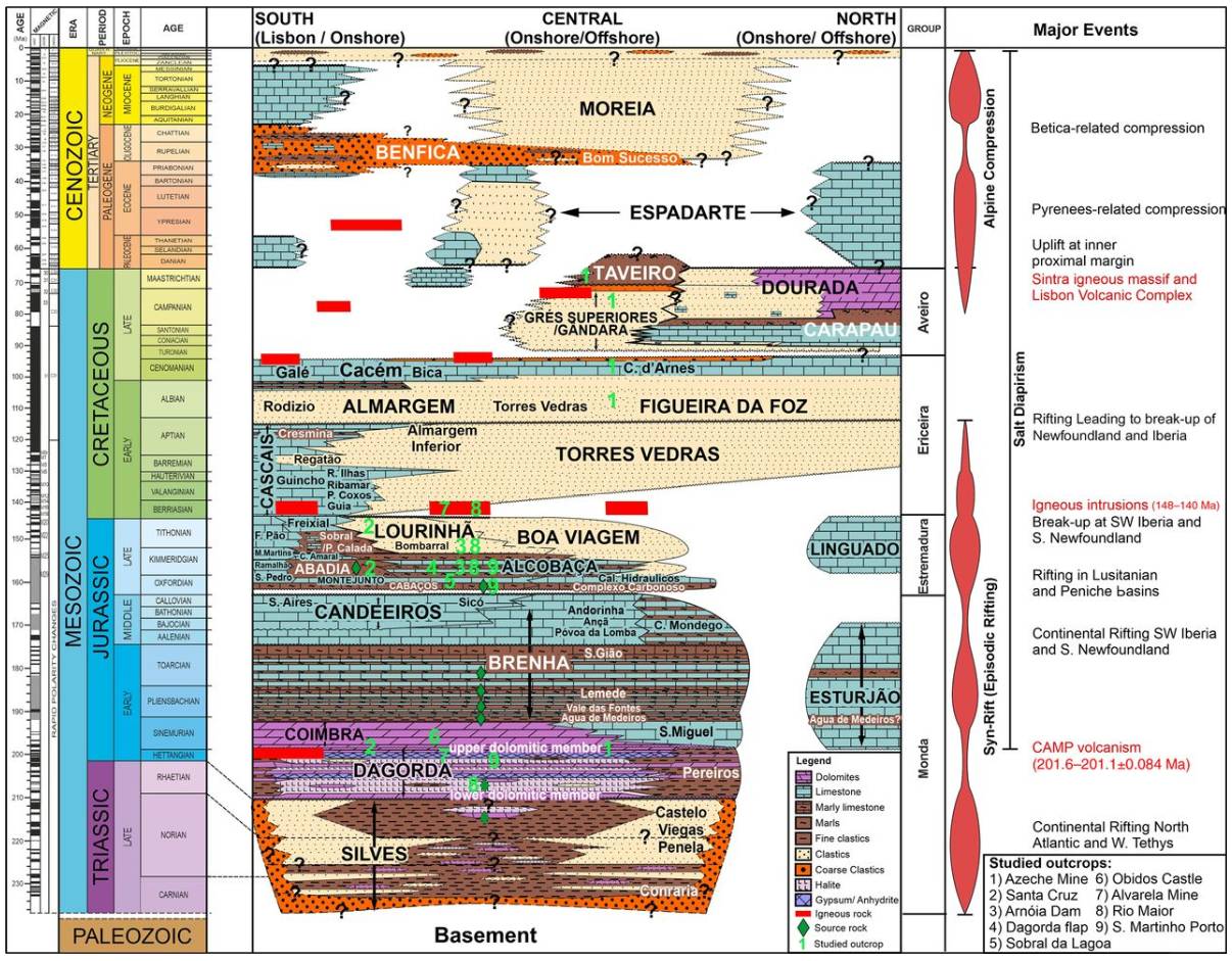
| Evaporite unit/s name | Dagorda Fm. |
| Evaporite unit/s age | Late Rhaetian-Hettangian (Upper Triassic-Lower Jurassic) |
| Evaporite unit/s origin | Marine |
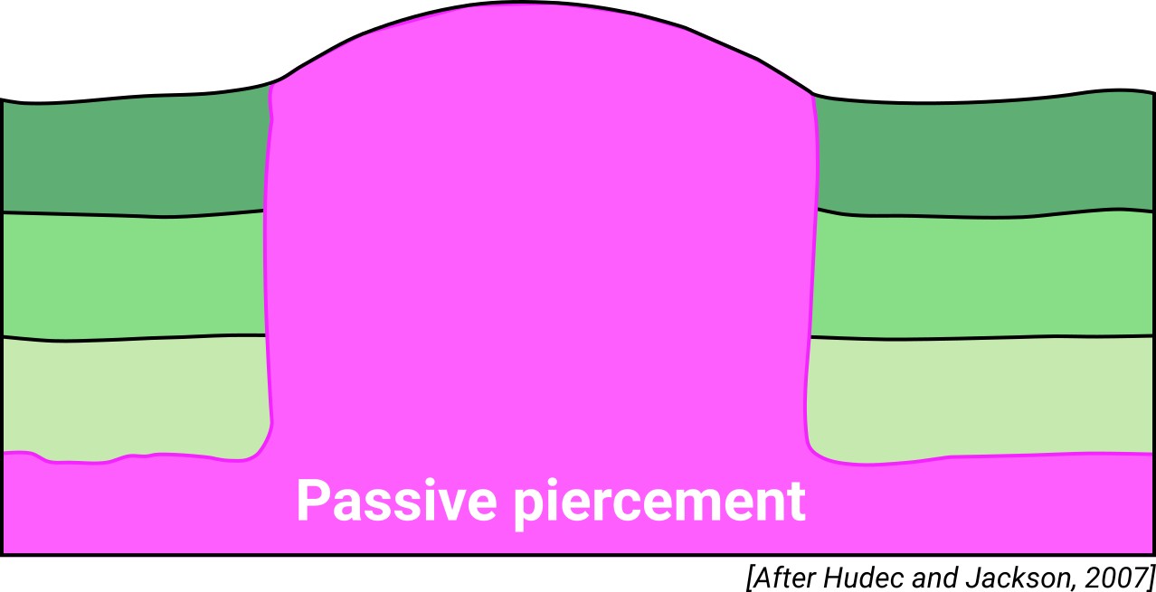
| Classif. (Hudec and Jackson, 2009) | Passive piercement |
| Classif. (Jackson and Talbot, 1986) | Salt glacier |
| Age of evaporite flow or deformation (when deformed) | late Cretaceous to Miocene, Upper Jurassic to Lower Cretaceous |
| Other comments | Matacães diapir geometry is the result of different tectonic periods (distensive-compressive) that were registered in the Lusitanian Basin, with special relevance to the Miocene compressive period. In this context, the Matacaes Diapir has intermediary characteristics between a salt glacier and a "salt tongue" (see Miranda et al., 2010) |
Generic Data
| Unique ID | 143 |
| Name | Matacaes |
| Structure type | Evaporite diapir |
| Deformed/Undeformed | Deformed |
| Buried/Outcropping | Outcropping |
| Geological setting | Lusitanian Basin |
| Geological Regional Setting | Central Domain |
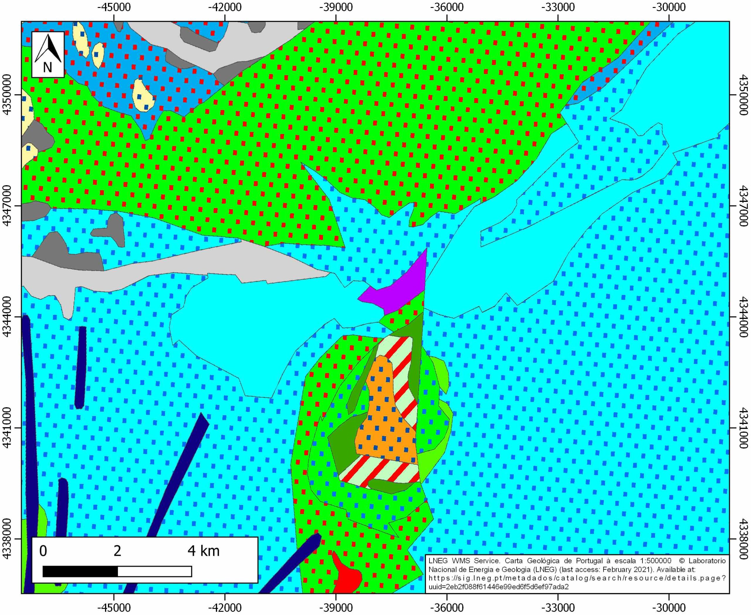
| Evaporite unit/s name | Dagorda Fm. |
| Evaporite unit/s age | Late Rhaetian-Hettangian (Upper Triassic-Lower Jurassic) |
| Evaporite unit/s era | Mesozoic |
| Evaporite unit/s origin | Marine |
| Evaporite unit/s composition | Gypsum-Marlstone-Halite-Bituminous dolomite-Shales |
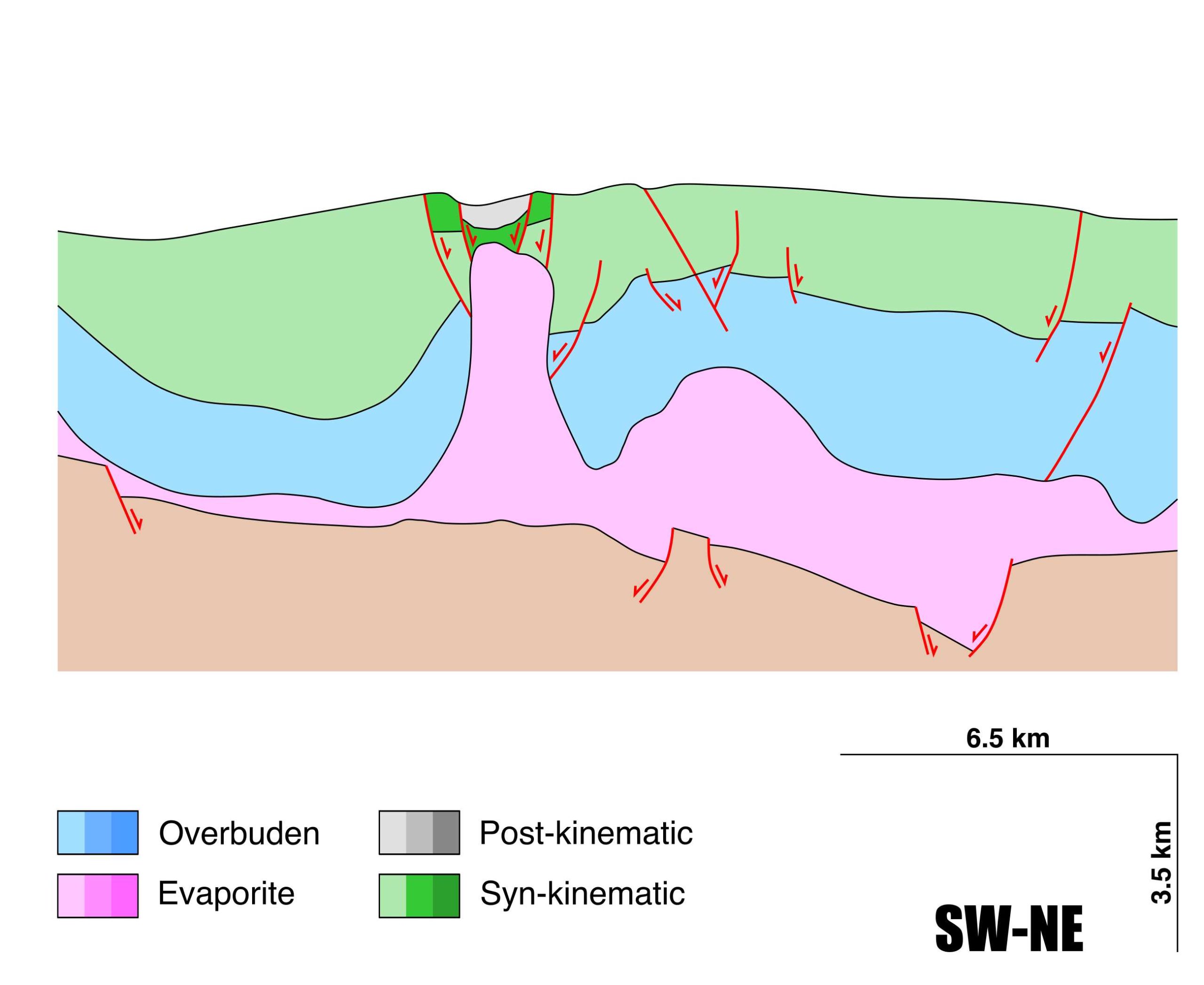
| Post-kinematic unit/s (or post-evaporite units when evaporites are undeformed) | Late Miocene (Moreia Fm., claystones, sandstones and conglomerates) ; Pliocene and Quaternary (alluvial and colluvial detrital deposits) |
| Post-kinematic unit/s age (or post-evaporite units when evaporites are undeformed) | Late Paleogene-Holocene |
| Classification (Hudec and Jackson, 2009) | Passive piercement |
| Classification (Jackson and Talbot, 1986) | Salt wall |
| Mining activity? | N |
| Mining activity start | |
| Mining activity end | |
| Mining galleries? | |
| Mining products | |
| Mining sub-products | |
| Evaporite flow? | Y |
| Age of evaporite flow | Oxfordian-Aptian (initial stage) and late Cretaceous-Miocene (main reactivation stage) |
| Flow or deformation triggering mechanisms | Extensional tectonics and Late Jurassic-Early Cretaceous rifting in the Lusitanian basin (initial stage) and Alpine compression and basin inversion (main stage) |
| Flow-linked structures? | Y |
| Halokinetic structures | Syncline-Anticline folding / normal faults / thrust faults |
| Post-evaporite and pre-kinematic unit/s (overbuden) | Early-Middle Jurassic (Brenha Fm., marlstones, limestones and marly limestones) |
| Syn-kinematic unit/s | Oxfordian-Kimmeridgian (Alcobaça Fm., marlstones and limestones) ; Tithonian (Lourinha-Boa Viagem Fm., sandstones, claystones and conglomerates) ; Berriasian-Aptian (Torres Vedras Fm., sandstones and claystones) ; Late Cretaceous-Miocene (Grés Superiores-Gándara Fm., sandstones and claystones) |
| Available seismic profiles | |
| Available boreholes | |
| Additional comments | Matacaes diapir geometry is the result of different tectonic periods (distensive-compressive) that were registered in the Lusitanian Basin, with special relevance to the Miocene compressive period. In this context, the Matacaes Diapir has intermediary characteristics between a namakier and a «salt tongue» (see Miranda et al., 2010) |
Mining Data
| UNIQUE_ID | 143 |
| Minning exploitations within <2km? | N |
| Historical/Active | |
| Exploitation name #1 | |
| Exploitation ID (Spanish National Mining Cadastre) #1 | |
| Municipality #1 | |
| Province #1 | |
| Company #1 | |
| Main minning Products #1 | |
| Exploitation name #2 | |
| Exploitation ID (Spanish National Mining Cadastre) #2 | |
| Municipality #2 | |
| Province #2 | |
| Company #2 | |
| Main minning Products #2 | |
| Exploitation name #3 | |
| Exploitation ID (Spanish National Mining Cadastre) #3 | |
| Municipality #3 | |
| Province #3 | |
| Company #3 | |
| Main minning Products #3 |
Quantitative Data
| UNIQUE_ID | 143 |
| Outcropping area (km2) | 2.74971 |
| Horizontal intersection area (km2) (when buried) | Not buried |
| Depth of intersection area (km2) (when buried) | Not buried |
| Max. Width (Km) | 1.8 |
| Max. Length (Km) | 2.9 |
| Max. Evaporites thickness (km) | 3.2 |
| Max. Deformation age (Ma) | 163 |
| Min. Deformation age (Ma) | 15 |
| Deformation stages | 2 |
Reference Data
| UNIQUE_ID | 143 |
| Section source | dos Reis, R. P., Pimentel, N., Fainstein, R., Reis, M., Rasmussen, B., 2017. Influence of salt diapirism on the basin architecture and hydrocarbon prospects of the Western Iberian Margin. In Permo-Triassic Salt Provinces of Europe, North Africa and the Atlantic Margins (pp. 313-329). Elsevier. [link] |
| Well / Borehole availability #1 | n.a. |
| Well / Borehole availability #2 | n.a. |
| Available data (Stratigraphy) #1 | Miranda, J. P., Figueiredo, F. P. O., Pimentel, N. L., 2010. Aquisicao e modelagem de dados gravimetricos sobre o diapiro salino de Matacaes (Torres Vedras, Bacia Lusitanica, Portugal). Boletim da Geociencias da Petrobras, 19(1), 2. [link] |
| Available data (Stratigraphy) #2 | Duarte, L. V., 2007. Lithostratigraphy, sequence stratigraphy and depositional setting of the Pliensbachian and Toarcian series in the Lusitanian Basin (Portugal). Ciencias de la Tierra, 16, 17-23. [link] |
| Available data (Stratigraphy) #3 | Alves, T. M., Manuppella, G., Gawthorpe, R. L., Hunt, D. W., Monteiro, J. H., 2003. The depositional evolution of diapir-and fault-bounded rift basins: examples from the Lusitanian Basin of West Iberia. Sedimentary Geology, 162(3-4), 273-303. [link] |
| Available data (Stratigraphy) #4 | dos Reis, R. P., Pimentel, N., Fainstein, R., Reis, M., Rasmussen, B., 2017. Influence of salt diapirism on the basin architecture and hydrocarbon prospects of the Western Iberian Margin. In Permo-Triassic Salt Provinces of Europe, North Africa and the Atlantic Margins (pp. 313-329). Elsevier. [link] |
| Available data (Stratigraphy) #5 | Davison, I., Barreto, P., 2020. Deformation and sedimentation processes, and hydrocarbon accumulations on upturned salt diapir flanks in the Lusitanian Basin, Portugal. Petroleum Geoscience, 27(1). [link] |
| Available data (Stratigraphy) #6 | Uphoff, T. L., 2005. Subsalt (pre-Jurassic) exploration play in the northern Lusitanian basin of Portugal. AAPG bulletin, 89(6), 699-714. [link] |
| Regional Stratigraphy | Davison, I., Barreto, P., 2020. Deformation and sedimentation processes, and hydrocarbon accumulations on upturned salt diapir flanks in the Lusitanian Basin, Portugal. Petroleum Geoscience, 27(1). [link] |
| Seismic data availability #1 | n.a. |
| Seismic data availability #2 | n.a. |
| Seismic data availability #3 | n.a. |
| Available data (Structure) #1 | Miranda, J. P., Figueiredo, F. P. O., Pimentel, N. L., 2010. Aquisicao e modelagem de dados gravimetricos sobre o diapiro salino de Matacaes (Torres Vedras, Bacia Lusitanica, Portugal). Boletim da Geociencias da Petrobras, 19(1), 2. [link] |
| Available data (Structure) #2 | Pereira, N., Carneiro, J. F., Araújo, A., Bezzeghoud, M., Borges, J., 2014. Seismic and structural geology constraints to the selection of CO2 storage sites—The case of the onshore Lusitanian basin, Portugal. Journal of Applied Geophysics, 102, 21-38. [link] |
| Available data (Structure) #3 | dos Reis, R. P., Pimentel, N., Fainstein, R., Reis, M., Rasmussen, B., 2017. Influence of salt diapirism on the basin architecture and hydrocarbon prospects of the Western Iberian Margin. In Permo-Triassic Salt Provinces of Europe, North Africa and the Atlantic Margins (pp. 313-329). Elsevier. [link] |
| Available data (Structure) #4 | Rasmussen, E. S., Lomholt, S., Andersen, C., Vejbæk, O. V., 1998. Aspects of the structural evolution of the Lusitanian Basin in Portugal and the shelf and slope area offshore Portugal. Tectonophysics, 300(1-4), 199-225. [link] |
| Available data (Structure) #5 | Davison, I., Barreto, P., 2020. Deformation and sedimentation processes, and hydrocarbon accumulations on upturned salt diapir flanks in the Lusitanian Basin, Portugal. Petroleum Geoscience, 27(1). [link] |
| Available data (Structure) #6 | Pimentel, N., Pena dos Reis, R., 2016. Petroleum systems of the West Iberian Margin: A review of the Lusitanian Basin and the deep offshore Peniche Basin. Journal of Petroleum Geology, 39(3), 305-326. [link] |
| Available data (Analogue modelling) #1 | n.a. |
| Available data (Analogue modelling) #2 | n.a. |
| Available data (Analogue modelling) #3 | n.a. |
| Available data (Gravimetry – Tomography) #1 | Miranda, J., Figueiredo, F., Pimentel, N. ,Dos Reis, R. P., 2010. Modelação gravimétrica de um perfil sobre o Diapiro de Matacães (Torres Vedras–Bacia Lusitânica) Gravimetric modelling of a profile over the Matacães salt diapir (Torres Vedras–Lusitanian Basin). GEOTIC – Sociedade Geológica de Portugal, VIII Congresso Nacional de Geologia. [link] |
| Available data (Gravimetry – Tomography) #2 | Miranda, J. P., Figueiredo, F. P. O., Pimentel, N. L., 2010. Aquisicao e modelagem de dados gravimetricos sobre o diapiro salino de Matacaes (Torres Vedras, Bacia Lusitanica, Portugal). Boletim da Geociencias da Petrobras, 19(1), 2. [link] |
| Available data (Gravimetry – Tomography) #3 | Cardoso, F., Reis, M., Cortesão, A., Pena dos Reis, R., Pimentel, N., 2015. Diapiric structures in the Peniche Basin (Portugal)-location, deformation timings and importance to petroleum exploration. AAPG European Regional Conference & Exhibition 2015, #90226. [link] |
| Available data (Geochemistry) #1 | n.a. |
| Available data (Geochemistry) #2 | n.a. |
| Available data (Geochemistry) #3 | n.a. |
| Available data (Geochemistry) #4 | n.a. |
| Available data (Petrophysics) #1 | Sêco, S. L., Silva, R. L., Watson, N., Duarte, L. V., Pereira, A. J., Wach, G., 2019. Application of petrophysical methods to estimate total organic carbon in Lower Jurassic source rocks from the offshore Lusitanian Basin (Portugal). Journal of Petroleum Science and Engineering, 180, 1058-1068. [link] |
| Available data (Petrophysics) #2 | Azerêdo, A. C., Inês, N., & Bizarro, P., 2020. Carbonate reservoir outcrop analogues with a glance at pore-scale (Middle Jurassic, Lusitanian Basin, Portugal). Marine and Petroleum Geology, 111, 815-851. [link] |
| IGME Geological Map (MAGNA50) Sheet number | n.a. |
| Other Maps #1 (source) | Davison, I., Barreto, P., 2020. Deformation and sedimentation processes, and hydrocarbon accumulations on upturned salt diapir flanks in the Lusitanian Basin, Portugal. Petroleum Geoscience, 27(1). [link] |
| Other Maps #2 (source) | Miranda, J. P., Figueiredo, F. P. O., Pimentel, N. L., 2010. Aquisicao e modelagem de dados gravimetricos sobre o diapiro salino de Matacaes (Torres Vedras, Bacia Lusitanica, Portugal). Boletim da Geociencias da Petrobras, 19(1), 2. [link] |
| Other related references #1 | Carneiro, J. F., Matos, C. R., Van Gessel, S., 2019. Opportunities for large-scale energy storage in geological formations in mainland Portugal. Renewable and Sustainable Energy Reviews, 99, 201-211. [link] |
| Other related references #2 | Carvalho, J. M. F., 2013. Tectónica e caraterização da fraturação do Maciço Calcário Estremenho, Bacia Lusitaniana. Contributo para a prospeção de rochas ornamentais e ordenamento da atividade extrativa [Ph.D. thesis:]: Universidade de Lisboa, Faculdade de Ciências, Departamento de Geologia, 449pp. [link] |
| Other related references #3 | Mateus, O., Dinis, J., & Cunha, P. P., 2017. The Lourinhã Formation: the Upper Jurassic to lower most Cretaceous of the Lusitanian Basin, Portugal–landscapes where dinosaurs walked. Ciências da Terra/Earth Sciences Journal, 19(1), 75-97. [link] |
| Other related references #4 | dos Reis, P., Cunha, P. P., Dinis, J., Trincão, P. R., 2000. Geological evolution of the Lusitanian Basin (Portugal) during the Late Jurassic. 5th Jurassic Symposium, Vancouver, 6, 345-356. [link] |
Well and Seismic Data
| UNIQUE_ID | 143 |
| Seismic survey name #1 | |
| Across structure? #1 | |
| Seismic profile ID (IGME) #1 | |
| Seismic profile code #1 | |
| Seismic profile name #1 | |
| Seismic survey year #1 | |
| Data repository #1 | |
| Length (km) #1 | |
| Seismic survey name #2 | |
| Across structure? #2 | |
| Seismic profile ID (IGME) #2 | |
| Seismic profile code #2 | |
| Seismic profile name #2 | |
| Seismic survey year #2 | |
| Data repository #2 | |
| Length (km) #2 | |
| Seismic survey name #3 | |
| Across structure? #3 | |
| Seismic profile ID (IGME) #3 | |
| Seismic profile code #3 | |
| Seismic profile name #3 | |
| Seismic survey year #3 | |
| Data repository #3 | |
| Length (km) #3 | |
| Seismic survey name #4 | |
| Across structure? #4 | |
| Seismic profile ID (IGME) #4 | |
| Seismic profile code #4 | |
| Seismic profile name #4 | |
| Seismic survey year #4 | |
| Data repository #4 | |
| Length (km) #4 | |
| Seismic survey name #5 | |
| Across structure? #5 | |
| Seismic profile ID (IGME) #5 | |
| Seismic profile code #5 | |
| Seismic profile name #5 | |
| Seismic survey year #5 | |
| Data repository #5 | |
| Length (km) #5 | |
| Seismic survey name #6 | |
| Across structure? #6 | |
| Seismic profile ID (IGME) #6 | |
| Seismic profile code #6 | |
| Seismic profile name #6 | |
| Seismic survey year #6 | |
| Data repository #6 | |
| Length (km) #6 | |
| Seismic survey name #7 | |
| Across structure? #7 | |
| Seismic profile ID (IGME) #7 | |
| Seismic profile code #7 | |
| Seismic profile name #7 | |
| Seismic survey year #7 | |
| Data repository #7 | |
| Length (km) #7 | |
| Seismic survey name #8 | |
| Across structure? #8 | |
| Seismic profile ID (IGME) #8 | |
| Seismic profile code #8 | |
| Seismic profile name #8 | |
| Seismic survey year #8 | |
| Data repository #8 | |
| Length (km) #8 | |
| Seismic survey name #9 | |
| Across structure? #9 | |
| Seismic profile ID (IGME) #9 | |
| Seismic profile code #9 | |
| Seismic profile name #9 | |
| Seismic survey year #9 | |
| Data repository #9 | |
| Length (km) #9 | |
| Seismic survey name #10 | |
| Across structure? #10 | |
| Seismic profile ID (IGME) #10 | |
| Seismic profile code #10 | |
| Seismic profile name #10 | |
| Seismic survey year #10 | |
| Data repository #10 | |
| Length (km) #10 | |
| Seismic survey name #11 | |
| Across structure? #11 | |
| Seismic profile ID (IGME) #11 | |
| Seismic profile code #11 | |
| Seismic profile name #11 | |
| Seismic survey year #11 | |
| Data repository #11 | |
| Length (km) #11 | |
| Seismic survey name #12 | |
| Across structure? #12 | |
| Seismic profile ID (IGME) #12 | |
| Seismic profile code #12 | |
| Seismic profile name #12 | |
| Seismic survey year #12 | |
| Data repository #12 | |
| Length (km) #12 | |
| Seismic survey name #13 | |
| Across structure? #13 | |
| Seismic profile ID (IGME) #13 | |
| Seismic profile code #13 | |
| Seismic profile name #13 | |
| Seismic survey year #13 | |
| Data repository #13 | |
| Length (km) #13 | |
| Seismic survey name #14 | |
| Across structure? #14 | |
| Seismic profile ID (IGME) #14 | |
| Seismic profile code #14 | |
| Seismic profile name #14 | |
| Seismic survey year #14 | |
| Data repository #14 | |
| Length (km) #14 | |
| Seismic survey name #15 | |
| Across structure? #15 | |
| Seismic profile ID (IGME) #15 | |
| Seismic profile code #15 | |
| Seismic profile name #15 | |
| Seismic survey year #15 | |
| Data repository #15 | |
| Length (km) #15 | |
| Seismic survey name #16 | |
| Across structure? #16 | |
| Seismic profile ID (IGME) #16 | |
| Seismic profile code #16 | |
| Seismic profile name #16 | |
| Seismic survey year #16 | |
| Data repository #16 | |
| Length (km) #16 | |
| Seismic survey name #17 | |
| Across structure? #17 | |
| Seismic profile ID (IGME) #17 | |
| Seismic profile code #17 | |
| Seismic profile name #17 | |
| Seismic survey year #17 | |
| Data repository #17 | |
| Length (km) #17 | |
| Seismic survey name #18 | |
| Across structure? #18 | |
| Seismic profile ID (IGME) #18 | |
| Seismic profile code #18 | |
| Seismic profile name #18 | |
| Seismic survey year #18 | |
| Data repository #18 | |
| Length (km) #18 | |
| Seismic survey name #19 | |
| Across structure? #19 | |
| Seismic profile ID (IGME) #19 | |
| Seismic profile code #19 | |
| Seismic profile name #19 | |
| Seismic survey year #19 | |
| Data repository #19 | |
| Length (km) #19 | |
| Seismic survey name #20 | |
| Across structure? #20 | |
| Seismic profile ID (IGME) #20 | |
| Seismic profile code #20 | |
| Seismic profile name #20 | |
| Seismic survey year #20 | |
| Data repository #20 | |
| Length (km) #20 | |
| Seismic survey name #21 | |
| Across structure? #21 | |
| Seismic profile ID (IGME) #21 | |
| Seismic profile code #21 | |
| Seismic profile name #21 | |
| Seismic survey year #21 | |
| Data repository #21 | |
| Length (km) #21 | |
| Borehole name #1 | |
| Company #1 | |
| Traget #1 | |
| Across structure? #1 | |
| Borehole name #2 | |
| Company #2 | |
| Traget #2 | |
| Across structure? #2 | |
| Borehole name #3 | |
| Company #3 | |
| Traget #3 | |
| Across structure? #3 | |
| Borehole name #4 | |
| Company #4 | |
| Traget #4 | |
| Across structure? #4 | |
| Borehole name #5 | |
| Company #5 | |
| Traget #5 | |
| Across structure? #5 | |
| Borehole name #6 | |
| Company #6 | |
| Traget #6 | |
| Across structure? #6 | |
| Borehole name #7 | |
| Company #7 | |
| Traget #7 | |
| Across structure? #7 | |
| Borehole name #8 | |
| Company #8 | |
| Traget #8 | |
| Across structure? #8 | |
| Borehole name #9 | |
| Company #9 | |
| Traget #9 | |
| Across structure? #9 | |
| Borehole name #10 | |
| Company #10 | |
| Traget #10 | |
| Across structure? #10 | |
| Borehole name #11 | |
| Company #11 | |
| Traget #11 | |
| Across structure? #11 | |
| Borehole name #12 | |
| Company #12 | |
| Traget #12 | |
| Across structure? #12 | |
| Borehole name #13 | |
| Company #13 | |
| Traget #13 | |
| Across structure? #13 | |
| Borehole name #14 | |
| Company #14 | |
| Traget #14 | |
| Across structure? #14 | |
| Borehole name #15 | |
| Company #15 | |
| Traget #15 | |
| Across structure? #15 |
Geographical Data (EPSG:4326 - WGS 84)
| UNIQUE_ID | 143 |
| X Centroid (Structure shape) | -9.220779 |
| Y Centroid (Structure shape) | -9.220779 |
| Xmin (Structure shape) | -9.236395 |
| Xmax (Structure shape) | -9.204185 |
| Ymin (Structure shape) | 39.080544 |
| Ymax (Structure shape) | 39.098107 |
| Xmin seismic line #1 | |
| Xmax seismic line #1 | |
| Ymin seismic line #1 | |
| Ymax seismic line #1 | |
| Xmin seismic line #2 | |
| Xmax seismic line #2 | |
| Ymin seismic line #2 | |
| Ymax seismic line #2 | |
| Xmin seismic line #3 | |
| Xmax seismic line #3 | |
| Ymin seismic line #3 | |
| Ymax seismic line #3 | |
| Xmin seismic line #4 | |
| Xmax seismic line #4 | |
| Ymin seismic line #4 | |
| Ymax seismic line #4 | |
| Xmin seismic line #5 | |
| Xmax seismic line #5 | |
| Ymin seismic line #5 | |
| Ymax seismic line #5 | |
| Xmin seismic line #6 | |
| Xmax seismic line #6 | |
| Ymin seismic line #6 | |
| Ymax seismic line #6 | |
| Xmin seismic line #7 | |
| Xmax seismic line #7 | |
| Ymin seismic line #7 | |
| Ymax seismic line #7 | |
| Xmin seismic line #8 | |
| Xmax seismic line #8 | |
| Ymin seismic line #8 | |
| Ymax seismic line #8 | |
| Xmin seismic line #9 | |
| Xmax seismic line #9 | |
| Ymin seismic line #9 | |
| Ymax seismic line #9 | |
| Xmin seismic line #10 | |
| Xmax seismic line #10 | |
| Ymin seismic line #10 | |
| Ymax seismic line #10 | |
| Xmin seismic line #11 | |
| Xmax seismic line #11 | |
| Ymin seismic line #11 | |
| Ymax seismic line #11 | |
| Xmin seismic line #12 | |
| Xmax seismic line #12 | |
| Ymin seismic line #12 | |
| Ymax seismic line #12 | |
| Xmin seismic line #13 | |
| Xmax seismic line #13 | |
| Ymin seismic line #13 | |
| Ymax seismic line #13 | |
| Xmin seismic line #14 | |
| Xmax seismic line #14 | |
| Ymin seismic line #14 | |
| Ymax seismic line #14 | |
| Xmin seismic line #15 | |
| Xmax seismic line #15 | |
| Ymin seismic line #15 | |
| Ymax seismic line #15 | |
| Xmin seismic line #16 | |
| Xmax seismic line #16 | |
| Ymin seismic line #16 | |
| Ymax seismic line #16 | |
| Xmin seismic line #17 | |
| Xmax seismic line #17 | |
| Ymin seismic line #17 | |
| Ymax seismic line #17 | |
| Xmin seismic line #18 | |
| Xmax seismic line #18 | |
| Ymin seismic line #18 | |
| Ymax seismic line #18 | |
| Xmin seismic line #19 | |
| Xmax seismic line #19 | |
| Ymin seismic line #19 | |
| Ymax seismic line #19 | |
| Xmin seismic line #20 | |
| Xmax seismic line #20 | |
| Ymin seismic line #20 | |
| Ymax seismic line #20 | |
| Xmin seismic line #21 | |
| Xmax seismic line #21 | |
| Ymin seismic line #21 | |
| Ymax seismic line #21 | |
| X borehole #1 | |
| Y borehole #1 | |
| X borehole #2 | |
| Y borehole #2 | |
| X borehole #3 | |
| Y borehole #3 | |
| X borehole #4 | |
| Y borehole #4 | |
| X borehole #5 | |
| Y borehole #5 | |
| X borehole #6 | |
| Y borehole #6 | |
| X borehole #7 | |
| Y borehole #7 | |
| X borehole #8 | |
| Y borehole #8 | |
| X borehole #9 | |
| Y borehole #9 | |
| X borehole #10 | |
| Y borehole #10 | |
| X borehole #11 | |
| Y borehole #11 | |
| X borehole #12 | |
| Y borehole #12 | |
| X borehole #13 | |
| Y borehole #13 | |
| X borehole #14 | |
| Y borehole #14 | |
| X borehole #15 | |
| Y borehole #15 |

