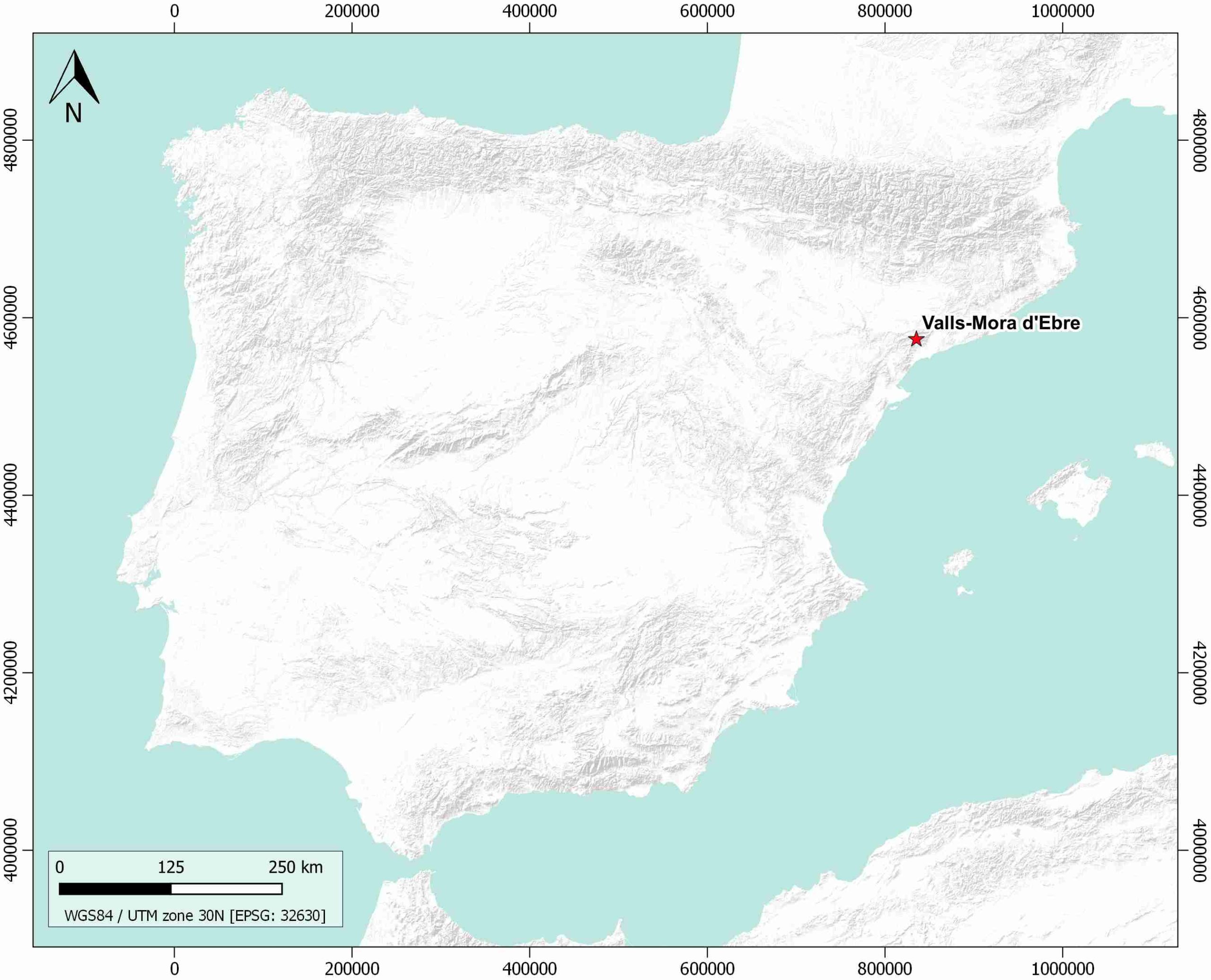
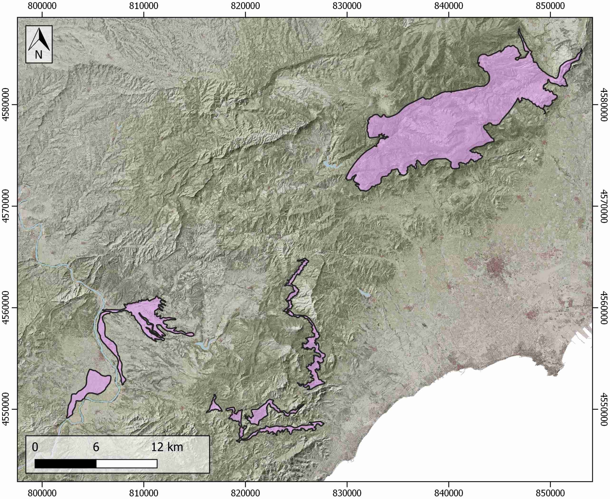
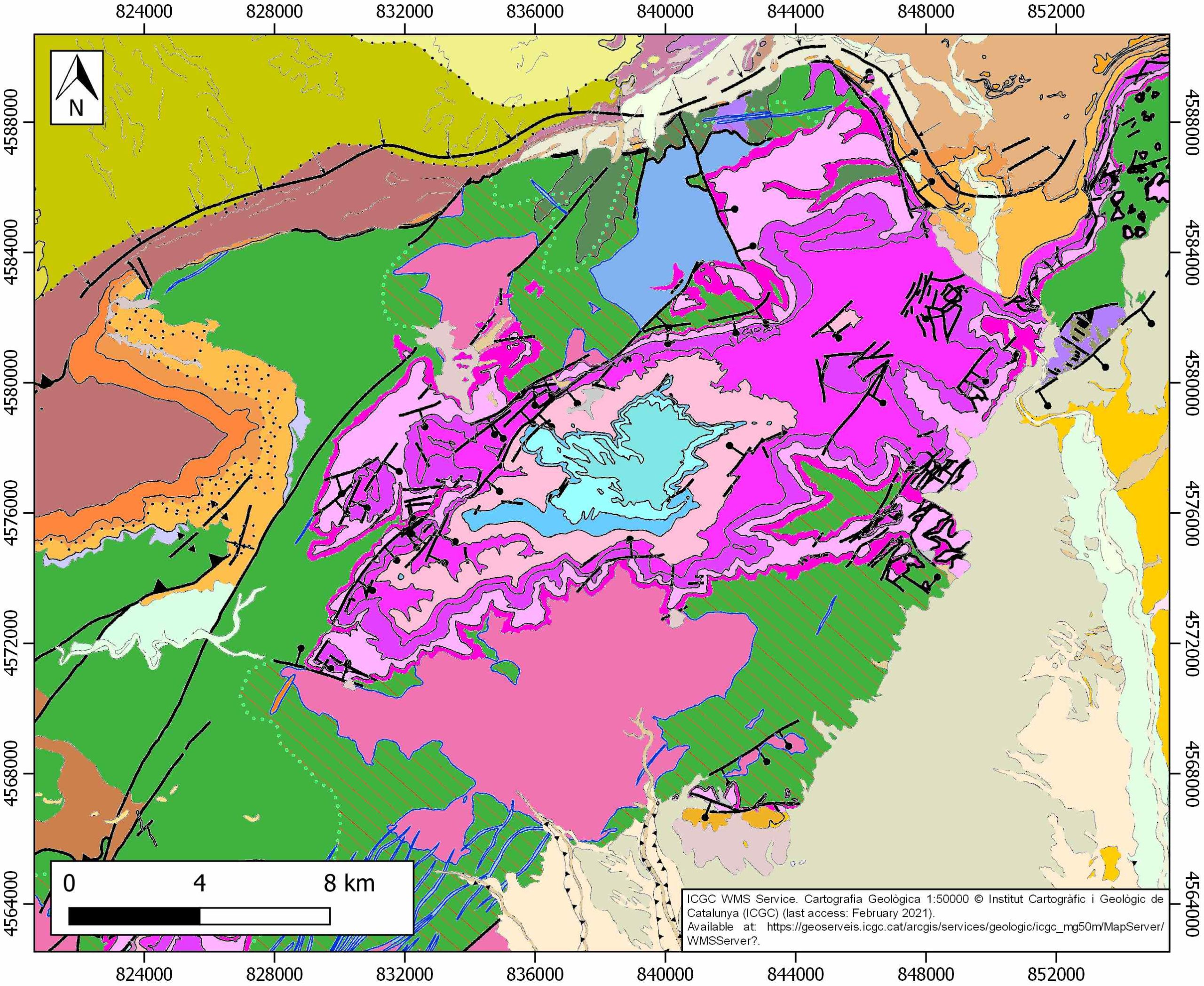
Valls-Mora d’Ebre
ID #148
General Information
| Structure type | Evaporite body |
| Deformed/Undeformed | Deformed |
| Geological Setting | Catalan Coastal Ranges |
| Outcropping/buried | Outcropping |
| Evaporite unit/s name | Keuper facies, Middle Muschelkalk facies |
| Evaporite unit/s age | Upper Anisian and Carnian-Rhaetian (Middle-Upper Triassic) |
| Evaporite unit/s origin | Marine |
| Classif. (Hudec and Jackson, 2009) | No diapirism |
| Classif. (Jackson and Talbot, 1986) | No diapirism |
| Age of evaporite flow or deformation (when deformed) | Eocene to Oligocene, Paleocene-Eocene, Upper Jurassic to Lower Cretaceous |
| Other comments | - |
Generic Data
| Unique ID | 148 |
| Name | Valls-Mora d’Ebre |
| Structure type | Evaporite body |
| Deformed/Undeformed | Deformed |
| Buried/Outcropping | Outcropping |
| Geological setting | Catalan Coastal Ranges |
| Geological Regional Setting | SW Domain |
| Evaporite unit/s name | Middle Muschelkalk and Keuper Facies |
| Evaporite unit/s age | Upper Anisian and Carnian-Rhaetian (Middle-Upper Triassic) |
| Evaporite unit/s era | Mesozoic |
| Evaporite unit/s origin | Marine |
| Evaporite unit/s composition | Marlstone-Gypsum-Red Claystonestone |
| Post-kinematic unit/s (or post-evaporite units when evaporites are undeformed) | Lower Miocene (Conglomerates and claystones) ; Upper Miocene (Calcarenites, limestones, marlstones and marly limestones) ; Quaternary (alluvial and colluvial detrital deposits) |
| Post-kinematic unit/s age (or post-evaporite units when evaporites are undeformed) | Lower Miocene-Holocene |
| Classification (Hudec and Jackson, 2009) | No diapirism |
| Classification (Jackson and Talbot, 1986) | No diapirism |
| Mining activity? | Y |
| Mining activity start | |
| Mining activity end | Active |
| Mining galleries? | N |
| Mining products | Gravel and sand |
| Mining sub-products | – |
| Evaporite flow? | Y |
| Age of evaporite flow | Late Jurassic-Early Cretaceous (early stage) and Paleogene (main stage) |
| Flow or deformation triggering mechanisms | Regional extension and differential tectonic block activity in the Catalan Coastal Ranges (early stage) and Alpine compression and range development (main stage) |
| Flow-linked structures? | Y |
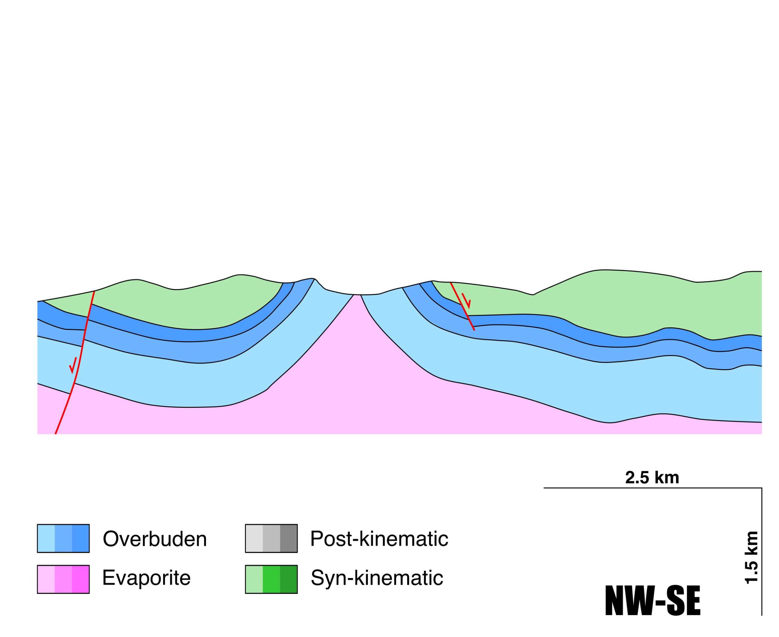
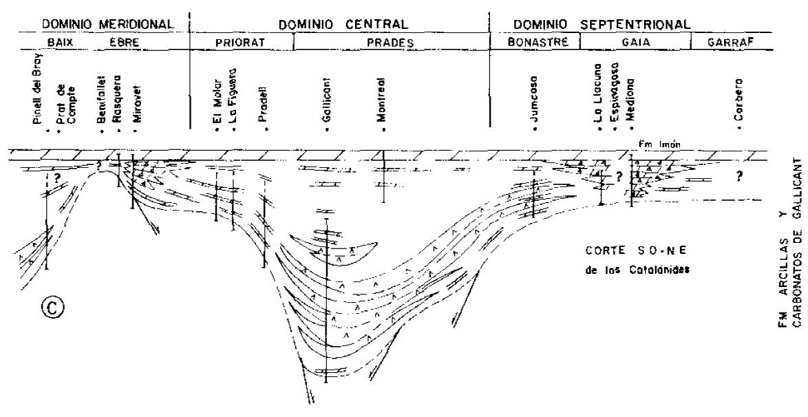
| Halokinetic structures | Syncline-Anticline folding / thrust faults / Normal Faults |
| Post-evaporite and pre-kinematic unit/s (overbuden) | Jurassic (dolostones, limestones and marlstones) |
| Syn-kinematic unit/s | Upper Jurassic (black dolostones and limestones) ; Early Cretaceous (sandstones, marlstones and red claystones) ; Paleogene (red claystones, sandstones, marlstones and conglomerates) |
| Available seismic profiles | 12E-ST-129 |
| Available boreholes | SE-4 (ARBOLI) / FALSET / PRADES / MORA DEL EBRO / MIRAVET-1 / MONTBLANC-1 / MORA DE EBRO-1 |
| Additional comments | – |
Mining Data
| UNIQUE_ID | 148 |
| Minning exploitations within <2km? | Y |
| Historical/Active | Active |
| Exploitation name #1 | AITANA |
| Exploitation ID (Spanish National Mining Cadastre) #1 | 300018 |
| Municipality #1 | Vilanova d’Escornalbou |
| Province #1 | TARRAGONA |
| Company #1 | EXCAVACIONES HERNÁNDEZ CASTILLO, SL |
| Main minning Products #1 | Gravel and sand |
| Exploitation name #2 | VILANOVA |
| Exploitation ID (Spanish National Mining Cadastre) #2 | 2194 |
| Municipality #2 | Vilanova d’Escornalbou |
| Province #2 | TARRAGONA |
| Company #2 | ARCILLAS Y ARENAS REFRACTARIAS PANDOLS,S.A |
| Main minning Products #2 | Sandstone |
| Exploitation name #3 | MIRAMAR II |
| Exploitation ID (Spanish National Mining Cadastre) #3 | 300005A |
| Municipality #3 | Vilanova d’Escornalbou |
| Province #3 | TARRAGONA |
| Company #3 | ARCILLAS Y ARENAS REFRACTARIAS PANDOLS,S.A |
| Main minning Products #3 | Sandstone |
Quantitative Data
| UNIQUE_ID | 148 |
| Outcropping area (km2) | 154.62685 |
| Horizontal intersection area (km2) (when buried) | Not buried |
| Depth of intersection area (km2) (when buried) | Not buried |
| Max. Width (Km) | 22.0181826 |
| Max. Length (Km) | 62.37262 |
| Max. Evaporites thickness (km) | 0.4 |
| Max. Deformation age (Ma) | 160 |
| Min. Deformation age (Ma) | 28 |
| Deformation stages | 2 |
Reference Data
| UNIQUE_ID | 148 |
| Section source | IGME MAGNA 50. SHEET 471 (MORA D’EBRE) |
| Well / Borehole availability #1 | Ortí, F., Salvany, J. M., Rosell, L., Castelltort, X., Inglès, M., Playà, E., 2018. Middle Triassic evaporite sedimentation in the Catalan basin: Implications for the paleogeographic evolution in the NE Iberian platform. Sedimentary geology, 374, 158-178. [link] |
| Well / Borehole availability #2 | n.a. |
| Available data (Stratigraphy) #1 | Ortí, F., Salvany, J. M., Rosell, L., Castelltort, X., Inglès, M., Playà, E., 2018. Middle Triassic evaporite sedimentation in the Catalan basin: Implications for the paleogeographic evolution in the NE Iberian platform. Sedimentary geology, 374, 158-178. [link] |
| Available data (Stratigraphy) #2 | García-Ávila, M., Mercedes-Martín, R., Juncal, M. A., Diez, J. B., 2020. New palynological data in Muschelkalk facies of the Catalan Coastal Ranges (NE of the Iberian Peninsula). Comptes Rendus. Géoscience, 352(6-7), 443-454. [link] |
| Available data (Stratigraphy) #3 | Escudero-Mozo, M. J., Márquez-Aliaga, A., Goy, A., Martín-Chivelet, J., López-Gómez, J., Márquez, L., …, Sánchez-Fernández, D., 2015. Middle Triassic carbonate platforms in eastern Iberia: evolution of their fauna and palaeogeographic significance in the western Tethys. Palaeogeography, Palaeoclimatology, Palaeoecology, 417, 236-260. [link] |
| Available data (Stratigraphy) #4 | Ortí, F., Salvany, J. M., 1987. El Keuper de los Catalánides. Cuadernos de geología ibérica= Journal of iberian geology: an international publication of earth sciences, (11), 215-236. [link] |
| Available data (Stratigraphy) #5 | Arnal, I., Rovira, F. C., Márquez, L., Aliaga, A. M., de Porta, N. S., 2002. La plataforma carbonatada epeírica (Formaciones Imón e Isábena) del Triásico superior del Noreste de la Península Ibérica. Acta geológica hispánica, 4, 299-328. [link] |
| Available data (Stratigraphy) #6 | Mercedes-Martín, R., Arenas, C., Salas, R., 2014. Diversity and factors controlling widespread occurrence of syn-rift Ladinian microbialites in the western Tethys (Triassic Catalan Basin, NE Spain). Sedimentary Geology, 313, 68-90. [link] |
| Regional Stratigraphy | Ortí, F., Salvany, J. M., 1987. El Keuper de los Catalánides. Cuadernos de geología ibérica= Journal of iberian geology: an international publication of earth sciences, (11), 215-236. [link] |
| Seismic data availability #1 | n.a. |
| Seismic data availability #2 | n.a. |
| Seismic data availability #3 | n.a. |
| Available data (Structure) #1 | Vargas, H., Gaspar-Escribano, J. M., López-Gómez, J., Van Wees, J. D., Cloetingh, S., de La Horra, R., Arche, A., 2009. A comparison of the Iberian and Ebro Basins during the Permian and Triassic, eastern Spain: A quantitative subsidence modelling approach. Tectonophysics, 474(1-2), 160-183. [link] |
| Available data (Structure) #2 | Anadón, P., Cabrera, L., Guimerà, J., Santanach, P., 1985. Paleogene Strike-Slip Deformation and Sedimentation Along the Southeastern Margin of the Ebro Basin», Strike-Slip Deformation, Basin Formation, and Sedimentation, Kevin T. Biddle, Nicholas Christie-Blick. [link] |
| Available data (Structure) #3 | Ortí, F., Salvany, J. M., 1987. El Keuper de los Catalánides. Cuadernos de geología ibérica= Journal of iberian geology: an international publication of earth sciences, (11), 215-236. [link] |
| Available data (Structure) #4 | Izquierdo‐Llavall, E., Ayala, C., Pueyo, E. L., Casas‐Sainz, A. M., Oliva‐Urcia, B., Rubio, F., …, García‐Crespo, J., 2019. Basement‐cover relationships and their along‐strike changes in the linking zone (Iberian range, Spain): A combined structural and gravimetric study. Tectonics, 38(8), 2934-2960. [link] |
| Available data (Structure) #5 | Juez-Larré, J., Andriessen, P. A. M., 2002. Post Late Paleozoic tectonism in the southern Catalan Coastal Ranges (NE Spain), assessed by apatite fission track analysis. Tectonophysics, 349(1-4), 113-129. [link] |
| Available data (Structure) #6 | n.a. |
| Available data (Analogue modelling) #1 | n.a. |
| Available data (Analogue modelling) #2 | n.a. |
| Available data (Analogue modelling) #3 | n.a. |
| Available data (Gravimetry – Tomography) #1 | Izquierdo‐Llavall, E., Ayala, C., Pueyo, E. L., Casas‐Sainz, A. M., Oliva‐Urcia, B., Rubio, F., …, García‐Crespo, J., 2019. Basement‐cover relationships and their along‐strike changes in the linking zone (Iberian range, Spain): A combined structural and gravimetric study. Tectonics, 38(8), 2934-2960. [link] |
| Available data (Gravimetry – Tomography) #2 | Ayala, C., Bohoyo, F., Maestro, A., Reguera, M. I., Torne, M., Rubio, F., Fernández, M., García-Lobón, J. L., 2016. Updated Bouguer anomalies of the Iberian Peninsula: a new perspective to interpret the regional geology. Journal of Maps, 12(5), 1089-1092. [link] |
| Available data (Gravimetry – Tomography) #3 | n.a. |
| Available data (Geochemistry) #1 | Ortí, F., Salvany, J. M., Rosell, L., Castelltort, X., Inglès, M., Playà, E., 2018. Middle Triassic evaporite sedimentation in the Catalan basin: Implications for the paleogeographic evolution in the NE Iberian platform. Sedimentary geology, 374, 158-178. [link] |
| Available data (Geochemistry) #2 | Juez-Larré, J., Andriessen, P. A. M., 2002. Post Late Paleozoic tectonism in the southern Catalan Coastal Ranges (NE Spain), assessed by apatite fission track analysis. Tectonophysics, 349(1-4), 113-129. [link] |
| Available data (Geochemistry) #3 | n.a. |
| Available data (Geochemistry) #4 | n.a. |
| Available data (Petrophysics) #1 | Pueyo, E. L., Izquierdo-Llavall, E., Rodríguez-Pintó, A., Rey-Moral, C., Oliva-Urcia, B., Casas, A. M., …, García-Lobón, J. L. 2016. Petrophysical properties in the Iberian Range and surrounding areas (NE Spain): 1-density. Journal of Maps, 12(5), 836-844. [link] |
| Available data (Petrophysics) #2 | n.a. |
| IGME Geological Map (MAGNA50) Sheet number | 471-Mora de Ebro. [link] and 446-Valls. [link] |
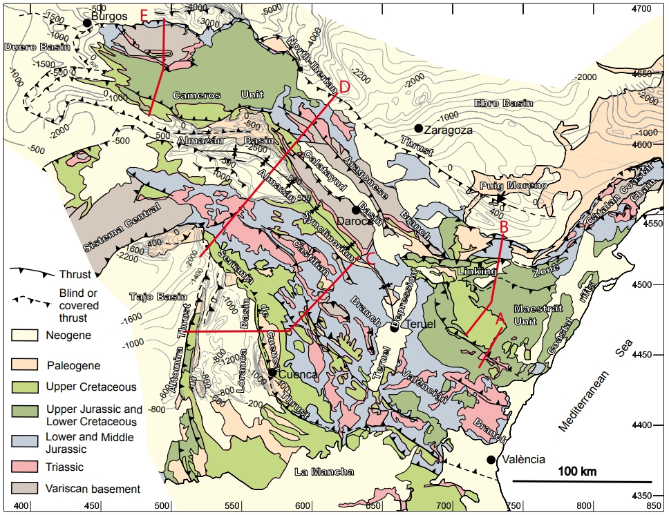
| Other Maps #1 (source) | Guimerà, J. J., 2018. Structure of an intraplate fold-and-thrust belt: The Iberian Chain. A synthesis. Geologica Acta, 16(4), 427-438. [link] |
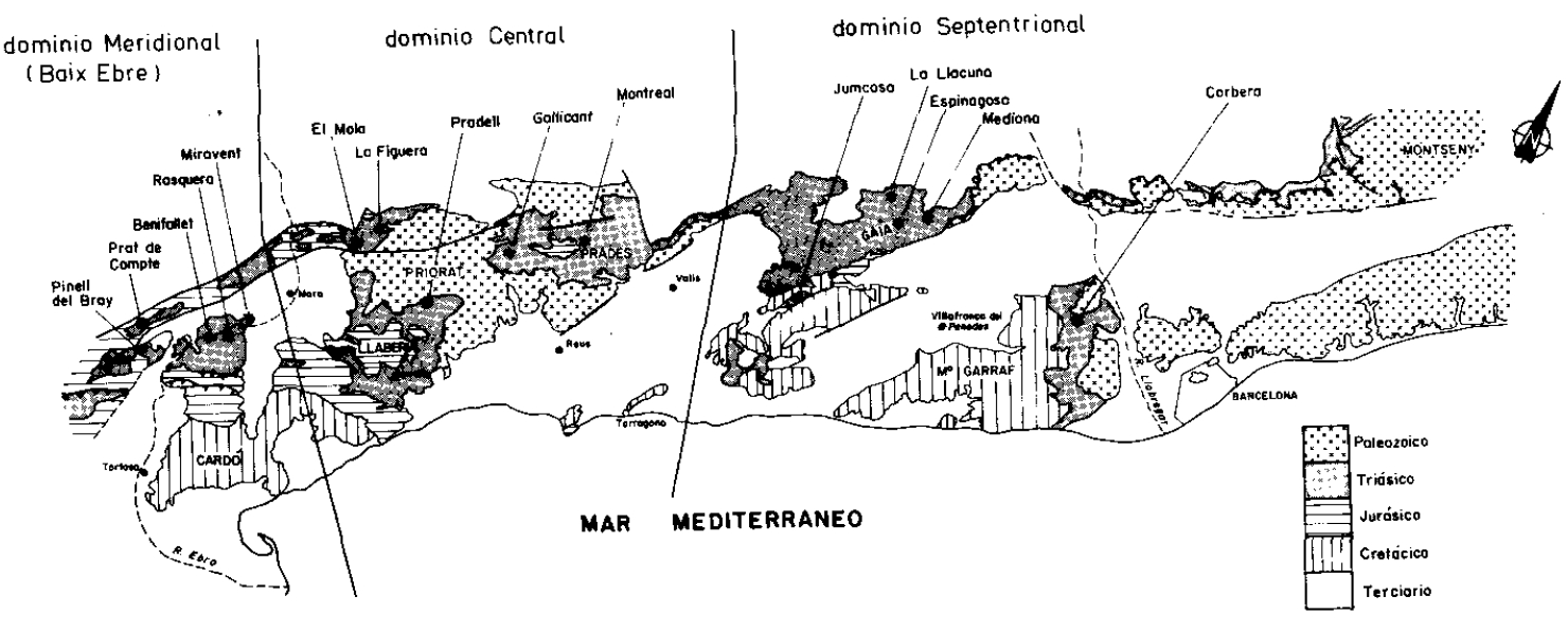
| Other Maps #2 (source) | Ortí, F., Salvany, J. M., 1987. El Keuper de los Catalánides. Cuadernos de geología ibérica= Journal of iberian geology: an international publication of earth sciences, (11), 215-236. [link] |
| Other related references #1 | Sanz, T., Lago, M., Gil, A., Galé, C., Ubide, T., Larrea, P., …, Pocoví, A., 2012. Estratigrafía y petrología de la región volcánica del Baix Ebre (Tarragona): etapas y edad del magmatismo. Geogaceta, 52, 33-36. [link] |
| Other related references #2 | n.a. |
| Other related references #3 | n.a. |
| Other related references #4 | n.a. |
Well and Seismic Data
| UNIQUE_ID | 148 |
| Seismic survey name #1 | 12E-ST-129 |
| Across structure? #1 | N (within 3km) |
| Seismic profile ID (IGME) #1 | 14885 |
| Seismic profile code #1 | 19620 |
| Seismic profile name #1 | RV-3 |
| Seismic survey year #1 | 1972 |
| Data repository #1 | SIGEOF Data Catalogue (Section available under request). ©Instituto Geológico y Minero de España (IGME). https://info.igme.es/SIGEOF/ |
| Length (km) #1 | 9.90 |
| Seismic survey name #2 | |
| Across structure? #2 | |
| Seismic profile ID (IGME) #2 | |
| Seismic profile code #2 | |
| Seismic profile name #2 | |
| Seismic survey year #2 | |
| Data repository #2 | |
| Length (km) #2 | |
| Seismic survey name #3 | |
| Across structure? #3 | |
| Seismic profile ID (IGME) #3 | |
| Seismic profile code #3 | |
| Seismic profile name #3 | |
| Seismic survey year #3 | |
| Data repository #3 | |
| Length (km) #3 | |
| Seismic survey name #4 | |
| Across structure? #4 | |
| Seismic profile ID (IGME) #4 | |
| Seismic profile code #4 | |
| Seismic profile name #4 | |
| Seismic survey year #4 | |
| Data repository #4 | |
| Length (km) #4 | |
| Seismic survey name #5 | |
| Across structure? #5 | |
| Seismic profile ID (IGME) #5 | |
| Seismic profile code #5 | |
| Seismic profile name #5 | |
| Seismic survey year #5 | |
| Data repository #5 | |
| Length (km) #5 | |
| Seismic survey name #6 | |
| Across structure? #6 | |
| Seismic profile ID (IGME) #6 | |
| Seismic profile code #6 | |
| Seismic profile name #6 | |
| Seismic survey year #6 | |
| Data repository #6 | |
| Length (km) #6 | |
| Seismic survey name #7 | |
| Across structure? #7 | |
| Seismic profile ID (IGME) #7 | |
| Seismic profile code #7 | |
| Seismic profile name #7 | |
| Seismic survey year #7 | |
| Data repository #7 | |
| Length (km) #7 | |
| Seismic survey name #8 | |
| Across structure? #8 | |
| Seismic profile ID (IGME) #8 | |
| Seismic profile code #8 | |
| Seismic profile name #8 | |
| Seismic survey year #8 | |
| Data repository #8 | |
| Length (km) #8 | |
| Seismic survey name #9 | |
| Across structure? #9 | |
| Seismic profile ID (IGME) #9 | |
| Seismic profile code #9 | |
| Seismic profile name #9 | |
| Seismic survey year #9 | |
| Data repository #9 | |
| Length (km) #9 | |
| Seismic survey name #10 | |
| Across structure? #10 | |
| Seismic profile ID (IGME) #10 | |
| Seismic profile code #10 | |
| Seismic profile name #10 | |
| Seismic survey year #10 | |
| Data repository #10 | |
| Length (km) #10 | |
| Seismic survey name #11 | |
| Across structure? #11 | |
| Seismic profile ID (IGME) #11 | |
| Seismic profile code #11 | |
| Seismic profile name #11 | |
| Seismic survey year #11 | |
| Data repository #11 | |
| Length (km) #11 | |
| Seismic survey name #12 | |
| Across structure? #12 | |
| Seismic profile ID (IGME) #12 | |
| Seismic profile code #12 | |
| Seismic profile name #12 | |
| Seismic survey year #12 | |
| Data repository #12 | |
| Length (km) #12 | |
| Seismic survey name #13 | |
| Across structure? #13 | |
| Seismic profile ID (IGME) #13 | |
| Seismic profile code #13 | |
| Seismic profile name #13 | |
| Seismic survey year #13 | |
| Data repository #13 | |
| Length (km) #13 | |
| Seismic survey name #14 | |
| Across structure? #14 | |
| Seismic profile ID (IGME) #14 | |
| Seismic profile code #14 | |
| Seismic profile name #14 | |
| Seismic survey year #14 | |
| Data repository #14 | |
| Length (km) #14 | |
| Seismic survey name #15 | |
| Across structure? #15 | |
| Seismic profile ID (IGME) #15 | |
| Seismic profile code #15 | |
| Seismic profile name #15 | |
| Seismic survey year #15 | |
| Data repository #15 | |
| Length (km) #15 | |
| Seismic survey name #16 | |
| Across structure? #16 | |
| Seismic profile ID (IGME) #16 | |
| Seismic profile code #16 | |
| Seismic profile name #16 | |
| Seismic survey year #16 | |
| Data repository #16 | |
| Length (km) #16 | |
| Seismic survey name #17 | |
| Across structure? #17 | |
| Seismic profile ID (IGME) #17 | |
| Seismic profile code #17 | |
| Seismic profile name #17 | |
| Seismic survey year #17 | |
| Data repository #17 | |
| Length (km) #17 | |
| Seismic survey name #18 | |
| Across structure? #18 | |
| Seismic profile ID (IGME) #18 | |
| Seismic profile code #18 | |
| Seismic profile name #18 | |
| Seismic survey year #18 | |
| Data repository #18 | |
| Length (km) #18 | |
| Seismic survey name #19 | |
| Across structure? #19 | |
| Seismic profile ID (IGME) #19 | |
| Seismic profile code #19 | |
| Seismic profile name #19 | |
| Seismic survey year #19 | |
| Data repository #19 | |
| Length (km) #19 | |
| Seismic survey name #20 | |
| Across structure? #20 | |
| Seismic profile ID (IGME) #20 | |
| Seismic profile code #20 | |
| Seismic profile name #20 | |
| Seismic survey year #20 | |
| Data repository #20 | |
| Length (km) #20 | |
| Seismic survey name #21 | |
| Across structure? #21 | |
| Seismic profile ID (IGME) #21 | |
| Seismic profile code #21 | |
| Seismic profile name #21 | |
| Seismic survey year #21 | |
| Data repository #21 | |
| Length (km) #21 | |
| Borehole name #1 | SE-4 (ARBOLI) |
| Company #1 | IGME |
| Traget #1 | GAS |
| Across structure? #1 | Y |
| Borehole name #2 | FALSET |
| Company #2 | CONFEDERACION HIDROGRAFICA DEL EBRO |
| Traget #2 | HYDROGEOLOGY |
| Across structure? #2 | N (within 5 km) |
| Borehole name #3 | PRADES |
| Company #3 | CONFEDERACION HIDROGRAFICA DEL EBRO |
| Traget #3 | HYDROGEOLOGY |
| Across structure? #3 | N (within 5 km) |
| Borehole name #4 | MORA DEL EBRO |
| Company #4 | CONFEDERACION HIDROGRAFICA DEL EBRO |
| Traget #4 | HYDROGEOLOGY |
| Across structure? #4 | N (within 5 km) |
| Borehole name #5 | MIRAVET-1 |
| Company #5 | TRAGSA |
| Traget #5 | HYDROGEOLOGY |
| Across structure? #5 | N (within 5 km) |
| Borehole name #6 | MONTBLANC-1 |
| Company #6 | TRAGSA |
| Traget #6 | HYDROGEOLOGY |
| Across structure? #6 | N (within 5 km) |
| Borehole name #7 | MORA DE EBRO-1 |
| Company #7 | TRAGSA |
| Traget #7 | HYDROGEOLOGY |
| Across structure? #7 | N (within 5 km) |
| Borehole name #8 | |
| Company #8 | |
| Traget #8 | |
| Across structure? #8 | |
| Borehole name #9 | |
| Company #9 | |
| Traget #9 | |
| Across structure? #9 | |
| Borehole name #10 | |
| Company #10 | |
| Traget #10 | |
| Across structure? #10 | |
| Borehole name #11 | |
| Company #11 | |
| Traget #11 | |
| Across structure? #11 | |
| Borehole name #12 | |
| Company #12 | |
| Traget #12 | |
| Across structure? #12 | |
| Borehole name #13 | |
| Company #13 | |
| Traget #13 | |
| Across structure? #13 | |
| Borehole name #14 | |
| Company #14 | |
| Traget #14 | |
| Across structure? #14 | |
| Borehole name #15 | |
| Company #15 | |
| Traget #15 | |
| Across structure? #15 |
Geographical Data (EPSG:4326 - WGS 84)
| UNIQUE_ID | 148 |
| X Centroid (Structure shape) | 0.990548 |
| Y Centroid (Structure shape) | 0.990548 |
| Xmin (Structure shape) | 0.597366 |
| Xmax (Structure shape) | 1.220145 |
| Ymin (Structure shape) | 41.008898 |
| Ymax (Structure shape) | 41.364025 |
| Xmin seismic line #1 | 1.226459 |
| Xmax seismic line #1 | 1.332769 |
| Ymin seismic line #1 | 41.289879 |
| Ymax seismic line #1 | 41.328516 |
| Xmin seismic line #2 | |
| Xmax seismic line #2 | |
| Ymin seismic line #2 | |
| Ymax seismic line #2 | |
| Xmin seismic line #3 | |
| Xmax seismic line #3 | |
| Ymin seismic line #3 | |
| Ymax seismic line #3 | |
| Xmin seismic line #4 | |
| Xmax seismic line #4 | |
| Ymin seismic line #4 | |
| Ymax seismic line #4 | |
| Xmin seismic line #5 | |
| Xmax seismic line #5 | |
| Ymin seismic line #5 | |
| Ymax seismic line #5 | |
| Xmin seismic line #6 | |
| Xmax seismic line #6 | |
| Ymin seismic line #6 | |
| Ymax seismic line #6 | |
| Xmin seismic line #7 | |
| Xmax seismic line #7 | |
| Ymin seismic line #7 | |
| Ymax seismic line #7 | |
| Xmin seismic line #8 | |
| Xmax seismic line #8 | |
| Ymin seismic line #8 | |
| Ymax seismic line #8 | |
| Xmin seismic line #9 | |
| Xmax seismic line #9 | |
| Ymin seismic line #9 | |
| Ymax seismic line #9 | |
| Xmin seismic line #10 | |
| Xmax seismic line #10 | |
| Ymin seismic line #10 | |
| Ymax seismic line #10 | |
| Xmin seismic line #11 | |
| Xmax seismic line #11 | |
| Ymin seismic line #11 | |
| Ymax seismic line #11 | |
| Xmin seismic line #12 | |
| Xmax seismic line #12 | |
| Ymin seismic line #12 | |
| Ymax seismic line #12 | |
| Xmin seismic line #13 | |
| Xmax seismic line #13 | |
| Ymin seismic line #13 | |
| Ymax seismic line #13 | |
| Xmin seismic line #14 | |
| Xmax seismic line #14 | |
| Ymin seismic line #14 | |
| Ymax seismic line #14 | |
| Xmin seismic line #15 | |
| Xmax seismic line #15 | |
| Ymin seismic line #15 | |
| Ymax seismic line #15 | |
| Xmin seismic line #16 | |
| Xmax seismic line #16 | |
| Ymin seismic line #16 | |
| Ymax seismic line #16 | |
| Xmin seismic line #17 | |
| Xmax seismic line #17 | |
| Ymin seismic line #17 | |
| Ymax seismic line #17 | |
| Xmin seismic line #18 | |
| Xmax seismic line #18 | |
| Ymin seismic line #18 | |
| Ymax seismic line #18 | |
| Xmin seismic line #19 | |
| Xmax seismic line #19 | |
| Ymin seismic line #19 | |
| Ymax seismic line #19 | |
| Xmin seismic line #20 | |
| Xmax seismic line #20 | |
| Ymin seismic line #20 | |
| Ymax seismic line #20 | |
| Xmin seismic line #21 | |
| Xmax seismic line #21 | |
| Ymin seismic line #21 | |
| Ymax seismic line #21 | |
| X borehole #1 | 0.951977 |
| Y borehole #1 | 41.242477 |
| X borehole #2 | 0.831815 |
| Y borehole #2 | 41.138824 |
| X borehole #3 | 0.981011 |
| Y borehole #3 | 41.304970 |
| X borehole #4 | 0.585574 |
| Y borehole #4 | 41.091045 |
| X borehole #5 | 0.553807 |
| Y borehole #5 | 41.054909 |
| X borehole #6 | 1.177457 |
| Y borehole #6 | 41.370196 |
| X borehole #7 | 0.569635 |
| Y borehole #7 | 41.075673 |
| X borehole #8 | |
| Y borehole #8 | |
| X borehole #9 | |
| Y borehole #9 | |
| X borehole #10 | |
| Y borehole #10 | |
| X borehole #11 | |
| Y borehole #11 | |
| X borehole #12 | |
| Y borehole #12 | |
| X borehole #13 | |
| Y borehole #13 | |
| X borehole #14 | |
| Y borehole #14 | |
| X borehole #15 | |
| Y borehole #15 |

