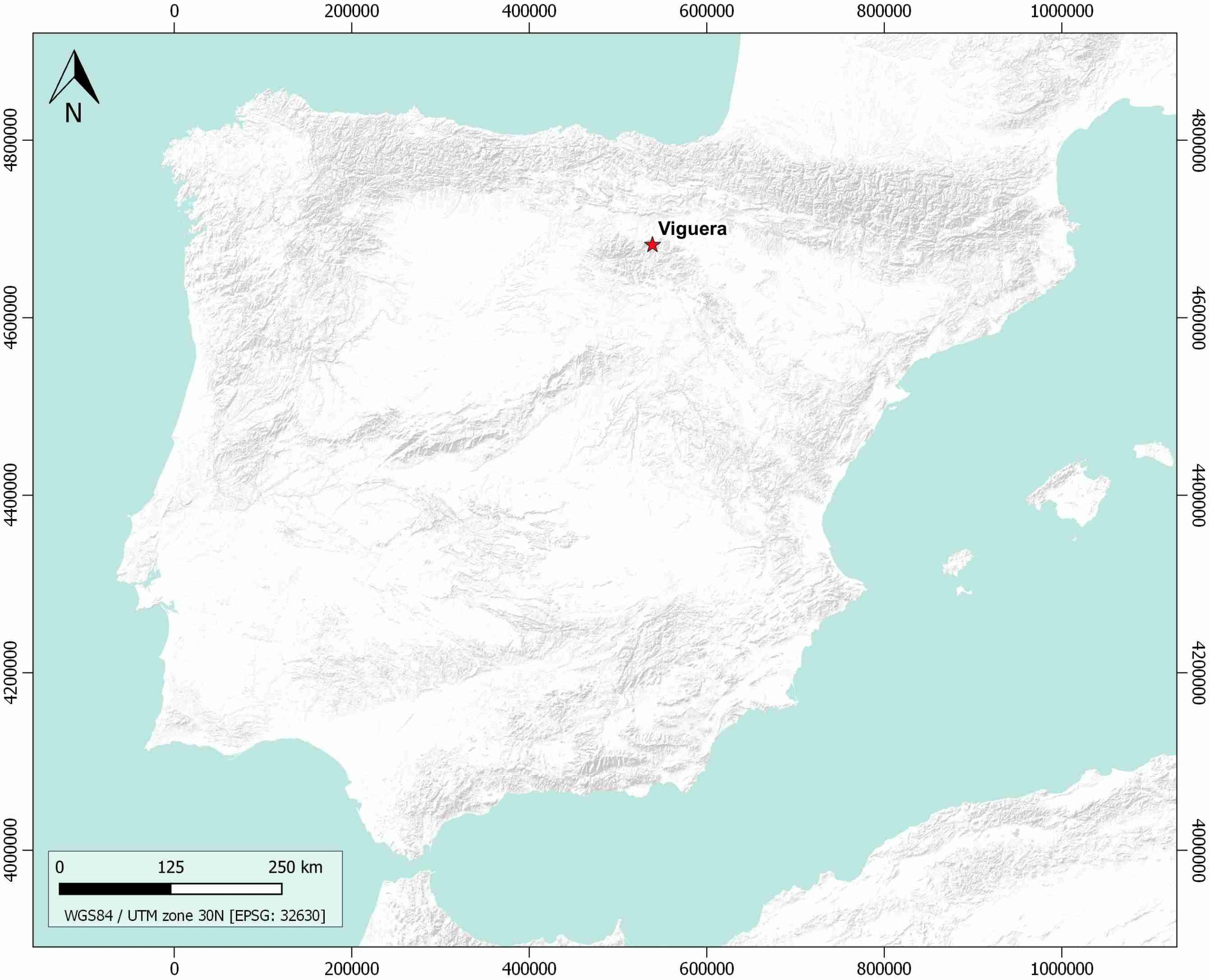
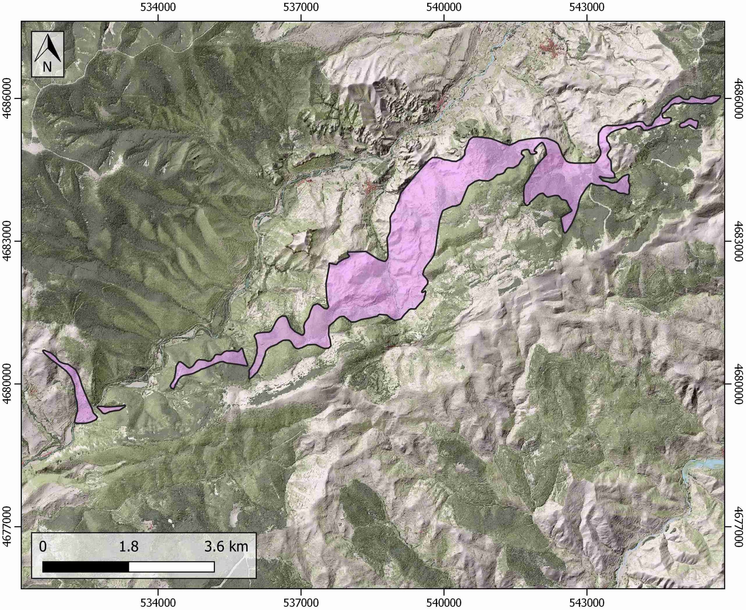
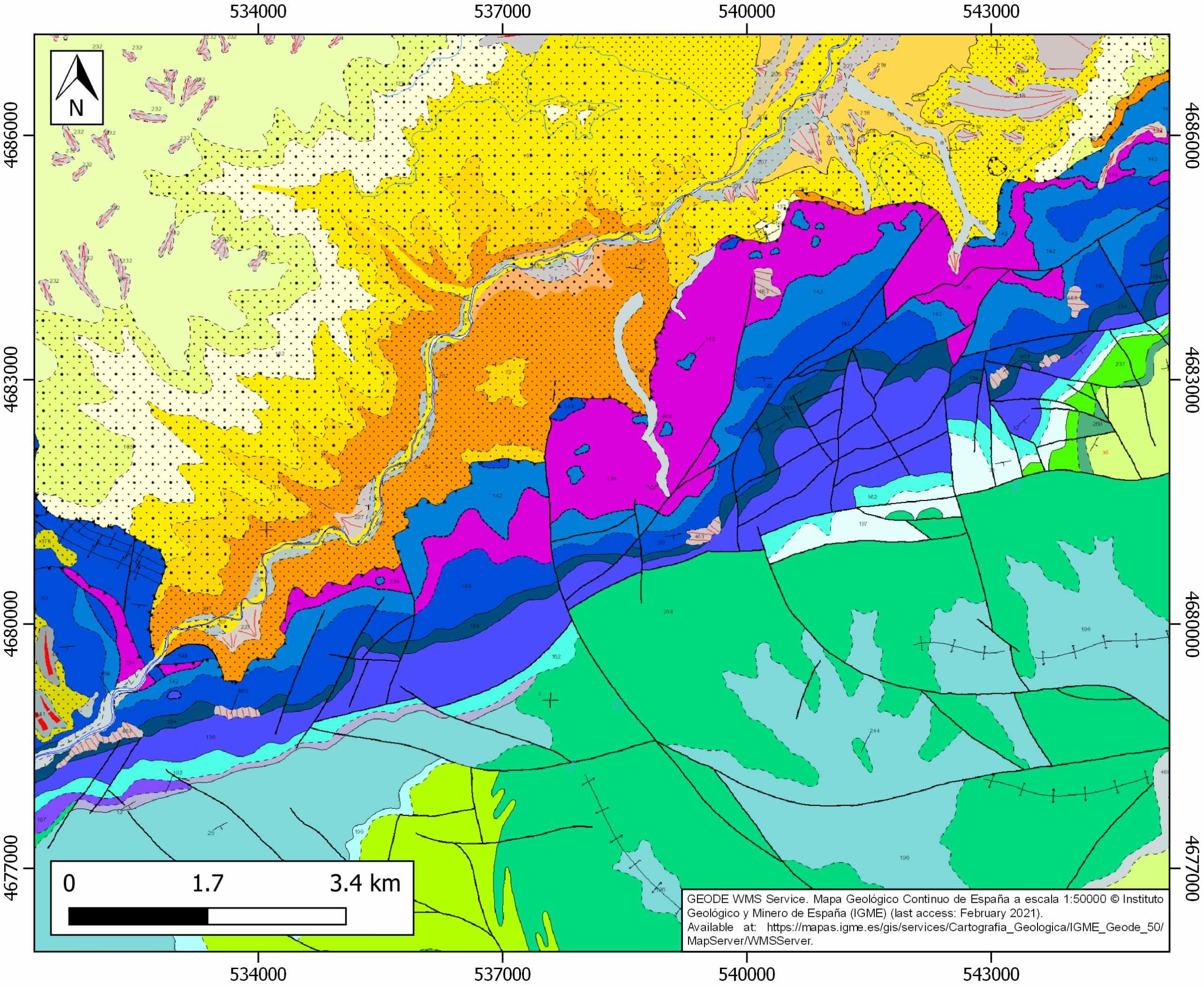
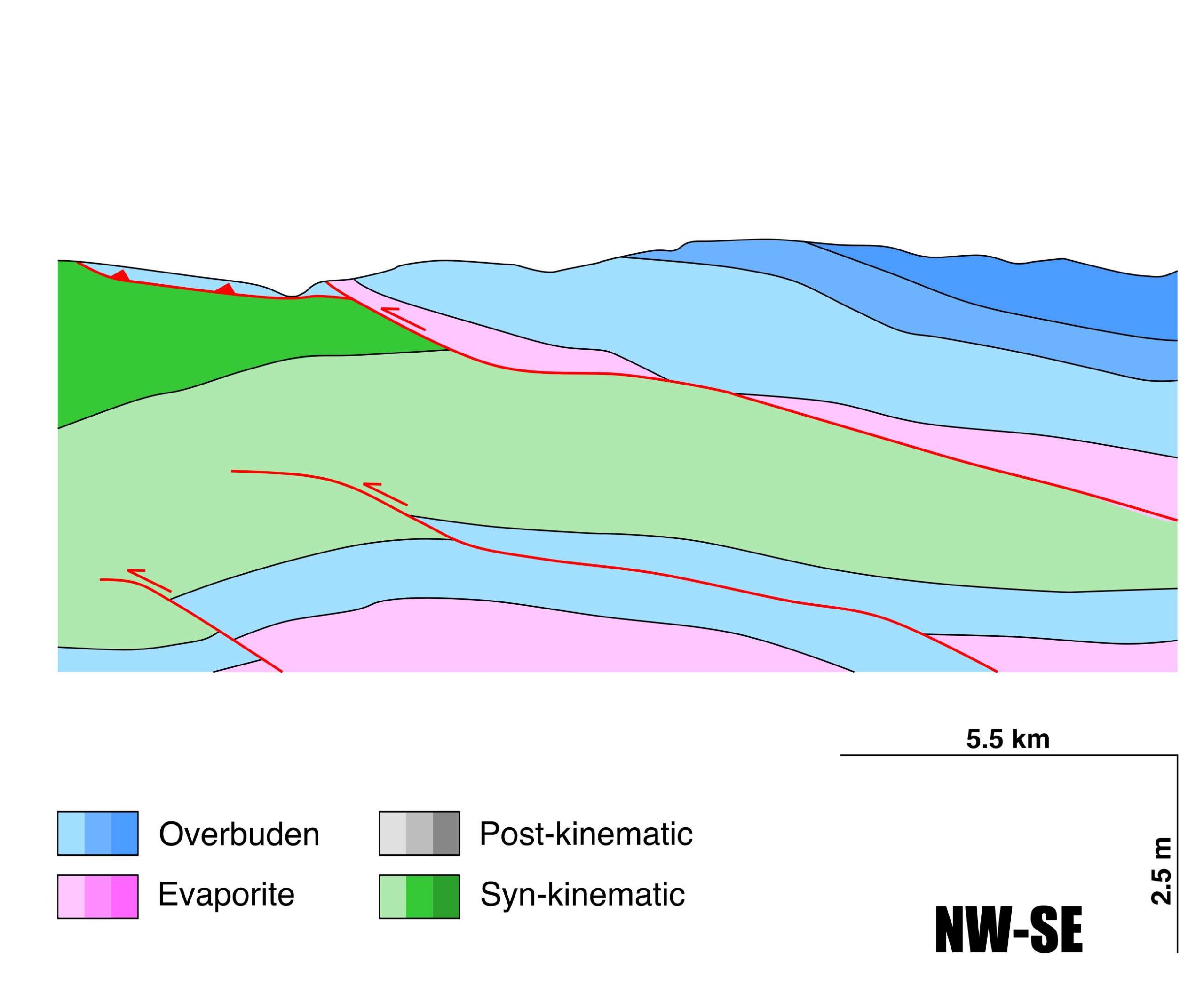
General Information
| Structure type | Evaporite-detached thrust |
| Deformed/Undeformed | Deformed |
| Geological Setting | Cameros Massif |
| Outcropping/buried | Outcropping |
| Evaporite unit/s name | Keuper facies |
| Evaporite unit/s age | Carnian-Rhaetian (Upper Triassic) |
| Evaporite unit/s origin | Marine |
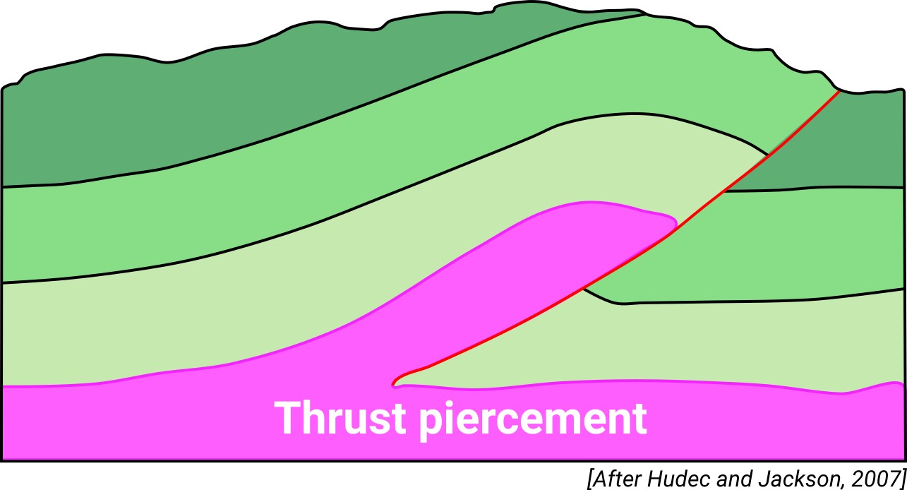
| Classif. (Hudec and Jackson, 2009) | Thrust piercement |
| Classif. (Jackson and Talbot, 1986) | |
| Age of evaporite flow or deformation (when deformed) | Eocene, Miocene |
| Other comments | Keuper facies are largely deformed, and their thickness varies significantly along the northern Cameros thrust. |
Generic Data
| Unique ID | 129 |
| Name | Viguera |
| Structure type | Evaporite-detached thrust |
| Deformed/Undeformed | Deformed |
| Buried/Outcropping | Outcropping |
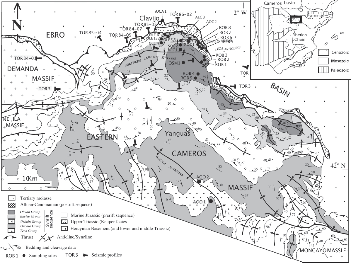
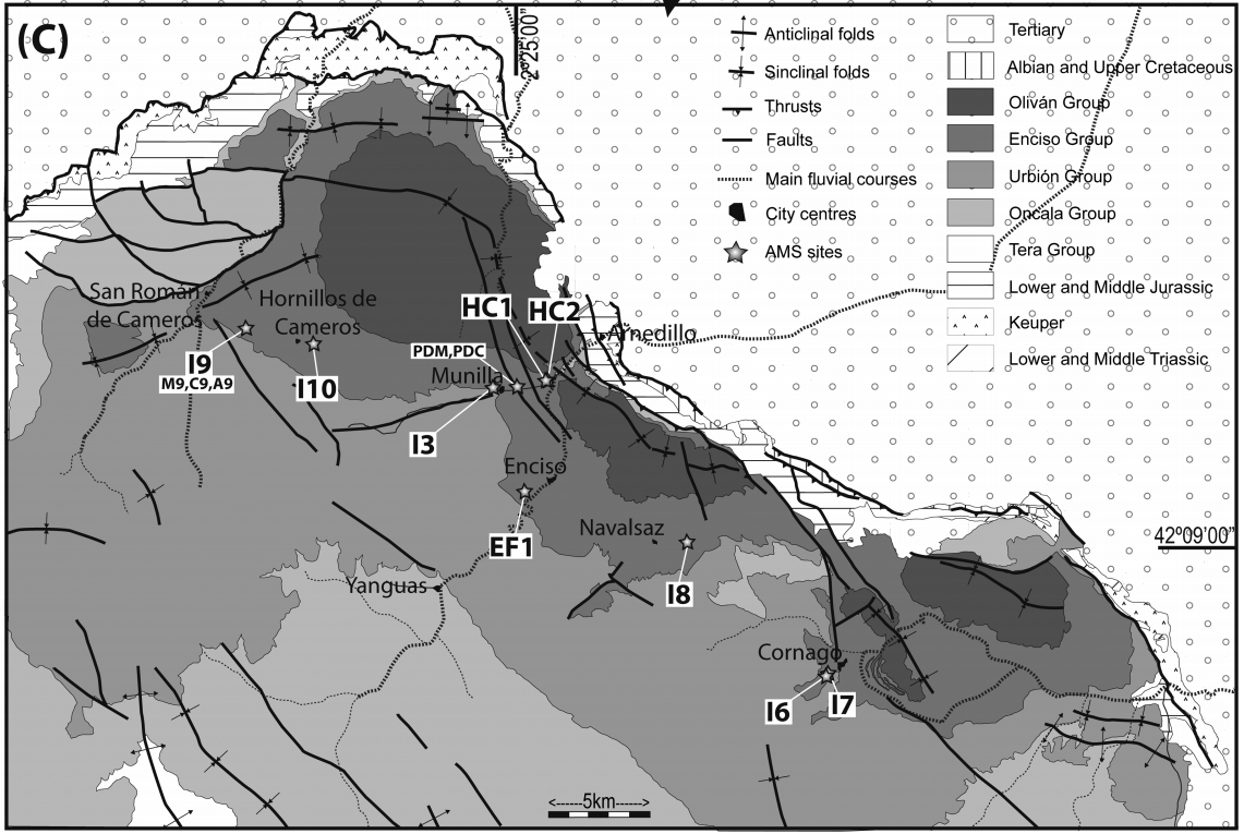
| Geological setting | Cameros Massif |
| Geological Regional Setting | Northern Termination |
| Evaporite unit/s name | Keuper facies |
| Evaporite unit/s age | Carnian-Rhaetian (Upper Triassic) |
| Evaporite unit/s era | Mesozoic |
| Evaporite unit/s origin | Marine |
| Evaporite unit/s composition | Gypsum-Claystonestone-Sandstone |
| Post-kinematic unit/s (or post-evaporite units when evaporites are undeformed) | Quaternary (alluvial and colluvial detrital deposits) |
| Post-kinematic unit/s age (or post-evaporite units when evaporites are undeformed) | Pleistocene-Holocene |
| Classification (Hudec and Jackson, 2009) | Thrust piercement |
| Classification (Jackson and Talbot, 1986) | |
| Mining activity? | Y |
| Mining activity start | |
| Mining activity end | Active |
| Mining galleries? | N |
| Mining products | Gypsum |
| Mining sub-products | |
| Evaporite flow? | Y |
| Age of evaporite flow | Eocene-Early Miocene |
| Flow or deformation triggering mechanisms | Basin tectonic inversion and northwards thrusting in the Cameros Basin. |
| Flow-linked structures? | Y |
| Halokinetic structures | Thrust faults / anticline-syncline folding / Low-angle unconformities |
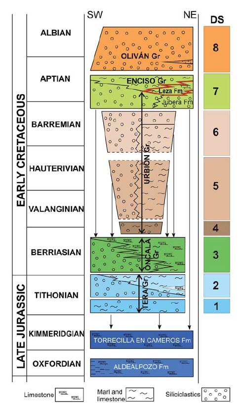
| Post-evaporite and pre-kinematic unit/s (overbuden) | Lower Jurassic (dolostones and limestones) ; Upper Jurassic-Lower Cretaceous (Tera and Oncala Gr., sandstones, claystones, marlstones and limestones) ; Barremian (Urbión Gr, Jubera Fm., sandstones, conglomerates, siliciclastic mudstone) ; Late Barremian-Early Aptian (Leza Fm., marlstones and limestones) |
| Syn-kinematic unit/s | Oligocene (shales and sandstones) ; Early Miocene (conglomerates and sandstones) |
| Available seismic profiles | |
| Available boreholes | V-04-1 / RESTAURO |
| Additional comments | Keuper facies are largely deformed, and their thickness varies significantly along the northern Cameros thrust |
Mining Data
| UNIQUE_ID | 129 |
| Minning exploitations within <2km? | Y |
| Historical/Active | Active |
| Exploitation name #1 | LA SOLANA |
| Exploitation ID (Spanish National Mining Cadastre) #1 | 3309 |
| Municipality #1 | Viguera |
| Province #1 | LA RIOJA |
| Company #1 | SAINT-GOBAIN PLACO IBERICA, SA |
| Main minning Products #1 | Gypsum |
| Exploitation name #2 | PASCUAL |
| Exploitation ID (Spanish National Mining Cadastre) #2 | 20100 |
| Municipality #2 | Albelda de Iregua |
| Province #2 | LA RIOJA |
| Company #2 | HORMIGONES Y EXCAVACIONES PASCUAL S/L |
| Main minning Products #2 | Gravel and sand |
| Exploitation name #3 | EL PRADO |
| Exploitation ID (Spanish National Mining Cadastre) #3 | 3308 |
| Municipality #3 | Viguera |
| Province #3 | LA RIOJA |
| Company #3 | SAINT-GOBAIN PLACO IBERICA, SA |
| Main minning Products #3 | Gypsum |
Quantitative Data
| UNIQUE_ID | 129 |
| Outcropping area (km2) | 9.46009 |
| Horizontal intersection area (km2) (when buried) | Not buried |
| Depth of intersection area (km2) (when buried) | Not buried |
| Max. Width (Km) | 15.1755525 |
| Max. Length (Km) | 3.33239232 |
| Max. Evaporites thickness (km) | 0.2 |
| Max. Deformation age (Ma) | 45 |
| Min. Deformation age (Ma) | 20 |
| Deformation stages | 1 |
Reference Data
| UNIQUE_ID | 129 |
| Section source | IGME MAGNA 50. SHEET 241 (ANGUIANO) |
| Well / Borehole availability #1 | n.a. |
| Well / Borehole availability #2 | n.a. |
| Available data (Stratigraphy) #1 | Suárez González, P., Quijada, I. E., Benito Moreno, M. I., Mas Mayoral, J. R., 2013. Eustatic versus tectonic control in an intraplate rift basin (Leza Fm, Cameros Basin). Chronostratigraphic and paleogeographic implications for the Aptian of Iberia. Journal of Iberian Geology, 39(2), 285-312. [link] |
| Available data (Stratigraphy) #2 | Benito, M. I., Suarez-Gonzalez, P., Quijada, I. E., Campos-Soto, S., Rodríguez-Martínez, M., 2020. Constraints of applying strontium isotope stratigraphy in coastal and shallow marine environments: insights from Lower Cretaceous carbonates deposited in an active tectonic setting (N Iberian Basin, Spain). Journal of Iberian Geology, 1-19. [link] |
| Available data (Stratigraphy) #3 | Salè, S. O., Guimerà, J., Mas, R., Arribas, J., 2014. Tectono-stratigraphic evolution of an inverted extensional basin: the Cameros Basin (north of Spain). International Journal of Earth Sciences, 103(6), 1597-1620. [link] |
| Available data (Stratigraphy) #4 | Guimerà, J., Alonso, Á., Mas, J. R., 1995. Inversion of an extensional-ramp basin by a newly formed thrust: the Cameros basin (N. Spain). Geological Society, London, Special Publications, 88(1), 433-453. [link] |
| Available data (Stratigraphy) #5 | Omodeo‐Salé, S., Salas, R., Guimerà, J., Ondrak, R., Mas, R., Arribas, J., …, Martinez, L., 2017. Subsidence and thermal history of an inverted Late Jurassic‐Early Cretaceous extensional basin (Cameros, North‐central Spain) affected by very low‐to low‐grade metamorphism. Basin Research, 29, 156-174. [link] |
| Available data (Stratigraphy) #6 | n.a. |
| Regional Stratigraphy | Suárez González, P., Quijada, I. E., Benito Moreno, M. I., Mas Mayoral, J. R., 2013. Eustatic versus tectonic control in an intraplate rift basin (Leza Fm, Cameros Basin). Chronostratigraphic and paleogeographic implications for the Aptian of Iberia. Journal of Iberian Geology, 39(2), 285-312. [link] |
| Seismic data availability #1 | Del Río, P., Casas, A., Villalaín, J. J., Mochales, T., Soto, R., Oliva-Urcia, B., 2013. Interpretation of gravimetric and magnetic anomalies in the Cameros Basin (North Spain): combination of deep and shallow sources. Studia Geophysica et Geodaetica, 57(3), 442-459. [link] |
| Seismic data availability #2 | Salè, S. O., Guimerà, J., Mas, R., Arribas, J., 2014. Tectono-stratigraphic evolution of an inverted extensional basin: the Cameros Basin (north of Spain). International Journal of Earth Sciences, 103(6), 1597-1620. [link] |
| Seismic data availability #3 | Guimerà, J., Alonso, Á., Mas, J. R., 1995. Inversion of an extensional-ramp basin by a newly formed thrust: the Cameros basin (N. Spain). Geological Society, London, Special Publications, 88(1), 433-453. [link] |
| Available data (Structure) #1 | Suárez González, P., Quijada, I. E., Benito Moreno, M. I., Mas Mayoral, J. R., 2013. Eustatic versus tectonic control in an intraplate rift basin (Leza Fm, Cameros Basin). Chronostratigraphic and paleogeographic implications for the Aptian of Iberia. Journal of Iberian Geology, 39(2), 285-312. [link] |
| Available data (Structure) #2 | Salè, S. O., Guimerà, J., Mas, R., Arribas, J., 2014. Tectono-stratigraphic evolution of an inverted extensional basin: the Cameros Basin (north of Spain). International Journal of Earth Sciences, 103(6), 1597-1620. [link] |
| Available data (Structure) #3 | Guimerà, J., Alonso, Á., Mas, J. R., 1995. Inversion of an extensional-ramp basin by a newly formed thrust: the Cameros basin (N. Spain). Geological Society, London, Special Publications, 88(1), 433-453. [link] |
| Available data (Structure) #4 | Soto, R., Casas, A. M., Villalaín, J. J., Gil-Imaz, A., Del Río, P., Fernández, G., 2010. Integration of surface and subsurface data, paleomagnetism and analogue modelling to reconstruct the extensional geometry of the Cameros basin (N Spain). Trabajos de geología, 30. [link] |
| Available data (Structure) #5 | Suárez-González, P., Benito, M. I., Mas, J. R., Quijada, I. E., Campos-Soto, S., 2016. Influencia del Keuper y de la estructuración tardivarisca en la arquitectura de las unidades sin-extensionales del borde norte de la Cuenca de Cameros. Geotemas, 16, 185-188. [link] |
| Available data (Structure) #6 | Casas-Sainz, A. M., Román-Berdiel, T., Oliva-Urcia, B., García-Lasanta, C., Villalaín, J. J., Aldega, L., …, Osácar, M. C., 2017. Multidisciplinary approach to constrain kinematics of fault zones at shallow depths: a case study from the Cameros–Demanda thrust (North Spain). International Journal of Earth Sciences, 106(3), 1023-1055. [link] |
| Available data (Analogue modelling) #1 | Soto, R., Casas, A. M., Villalaín, J. J., Gil-Imaz, A., Del Río, P., Fernández, G., 2010. Integration of surface and subsurface data, paleomagnetism and analogue modelling to reconstruct the extensional geometry of the Cameros basin (N Spain). Trabajos de geología, 30. [link] |
| Available data (Analogue modelling) #2 | n.a. |
| Available data (Analogue modelling) #3 | n.a. |
| Available data (Gravimetry – Tomography) #1 | Del Río, P., Casas, A., Villalaín, J. J., Mochales, T., Soto, R., Oliva-Urcia, B., 2013. Interpretation of gravimetric and magnetic anomalies in the Cameros Basin (North Spain): combination of deep and shallow sources. Studia Geophysica et Geodaetica, 57(3), 442-459. [link] |
| Available data (Gravimetry – Tomography) #2 | Ayala, C., Bohoyo, F., Maestro, A., Reguera, M. I., Torne, M., Rubio, F., Fernández, M., García-Lobón, J. L., 2016. Updated Bouguer anomalies of the Iberian Peninsula: a new perspective to interpret the regional geology. Journal of Maps, 12(5), 1089-1092. [link] |
| Available data (Gravimetry – Tomography) #3 | n.a. |
| Available data (Geochemistry) #1 | Benito, M. I., Suarez-Gonzalez, P., Quijada, I. E., Campos-Soto, S., Rodríguez-Martínez, M., 2020. Constraints of applying strontium isotope stratigraphy in coastal and shallow marine environments: insights from Lower Cretaceous carbonates deposited in an active tectonic setting (N Iberian Basin, Spain). Journal of Iberian Geology, 1-19. [link] |
| Available data (Geochemistry) #2 | n.a. |
| Available data (Geochemistry) #3 | n.a. |
| Available data (Geochemistry) #4 | n.a. |
| Available data (Petrophysics) #1 | Soto, R., Casas, A. M., Villalaín, J. J., Gil-Imaz, A., Del Río, P., Fernández, G., 2010. Integration of surface and subsurface data, paleomagnetism and analogue modelling to reconstruct the extensional geometry of the Cameros basin (N Spain). Trabajos de geología, 30. [link] |
| Available data (Petrophysics) #2 | García-Lasanta, C., Oliva-Urcia, B., Román-Berdiel, T., Casas, A. M., Pérez-Lorente, F., 2013. Development of magnetic fabric in sedimentary rocks: insights from early compactional structures. Geophysical Journal International, 194(1), 182-199. [link] |
| IGME Geological Map (MAGNA50) Sheet number | 241-Anguiano. [link] |
| Other Maps #1 (source) | Soto, R., Casas, A. M., Villalaín, J. J., Gil-Imaz, A., Del Río, P., Fernández, G., 2010. Integration of surface and subsurface data, paleomagnetism and analogue modelling to reconstruct the extensional geometry of the Cameros basin (N Spain). Trabajos de geología, 30. [link] |
| Other Maps #2 (source) | García-Lasanta, C., Oliva-Urcia, B., Román-Berdiel, T., Casas, A. M., Pérez-Lorente, F., 2013. Development of magnetic fabric in sedimentary rocks: insights from early compactional structures. Geophysical Journal International, 194(1), 182-199. [link] |
| Other related references #1 | Villalaín, J. J., Fernández-González, G., Casas, A. M., Gil-Imaz, A., 2003. Evidence of a Cretaceous remagnetization in the Cameros Basin (North Spain): implications for basin geometry. Tectonophysics, 377(1-2), 101-117. [link] |
| Other related references #2 | Casas-Sainz, A. M., 1990. El frente norte de las Sierras de Cameros: estructuras cabalgantes y campo de esfuerzos [Ph.D. thesis]: University of Zaragoza, 384p. [link] |
| Other related references #3 | Suárez González, P., 2015. Sedimentología y paleogeografía de los sistemas de humedales costeros de la Fm Leza (Cretácico Inferior, Cuenca de Cameros): implicaciones en el origen y desarrollo de los depósitos microbianos asociados [Ph.D. Thesis]: Universidad Complutense de Madrid, 414pp. [link] |
| Other related references #4 |
Well and Seismic Data
| UNIQUE_ID | 129 |
| Seismic survey name #1 | |
| Across structure? #1 | |
| Seismic profile ID (IGME) #1 | |
| Seismic profile code #1 | |
| Seismic profile name #1 | |
| Seismic survey year #1 | |
| Data repository #1 | |
| Length (km) #1 | |
| Seismic survey name #2 | |
| Across structure? #2 | |
| Seismic profile ID (IGME) #2 | |
| Seismic profile code #2 | |
| Seismic profile name #2 | |
| Seismic survey year #2 | |
| Data repository #2 | |
| Length (km) #2 | |
| Seismic survey name #3 | |
| Across structure? #3 | |
| Seismic profile ID (IGME) #3 | |
| Seismic profile code #3 | |
| Seismic profile name #3 | |
| Seismic survey year #3 | |
| Data repository #3 | |
| Length (km) #3 | |
| Seismic survey name #4 | |
| Across structure? #4 | |
| Seismic profile ID (IGME) #4 | |
| Seismic profile code #4 | |
| Seismic profile name #4 | |
| Seismic survey year #4 | |
| Data repository #4 | |
| Length (km) #4 | |
| Seismic survey name #5 | |
| Across structure? #5 | |
| Seismic profile ID (IGME) #5 | |
| Seismic profile code #5 | |
| Seismic profile name #5 | |
| Seismic survey year #5 | |
| Data repository #5 | |
| Length (km) #5 | |
| Seismic survey name #6 | |
| Across structure? #6 | |
| Seismic profile ID (IGME) #6 | |
| Seismic profile code #6 | |
| Seismic profile name #6 | |
| Seismic survey year #6 | |
| Data repository #6 | |
| Length (km) #6 | |
| Seismic survey name #7 | |
| Across structure? #7 | |
| Seismic profile ID (IGME) #7 | |
| Seismic profile code #7 | |
| Seismic profile name #7 | |
| Seismic survey year #7 | |
| Data repository #7 | |
| Length (km) #7 | |
| Seismic survey name #8 | |
| Across structure? #8 | |
| Seismic profile ID (IGME) #8 | |
| Seismic profile code #8 | |
| Seismic profile name #8 | |
| Seismic survey year #8 | |
| Data repository #8 | |
| Length (km) #8 | |
| Seismic survey name #9 | |
| Across structure? #9 | |
| Seismic profile ID (IGME) #9 | |
| Seismic profile code #9 | |
| Seismic profile name #9 | |
| Seismic survey year #9 | |
| Data repository #9 | |
| Length (km) #9 | |
| Seismic survey name #10 | |
| Across structure? #10 | |
| Seismic profile ID (IGME) #10 | |
| Seismic profile code #10 | |
| Seismic profile name #10 | |
| Seismic survey year #10 | |
| Data repository #10 | |
| Length (km) #10 | |
| Seismic survey name #11 | |
| Across structure? #11 | |
| Seismic profile ID (IGME) #11 | |
| Seismic profile code #11 | |
| Seismic profile name #11 | |
| Seismic survey year #11 | |
| Data repository #11 | |
| Length (km) #11 | |
| Seismic survey name #12 | |
| Across structure? #12 | |
| Seismic profile ID (IGME) #12 | |
| Seismic profile code #12 | |
| Seismic profile name #12 | |
| Seismic survey year #12 | |
| Data repository #12 | |
| Length (km) #12 | |
| Seismic survey name #13 | |
| Across structure? #13 | |
| Seismic profile ID (IGME) #13 | |
| Seismic profile code #13 | |
| Seismic profile name #13 | |
| Seismic survey year #13 | |
| Data repository #13 | |
| Length (km) #13 | |
| Seismic survey name #14 | |
| Across structure? #14 | |
| Seismic profile ID (IGME) #14 | |
| Seismic profile code #14 | |
| Seismic profile name #14 | |
| Seismic survey year #14 | |
| Data repository #14 | |
| Length (km) #14 | |
| Seismic survey name #15 | |
| Across structure? #15 | |
| Seismic profile ID (IGME) #15 | |
| Seismic profile code #15 | |
| Seismic profile name #15 | |
| Seismic survey year #15 | |
| Data repository #15 | |
| Length (km) #15 | |
| Seismic survey name #16 | |
| Across structure? #16 | |
| Seismic profile ID (IGME) #16 | |
| Seismic profile code #16 | |
| Seismic profile name #16 | |
| Seismic survey year #16 | |
| Data repository #16 | |
| Length (km) #16 | |
| Seismic survey name #17 | |
| Across structure? #17 | |
| Seismic profile ID (IGME) #17 | |
| Seismic profile code #17 | |
| Seismic profile name #17 | |
| Seismic survey year #17 | |
| Data repository #17 | |
| Length (km) #17 | |
| Seismic survey name #18 | |
| Across structure? #18 | |
| Seismic profile ID (IGME) #18 | |
| Seismic profile code #18 | |
| Seismic profile name #18 | |
| Seismic survey year #18 | |
| Data repository #18 | |
| Length (km) #18 | |
| Seismic survey name #19 | |
| Across structure? #19 | |
| Seismic profile ID (IGME) #19 | |
| Seismic profile code #19 | |
| Seismic profile name #19 | |
| Seismic survey year #19 | |
| Data repository #19 | |
| Length (km) #19 | |
| Seismic survey name #20 | |
| Across structure? #20 | |
| Seismic profile ID (IGME) #20 | |
| Seismic profile code #20 | |
| Seismic profile name #20 | |
| Seismic survey year #20 | |
| Data repository #20 | |
| Length (km) #20 | |
| Seismic survey name #21 | |
| Across structure? #21 | |
| Seismic profile ID (IGME) #21 | |
| Seismic profile code #21 | |
| Seismic profile name #21 | |
| Seismic survey year #21 | |
| Data repository #21 | |
| Length (km) #21 | |
| Borehole name #1 | V-04-1 |
| Company #1 | ADARO |
| Traget #1 | GYPSUM |
| Across structure? #1 | Y |
| Borehole name #2 | RESTAURO |
| Company #2 | CONFEDERACION HIDROGRAFICA DEL EBRO |
| Traget #2 | HYDROGEOLOGY |
| Across structure? #2 | N (within 5 km) |
| Borehole name #3 | |
| Company #3 | |
| Traget #3 | |
| Across structure? #3 | |
| Borehole name #4 | |
| Company #4 | |
| Traget #4 | |
| Across structure? #4 | |
| Borehole name #5 | |
| Company #5 | |
| Traget #5 | |
| Across structure? #5 | |
| Borehole name #6 | |
| Company #6 | |
| Traget #6 | |
| Across structure? #6 | |
| Borehole name #7 | |
| Company #7 | |
| Traget #7 | |
| Across structure? #7 | |
| Borehole name #8 | |
| Company #8 | |
| Traget #8 | |
| Across structure? #8 | |
| Borehole name #9 | |
| Company #9 | |
| Traget #9 | |
| Across structure? #9 | |
| Borehole name #10 | |
| Company #10 | |
| Traget #10 | |
| Across structure? #10 | |
| Borehole name #11 | |
| Company #11 | |
| Traget #11 | |
| Across structure? #11 | |
| Borehole name #12 | |
| Company #12 | |
| Traget #12 | |
| Across structure? #12 | |
| Borehole name #13 | |
| Company #13 | |
| Traget #13 | |
| Across structure? #13 | |
| Borehole name #14 | |
| Company #14 | |
| Traget #14 | |
| Across structure? #14 | |
| Borehole name #15 | |
| Company #15 | |
| Traget #15 | |
| Across structure? #15 |
Geographical Data (EPSG:4326 - WGS 84)
| UNIQUE_ID | 129 |
| X Centroid (Structure shape) | -2.520927 |
| Y Centroid (Structure shape) | -2.520927 |
| Xmin (Structure shape) | -2.617026 |
| Xmax (Structure shape) | -2.444095 |
| Ymin (Structure shape) | 42.264069 |
| Ymax (Structure shape) | 42.325432 |
| Xmin seismic line #1 | |
| Xmax seismic line #1 | |
| Ymin seismic line #1 | |
| Ymax seismic line #1 | |
| Xmin seismic line #2 | |
| Xmax seismic line #2 | |
| Ymin seismic line #2 | |
| Ymax seismic line #2 | |
| Xmin seismic line #3 | |
| Xmax seismic line #3 | |
| Ymin seismic line #3 | |
| Ymax seismic line #3 | |
| Xmin seismic line #4 | |
| Xmax seismic line #4 | |
| Ymin seismic line #4 | |
| Ymax seismic line #4 | |
| Xmin seismic line #5 | |
| Xmax seismic line #5 | |
| Ymin seismic line #5 | |
| Ymax seismic line #5 | |
| Xmin seismic line #6 | |
| Xmax seismic line #6 | |
| Ymin seismic line #6 | |
| Ymax seismic line #6 | |
| Xmin seismic line #7 | |
| Xmax seismic line #7 | |
| Ymin seismic line #7 | |
| Ymax seismic line #7 | |
| Xmin seismic line #8 | |
| Xmax seismic line #8 | |
| Ymin seismic line #8 | |
| Ymax seismic line #8 | |
| Xmin seismic line #9 | |
| Xmax seismic line #9 | |
| Ymin seismic line #9 | |
| Ymax seismic line #9 | |
| Xmin seismic line #10 | |
| Xmax seismic line #10 | |
| Ymin seismic line #10 | |
| Ymax seismic line #10 | |
| Xmin seismic line #11 | |
| Xmax seismic line #11 | |
| Ymin seismic line #11 | |
| Ymax seismic line #11 | |
| Xmin seismic line #12 | |
| Xmax seismic line #12 | |
| Ymin seismic line #12 | |
| Ymax seismic line #12 | |
| Xmin seismic line #13 | |
| Xmax seismic line #13 | |
| Ymin seismic line #13 | |
| Ymax seismic line #13 | |
| Xmin seismic line #14 | |
| Xmax seismic line #14 | |
| Ymin seismic line #14 | |
| Ymax seismic line #14 | |
| Xmin seismic line #15 | |
| Xmax seismic line #15 | |
| Ymin seismic line #15 | |
| Ymax seismic line #15 | |
| Xmin seismic line #16 | |
| Xmax seismic line #16 | |
| Ymin seismic line #16 | |
| Ymax seismic line #16 | |
| Xmin seismic line #17 | |
| Xmax seismic line #17 | |
| Ymin seismic line #17 | |
| Ymax seismic line #17 | |
| Xmin seismic line #18 | |
| Xmax seismic line #18 | |
| Ymin seismic line #18 | |
| Ymax seismic line #18 | |
| Xmin seismic line #19 | |
| Xmax seismic line #19 | |
| Ymin seismic line #19 | |
| Ymax seismic line #19 | |
| Xmin seismic line #20 | |
| Xmax seismic line #20 | |
| Ymin seismic line #20 | |
| Ymax seismic line #20 | |
| Xmin seismic line #21 | |
| Xmax seismic line #21 | |
| Ymin seismic line #21 | |
| Ymax seismic line #21 | |
| X borehole #1 | -2.531212 |
| Y borehole #1 | 42.290236 |
| X borehole #2 | -2.425747 |
| Y borehole #2 | 42.291071 |
| X borehole #3 | |
| Y borehole #3 | |
| X borehole #4 | |
| Y borehole #4 | |
| X borehole #5 | |
| Y borehole #5 | |
| X borehole #6 | |
| Y borehole #6 | |
| X borehole #7 | |
| Y borehole #7 | |
| X borehole #8 | |
| Y borehole #8 | |
| X borehole #9 | |
| Y borehole #9 | |
| X borehole #10 | |
| Y borehole #10 | |
| X borehole #11 | |
| Y borehole #11 | |
| X borehole #12 | |
| Y borehole #12 | |
| X borehole #13 | |
| Y borehole #13 | |
| X borehole #14 | |
| Y borehole #14 | |
| X borehole #15 | |
| Y borehole #15 |

