General Information
| Structure type | Evaporite body |
| Deformed/Undeformed | Deformed |
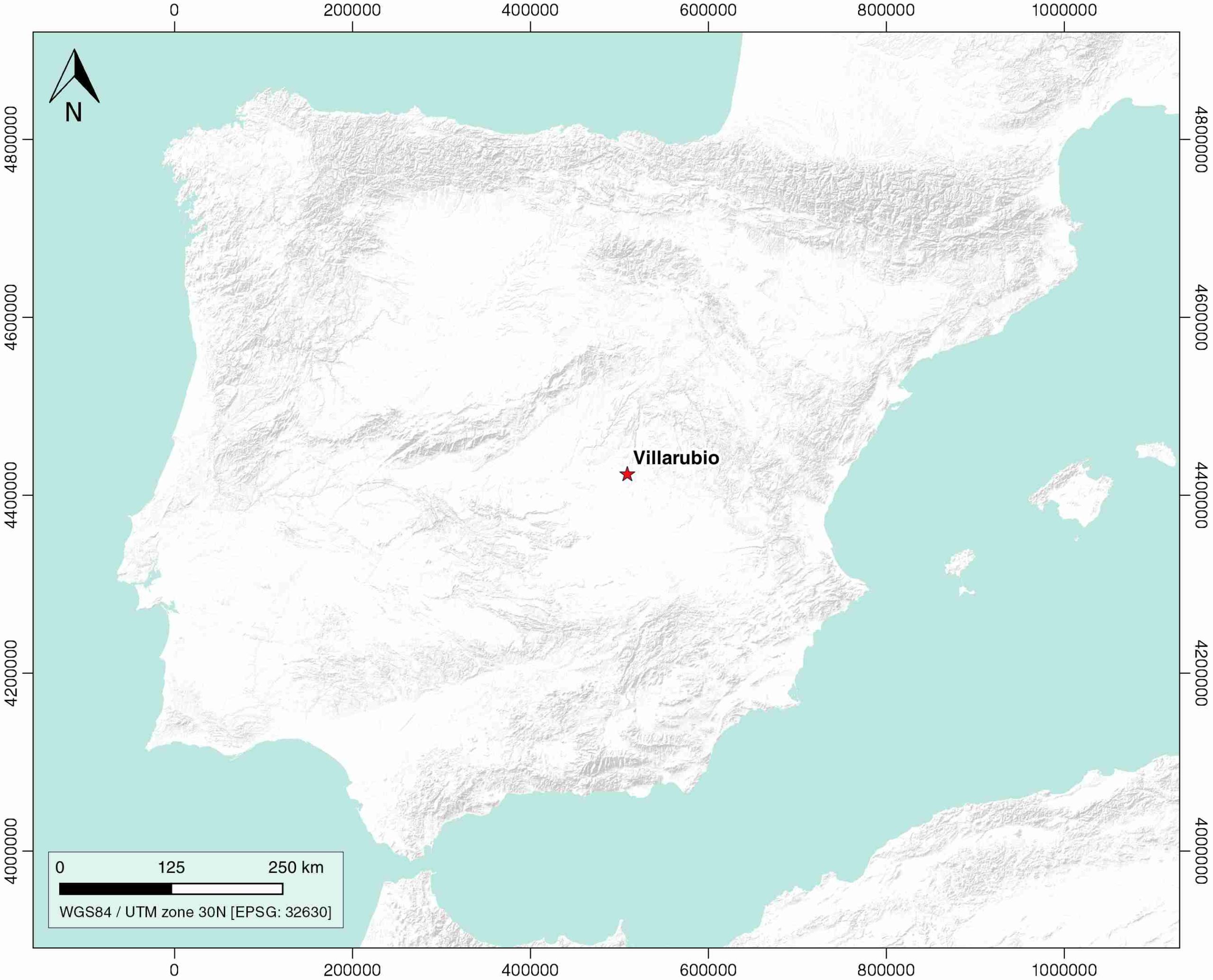
| Geological Setting | Madrid Sub-Basin, Tagus Basin |
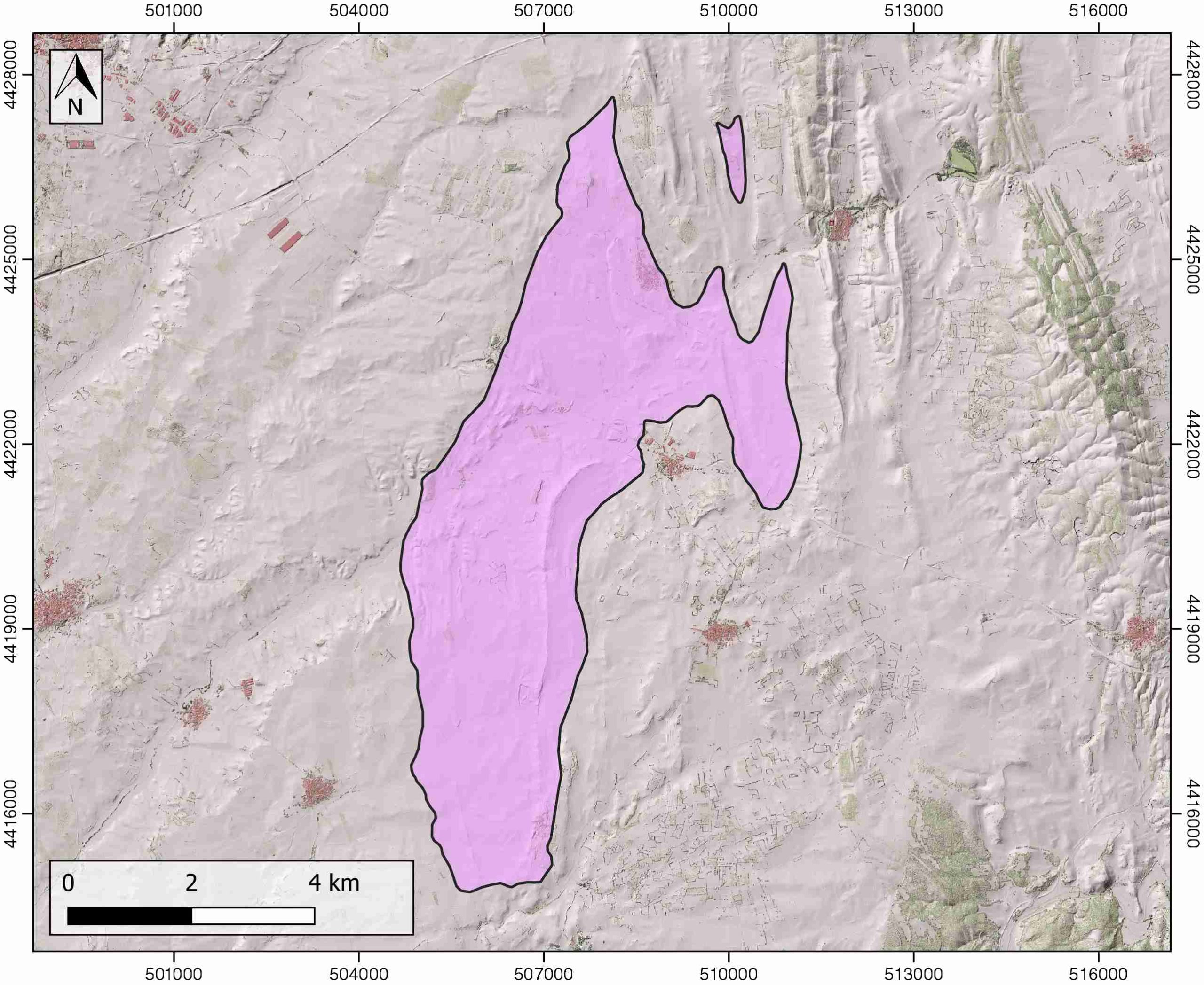
| Outcropping/buried | Outcropping |
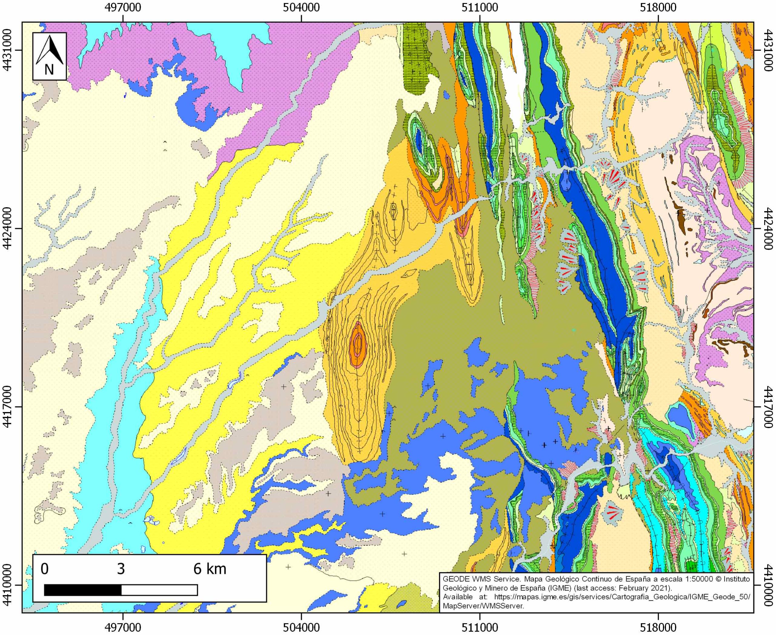
| Evaporite unit/s name | Garumnian equivalent |
| Evaporite unit/s age | Late Cretaceous-Paleogene |
| Evaporite unit/s origin | Continental |
| Classif. (Hudec and Jackson, 2009) | No diapirism |
| Classif. (Jackson and Talbot, 1986) | No diapirism |
| Age of evaporite flow or deformation (when deformed) | Oligocene to Miocene, Paleocene-Eocene |
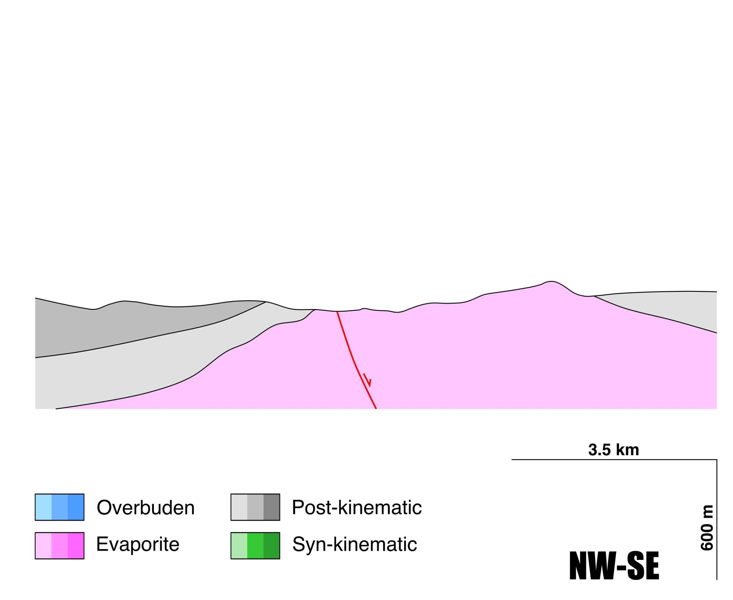
| Other comments | N-S salt-cored anticline, the same as the Sierra de Altromira, to which it belongs structurally. Studied as a formation with a potential of CO2 storage (Early Cretaceous reservoir and Late Cretaceous seal). |
Generic Data
| Unique ID | 117 |
| Name | Villarubia |
| Structure type | Evaporite body |
| Deformed/Undeformed | Deformed |
| Buried/Outcropping | Outcropping |
| Geological setting | Tagus Basin |
| Geological Regional Setting | Madrid Basin |
| Evaporite unit/s name | Garumnian equivalent |
| Evaporite unit/s age | Late Cretaceous-Paleogene |
| Evaporite unit/s era | Mesozoic-Cenozoic |
| Evaporite unit/s origin | Continental (lacustrine) |
| Evaporite unit/s composition | Gypsum-Shale-Marlstone-Limestone |
| Post-kinematic unit/s (or post-evaporite units when evaporites are undeformed) | Quaternary (alluvial and colluvial detrital deposits) |
| Post-kinematic unit/s age (or post-evaporite units when evaporites are undeformed) | Pleistocene-Holocene |
| Classification (Hudec and Jackson, 2009) | No diapirism |
| Classification (Jackson and Talbot, 1986) | No diapirism |
| Mining activity? | Y |
| Mining activity start | |
| Mining activity end | Active |
| Mining galleries? | Y |
| Mining products | Gypsum |
| Mining sub-products | |
| Evaporite flow? | Y |
| Age of evaporite flow | Paleogene-Miocene |
| Flow or deformation triggering mechanisms | Alpine compression, Altromira range development |
| Flow-linked structures? | Y |
| Halokinetic structures | Syncline-Anticline folding / thrust faults |
| Post-evaporite and pre-kinematic unit/s (overbuden) | Middle Miocene (gypsiferous shales, shales) |
| Syn-kinematic unit/s | |
| Available seismic profiles | T-31 / T-19 / T-2 |
| Available boreholes | TRIBALDOS-1 |
| Additional comments | N-S salt-cored anticline, the same as the Sierra de Altromira, to which it belongs structurally. Studied as a formation with a potential of CO2 storage (Early Cretaceous reservoir and Late Cretaceous seal). |
Mining Data
| UNIQUE_ID | 117 |
| Minning exploitations within <2km? | Y |
| Historical/Active | Active |
| Exploitation name #1 | MARIN FR. I |
| Exploitation ID (Spanish National Mining Cadastre) #1 | 1018-1 |
| Municipality #1 | Villarrubio |
| Province #1 | CUENCA |
| Company #1 | ESCAYOLAS MARÍN, S.L. |
| Main minning Products #1 | Gypsum |
| Exploitation name #2 | YESOS MARIN |
| Exploitation ID (Spanish National Mining Cadastre) #2 | 1181 |
| Municipality #2 | Villarrubio |
| Province #2 | CUENCA |
| Company #2 | ESCAYOLAS MARÍN, S.L. |
| Main minning Products #2 | Gypsum |
| Exploitation name #3 | CASASOLA |
| Exploitation ID (Spanish National Mining Cadastre) #3 | 7 |
| Municipality #3 | Torrubia del Campo |
| Province #3 | CUENCA |
| Company #3 | ESCAYOLAS MARÍN, S.L. |
| Main minning Products #3 | Gypsum |
Quantitative Data
| UNIQUE_ID | 117 |
| Outcropping area (km2) | 34.13276 |
| Horizontal intersection area (km2) (when buried) | Not buried |
| Depth of intersection area (km2) (when buried) | Not buried |
| Max. Width (Km) | 13.3598314 |
| Max. Length (Km) | 5.64647528 |
| Max. Evaporites thickness (km) | 0.8 |
| Max. Deformation age (Ma) | 26 |
| Min. Deformation age (Ma) | 20 |
| Deformation stages | 1 |
Reference Data
| UNIQUE_ID | 117 |
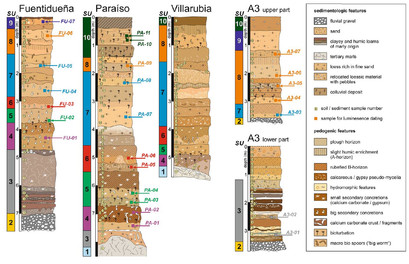
| Section source | IGME MAGNA 50. SHEET 632 (HORCAJO DE SANTIAGO) |
| Well / Borehole availability #1 | Lanaja, J. M., R. Querol, A. Navarro, 1987. Contribución de la Exploración Petrolífera al Conocimiento de la Geología de España, pp. 1–465, Instituto Geológico y Minero de España, Madrid. [link] |
| Well / Borehole availability #2 | del Olmo, W. M., 2019. Cambio climático, acuerdos de París y trampas geológicas donde secuestrar el CO2 en España. Revista de la Sociedad Geológica de España, 32(2), 87-106. [link] |
| Available data (Stratigraphy) #1 | Pérez-Hidalgo, T., 1991. Síntesis de la estratigrafía y paleogeografía de los materiales del Cretácico terminal y Cenozoico de la Depresión Intermedia y de la Cuenca de Madrid. In «Síntesis de los trabajos de investigación de uranio e hidrocarburos en la Depresión Intermedia y Cuenca de Madrid». Instituto Geológico y Minero de España, pp. 201-257. [link] |
| Available data (Stratigraphy) #2 | Herrero, M. J., Escavy, J. I., Schreiber, B. C., 2015. Thenardite after mirabilite deposits as a cool climate indicator in the geological record: lower Miocene of central Spain. Climate of the Past, 11(1), 1-13. [link] |
| Available data (Stratigraphy) #3 | Ordónez, S., García del Cura, M. A., 1994. Deposition and diagenesis of sodium-calcium sulfate salts in the tertiary saline lakes of the Madrid Basin, Spain. [link] |
| Available data (Stratigraphy) #4 | del Olmo, W. M., 2019. Cambio climático, acuerdos de París y trampas geológicas donde secuestrar el CO2 en España. Revista de la Sociedad Geológica de España, 32(2), 87-106. [link] |
| Available data (Stratigraphy) #5 | Sanz Montero, M. E., García del Cura, M., Ordóñez Delgado, S., 1991. Origin and diagenesis of calcretes in upper miocene limestones, southern Madrid Basin, Spain. Revista de la Sociedad Geológica de España, 4(1-2), 127-142. [link] |
| Available data (Stratigraphy) #6 | n.a. |
| Regional Stratigraphy | Wolf, D., Kolb, T., Alcaraz-Castaño, M., Heinrich, S., Baumgart, P., Calvo, R., …, Faust, D., 2018. Climate deteriorations and Neanderthal demise in interior Iberia. Scientific reports, 8(1), 1-10. [link] |
| Seismic data availability #1 | del Olmo, W. M., 2019. Cambio climático, acuerdos de París y trampas geológicas donde secuestrar el CO2 en España. Revista de la Sociedad Geológica de España, 32(2), 87-106. [link] |
| Seismic data availability #2 | n.a. |
| Seismic data availability #3 | n.a. |
| Available data (Structure) #1 | Giner Robles, J. L., Perez López, R., Silva, P. G., Jiménez Díaz, A., Rodríguez Pascua, M. A., 2012. Recent tectonic model for the Upper Tagus Basin (central Spain). Journal of Iberian Geology, 38, 113-126. [link] |
| Available data (Structure) #2 | Herrero, M. J., Escavy, J. I., Schreiber, B. C., 2015. Thenardite after mirabilite deposits as a cool climate indicator in the geological record: lower Miocene of central Spain. Climate of the Past, 11(1), 1-13. [link] |
| Available data (Structure) #3 | del Olmo, W. M., 2019. Cambio climático, acuerdos de París y trampas geológicas donde secuestrar el CO2 en España. Revista de la Sociedad Geológica de España, 32(2), 87-106. [link] |
| Available data (Structure) #4 | Suárez, I., Zapatero, M. A., Martínez, R., Marina, M., 2009. Synthesis of the exploration of formations with a potential of CO2 storage: Intermediate Depression and Madrid Basin. Energy Procedia, 1(1), 2709-2715. [link] |
| Available data (Structure) #5 | n.a. |
| Available data (Structure) #6 | n.a. |
| Available data (Analogue modelling) #1 | n.a. |
| Available data (Analogue modelling) #2 | n.a. |
| Available data (Analogue modelling) #3 | n.a. |
| Available data (Gravimetry – Tomography) #1 | Ayala, C., Bohoyo, F., Maestro, A., Reguera, M. I., Torne, M., Rubio, F., Fernández, M., García-Lobón, J. L., 2016. Updated Bouguer anomalies of the Iberian Peninsula: a new perspective to interpret the regional geology. Journal of Maps, 12(5), 1089-1092. [link] |
| Available data (Gravimetry – Tomography) #2 | n.a. |
| Available data (Gravimetry – Tomography) #3 | n.a. |
| Available data (Geochemistry) #1 | Herrero, M. J., Escavy, J. I., Schreiber, B. C., 2015. Thenardite after mirabilite deposits as a cool climate indicator in the geological record: lower Miocene of central Spain. Climate of the Past, 11(1), 1-13. [link] |
| Available data (Geochemistry) #2 | n.a. |
| Available data (Geochemistry) #3 | n.a. |
| Available data (Geochemistry) #4 | n.a. |
| Available data (Petrophysics) #1 | n.a. |
| Available data (Petrophysics) #2 | n.a. |
| IGME Geological Map (MAGNA50) Sheet number | 632-Horcajo de Santiago. [link] |
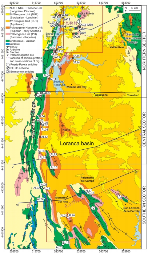
| Other Maps #1 (source) | Valcárcel, M., Soto, R., Beamud, E., Oliva-Urcia, B., Muñoz, J. A., Biete, C., 2016. Integration of palaeomagnetic data, basement-cover relationships and theoretical calculations to characterize the obliquity of the Altomira–Loranca structures (central Spain). Geological Society, London, Special Publications, 425(1), 169-188. [link] |
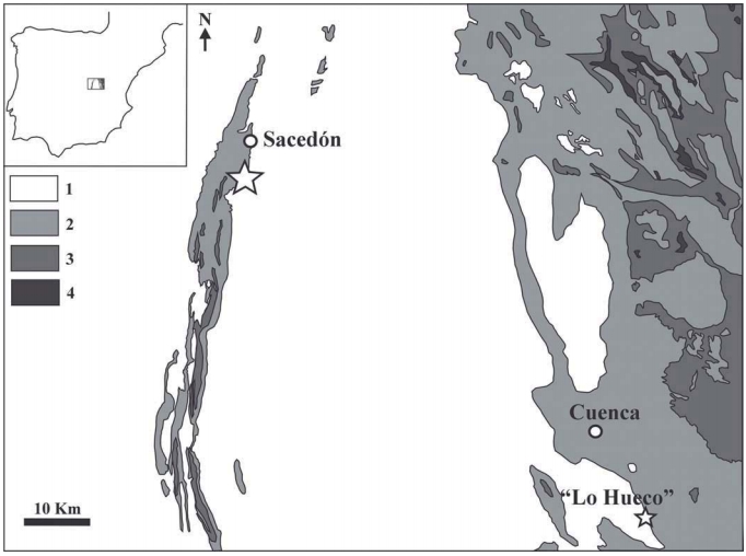
| Other Maps #2 (source) | Ortega, F. Pérez-García, A., 2009. cf. Lirainosaurus sp.(Dinosauria: Titanosauria) en el Cretácico Superior de Sacedón (Guadalajara). Geogaceta, 46, 87-90. [link] |
| Other related references #1 | IGME, 2015. Informes hidrogelógico para la mejora del abastecimiento público de agua potable a Horcajo de Santiago (Cuenca). Unpublished, 27pp. [link] |
| Other related references #2 | Sanz-Montero, M. E., Rodríguez-Aranda, J. P., Calvo, J. P., 2006. Mediation of endoevaporitic microbial communities in early replacement of gypsum by dolomite: a case study from Miocene lake deposits of the Madrid Basin, Spain. Journal of Sedimentary Research, 76(12), 1257-1266. [link] |
| Other related references #3 | n.a. |
| Other related references #4 | n.a. |
Well and Seismic Data
| UNIQUE_ID | 117 |
| Seismic survey name #1 | 8G-ST-43 |
| Across structure? #1 | N (within 3km) |
| Seismic profile ID (IGME) #1 | 13485 |
| Seismic profile code #1 | 18203 |
| Seismic profile name #1 | T-31 |
| Seismic survey year #1 | 1970 |
| Data repository #1 | SIGEOF Data Catalogue (Section available under request). ©Instituto Geológico y Minero de España (IGME). https://info.igme.es/SIGEOF/ |
| Length (km) #1 | 61.96 |
| Seismic survey name #2 | 8G-ST-43 |
| Across structure? #2 | N (within 3km) |
| Seismic profile ID (IGME) #2 | 13491 |
| Seismic profile code #2 | 18209 |
| Seismic profile name #2 | T-19 |
| Seismic survey year #2 | 1970 |
| Data repository #2 | SIGEOF Data Catalogue (Section available under request). ©Instituto Geológico y Minero de España (IGME). https://info.igme.es/SIGEOF/ |
| Length (km) #2 | 38.83 |
| Seismic survey name #3 | 8G-ST-43 |
| Across structure? #3 | N (within 3km) |
| Seismic profile ID (IGME) #3 | 13490 |
| Seismic profile code #3 | 18208 |
| Seismic profile name #3 | T-2 |
| Seismic survey year #3 | 1970 |
| Data repository #3 | SIGEOF Data Catalogue (Section available under request). ©Instituto Geológico y Minero de España (IGME). https://info.igme.es/SIGEOF/ |
| Length (km) #3 | 50.16 |
| Seismic survey name #4 | |
| Across structure? #4 | |
| Seismic profile ID (IGME) #4 | |
| Seismic profile code #4 | |
| Seismic profile name #4 | |
| Seismic survey year #4 | |
| Data repository #4 | |
| Length (km) #4 | |
| Seismic survey name #5 | |
| Across structure? #5 | |
| Seismic profile ID (IGME) #5 | |
| Seismic profile code #5 | |
| Seismic profile name #5 | |
| Seismic survey year #5 | |
| Data repository #5 | |
| Length (km) #5 | |
| Seismic survey name #6 | |
| Across structure? #6 | |
| Seismic profile ID (IGME) #6 | |
| Seismic profile code #6 | |
| Seismic profile name #6 | |
| Seismic survey year #6 | |
| Data repository #6 | |
| Length (km) #6 | |
| Seismic survey name #7 | |
| Across structure? #7 | |
| Seismic profile ID (IGME) #7 | |
| Seismic profile code #7 | |
| Seismic profile name #7 | |
| Seismic survey year #7 | |
| Data repository #7 | |
| Length (km) #7 | |
| Seismic survey name #8 | |
| Across structure? #8 | |
| Seismic profile ID (IGME) #8 | |
| Seismic profile code #8 | |
| Seismic profile name #8 | |
| Seismic survey year #8 | |
| Data repository #8 | |
| Length (km) #8 | |
| Seismic survey name #9 | |
| Across structure? #9 | |
| Seismic profile ID (IGME) #9 | |
| Seismic profile code #9 | |
| Seismic profile name #9 | |
| Seismic survey year #9 | |
| Data repository #9 | |
| Length (km) #9 | |
| Seismic survey name #10 | |
| Across structure? #10 | |
| Seismic profile ID (IGME) #10 | |
| Seismic profile code #10 | |
| Seismic profile name #10 | |
| Seismic survey year #10 | |
| Data repository #10 | |
| Length (km) #10 | |
| Seismic survey name #11 | |
| Across structure? #11 | |
| Seismic profile ID (IGME) #11 | |
| Seismic profile code #11 | |
| Seismic profile name #11 | |
| Seismic survey year #11 | |
| Data repository #11 | |
| Length (km) #11 | |
| Seismic survey name #12 | |
| Across structure? #12 | |
| Seismic profile ID (IGME) #12 | |
| Seismic profile code #12 | |
| Seismic profile name #12 | |
| Seismic survey year #12 | |
| Data repository #12 | |
| Length (km) #12 | |
| Seismic survey name #13 | |
| Across structure? #13 | |
| Seismic profile ID (IGME) #13 | |
| Seismic profile code #13 | |
| Seismic profile name #13 | |
| Seismic survey year #13 | |
| Data repository #13 | |
| Length (km) #13 | |
| Seismic survey name #14 | |
| Across structure? #14 | |
| Seismic profile ID (IGME) #14 | |
| Seismic profile code #14 | |
| Seismic profile name #14 | |
| Seismic survey year #14 | |
| Data repository #14 | |
| Length (km) #14 | |
| Seismic survey name #15 | |
| Across structure? #15 | |
| Seismic profile ID (IGME) #15 | |
| Seismic profile code #15 | |
| Seismic profile name #15 | |
| Seismic survey year #15 | |
| Data repository #15 | |
| Length (km) #15 | |
| Seismic survey name #16 | |
| Across structure? #16 | |
| Seismic profile ID (IGME) #16 | |
| Seismic profile code #16 | |
| Seismic profile name #16 | |
| Seismic survey year #16 | |
| Data repository #16 | |
| Length (km) #16 | |
| Seismic survey name #17 | |
| Across structure? #17 | |
| Seismic profile ID (IGME) #17 | |
| Seismic profile code #17 | |
| Seismic profile name #17 | |
| Seismic survey year #17 | |
| Data repository #17 | |
| Length (km) #17 | |
| Seismic survey name #18 | |
| Across structure? #18 | |
| Seismic profile ID (IGME) #18 | |
| Seismic profile code #18 | |
| Seismic profile name #18 | |
| Seismic survey year #18 | |
| Data repository #18 | |
| Length (km) #18 | |
| Seismic survey name #19 | |
| Across structure? #19 | |
| Seismic profile ID (IGME) #19 | |
| Seismic profile code #19 | |
| Seismic profile name #19 | |
| Seismic survey year #19 | |
| Data repository #19 | |
| Length (km) #19 | |
| Seismic survey name #20 | |
| Across structure? #20 | |
| Seismic profile ID (IGME) #20 | |
| Seismic profile code #20 | |
| Seismic profile name #20 | |
| Seismic survey year #20 | |
| Data repository #20 | |
| Length (km) #20 | |
| Seismic survey name #21 | |
| Across structure? #21 | |
| Seismic profile ID (IGME) #21 | |
| Seismic profile code #21 | |
| Seismic profile name #21 | |
| Seismic survey year #21 | |
| Data repository #21 | |
| Length (km) #21 | |
| Borehole name #1 | TRIBALDOS-1 |
| Company #1 | C.G.S. |
| Traget #1 | HYDROCARBONS |
| Across structure? #1 | N (within 5 km) |
| Borehole name #2 | |
| Company #2 | |
| Traget #2 | |
| Across structure? #2 | |
| Borehole name #3 | |
| Company #3 | |
| Traget #3 | |
| Across structure? #3 | |
| Borehole name #4 | |
| Company #4 | |
| Traget #4 | |
| Across structure? #4 | |
| Borehole name #5 | |
| Company #5 | |
| Traget #5 | |
| Across structure? #5 | |
| Borehole name #6 | |
| Company #6 | |
| Traget #6 | |
| Across structure? #6 | |
| Borehole name #7 | |
| Company #7 | |
| Traget #7 | |
| Across structure? #7 | |
| Borehole name #8 | |
| Company #8 | |
| Traget #8 | |
| Across structure? #8 | |
| Borehole name #9 | |
| Company #9 | |
| Traget #9 | |
| Across structure? #9 | |
| Borehole name #10 | |
| Company #10 | |
| Traget #10 | |
| Across structure? #10 | |
| Borehole name #11 | |
| Company #11 | |
| Traget #11 | |
| Across structure? #11 | |
| Borehole name #12 | |
| Company #12 | |
| Traget #12 | |
| Across structure? #12 | |
| Borehole name #13 | |
| Company #13 | |
| Traget #13 | |
| Across structure? #13 | |
| Borehole name #14 | |
| Company #14 | |
| Traget #14 | |
| Across structure? #14 | |
| Borehole name #15 | |
| Company #15 | |
| Traget #15 | |
| Across structure? #15 |
Geographical Data (EPSG:4326 - WGS 84)
| UNIQUE_ID | 117 |
| X Centroid (Structure shape) | -2.914356 |
| Y Centroid (Structure shape) | -2.914356 |
| Xmin (Structure shape) | -2.945280 |
| Xmax (Structure shape) | -2.869181 |
| Ymin (Structure shape) | 39.882570 |
| Ymax (Structure shape) | 39.998832 |
| Xmin seismic line #1 | -2.977994 |
| Xmax seismic line #1 | -2.833274 |
| Ymin seismic line #1 | 39.831853 |
| Ymax seismic line #1 | 40.374616 |
| Xmin seismic line #2 | -2.841327 |
| Xmax seismic line #2 | -2.388640 |
| Ymin seismic line #2 | 39.930720 |
| Ymax seismic line #2 | 39.939800 |
| Xmin seismic line #3 | -2.858722 |
| Xmax seismic line #3 | -2.281855 |
| Ymin seismic line #3 | 39.956790 |
| Ymax seismic line #3 | 40.029583 |
| Xmin seismic line #4 | |
| Xmax seismic line #4 | |
| Ymin seismic line #4 | |
| Ymax seismic line #4 | |
| Xmin seismic line #5 | |
| Xmax seismic line #5 | |
| Ymin seismic line #5 | |
| Ymax seismic line #5 | |
| Xmin seismic line #6 | |
| Xmax seismic line #6 | |
| Ymin seismic line #6 | |
| Ymax seismic line #6 | |
| Xmin seismic line #7 | |
| Xmax seismic line #7 | |
| Ymin seismic line #7 | |
| Ymax seismic line #7 | |
| Xmin seismic line #8 | |
| Xmax seismic line #8 | |
| Ymin seismic line #8 | |
| Ymax seismic line #8 | |
| Xmin seismic line #9 | |
| Xmax seismic line #9 | |
| Ymin seismic line #9 | |
| Ymax seismic line #9 | |
| Xmin seismic line #10 | |
| Xmax seismic line #10 | |
| Ymin seismic line #10 | |
| Ymax seismic line #10 | |
| Xmin seismic line #11 | |
| Xmax seismic line #11 | |
| Ymin seismic line #11 | |
| Ymax seismic line #11 | |
| Xmin seismic line #12 | |
| Xmax seismic line #12 | |
| Ymin seismic line #12 | |
| Ymax seismic line #12 | |
| Xmin seismic line #13 | |
| Xmax seismic line #13 | |
| Ymin seismic line #13 | |
| Ymax seismic line #13 | |
| Xmin seismic line #14 | |
| Xmax seismic line #14 | |
| Ymin seismic line #14 | |
| Ymax seismic line #14 | |
| Xmin seismic line #15 | |
| Xmax seismic line #15 | |
| Ymin seismic line #15 | |
| Ymax seismic line #15 | |
| Xmin seismic line #16 | |
| Xmax seismic line #16 | |
| Ymin seismic line #16 | |
| Ymax seismic line #16 | |
| Xmin seismic line #17 | |
| Xmax seismic line #17 | |
| Ymin seismic line #17 | |
| Ymax seismic line #17 | |
| Xmin seismic line #18 | |
| Xmax seismic line #18 | |
| Ymin seismic line #18 | |
| Ymax seismic line #18 | |
| Xmin seismic line #19 | |
| Xmax seismic line #19 | |
| Ymin seismic line #19 | |
| Ymax seismic line #19 | |
| Xmin seismic line #20 | |
| Xmax seismic line #20 | |
| Ymin seismic line #20 | |
| Ymax seismic line #20 | |
| Xmin seismic line #21 | |
| Xmax seismic line #21 | |
| Ymin seismic line #21 | |
| Ymax seismic line #21 | |
| X borehole #1 | -2.945720 |
| Y borehole #1 | 39.975542 |
| X borehole #2 | |
| Y borehole #2 | |
| X borehole #3 | |
| Y borehole #3 | |
| X borehole #4 | |
| Y borehole #4 | |
| X borehole #5 | |
| Y borehole #5 | |
| X borehole #6 | |
| Y borehole #6 | |
| X borehole #7 | |
| Y borehole #7 | |
| X borehole #8 | |
| Y borehole #8 | |
| X borehole #9 | |
| Y borehole #9 | |
| X borehole #10 | |
| Y borehole #10 | |
| X borehole #11 | |
| Y borehole #11 | |
| X borehole #12 | |
| Y borehole #12 | |
| X borehole #13 | |
| Y borehole #13 | |
| X borehole #14 | |
| Y borehole #14 | |
| X borehole #15 | |
| Y borehole #15 |

