General Information
| Structure type | Evaporite Diapir |
| Deformed/Undeformed | Deformed |
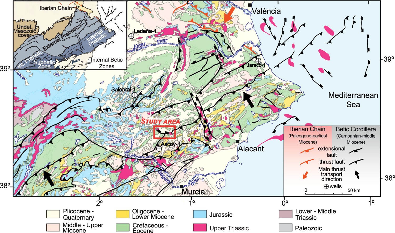
| Geological Setting | Betic system, Pre-Betic cordillera |
| Outcropping/buried | Outcropping |
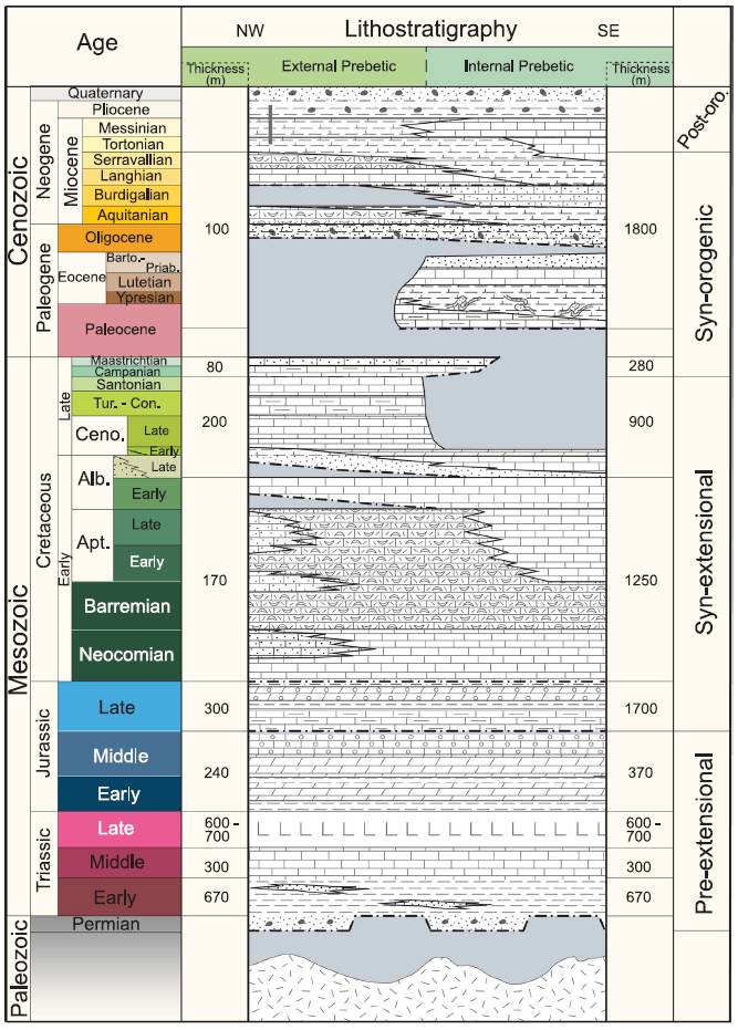
| Evaporite unit/s name | Keuper facies |
| Evaporite unit/s age | Carnian-Rhaetian (Upper Triassic) |
| Evaporite unit/s origin | Marine |
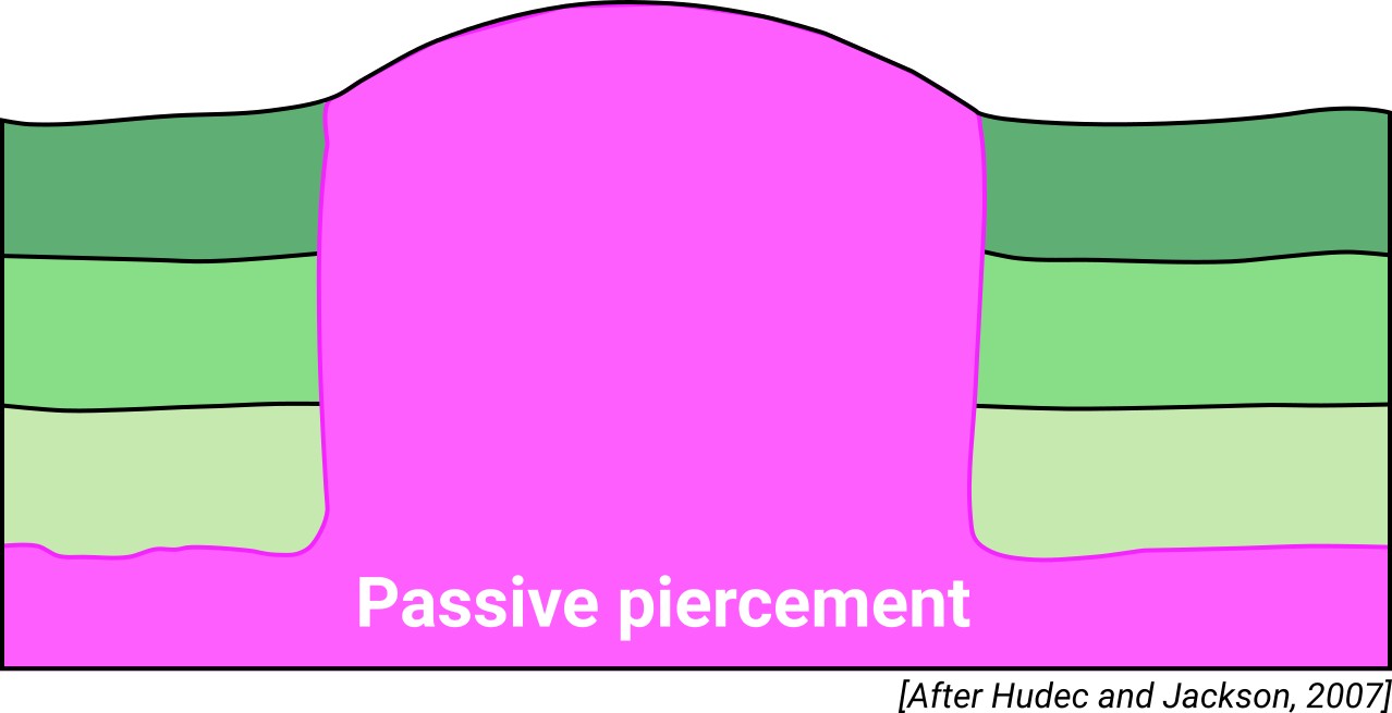
| Classif. (Hudec and Jackson, 2009) | Passive piercement |
| Classif. (Jackson and Talbot, 1986) | Salt stock |
| Age of evaporite flow or deformation (when deformed) | Quaternary / Active now(?) |
| Other comments | The onset of diapirism is unknown. Also known as "El Morrón". |
Generic Data
| Unique ID | 06 |
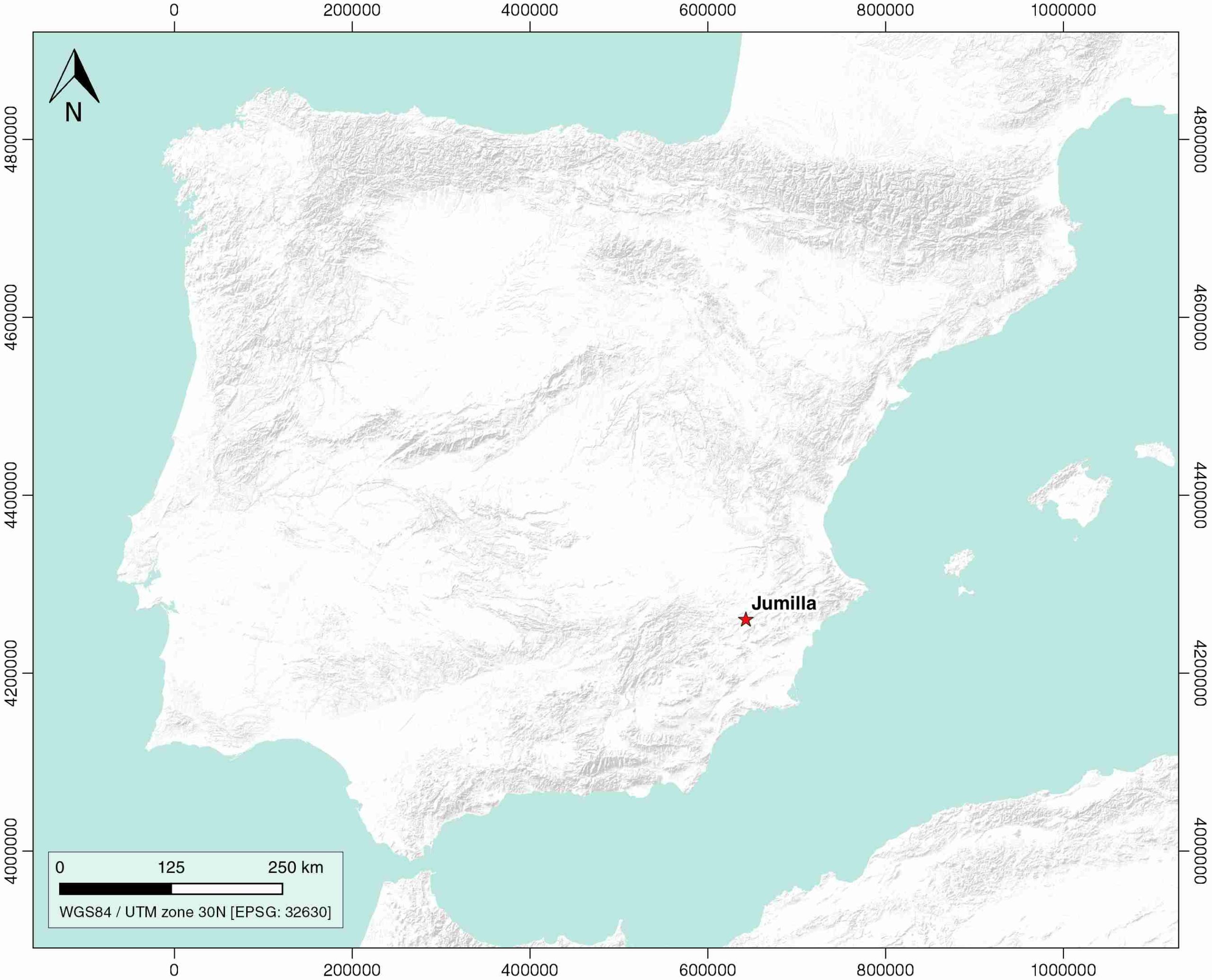
| Name | Jumilla (Morrón) |
| Structure type | Evaporite diapir |
| Deformed/Undeformed | Deformed |
| Buried/Outcropping | Outcropping |
| Geological setting | Betic System |
| Geological Regional Setting | Pre-Betic Cordillera |
| Evaporite unit/s name | Keuper facies |
| Evaporite unit/s age | Carnian-Rhaetian (Upper Triassic) |
| Evaporite unit/s era | Mesozoic |
| Evaporite unit/s origin | Marine |
| Evaporite unit/s composition | Halite-Claystone-Carbonate-Gypsum-Anhydrite |
| Post-kinematic unit/s (or post-evaporite units when evaporites are undeformed) | Quaternary (alluvial and colluvial detrital deposits) |
| Post-kinematic unit/s age (or post-evaporite units when evaporites are undeformed) | Pleistocene-Holocene |
| Classification (Hudec and Jackson, 2009) | Passive piercement |
| Classification (Jackson and Talbot, 1986) | Salt stock |
| Mining activity? | Y |
| Mining activity start | – |
| Mining activity end | – |
| Mining galleries? | – |
| Mining products | Gem Salt, Common salt |
| Mining sub-products | – |
| Evaporite flow? | Y |
| Age of evaporite flow | Active now |
| Flow or deformation triggering mechanisms | Miocene subsalt extension, Jumilla fault and Quaternary fault activity |
| Flow-linked structures? | Y |
| Halokinetic structures | Normal faults / radial joints / Progressive unconformities |
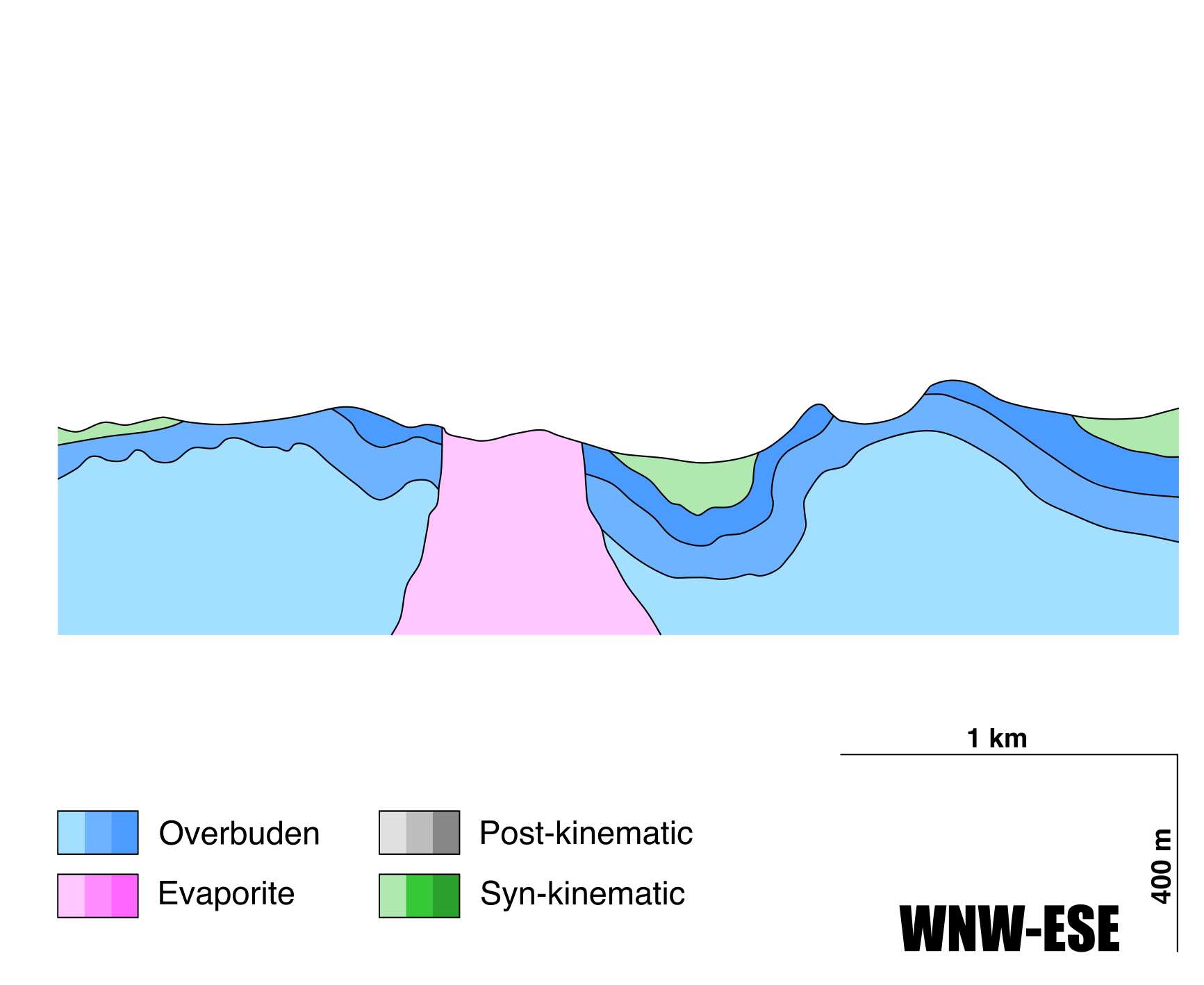
| Post-evaporite and pre-kinematic unit/s (overbuden) | Jurassic-Cretaceous carbonate cover |
| Syn-kinematic unit/s | Miocene to Quaternary (alluvial and colluvial detrital deposits) |
| Available seismic profiles | RV-62-EXT / RV-62EXT / RV-62EXT / RV-62EXT / RV-58EXT / RV-58EXT / RV-58EXT-N / RV-58 / RV-76 / RV-76 / RV-62EXT / RV-76 / RV-62EXT / RV-76 / RV-62-EXT / RV-62EXT |
| Available boreholes | S-02 (SIERRA DEL MOLAR) / S-05 (MOLAR DEL CASTILLO) / S-02 (SIERRA DEL MOLAR) / S-05 (MOLAR DEL CASTILLO) / PORTICHUELO, EL (JUMILLA-4) / PUNTILLAS, LAS / LOMA DE HELLIN / SANTA ANA / SOMBLANCA-1 (OMBLANCA-1) / SOMBLANCA-1 BIS (OMBLANCA-1 BIS) / VEREDA DEL CERCO-2 / VEREDA DEL CERCO-1 (JUMILLA-5) / CAÑADA DEL JUDIO (JUMILLA-1) / ESCARABAJA, LA / ESTRECHO PORTICHUELO (JUMILLA-3) |
| Additional comments | – |
Mining Data
| UNIQUE_ID | 6 |
| Minning exploitations within <2km? | Y |
| Historical/Active | Active |
| Exploitation name #1 | SALERO DEL PRINCIPAL |
| Exploitation ID (Spanish National Mining Cadastre) #1 | 21613 |
| Municipality #1 | Jumilla |
| Province #1 | MURCIA |
| Company #1 | CRUZ NAVARRO PASCUAL |
| Main minning Products #1 | Gem Salt, Common salt |
| Exploitation name #2 | LOMA DE HELLIN |
| Exploitation ID (Spanish National Mining Cadastre) #2 | 1175 |
| Municipality #2 | Jumilla |
| Province #2 | MURCIA |
| Company #2 | CANTERAS Y RECICLADOS, SL |
| Main minning Products #2 | Limestone (other uses) |
| Exploitation name #3 | NOBLEZA |
| Exploitation ID (Spanish National Mining Cadastre) #3 | 21594 |
| Municipality #3 | Jumilla |
| Province #3 | MURCIA |
| Company #3 | PASCUAL TOMAS LOPEZ |
| Main minning Products #3 | Ornamental limestone |
Quantitative Data
| UNIQUE_ID | 6 |
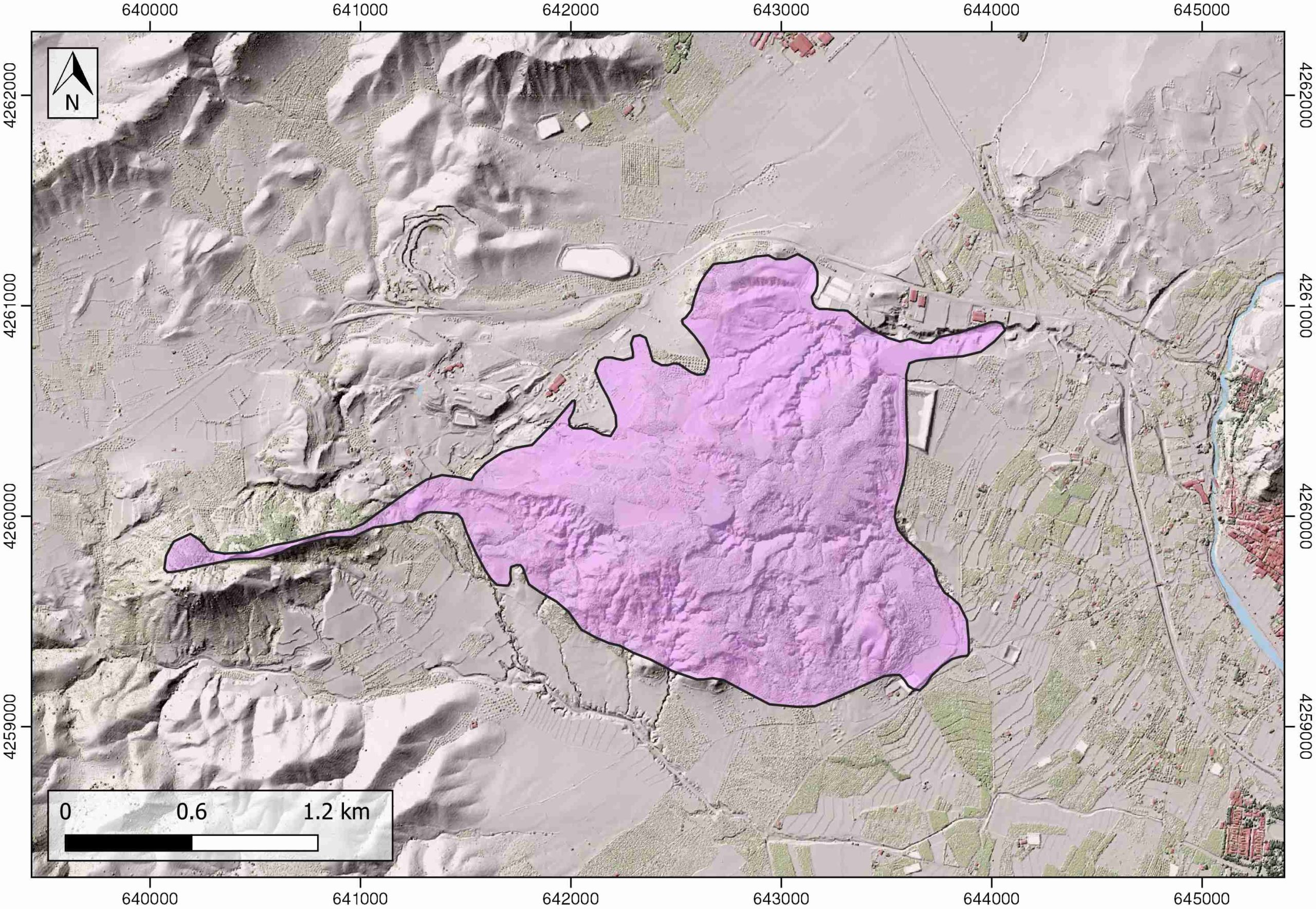
| Outcropping area (km2) | 3.29958 |
| Horizontal intersection area (km2) (when buried) | Not buried |
| Depth of intersection area (km2) (when buried) | Not buried |
| Max. Width (Km) | 3.8 |
| Max. Length (Km) | 2.1 |
| Max. Evaporites thickness (km) | 0.6 |
| Max. Deformation age (Ma) | 23 |
| Min. Deformation age (Ma) | Active |
| Deformation stages | 1 |
Reference Data
| UNIQUE_ID | 6 |
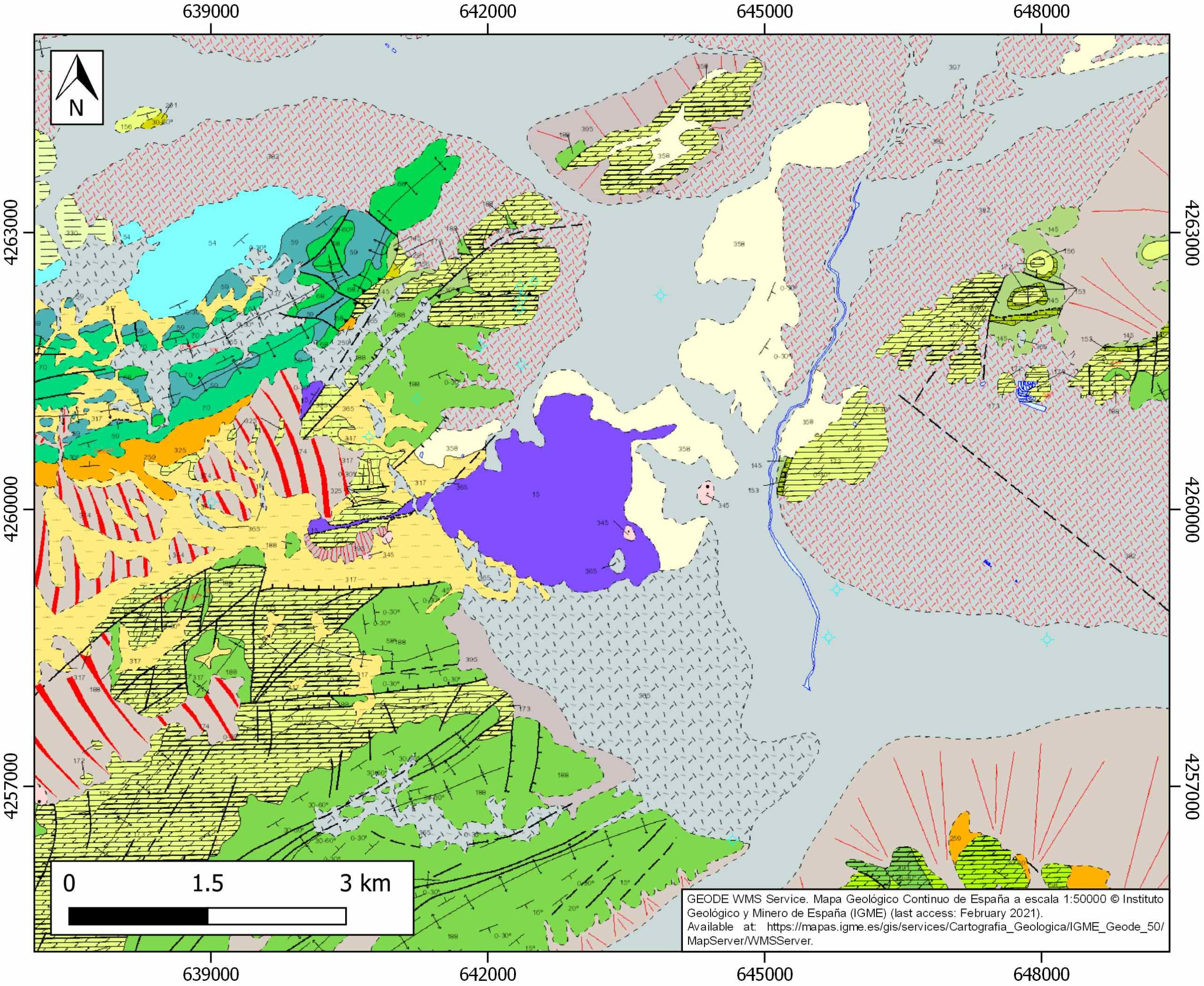
| Section source | IGME MAGNA 50. SHEET 869 (JUMILLA) |
| Well / Borehole availability #1 | Escosa, F.O., Roca, E., Ferrer, O., 2018. Testing thin-skinned inversion of a prerift salt-bearing passive margin (Eastern Prebetic Zone, SE Iberia). Journal of Structural Geology, 109, 55-73. [link] |
| Well / Borehole availability #2 | n.a. |
| Available data (Stratigraphy) #1 | Escosa, F.O., Roca, E., Ferrer, O., 2018. Testing thin-skinned inversion of a prerift salt-bearing passive margin (Eastern Prebetic Zone, SE Iberia). Journal of Structural Geology, 109, 55-73. [link] |
| Available data (Stratigraphy) #2 | Guerrera, F., Mancheño, M.A., Martín-Martín, M., Raffaelli, G., Rodríguez-Estrella, T., Serrano, F., 2014. Paleogene evolution of the external betic zone and geodynamic implications. Geologica Acta, 12, 170–192. [link] |
| Available data (Stratigraphy) #3 | Arche, A., López-Gómez, J., García-Hidalgo, J. F., 2002. Control climático y eustático en depósitos del Carniense (Triásico Superior) del SE de la Peninsula Iberica. Journal of Iberian Geology, 28, 13-30. [link] |
| Available data (Stratigraphy) #4 | Vilas, L., Martín-Chivelet, J., Arias, C., 2003. Integration of subsidence and sequence stratigraphic analyses in the Cretaceous carbonate platforms of the Prebetic (Jumilla-Yecla Region), Spain. Palaeogeography, Palaeoclimatology, Palaeoecology, 200, 107-129. [link] |
| Available data (Stratigraphy) #5 | Rodríguez-Estrella, T., 1977. Síntesis geológica del Prebético de la provincia de Alicante. Boletín del Instituto Geológico y Minero de España 88, 183–214 and 273–299. [link] |
| Available data (Stratigraphy) #6 | Mancheño, M.A., Rodriguez-Estrella, T., 1985. Geología de los diapiros triásicos del nordeste de la provincia de Murcia. Estudios geológicos, 41, 189-200. [link] |
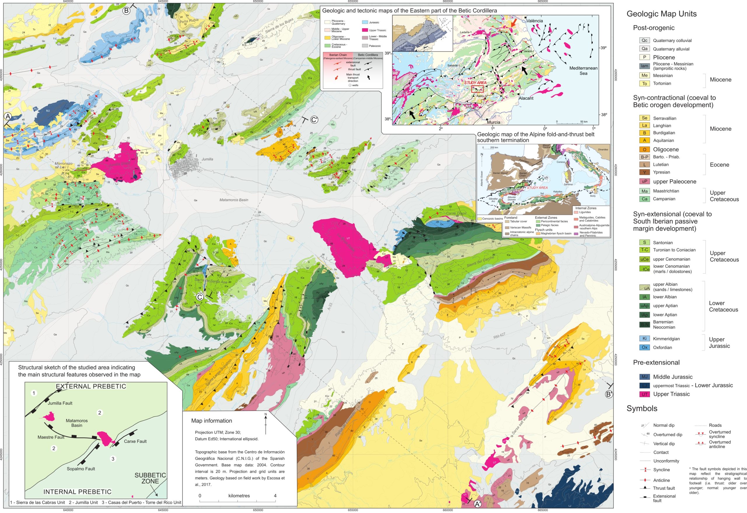
| Regional Stratigraphy | Escosa, F. O., Ferrer, O., Roca, E., 2018. Geology of the Eastern Prebetic Zone at the Jumilla region (SE Iberia). Journal of Maps, 14(2), 77-86. [link] |
| Seismic data availability #1 | Escosa, F.O., Roca, E., Ferrer, O., 2018. Testing thin-skinned inversion of a prerift salt-bearing passive margin (Eastern Prebetic Zone, SE Iberia). Journal of Structural Geology, 109, 55-73. [link] |
| Seismic data availability #2 | n.a. |
| Seismic data availability #3 | n.a. |
| Available data (Structure) #1 | Escosa, F.O., Roca, E., Ferrer, O., 2018. Testing thin-skinned inversion of a prerift salt-bearing passive margin (Eastern Prebetic Zone, SE Iberia). Journal of Structural Geology, 109, 55-73. [link] |
| Available data (Structure) #2 | Navarro-Hervás, F., Rodríguez-Estrella, T., 1985. Características morfoestructurales de los diapiros triásicos de Hellín, Ontur, la Celia, Jumilla, La Rosa y Pinoso, en las provincias de Albacete, Murcia y Alicante. Papeles de geografía, 10, 49-69. [link] |
| Available data (Structure) #3 | Guerrera, F., Mancheño, M.A., Martín-Martín, M., Raffaelli, G., Rodríguez-Estrella, T., Serrano, F., 2014. Paleogene evolution of the external betic zone and geodynamic implications. Geologica Acta, 12, 170–192. [link] |
| Available data (Structure) #4 | Roca, E., Sans, M., Koyi, H.A., 2006. Polyphase deformation of diapiric areas in models and in the eastern Prebetics (Spain). AAPG Bulletin, 90, 115-136. [link] |
| Available data (Structure) #5 | Mancheño, M.A., Rodriguez-Estrella, T., 1985. Geología de los diapiros triásicos del nordeste de la provincia de Murcia. Estudios geológicos, 41, 189-200. [link] |
| Available data (Structure) #6 | n.a. |
| Available data (Analogue modelling) #1 | Roca, E., Sans, M., Koyi, H.A., 2006. Polyphase deformation of diapiric areas in models and in the eastern Prebetics (Spain). AAPG Bulletin, 90, 115-136. [link] |
| Available data (Analogue modelling) #2 | n.a. |
| Available data (Analogue modelling) #3 | n.a. |
| Available data (Gravimetry – Tomography) #1 | Castaño-Fernández, S., 1993. La estructura cortical del area de unión de las cordilleras Ibérica y Béticas. Interpretación geotectónica basada en datos gravimétricos. PhD thesis, Universidad Complutense de Madrid, Madrid. [link] |
| Available data (Gravimetry – Tomography) #2 | Ayala, C., Bohoyo, F., Maestro, A., Reguera, M. I., Torne, M., Rubio, F., Fernández, M., García-Lobón, J. L., 2016. Updated Bouguer anomalies of the Iberian Peninsula: a new perspective to interpret the regional geology. Journal of Maps, 12(5), 1089-1092. [link] |
| Available data (Gravimetry – Tomography) #3 | n.a. |
| Available data (Geochemistry) #1 | Ortí, F., García-Veigas, J., Rossell, L., Jurado, M. J., Utrilla, R., 1996. Formaciones salinas de las cuencas triásicas en la Península Ibérica: Caracterización Petrológica y Geoquímica. Cuadernos de Geología Ibérica, 20, 13-35. [link] |
| Available data (Geochemistry) #2 | n.a. |
| Available data (Geochemistry) #3 | n.a. |
| Available data (Geochemistry) #4 | n.a. |
| Available data (Petrophysics) #1 | n.a. |
| Available data (Petrophysics) #2 | n.a. |
| IGME Geological Map (MAGNA50) Sheet number | 869-Jumilla. [link] |
| Other Maps #1 (source) | Escosa, F. O., Ferrer, O., Roca, E., 2018. Geology of the Eastern Prebetic Zone at the Jumilla region (SE Iberia). Journal of Maps, 14(2), 77-86. [link] |
| Other Maps #2 (source) | Escosa, F. O., Ferrer, O., Roca, E., 2018. Geology of the Eastern Prebetic Zone at the Jumilla region (SE Iberia). Journal of Maps, 14(2), 77-86. [link] |
| Other related references #1 | Rodríguez-Estrella, T., 1983. Neotectónica relacionada con las estructuras diapíricas en el Sureste de la Península Ibérica. Tecniterrae, 9, 14-30. |
| Other related references #2 | Ortí, F. C., 1990. El domo de Pinoso, La sal del domo de La Rosa y el domo de Jumilla Formaciones evaporíticas de la Cuenca del Ebro y Cadenas periféricas, y de la zona de Levante. Ortí y Salvany (Eds.) ENRESA-GPPG. Barcelona: 289-291. |
| Other related references #3 | Ortí, F. C., 1974. El Keuper del Levante español. Estudios Geológicos, 30, 7- 46. [link] |
| Other related references #4 | Ortí, F. C., 1987. Aspectos sedimentológicos de las evaporitas del Triásico y del Liásico inferior en el Este de la Península Ibérica. Cuadernos de Geología Ibérica 11, 837-858. [link] |
Well and Seismic Data
| UNIQUE_ID | 6 |
| Seismic survey name #1 | 9I1-RV |
| Across structure? #1 | Y |
| Seismic profile ID (IGME) #1 | 10938 |
| Seismic profile code #1 | 15577 |
| Seismic profile name #1 | RV-62-EXT |
| Seismic survey year #1 | 1985 |
| Data repository #1 | SIGEOF Data Catalogue (Private access section). ©Instituto Geológico y Minero de España (IGME). https://info.igme.es/SIGEOF/ |
| Length (km) #1 | 15.70 |
| Seismic survey name #2 | 0362A84U |
| Across structure? #2 | Y |
| Seismic profile ID (IGME) #2 | 4589 |
| Seismic profile code #2 | 6256 |
| Seismic profile name #2 | RV-62EXT |
| Seismic survey year #2 | 1984 |
| Data repository #2 | SIGEOF Data Catalogue (Private access section). ©Instituto Geológico y Minero de España (IGME). https://info.igme.es/SIGEOF/ |
| Length (km) #2 | 15.25 |
| Seismic survey name #3 | 0362A84S |
| Across structure? #3 | Y |
| Seismic profile ID (IGME) #3 | 4548 |
| Seismic profile code #3 | 6215 |
| Seismic profile name #3 | RV-62EXT |
| Seismic survey year #3 | 1984 |
| Data repository #3 | SIGEOF Data Catalogue (Private access section). ©Instituto Geológico y Minero de España (IGME). https://info.igme.es/SIGEOF/ |
| Length (km) #3 | 16.38 |
| Seismic survey name #4 | 0362A84G |
| Across structure? #4 | Y |
| Seismic profile ID (IGME) #4 | 4485 |
| Seismic profile code #4 | 6152 |
| Seismic profile name #4 | RV-62EXT |
| Seismic survey year #4 | 1984 |
| Data repository #4 | SIGEOF Data Catalogue (Private access section). ©Instituto Geológico y Minero de España (IGME). https://info.igme.es/SIGEOF/ |
| Length (km) #4 | 12.61 |
| Seismic survey name #5 | 0362A84G |
| Across structure? #5 | N (within 3km) |
| Seismic profile ID (IGME) #5 | 4469 |
| Seismic profile code #5 | 6136 |
| Seismic profile name #5 | RV-58EXT |
| Seismic survey year #5 | 1984 |
| Data repository #5 | SIGEOF Data Catalogue (Section available under request). ©Instituto Geológico y Minero de España (IGME). https://info.igme.es/SIGEOF/ |
| Length (km) #5 | 11.26 |
| Seismic survey name #6 | 0362A84S |
| Across structure? #6 | N (within 3km) |
| Seismic profile ID (IGME) #6 | 4539 |
| Seismic profile code #6 | 6206 |
| Seismic profile name #6 | RV-58EXT |
| Seismic survey year #6 | 1984 |
| Data repository #6 | SIGEOF Data Catalogue (Section available under request). ©Instituto Geológico y Minero de España (IGME). https://info.igme.es/SIGEOF/ |
| Length (km) #6 | 10.51 |
| Seismic survey name #7 | 0362A84G |
| Across structure? #7 | N (within 3km) |
| Seismic profile ID (IGME) #7 | 4470 |
| Seismic profile code #7 | 6137 |
| Seismic profile name #7 | RV-58EXT-N |
| Seismic survey year #7 | 1984 |
| Data repository #7 | SIGEOF Data Catalogue (Section available under request). ©Instituto Geológico y Minero de España (IGME). https://info.igme.es/SIGEOF/ |
| Length (km) #7 | 10.48 |
| Seismic survey name #8 | 9I3-RV |
| Across structure? #8 | N (within 3km) |
| Seismic profile ID (IGME) #8 | 10959 |
| Seismic profile code #8 | 15598 |
| Seismic profile name #8 | RV-58 |
| Seismic survey year #8 | 1985 |
| Data repository #8 | SIGEOF Data Catalogue (Section available under request). ©Instituto Geológico y Minero de España (IGME). https://info.igme.es/SIGEOF/ |
| Length (km) #8 | 35.53 |
| Seismic survey name #9 | 9I2-RV |
| Across structure? #9 | N (within 3km) |
| Seismic profile ID (IGME) #9 | 10940 |
| Seismic profile code #9 | 15579 |
| Seismic profile name #9 | RV-76 |
| Seismic survey year #9 | 1985 |
| Data repository #9 | SIGEOF Data Catalogue (Section available under request). ©Instituto Geológico y Minero de España (IGME). https://info.igme.es/SIGEOF/ |
| Length (km) #9 | 21.25 |
| Seismic survey name #10 | 0362A84U |
| Across structure? #10 | N (within 3km) |
| Seismic profile ID (IGME) #10 | 4599 |
| Seismic profile code #10 | 6266 |
| Seismic profile name #10 | RV-76 |
| Seismic survey year #10 | 1984 |
| Data repository #10 | SIGEOF Data Catalogue (Private access section). ©Instituto Geológico y Minero de España (IGME). https://info.igme.es/SIGEOF/ |
| Length (km) #10 | 20.70 |
| Seismic survey name #11 | 0362A84S |
| Across structure? #11 | N (within 3km) |
| Seismic profile ID (IGME) #11 | 4548 |
| Seismic profile code #11 | 6215 |
| Seismic profile name #11 | RV-62EXT |
| Seismic survey year #11 | 1984 |
| Data repository #11 | SIGEOF Data Catalogue (Private access section). ©Instituto Geológico y Minero de España (IGME). https://info.igme.es/SIGEOF/ |
| Length (km) #11 | 16.38 |
| Seismic survey name #12 | 0362A84S |
| Across structure? #12 | N (within 3km) |
| Seismic profile ID (IGME) #12 | 4563 |
| Seismic profile code #12 | 6230 |
| Seismic profile name #12 | RV-76 |
| Seismic survey year #12 | 1984 |
| Data repository #12 | SIGEOF Data Catalogue (Private access section). ©Instituto Geológico y Minero de España (IGME). https://info.igme.es/SIGEOF/ |
| Length (km) #12 | 22.48 |
| Seismic survey name #13 | 0362A84U |
| Across structure? #13 | N (within 3km) |
| Seismic profile ID (IGME) #13 | 4589 |
| Seismic profile code #13 | 6256 |
| Seismic profile name #13 | RV-62EXT |
| Seismic survey year #13 | 1984 |
| Data repository #13 | SIGEOF Data Catalogue (Private access section). ©Instituto Geológico y Minero de España (IGME). https://info.igme.es/SIGEOF/ |
| Length (km) #13 | 15.25 |
| Seismic survey name #14 | 0362A84G |
| Across structure? #14 | N (within 3km) |
| Seismic profile ID (IGME) #14 | 4509 |
| Seismic profile code #14 | 6176 |
| Seismic profile name #14 | RV-76 |
| Seismic survey year #14 | 1984 |
| Data repository #14 | SIGEOF Data Catalogue (Private access section). ©Instituto Geológico y Minero de España (IGME). https://info.igme.es/SIGEOF/ |
| Length (km) #14 | 12.39 |
| Seismic survey name #15 | 9I1-RV |
| Across structure? #15 | N (within 3km) |
| Seismic profile ID (IGME) #15 | 10938 |
| Seismic profile code #15 | 15577 |
| Seismic profile name #15 | RV-62-EXT |
| Seismic survey year #15 | 1985 |
| Data repository #15 | SIGEOF Data Catalogue (Private access section). ©Instituto Geológico y Minero de España (IGME). https://info.igme.es/SIGEOF/ |
| Length (km) #15 | 15.70 |
| Seismic survey name #16 | 0362A84G |
| Across structure? #16 | N (within 3km) |
| Seismic profile ID (IGME) #16 | 4485 |
| Seismic profile code #16 | 6152 |
| Seismic profile name #16 | RV-62EXT |
| Seismic survey year #16 | 1984 |
| Data repository #16 | SIGEOF Data Catalogue (Private access section). ©Instituto Geológico y Minero de España (IGME). https://info.igme.es/SIGEOF/ |
| Length (km) #16 | 12.61 |
| Seismic survey name #17 | |
| Across structure? #17 | |
| Seismic profile ID (IGME) #17 | |
| Seismic profile code #17 | |
| Seismic profile name #17 | |
| Seismic survey year #17 | |
| Data repository #17 | |
| Length (km) #17 | |
| Seismic survey name #18 | |
| Across structure? #18 | |
| Seismic profile ID (IGME) #18 | |
| Seismic profile code #18 | |
| Seismic profile name #18 | |
| Seismic survey year #18 | |
| Data repository #18 | |
| Length (km) #18 | |
| Seismic survey name #19 | |
| Across structure? #19 | |
| Seismic profile ID (IGME) #19 | |
| Seismic profile code #19 | |
| Seismic profile name #19 | |
| Seismic survey year #19 | |
| Data repository #19 | |
| Length (km) #19 | |
| Seismic survey name #20 | |
| Across structure? #20 | |
| Seismic profile ID (IGME) #20 | |
| Seismic profile code #20 | |
| Seismic profile name #20 | |
| Seismic survey year #20 | |
| Data repository #20 | |
| Length (km) #20 | |
| Seismic survey name #21 | |
| Across structure? #21 | |
| Seismic profile ID (IGME) #21 | |
| Seismic profile code #21 | |
| Seismic profile name #21 | |
| Seismic survey year #21 | |
| Data repository #21 | |
| Length (km) #21 | |
| Borehole name #1 | S-02 (SIERRA DEL MOLAR) |
| Company #1 | CTM |
| Traget #1 | INDUSTRIAL ROCKS |
| Across structure? #1 | N (within 5 km) |
| Borehole name #2 | S-05 (MOLAR DEL CASTILLO) |
| Company #2 | CTM |
| Traget #2 | INDUSTRIAL ROCKS |
| Across structure? #2 | N (within 5 km) |
| Borehole name #3 | S-02 (SIERRA DEL MOLAR) |
| Company #3 | CTM |
| Traget #3 | INDUSTRIAL ROCKS |
| Across structure? #3 | N (within 5 km) |
| Borehole name #4 | S-05 (MOLAR DEL CASTILLO) |
| Company #4 | CTM |
| Traget #4 | INDUSTRIAL ROCKS |
| Across structure? #4 | N (within 5 km) |
| Borehole name #5 | PORTICHUELO, EL (JUMILLA-4) |
| Company #5 | TRAGSA |
| Traget #5 | HYDROGEOLOGY |
| Across structure? #5 | N (within 5 km) |
| Borehole name #6 | PUNTILLAS, LAS |
| Company #6 | TRAGSA |
| Traget #6 | HYDROGEOLOGY |
| Across structure? #6 | N (within 5 km) |
| Borehole name #7 | LOMA DE HELLIN |
| Company #7 | TRAGSA |
| Traget #7 | HYDROGEOLOGY |
| Across structure? #7 | N (within 5 km) |
| Borehole name #8 | SANTA ANA |
| Company #8 | TRAGSA |
| Traget #8 | HYDROGEOLOGY |
| Across structure? #8 | N (within 5 km) |
| Borehole name #9 | SOMBLANCA-1 (OMBLANCA-1) |
| Company #9 | TRAGSA |
| Traget #9 | HYDROGEOLOGY |
| Across structure? #9 | N (within 5 km) |
| Borehole name #10 | SOMBLANCA-1 BIS (OMBLANCA-1 BIS) |
| Company #10 | TRAGSA |
| Traget #10 | HYDROGEOLOGY |
| Across structure? #10 | N (within 5 km) |
| Borehole name #11 | VEREDA DEL CERCO-2 |
| Company #11 | TRAGSA |
| Traget #11 | HYDROGEOLOGY |
| Across structure? #11 | N (within 5 km) |
| Borehole name #12 | VEREDA DEL CERCO-1 (JUMILLA-5) |
| Company #12 | TRAGSA |
| Traget #12 | HYDROGEOLOGY |
| Across structure? #12 | N (within 5 km) |
| Borehole name #13 | CAÑADA DEL JUDIO (JUMILLA-1) |
| Company #13 | TRAGSA |
| Traget #13 | HYDROGEOLOGY |
| Across structure? #13 | N (within 5 km) |
| Borehole name #14 | ESCARABAJA, LA |
| Company #14 | TRAGSA |
| Traget #14 | HYDROGEOLOGY |
| Across structure? #14 | N (within 5 km) |
| Borehole name #15 | ESTRECHO PORTICHUELO (JUMILLA-3) |
| Company #15 | TRAGSA |
| Traget #15 | HYDROGEOLOGY |
| Across structure? #15 | N (within 5 km) |
Geographical Data (EPSG:4326 - WGS 84)
| UNIQUE_ID | 6 |
| X Centroid (Structure shape) | -1.363714 |
| Y Centroid (Structure shape) | -1.363714 |
| Xmin (Structure shape) | -1.394292 |
| Xmax (Structure shape) | -1.348248 |
| Ymin (Structure shape) | 38.468689 |
| Ymax (Structure shape) | 38.488076 |
| Xmin seismic line #1 | -1.411807 |
| Xmax seismic line #1 | -1.253216 |
| Ymin seismic line #1 | 38.429976 |
| Ymax seismic line #1 | 38.496557 |
| Xmin seismic line #2 | -1.407887 |
| Xmax seismic line #2 | -1.253937 |
| Ymin seismic line #2 | 38.429982 |
| Ymax seismic line #2 | 38.494901 |
| Xmin seismic line #3 | -1.404054 |
| Xmax seismic line #3 | -1.253687 |
| Ymin seismic line #3 | 38.429787 |
| Ymax seismic line #3 | 38.493040 |
| Xmin seismic line #4 | -1.411748 |
| Xmax seismic line #4 | -1.284911 |
| Ymin seismic line #4 | 38.443230 |
| Ymax seismic line #4 | 38.496732 |
| Xmin seismic line #5 | -1.373636 |
| Xmax seismic line #5 | -1.285439 |
| Ymin seismic line #5 | 38.414535 |
| Ymax seismic line #5 | 38.488123 |
| Xmin seismic line #6 | -1.363191 |
| Xmax seismic line #6 | -1.285772 |
| Ymin seismic line #6 | 38.423591 |
| Ymax seismic line #6 | 38.487929 |
| Xmin seismic line #7 | -1.368413 |
| Xmax seismic line #7 | -1.285994 |
| Ymin seismic line #7 | 38.419036 |
| Ymax seismic line #7 | 38.487677 |
| Xmin seismic line #8 | -1.566161 |
| Xmax seismic line #8 | -1.285501 |
| Ymin seismic line #8 | 38.257163 |
| Ymax seismic line #8 | 38.488413 |
| Xmin seismic line #9 | -1.362022 |
| Xmax seismic line #9 | -1.167791 |
| Ymin seismic line #9 | 38.344262 |
| Ymax seismic line #9 | 38.458465 |
| Xmin seismic line #10 | -1.357107 |
| Xmax seismic line #10 | -1.168296 |
| Ymin seismic line #10 | 38.344092 |
| Ymax seismic line #10 | 38.456094 |
| Xmin seismic line #11 | -1.404054 |
| Xmax seismic line #11 | -1.253687 |
| Ymin seismic line #11 | 38.429787 |
| Ymax seismic line #11 | 38.493040 |
| Xmin seismic line #12 | -1.352441 |
| Xmax seismic line #12 | -1.168324 |
| Ymin seismic line #12 | 38.343645 |
| Ymax seismic line #12 | 38.453980 |
| Xmin seismic line #13 | -1.407887 |
| Xmax seismic line #13 | -1.253937 |
| Ymin seismic line #13 | 38.429982 |
| Ymax seismic line #13 | 38.494901 |
| Xmin seismic line #14 | -1.361774 |
| Xmax seismic line #14 | -1.250132 |
| Ymin seismic line #14 | 38.391288 |
| Ymax seismic line #14 | 38.458176 |
| Xmin seismic line #15 | -1.411807 |
| Xmax seismic line #15 | -1.253216 |
| Ymin seismic line #15 | 38.429976 |
| Ymax seismic line #15 | 38.496557 |
| Xmin seismic line #16 | -1.411748 |
| Xmax seismic line #16 | -1.284911 |
| Ymin seismic line #16 | 38.443230 |
| Ymax seismic line #16 | 38.496732 |
| Xmin seismic line #17 | |
| Xmax seismic line #17 | |
| Ymin seismic line #17 | |
| Ymax seismic line #17 | |
| Xmin seismic line #18 | |
| Xmax seismic line #18 | |
| Ymin seismic line #18 | |
| Ymax seismic line #18 | |
| Xmin seismic line #19 | |
| Xmax seismic line #19 | |
| Ymin seismic line #19 | |
| Ymax seismic line #19 | |
| Xmin seismic line #20 | |
| Xmax seismic line #20 | |
| Ymin seismic line #20 | |
| Ymax seismic line #20 | |
| Xmin seismic line #21 | |
| Xmax seismic line #21 | |
| Ymin seismic line #21 | |
| Ymax seismic line #21 | |
| X borehole #1 | -1.367461 |
| Y borehole #1 | 38.458501 |
| X borehole #2 | -1.401244 |
| Y borehole #2 | 38.462770 |
| X borehole #3 | -1.367461 |
| Y borehole #3 | 38.458501 |
| X borehole #4 | -1.401244 |
| Y borehole #4 | 38.462770 |
| X borehole #5 | -1.362343 |
| Y borehole #5 | 38.509939 |
| X borehole #6 | -1.376859 |
| Y borehole #6 | 38.528461 |
| X borehole #7 | -1.379282 |
| Y borehole #7 | 38.487439 |
| X borehole #8 | -1.358450 |
| Y borehole #8 | 38.433829 |
| X borehole #9 | -1.363812 |
| Y borehole #9 | 38.499263 |
| X borehole #10 | -1.363812 |
| Y borehole #10 | 38.499263 |
| X borehole #11 | -1.356579 |
| Y borehole #11 | 38.506190 |
| X borehole #12 | -1.356579 |
| Y borehole #12 | 38.506190 |
| X borehole #13 | -1.354919 |
| Y borehole #13 | 38.433446 |
| X borehole #14 | -1.372699 |
| Y borehole #14 | 38.489564 |
| X borehole #15 | -1.362344 |
| Y borehole #15 | 38.509380 |

