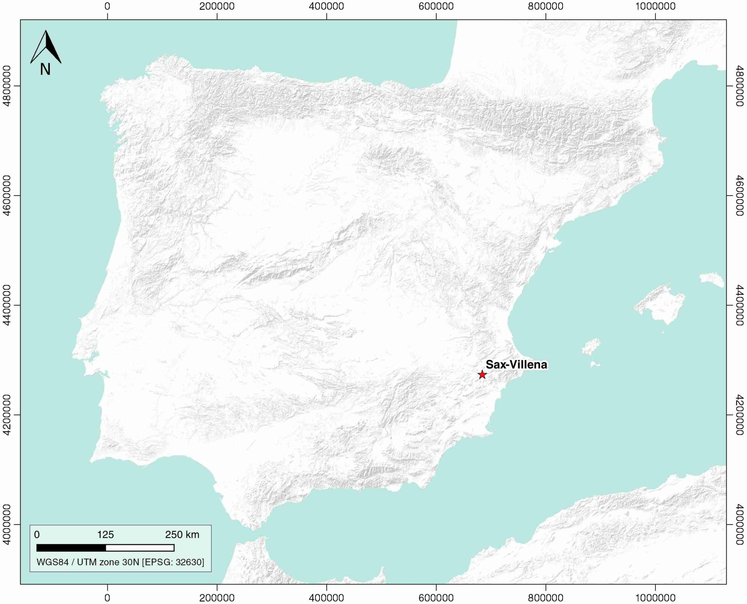
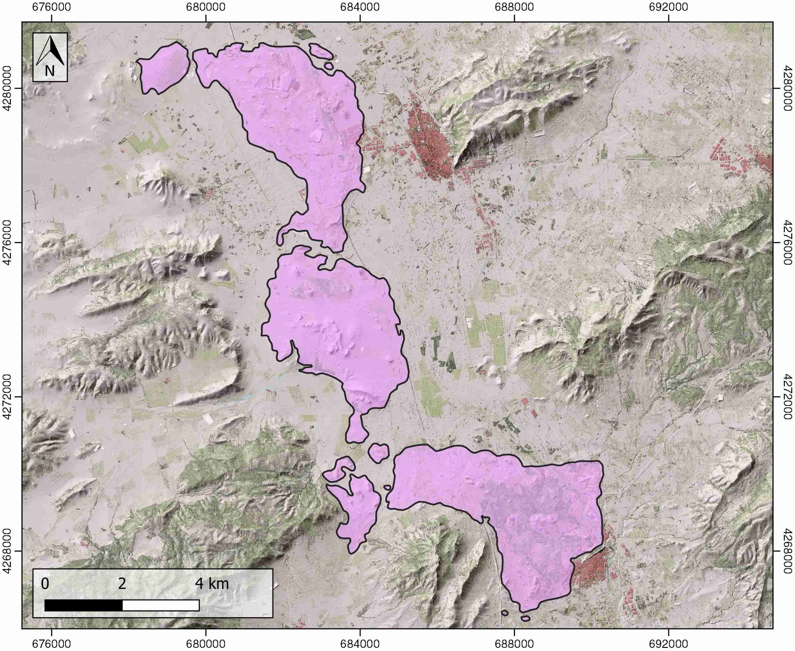
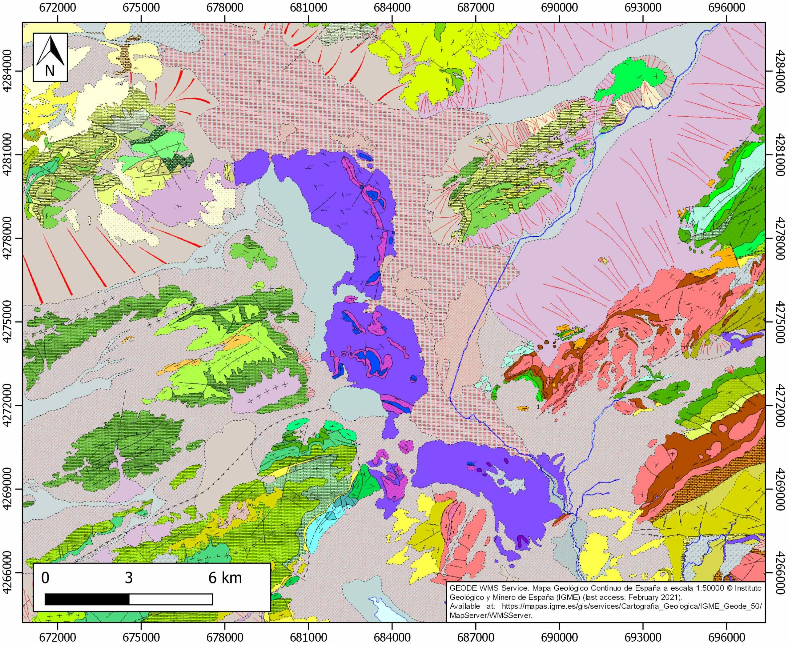
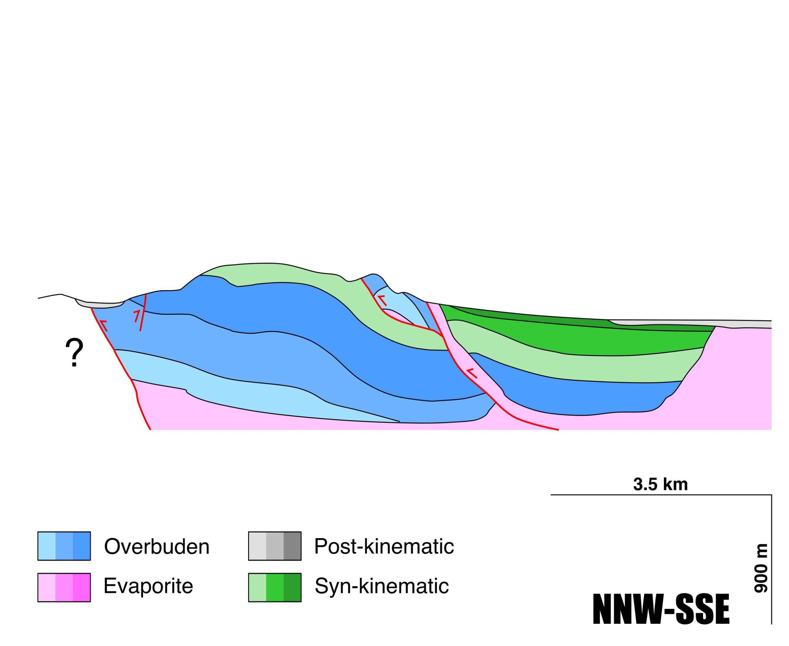
General Information
| Structure type | Evaporite body |
| Deformed/Undeformed | Deformed |
| Geological Setting | Betic system, Pre-Betic cordillera |
| Outcropping/buried | Outcropping |
| Evaporite unit/s name | Keuper facies |
| Evaporite unit/s age | Carnian-Rhaetian (Upper Triassic) |
| Evaporite unit/s origin | Marine |
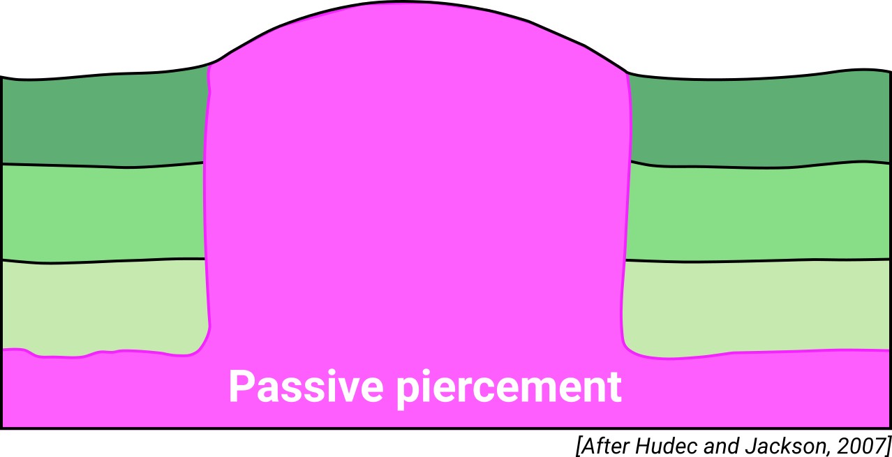
| Classif. (Hudec and Jackson, 2009) | Passive piercement |
| Classif. (Jackson and Talbot, 1986) | Salt wall |
| Age of evaporite flow or deformation (when deformed) | Miocene to Pliocene, Upper Cretaceous to Oligocene |
| Other comments | - |
Generic Data
| Unique ID | 76 |
| Name | Sax-Villena |
| Structure type | Evaporite body |
| Deformed/Undeformed | Deformed |
| Buried/Outcropping | Outcropping |
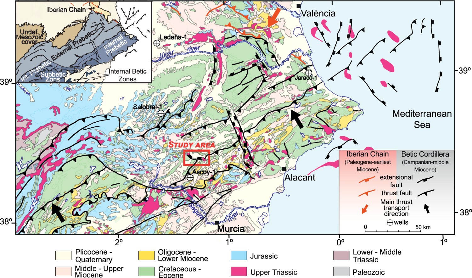
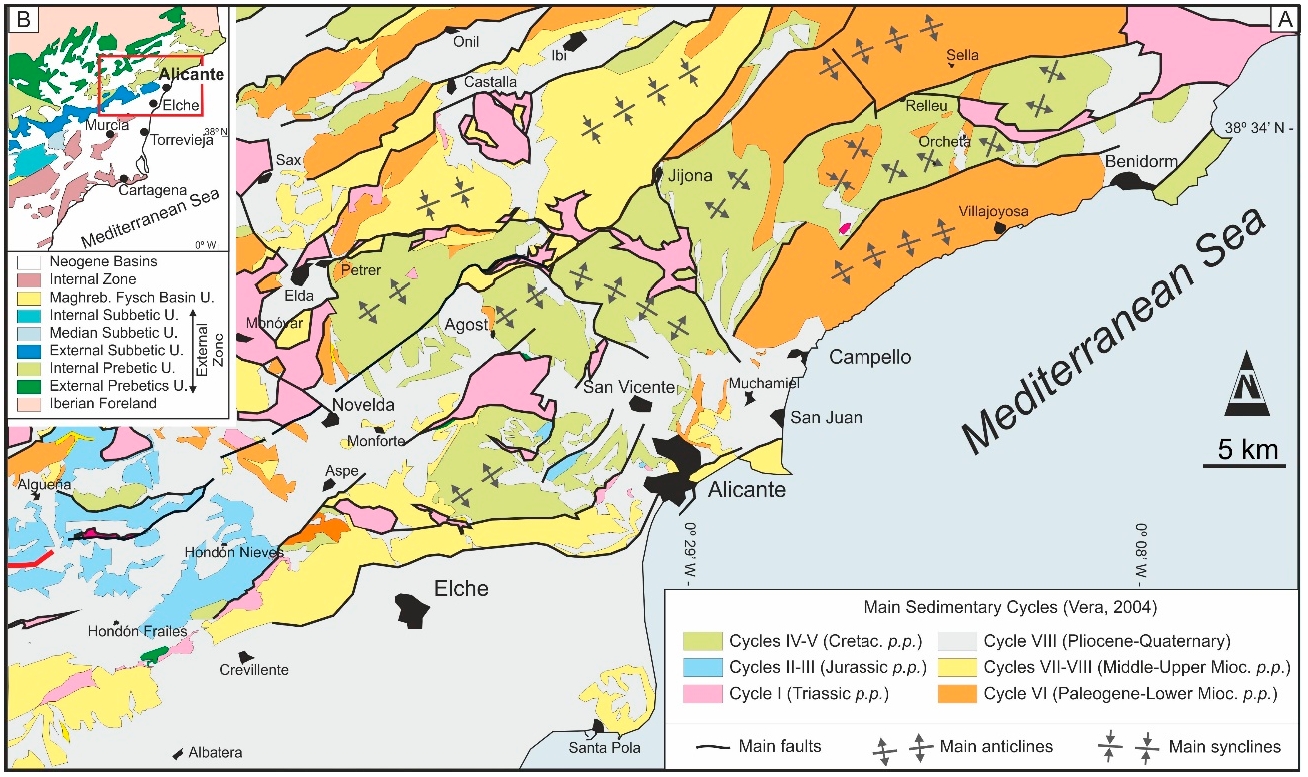
| Geological setting | Betic System |
| Geological Regional Setting | Pre-Betic Cordillera |
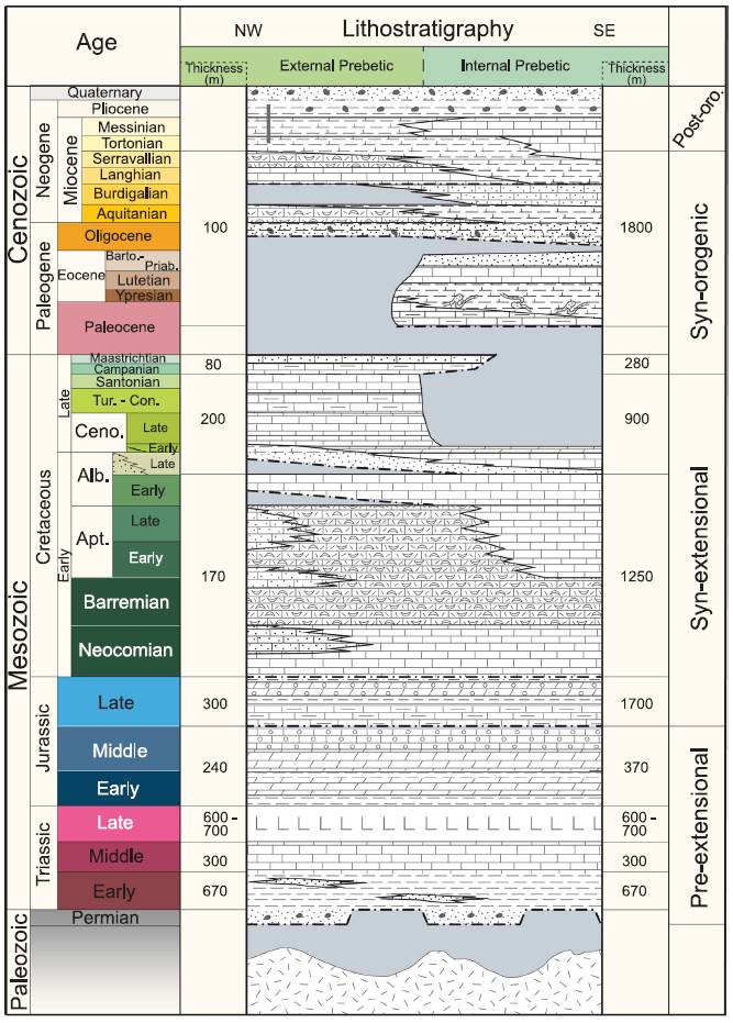
| Evaporite unit/s name | Keuper facies |
| Evaporite unit/s age | Carnian-Rhaetian (Upper Triassic) |
| Evaporite unit/s era | Mesozoic |
| Evaporite unit/s origin | Marine |
| Evaporite unit/s composition | Gypsum-Shale-Anhydrite-Ophites |
| Post-kinematic unit/s (or post-evaporite units when evaporites are undeformed) | Quaternary (alluvial and colluvial detrital deposits) |
| Post-kinematic unit/s age (or post-evaporite units when evaporites are undeformed) | Pleistocene-Holocene |
| Classification (Hudec and Jackson, 2009) | Passive piercement |
| Classification (Jackson and Talbot, 1986) | Salt wall |
| Mining activity? | Y |
| Mining activity start | |
| Mining activity end | |
| Mining galleries? | Y |
| Mining products | Salt springs, Common salt |
| Mining sub-products | |
| Evaporite flow? | Y |
| Age of evaporite flow | Upper Cretaceous-Paleogene (main stage?) ; Late Miocene – Pliocene (reactivation late stage) |
| Flow or deformation triggering mechanisms | Regional extension (main stage?) and strike-slip faulting (reactivation late stage) |
| Flow-linked structures? | Y |
| Halokinetic structures | |
| Post-evaporite and pre-kinematic unit/s (overbuden) | n.a. |
| Syn-kinematic unit/s | n.a. |
| Available seismic profiles | RV-79 / RV-79 / RV-79 / RV-60 / RV-60 / RV-79 / RV-79 / RV-79 / RV-60 / RV-8 / RV-80 / RV-79 / RV-60 / RV-80 / RV-60 / RV-80 / RV-60 / RV-60 / RV-79 / RV-80 / RV-79 |
| Available boreholes | BOQUERA-1D (BOQUERA-2) / BOQUERON II / BOQUERA-1 / ALORINES-4 / BARRANCO DE LOS PUENTES / ESTALLADOR / CUBICO, EL (LA VIRGEN) / BOQUERON-1D / BOQUERON-2D / BARRANCO DE LOS PUENTES-2 (PUENTES-3) / CANTALAR / ALORINES-1 / ALORINES-2 / BARRANCO DE LOS PUENTES-3 / CASTILLEJOS-2 |
| Additional comments | – |
Mining Data
| UNIQUE_ID | 76 |
| Minning exploitations within <2km? | Y |
| Historical/Active | Active |
| Exploitation name #1 | SALERO NUEVO |
| Exploitation ID (Spanish National Mining Cadastre) #1 | 2242 |
| Municipality #1 | Villena |
| Province #1 | ALICANTE |
| Company #1 | NURIA SARDÁ I CORTÉS, S.L. |
| Main minning Products #1 | Salt springs, Common salt |
| Exploitation name #2 | SALERO VIEJO |
| Exploitation ID (Spanish National Mining Cadastre) #2 | 2162 |
| Municipality #2 | Villena |
| Province #2 | ALICANTE |
| Company #2 | NURIA SARDÁ I CORTÉS, S.L. |
| Main minning Products #2 | Salt springs, Common salt |
| Exploitation name #3 | SALINA CARMEN |
| Exploitation ID (Spanish National Mining Cadastre) #3 | 2244 |
| Municipality #3 | Villena |
| Province #3 | ALICANTE |
| Company #3 | VICENTE Y RAFAEL BERNABEU COLOMA |
| Main minning Products #3 | Salt springs, Gem Salt, Common salt |
Quantitative Data
| UNIQUE_ID | 76 |
| Outcropping area (km2) | 39.0032 |
| Horizontal intersection area (km2) (when buried) | Not buried |
| Depth of intersection area (km2) (when buried) | Not buried |
| Max. Width (Km) | 17.5342917 |
| Max. Length (Km) | 6.96635693 |
| Max. Evaporites thickness (km) | |
| Max. Deformation age (Ma) | 86 |
| Min. Deformation age (Ma) | 7 |
| Deformation stages |
Reference Data
| UNIQUE_ID | 76 |
| Section source | IGME MAGNA 50. SHEET 845 (YECLA) |
| Well / Borehole availability #1 | n.a. |
| Well / Borehole availability #2 | n.a. |
| Available data (Stratigraphy) #1 | Martín-Martín, M., Guerrera, F., Tramontana, M., 2020. Tectono-Sedimentary Evolution of the Cenozoic Basins in the Eastern External Betic Zone (SE Spain). Geosciences, 10(10), 394. [link] |
| Available data (Stratigraphy) #2 | Castaño, S., Carbó, A., 1995. Los afloramientos triásicos de la zona de confluencia de las Cordilleras Ibérica y Bética. Aportes de la gravimetría a su interpretación. Cuadernos de Geología Ibérica, 19, 235-248. [link] |
| Available data (Stratigraphy) #3 | Ortí, F., Pueyo, J. J., 1983. Origen marino de la sal triásica del domo de Pinoso (Alicante, España). Acta geológica hispánica, 18(2), 139-145. [link] |
| Available data (Stratigraphy) #4 | del Olmo, W. M., Verdú, G. L., Alba, J. S., 1986. La estructuración diapirica del Sector Prebético. Geogaceta, (1), 43-44. [link] |
| Available data (Stratigraphy) #5 | Escosa, F.O., Roca, E., Ferrer, O., 2018. Testing thin-skinned inversion of a prerift salt-bearing passive margin (Eastern Prebetic Zone, SE Iberia). Journal of Structural Geology, 109, 55-73. [link] |
| Available data (Stratigraphy) #6 | Martín-Chivelet, J., López-Gómez, J., Aguado, R., Arias, C., Arribas, J., Arribas, M. E., … , Casas-Sainz, A., 2019. The Late Jurassic–Early Cretaceous Rifting. In (Quesada C., Oliveira J., eds.): The Geology of Iberia: A Geodynamic Approach. Regional Geology Reviews. Springer, Cham. [link] |
| Regional Stratigraphy | Escosa, F. O., Ferrer, O., Roca, E., 2018. Geology of the Eastern Prebetic Zone at the Jumilla region (SE Iberia). Journal of Maps, 14(2), 77-86. [link] |
| Seismic data availability #1 | n.a. |
| Seismic data availability #2 | n.a. |
| Seismic data availability #3 | n.a. |
| Available data (Structure) #1 | Martín-Martín, M., Guerrera, F., Tramontana, M., 2020. Tectono-Sedimentary Evolution of the Cenozoic Basins in the Eastern External Betic Zone (SE Spain). Geosciences, 10(10), 394. [link] |
| Available data (Structure) #2 | del Olmo, W. M., Verdú, G. L., Alba, J. S., 1986. La estructuración diapirica del Sector Prebético. Geogaceta, (1), 43-44. [link] |
| Available data (Structure) #3 | Escosa, F.O., Roca, E., Ferrer, O., 2018. Testing thin-skinned inversion of a prerift salt-bearing passive margin (Eastern Prebetic Zone, SE Iberia). Journal of Structural Geology, 109, 55-73. [link] |
| Available data (Structure) #4 | Escosa, F. O., Ferrer, O., Roca, E., 2018. Geology of the Eastern Prebetic Zone at the Jumilla region (SE Iberia). Journal of Maps, 14(2), 77-86. [link] |
| Available data (Structure) #5 | n.a. |
| Available data (Structure) #6 | n.a. |
| Available data (Analogue modelling) #1 | n.a. |
| Available data (Analogue modelling) #2 | n.a. |
| Available data (Analogue modelling) #3 | n.a. |
| Available data (Gravimetry – Tomography) #1 | Castaño, S., Carbó, A., 1995. Los afloramientos triásicos de la zona de confluencia de las Cordilleras Ibérica y Bética. Aportes de la gravimetría a su interpretación. Cuadernos de Geología Ibérica, 19, 235-248. [link] |
| Available data (Gravimetry – Tomography) #2 | Castaño-Fernández, S., 1993. La estructura cortical del area de unión de las cordilleras Ibérica y Béticas. Interpretación geotectónica basada en datos gravimétricos. PhD thesis, Universidad Complutense de Madrid, Madrid. [link] |
| Available data (Gravimetry – Tomography) #3 | Ayala, C., Bohoyo, F., Maestro, A., Reguera, M. I., Torne, M., Rubio, F., Fernández, M., García-Lobón, J. L., 2016. Updated Bouguer anomalies of the Iberian Peninsula: a new perspective to interpret the regional geology. Journal of Maps, 12(5), 1089-1092. [link] |
| Available data (Geochemistry) #1 | Ortí, F., García-Veigas, J., Rossell, L., Jurado, M. J., Utrilla, R., 1996. Formaciones salinas de las cuencas triásicas en la Península Ibérica: Caracterización Petrológica y Geoquímica. Cuadernos de Geología Ibérica, 20, 13-35. [link] |
| Available data (Geochemistry) #2 | n.a. |
| Available data (Geochemistry) #3 | n.a. |
| Available data (Geochemistry) #4 | n.a. |
| Available data (Petrophysics) #1 | n.a. |
| Available data (Petrophysics) #2 | n.a. |
| IGME Geological Map (MAGNA50) Sheet number | 845-Yecla. [link] |
| Other Maps #1 (source) | Escosa, F. O., Ferrer, O., Roca, E., 2018. Geology of the Eastern Prebetic Zone at the Jumilla region (SE Iberia). Journal of Maps, 14(2), 77-86. [link] |
| Other Maps #2 (source) | Martín-Martín, M., Guerrera, F., Tramontana, M., 2020. Tectono-Sedimentary Evolution of the Cenozoic Basins in the Eastern External Betic Zone (SE Spain). Geosciences, 10(10), 394. [link] |
| Other related references #1 | n.a. |
| Other related references #2 | n.a. |
| Other related references #3 | n.a. |
| Other related references #4 | n.a. |
Well and Seismic Data
| UNIQUE_ID | 76 |
| Seismic survey name #1 | 9I1-RV |
| Across structure? #1 | Y |
| Seismic profile ID (IGME) #1 | 10935 |
| Seismic profile code #1 | 15574 |
| Seismic profile name #1 | RV-79 |
| Seismic survey year #1 | 1985 |
| Data repository #1 | SIGEOF Data Catalogue (Section available under request). ©Instituto Geológico y Minero de España (IGME). https://info.igme.es/SIGEOF/ |
| Length (km) #1 | 32.18 |
| Seismic survey name #2 | 0362A84S |
| Across structure? #2 | Y |
| Seismic profile ID (IGME) #2 | 4567 |
| Seismic profile code #2 | 6234 |
| Seismic profile name #2 | RV-79 |
| Seismic survey year #2 | 1984 |
| Data repository #2 | SIGEOF Data Catalogue (Private access section). ©Instituto Geológico y Minero de España (IGME). https://info.igme.es/SIGEOF/ |
| Length (km) #2 | 8.52 |
| Seismic survey name #3 | 0362A84G |
| Across structure? #3 | Y |
| Seismic profile ID (IGME) #3 | 4517 |
| Seismic profile code #3 | 6184 |
| Seismic profile name #3 | RV-79 |
| Seismic survey year #3 | 1984 |
| Data repository #3 | SIGEOF Data Catalogue (Private access section). ©Instituto Geológico y Minero de España (IGME). https://info.igme.es/SIGEOF/ |
| Length (km) #3 | 12.32 |
| Seismic survey name #4 | 0362A84S |
| Across structure? #4 | Y |
| Seismic profile ID (IGME) #4 | 4543 |
| Seismic profile code #4 | 6210 |
| Seismic profile name #4 | RV-60 |
| Seismic survey year #4 | 1984 |
| Data repository #4 | SIGEOF Data Catalogue (Private access section). ©Instituto Geológico y Minero de España (IGME). https://info.igme.es/SIGEOF/ |
| Length (km) #4 | 29.62 |
| Seismic survey name #5 | 0362A84G |
| Across structure? #5 | Y |
| Seismic profile ID (IGME) #5 | 4477 |
| Seismic profile code #5 | 6144 |
| Seismic profile name #5 | RV-60 |
| Seismic survey year #5 | 1984 |
| Data repository #5 | SIGEOF Data Catalogue (Private access section). ©Instituto Geológico y Minero de España (IGME). https://info.igme.es/SIGEOF/ |
| Length (km) #5 | 8.95 |
| Seismic survey name #6 | 0362A84S |
| Across structure? #6 | Y |
| Seismic profile ID (IGME) #6 | 4566 |
| Seismic profile code #6 | 6233 |
| Seismic profile name #6 | RV-79 |
| Seismic survey year #6 | 1984 |
| Data repository #6 | SIGEOF Data Catalogue (Private access section). ©Instituto Geológico y Minero de España (IGME). https://info.igme.es/SIGEOF/ |
| Length (km) #6 | 28.15 |
| Seismic survey name #7 | 0362A84U |
| Across structure? #7 | Y |
| Seismic profile ID (IGME) #7 | 4602 |
| Seismic profile code #7 | 6269 |
| Seismic profile name #7 | RV-79 |
| Seismic survey year #7 | 1984 |
| Data repository #7 | SIGEOF Data Catalogue (Private access section). ©Instituto Geológico y Minero de España (IGME). https://info.igme.es/SIGEOF/ |
| Length (km) #7 | 32.77 |
| Seismic survey name #8 | 0362A84G |
| Across structure? #8 | Y |
| Seismic profile ID (IGME) #8 | 4518 |
| Seismic profile code #8 | 6185 |
| Seismic profile name #8 | RV-79 |
| Seismic survey year #8 | 1984 |
| Data repository #8 | SIGEOF Data Catalogue (Private access section). ©Instituto Geológico y Minero de España (IGME). https://info.igme.es/SIGEOF/ |
| Length (km) #8 | 8.56 |
| Seismic survey name #9 | 9I2-RV |
| Across structure? #9 | Y |
| Seismic profile ID (IGME) #9 | 10946 |
| Seismic profile code #9 | 15585 |
| Seismic profile name #9 | RV-60 |
| Seismic survey year #9 | 1985 |
| Data repository #9 | SIGEOF Data Catalogue (Section available under request). ©Instituto Geológico y Minero de España (IGME). https://info.igme.es/SIGEOF/ |
| Length (km) #9 | 66.32 |
| Seismic survey name #10 | 10I4-RV |
| Across structure? #10 | N (within 3km) |
| Seismic profile ID (IGME) #10 | 10923 |
| Seismic profile code #10 | 15562 |
| Seismic profile name #10 | RV-8 |
| Seismic survey year #10 | 1985 |
| Data repository #10 | SIGEOF Data Catalogue (Section available under request). ©Instituto Geológico y Minero de España (IGME). https://info.igme.es/SIGEOF/ |
| Length (km) #10 | 23.08 |
| Seismic survey name #11 | 9I1-RV |
| Across structure? #11 | N (within 3km) |
| Seismic profile ID (IGME) #11 | 10934 |
| Seismic profile code #11 | 15573 |
| Seismic profile name #11 | RV-80 |
| Seismic survey year #11 | 1985 |
| Data repository #11 | SIGEOF Data Catalogue (Section available under request). ©Instituto Geológico y Minero de España (IGME). https://info.igme.es/SIGEOF/ |
| Length (km) #11 | 13.69 |
| Seismic survey name #12 | 9I1-RV |
| Across structure? #12 | N (within 3km) |
| Seismic profile ID (IGME) #12 | 10935 |
| Seismic profile code #12 | 15574 |
| Seismic profile name #12 | RV-79 |
| Seismic survey year #12 | 1985 |
| Data repository #12 | SIGEOF Data Catalogue (Section available under request). ©Instituto Geológico y Minero de España (IGME). https://info.igme.es/SIGEOF/ |
| Length (km) #12 | 32.18 |
| Seismic survey name #13 | 9I2-RV |
| Across structure? #13 | N (within 3km) |
| Seismic profile ID (IGME) #13 | 10946 |
| Seismic profile code #13 | 15585 |
| Seismic profile name #13 | RV-60 |
| Seismic survey year #13 | 1985 |
| Data repository #13 | SIGEOF Data Catalogue (Section available under request). ©Instituto Geológico y Minero de España (IGME). https://info.igme.es/SIGEOF/ |
| Length (km) #13 | 66.32 |
| Seismic survey name #14 | 0362A84G |
| Across structure? #14 | N (within 3km) |
| Seismic profile ID (IGME) #14 | 4520 |
| Seismic profile code #14 | 6187 |
| Seismic profile name #14 | RV-80 |
| Seismic survey year #14 | 1984 |
| Data repository #14 | SIGEOF Data Catalogue (Private access section). ©Instituto Geológico y Minero de España (IGME). https://info.igme.es/SIGEOF/ |
| Length (km) #14 | 1.27 |
| Seismic survey name #15 | 0362A84U |
| Across structure? #15 | N (within 3km) |
| Seismic profile ID (IGME) #15 | 4586 |
| Seismic profile code #15 | 6253 |
| Seismic profile name #15 | RV-60 |
| Seismic survey year #15 | 1984 |
| Data repository #15 | SIGEOF Data Catalogue (Private access section). ©Instituto Geológico y Minero de España (IGME). https://info.igme.es/SIGEOF/ |
| Length (km) #15 | 3.24 |
| Seismic survey name #16 | 0362A84G |
| Across structure? #16 | N (within 3km) |
| Seismic profile ID (IGME) #16 | 4519 |
| Seismic profile code #16 | 6186 |
| Seismic profile name #16 | RV-80 |
| Seismic survey year #16 | 1984 |
| Data repository #16 | SIGEOF Data Catalogue (Private access section). ©Instituto Geológico y Minero de España (IGME). https://info.igme.es/SIGEOF/ |
| Length (km) #16 | 12.50 |
| Seismic survey name #17 | 0362A84G |
| Across structure? #17 | N (within 3km) |
| Seismic profile ID (IGME) #17 | 4476 |
| Seismic profile code #17 | 6143 |
| Seismic profile name #17 | RV-60 |
| Seismic survey year #17 | 1984 |
| Data repository #17 | SIGEOF Data Catalogue (Private access section). ©Instituto Geológico y Minero de España (IGME). https://info.igme.es/SIGEOF/ |
| Length (km) #17 | 12.40 |
| Seismic survey name #18 | 0362A84G |
| Across structure? #18 | N (within 3km) |
| Seismic profile ID (IGME) #18 | 4477 |
| Seismic profile code #18 | 6144 |
| Seismic profile name #18 | RV-60 |
| Seismic survey year #18 | 1984 |
| Data repository #18 | SIGEOF Data Catalogue (Private access section). ©Instituto Geológico y Minero de España (IGME). https://info.igme.es/SIGEOF/ |
| Length (km) #18 | 8.95 |
| Seismic survey name #19 | 0362A84S |
| Across structure? #19 | N (within 3km) |
| Seismic profile ID (IGME) #19 | 4566 |
| Seismic profile code #19 | 6233 |
| Seismic profile name #19 | RV-79 |
| Seismic survey year #19 | 1984 |
| Data repository #19 | SIGEOF Data Catalogue (Private access section). ©Instituto Geológico y Minero de España (IGME). https://info.igme.es/SIGEOF/ |
| Length (km) #19 | 28.15 |
| Seismic survey name #20 | 0362A84S |
| Across structure? #20 | N (within 3km) |
| Seismic profile ID (IGME) #20 | 4568 |
| Seismic profile code #20 | 6235 |
| Seismic profile name #20 | RV-80 |
| Seismic survey year #20 | 1984 |
| Data repository #20 | SIGEOF Data Catalogue (Private access section). ©Instituto Geológico y Minero de España (IGME). https://info.igme.es/SIGEOF/ |
| Length (km) #20 | 14.85 |
| Seismic survey name #21 | 0362A84U |
| Across structure? #21 | N (within 3km) |
| Seismic profile ID (IGME) #21 | 4602 |
| Seismic profile code #21 | 6269 |
| Seismic profile name #21 | RV-79 |
| Seismic survey year #21 | 1984 |
| Data repository #21 | SIGEOF Data Catalogue (Private access section). ©Instituto Geológico y Minero de España (IGME). https://info.igme.es/SIGEOF/ |
| Length (km) #21 | 32.77 |
| Borehole name #1 | BOQUERA-1D (BOQUERA-2) |
| Company #1 | TRAGSA |
| Traget #1 | HYDROGEOLOGY |
| Across structure? #1 | N (within 5 km) |
| Borehole name #2 | BOQUERON II |
| Company #2 | TRAGSA |
| Traget #2 | HYDROGEOLOGY |
| Across structure? #2 | N (within 5 km) |
| Borehole name #3 | BOQUERA-1 |
| Company #3 | TRAGSA |
| Traget #3 | HYDROGEOLOGY |
| Across structure? #3 | N (within 5 km) |
| Borehole name #4 | ALORINES-4 |
| Company #4 | TRAGSA |
| Traget #4 | HYDROGEOLOGY |
| Across structure? #4 | N (within 5 km) |
| Borehole name #5 | BARRANCO DE LOS PUENTES |
| Company #5 | TRAGSA |
| Traget #5 | HYDROGEOLOGY |
| Across structure? #5 | N (within 5 km) |
| Borehole name #6 | ESTALLADOR |
| Company #6 | TRAGSA |
| Traget #6 | HYDROGEOLOGY |
| Across structure? #6 | N (within 5 km) |
| Borehole name #7 | CUBICO, EL (LA VIRGEN) |
| Company #7 | TRAGSA |
| Traget #7 | HYDROGEOLOGY |
| Across structure? #7 | N (within 5 km) |
| Borehole name #8 | BOQUERON-1D |
| Company #8 | TRAGSA |
| Traget #8 | HYDROGEOLOGY |
| Across structure? #8 | N (within 5 km) |
| Borehole name #9 | BOQUERON-2D |
| Company #9 | TRAGSA |
| Traget #9 | HYDROGEOLOGY |
| Across structure? #9 | N (within 5 km) |
| Borehole name #10 | BARRANCO DE LOS PUENTES-2 (PUENTES-3) |
| Company #10 | TRAGSA |
| Traget #10 | HYDROGEOLOGY |
| Across structure? #10 | N (within 5 km) |
| Borehole name #11 | CANTALAR |
| Company #11 | TRAGSA |
| Traget #11 | HYDROGEOLOGY |
| Across structure? #11 | N (within 5 km) |
| Borehole name #12 | ALORINES-1 |
| Company #12 | TRAGSA |
| Traget #12 | HYDROGEOLOGY |
| Across structure? #12 | N (within 5 km) |
| Borehole name #13 | ALORINES-2 |
| Company #13 | TRAGSA |
| Traget #13 | HYDROGEOLOGY |
| Across structure? #13 | N (within 5 km) |
| Borehole name #14 | BARRANCO DE LOS PUENTES-3 |
| Company #14 | TRAGSA |
| Traget #14 | HYDROGEOLOGY |
| Across structure? #14 | N (within 5 km) |
| Borehole name #15 | CASTILLEJOS-2 |
| Company #15 | TRAGSA |
| Traget #15 | HYDROGEOLOGY |
| Across structure? #15 | N (within 5 km) |
Geographical Data (EPSG:4326 - WGS 84)
| UNIQUE_ID | 76 |
| X Centroid (Structure shape) | -0.881580 |
| Y Centroid (Structure shape) | -0.881580 |
| Xmin (Structure shape) | -0.951988 |
| Xmax (Structure shape) | -0.815843 |
| Ymin (Structure shape) | 38.524146 |
| Ymax (Structure shape) | 38.661274 |
| Xmin seismic line #1 | -1.112258 |
| Xmax seismic line #1 | -0.807276 |
| Ymin seismic line #1 | 38.471996 |
| Ymax seismic line #1 | 38.629005 |
| Xmin seismic line #2 | -0.885596 |
| Xmax seismic line #2 | -0.808621 |
| Ymin seismic line #2 | 38.593153 |
| Ymax seismic line #2 | 38.628043 |
| Xmin seismic line #3 | -1.016488 |
| Xmax seismic line #3 | -0.891763 |
| Ymin seismic line #3 | 38.539623 |
| Ymax seismic line #3 | 38.590239 |
| Xmin seismic line #4 | -1.005987 |
| Xmax seismic line #4 | -0.732562 |
| Ymin seismic line #4 | 38.469069 |
| Ymax seismic line #4 | 38.593265 |
| Xmin seismic line #5 | -0.905123 |
| Xmax seismic line #5 | -0.815398 |
| Ymin seismic line #5 | 38.516846 |
| Ymax seismic line #5 | 38.554765 |
| Xmin seismic line #6 | -1.117184 |
| Xmax seismic line #6 | -0.885596 |
| Ymin seismic line #6 | 38.467149 |
| Ymax seismic line #6 | 38.593153 |
| Xmin seismic line #7 | -1.118490 |
| Xmax seismic line #7 | -0.808927 |
| Ymin seismic line #7 | 38.466455 |
| Ymax seismic line #7 | 38.627933 |
| Xmin seismic line #8 | -0.891763 |
| Xmax seismic line #8 | -0.807316 |
| Ymin seismic line #8 | 38.590239 |
| Ymax seismic line #8 | 38.628711 |
| Xmin seismic line #9 | -1.246637 |
| Xmax seismic line #9 | -0.614979 |
| Ymin seismic line #9 | 38.314487 |
| Ymax seismic line #9 | 38.640693 |
| Xmin seismic line #10 | -0.918594 |
| Xmax seismic line #10 | -0.793738 |
| Ymin seismic line #10 | 38.348593 |
| Ymax seismic line #10 | 38.531680 |
| Xmin seismic line #11 | -0.977880 |
| Xmax seismic line #11 | -0.869848 |
| Ymin seismic line #11 | 38.505744 |
| Ymax seismic line #11 | 38.591848 |
| Xmin seismic line #12 | -1.112258 |
| Xmax seismic line #12 | -0.807276 |
| Ymin seismic line #12 | 38.471996 |
| Ymax seismic line #12 | 38.629005 |
| Xmin seismic line #13 | -1.246637 |
| Xmax seismic line #13 | -0.614979 |
| Ymin seismic line #13 | 38.314487 |
| Ymax seismic line #13 | 38.640693 |
| Xmin seismic line #14 | -0.879067 |
| Xmax seismic line #14 | -0.869233 |
| Ymin seismic line #14 | 38.505764 |
| Ymax seismic line #14 | 38.514180 |
| Xmin seismic line #15 | -0.902290 |
| Xmax seismic line #15 | -0.870567 |
| Ymin seismic line #15 | 38.518460 |
| Ymax seismic line #15 | 38.533376 |
| Xmin seismic line #16 | -0.977349 |
| Xmax seismic line #16 | -0.879067 |
| Ymin seismic line #16 | 38.514180 |
| Ymax seismic line #16 | 38.591848 |
| Xmin seismic line #17 | -1.024460 |
| Xmax seismic line #17 | -0.905123 |
| Ymin seismic line #17 | 38.457761 |
| Ymax seismic line #17 | 38.516846 |
| Xmin seismic line #18 | -0.905123 |
| Xmax seismic line #18 | -0.815398 |
| Ymin seismic line #18 | 38.516846 |
| Ymax seismic line #18 | 38.554765 |
| Xmin seismic line #19 | -1.117184 |
| Xmax seismic line #19 | -0.885596 |
| Ymin seismic line #19 | 38.467149 |
| Ymax seismic line #19 | 38.593153 |
| Xmin seismic line #20 | -0.977238 |
| Xmax seismic line #20 | -0.869317 |
| Ymin seismic line #20 | 38.505818 |
| Ymax seismic line #20 | 38.591791 |
| Xmin seismic line #21 | -1.118490 |
| Xmax seismic line #21 | -0.808927 |
| Ymin seismic line #21 | 38.466455 |
| Ymax seismic line #21 | 38.627933 |
| X borehole #1 | -0.929612 |
| Y borehole #1 | 38.578172 |
| X borehole #2 | -0.911004 |
| Y borehole #2 | 38.541709 |
| X borehole #3 | -0.931010 |
| Y borehole #3 | 38.577026 |
| X borehole #4 | -0.919338 |
| Y borehole #4 | 38.705670 |
| X borehole #5 | -0.851836 |
| Y borehole #5 | 38.682283 |
| X borehole #6 | -0.797105 |
| Y borehole #6 | 38.599810 |
| X borehole #7 | -0.911559 |
| Y borehole #7 | 38.510632 |
| X borehole #8 | -0.909700 |
| Y borehole #8 | 38.543181 |
| X borehole #9 | -0.912143 |
| Y borehole #9 | 38.541999 |
| X borehole #10 | -0.851836 |
| Y borehole #10 | 38.682283 |
| X borehole #11 | -0.840718 |
| Y borehole #11 | 38.583954 |
| X borehole #12 | -0.916556 |
| Y borehole #12 | 38.705621 |
| X borehole #13 | -0.922670 |
| Y borehole #13 | 38.704558 |
| X borehole #14 | -0.851836 |
| Y borehole #14 | 38.682283 |
| X borehole #15 | -0.927389 |
| Y borehole #15 | 38.522897 |

