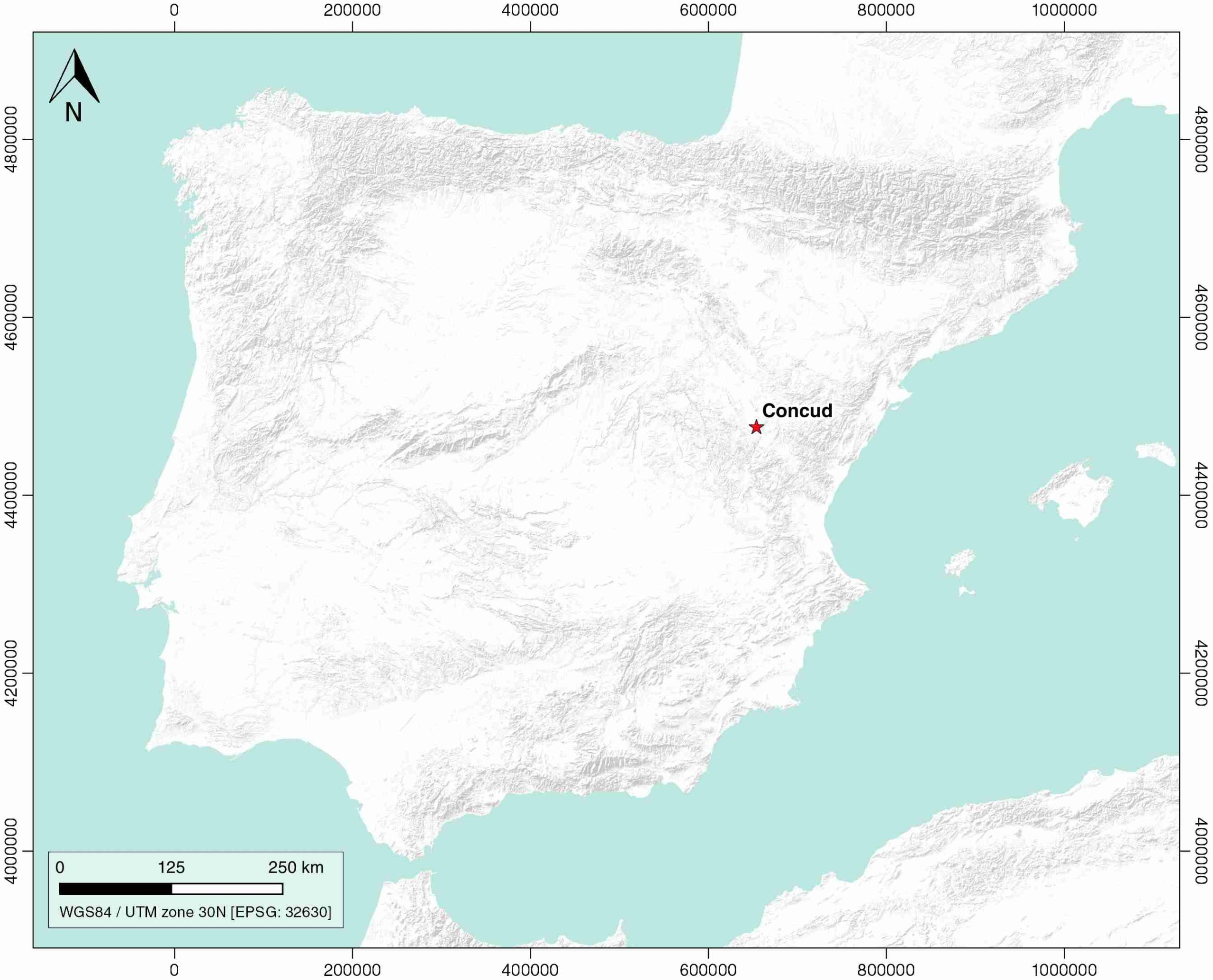
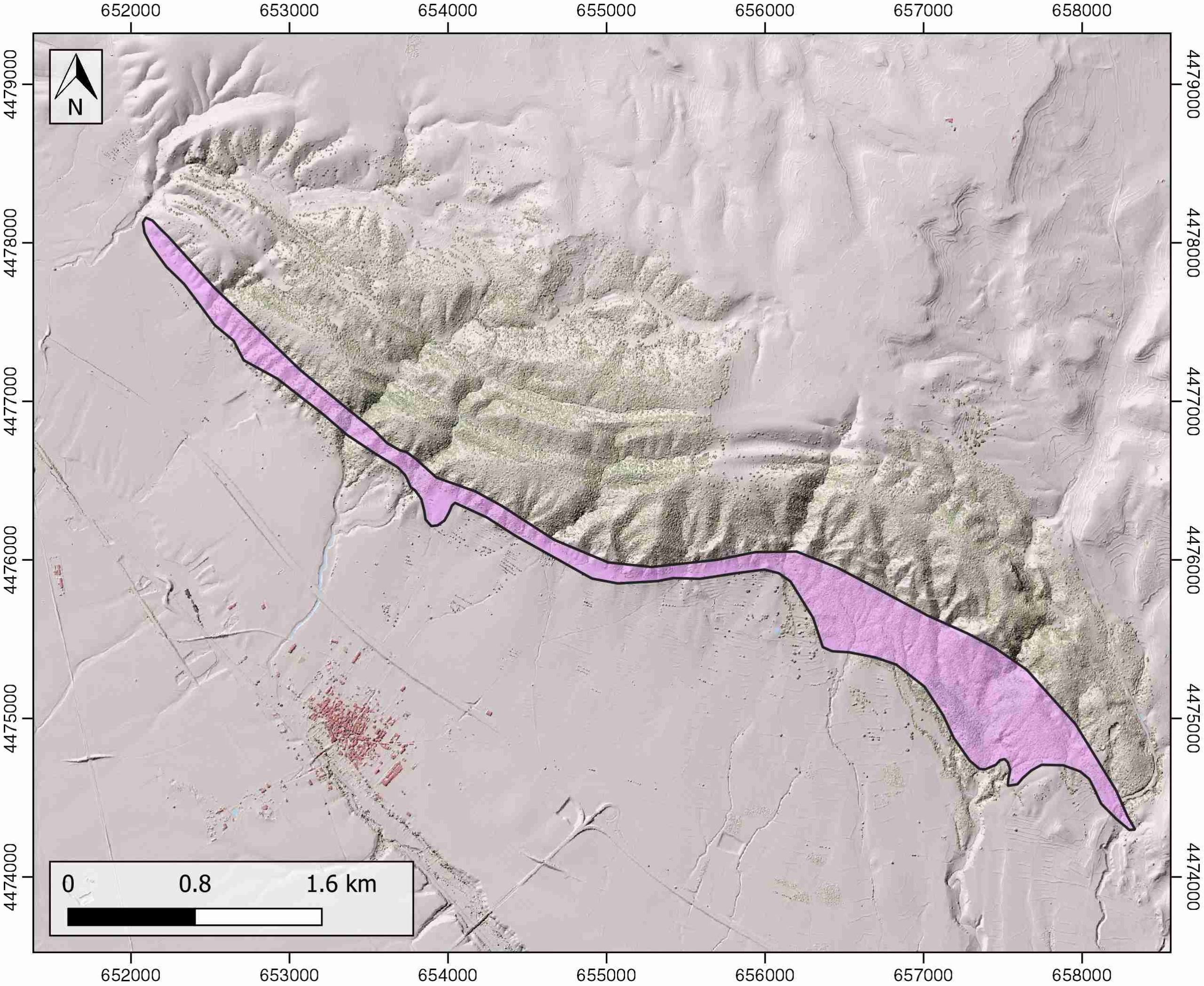
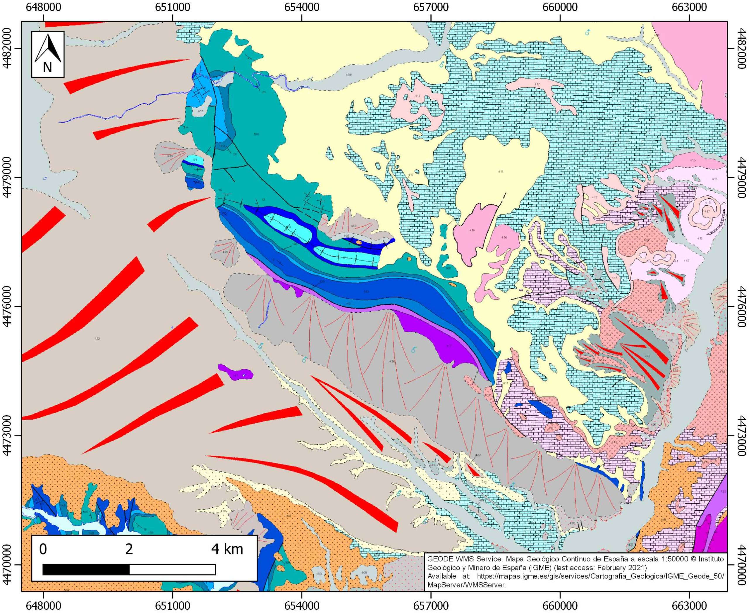
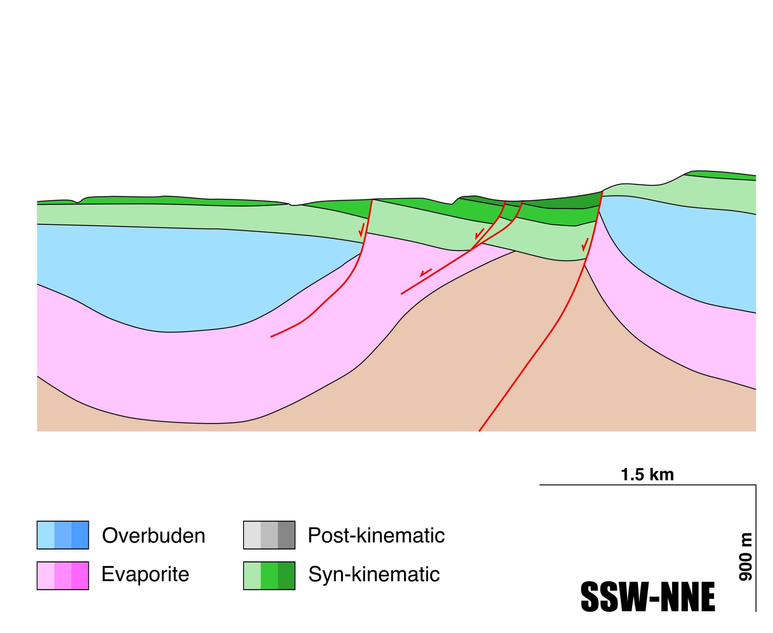
General Information
| Structure type | Evaporite-detached thrust |
| Deformed/Undeformed | Deformed |
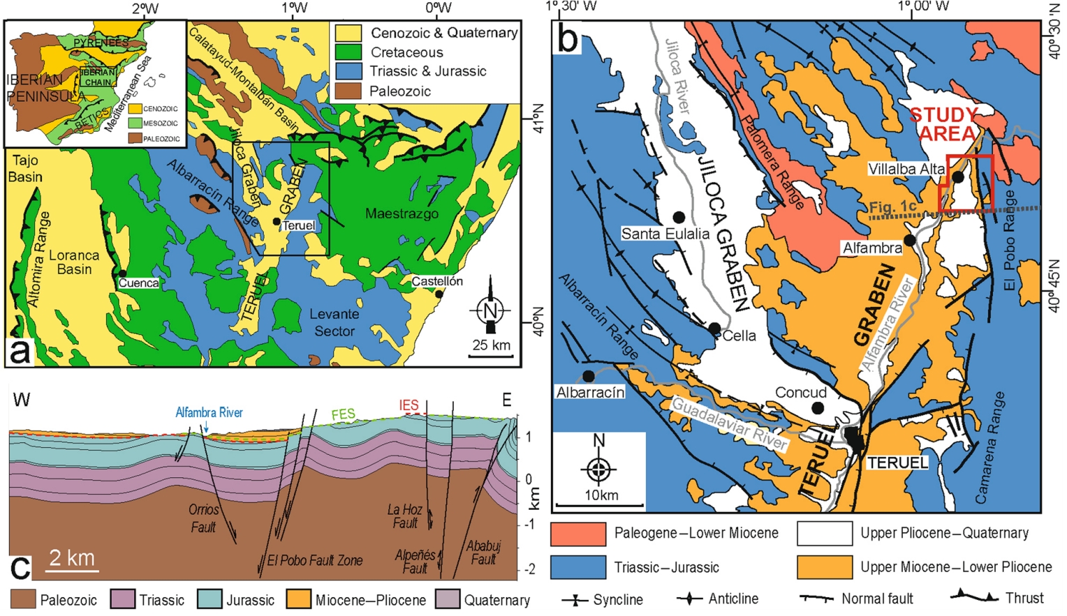
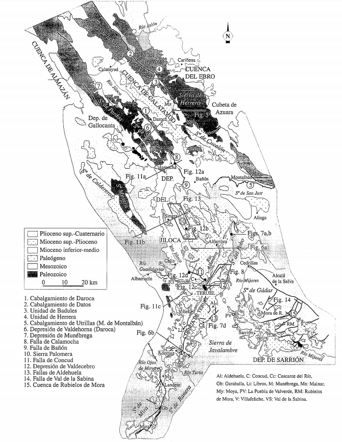
| Geological Setting | Iberian Range, Teruel-Jiloca Graben |
| Outcropping/buried | Outcropping |
| Evaporite unit/s name | Keuper facies |
| Evaporite unit/s age | Carnian-Rhaetian (Upper Triassic) |
| Evaporite unit/s origin | Marine |
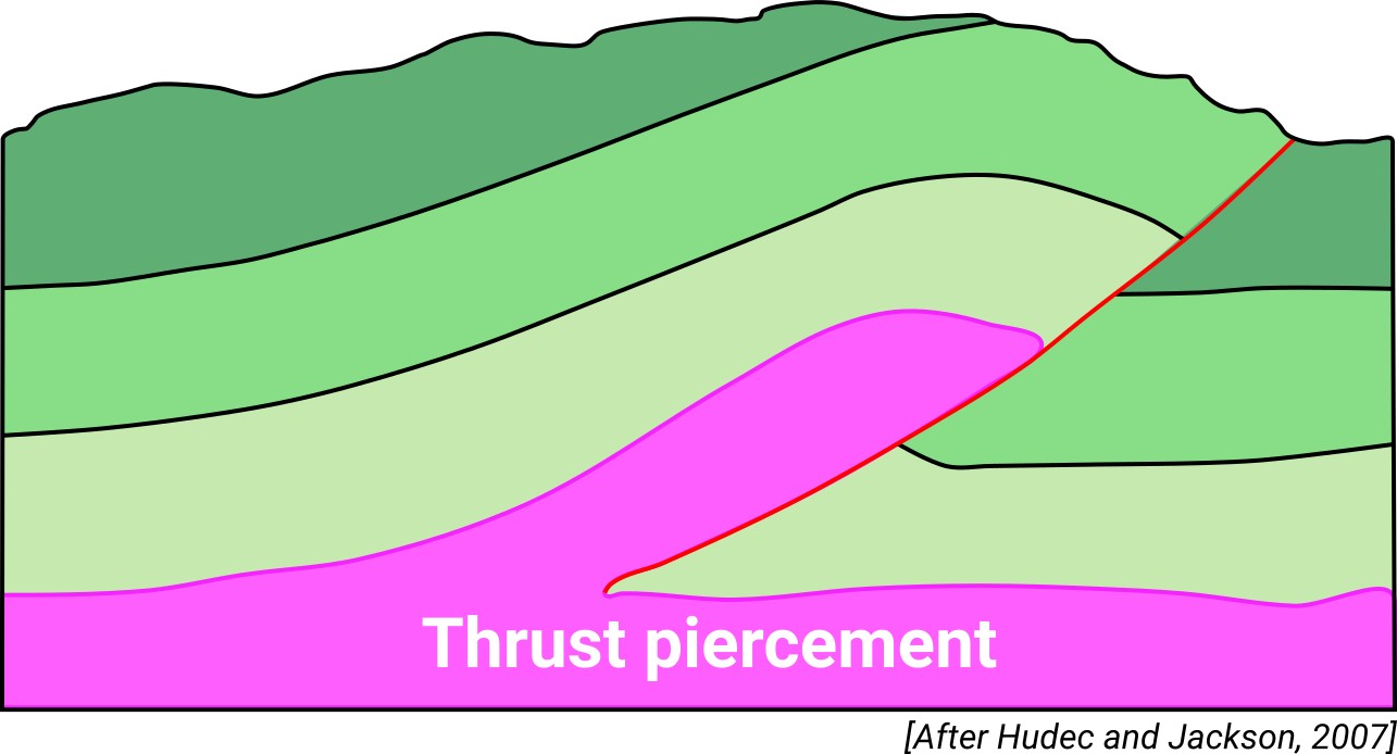
| Classif. (Hudec and Jackson, 2009) | Thrust piercement |
| Classif. (Jackson and Talbot, 1986) | Salt wall |
| Age of evaporite flow or deformation (when deformed) | Miocene to Pliocene, Quaternary / Active now(?) |
| Other comments | Recent paleoseismological studies of Quaternary (alluvial and colluvial detrital deposits) affected by the Concud Fault have recognized eleven events between ca. 74 ka BP and the present day (see Ezquerro et al., 2016). |
Generic Data
| Unique ID | 84 |
| Name | Concud |
| Structure type | Evaporite-detached thrust |
| Deformed/Undeformed | Deformed |
| Buried/Outcropping | Outcropping |
| Geological setting | Iberian Range |
| Geological Regional Setting | Teruel-Jiloca Graben |
| Evaporite unit/s name | Keuper facies |
| Evaporite unit/s age | Carnian-Rhaetian (Upper Triassic) |
| Evaporite unit/s era | Mesozoic |
| Evaporite unit/s origin | Marine |
| Evaporite unit/s composition | Shale-Gypsum-Anhydrite-Ophites |
| Post-kinematic unit/s (or post-evaporite units when evaporites are undeformed) | Quaternary (alluvial and colluvial detrital deposits) |
| Post-kinematic unit/s age (or post-evaporite units when evaporites are undeformed) | Pleistocene-Holocene |
| Classification (Hudec and Jackson, 2009) | Thrust piercement |
| Classification (Jackson and Talbot, 1986) | Salt wall |
| Mining activity? | N |
| Mining activity start | |
| Mining activity end | |
| Mining galleries? | |
| Mining products | |
| Mining sub-products | |
| Evaporite flow? | Y |
| Age of evaporite flow | Late Miocene-Active now |
| Flow or deformation triggering mechanisms | Active extensional system in the Iberian range |
| Flow-linked structures? | Y |
| Halokinetic structures | Low-angle unconformities / joints |
| Post-evaporite and pre-kinematic unit/s (overbuden) | Jurassic (limestones, dolostones, marlstones, bioclastic limestones marly limestones) |
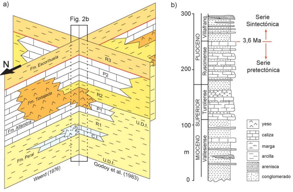
| Syn-kinematic unit/s | Miocene (shales, claystones, conglomerates, brecchias) ; Pliocene (conglomerates, alluvial deposits) ; Pleistocene-Holocene (alluvial and colluvial deposits) |
| Available seismic profiles | ILIHA C-F |
| Available boreholes | VENTA GUARINA (CAUDE-1) / CAUDE-2 / CELADAS |
| Additional comments | Recent paleo seismological studies of Quaternary (alluvial and colluvial detrital deposits) affected by the Concud Fault have recognized eleven events between ca. 74 ka BP and the present day (see Ezquerro et al., 2016) |
Mining Data
| UNIQUE_ID | 84 |
| Minning exploitations within <2km? | N |
| Historical/Active | |
| Exploitation name #1 | |
| Exploitation ID (Spanish National Mining Cadastre) #1 | |
| Municipality #1 | |
| Province #1 | |
| Company #1 | |
| Main minning Products #1 | |
| Exploitation name #2 | |
| Exploitation ID (Spanish National Mining Cadastre) #2 | |
| Municipality #2 | |
| Province #2 | |
| Company #2 | |
| Main minning Products #2 | |
| Exploitation name #3 | |
| Exploitation ID (Spanish National Mining Cadastre) #3 | |
| Municipality #3 | |
| Province #3 | |
| Company #3 | |
| Main minning Products #3 |
Quantitative Data
| UNIQUE_ID | 84 |
| Outcropping area (km2) | 1.65245 |
| Horizontal intersection area (km2) (when buried) | Not buried |
| Depth of intersection area (km2) (when buried) | Not buried |
| Max. Width (Km) | 1.51447414 |
| Max. Length (Km) | 7.19064132 |
| Max. Evaporites thickness (km) | 0.4 |
| Max. Deformation age (Ma) | 10 |
| Min. Deformation age (Ma) | Active |
| Deformation stages | 1 |
Reference Data
| UNIQUE_ID | 84 |
| Section source | Lafuente, P., Arlegui, L. E., Liesa, C. L., Pueyo, Ó., Simón, J. L., 2014. Spatial and temporal variation of palaeoseismic activity at an intraplate, historically quiescent structure: The Concud fault (Iberian Chain, Spain). Tectonophysics, 632, 167-187. [link] |
| Well / Borehole availability #1 | n.a. |
| Well / Borehole availability #2 | n.a. |
| Available data (Stratigraphy) #1 | Ezquerro, L., Moretti, M., Liesa, C. L., Luzón, A., Pueyo, E. L., Simón, J. L., 2016. Controls on space–time distribution of soft-sediment deformation structures: applying palaeomagnetic dating to approach the apparent recurrence period of paleoseisms at the Concud Fault (eastern Spain). Sedimentary Geology, 344, 91-111. [link] |
| Available data (Stratigraphy) #2 | Lafuente, P., Arlegui, L. E., Liesa, C. L., Pueyo, Ó., Simón, J. L., 2014. Spatial and temporal variation of palaeoseismic activity at an intraplate, historically quiescent structure: The Concud fault (Iberian Chain, Spain). Tectonophysics, 632, 167-187. [link] |
| Available data (Stratigraphy) #3 | Arche, A., López-Gómez, J., Herranz, P., Márquez-Aliaga, A., Sole de Porta, N., 1995. The Permian and Triassic sediments of the Teruel area, SE Iberian Ranges, Spain/Les sédiments permiens et triasiques de la région de Teruel, Chaîne Ibérique, Espagne. Sciences Géologiques, bulletins et mémoires, 48(1), 101-117. [link] |
| Available data (Stratigraphy) #4 | Alonso-Zarza, A. M., Meléndez, A., Martín-García, R., Herrero, M. J., Martín-Pérez, A., 2012. Discriminating between tectonism and climate signatures in palustrine deposits: lessons from the Miocene of the Teruel Graben, NE Spain. Earth-Science Reviews, 113(3-4), 141-160. [link] |
| Available data (Stratigraphy) #5 | Ezquerro, L., Simón, J. L., Luzón, A., Liesa, C. L., 2020. Segmentation and increasing activity in the Neogene-Quaternary Teruel Basin rift (Spain) revealed by morphotectonic approach. Journal of Structural Geology, 104043. [link] |
| Available data (Stratigraphy) #6 | Arche, A., Gómez, J. L., Marzo, M., Hernández, H. M. V., 2004. The siliciclastic Permian-Triassic deposits in Central and northeastern Iberian Peninsula (Iberian, Ebro and Catalan basins): a proposal for correlation. Geologica Acta, 4, 305-320. [link] |
| Regional Stratigraphy | Ezquerro, L., Lafuente, P., Pesquero, M. D., Alcalá, L., Arlegui, L., Liesa, C., Luque, L., Rodriguez-Pascua, M., Simón, J.L., 2012. Una cubeta endorreica residual Plio-Pleistocena en la zona de relevo entre las fallas de Concud y Teruel: implicaciones paleogeográficas. Revista de la Sociedad Geológica de España, 25, 157-175. [link] |
| Seismic data availability #1 | Diaz, J., Gallart Muset, J., Córdoba, D., Senos, L., Matias, L., Suriñach, E., …, Maguire, P., 2020. The ILIHA deep seismic sounding experiment (Iberian LIthosphere Heterogeneity and Anisotropy). DigitalCSIC – SEISDARE data repository. [link] |
| Seismic data availability #2 | n.a. |
| Seismic data availability #3 | n.a. |
| Available data (Structure) #1 | Ezquerro, L., Simón, J. L., Luzón, A., Liesa, C. L., 2020. Segmentation and increasing activity in the Neogene-Quaternary Teruel Basin rift (Spain) revealed by morphotectonic approach. Journal of Structural Geology, 104043. [link] |
| Available data (Structure) #2 | Lafuente, P., Arlegui, L. E., Casado, I., Ezquerro, L., Liesa, C. L., Pueyo, Ó., Simón, J. L., 2011. Geometría y cinemática de la zona de relevo entre las fallas neógeno-cuaternarias de Concud y Teruel (Cordillera Ibérica). Revista de la Sociedad Geológica de España, 24(1–2), 117-133. [link] |
| Available data (Structure) #3 | Ezquerro, L., Moretti, M., Liesa, C. L., Luzón, A., Pueyo, E. L., Simón, J. L., 2016. Controls on space–time distribution of soft-sediment deformation structures: applying palaeomagnetic dating to approach the apparent recurrence period of paleoseisms at the Concud Fault (eastern Spain). Sedimentary Geology, 344, 91-111. [link] |
| Available data (Structure) #4 | Lafuente, P., Arlegui, L. E., Liesa, C. L., Pueyo, Ó., Simón, J. L., 2014. Spatial and temporal variation of palaeoseismic activity at an intraplate, historically quiescent structure: The Concud fault (Iberian Chain, Spain). Tectonophysics, 632, 167-187. [link] |
| Available data (Structure) #5 | Gracia, A. C., Sainz, A. C., 2000. ¿Tiene el sistema de fosas de Teruel origen extensional?. Revista de la Sociedad Geológica de España, 13(3–4), 445-470. [link] |
| Available data (Structure) #6 | Peiro, A., Simón, J. L., Román-Berdiel, T., 2020. Fault relay zones evolving through distributed longitudinal fractures: The case of the Teruel graben system (Iberian Chain, Spain). Journal of Structural Geology, 131, 103942. [link] |
| Available data (Analogue modelling) #1 | n.a. |
| Available data (Analogue modelling) #2 | n.a. |
| Available data (Analogue modelling) #3 | n.a. |
| Available data (Gravimetry – Tomography) #1 | Ayala, C., Bohoyo, F., Maestro, A., Reguera, M. I., Torne, M., Rubio, F., Fernández, M., García-Lobón, J. L., 2016. Updated Bouguer anomalies of the Iberian Peninsula: a new perspective to interpret the regional geology. Journal of Maps, 12(5), 1089-1092. [link] |
| Available data (Gravimetry – Tomography) #2 | n.a. |
| Available data (Gravimetry – Tomography) #3 | n.a. |
| Available data (Geochemistry) #1 | Ortí, F., García-Veigas, J., Rossell, L., Jurado, M. J., Utrilla, R., 1996. Formaciones salinas de las cuencas triásicas en la Península Ibérica: Caracterización Petrológica y Geoquímica. Cuadernos de Geología Ibérica, 20, 13-35. [link] |
| Available data (Geochemistry) #2 | n.a. |
| Available data (Geochemistry) #3 | n.a. |
| Available data (Geochemistry) #4 | n.a. |
| Available data (Petrophysics) #1 | Ezquerro, L., Moretti, M., Liesa, C. L., Luzón, A., Pueyo, E. L., Simón, J. L., 2016. Controls on space–time distribution of soft-sediment deformation structures: applying palaeomagnetic dating to approach the apparent recurrence period of paleoseisms at the Concud Fault (eastern Spain). Sedimentary Geology, 344, 91-111. [link] |
| Available data (Petrophysics) #2 | n.a. |
| IGME Geological Map (MAGNA50) Sheet number | 567-Teruel. [link] |
| Other Maps #1 (source) | Ezquerro, L., Luzón, A., Simón, J. L., Liesa, C. L., 2019. Alluvial sedimentation and tectono-stratigraphic evolution in a narrow extensional zigzag basin margin (northern Teruel Basin, Spain). Journal of Palaeogeography, 8(1), 1-25. [link] |
| Other Maps #2 (source) | Gracia, A. C., Sainz, A. C., 2000. ¿ Tiene el sistema de fosas de Teruel origen extensional?. Revista de la Sociedad Geológica de España, 13(3–4), 445-470. [link] |
| Other related references #1 | Lago, M., Dumitrescu, R., Bastida, J., Arranz, E., Gil-Imaz, A., Pocovi, A., …, Vaquer, R., 1996. Características de los magmatismos alcalino y subalcalino, pre-Hettangiense, del borde SE de la Cordillera Ibérica. Cuadernos de Geología Ibérica, 20, 159-181. [link] |
| Other related references #2 | Rodríguez-López, J. P., Melendez, N., De Boer, P. L., Soria, A. R., 2012. Controls on marine–erg margin cycle variability: aeolian–marine interaction in the mid‐Cretaceous Iberian Desert System, Spain. Sedimentology, 59(2), 466-501. [link] |
| Other related references #3 | Guitérrez, F., Ortí, F., Gutiérrez, M., Pérez-González, A., Benito, G., Gracia, F. J., Durán, J. J., 2002. Paleosubsidence and active subsidence due to evaporite dissolution in Spain. Carbonates and Evaporites, 17(2), 121. [link] |
| Other related references #4 | n.a. |
Well and Seismic Data
| UNIQUE_ID | 84 |
| Seismic survey name #1 | ILIHA C-F |
| Across structure? #1 | Y |
| Seismic profile ID (IGME) #1 | n.a. |
| Seismic profile code #1 | n.a. |
| Seismic profile name #1 | n.a. |
| Seismic survey year #1 | n.a. |
| Data repository #1 | SeisDARE Database: https://digital.csic.es/handle/10261/101879 |
| Length (km) #1 | 879.18 |
| Seismic survey name #2 | |
| Across structure? #2 | |
| Seismic profile ID (IGME) #2 | |
| Seismic profile code #2 | |
| Seismic profile name #2 | |
| Seismic survey year #2 | |
| Data repository #2 | |
| Length (km) #2 | |
| Seismic survey name #3 | |
| Across structure? #3 | |
| Seismic profile ID (IGME) #3 | |
| Seismic profile code #3 | |
| Seismic profile name #3 | |
| Seismic survey year #3 | |
| Data repository #3 | |
| Length (km) #3 | |
| Seismic survey name #4 | |
| Across structure? #4 | |
| Seismic profile ID (IGME) #4 | |
| Seismic profile code #4 | |
| Seismic profile name #4 | |
| Seismic survey year #4 | |
| Data repository #4 | |
| Length (km) #4 | |
| Seismic survey name #5 | |
| Across structure? #5 | |
| Seismic profile ID (IGME) #5 | |
| Seismic profile code #5 | |
| Seismic profile name #5 | |
| Seismic survey year #5 | |
| Data repository #5 | |
| Length (km) #5 | |
| Seismic survey name #6 | |
| Across structure? #6 | |
| Seismic profile ID (IGME) #6 | |
| Seismic profile code #6 | |
| Seismic profile name #6 | |
| Seismic survey year #6 | |
| Data repository #6 | |
| Length (km) #6 | |
| Seismic survey name #7 | |
| Across structure? #7 | |
| Seismic profile ID (IGME) #7 | |
| Seismic profile code #7 | |
| Seismic profile name #7 | |
| Seismic survey year #7 | |
| Data repository #7 | |
| Length (km) #7 | |
| Seismic survey name #8 | |
| Across structure? #8 | |
| Seismic profile ID (IGME) #8 | |
| Seismic profile code #8 | |
| Seismic profile name #8 | |
| Seismic survey year #8 | |
| Data repository #8 | |
| Length (km) #8 | |
| Seismic survey name #9 | |
| Across structure? #9 | |
| Seismic profile ID (IGME) #9 | |
| Seismic profile code #9 | |
| Seismic profile name #9 | |
| Seismic survey year #9 | |
| Data repository #9 | |
| Length (km) #9 | |
| Seismic survey name #10 | |
| Across structure? #10 | |
| Seismic profile ID (IGME) #10 | |
| Seismic profile code #10 | |
| Seismic profile name #10 | |
| Seismic survey year #10 | |
| Data repository #10 | |
| Length (km) #10 | |
| Seismic survey name #11 | |
| Across structure? #11 | |
| Seismic profile ID (IGME) #11 | |
| Seismic profile code #11 | |
| Seismic profile name #11 | |
| Seismic survey year #11 | |
| Data repository #11 | |
| Length (km) #11 | |
| Seismic survey name #12 | |
| Across structure? #12 | |
| Seismic profile ID (IGME) #12 | |
| Seismic profile code #12 | |
| Seismic profile name #12 | |
| Seismic survey year #12 | |
| Data repository #12 | |
| Length (km) #12 | |
| Seismic survey name #13 | |
| Across structure? #13 | |
| Seismic profile ID (IGME) #13 | |
| Seismic profile code #13 | |
| Seismic profile name #13 | |
| Seismic survey year #13 | |
| Data repository #13 | |
| Length (km) #13 | |
| Seismic survey name #14 | |
| Across structure? #14 | |
| Seismic profile ID (IGME) #14 | |
| Seismic profile code #14 | |
| Seismic profile name #14 | |
| Seismic survey year #14 | |
| Data repository #14 | |
| Length (km) #14 | |
| Seismic survey name #15 | |
| Across structure? #15 | |
| Seismic profile ID (IGME) #15 | |
| Seismic profile code #15 | |
| Seismic profile name #15 | |
| Seismic survey year #15 | |
| Data repository #15 | |
| Length (km) #15 | |
| Seismic survey name #16 | |
| Across structure? #16 | |
| Seismic profile ID (IGME) #16 | |
| Seismic profile code #16 | |
| Seismic profile name #16 | |
| Seismic survey year #16 | |
| Data repository #16 | |
| Length (km) #16 | |
| Seismic survey name #17 | |
| Across structure? #17 | |
| Seismic profile ID (IGME) #17 | |
| Seismic profile code #17 | |
| Seismic profile name #17 | |
| Seismic survey year #17 | |
| Data repository #17 | |
| Length (km) #17 | |
| Seismic survey name #18 | |
| Across structure? #18 | |
| Seismic profile ID (IGME) #18 | |
| Seismic profile code #18 | |
| Seismic profile name #18 | |
| Seismic survey year #18 | |
| Data repository #18 | |
| Length (km) #18 | |
| Seismic survey name #19 | |
| Across structure? #19 | |
| Seismic profile ID (IGME) #19 | |
| Seismic profile code #19 | |
| Seismic profile name #19 | |
| Seismic survey year #19 | |
| Data repository #19 | |
| Length (km) #19 | |
| Seismic survey name #20 | |
| Across structure? #20 | |
| Seismic profile ID (IGME) #20 | |
| Seismic profile code #20 | |
| Seismic profile name #20 | |
| Seismic survey year #20 | |
| Data repository #20 | |
| Length (km) #20 | |
| Seismic survey name #21 | |
| Across structure? #21 | |
| Seismic profile ID (IGME) #21 | |
| Seismic profile code #21 | |
| Seismic profile name #21 | |
| Seismic survey year #21 | |
| Data repository #21 | |
| Length (km) #21 | |
| Borehole name #1 | VENTA GUARINA (CAUDE-1) |
| Company #1 | TRAGSA |
| Traget #1 | HYDROGEOLOGY |
| Across structure? #1 | N (within 5 km) |
| Borehole name #2 | CAUDE-2 |
| Company #2 | TRAGSA |
| Traget #2 | HYDROGEOLOGY |
| Across structure? #2 | N (within 5 km) |
| Borehole name #3 | CELADAS |
| Company #3 | CONFEDERACION HIDROGRAFICA DEL EBRO |
| Traget #3 | HYDROGEOLOGY |
| Across structure? #3 | N (within 5 km) |
| Borehole name #4 | |
| Company #4 | |
| Traget #4 | |
| Across structure? #4 | |
| Borehole name #5 | |
| Company #5 | |
| Traget #5 | |
| Across structure? #5 | |
| Borehole name #6 | |
| Company #6 | |
| Traget #6 | |
| Across structure? #6 | |
| Borehole name #7 | |
| Company #7 | |
| Traget #7 | |
| Across structure? #7 | |
| Borehole name #8 | |
| Company #8 | |
| Traget #8 | |
| Across structure? #8 | |
| Borehole name #9 | |
| Company #9 | |
| Traget #9 | |
| Across structure? #9 | |
| Borehole name #10 | |
| Company #10 | |
| Traget #10 | |
| Across structure? #10 | |
| Borehole name #11 | |
| Company #11 | |
| Traget #11 | |
| Across structure? #11 | |
| Borehole name #12 | |
| Company #12 | |
| Traget #12 | |
| Across structure? #12 | |
| Borehole name #13 | |
| Company #13 | |
| Traget #13 | |
| Across structure? #13 | |
| Borehole name #14 | |
| Company #14 | |
| Traget #14 | |
| Across structure? #14 | |
| Borehole name #15 | |
| Company #15 | |
| Traget #15 | |
| Across structure? #15 |
Geographical Data (EPSG:4326 - WGS 84)
| UNIQUE_ID | 84 |
| X Centroid (Structure shape) | -1.162208 |
| Y Centroid (Structure shape) | -1.162208 |
| Xmin (Structure shape) | -1.206904 |
| Xmax (Structure shape) | -1.134084 |
| Ymin (Structure shape) | 40.404231 |
| Ymax (Structure shape) | 40.440175 |
| Xmin seismic line #1 | -8.883330 |
| Xmax seismic line #1 | 0.807795 |
| Ymin seismic line #1 | 38.313300 |
| Ymax seismic line #1 | 40.877338 |
| Xmin seismic line #2 | |
| Xmax seismic line #2 | |
| Ymin seismic line #2 | |
| Ymax seismic line #2 | |
| Xmin seismic line #3 | |
| Xmax seismic line #3 | |
| Ymin seismic line #3 | |
| Ymax seismic line #3 | |
| Xmin seismic line #4 | |
| Xmax seismic line #4 | |
| Ymin seismic line #4 | |
| Ymax seismic line #4 | |
| Xmin seismic line #5 | |
| Xmax seismic line #5 | |
| Ymin seismic line #5 | |
| Ymax seismic line #5 | |
| Xmin seismic line #6 | |
| Xmax seismic line #6 | |
| Ymin seismic line #6 | |
| Ymax seismic line #6 | |
| Xmin seismic line #7 | |
| Xmax seismic line #7 | |
| Ymin seismic line #7 | |
| Ymax seismic line #7 | |
| Xmin seismic line #8 | |
| Xmax seismic line #8 | |
| Ymin seismic line #8 | |
| Ymax seismic line #8 | |
| Xmin seismic line #9 | |
| Xmax seismic line #9 | |
| Ymin seismic line #9 | |
| Ymax seismic line #9 | |
| Xmin seismic line #10 | |
| Xmax seismic line #10 | |
| Ymin seismic line #10 | |
| Ymax seismic line #10 | |
| Xmin seismic line #11 | |
| Xmax seismic line #11 | |
| Ymin seismic line #11 | |
| Ymax seismic line #11 | |
| Xmin seismic line #12 | |
| Xmax seismic line #12 | |
| Ymin seismic line #12 | |
| Ymax seismic line #12 | |
| Xmin seismic line #13 | |
| Xmax seismic line #13 | |
| Ymin seismic line #13 | |
| Ymax seismic line #13 | |
| Xmin seismic line #14 | |
| Xmax seismic line #14 | |
| Ymin seismic line #14 | |
| Ymax seismic line #14 | |
| Xmin seismic line #15 | |
| Xmax seismic line #15 | |
| Ymin seismic line #15 | |
| Ymax seismic line #15 | |
| Xmin seismic line #16 | |
| Xmax seismic line #16 | |
| Ymin seismic line #16 | |
| Ymax seismic line #16 | |
| Xmin seismic line #17 | |
| Xmax seismic line #17 | |
| Ymin seismic line #17 | |
| Ymax seismic line #17 | |
| Xmin seismic line #18 | |
| Xmax seismic line #18 | |
| Ymin seismic line #18 | |
| Ymax seismic line #18 | |
| Xmin seismic line #19 | |
| Xmax seismic line #19 | |
| Ymin seismic line #19 | |
| Ymax seismic line #19 | |
| Xmin seismic line #20 | |
| Xmax seismic line #20 | |
| Ymin seismic line #20 | |
| Ymax seismic line #20 | |
| Xmin seismic line #21 | |
| Xmax seismic line #21 | |
| Ymin seismic line #21 | |
| Ymax seismic line #21 | |
| X borehole #1 | -1.200462 |
| Y borehole #1 | 40.414599 |
| X borehole #2 | -1.200460 |
| Y borehole #2 | 40.415139 |
| X borehole #3 | -1.203192 |
| Y borehole #3 | 40.458170 |
| X borehole #4 | |
| Y borehole #4 | |
| X borehole #5 | |
| Y borehole #5 | |
| X borehole #6 | |
| Y borehole #6 | |
| X borehole #7 | |
| Y borehole #7 | |
| X borehole #8 | |
| Y borehole #8 | |
| X borehole #9 | |
| Y borehole #9 | |
| X borehole #10 | |
| Y borehole #10 | |
| X borehole #11 | |
| Y borehole #11 | |
| X borehole #12 | |
| Y borehole #12 | |
| X borehole #13 | |
| Y borehole #13 | |
| X borehole #14 | |
| Y borehole #14 | |
| X borehole #15 | |
| Y borehole #15 |

