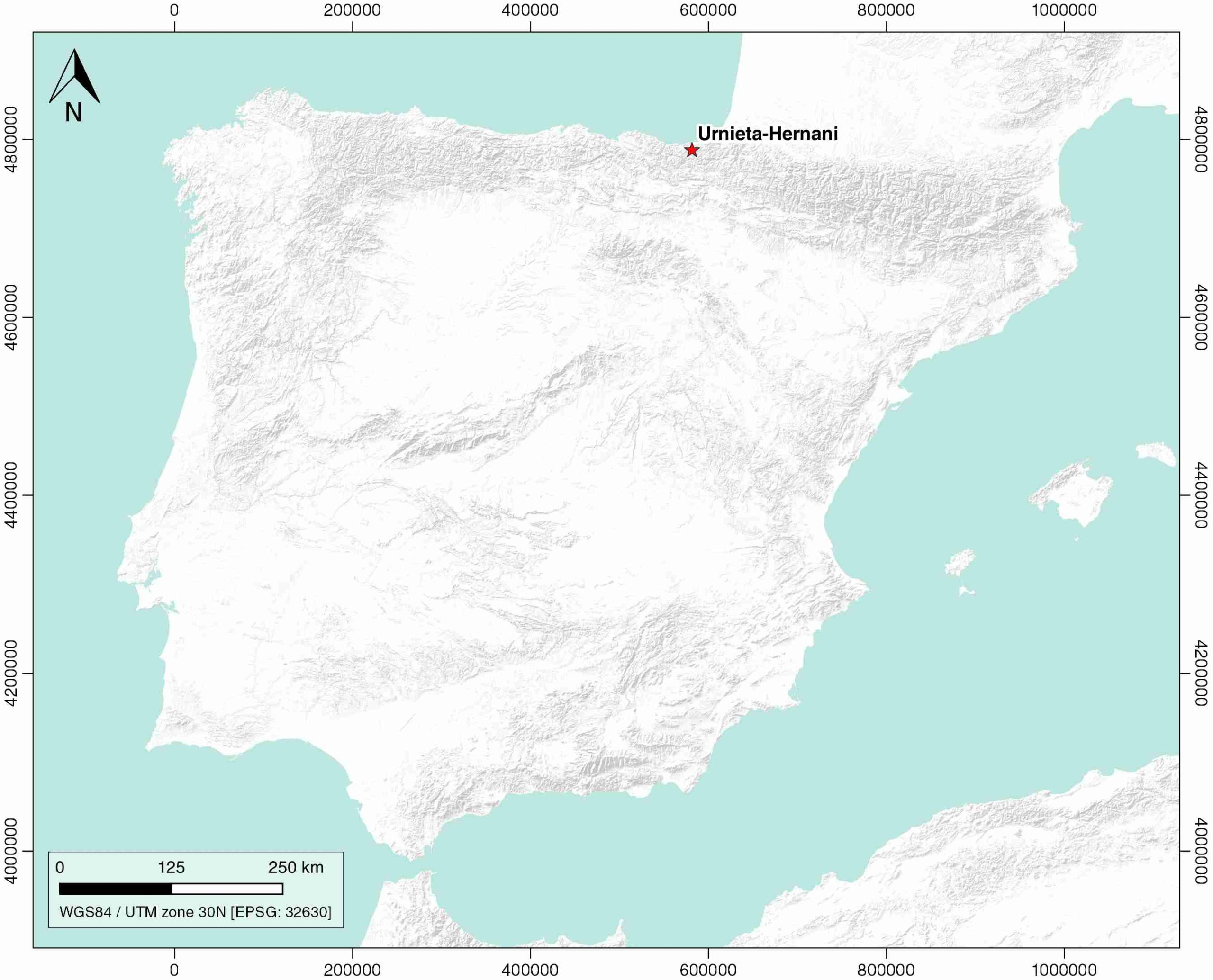
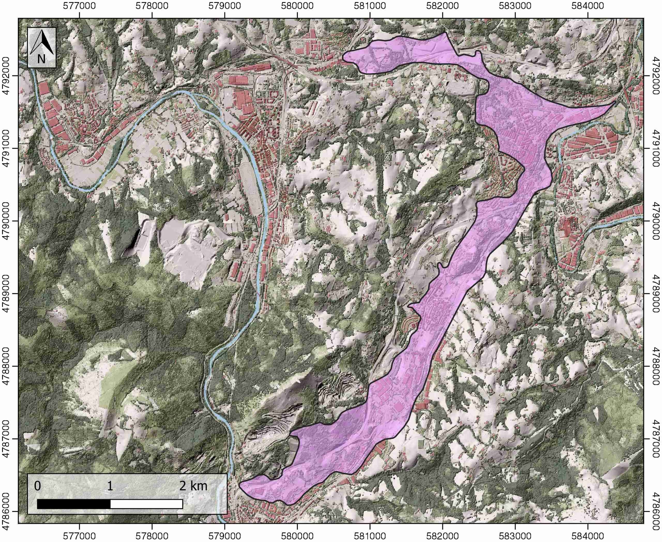
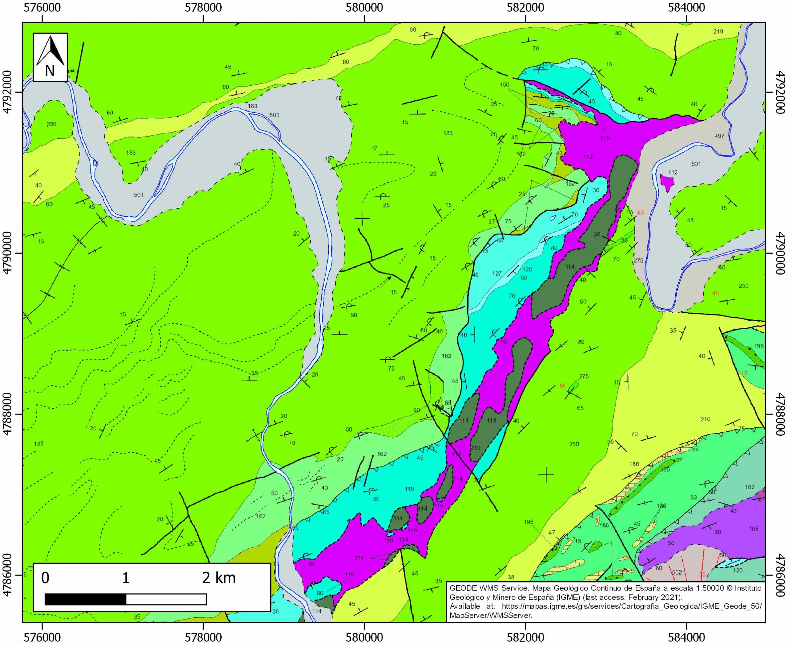
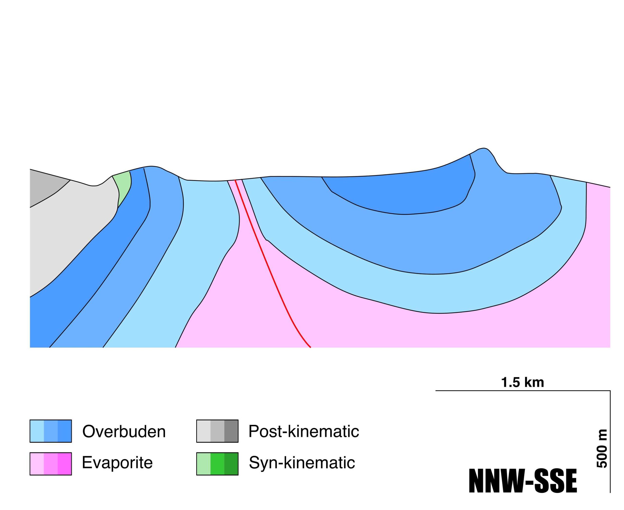
Urnieta-Hernani
ID #090
General Information
| Structure type | Evaporite-cored anticline |
| Deformed/Undeformed | Deformed |
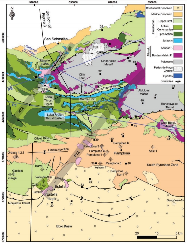
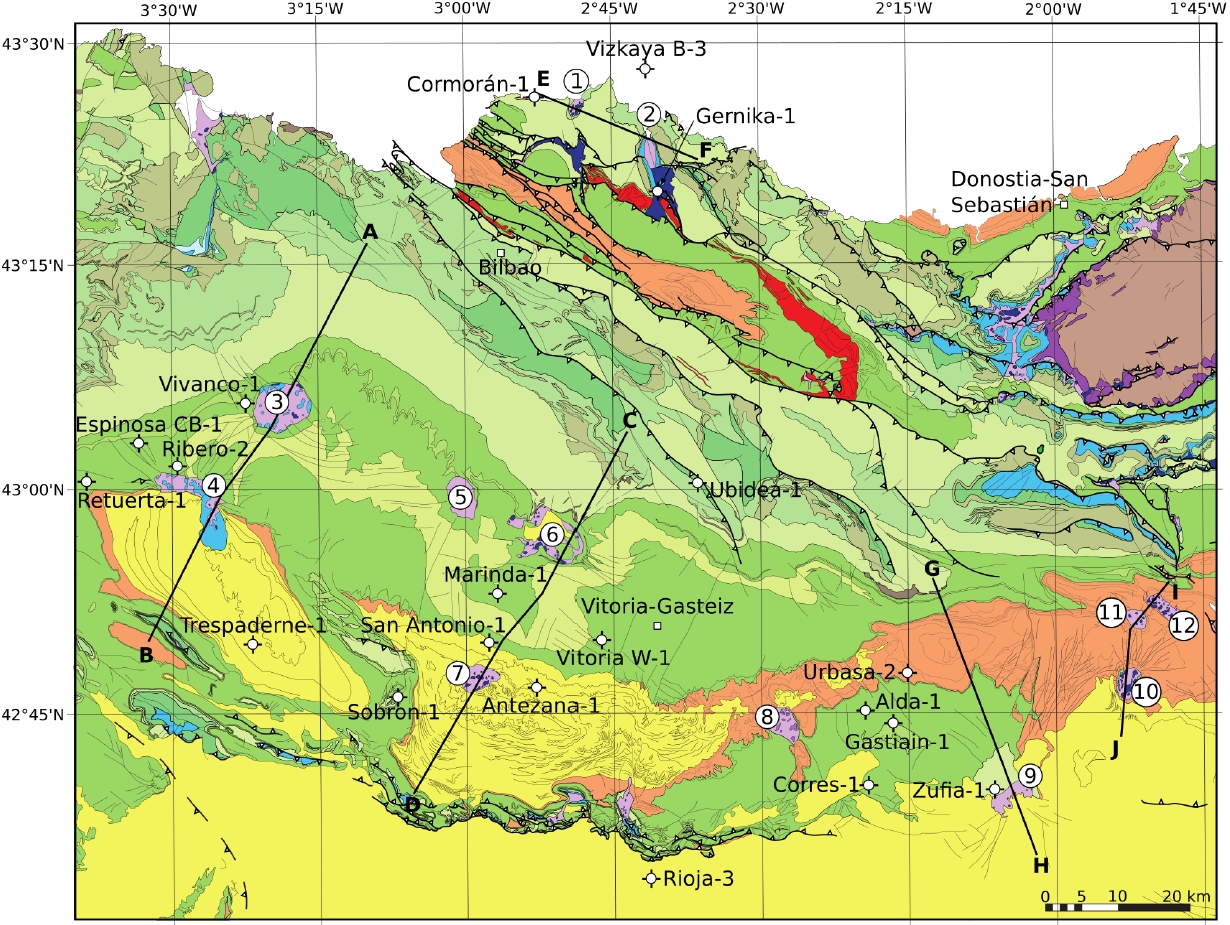
| Geological Setting | Basque Arc, Basque-Cantabrian Basin |
| Outcropping/buried | Outcropping |
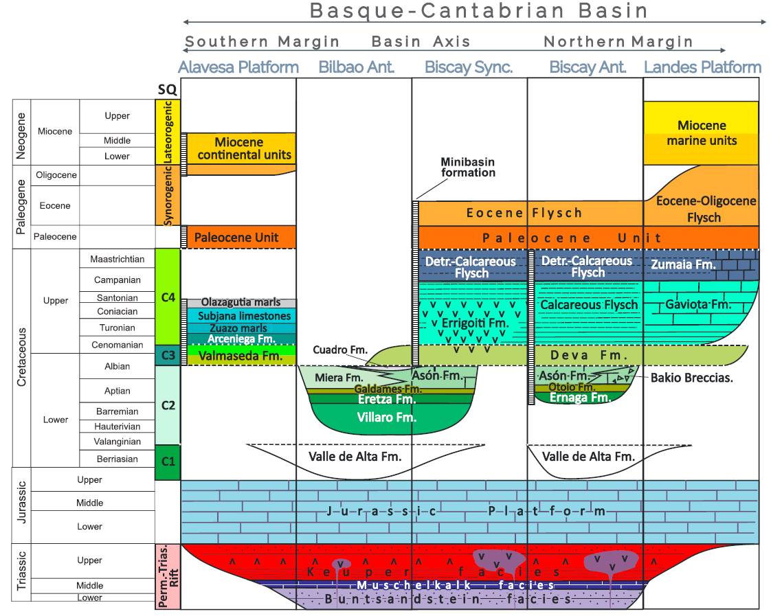
| Evaporite unit/s name | Keuper facies |
| Evaporite unit/s age | Carnian-Rhaetian (Upper Triassic) |
| Evaporite unit/s origin | Marine |
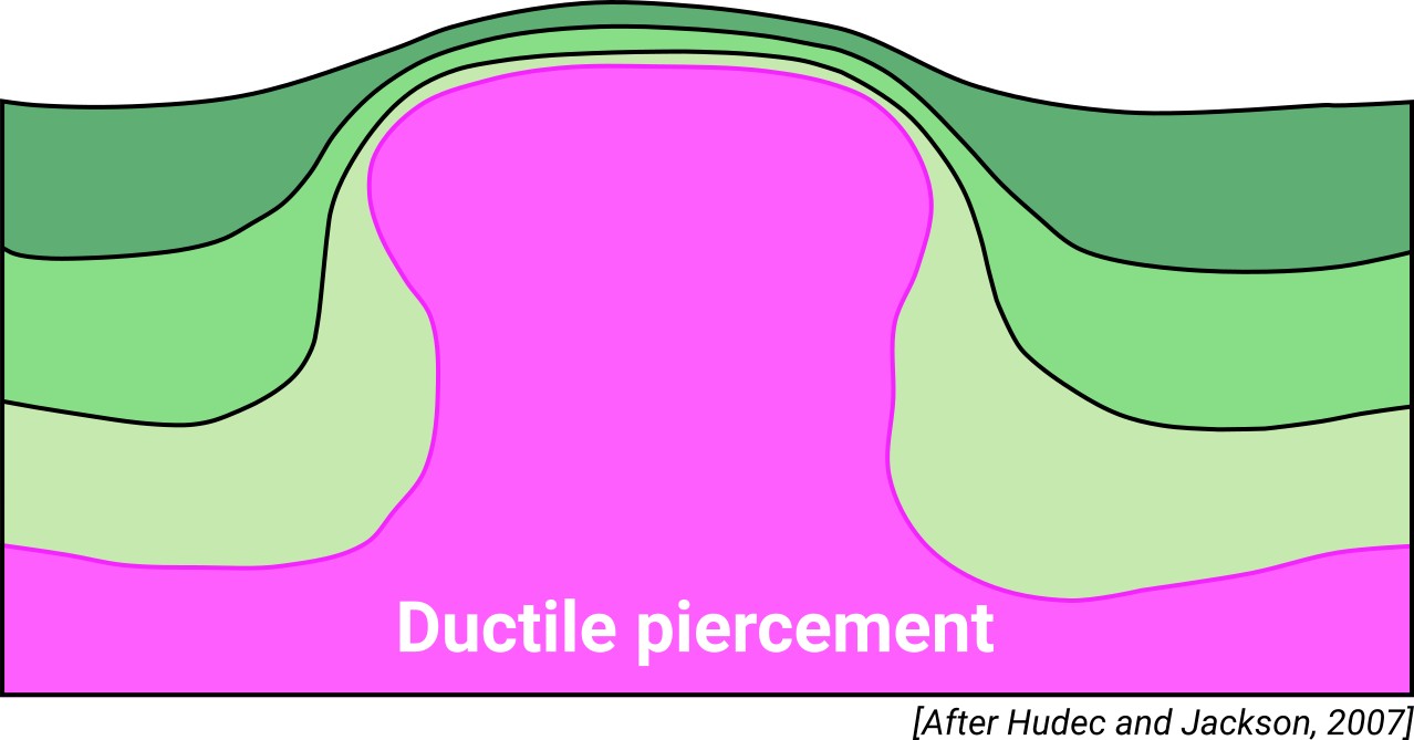
| Classif. (Hudec and Jackson, 2009) | Ductile piercement |
| Classif. (Jackson and Talbot, 1986) | Salt wall |
| Age of evaporite flow or deformation (when deformed) | Middle Cretaceous |
| Other comments | Txoritokieta-Astigarraga (ID #089), Urnieta-Hernani and Oiartzun (ID #091) diapirs are nowadays located along the trace of ancient basement faults, probably denoting the preferential migration of the decollement halokinetic layer towards them (see Bodego et al., 2014) |
Generic Data
| Unique ID | 90 |
| Name | Urnieta-Hernani |
| Structure type | Evaporite-cored anticline |
| Deformed/Undeformed | Deformed |
| Buried/Outcropping | Outcropping |
| Geological setting | Basque-Cantabrian Basin |
| Geological Regional Setting | Basque Arc |
| Evaporite unit/s name | Keuper facies |
| Evaporite unit/s age | Carnian-Rhaetian (Upper Triassic) |
| Evaporite unit/s era | Mesozoic |
| Evaporite unit/s origin | Marine |
| Evaporite unit/s composition | Red Claystones-Gypsum-Halite |
| Post-kinematic unit/s (or post-evaporite units when evaporites are undeformed) | Middle-Upper Cenomanian (hemipelagic limestones and marls, turbiditic sandstones) ; Quaternary (alluvial and colluvial detrital deposits) |
| Post-kinematic unit/s age (or post-evaporite units when evaporites are undeformed) | Upper Cretaceous-Holocene |
| Classification (Hudec and Jackson, 2009) | Ductile piercement |
| Classification (Jackson and Talbot, 1986) | Salt wall |
| Mining activity? | Y |
| Mining activity start | |
| Mining activity end | Active |
| Mining galleries? | N |
| Mining products | Limestone (other uses) |
| Mining sub-products | – |
| Evaporite flow? | Y |
| Age of evaporite flow | Upper Albian-Lower Cenomanian |
| Flow or deformation triggering mechanisms | Cretaceous rifting of the Basque-Cantabrian basin |
| Flow-linked structures? | Y |
| Halokinetic structures | Normal faults / progressive unconformities / anticline-syncline folding |
| Post-evaporite and pre-kinematic unit/s (overbuden) | Jurassic (micritic limestones, marlstones and marly limestones) ; Neocomian («serpulid» limestones) ; Lower Aptian (Errenaga Fm., mudstones, limestones, sandstones and wackestones) ; Upper Aptian-Lower Albian (Burunzta limestone Fm., limestones and calcarenites); Early Upper Albian (Azkorte and Abalotz Fms., sandstones, claystones) Early Upper Albian (Oriamendi Fm., mudstones and sandstones) |
| Syn-kinematic unit/s | Upper Albian-Lower Cenomanian (Kostartzu and Lasarte Fms., breccia and megabreccias, sandstones, limestones and mudstones) |
| Available seismic profiles | BR-34 / BR-35-PR / BR-39 / BR-32 / BR-34 / BR-32 / BR-39 / BR-35-PR / |
| Available boreholes | |
| Additional comments | Txoritokieta-Astigarraga, Urnieta-Hernani and Oiartzun diapirs are nowadays located along the trace of ancient basement faults, probably denoting the preferential migration of the decollement halokinetic layer towards them (see Bodego et al., 2014) |
Mining Data
| UNIQUE_ID | 90 |
| Minning exploitations within <2km? | Y |
| Historical/Active | Active |
| Exploitation name #1 | SAN JOSE |
| Exploitation ID (Spanish National Mining Cadastre) #1 | 4745 |
| Municipality #1 | Urnieta |
| Province #1 | GUIPUZCOA |
| Company #1 | AIZKIBEL, SA |
| Main minning Products #1 | Limestone (other uses) |
| Exploitation name #2 | BURUNTZA |
| Exploitation ID (Spanish National Mining Cadastre) #2 | 4642 |
| Municipality #2 | Andoain |
| Province #2 | GUIPUZCOA |
| Company #2 | SOCIEDAD FINANCIERA Y MINERA, S.A. |
| Main minning Products #2 | Limestone (other uses) |
| Exploitation name #3 | ARROBIETA ARAMBURU |
| Exploitation ID (Spanish National Mining Cadastre) #3 | 4643 |
| Municipality #3 | Andoain |
| Province #3 | GUIPUZCOA |
| Company #3 | SOCIEDAD FINANCIERA Y MINERA, S.A. |
| Main minning Products #3 | Marlstone |
Quantitative Data
| UNIQUE_ID | 90 |
| Outcropping area (km2) | 4.91112 |
| Horizontal intersection area (km2) (when buried) | Not buried |
| Depth of intersection area (km2) (when buried) | Not buried |
| Max. Width (Km) | 7.30947249 |
| Max. Length (Km) | 3.5066239 |
| Max. Evaporites thickness (km) | 0.4 |
| Max. Deformation age (Ma) | 106 |
| Min. Deformation age (Ma) | 98 |
| Deformation stages | 1 |
Reference Data
| UNIQUE_ID | 90 |
| Section source | Bodego, A., Iriarte, E., López-Horgue, M. A., Álvarez, I., 2018. Rift-margin extensional forced folds and salt tectonics in the eastern Basque-Cantabrian rift basin (western Pyrenees). Marine and Petroleum Geology, 91, 667-682. [link] |
| Well / Borehole availability #1 | n.a. |
| Well / Borehole availability #2 | n.a. |
| Available data (Stratigraphy) #1 | Bodego, A., Iriarte, E., López-Horgue, M. A., Álvarez, I., 2018. Rift-margin extensional forced folds and salt tectonics in the eastern Basque-Cantabrian rift basin (western Pyrenees). Marine and Petroleum Geology, 91, 667-682. [link] |
| Available data (Stratigraphy) #2 | Bodego, A., Agirrezabala, L. M., 2017. The Andatza coarse-grained turbidite system (westernmost Pyrenees): Stratigraphy, sedimentology and structural control. Estudios Geológicos, 73(1), 3. [link] |
| Available data (Stratigraphy) #3 | Bodego, A., Iriarte, E., Agirrezabala, L. M., García-Mondéjar, J., López-Horgue, M. A., 2015. Synextensional mid-Cretaceous stratigraphic architecture of the eastern Basque–Cantabrian basin margin (western Pyrenees). Cretaceous Research, 55, 229-261. [link] |
| Available data (Stratigraphy) #4 | Mathey, B., 1986. Les flyschs crétacé supérieur des Pyrénées basques: âge, anatomie, origine du matériel, milieu de dépôt et relations avec l’ouverture du Golfe de Gascogne. Memoires G eologique de l’Universit e de Dijon 12, 402. [link] |
| Available data (Stratigraphy) #5 | Campos, J., 1979. Estudio geológico del Pirineo vasco al W del río Bidasoa. Munibe, SC Aranzadi, 31(1-2), 3-139. [link] |
| Available data (Stratigraphy) #6 | Bodego, A., 2011. Evolución tectosedimentaria durante el Cretácico medio del borde noreste de la Cuenca Vasco-Cantábrica (Pirineo occidental) [Ph.D. thesis]: UPV/EHU, 317 pp. [link] |
| Regional Stratigraphy | Pedrera, A., García‐Senz, J., Ayala, C., Ruiz‐Constán, A., Rodríguez‐Fernández, L. R., Robador, A., González Menéndez, L., 2017. Reconstruction of the exhumed mantle across the North Iberian Margin by crustal‐scale 3‐D gravity inversion and geological cross section. Tectonics, 36, 3155-3177. [link] |
| Seismic data availability #1 | n.a. |
| Seismic data availability #2 | n.a. |
| Seismic data availability #3 | n.a. |
| Available data (Structure) #1 | Bodego, A., Iriarte, E., López-Horgue, M. A., Álvarez, I., 2018. Rift-margin extensional forced folds and salt tectonics in the eastern Basque-Cantabrian rift basin (western Pyrenees). Marine and Petroleum Geology, 91, 667-682. [link] |
| Available data (Structure) #2 | Bodego, A., Iriarte, E., Agirrezabala, L. M., García-Mondéjar, J., López-Horgue, M. A., 2015. Synextensional mid-Cretaceous stratigraphic architecture of the eastern Basque–Cantabrian basin margin (western Pyrenees). Cretaceous Research, 55, 229-261. [link] |
| Available data (Structure) #3 | Iriarte, E., 2004. La Depresión Intermedia entre Leitza y Elizondo (Pirineo occidental): estratigrafía y relaciones tectónica-sedimentación durante el Cretácico [Ph.D. thesis]: UPV/EHU, 310pp. [link] |
| Available data (Structure) #4 | Bodego, A., Agirrezabala, L. M., 2017. The Andatza coarse-grained turbidite system (westernmost Pyrenees): Stratigraphy, sedimentology and structural control. Estudios Geológicos, 73(1), 3. [link] |
| Available data (Structure) #5 | Cámara, P., 2017. Salt and Strike-Slip Tectonics as Main Drivers in the Structural Evolution of the Basque-Cantabrian Basin, Spain. In Permo-Triassic Salt Provinces of Europe, North Africa and the Atlantic Margins (pp. 371-393). Elsevier. [link] |
| Available data (Structure) #6 | n.a. |
| Available data (Analogue modelling) #1 | n.a. |
| Available data (Analogue modelling) #2 | n.a. |
| Available data (Analogue modelling) #3 | n.a. |
| Available data (Gravimetry – Tomography) #1 | Ayala, C., Bohoyo, F., Maestro, A., Reguera, M. I., Torne, M., Rubio, F., Fernández, M., García-Lobón, J. L., 2016. Updated Bouguer anomalies of the Iberian Peninsula: a new perspective to interpret the regional geology. Journal of Maps, 12(5), 1089-1092. [link] |
| Available data (Gravimetry – Tomography) #2 | n.a. |
| Available data (Gravimetry – Tomography) #3 | n.a. |
| Available data (Geochemistry) #1 | Ortí, F., García-Veigas, J., Rossell, L., Jurado, M. J., Utrilla, R., 1996. Formaciones salinas de las cuencas triásicas en la Península Ibérica: Caracterización Petrológica y Geoquímica. Cuadernos de Geología Ibérica, 20, 13-35. [link] |
| Available data (Geochemistry) #2 | Iribar, V., Ábalos, B. 2011. The geochemical and isotopic record of evaporite recycling in spas and salterns of the Basque Cantabrian basin, Spain. Applied geochemistry, 26, 1315-1329. [link] |
| Available data (Geochemistry) #3 | n.a. |
| Available data (Geochemistry) #4 | n.a. |
| Available data (Petrophysics) #1 | Llamas, B., Castañeda, M. C., Laín, C., Pous, J., 2017. Study of the Basque–Cantabrian basin as a suitable region for the implementation of an energy storage system based on compressed air energy storage (CAES). Environmental Earth Sciences, 76(5), 204. [link] |
| Available data (Petrophysics) #2 | Soto, R., Beamud, E., Roca, E., Carola, E., Almar, Y., 2017. Distinguishing the effect of diapir growth on magnetic fabrics of syn-diapiric overburden rocks: Basque-Cantabrian basin, Northern Spain. Terra Nova 29, 191-201. http://dx.doi.org/10.1111/ter.12262 |
| IGME Geological Map (MAGNA50) Sheet number | 64-San Sebastián. [link] |
| Other Maps #1 (source) | DeFelipe, I., Álvarez Pulgar, F. J., & Pedreira Rodríguez, D., 2018. Crustal structure of the Eastern Basque-Cantabrian Zone-western Pyrenees: from the Cretaceous hyperextension to the Cenozoic inversion. Revista de la Sociedad Geológica de España, 31 (2), 69-82. [link] |
| Other Maps #2 (source) | Poprawski, Y., Basile, C., 2018. Long-lasting diapir growth history in the Basque-Cantabrian basin (Northern Spain): a review. Conference poster, Advances in Salt Tectonics: Observations, Applications, and Perspective: In Honor of Martin P.A. Jackson. [link] |
| Other related references #1 | Cámara, P., 2020. Inverted turtle salt anticlines in the eastern basque-cantabrian basin, Spain. Marine and Petroleum Geology, 104358. [link] |
| Other related references #2 | Ábalos, B., 2016. Geologic map of the Basque-Cantabrian Basin and a new tectonic interpretation of the Basque Arc. International Journal of Earth Sciences, 105, 2327-2354. [link] |
| Other related references #3 | Serrano, A., Martínez del Olmo, W., 2004. Estructuras diapíricas de la zona meridional de la Cuenca Vasco-Cantábrica. In: Vera, J.A. (Ed.), Geología de España. Sociedad Geológica de España. Instituto Geológico y Minero de España, Madrid, pp. 334–338. [link] |
| Other related references #4 | Martín-Chivelet, J., López-Gómez, J., Aguado, R., Arias, C., Arribas, J., Arribas, M. E., … , Casas-Sainz, A., 2019. The Late Jurassic–Early Cretaceous Rifting. In (Quesada C., Oliveira J., eds.): The Geology of Iberia: A Geodynamic Approach. Regional Geology Reviews. Springer, Cham. [link] |
Well and Seismic Data
| UNIQUE_ID | 90 |
| Seismic survey name #1 | 8B2-BR |
| Across structure? #1 | Y |
| Seismic profile ID (IGME) #1 | 9118 |
| Seismic profile code #1 | 13690 |
| Seismic profile name #1 | BR-34 |
| Seismic survey year #1 | 1978 |
| Data repository #1 | SIGEOF Data Catalogue (Section available under request). ©Instituto Geológico y Minero de España (IGME). https://info.igme.es/SIGEOF/ |
| Length (km) #1 | 17.98 |
| Seismic survey name #2 | 8B2-BR |
| Across structure? #2 | Y |
| Seismic profile ID (IGME) #2 | 9117 |
| Seismic profile code #2 | 13689 |
| Seismic profile name #2 | BR-35-PR |
| Seismic survey year #2 | 1978 |
| Data repository #2 | SIGEOF Data Catalogue (Private access section). ©Instituto Geológico y Minero de España (IGME). https://info.igme.es/SIGEOF/ |
| Length (km) #2 | 25.02 |
| Seismic survey name #3 | 8B2-BR |
| Across structure? #3 | Y |
| Seismic profile ID (IGME) #3 | 9115 |
| Seismic profile code #3 | 13687 |
| Seismic profile name #3 | BR-39 |
| Seismic survey year #3 | 1978 |
| Data repository #3 | SIGEOF Data Catalogue (Section available under request). ©Instituto Geológico y Minero de España (IGME). https://info.igme.es/SIGEOF/ |
| Length (km) #3 | 9.96 |
| Seismic survey name #4 | 8B2-BR |
| Across structure? #4 | Y |
| Seismic profile ID (IGME) #4 | 9119 |
| Seismic profile code #4 | 13691 |
| Seismic profile name #4 | BR-32 |
| Seismic survey year #4 | 1978 |
| Data repository #4 | SIGEOF Data Catalogue (Section available under request). ©Instituto Geológico y Minero de España (IGME). https://info.igme.es/SIGEOF/ |
| Length (km) #4 | 16.42 |
| Seismic survey name #5 | 8B2-BR |
| Across structure? #5 | N (within 3km) |
| Seismic profile ID (IGME) #5 | 9118 |
| Seismic profile code #5 | 13690 |
| Seismic profile name #5 | BR-34 |
| Seismic survey year #5 | 1978 |
| Data repository #5 | SIGEOF Data Catalogue (Section available under request). ©Instituto Geológico y Minero de España (IGME). https://info.igme.es/SIGEOF/ |
| Length (km) #5 | 17.98 |
| Seismic survey name #6 | 8B2-BR |
| Across structure? #6 | N (within 3km) |
| Seismic profile ID (IGME) #6 | 9119 |
| Seismic profile code #6 | 13691 |
| Seismic profile name #6 | BR-32 |
| Seismic survey year #6 | 1978 |
| Data repository #6 | SIGEOF Data Catalogue (Section available under request). ©Instituto Geológico y Minero de España (IGME). https://info.igme.es/SIGEOF/ |
| Length (km) #6 | 16.42 |
| Seismic survey name #7 | 8B2-BR |
| Across structure? #7 | N (within 3km) |
| Seismic profile ID (IGME) #7 | 9115 |
| Seismic profile code #7 | 13687 |
| Seismic profile name #7 | BR-39 |
| Seismic survey year #7 | 1978 |
| Data repository #7 | SIGEOF Data Catalogue (Section available under request). ©Instituto Geológico y Minero de España (IGME). https://info.igme.es/SIGEOF/ |
| Length (km) #7 | 9.96 |
| Seismic survey name #8 | 8B2-BR |
| Across structure? #8 | N (within 3km) |
| Seismic profile ID (IGME) #8 | 9117 |
| Seismic profile code #8 | 13689 |
| Seismic profile name #8 | BR-35-PR |
| Seismic survey year #8 | 1978 |
| Data repository #8 | SIGEOF Data Catalogue (Private access section). ©Instituto Geológico y Minero de España (IGME). https://info.igme.es/SIGEOF/ |
| Length (km) #8 | 25.02 |
| Seismic survey name #9 | |
| Across structure? #9 | |
| Seismic profile ID (IGME) #9 | |
| Seismic profile code #9 | |
| Seismic profile name #9 | |
| Seismic survey year #9 | |
| Data repository #9 | |
| Length (km) #9 | |
| Seismic survey name #10 | |
| Across structure? #10 | |
| Seismic profile ID (IGME) #10 | |
| Seismic profile code #10 | |
| Seismic profile name #10 | |
| Seismic survey year #10 | |
| Data repository #10 | |
| Length (km) #10 | |
| Seismic survey name #11 | |
| Across structure? #11 | |
| Seismic profile ID (IGME) #11 | |
| Seismic profile code #11 | |
| Seismic profile name #11 | |
| Seismic survey year #11 | |
| Data repository #11 | |
| Length (km) #11 | |
| Seismic survey name #12 | |
| Across structure? #12 | |
| Seismic profile ID (IGME) #12 | |
| Seismic profile code #12 | |
| Seismic profile name #12 | |
| Seismic survey year #12 | |
| Data repository #12 | |
| Length (km) #12 | |
| Seismic survey name #13 | |
| Across structure? #13 | |
| Seismic profile ID (IGME) #13 | |
| Seismic profile code #13 | |
| Seismic profile name #13 | |
| Seismic survey year #13 | |
| Data repository #13 | |
| Length (km) #13 | |
| Seismic survey name #14 | |
| Across structure? #14 | |
| Seismic profile ID (IGME) #14 | |
| Seismic profile code #14 | |
| Seismic profile name #14 | |
| Seismic survey year #14 | |
| Data repository #14 | |
| Length (km) #14 | |
| Seismic survey name #15 | |
| Across structure? #15 | |
| Seismic profile ID (IGME) #15 | |
| Seismic profile code #15 | |
| Seismic profile name #15 | |
| Seismic survey year #15 | |
| Data repository #15 | |
| Length (km) #15 | |
| Seismic survey name #16 | |
| Across structure? #16 | |
| Seismic profile ID (IGME) #16 | |
| Seismic profile code #16 | |
| Seismic profile name #16 | |
| Seismic survey year #16 | |
| Data repository #16 | |
| Length (km) #16 | |
| Seismic survey name #17 | |
| Across structure? #17 | |
| Seismic profile ID (IGME) #17 | |
| Seismic profile code #17 | |
| Seismic profile name #17 | |
| Seismic survey year #17 | |
| Data repository #17 | |
| Length (km) #17 | |
| Seismic survey name #18 | |
| Across structure? #18 | |
| Seismic profile ID (IGME) #18 | |
| Seismic profile code #18 | |
| Seismic profile name #18 | |
| Seismic survey year #18 | |
| Data repository #18 | |
| Length (km) #18 | |
| Seismic survey name #19 | |
| Across structure? #19 | |
| Seismic profile ID (IGME) #19 | |
| Seismic profile code #19 | |
| Seismic profile name #19 | |
| Seismic survey year #19 | |
| Data repository #19 | |
| Length (km) #19 | |
| Seismic survey name #20 | |
| Across structure? #20 | |
| Seismic profile ID (IGME) #20 | |
| Seismic profile code #20 | |
| Seismic profile name #20 | |
| Seismic survey year #20 | |
| Data repository #20 | |
| Length (km) #20 | |
| Seismic survey name #21 | |
| Across structure? #21 | |
| Seismic profile ID (IGME) #21 | |
| Seismic profile code #21 | |
| Seismic profile name #21 | |
| Seismic survey year #21 | |
| Data repository #21 | |
| Length (km) #21 | |
| Borehole name #1 | |
| Company #1 | |
| Traget #1 | |
| Across structure? #1 | |
| Borehole name #2 | |
| Company #2 | |
| Traget #2 | |
| Across structure? #2 | |
| Borehole name #3 | |
| Company #3 | |
| Traget #3 | |
| Across structure? #3 | |
| Borehole name #4 | |
| Company #4 | |
| Traget #4 | |
| Across structure? #4 | |
| Borehole name #5 | |
| Company #5 | |
| Traget #5 | |
| Across structure? #5 | |
| Borehole name #6 | |
| Company #6 | |
| Traget #6 | |
| Across structure? #6 | |
| Borehole name #7 | |
| Company #7 | |
| Traget #7 | |
| Across structure? #7 | |
| Borehole name #8 | |
| Company #8 | |
| Traget #8 | |
| Across structure? #8 | |
| Borehole name #9 | |
| Company #9 | |
| Traget #9 | |
| Across structure? #9 | |
| Borehole name #10 | |
| Company #10 | |
| Traget #10 | |
| Across structure? #10 | |
| Borehole name #11 | |
| Company #11 | |
| Traget #11 | |
| Across structure? #11 | |
| Borehole name #12 | |
| Company #12 | |
| Traget #12 | |
| Across structure? #12 | |
| Borehole name #13 | |
| Company #13 | |
| Traget #13 | |
| Across structure? #13 | |
| Borehole name #14 | |
| Company #14 | |
| Traget #14 | |
| Across structure? #14 | |
| Borehole name #15 | |
| Company #15 | |
| Traget #15 | |
| Across structure? #15 |
Geographical Data (EPSG:4326 - WGS 84)
| UNIQUE_ID | 90 |
| X Centroid (Structure shape) | -1.991828 |
| Y Centroid (Structure shape) | -1.991828 |
| Xmin (Structure shape) | -2.024789 |
| Xmax (Structure shape) | -1.960110 |
| Ymin (Structure shape) | 43.223330 |
| Ymax (Structure shape) | 43.281774 |
| Xmin seismic line #1 | -2.002679 |
| Xmax seismic line #1 | -1.794398 |
| Ymin seismic line #1 | 43.276478 |
| Ymax seismic line #1 | 43.318560 |
| Xmin seismic line #2 | -2.265678 |
| Xmax seismic line #2 | -1.988441 |
| Ymin seismic line #2 | 43.236877 |
| Ymax seismic line #2 | 43.278143 |
| Xmin seismic line #3 | -1.998535 |
| Xmax seismic line #3 | -1.983079 |
| Ymin seismic line #3 | 43.226601 |
| Ymax seismic line #3 | 43.313060 |
| Xmin seismic line #4 | -2.148003 |
| Xmax seismic line #4 | -1.967135 |
| Ymin seismic line #4 | 43.195478 |
| Ymax seismic line #4 | 43.246966 |
| Xmin seismic line #5 | -2.002679 |
| Xmax seismic line #5 | -1.794398 |
| Ymin seismic line #5 | 43.276478 |
| Ymax seismic line #5 | 43.318560 |
| Xmin seismic line #6 | -2.148003 |
| Xmax seismic line #6 | -1.967135 |
| Ymin seismic line #6 | 43.195478 |
| Ymax seismic line #6 | 43.246966 |
| Xmin seismic line #7 | -1.998535 |
| Xmax seismic line #7 | -1.983079 |
| Ymin seismic line #7 | 43.226601 |
| Ymax seismic line #7 | 43.313060 |
| Xmin seismic line #8 | -2.265678 |
| Xmax seismic line #8 | -1.988441 |
| Ymin seismic line #8 | 43.236877 |
| Ymax seismic line #8 | 43.278143 |
| Xmin seismic line #9 | |
| Xmax seismic line #9 | |
| Ymin seismic line #9 | |
| Ymax seismic line #9 | |
| Xmin seismic line #10 | |
| Xmax seismic line #10 | |
| Ymin seismic line #10 | |
| Ymax seismic line #10 | |
| Xmin seismic line #11 | |
| Xmax seismic line #11 | |
| Ymin seismic line #11 | |
| Ymax seismic line #11 | |
| Xmin seismic line #12 | |
| Xmax seismic line #12 | |
| Ymin seismic line #12 | |
| Ymax seismic line #12 | |
| Xmin seismic line #13 | |
| Xmax seismic line #13 | |
| Ymin seismic line #13 | |
| Ymax seismic line #13 | |
| Xmin seismic line #14 | |
| Xmax seismic line #14 | |
| Ymin seismic line #14 | |
| Ymax seismic line #14 | |
| Xmin seismic line #15 | |
| Xmax seismic line #15 | |
| Ymin seismic line #15 | |
| Ymax seismic line #15 | |
| Xmin seismic line #16 | |
| Xmax seismic line #16 | |
| Ymin seismic line #16 | |
| Ymax seismic line #16 | |
| Xmin seismic line #17 | |
| Xmax seismic line #17 | |
| Ymin seismic line #17 | |
| Ymax seismic line #17 | |
| Xmin seismic line #18 | |
| Xmax seismic line #18 | |
| Ymin seismic line #18 | |
| Ymax seismic line #18 | |
| Xmin seismic line #19 | |
| Xmax seismic line #19 | |
| Ymin seismic line #19 | |
| Ymax seismic line #19 | |
| Xmin seismic line #20 | |
| Xmax seismic line #20 | |
| Ymin seismic line #20 | |
| Ymax seismic line #20 | |
| Xmin seismic line #21 | |
| Xmax seismic line #21 | |
| Ymin seismic line #21 | |
| Ymax seismic line #21 | |
| X borehole #1 | |
| Y borehole #1 | |
| X borehole #2 | |
| Y borehole #2 | |
| X borehole #3 | |
| Y borehole #3 | |
| X borehole #4 | |
| Y borehole #4 | |
| X borehole #5 | |
| Y borehole #5 | |
| X borehole #6 | |
| Y borehole #6 | |
| X borehole #7 | |
| Y borehole #7 | |
| X borehole #8 | |
| Y borehole #8 | |
| X borehole #9 | |
| Y borehole #9 | |
| X borehole #10 | |
| Y borehole #10 | |
| X borehole #11 | |
| Y borehole #11 | |
| X borehole #12 | |
| Y borehole #12 | |
| X borehole #13 | |
| Y borehole #13 | |
| X borehole #14 | |
| Y borehole #14 | |
| X borehole #15 | |
| Y borehole #15 |

