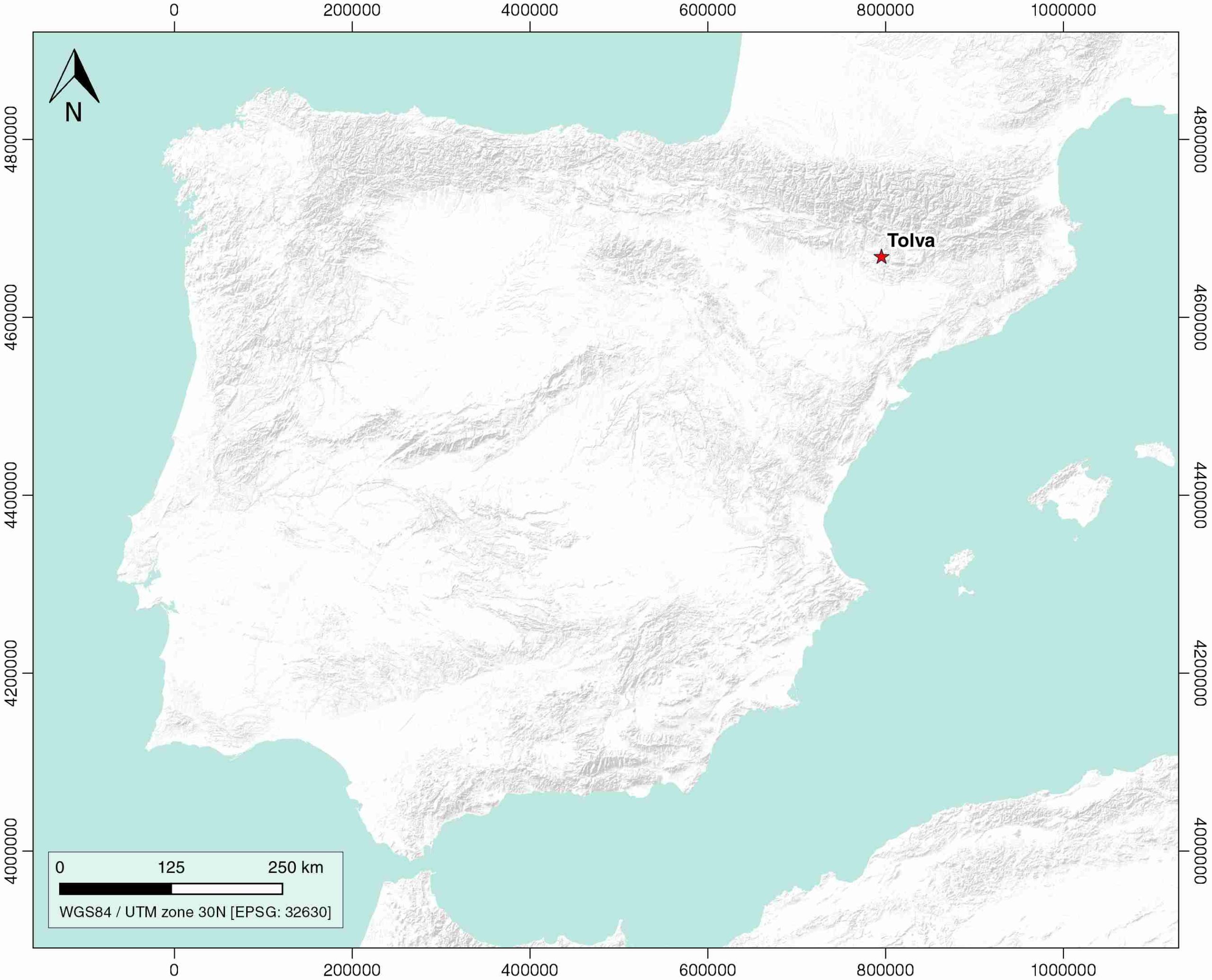
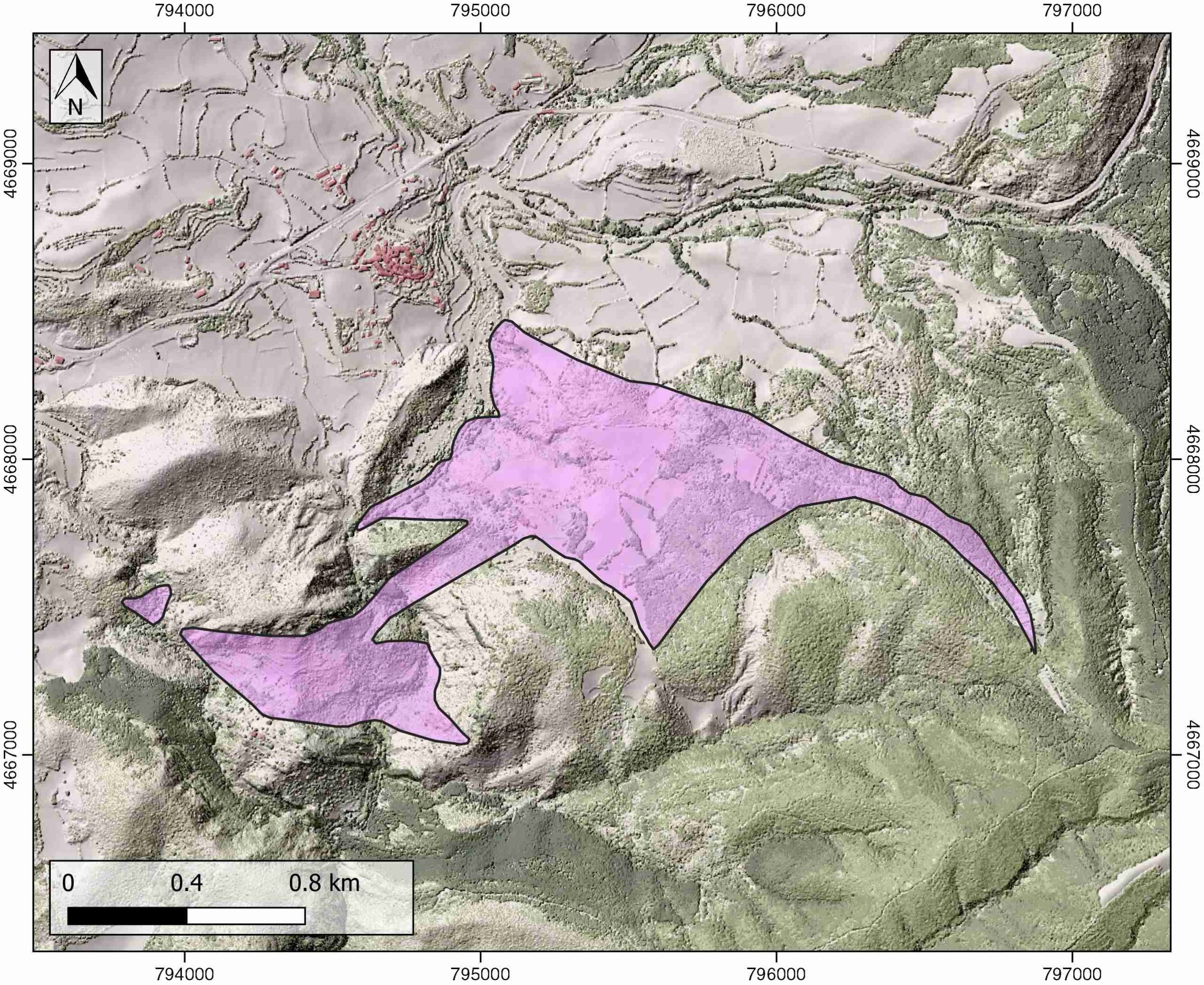
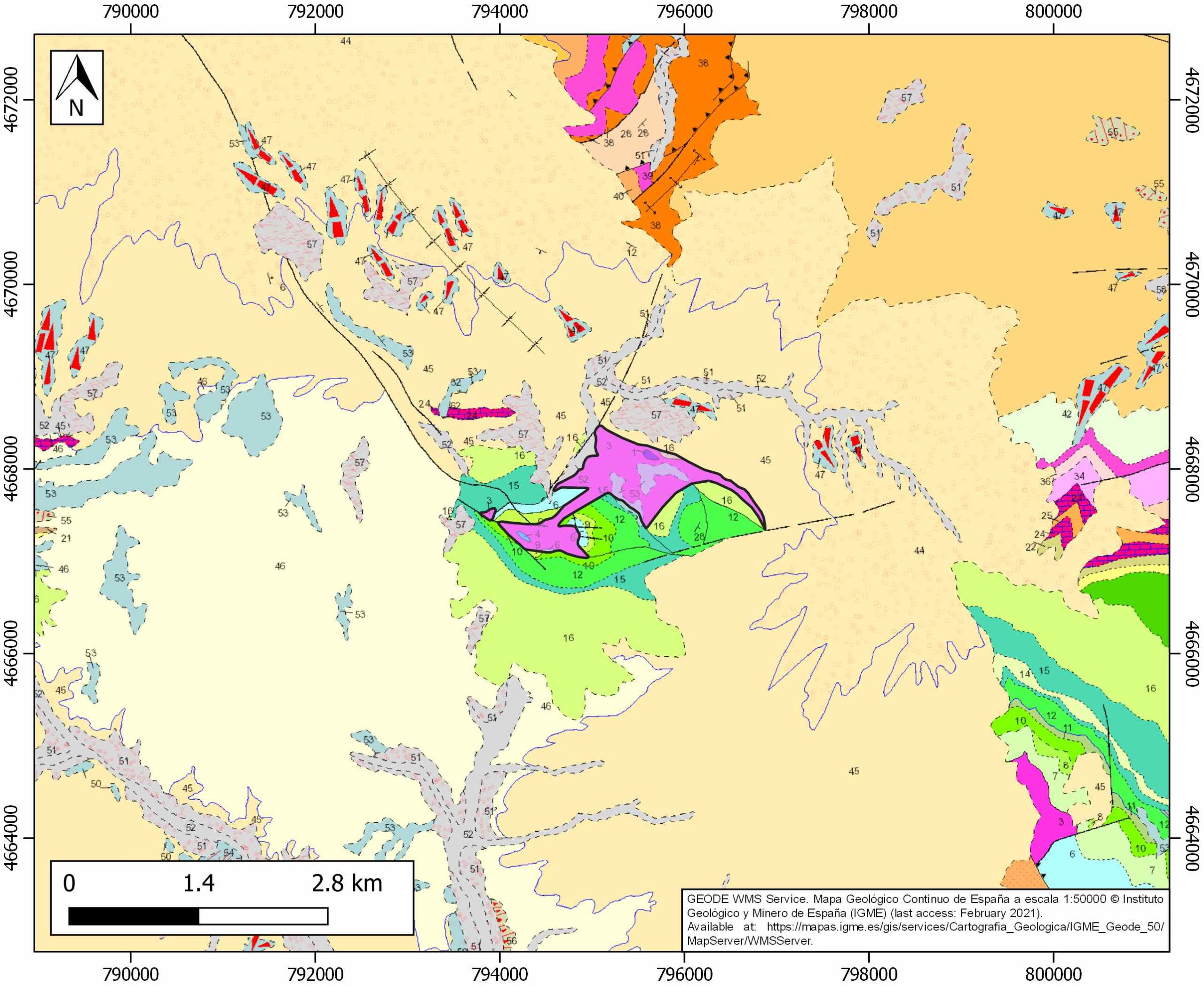
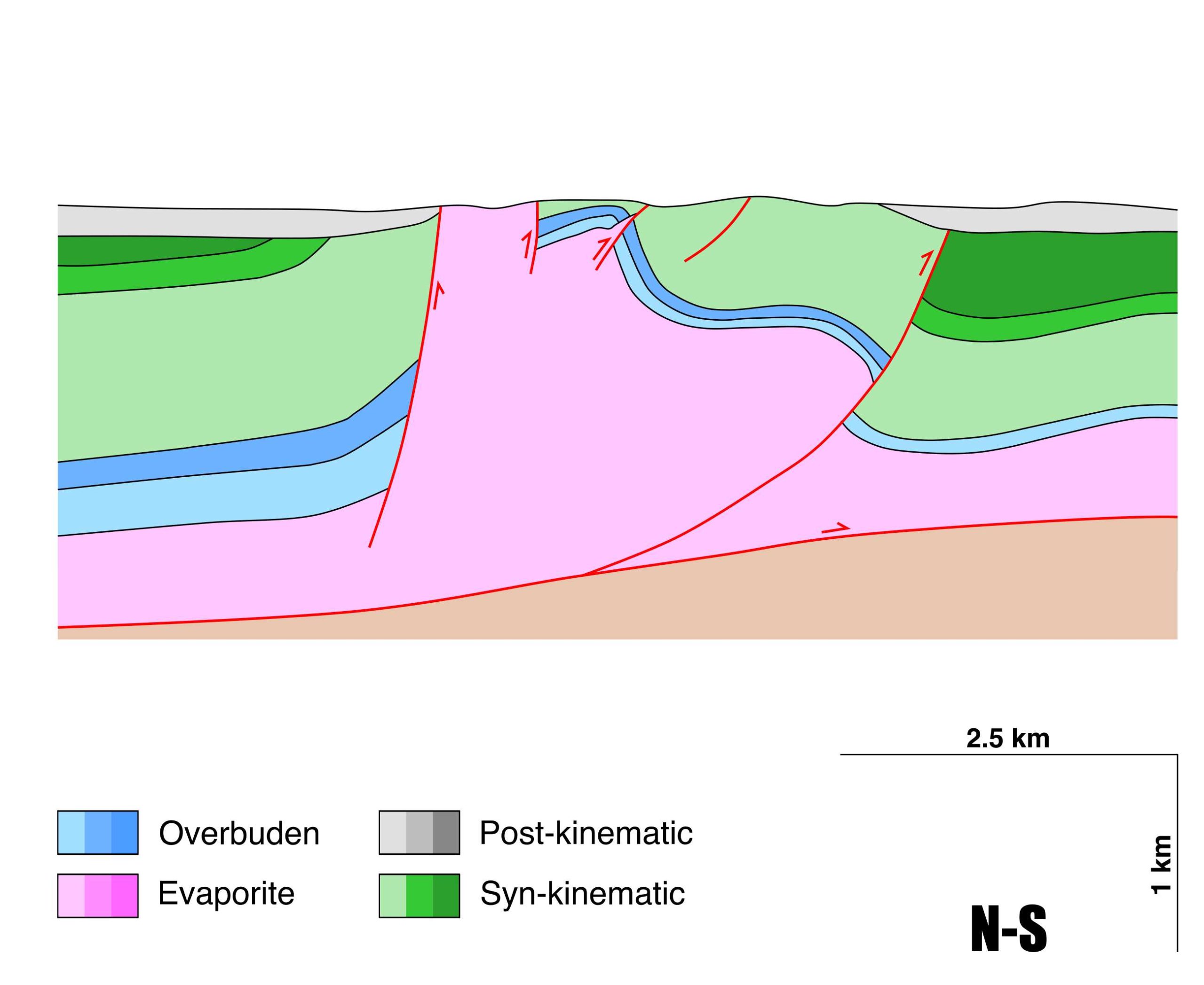
General Information
| Structure type | Evaporite-cored anticline |
| Deformed/Undeformed | Deformed |
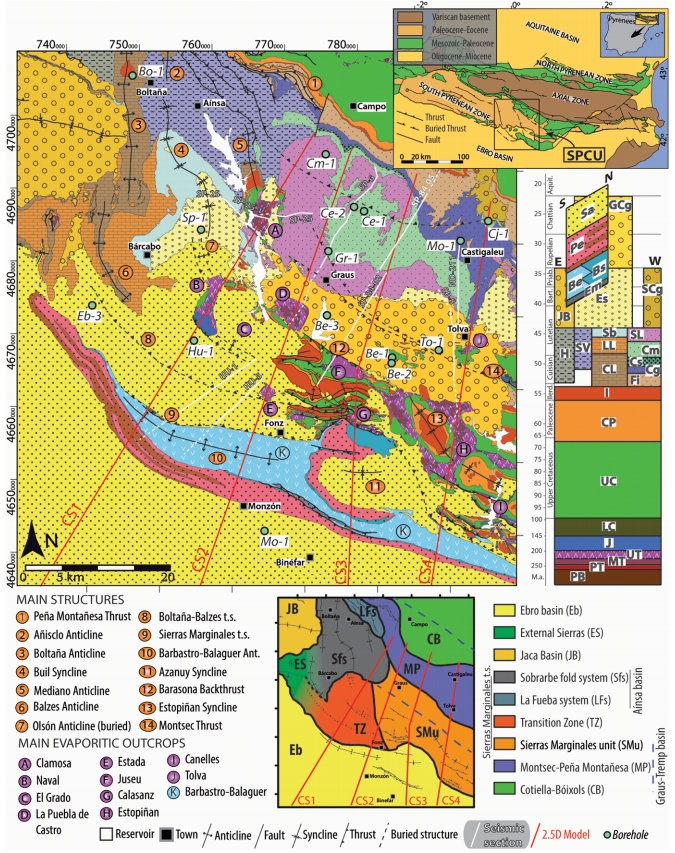
| Geological Setting | South Pyrenees Central Unit (Sierras Marginales; Boltaña-Balzes thrust sheet) |
| Outcropping/buried | Outcropping |
| Evaporite unit/s name | El Pont de Suert Fm. |
| Evaporite unit/s age | Upper Anisian and Carnian-Rhaetian (Middle-Upper Triassic) |
| Evaporite unit/s origin | Marine |
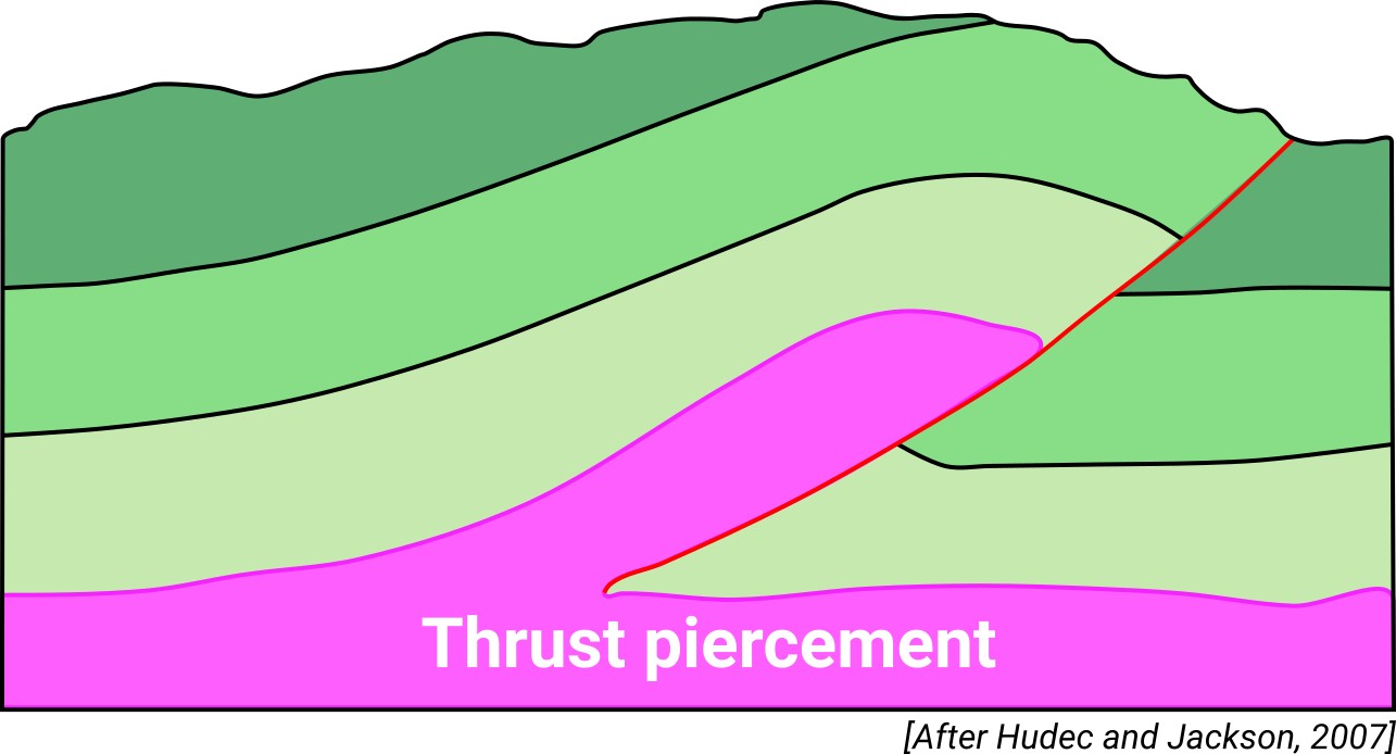
| Classif. (Hudec and Jackson, 2009) | Passive piercement |
| Classif. (Jackson and Talbot, 1986) | Salt anticline |
| Age of evaporite flow or deformation (when deformed) | Upper Cretaceous to Oligocene |
| Other comments | Genetically linked to the Tolva anticline, developed during the alpine compression in the Graus-Tremp basin (see Franco-Balaguer and Casas-Sainz, 2016). |
Generic Data
| Unique ID | 95 |
| Name | Tolva |
| Structure type | Evaporite-cored anticline |
| Deformed/Undeformed | Deformed |
| Buried/Outcropping | Outcropping |
| Geological setting | Southern Pyrenees |
| Geological Regional Setting | South Pyrenees Central Unit (Sierras Marginales; Boltaña-Balzes thrust sheet) |
| Evaporite unit/s name | El Pont de Suert Fm. (Middle Muschelkalk and Keuper Facies) |
| Evaporite unit/s age | Upper Anisian and Carnian-Rhaetian (Middle-Upper Triassic) |
| Evaporite unit/s era | Mesozoic |
| Evaporite unit/s origin | Marine |
| Evaporite unit/s composition | Shale-Gypsum-Anhydrite-Ophites |
| Post-kinematic unit/s (or post-evaporite units when evaporites are undeformed) | Quaternary (alluvial and colluvial detrital deposits) |
| Post-kinematic unit/s age (or post-evaporite units when evaporites are undeformed) | Pleistocene-Holocene |
| Classification (Hudec and Jackson, 2009) | Passive piercement |
| Classification (Jackson and Talbot, 1986) | Salt anticline |
| Mining activity? | N |
| Mining activity start | |
| Mining activity end | |
| Mining galleries? | |
| Mining products | |
| Mining sub-products | |
| Evaporite flow? | Y |
| Age of evaporite flow | Coniacian/Santonian-Lower Oligocene |
| Flow or deformation triggering mechanisms | E-W regional normal fault |
| Flow-linked structures? | Y |
| Halokinetic structures | Normal faults / progressive unconformities / anticline-syncline folding |
| Post-evaporite and pre-kinematic unit/s (overbuden) | Lower Jurassic (tabular limestones) ; Upper Jurassic (limestones, dolostones) ; Lower Cretaceous (marlstones, limestones, marly limestones) Early Upper Cretaceous (Santa Fe Fm., limestones) |
| Syn-kinematic unit/s | Upper Cretaceous (Calizas de La Pardina, Calizas de La Cova y Font de les Bagasses Fms., limestones, marlstones and marly limestones) ; Late Upper Cretaceous (Calizas de Terradets Fm., limestones) ; Palaeocene (Tremp and Arén Fms., sandstones) ; Lower Eocene (limestones with alveolines, marly limestones) ; Early Oligocene (Graus Fm., conglomerates and sandstones) |
| Available seismic profiles | ND-132 / SP-9 / SP-8 / ND-132 / ND-211 / SP-9 / ND-111 / ND-198 / ND-208 / ND-125 / ND-129 / ND-127 / ND-208 |
| Available boreholes | TOLVA |
| Additional comments | Genetically linked to the Tolva anticline, developed during the alpine compression in the Graus-Tremp basin (see Franco-Balaguer and Casas-Sainz, 2016) |
Mining Data
| UNIQUE_ID | 95 |
| Minning exploitations within <2km? | N |
| Historical/Active | |
| Exploitation name #1 | |
| Exploitation ID (Spanish National Mining Cadastre) #1 | |
| Municipality #1 | |
| Province #1 | |
| Company #1 | |
| Main minning Products #1 | |
| Exploitation name #2 | |
| Exploitation ID (Spanish National Mining Cadastre) #2 | |
| Municipality #2 | |
| Province #2 | |
| Company #2 | |
| Main minning Products #2 | |
| Exploitation name #3 | |
| Exploitation ID (Spanish National Mining Cadastre) #3 | |
| Municipality #3 | |
| Province #3 | |
| Company #3 | |
| Main minning Products #3 |
Quantitative Data
| UNIQUE_ID | 95 |
| Outcropping area (km2) | 1.13655 |
| Horizontal intersection area (km2) (when buried) | Not buried |
| Depth of intersection area (km2) (when buried) | Not buried |
| Max. Width (Km) | 1.40546317 |
| Max. Length (Km) | 3.02438435 |
| Max. Evaporites thickness (km) | 3.1 |
| Max. Deformation age (Ma) | 89 |
| Min. Deformation age (Ma) | 30 |
| Deformation stages | 1 |
Reference Data
| UNIQUE_ID | 95 |
| Section source | Franco-Balaguer, J., Casas-Sainz, A. M., 2016. Estructura de la terminación occidental del cabalgamiento del Montsec (Pirineos Centrales). Revista de la Sociedad Geológica de España, 29(2), 39-56. [link] |
| Well / Borehole availability #1 | Cámara, P., Flinch, J. F., 2017. The southern Pyrenees: a salt-based fold-and-thrust belt. In Permo-Triassic Salt Provinces of Europe, North Africa and the Atlantic Margins (pp. 395-415). Elsevier. [link] |
| Well / Borehole availability #2 | Franco-Balaguer, J., Casas-Sainz, A. M., 2016. Estructura de la terminación occidental del cabalgamiento del Montsec (Pirineos Centrales). Revista de la Sociedad Geológica de España, 29(2), 39-56. [link] |
| Available data (Stratigraphy) #1 | Franco-Balaguer, J., Casas-Sainz, A. M., 2016. Estructura de la terminación occidental del cabalgamiento del Montsec (Pirineos Centrales). Revista de la Sociedad Geológica de España, 29(2), 39-56. [link] |
| Available data (Stratigraphy) #2 | Santolaria, P., Casas-Sainz, A. M., Soto, R., Casas, A., 2017. Gravity modelling to assess salt tectonics in the western end of the South Pyrenean Central Unit. Journal of the Geological Society, 174(2), 269-288. [link] |
| Available data (Stratigraphy) #3 | Salvany, J. M., Bastida, J., 2004. Análisis litoestratigráfico del Keuper surpirenaico central. Revista de la Sociedad Geológica de España, 17(1), 3-26. [link] |
| Available data (Stratigraphy) #4 | Martín-Chivelet, J., Floquet, M., García-Senz, J., Callapez, P. M., López-Mir, B., Muñoz, J. A., Barroso-Barcenilla, F., Segura, M., Ferrerira-Soares, A., Morgado, P., Marques, J. F., Arbués, P., 2019. Late Cretaceous Post-Rift to Convergence in Iberia. In The Geology of Iberia: A Geodynamic Approach (pp. 285-376). Springer, Cham. [link] |
| Available data (Stratigraphy) #5 | Chanvry, E., Deschamps, R., Joseph, P., Puigdefàbregas, C., Poyatos-Moré, M., Serra-Kiel, J., …, Teinturier, S., 2018. The influence of intrabasinal tectonics in the stratigraphic evolution of piggyback basin fills: Towards a model from the Tremp-Graus-Ainsa Basin (South-Pyrenean Zone, Spain). Sedimentary Geology, 377, 34-62. [link] |
| Available data (Stratigraphy) #6 | n.a. |
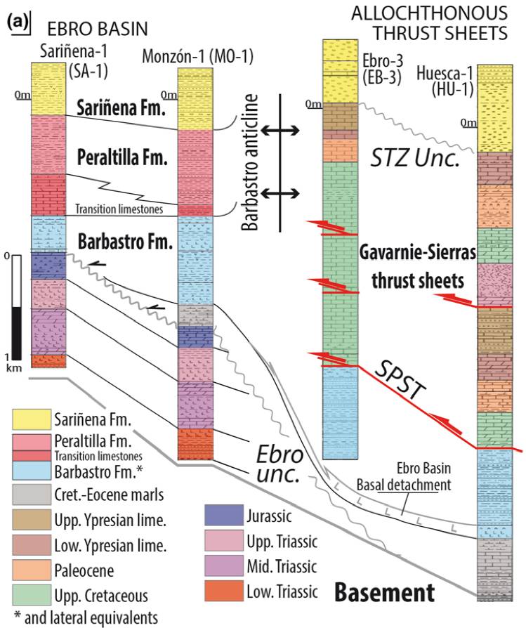
| Regional Stratigraphy | Santolaria, P., Ayala, C., Pueyo, E. L., Rubio, F. M., Soto, R., Calvín, P., …, Casas‐Sainz, A. M., 2020. Structural and geophysical characterization of the western termination of the South Pyrenean triangle zone. Tectonics, 39(8), e2019TC005891. [link] |
| Seismic data availability #1 | Franco-Balaguer, J., Casas-Sainz, A. M., 2016. Estructura de la terminación occidental del cabalgamiento del Montsec (Pirineos Centrales). Revista de la Sociedad Geológica de España, 29(2), 39-56. [link] |
| Seismic data availability #2 | Santolaria, P., Casas-Sainz, A. M., Soto, R., Casas, A., 2017. Gravity modelling to assess salt tectonics in the western end of the South Pyrenean Central Unit. Journal of the Geological Society, 174(2), 269-288. [link] |
| Seismic data availability #3 | n.a. |
| Available data (Structure) #1 | Franco-Balaguer, J., Casas-Sainz, A. M., 2016. Estructura de la terminación occidental del cabalgamiento del Montsec (Pirineos Centrales). Revista de la Sociedad Geológica de España, 29(2), 39-56. [link] |
| Available data (Structure) #2 | Santolaria, P., Casas-Sainz, A. M., Soto, R., Casas, A., 2017. Gravity modelling to assess salt tectonics in the western end of the South Pyrenean Central Unit. Journal of the Geological Society, 174(2), 269-288. [link] |
| Available data (Structure) #3 | Cámara, P., Flinch, J. F., 2017. The southern Pyrenees: a salt-based fold-and-thrust belt. In Permo-Triassic Salt Provinces of Europe, North Africa and the Atlantic Margins (pp. 395-415). Elsevier. [link] |
| Available data (Structure) #4 | Muñoz, J. A., Mencos, J., Roca, E., Carrera, N., Gratacós, O., Ferrer, O., Fernández, O., 2018. The structure of the South-Central-Pyrenean fold and thrust belt as constrained by subsurface data. Geologica Acta, 16(4), 439-460. [link] |
| Available data (Structure) #5 | n.a. |
| Available data (Structure) #6 | n.a. |
| Available data (Analogue modelling) #1 | n.a. |
| Available data (Analogue modelling) #2 | n.a. |
| Available data (Analogue modelling) #3 | n.a. |
| Available data (Gravimetry – Tomography) #1 | Santolaria, P., Casas-Sainz, A. M., Soto, R., Casas, A., 2017. Gravity modelling to assess salt tectonics in the western end of the South Pyrenean Central Unit. Journal of the Geological Society, 174(2), 269-288. [link] |
| Available data (Gravimetry – Tomography) #2 | Casas, A., Santolaria, P., Rivero, L., Casas-Sainz, A., Himi, M., Pinto, V., Sendrós, A., 2016. The gravity method: new challenges for delineation diapiric structures in north-east Spain. First Break, 34(8). [link] |
| Available data (Gravimetry – Tomography) #3 | Ayala, C., Bohoyo, F., Maestro, A., Reguera, M. I., Torne, M., Rubio, F., Fernández, M., García-Lobón, J. L., 2016. Updated Bouguer anomalies of the Iberian Peninsula: a new perspective to interpret the regional geology. Journal of Maps, 12(5), 1089-1092. [link] |
| Available data (Geochemistry) #1 | Salvany, J. M., Bastida, J., 2004. Análisis litoestratigráfico del Keuper surpirenaico central. Revista de la Sociedad Geológica de España, 17(1), 3-26. [link] |
| Available data (Geochemistry) #2 | n.a. |
| Available data (Geochemistry) #3 | n.a. |
| Available data (Geochemistry) #4 | n.a. |
| Available data (Petrophysics) #1 | Santolaria, P., Casas-Sainz, A. M., Soto, R., Casas, A., 2017. Gravity modelling to assess salt tectonics in the western end of the South Pyrenean Central Unit. Journal of the Geological Society, 174(2), 269-288. [link] |
| Available data (Petrophysics) #2 | n.a. |
| IGME Geological Map (MAGNA50) Sheet number | 289-Benabarre. [link] |
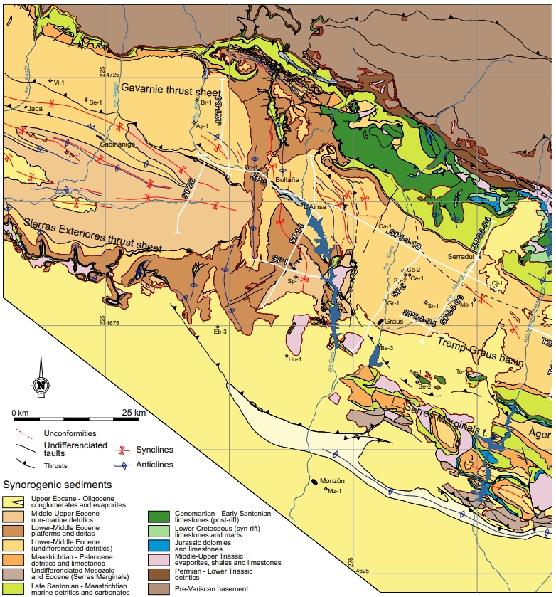
| Other Maps #1 (source) | Muñoz, J. A., Mencos, J., Roca, E., Carrera, N., Gratacós, O., Ferrer, O., Fernández, O., 2018. The structure of the South-Central-Pyrenean fold and thrust belt as constrained by subsurface data. Geologica Acta, 16(4), 439-460. [link] |
| Other Maps #2 (source) | Santolaria, P., Casas-Sainz, A. M., Soto, R., Casas, A., 2017. Gravity modelling to assess salt tectonics in the western end of the South Pyrenean Central Unit. Journal of the Geological Society, 174(2), 269-288. [link] |
| Other related references #1 | Santolaria, P., Ayala, C., Pueyo, E. L., Rubio, F. M., Soto, R., Calvín, P., …, Casas‐Sainz, A. M., 2020. Structural and geophysical characterization of the western termination of the South Pyrenean triangle zone. Tectonics, 39(8), e2019TC005891. [link] |
| Other related references #2 | López Martínez, N., Arribas Mocoroa, M. E., Robador, A., Vicens, E., Ardèvol, L., 2006. Los carbonatos danienses (Unidad 3) de la Fm Tremp (Pirineos sur-centrales): paleogeografía y relación con el límite Cretácico-Terciario. Revista de la Sociedad Geológica de España, 19(3-4), 233-255. [link] |
| Other related references #3 | Arenas, C., Millán, H., Pardo, G., Pocoví, A., 2001. Ebro Basin continental sedimentation associated with late compressional Pyrenean tectonics (north‐eastern Iberia): controls on basin margin fans and fluvial systems. Basin Research, 13(1), 65-89. [link] |
| Other related references #4 | Garrido, H. M., Morer, E. P., Cardona, M. A., Aguado, A. L., Urcia, B. O., Peña, B. M., 2000. Actividad tectónica registrada en los depósitos terciarios del frente meridional del Pirineo central. Revista de la Sociedad Geológica de España, 13(2), 279-300. [link] |
Well and Seismic Data
| UNIQUE_ID | 95 |
| Seismic survey name #1 | 11D1-ND |
| Across structure? #1 | Y |
| Seismic profile ID (IGME) #1 | 10202 |
| Seismic profile code #1 | 14830 |
| Seismic profile name #1 | ND-132 |
| Seismic survey year #1 | 1962 |
| Data repository #1 | SIGEOF Data Catalogue (Section available under request). ©Instituto Geológico y Minero de España (IGME). https://info.igme.es/SIGEOF/ |
| Length (km) #1 | 6.45 |
| Seismic survey name #2 | 11D1-SP |
| Across structure? #2 | Y |
| Seismic profile ID (IGME) #2 | 10250 |
| Seismic profile code #2 | 14878 |
| Seismic profile name #2 | SP-9 |
| Seismic survey year #2 | 1979 |
| Data repository #2 | SIGEOF Data Catalogue (Section available under request). ©Instituto Geológico y Minero de España (IGME). https://info.igme.es/SIGEOF/ |
| Length (km) #2 | 19.46 |
| Seismic survey name #3 | 11D1-SP |
| Across structure? #3 | N (within 3km) |
| Seismic profile ID (IGME) #3 | 10251 |
| Seismic profile code #3 | 14879 |
| Seismic profile name #3 | SP-8 |
| Seismic survey year #3 | 1979 |
| Data repository #3 | SIGEOF Data Catalogue (Section available under request). ©Instituto Geológico y Minero de España (IGME). https://info.igme.es/SIGEOF/ |
| Length (km) #3 | 21.87 |
| Seismic survey name #4 | 11D1-ND |
| Across structure? #4 | N (within 3km) |
| Seismic profile ID (IGME) #4 | 10202 |
| Seismic profile code #4 | 14830 |
| Seismic profile name #4 | ND-132 |
| Seismic survey year #4 | 1962 |
| Data repository #4 | SIGEOF Data Catalogue (Section available under request). ©Instituto Geológico y Minero de España (IGME). https://info.igme.es/SIGEOF/ |
| Length (km) #4 | 6.45 |
| Seismic survey name #5 | 11D1-ND |
| Across structure? #5 | N (within 3km) |
| Seismic profile ID (IGME) #5 | 10161 |
| Seismic profile code #5 | 14789 |
| Seismic profile name #5 | ND-211 |
| Seismic survey year #5 | 1962 |
| Data repository #5 | SIGEOF Data Catalogue (Section available under request). ©Instituto Geológico y Minero de España (IGME). https://info.igme.es/SIGEOF/ |
| Length (km) #5 | 14.76 |
| Seismic survey name #6 | 11D1-SP |
| Across structure? #6 | N (within 3km) |
| Seismic profile ID (IGME) #6 | 10250 |
| Seismic profile code #6 | 14878 |
| Seismic profile name #6 | SP-9 |
| Seismic survey year #6 | 1979 |
| Data repository #6 | SIGEOF Data Catalogue (Section available under request). ©Instituto Geológico y Minero de España (IGME). https://info.igme.es/SIGEOF/ |
| Length (km) #6 | 19.46 |
| Seismic survey name #7 | 11D1-ND |
| Across structure? #7 | N (within 3km) |
| Seismic profile ID (IGME) #7 | 10215 |
| Seismic profile code #7 | 14843 |
| Seismic profile name #7 | ND-111 |
| Seismic survey year #7 | 1962 |
| Data repository #7 | SIGEOF Data Catalogue (Section available under request). ©Instituto Geológico y Minero de España (IGME). https://info.igme.es/SIGEOF/ |
| Length (km) #7 | 12.83 |
| Seismic survey name #8 | 11D1-ND |
| Across structure? #8 | N (within 3km) |
| Seismic profile ID (IGME) #8 | 10171 |
| Seismic profile code #8 | 14799 |
| Seismic profile name #8 | ND-198 |
| Seismic survey year #8 | 1962 |
| Data repository #8 | SIGEOF Data Catalogue (Section available under request). ©Instituto Geológico y Minero de España (IGME). https://info.igme.es/SIGEOF/ |
| Length (km) #8 | 11.54 |
| Seismic survey name #9 | 11D-ST-148 |
| Across structure? #9 | N (within 3km) |
| Seismic profile ID (IGME) #9 | 14090 |
| Seismic profile code #9 | 18824 |
| Seismic profile name #9 | ND-208 |
| Seismic survey year #9 | 1968 |
| Data repository #9 | SIGEOF Data Catalogue (Private access section). ©Instituto Geológico y Minero de España (IGME). https://info.igme.es/SIGEOF/ |
| Length (km) #9 | 11.87 |
| Seismic survey name #10 | 11D1-ND |
| Across structure? #10 | N (within 3km) |
| Seismic profile ID (IGME) #10 | 10208 |
| Seismic profile code #10 | 14836 |
| Seismic profile name #10 | ND-125 |
| Seismic survey year #10 | 1962 |
| Data repository #10 | SIGEOF Data Catalogue (Private access section). ©Instituto Geológico y Minero de España (IGME). https://info.igme.es/SIGEOF/ |
| Length (km) #10 | 5.21 |
| Seismic survey name #11 | 11D1-ND |
| Across structure? #11 | N (within 3km) |
| Seismic profile ID (IGME) #11 | 10205 |
| Seismic profile code #11 | 14833 |
| Seismic profile name #11 | ND-129 |
| Seismic survey year #11 | 1962 |
| Data repository #11 | SIGEOF Data Catalogue (Private access section). ©Instituto Geológico y Minero de España (IGME). https://info.igme.es/SIGEOF/ |
| Length (km) #11 | 2.71 |
| Seismic survey name #12 | 11D1-ND |
| Across structure? #12 | N (within 3km) |
| Seismic profile ID (IGME) #12 | 10207 |
| Seismic profile code #12 | 14835 |
| Seismic profile name #12 | ND-127 |
| Seismic survey year #12 | 1962 |
| Data repository #12 | SIGEOF Data Catalogue (Private access section). ©Instituto Geológico y Minero de España (IGME). https://info.igme.es/SIGEOF/ |
| Length (km) #12 | 2.94 |
| Seismic survey name #13 | 11D1-ND |
| Across structure? #13 | N (within 3km) |
| Seismic profile ID (IGME) #13 | 10164 |
| Seismic profile code #13 | 14792 |
| Seismic profile name #13 | ND-208 |
| Seismic survey year #13 | 1962 |
| Data repository #13 | SIGEOF Data Catalogue (Private access section). ©Instituto Geológico y Minero de España (IGME). https://info.igme.es/SIGEOF/ |
| Length (km) #13 | 12.11 |
| Seismic survey name #14 | |
| Across structure? #14 | |
| Seismic profile ID (IGME) #14 | |
| Seismic profile code #14 | |
| Seismic profile name #14 | |
| Seismic survey year #14 | |
| Data repository #14 | |
| Length (km) #14 | |
| Seismic survey name #15 | |
| Across structure? #15 | |
| Seismic profile ID (IGME) #15 | |
| Seismic profile code #15 | |
| Seismic profile name #15 | |
| Seismic survey year #15 | |
| Data repository #15 | |
| Length (km) #15 | |
| Seismic survey name #16 | |
| Across structure? #16 | |
| Seismic profile ID (IGME) #16 | |
| Seismic profile code #16 | |
| Seismic profile name #16 | |
| Seismic survey year #16 | |
| Data repository #16 | |
| Length (km) #16 | |
| Seismic survey name #17 | |
| Across structure? #17 | |
| Seismic profile ID (IGME) #17 | |
| Seismic profile code #17 | |
| Seismic profile name #17 | |
| Seismic survey year #17 | |
| Data repository #17 | |
| Length (km) #17 | |
| Seismic survey name #18 | |
| Across structure? #18 | |
| Seismic profile ID (IGME) #18 | |
| Seismic profile code #18 | |
| Seismic profile name #18 | |
| Seismic survey year #18 | |
| Data repository #18 | |
| Length (km) #18 | |
| Seismic survey name #19 | |
| Across structure? #19 | |
| Seismic profile ID (IGME) #19 | |
| Seismic profile code #19 | |
| Seismic profile name #19 | |
| Seismic survey year #19 | |
| Data repository #19 | |
| Length (km) #19 | |
| Seismic survey name #20 | |
| Across structure? #20 | |
| Seismic profile ID (IGME) #20 | |
| Seismic profile code #20 | |
| Seismic profile name #20 | |
| Seismic survey year #20 | |
| Data repository #20 | |
| Length (km) #20 | |
| Seismic survey name #21 | |
| Across structure? #21 | |
| Seismic profile ID (IGME) #21 | |
| Seismic profile code #21 | |
| Seismic profile name #21 | |
| Seismic survey year #21 | |
| Data repository #21 | |
| Length (km) #21 | |
| Borehole name #1 | TOLVA |
| Company #1 | CONFEDERACION HIDROGRAFICA DEL EBRO |
| Traget #1 | HYDROGEOLOGY |
| Across structure? #1 | N (within 5 km) |
| Borehole name #2 | |
| Company #2 | |
| Traget #2 | |
| Across structure? #2 | |
| Borehole name #3 | |
| Company #3 | |
| Traget #3 | |
| Across structure? #3 | |
| Borehole name #4 | |
| Company #4 | |
| Traget #4 | |
| Across structure? #4 | |
| Borehole name #5 | |
| Company #5 | |
| Traget #5 | |
| Across structure? #5 | |
| Borehole name #6 | |
| Company #6 | |
| Traget #6 | |
| Across structure? #6 | |
| Borehole name #7 | |
| Company #7 | |
| Traget #7 | |
| Across structure? #7 | |
| Borehole name #8 | |
| Company #8 | |
| Traget #8 | |
| Across structure? #8 | |
| Borehole name #9 | |
| Company #9 | |
| Traget #9 | |
| Across structure? #9 | |
| Borehole name #10 | |
| Company #10 | |
| Traget #10 | |
| Across structure? #10 | |
| Borehole name #11 | |
| Company #11 | |
| Traget #11 | |
| Across structure? #11 | |
| Borehole name #12 | |
| Company #12 | |
| Traget #12 | |
| Across structure? #12 | |
| Borehole name #13 | |
| Company #13 | |
| Traget #13 | |
| Across structure? #13 | |
| Borehole name #14 | |
| Company #14 | |
| Traget #14 | |
| Across structure? #14 | |
| Borehole name #15 | |
| Company #15 | |
| Traget #15 | |
| Across structure? #15 |
Geographical Data (EPSG:4326 - WGS 84)
| UNIQUE_ID | 95 |
| X Centroid (Structure shape) | 0.571084 |
| Y Centroid (Structure shape) | 0.571084 |
| Xmin (Structure shape) | 0.553006 |
| Xmax (Structure shape) | 0.590206 |
| Ymin (Structure shape) | 42.099976 |
| Ymax (Structure shape) | 42.112830 |
| Xmin seismic line #1 | 0.568975 |
| Xmax seismic line #1 | 0.579283 |
| Ymin seismic line #1 | 42.107801 |
| Ymax seismic line #1 | 42.164317 |
| Xmin seismic line #2 | 0.444539 |
| Xmax seismic line #2 | 0.652901 |
| Ymin seismic line #2 | 42.076296 |
| Ymax seismic line #2 | 42.111468 |
| Xmin seismic line #3 | 0.521535 |
| Xmax seismic line #3 | 0.555573 |
| Ymin seismic line #3 | 42.007586 |
| Ymax seismic line #3 | 42.194336 |
| Xmin seismic line #4 | 0.568975 |
| Xmax seismic line #4 | 0.579283 |
| Ymin seismic line #4 | 42.107801 |
| Ymax seismic line #4 | 42.164317 |
| Xmin seismic line #5 | 0.554865 |
| Xmax seismic line #5 | 0.565075 |
| Ymin seismic line #5 | 42.112805 |
| Ymax seismic line #5 | 42.244360 |
| Xmin seismic line #6 | 0.444539 |
| Xmax seismic line #6 | 0.652901 |
| Ymin seismic line #6 | 42.076296 |
| Ymax seismic line #6 | 42.111468 |
| Xmin seismic line #7 | 0.545440 |
| Xmax seismic line #7 | 0.575197 |
| Ymin seismic line #7 | 42.083584 |
| Ymax seismic line #7 | 42.191872 |
| Xmin seismic line #8 | 0.556173 |
| Xmax seismic line #8 | 0.566059 |
| Ymin seismic line #8 | 42.112016 |
| Ymax seismic line #8 | 42.214741 |
| Xmin seismic line #9 | 0.554744 |
| Xmax seismic line #9 | 0.691320 |
| Ymin seismic line #9 | 42.109418 |
| Ymax seismic line #9 | 42.119940 |
| Xmin seismic line #10 | 0.587627 |
| Xmax seismic line #10 | 0.648448 |
| Ymin seismic line #10 | 42.130162 |
| Ymax seismic line #10 | 42.138957 |
| Xmin seismic line #11 | 0.546846 |
| Xmax seismic line #11 | 0.556188 |
| Ymin seismic line #11 | 42.066418 |
| Ymax seismic line #11 | 42.089775 |
| Xmin seismic line #12 | 0.590178 |
| Xmax seismic line #12 | 0.610215 |
| Ymin seismic line #12 | 42.112379 |
| Ymax seismic line #12 | 42.134045 |
| Xmin seismic line #13 | 0.557209 |
| Xmax seismic line #13 | 0.696358 |
| Ymin seismic line #13 | 42.111038 |
| Ymax seismic line #13 | 42.122052 |
| Xmin seismic line #14 | |
| Xmax seismic line #14 | |
| Ymin seismic line #14 | |
| Ymax seismic line #14 | |
| Xmin seismic line #15 | |
| Xmax seismic line #15 | |
| Ymin seismic line #15 | |
| Ymax seismic line #15 | |
| Xmin seismic line #16 | |
| Xmax seismic line #16 | |
| Ymin seismic line #16 | |
| Ymax seismic line #16 | |
| Xmin seismic line #17 | |
| Xmax seismic line #17 | |
| Ymin seismic line #17 | |
| Ymax seismic line #17 | |
| Xmin seismic line #18 | |
| Xmax seismic line #18 | |
| Ymin seismic line #18 | |
| Ymax seismic line #18 | |
| Xmin seismic line #19 | |
| Xmax seismic line #19 | |
| Ymin seismic line #19 | |
| Ymax seismic line #19 | |
| Xmin seismic line #20 | |
| Xmax seismic line #20 | |
| Ymin seismic line #20 | |
| Ymax seismic line #20 | |
| Xmin seismic line #21 | |
| Xmax seismic line #21 | |
| Ymin seismic line #21 | |
| Ymax seismic line #21 | |
| X borehole #1 | 0.560217 |
| Y borehole #1 | 42.115770 |
| X borehole #2 | |
| Y borehole #2 | |
| X borehole #3 | |
| Y borehole #3 | |
| X borehole #4 | |
| Y borehole #4 | |
| X borehole #5 | |
| Y borehole #5 | |
| X borehole #6 | |
| Y borehole #6 | |
| X borehole #7 | |
| Y borehole #7 | |
| X borehole #8 | |
| Y borehole #8 | |
| X borehole #9 | |
| Y borehole #9 | |
| X borehole #10 | |
| Y borehole #10 | |
| X borehole #11 | |
| Y borehole #11 | |
| X borehole #12 | |
| Y borehole #12 | |
| X borehole #13 | |
| Y borehole #13 | |
| X borehole #14 | |
| Y borehole #14 | |
| X borehole #15 | |
| Y borehole #15 |

