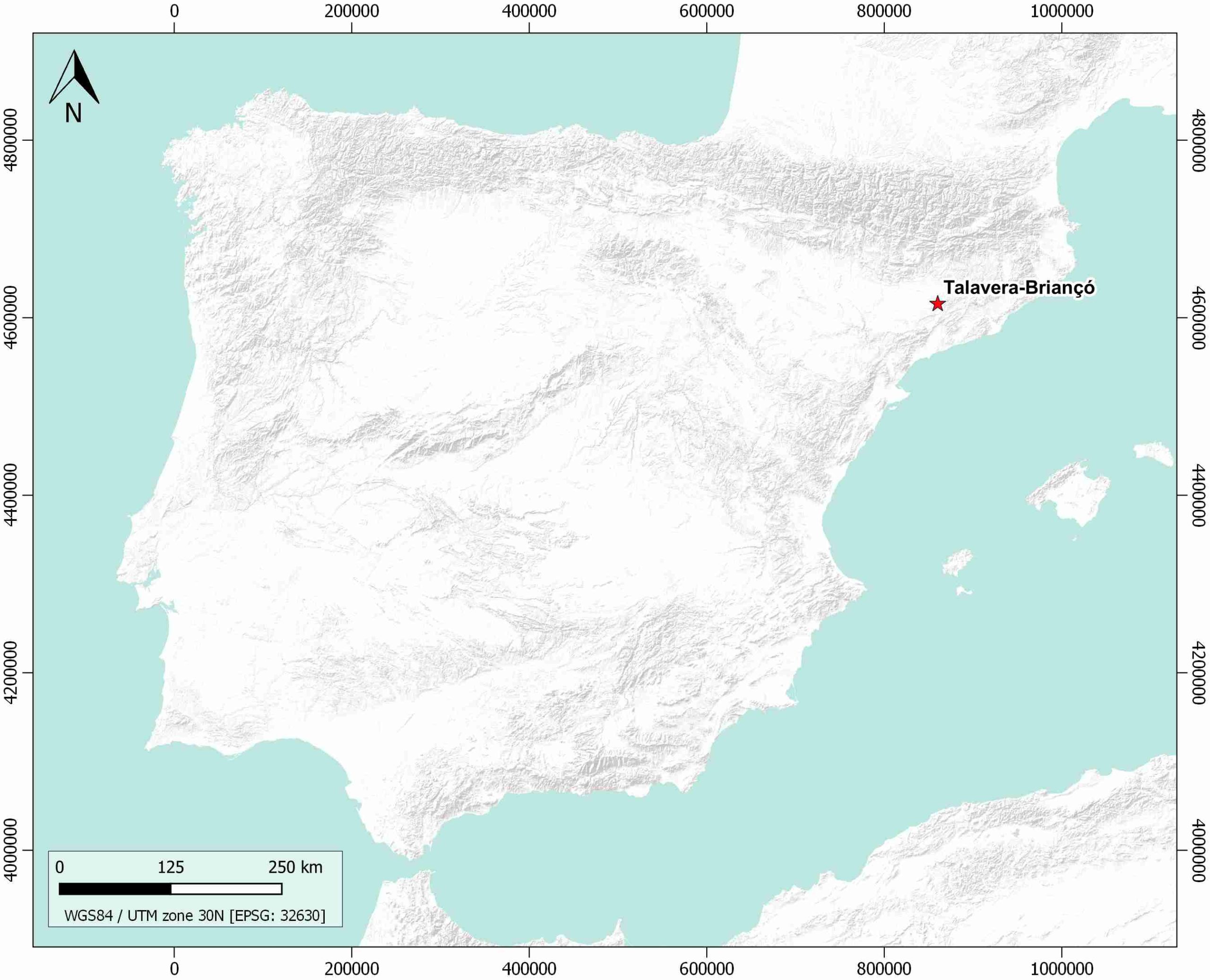
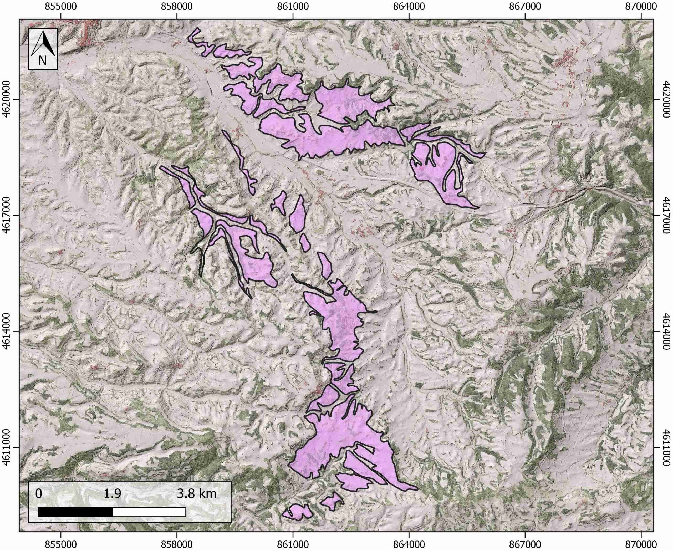
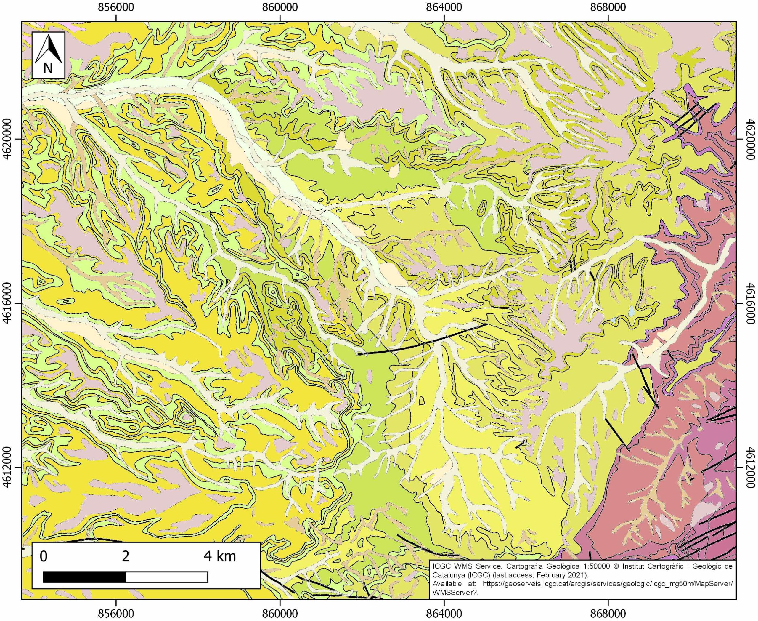
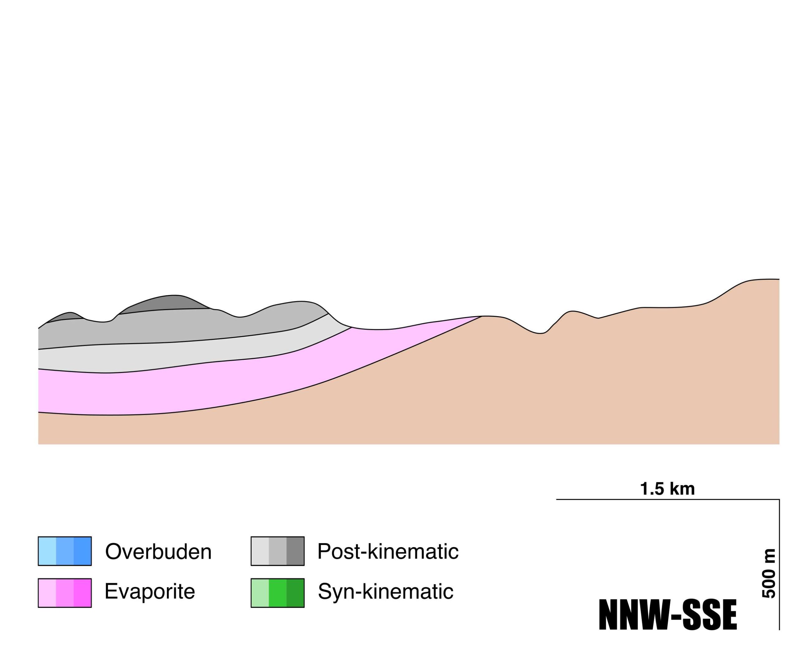
Talavera-Briançó
ID #120
General Information
| Structure type | Evaporite body |
| Deformed/Undeformed | Undeformed |
| Geological Setting | Ebro foreland basin, Southeastern Domain |
| Outcropping/buried | Outcropping |
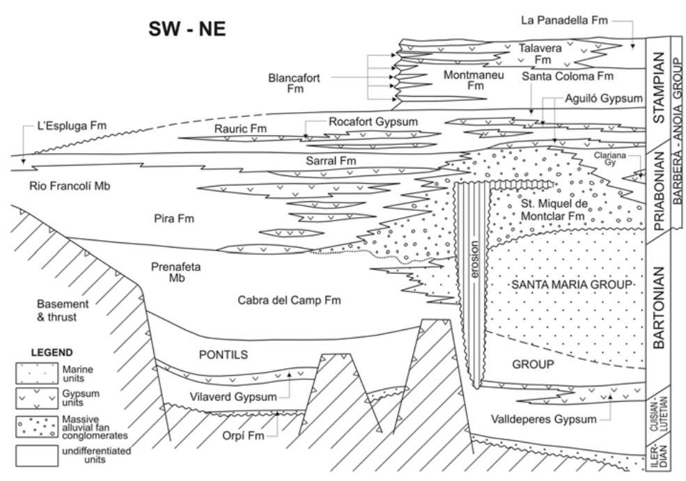
| Evaporite unit/s name | Talavera Fm. |
| Evaporite unit/s age | Stampian (Paleogene) |
| Evaporite unit/s origin | Continental |
| Classif. (Hudec and Jackson, 2009) | No diapirism |
| Classif. (Jackson and Talbot, 1986) | No diapirism |
| Age of evaporite flow or deformation (when deformed) | Undeformed |
| Other comments | - |
Generic Data
| Unique ID | 120 |
| Name | Talavera-Briançó |
| Structure type | Evaporite body |
| Deformed/Undeformed | Undeformed |
| Buried/Outcropping | Outcropping |
| Geological setting | Ebro Basin |
| Geological Regional Setting | SE Sector |
| Evaporite unit/s name | Talavera Fm. (Talavera Gypsum) |
| Evaporite unit/s age | Stampian (Paleogene) |
| Evaporite unit/s era | Cenozoic |
| Evaporite unit/s origin | Continental (lacustrine) |
| Evaporite unit/s composition | Massive gypsum-Nodular gypsum-Grey lutites-Marlstones |
| Post-kinematic unit/s (or post-evaporite units when evaporites are undeformed) | Upper Oligocene (sandstones, shales, marlstones, marly limestones and limestones) ; Quaternary (alluvial and colluvial detrital deposits) |
| Post-kinematic unit/s age (or post-evaporite units when evaporites are undeformed) | Upper Oligocene and Holocene |
| Classification (Hudec and Jackson, 2009) | No diapirism |
| Classification (Jackson and Talbot, 1986) | No diapirism |
| Mining activity? | Y |
| Mining activity start | – |
| Mining activity end | – |
| Mining galleries? | – |
| Mining products | Gypsum |
| Mining sub-products | – |
| Evaporite flow? | N |
| Age of evaporite flow | – |
| Flow or deformation triggering mechanisms | – |
| Flow-linked structures? | – |
| Halokinetic structures | – |
| Post-evaporite and pre-kinematic unit/s (overbuden) | – |
| Syn-kinematic unit/s | – |
| Available seismic profiles | 1 |
| Available boreholes | SANT GUIM DE FREIXENET |
| Additional comments | – |
Mining Data
| UNIQUE_ID | 120 |
| Minning exploitations within <2km? | Y |
| Historical/Active | Active |
| Exploitation name #1 | RUBINAT-AMP.RUBINAT (RA 90684-5587) |
| Exploitation ID (Spanish National Mining Cadastre) #1 | 90684 |
| Municipality #1 | Ribera d’Ondara |
| Province #1 | LERIDA |
| Company #1 | ANNA CARULLA BECH |
| Main minning Products #1 | Gypsum |
| Exploitation name #2 | |
| Exploitation ID (Spanish National Mining Cadastre) #2 | |
| Municipality #2 | |
| Province #2 | |
| Company #2 | |
| Main minning Products #2 | |
| Exploitation name #3 | |
| Exploitation ID (Spanish National Mining Cadastre) #3 | |
| Municipality #3 | |
| Province #3 | |
| Company #3 | |
| Main minning Products #3 |
Quantitative Data
| UNIQUE_ID | 120 |
| Outcropping area (km2) | 15.78273 |
| Horizontal intersection area (km2) (when buried) | Not buried |
| Depth of intersection area (km2) (when buried) | Not buried |
| Max. Width (Km) | 8.4435057 |
| Max. Length (Km) | 11.8307501 |
| Max. Evaporites thickness (km) | 0.1 |
| Max. Deformation age (Ma) | – |
| Min. Deformation age (Ma) | – |
| Deformation stages | 0 |
Reference Data
| UNIQUE_ID | 120 |
| Section source | IGME MAGNA 50. SHEET 390 (CERVERA) |
| Well / Borehole availability #1 | n.a. |
| Well / Borehole availability #2 | n.a. |
| Available data (Stratigraphy) #1 | Colldeforns, B., Anadón, P., Cabrera, L., 1994. Nuevos datos sobre la litoestratigrafía del Eoceno-Oligoceno inferior de la zona suroriental de la Cuenca del Ebro (sector de Pontils-Montblanc, provincias de Tarragona y Barcelona). Geogaceta, 16, 98-101. [link] |
| Available data (Stratigraphy) #2 | Sanjuan, J., Martín-Closas, C., Costa, E., Barberà, X., Garcés, M., 2014. Calibration of Eocene-Oligocene charophyte biozones in the Eastern Ebro Basin (Catalonia, Spain). Stratigraphy, 11(1), 61-81. [link] |
| Available data (Stratigraphy) #3 | Ortí, F., Rosell, L., Ingles, M., Playa, E., 2007. Depositional models of lacustrine evaporites in the SE margin of the Ebro Basin (Paleogene, NE Spain). Geologica Acta: an international earth science journal, 5(1), 19-34. [link] |
| Available data (Stratigraphy) #4 | Colldeforns, B., Anadón, P., Cabrera, L., 1994. Litoestratigrafía del Eoceno superior-Oligoceno inferior de la zona oriental de la cuenca del Ebro. Sector de Igualada-Santa Coloma de Queralt. Geogaceta, 15, 55-58. [link] |
| Available data (Stratigraphy) #5 | Colombo, F., 1986. Estratigrafía y Sedimentología del borde meridional occidental de los Catalánides (prov. de Tarragona, España). Cuadernos de geología ibérica, 10, 55-116. [link] |
| Available data (Stratigraphy) #6 | Costa, E., Garces, M., López‐Blanco, M., Beamud, E., Gómez‐Paccard, M., Larrasoaña, J. C., 2010. Closing and continentalization of the South Pyrenean foreland basin (NE Spain): magnetochronological constraints. Basin Research, 22(6), 904-917. [link] |
| Regional Stratigraphy | Ortí, F., Rosell, L., Ingles, M., Playa, E., 2007. Depositional models of lacustrine evaporites in the SE margin of the Ebro Basin (Paleogene, NE Spain). Geologica Acta: an international earth science journal, 5(1), 19-34. [link] |
| Seismic data availability #1 | n.a. |
| Seismic data availability #2 | n.a. |
| Seismic data availability #3 | n.a. |
| Available data (Structure) #1 | Gaspar‐Escribano, J. M., Garcia‐Castellanos, D., Roca, E., Cloetingh, S. A. P. L., 2004. Cenozoic vertical motions of the Catalan Coastal Ranges (NE Spain): The role of tectonics, isostasy, and surface transport. Tectonics, 23(1). [link] |
| Available data (Structure) #2 | Vergés, J., Marzo, M., Santaeulària, T., Serra-Kiel, J., Burbank, D. W., Muñoz, J. A., Giménez-Montsant, J., 1998. Quantified vertical motions and tectonic evolution of the SE Pyrenean foreland basin. Geological Society, London, Special Publications, 134(1), 107-134. [link] |
| Available data (Structure) #3 | Anadón, P., Cabrera, L., Colombo, F., Marzo, M. y Riba, O., 1986. Syntectonic intradeforrnational unconformities in alluvial fan deposits, Eastern Ebro Basin margins (NE Spain). In Ph. Allen and P. Hornewood (eds.): Foreland basins. Spec. Publ. I.A.S., 8: 33-45. [link] |
| Available data (Structure) #4 | Anadón, P., Cabrera, L., GuimerÀ, J. and Santanach, P., 1985. Paleogene strike-slip deformation and sedimentation along the southeastern margin of the Ebro basin. In: K. T. Biddle and N. Christie-Blick (Editors), Strike-Slip Deformation, Basin Formation and Sedimentation. Soc. Econ. Palaeontol. Mineral. Spec. Publ., 37: 303-318. [link] |
| Available data (Structure) #5 | n.a. |
| Available data (Structure) #6 | n.a. |
| Available data (Analogue modelling) #1 | n.a. |
| Available data (Analogue modelling) #2 | n.a. |
| Available data (Analogue modelling) #3 | n.a. |
| Available data (Gravimetry – Tomography) #1 | Guinea, A., Playà, E., Rivero, L., Himi, M., 2010. Electrical resistivity tomography and induced polarization techniques applied to the identification of gypsum rocks. Near Surface Geophysics, 8(3), 249-257. [link] |
| Available data (Gravimetry – Tomography) #2 | Ayala, C., Bohoyo, F., Maestro, A., Reguera, M. I., Torne, M., Rubio, F., Fernández, M., García-Lobón, J. L., 2016. Updated Bouguer anomalies of the Iberian Peninsula: a new perspective to interpret the regional geology. Journal of Maps, 12(5), 1089-1092. [link] |
| Available data (Gravimetry – Tomography) #3 | n.a. |
| Available data (Geochemistry) #1 | Utrilla, R., Pierre, C., Orti, F., Pueyo, J. J., 1992. Oxygen and sulphur isotope compositions as indicators of the origin of Mesozoic and Cenozoic evaporites from Spain. Chemical Geology, 102(1-4), 229-244. [link] |
| Available data (Geochemistry) #2 | n.a. |
| Available data (Geochemistry) #3 | n.a. |
| Available data (Geochemistry) #4 | n.a. |
| Available data (Petrophysics) #1 | Costa, E., 2011. Paleogene Chronostratigraphy of the SE Margin of the Ebro Basin: Biochronological and Tectonosedimentary Evolution Implications [Ph.D. thesis]: Universitat de Barcelona, 271p. [link] |
| Available data (Petrophysics) #2 | Costa, E., Garces, M., López‐Blanco, M., Beamud, E., Gómez‐Paccard, M., Larrasoaña, J. C., 2010. Closing and continentalization of the South Pyrenean foreland basin (NE Spain): magnetochronological constraints. Basin Research, 22(6), 904-917. [link] |
| IGME Geological Map (MAGNA50) Sheet number | 390-Cervera. [link] |
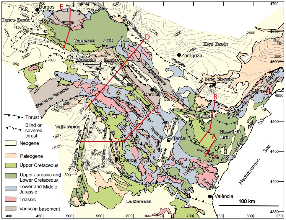
| Other Maps #1 (source) | Guimerà, J. J., 2018. Structure of an intraplate fold-and-thrust belt: The Iberian Chain. A synthesis. Geologica Acta, 16(4), 427-438. [link] |
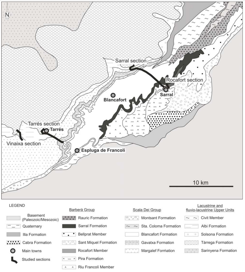
| Other Maps #2 (source) | Sanjuan, J., Martín-Closas, C., Costa, E., Barberà, X., Garcés, M., 2014. Calibration of Eocene-Oligocene charophyte biozones in the Eastern Ebro Basin (Catalonia, Spain). Stratigraphy, 11(1), 61-81. [link] |
| Other related references #1 | Colombo, F., 1980. Estratigrafía y sedimentología del Terciario Inferior continental de los Catalánides [Ph.D. thesis]: Universitat de Barcelona, 116p. [link] |
| Other related references #2 | Costa, E., 2011. Paleogene Chronostratigraphy of the SE Margin of the Ebro Basin: Biochronological and Tectonosedimentary Evolution Implications [Ph.D. thesis]: Universitat de Barcelona, 271p. [link] |
| Other related references #3 | n.a. |
| Other related references #4 | n.a. |
Well and Seismic Data
| UNIQUE_ID | 120 |
| Seismic survey name #1 | 12E4-1 |
| Across structure? #1 | N (within 3km) |
| Seismic profile ID (IGME) #1 | 10835 |
| Seismic profile code #1 | 15474 |
| Seismic profile name #1 | 1 |
| Seismic survey year #1 | 1961 |
| Data repository #1 | SIGEOF Data Catalogue (Private access section). ©Instituto Geológico y Minero de España (IGME). https://info.igme.es/SIGEOF/ |
| Length (km) #1 | 47.19 |
| Seismic survey name #2 | |
| Across structure? #2 | |
| Seismic profile ID (IGME) #2 | |
| Seismic profile code #2 | |
| Seismic profile name #2 | |
| Seismic survey year #2 | |
| Data repository #2 | |
| Length (km) #2 | |
| Seismic survey name #3 | |
| Across structure? #3 | |
| Seismic profile ID (IGME) #3 | |
| Seismic profile code #3 | |
| Seismic profile name #3 | |
| Seismic survey year #3 | |
| Data repository #3 | |
| Length (km) #3 | |
| Seismic survey name #4 | |
| Across structure? #4 | |
| Seismic profile ID (IGME) #4 | |
| Seismic profile code #4 | |
| Seismic profile name #4 | |
| Seismic survey year #4 | |
| Data repository #4 | |
| Length (km) #4 | |
| Seismic survey name #5 | |
| Across structure? #5 | |
| Seismic profile ID (IGME) #5 | |
| Seismic profile code #5 | |
| Seismic profile name #5 | |
| Seismic survey year #5 | |
| Data repository #5 | |
| Length (km) #5 | |
| Seismic survey name #6 | |
| Across structure? #6 | |
| Seismic profile ID (IGME) #6 | |
| Seismic profile code #6 | |
| Seismic profile name #6 | |
| Seismic survey year #6 | |
| Data repository #6 | |
| Length (km) #6 | |
| Seismic survey name #7 | |
| Across structure? #7 | |
| Seismic profile ID (IGME) #7 | |
| Seismic profile code #7 | |
| Seismic profile name #7 | |
| Seismic survey year #7 | |
| Data repository #7 | |
| Length (km) #7 | |
| Seismic survey name #8 | |
| Across structure? #8 | |
| Seismic profile ID (IGME) #8 | |
| Seismic profile code #8 | |
| Seismic profile name #8 | |
| Seismic survey year #8 | |
| Data repository #8 | |
| Length (km) #8 | |
| Seismic survey name #9 | |
| Across structure? #9 | |
| Seismic profile ID (IGME) #9 | |
| Seismic profile code #9 | |
| Seismic profile name #9 | |
| Seismic survey year #9 | |
| Data repository #9 | |
| Length (km) #9 | |
| Seismic survey name #10 | |
| Across structure? #10 | |
| Seismic profile ID (IGME) #10 | |
| Seismic profile code #10 | |
| Seismic profile name #10 | |
| Seismic survey year #10 | |
| Data repository #10 | |
| Length (km) #10 | |
| Seismic survey name #11 | |
| Across structure? #11 | |
| Seismic profile ID (IGME) #11 | |
| Seismic profile code #11 | |
| Seismic profile name #11 | |
| Seismic survey year #11 | |
| Data repository #11 | |
| Length (km) #11 | |
| Seismic survey name #12 | |
| Across structure? #12 | |
| Seismic profile ID (IGME) #12 | |
| Seismic profile code #12 | |
| Seismic profile name #12 | |
| Seismic survey year #12 | |
| Data repository #12 | |
| Length (km) #12 | |
| Seismic survey name #13 | |
| Across structure? #13 | |
| Seismic profile ID (IGME) #13 | |
| Seismic profile code #13 | |
| Seismic profile name #13 | |
| Seismic survey year #13 | |
| Data repository #13 | |
| Length (km) #13 | |
| Seismic survey name #14 | |
| Across structure? #14 | |
| Seismic profile ID (IGME) #14 | |
| Seismic profile code #14 | |
| Seismic profile name #14 | |
| Seismic survey year #14 | |
| Data repository #14 | |
| Length (km) #14 | |
| Seismic survey name #15 | |
| Across structure? #15 | |
| Seismic profile ID (IGME) #15 | |
| Seismic profile code #15 | |
| Seismic profile name #15 | |
| Seismic survey year #15 | |
| Data repository #15 | |
| Length (km) #15 | |
| Seismic survey name #16 | |
| Across structure? #16 | |
| Seismic profile ID (IGME) #16 | |
| Seismic profile code #16 | |
| Seismic profile name #16 | |
| Seismic survey year #16 | |
| Data repository #16 | |
| Length (km) #16 | |
| Seismic survey name #17 | |
| Across structure? #17 | |
| Seismic profile ID (IGME) #17 | |
| Seismic profile code #17 | |
| Seismic profile name #17 | |
| Seismic survey year #17 | |
| Data repository #17 | |
| Length (km) #17 | |
| Seismic survey name #18 | |
| Across structure? #18 | |
| Seismic profile ID (IGME) #18 | |
| Seismic profile code #18 | |
| Seismic profile name #18 | |
| Seismic survey year #18 | |
| Data repository #18 | |
| Length (km) #18 | |
| Seismic survey name #19 | |
| Across structure? #19 | |
| Seismic profile ID (IGME) #19 | |
| Seismic profile code #19 | |
| Seismic profile name #19 | |
| Seismic survey year #19 | |
| Data repository #19 | |
| Length (km) #19 | |
| Seismic survey name #20 | |
| Across structure? #20 | |
| Seismic profile ID (IGME) #20 | |
| Seismic profile code #20 | |
| Seismic profile name #20 | |
| Seismic survey year #20 | |
| Data repository #20 | |
| Length (km) #20 | |
| Seismic survey name #21 | |
| Across structure? #21 | |
| Seismic profile ID (IGME) #21 | |
| Seismic profile code #21 | |
| Seismic profile name #21 | |
| Seismic survey year #21 | |
| Data repository #21 | |
| Length (km) #21 | |
| Borehole name #1 | SANT GUIM DE FREIXENET |
| Company #1 | CONFEDERACION HIDROGRAFICA DEL EBRO |
| Traget #1 | HYDROGEOLOGY |
| Across structure? #1 | N (within 5 km) |
| Borehole name #2 | |
| Company #2 | |
| Traget #2 | |
| Across structure? #2 | |
| Borehole name #3 | |
| Company #3 | |
| Traget #3 | |
| Across structure? #3 | |
| Borehole name #4 | |
| Company #4 | |
| Traget #4 | |
| Across structure? #4 | |
| Borehole name #5 | |
| Company #5 | |
| Traget #5 | |
| Across structure? #5 | |
| Borehole name #6 | |
| Company #6 | |
| Traget #6 | |
| Across structure? #6 | |
| Borehole name #7 | |
| Company #7 | |
| Traget #7 | |
| Across structure? #7 | |
| Borehole name #8 | |
| Company #8 | |
| Traget #8 | |
| Across structure? #8 | |
| Borehole name #9 | |
| Company #9 | |
| Traget #9 | |
| Across structure? #9 | |
| Borehole name #10 | |
| Company #10 | |
| Traget #10 | |
| Across structure? #10 | |
| Borehole name #11 | |
| Company #11 | |
| Traget #11 | |
| Across structure? #11 | |
| Borehole name #12 | |
| Company #12 | |
| Traget #12 | |
| Across structure? #12 | |
| Borehole name #13 | |
| Company #13 | |
| Traget #13 | |
| Across structure? #13 | |
| Borehole name #14 | |
| Company #14 | |
| Traget #14 | |
| Across structure? #14 | |
| Borehole name #15 | |
| Company #15 | |
| Traget #15 | |
| Across structure? #15 |
Geographical Data (EPSG:4326 - WGS 84)
| UNIQUE_ID | 120 |
| X Centroid (Structure shape) | 1.342773 |
| Y Centroid (Structure shape) | 1.342773 |
| Xmin (Structure shape) | 1.292359 |
| Xmax (Structure shape) | 1.393748 |
| Ymin (Structure shape) | 41.552067 |
| Ymax (Structure shape) | 41.667797 |
| Xmin seismic line #1 | 1.092912 |
| Xmax seismic line #1 | 1.437921 |
| Ymin seismic line #1 | 41.647332 |
| Ymax seismic line #1 | 41.893963 |
| Xmin seismic line #2 | |
| Xmax seismic line #2 | |
| Ymin seismic line #2 | |
| Ymax seismic line #2 | |
| Xmin seismic line #3 | |
| Xmax seismic line #3 | |
| Ymin seismic line #3 | |
| Ymax seismic line #3 | |
| Xmin seismic line #4 | |
| Xmax seismic line #4 | |
| Ymin seismic line #4 | |
| Ymax seismic line #4 | |
| Xmin seismic line #5 | |
| Xmax seismic line #5 | |
| Ymin seismic line #5 | |
| Ymax seismic line #5 | |
| Xmin seismic line #6 | |
| Xmax seismic line #6 | |
| Ymin seismic line #6 | |
| Ymax seismic line #6 | |
| Xmin seismic line #7 | |
| Xmax seismic line #7 | |
| Ymin seismic line #7 | |
| Ymax seismic line #7 | |
| Xmin seismic line #8 | |
| Xmax seismic line #8 | |
| Ymin seismic line #8 | |
| Ymax seismic line #8 | |
| Xmin seismic line #9 | |
| Xmax seismic line #9 | |
| Ymin seismic line #9 | |
| Ymax seismic line #9 | |
| Xmin seismic line #10 | |
| Xmax seismic line #10 | |
| Ymin seismic line #10 | |
| Ymax seismic line #10 | |
| Xmin seismic line #11 | |
| Xmax seismic line #11 | |
| Ymin seismic line #11 | |
| Ymax seismic line #11 | |
| Xmin seismic line #12 | |
| Xmax seismic line #12 | |
| Ymin seismic line #12 | |
| Ymax seismic line #12 | |
| Xmin seismic line #13 | |
| Xmax seismic line #13 | |
| Ymin seismic line #13 | |
| Ymax seismic line #13 | |
| Xmin seismic line #14 | |
| Xmax seismic line #14 | |
| Ymin seismic line #14 | |
| Ymax seismic line #14 | |
| Xmin seismic line #15 | |
| Xmax seismic line #15 | |
| Ymin seismic line #15 | |
| Ymax seismic line #15 | |
| Xmin seismic line #16 | |
| Xmax seismic line #16 | |
| Ymin seismic line #16 | |
| Ymax seismic line #16 | |
| Xmin seismic line #17 | |
| Xmax seismic line #17 | |
| Ymin seismic line #17 | |
| Ymax seismic line #17 | |
| Xmin seismic line #18 | |
| Xmax seismic line #18 | |
| Ymin seismic line #18 | |
| Ymax seismic line #18 | |
| Xmin seismic line #19 | |
| Xmax seismic line #19 | |
| Ymin seismic line #19 | |
| Ymax seismic line #19 | |
| Xmin seismic line #20 | |
| Xmax seismic line #20 | |
| Ymin seismic line #20 | |
| Ymax seismic line #20 | |
| Xmin seismic line #21 | |
| Xmax seismic line #21 | |
| Ymin seismic line #21 | |
| Ymax seismic line #21 | |
| X borehole #1 | 1.414159 |
| Y borehole #1 | 41.659733 |
| X borehole #2 | |
| Y borehole #2 | |
| X borehole #3 | |
| Y borehole #3 | |
| X borehole #4 | |
| Y borehole #4 | |
| X borehole #5 | |
| Y borehole #5 | |
| X borehole #6 | |
| Y borehole #6 | |
| X borehole #7 | |
| Y borehole #7 | |
| X borehole #8 | |
| Y borehole #8 | |
| X borehole #9 | |
| Y borehole #9 | |
| X borehole #10 | |
| Y borehole #10 | |
| X borehole #11 | |
| Y borehole #11 | |
| X borehole #12 | |
| Y borehole #12 | |
| X borehole #13 | |
| Y borehole #13 | |
| X borehole #14 | |
| Y borehole #14 | |
| X borehole #15 | |
| Y borehole #15 |

