General Information
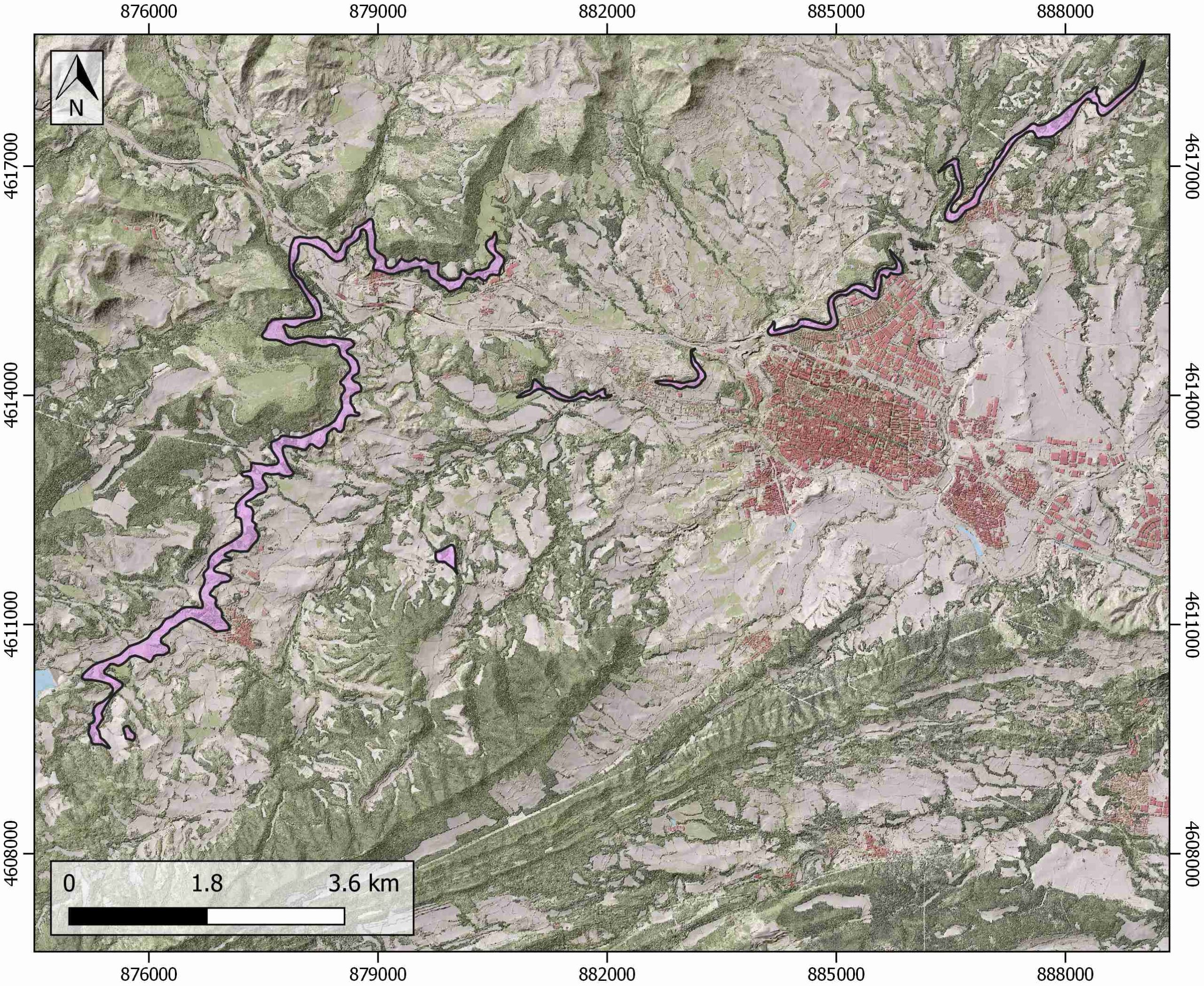
| Structure type | Evaporite body |
| Deformed/Undeformed | Undeformed |
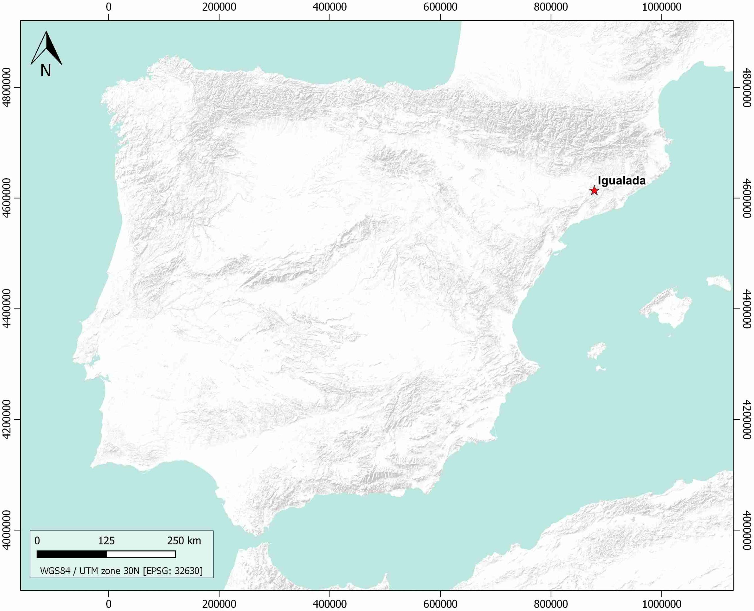
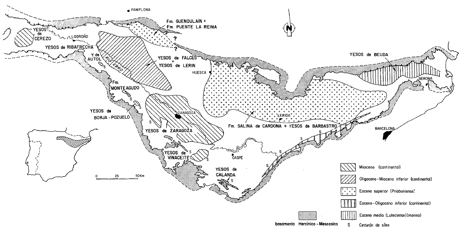
| Geological Setting | Ebro foreland basin, Southeastern Domain |
| Outcropping/buried | Outcropping |
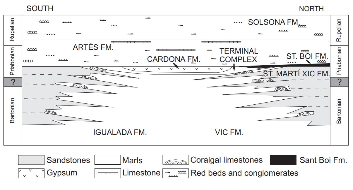
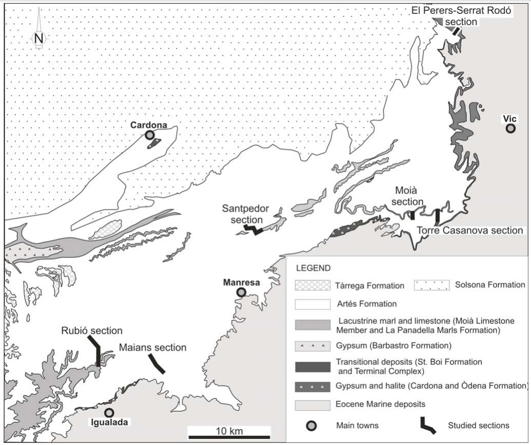
| Evaporite unit/s name | Òdena Gypsum Fm. |
| Evaporite unit/s age | Priabonian (Eocene) |
| Evaporite unit/s origin | Marine |
| Classif. (Hudec and Jackson, 2009) | No diapirism |
| Classif. (Jackson and Talbot, 1986) | No diapirism |
| Age of evaporite flow or deformation (when deformed) | Undeformed |
| Other comments | - |
Generic Data
| Unique ID | 123 |
| Name | Igualada |
| Structure type | Evaporite body |
| Deformed/Undeformed | Undeformed |
| Buried/Outcropping | Outcropping |
| Geological setting | Ebro Basin |
| Geological Regional Setting | SE Sector |
| Evaporite unit/s name | Òdena Gypsum Fm. |
| Evaporite unit/s age | Priabonian (Eocene) |
| Evaporite unit/s era | Cenozoic |
| Evaporite unit/s origin | Marine |
| Evaporite unit/s composition | Gypsum-Shale-Marlstone-Anhydrite |
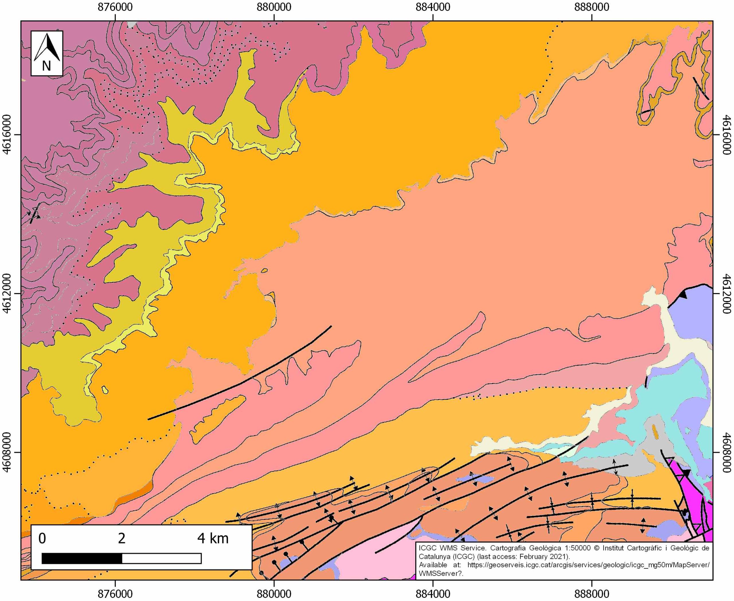
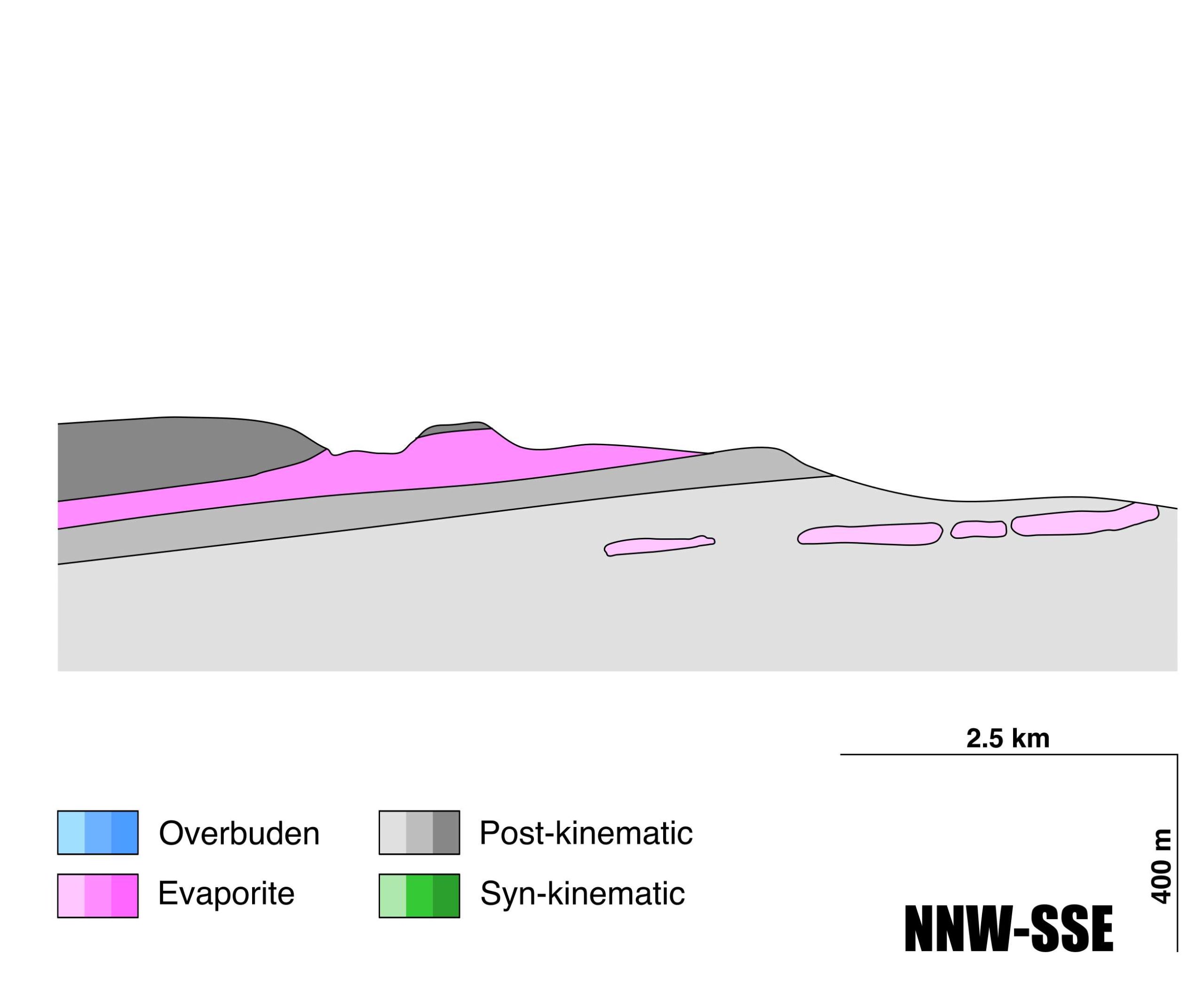
| Post-kinematic unit/s (or post-evaporite units when evaporites are undeformed) | Upper Priabonian (marlstones and red sandstones) ; Lower Oligocene (grey marlstones, sandstones and conglomerates) ; Upper Miocene (conglomerates, sandstones and claystones) ; Quaternary (alluvial and colluvial detrital deposits) |
| Post-kinematic unit/s age (or post-evaporite units when evaporites are undeformed) | Upper Priabonian-Lower Oligocene and Upper Miocene-Holocene |
| Classification (Hudec and Jackson, 2009) | No diapirism |
| Classification (Jackson and Talbot, 1986) | No diapirism |
| Mining activity? | Y |
| Mining activity start | |
| Mining activity end | Active |
| Mining galleries? | Y |
| Mining products | Gypsum |
| Mining sub-products | |
| Evaporite flow? | N |
| Age of evaporite flow | – |
| Flow or deformation triggering mechanisms | – |
| Flow-linked structures? | – |
| Halokinetic structures | – |
| Post-evaporite and pre-kinematic unit/s (overbuden) | – |
| Syn-kinematic unit/s | – |
| Available seismic profiles | 19 |
| Available boreholes | |
| Additional comments | – |
Mining Data
| UNIQUE_ID | 123 |
| Minning exploitations within <2km? | Y |
| Historical/Active | Active |
| Exploitation name #1 | SANT JORDI |
| Exploitation ID (Spanish National Mining Cadastre) #1 | 2619 |
| Municipality #1 | Jorba |
| Province #1 | BARCELONA |
| Company #1 | TERRACUITA JORBA, SAU |
| Main minning Products #1 | Gypsum |
| Exploitation name #2 | IDYSA |
| Exploitation ID (Spanish National Mining Cadastre) #2 | 3895-9 |
| Municipality #2 | Jorba |
| Province #2 | BARCELONA |
| Company #2 | GUIXOS CANALS, S.L. |
| Main minning Products #2 | Gypsum |
| Exploitation name #3 | LAS IGLAS |
| Exploitation ID (Spanish National Mining Cadastre) #3 | 2452 |
| Municipality #3 | Jorba |
| Province #3 | BARCELONA |
| Company #3 | GUIXOS CANALS, S.L. |
| Main minning Products #3 | Gypsum |
Quantitative Data
| UNIQUE_ID | 123 |
| Outcropping area (km2) | 2.75049 |
| Horizontal intersection area (km2) (when buried) | Not buried |
| Depth of intersection area (km2) (when buried) | Not buried |
| Max. Width (Km) | 5.69189446 |
| Max. Length (Km) | 16.2887988 |
| Max. Evaporites thickness (km) | 0.1 |
| Max. Deformation age (Ma) | – |
| Min. Deformation age (Ma) | – |
| Deformation stages | 0 |
Reference Data
| UNIQUE_ID | 123 |
| Section source | IGME MAGNA 50. SHEET 391 (IGUALADA) |
| Well / Borehole availability #1 | IGME MAGNA 50. SHEET 391 (IGUALADA). Supplementary information. [link] |
| Well / Borehole availability #2 | n.a. |
| Available data (Stratigraphy) #1 | Serra-Kiel, J., Travé, A., i Palós, E. M., Briansó, E. S., i Cañadell, C. F., Busquets, P., …, Masip, J. V., 2003. Marine and Transitional Middle/Upper Eocene Units of the Southeastern Pyrenean Foreland Basin (NE Spain). Geologica Acta, 1(2), 177-200. [link] |
| Available data (Stratigraphy) #2 | Sanjuan, J., Martín-Closas, C., Costa, E., Barberà, X., Garcés, M., 2014. Calibration of Eocene-Oligocene charophyte biozones in the Eastern Ebro Basin (Catalonia, Spain). Stratigraphy, 11(1), 61-81. [link] |
| Available data (Stratigraphy) #3 | Costa, E., Garces, M., López‐Blanco, M., Beamud, E., Gómez‐Paccard, M., Larrasoaña, J. C., 2010. Closing and continentalization of the South Pyrenean foreland basin (NE Spain): magnetochronological constraints. Basin Research, 22(6), 904-917. [link] |
| Available data (Stratigraphy) #4 | Colldeforns, B., Anadón, P., Cabrera, L., 1994. Litoestratigrafía del Eoceno superior-Oligoceno inferior de la zona oriental de la cuenca del Ebro. Sector de Igualada-Santa Coloma de Queralt. Geogaceta, 15, 55-58. [link] |
| Available data (Stratigraphy) #5 | Ortí, F., Rosell, L., Ingles, M., Playa, E., 2007. Depositional models of lacustrine evaporites in the SE margin of the Ebro Basin (Paleogene, NE Spain). Geologica Acta: an international earth science journal, 5(1), 19-34. [link] |
| Available data (Stratigraphy) #6 | n.a. |
| Regional Stratigraphy | Sanjuan, J., Martín-Closas, C., Serra-Kiel, J., Gallardo, H., 2012. Stratigraphy and biostratigraphy (charophytes) of the marine-terrestrial transition in the Upper Eocene of the NE Ebro Basin (Catalonia, Spain). Geologica Acta, 10(1), 1-13. [link] |
| Seismic data availability #1 | n.a. |
| Seismic data availability #2 | n.a. |
| Seismic data availability #3 | n.a. |
| Available data (Structure) #1 | Vergés, J., Marzo, M., Santaeulària, T., Serra-Kiel, J., Burbank, D. W., Muñoz, J. A., Giménez-Montsant, J., 1998. Quantified vertical motions and tectonic evolution of the SE Pyrenean foreland basin. Geological Society, London, Special Publications, 134(1), 107-134. [link] |
| Available data (Structure) #2 | Vergés J., Muñoz J.A., Martínez A., 1992. South Pyrenean fold and thrust belt: The role of foreland evaporitic levels in thrust geometry. In: McClay K.R. (eds), Thrust Tectonics. Springer, Dordrecht, 255-264 pp. [link] |
| Available data (Structure) #3 | Anadón, P., Cabrera, L., GuimerÀ, J. and Santanach, P., 1985. Paleogene strike-slip deformation and sedimentation along the southeastern margin of the Ebro basin. In: K. T. Biddle and N. Christie-Blick (Editors), Strike-Slip Deformation, Basin Formation and Sedimentation. Soc. Econ. Palaeontol. Mineral. Spec. Publ., 37: 303-318. [link] |
| Available data (Structure) #4 | Anadón, P., Cabrera, L., Colombo, F., Marzo, M. y Riba, O., 1986. Syntectonic intradeforrnational unconformities in alluvial fan deposits, Eastern Ebro Basin margins (NE Spain). In Ph. Allen and P. Hornewood (eds.): Foreland basins. Spec. Publ. I.A.S., 8: 33-45. [link] |
| Available data (Structure) #5 | n.a. |
| Available data (Structure) #6 | n.a. |
| Available data (Analogue modelling) #1 | n.a. |
| Available data (Analogue modelling) #2 | n.a. |
| Available data (Analogue modelling) #3 | n.a. |
| Available data (Gravimetry – Tomography) #1 | Guinea, A., Playà, E., Rivero, L., Ledo, J. J., Queralt, P., 2012. The electrical properties of calcium sulfate rocks from decametric to micrometric scale. Journal of applied geophysics, 85, 80-91. [link] |
| Available data (Gravimetry – Tomography) #2 | Lugo, E., Playà, E., Rivero, L., 2008. Aplicación de la tomografía eléctrica a la prospección de formaciones evaporíticas. Geogaceta, 44, 223-226. [link] |
| Available data (Gravimetry – Tomography) #3 | Ayala, C., Bohoyo, F., Maestro, A., Reguera, M. I., Torne, M., Rubio, F., Fernández, M., García-Lobón, J. L., 2016. Updated Bouguer anomalies of the Iberian Peninsula: a new perspective to interpret the regional geology. Journal of Maps, 12(5), 1089-1092. [link] |
| Available data (Geochemistry) #1 | Utrilla, R., Pierre, C., Orti, F., Pueyo, J. J., 1992. Oxygen and sulphur isotope compositions as indicators of the origin of Mesozoic and Cenozoic evaporites from Spain. Chemical Geology, 102(1-4), 229-244. [link] |
| Available data (Geochemistry) #2 | Casado, J., Calvo Torralba, D., Monterde Ruiz, E., Alfonso Abella, M. P., 2013. Determinación del origen de los sulfatos disueltos en las aguas de La Cuenca del LLobregat en el Bages. In Libro de Actas del III Congreso Internacional de Geología y Minería Ambiental para el Ordenamiento Territorial y el Desarrollo. (pp. 1-14). [link] |
| Available data (Geochemistry) #3 | n.a. |
| Available data (Geochemistry) #4 | n.a. |
| Available data (Petrophysics) #1 | Costa, E., Garces, M., López‐Blanco, M., Beamud, E., Gómez‐Paccard, M., Larrasoaña, J. C., 2010. Closing and continentalization of the South Pyrenean foreland basin (NE Spain): magnetochronological constraints. Basin Research, 22(6), 904-917. [link] |
| Available data (Petrophysics) #2 | Guinea, A., Playà, E., Rivero, L., Ledo, J. J., Queralt, P., 2012. The electrical properties of calcium sulfate rocks from decametric to micrometric scale. Journal of applied geophysics, 85, 80-91. [link] |
| IGME Geological Map (MAGNA50) Sheet number | 391-Igualada. [link] |
| Other Maps #1 (source) | Utrilla, R.,Ortí, F.,, Pierre, C., Pueyo, J. J., 1991. Composición isotópica de las evaporitas terciarias continentales de la Cuenca del Ebro: relación con los ambientes deposicionales. Revista de la Sociedad Geológica de España, 4(3), 353-360. [link] |
| Other Maps #2 (source) | Sanjuan, J., Martín-Closas, C., Costa, E., Barberà, X., Garcés, M., 2014. Calibration of Eocene-Oligocene charophyte biozones in the Eastern Ebro Basin (Catalonia, Spain). Stratigraphy, 11(1), 61-81. [link] |
| Other related references #1 | Playà, E., Inglès, M., Rosell, L., Ortí, M., Artigau, M., Yeguas, …, Pey, J., 2012. Determining gypsum alabaster provenance in sculptural artefacts: an application example. Macla, Revista de la Sociedad Española de Mineralogía, 16, 50-51. [link] |
| Other related references #2 | Sanjuan, J., Martín-Closas, C., Serra-Kiel, J., Gallardo, H., 2012. Stratigraphy and biostratigraphy (charophytes) of the marine-terrestrial transition in the Upper Eocene of the NE Ebro Basin (Catalonia, Spain). Geologica Acta: an international earth science journal, 10(1), 1-13. [link] |
| Other related references #3 | Rosell i Ortiz, L. and Pueyo Mur, J. J., 1984. Características geoquímicas de la formación de sales potásicas de Navarra (Eoceno superior). Comparación con la cuenca potásica catalana. Acta Geologica Hispanica, 19, 81-95. [link] |
| Other related references #4 | n.a. |
Well and Seismic Data
| UNIQUE_ID | 123 |
| Seismic survey name #1 | 12E-ST-156 |
| Across structure? #1 | N (within 3km) |
| Seismic profile ID (IGME) #1 | 14915 |
| Seismic profile code #1 | 19650 |
| Seismic profile name #1 | 19 |
| Seismic survey year #1 | 1961 |
| Data repository #1 | SIGEOF Data Catalogue (Private access section). ©Instituto Geológico y Minero de España (IGME). https://info.igme.es/SIGEOF/ |
| Length (km) #1 | 7.62 |
| Seismic survey name #2 | |
| Across structure? #2 | |
| Seismic profile ID (IGME) #2 | |
| Seismic profile code #2 | |
| Seismic profile name #2 | |
| Seismic survey year #2 | |
| Data repository #2 | |
| Length (km) #2 | |
| Seismic survey name #3 | |
| Across structure? #3 | |
| Seismic profile ID (IGME) #3 | |
| Seismic profile code #3 | |
| Seismic profile name #3 | |
| Seismic survey year #3 | |
| Data repository #3 | |
| Length (km) #3 | |
| Seismic survey name #4 | |
| Across structure? #4 | |
| Seismic profile ID (IGME) #4 | |
| Seismic profile code #4 | |
| Seismic profile name #4 | |
| Seismic survey year #4 | |
| Data repository #4 | |
| Length (km) #4 | |
| Seismic survey name #5 | |
| Across structure? #5 | |
| Seismic profile ID (IGME) #5 | |
| Seismic profile code #5 | |
| Seismic profile name #5 | |
| Seismic survey year #5 | |
| Data repository #5 | |
| Length (km) #5 | |
| Seismic survey name #6 | |
| Across structure? #6 | |
| Seismic profile ID (IGME) #6 | |
| Seismic profile code #6 | |
| Seismic profile name #6 | |
| Seismic survey year #6 | |
| Data repository #6 | |
| Length (km) #6 | |
| Seismic survey name #7 | |
| Across structure? #7 | |
| Seismic profile ID (IGME) #7 | |
| Seismic profile code #7 | |
| Seismic profile name #7 | |
| Seismic survey year #7 | |
| Data repository #7 | |
| Length (km) #7 | |
| Seismic survey name #8 | |
| Across structure? #8 | |
| Seismic profile ID (IGME) #8 | |
| Seismic profile code #8 | |
| Seismic profile name #8 | |
| Seismic survey year #8 | |
| Data repository #8 | |
| Length (km) #8 | |
| Seismic survey name #9 | |
| Across structure? #9 | |
| Seismic profile ID (IGME) #9 | |
| Seismic profile code #9 | |
| Seismic profile name #9 | |
| Seismic survey year #9 | |
| Data repository #9 | |
| Length (km) #9 | |
| Seismic survey name #10 | |
| Across structure? #10 | |
| Seismic profile ID (IGME) #10 | |
| Seismic profile code #10 | |
| Seismic profile name #10 | |
| Seismic survey year #10 | |
| Data repository #10 | |
| Length (km) #10 | |
| Seismic survey name #11 | |
| Across structure? #11 | |
| Seismic profile ID (IGME) #11 | |
| Seismic profile code #11 | |
| Seismic profile name #11 | |
| Seismic survey year #11 | |
| Data repository #11 | |
| Length (km) #11 | |
| Seismic survey name #12 | |
| Across structure? #12 | |
| Seismic profile ID (IGME) #12 | |
| Seismic profile code #12 | |
| Seismic profile name #12 | |
| Seismic survey year #12 | |
| Data repository #12 | |
| Length (km) #12 | |
| Seismic survey name #13 | |
| Across structure? #13 | |
| Seismic profile ID (IGME) #13 | |
| Seismic profile code #13 | |
| Seismic profile name #13 | |
| Seismic survey year #13 | |
| Data repository #13 | |
| Length (km) #13 | |
| Seismic survey name #14 | |
| Across structure? #14 | |
| Seismic profile ID (IGME) #14 | |
| Seismic profile code #14 | |
| Seismic profile name #14 | |
| Seismic survey year #14 | |
| Data repository #14 | |
| Length (km) #14 | |
| Seismic survey name #15 | |
| Across structure? #15 | |
| Seismic profile ID (IGME) #15 | |
| Seismic profile code #15 | |
| Seismic profile name #15 | |
| Seismic survey year #15 | |
| Data repository #15 | |
| Length (km) #15 | |
| Seismic survey name #16 | |
| Across structure? #16 | |
| Seismic profile ID (IGME) #16 | |
| Seismic profile code #16 | |
| Seismic profile name #16 | |
| Seismic survey year #16 | |
| Data repository #16 | |
| Length (km) #16 | |
| Seismic survey name #17 | |
| Across structure? #17 | |
| Seismic profile ID (IGME) #17 | |
| Seismic profile code #17 | |
| Seismic profile name #17 | |
| Seismic survey year #17 | |
| Data repository #17 | |
| Length (km) #17 | |
| Seismic survey name #18 | |
| Across structure? #18 | |
| Seismic profile ID (IGME) #18 | |
| Seismic profile code #18 | |
| Seismic profile name #18 | |
| Seismic survey year #18 | |
| Data repository #18 | |
| Length (km) #18 | |
| Seismic survey name #19 | |
| Across structure? #19 | |
| Seismic profile ID (IGME) #19 | |
| Seismic profile code #19 | |
| Seismic profile name #19 | |
| Seismic survey year #19 | |
| Data repository #19 | |
| Length (km) #19 | |
| Seismic survey name #20 | |
| Across structure? #20 | |
| Seismic profile ID (IGME) #20 | |
| Seismic profile code #20 | |
| Seismic profile name #20 | |
| Seismic survey year #20 | |
| Data repository #20 | |
| Length (km) #20 | |
| Seismic survey name #21 | |
| Across structure? #21 | |
| Seismic profile ID (IGME) #21 | |
| Seismic profile code #21 | |
| Seismic profile name #21 | |
| Seismic survey year #21 | |
| Data repository #21 | |
| Length (km) #21 | |
| Borehole name #1 | |
| Company #1 | |
| Traget #1 | |
| Across structure? #1 | |
| Borehole name #2 | |
| Company #2 | |
| Traget #2 | |
| Across structure? #2 | |
| Borehole name #3 | |
| Company #3 | |
| Traget #3 | |
| Across structure? #3 | |
| Borehole name #4 | |
| Company #4 | |
| Traget #4 | |
| Across structure? #4 | |
| Borehole name #5 | |
| Company #5 | |
| Traget #5 | |
| Across structure? #5 | |
| Borehole name #6 | |
| Company #6 | |
| Traget #6 | |
| Across structure? #6 | |
| Borehole name #7 | |
| Company #7 | |
| Traget #7 | |
| Across structure? #7 | |
| Borehole name #8 | |
| Company #8 | |
| Traget #8 | |
| Across structure? #8 | |
| Borehole name #9 | |
| Company #9 | |
| Traget #9 | |
| Across structure? #9 | |
| Borehole name #10 | |
| Company #10 | |
| Traget #10 | |
| Across structure? #10 | |
| Borehole name #11 | |
| Company #11 | |
| Traget #11 | |
| Across structure? #11 | |
| Borehole name #12 | |
| Company #12 | |
| Traget #12 | |
| Across structure? #12 | |
| Borehole name #13 | |
| Company #13 | |
| Traget #13 | |
| Across structure? #13 | |
| Borehole name #14 | |
| Company #14 | |
| Traget #14 | |
| Across structure? #14 | |
| Borehole name #15 | |
| Company #15 | |
| Traget #15 | |
| Across structure? #15 |
Geographical Data (EPSG:4326 - WGS 84)
| UNIQUE_ID | 123 |
| X Centroid (Structure shape) | 1.556781 |
| Y Centroid (Structure shape) | 1.556781 |
| Xmin (Structure shape) | 1.497796 |
| Xmax (Structure shape) | 1.669464 |
| Ymin (Structure shape) | 41.547900 |
| Ymax (Structure shape) | 41.622367 |
| Xmin seismic line #1 | 1.512522 |
| Xmax seismic line #1 | 1.530594 |
| Ymin seismic line #1 | 41.498140 |
| Ymax seismic line #1 | 41.560639 |
| Xmin seismic line #2 | |
| Xmax seismic line #2 | |
| Ymin seismic line #2 | |
| Ymax seismic line #2 | |
| Xmin seismic line #3 | |
| Xmax seismic line #3 | |
| Ymin seismic line #3 | |
| Ymax seismic line #3 | |
| Xmin seismic line #4 | |
| Xmax seismic line #4 | |
| Ymin seismic line #4 | |
| Ymax seismic line #4 | |
| Xmin seismic line #5 | |
| Xmax seismic line #5 | |
| Ymin seismic line #5 | |
| Ymax seismic line #5 | |
| Xmin seismic line #6 | |
| Xmax seismic line #6 | |
| Ymin seismic line #6 | |
| Ymax seismic line #6 | |
| Xmin seismic line #7 | |
| Xmax seismic line #7 | |
| Ymin seismic line #7 | |
| Ymax seismic line #7 | |
| Xmin seismic line #8 | |
| Xmax seismic line #8 | |
| Ymin seismic line #8 | |
| Ymax seismic line #8 | |
| Xmin seismic line #9 | |
| Xmax seismic line #9 | |
| Ymin seismic line #9 | |
| Ymax seismic line #9 | |
| Xmin seismic line #10 | |
| Xmax seismic line #10 | |
| Ymin seismic line #10 | |
| Ymax seismic line #10 | |
| Xmin seismic line #11 | |
| Xmax seismic line #11 | |
| Ymin seismic line #11 | |
| Ymax seismic line #11 | |
| Xmin seismic line #12 | |
| Xmax seismic line #12 | |
| Ymin seismic line #12 | |
| Ymax seismic line #12 | |
| Xmin seismic line #13 | |
| Xmax seismic line #13 | |
| Ymin seismic line #13 | |
| Ymax seismic line #13 | |
| Xmin seismic line #14 | |
| Xmax seismic line #14 | |
| Ymin seismic line #14 | |
| Ymax seismic line #14 | |
| Xmin seismic line #15 | |
| Xmax seismic line #15 | |
| Ymin seismic line #15 | |
| Ymax seismic line #15 | |
| Xmin seismic line #16 | |
| Xmax seismic line #16 | |
| Ymin seismic line #16 | |
| Ymax seismic line #16 | |
| Xmin seismic line #17 | |
| Xmax seismic line #17 | |
| Ymin seismic line #17 | |
| Ymax seismic line #17 | |
| Xmin seismic line #18 | |
| Xmax seismic line #18 | |
| Ymin seismic line #18 | |
| Ymax seismic line #18 | |
| Xmin seismic line #19 | |
| Xmax seismic line #19 | |
| Ymin seismic line #19 | |
| Ymax seismic line #19 | |
| Xmin seismic line #20 | |
| Xmax seismic line #20 | |
| Ymin seismic line #20 | |
| Ymax seismic line #20 | |
| Xmin seismic line #21 | |
| Xmax seismic line #21 | |
| Ymin seismic line #21 | |
| Ymax seismic line #21 | |
| X borehole #1 | |
| Y borehole #1 | |
| X borehole #2 | |
| Y borehole #2 | |
| X borehole #3 | |
| Y borehole #3 | |
| X borehole #4 | |
| Y borehole #4 | |
| X borehole #5 | |
| Y borehole #5 | |
| X borehole #6 | |
| Y borehole #6 | |
| X borehole #7 | |
| Y borehole #7 | |
| X borehole #8 | |
| Y borehole #8 | |
| X borehole #9 | |
| Y borehole #9 | |
| X borehole #10 | |
| Y borehole #10 | |
| X borehole #11 | |
| Y borehole #11 | |
| X borehole #12 | |
| Y borehole #12 | |
| X borehole #13 | |
| Y borehole #13 | |
| X borehole #14 | |
| Y borehole #14 | |
| X borehole #15 | |
| Y borehole #15 |

