General Information
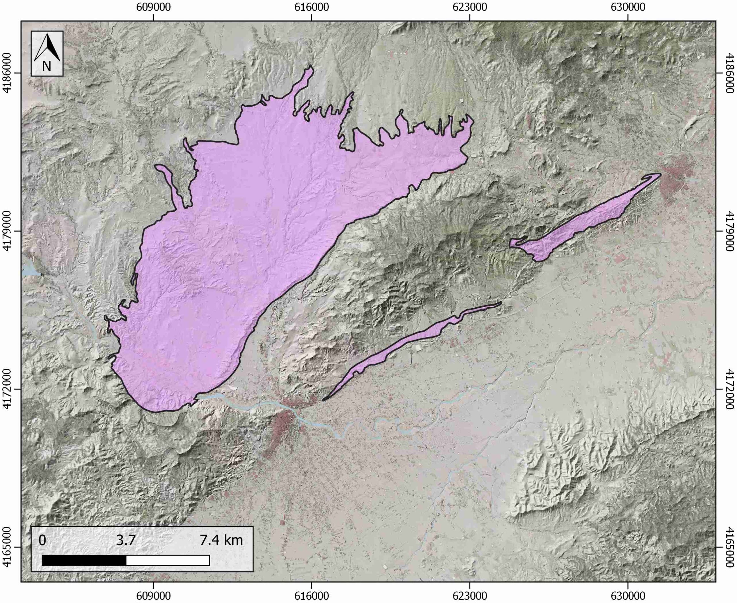
| Structure type | Evaporite body |
| Deformed/Undeformed | Undeformed |
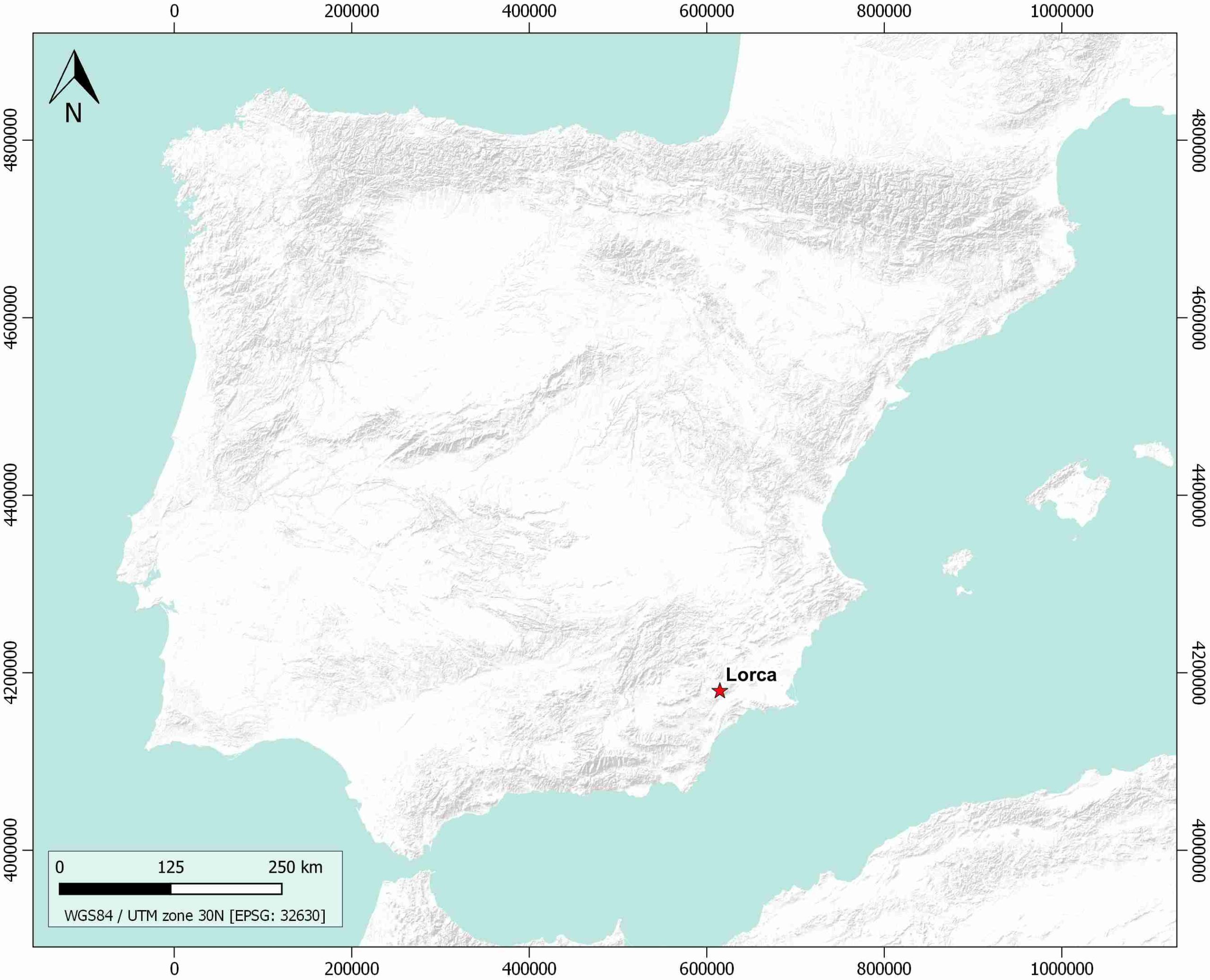
| Geological Setting | Betic system, Lorca Basin |
| Outcropping/buried | Outcropping |
| Evaporite unit/s name | La Serrata Fm. |
| Evaporite unit/s age | Late Tortonian-Early Messinian (Upper Miocene) |
| Evaporite unit/s origin | Continental, Marine |
| Classif. (Hudec and Jackson, 2009) | No diapirism |
| Classif. (Jackson and Talbot, 1986) | No diapirism |
| Age of evaporite flow or deformation (when deformed) | Undeformed |
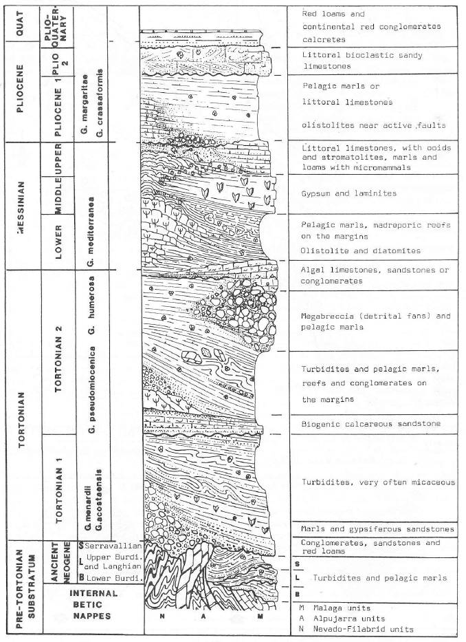
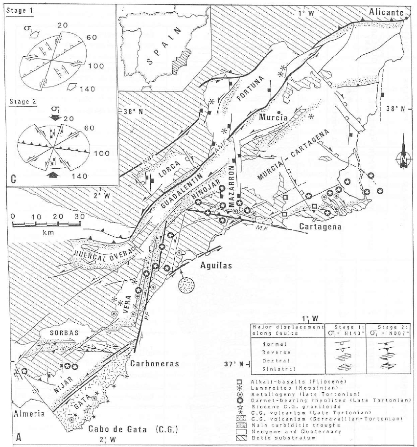
| Other comments | Messinian salinity crisis represented in the Lorca basin. Early-Middle Miocene compression produced sectorial uplifts and basin development that increased marine restriction and isolation, favouring the evaporite precipitation. During the Late Miocene, extensional tectonics occurred along the Lorca basin. Evaporites can be stratigraphically and chemically correlated with those outcropping in the Fortuna basin. |
Generic Data
| Unique ID | 136 |
| Name | Lorca |
| Structure type | Evaporite body |
| Deformed/Undeformed | Undeformed |
| Buried/Outcropping | Outcropping |
| Geological setting | Betic System |
| Geological Regional Setting | Lorca Basin |
| Evaporite unit/s name | La Serrata Fm. (Varied Mb unit, Detrital Mb unit, Lower Gypsum unit, Upper Gypsum Unit, Laminated Peliteunit, Basal Anhydrite unit, Lower Salt unit, Upper Salt unit and Overlying Gypsum unit |
| Evaporite unit/s age | Late Tortonian-Early Messinian (Upper Miocene) |
| Evaporite unit/s era | Cenozoic |
| Evaporite unit/s origin | Marine and Continental |
| Evaporite unit/s composition | Marlstone-Massive gypsum-Sandstones-Halite |
| Post-kinematic unit/s (or post-evaporite units when evaporites are undeformed) | Quaternary (alluvial and colluvial detrital deposits) |
| Post-kinematic unit/s age (or post-evaporite units when evaporites are undeformed) | Pleistocene-Holocene |
| Classification (Hudec and Jackson, 2009) | No diapirism |
| Classification (Jackson and Talbot, 1986) | No diapirism |
| Mining activity? | Y |
| Mining activity start | 1860 |
| Mining activity end | Active |
| Mining galleries? | Y |
| Mining products | Gypsum |
| Mining sub-products | Sandstone, Gravel |
| Evaporite flow? | N |
| Age of evaporite flow | – |
| Flow or deformation triggering mechanisms | – |
| Flow-linked structures? | – |
| Halokinetic structures | – |
| Post-evaporite and pre-kinematic unit/s (overbuden) | – |
| Syn-kinematic unit/s | – |
| Available seismic profiles | LA SALUD S / LA SALUD N / GUADALENTIN / S-85-74 |
| Available boreholes | LRC-2b / LRC-3 / LRC-1b / LRC-2 / LRC-1 / LRC-1b / LRC-4 / LRC-5 / LRC-3 / LRC-4 / LRC-2 / LRC-2b / LRC-5 / LRC-1 / CC-2 (CABEZO COLORAO) |
| Additional comments | Messinian salinity crisis represented in the Lorca basin. Early-Middle Miocene compression produced sectorial uplifts and basin development that increased marine restriction and isolation, favouring the evaporite precipitation. During the Late Miocene, extensional tectonics occurred along the Lorca basin. Evaporites can be stratigraphically and chemically correlated with those outcropping in the Fortuna basin |
Mining Data
| UNIQUE_ID | 136 |
| Minning exploitations within <2km? | Y |
| Historical/Active | Active |
| Exploitation name #1 | LA SERRATA |
| Exploitation ID (Spanish National Mining Cadastre) #1 | 1165 |
| Municipality #1 | Lorca |
| Province #1 | MURCIA |
| Company #1 | EXPLOTACIONES RIO DE AGUAS S.L |
| Main minning Products #1 | Gypsum |
| Exploitation name #2 | LOS TRINCHERAS |
| Exploitation ID (Spanish National Mining Cadastre) #2 | 1365 |
| Municipality #2 | Lorca |
| Province #2 | MURCIA |
| Company #2 | HERMANOS GONZALEZ LUCAS S.A. |
| Main minning Products #2 | Gravel and sand |
| Exploitation name #3 | |
| Exploitation ID (Spanish National Mining Cadastre) #3 | |
| Municipality #3 | |
| Province #3 | |
| Company #3 | |
| Main minning Products #3 |
Quantitative Data
| UNIQUE_ID | 136 |
| Outcropping area (km2) | 107.75687 |
| Horizontal intersection area (km2) (when buried) | Not buried |
| Depth of intersection area (km2) (when buried) | Not buried |
| Max. Width (Km) | 13.4627777 |
| Max. Length (Km) | 25.5379022 |
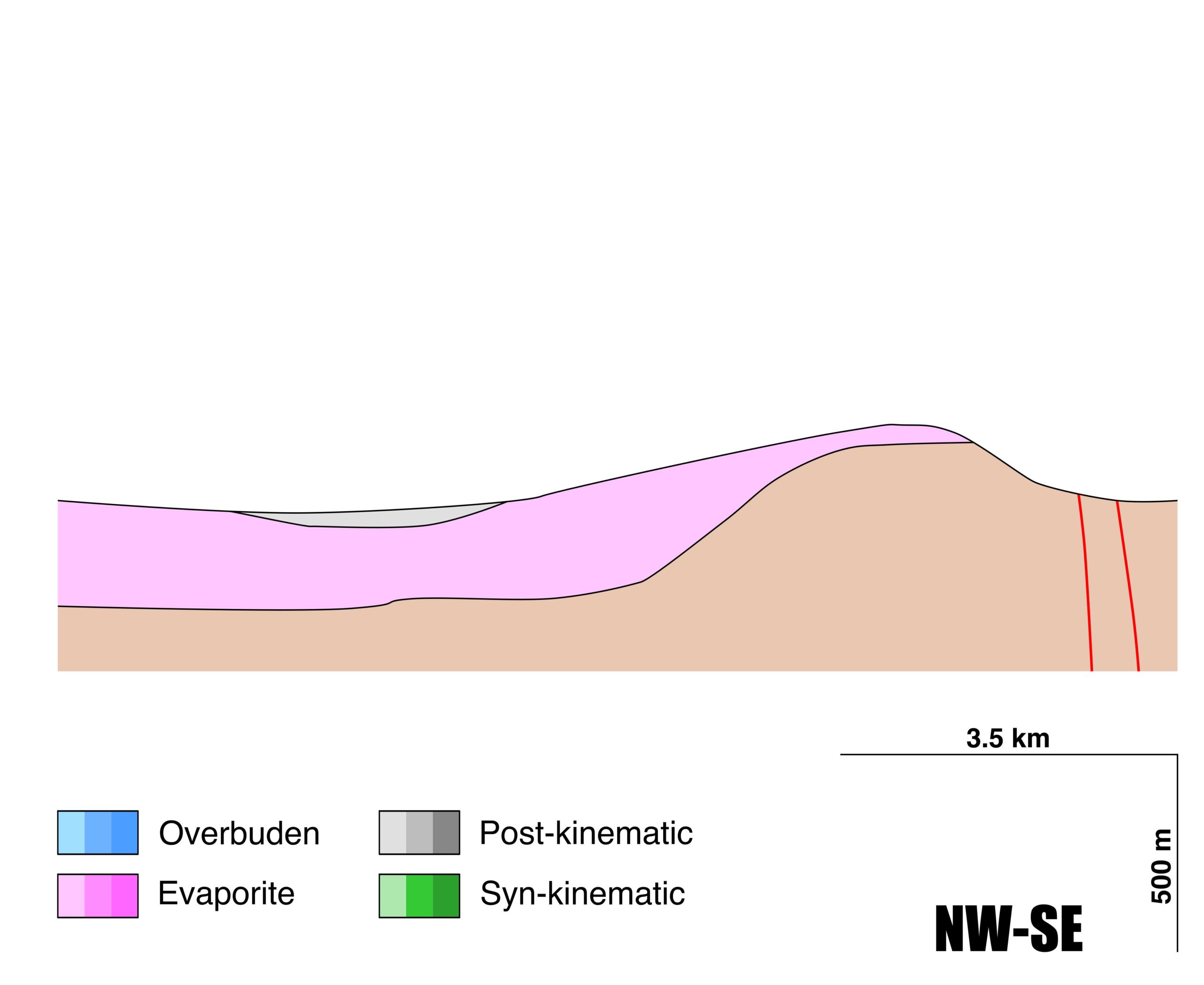
| Max. Evaporites thickness (km) | 0.5 |
| Max. Deformation age (Ma) | – |
| Min. Deformation age (Ma) | – |
| Deformation stages | 0 |
Reference Data
| UNIQUE_ID | 136 |
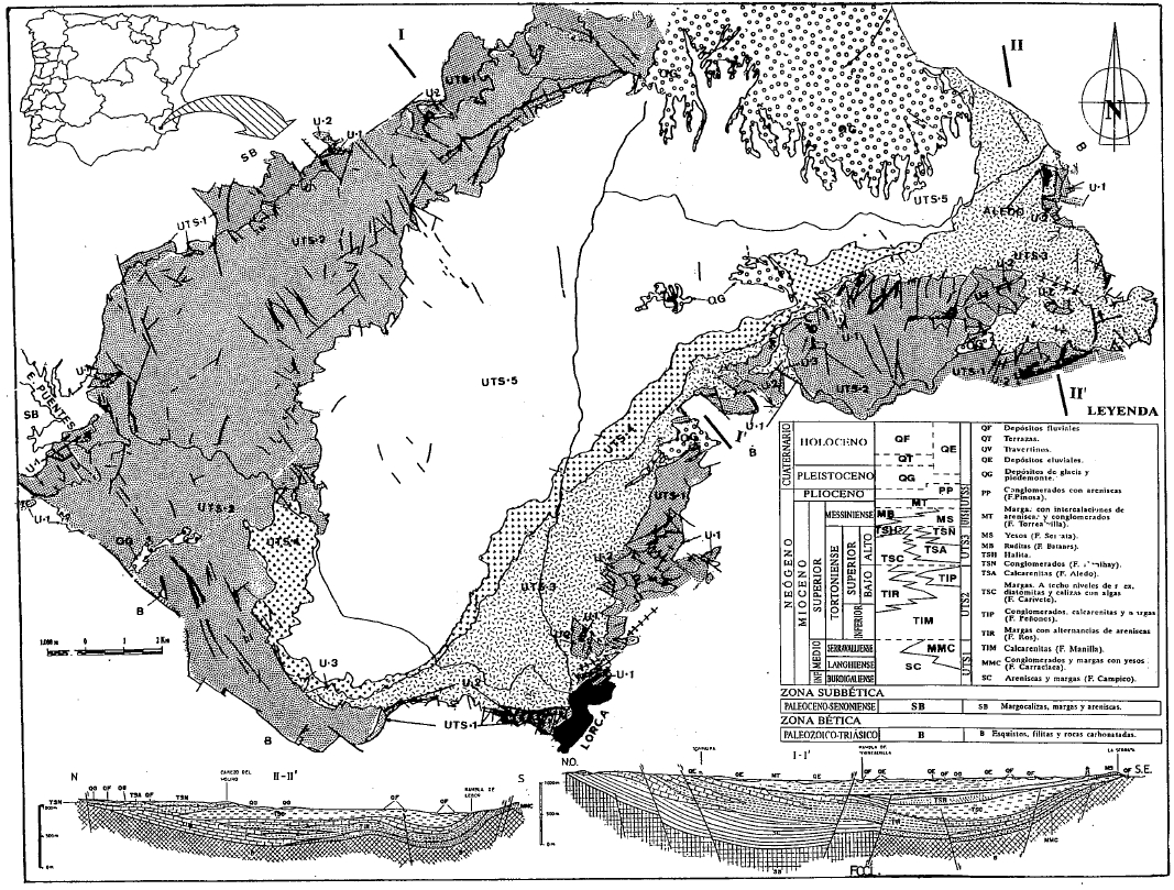
| Section source | de Galdeano, C. S., García-Mondéjar, J., Ferrairó, J. M., 2012. Evolución tectónica del sector de Lorca desde el Mioceno superior al Cuaternario/Tectonic evolution of the Lorca sector from the Late Miocene to the Quaternary. Física de la Tierra, 24, 193. [link] |
| Well / Borehole availability #1 | García-Veigas, J., Ortí, F., Rosell, L., Inglés, M., 1994. Caracterizacion petrologica y geoquimica de la unidad salina messiniense de la cuenca de Lorca (sondeos S4 y S5). Geogaceta, 15(78.8). [link] |
| Well / Borehole availability #2 | n.a. |
| Available data (Stratigraphy) #1 | García‐Veigas, J., Gibert, L., Cendón, D. I., Artiaga, D., Corbí, H., Soria, J. M., …, Sanz, E., 2020. Late Miocene evaporite geochemistry of Lorca and Fortuna basins (Eastern Betics, SE Spain): Evidence of restriction and continentalization. Basin Research, 32(5), 926-958. [link] |
| Available data (Stratigraphy) #2 | Carpentier, C., Vennin, E., Rouchy, J. M., Cornée, J. J., Melinte-Dobrinescu, M., Hibsch, C., …, Bartier, D., 2020. Ages and stratigraphical architecture of late Miocene deposits in the Lorca Basin (Betics, SE Spain): New insights for the salinity crisis in marginal basins. Sedimentary Geology, 405, 105700. [link] |
| Available data (Stratigraphy) #3 | Ortí, F., García-Veigas, J., Rosell, L., Rouchy, J. M., Ingles, M., Gimeno, D., …, Playa, E., 1993. Correlación litoestratigráfica de las evaporitas messinienses en las cuencas de Lorca y Fortuna (Murcia). Geogaceta, 14, 98-101. [link] |
| Available data (Stratigraphy) #4 | Playà, E., Ortı, F., Rosell, L., 2000. Marine to non-marine sedimentation in the upper Miocene evaporites of the Eastern Betics, SE Spain: sedimentological and geochemical evidence. Sedimentary Geology, 133(1-2), 135-166. [link] |
| Available data (Stratigraphy) #5 | Benali, S., Schreiber, B. C., Helman, M. L., Philp, R. P., 1995. Characterization of organic matter from a restricted/evaporative sedimentary environment: late Miocene of Lorca Basin, southeastern Spain. AAPG Bulletin, 79(6), 816-829. [link] |
| Available data (Stratigraphy) #6 | Krijgsman, W., Garcés, M., Agustı, J., Raffi, I., Taberner, C., Zachariasse, W. J., 2000. The ‘Tortonian salinity crisis’ of the eastern Betics (Spain). Earth and Planetary Science Letters, 181(4), 497-511. [link] |
| Regional Stratigraphy | Montenat C. H., d’Estevou, P. O., Fernandez, J. R., De Galdeano, C. S., 1990. Geodynamic evolution of the Betic Neogene intramontane basins (S and SE Spain). Paleontologia i Evolucio Especial, 2, 5-60, Unpublished. [link] |
| Seismic data availability #1 | n.a. |
| Seismic data availability #2 | n.a. |
| Seismic data availability #3 | n.a. |
| Available data (Structure) #1 | de Galdeano, C. S., García-Mondéjar, J., Ferrairó, J. M., 2012. Evolución tectónica del sector de Lorca desde el Mioceno superior al Cuaternario/Tectonic evolution of the Lorca sector from the Late Miocene to the Quaternary. Física de la Tierra, 24, 193. [link] |
| Available data (Structure) #2 | Guillén Mondéjar, F., 1994. La evolución espacio-temporal de la Cuenca de Lorca (Murcia). Aspectos geológicos y mineralógicos [Ph.D. Thesis]: Universidad de Murcia, 400pp. [link] |
| Available data (Structure) #3 | Krijgsman, W., Leewis, M. E., Garcés, M., Kouwenhoven, T. J., Kuiper, K. F., Sierro, F. J., 2006. Tectonic control for evaporite formation in the Eastern Betics (Tortonian; Spain). Sedimentary Geology, 188, 155-170. [link] |
| Available data (Structure) #4 | Frizon de Lamotte, D., Guézou, J. C., Albertini, M. A., 1989. Deformation related to Miocene westward translation in the core of the Betic zone Implications on the tectonic interpretation of the Betic orogen (Spain). Geodinamica Acta, 3(4), 267-281. [link] |
| Available data (Structure) #5 | Guillén Mondéjar, F., Rodríguez Estrella, T., Arana, R., López Aguayo, F., 1995. Historia geológica de la cuenca de Lorca (Murcia): influencia de la tectónica en la sedimentación. Geogaceta, 18, 30-33. [link] |
| Available data (Structure) #6 | n.a. |
| Available data (Analogue modelling) #1 | n.a. |
| Available data (Analogue modelling) #2 | n.a. |
| Available data (Analogue modelling) #3 | n.a. |
| Available data (Gravimetry – Tomography) #1 | Ayala, C., Bohoyo, F., Maestro, A., Reguera, M. I., Torne, M., Rubio, F., Fernández, M., García-Lobón, J. L., 2016. Updated Bouguer anomalies of the Iberian Peninsula: a new perspective to interpret the regional geology. Journal of Maps, 12(5), 1089-1092. [link] |
| Available data (Gravimetry – Tomography) #2 | n.a. |
| Available data (Gravimetry – Tomography) #3 | n.a. |
| Available data (Geochemistry) #1 | García‐Veigas, J., Gibert, L., Cendón, D. I., Artiaga, D., Corbí, H., Soria, J. M., …, Sanz, E., 2020. Late Miocene evaporite geochemistry of Lorca and Fortuna basins (Eastern Betics, SE Spain): Evidence of restriction and continentalization. Basin Research, 32(5), 926-958. [link] |
| Available data (Geochemistry) #2 | García-Veigas, J., Ortí, F., Rosell, L., Inglés, M., 1994. Caracterizacion petrologica y geoquimica de la unidad salina messiniense de la cuenca de Lorca (sondeos S4 y S5). Geogaceta, 15(78.8). [link] |
| Available data (Geochemistry) #3 | Benali, S., Schreiber, B. C., Helman, M. L., Philp, R. P., 1995. Characterization of organic matter from a restricted/evaporative sedimentary environment: late Miocene of Lorca Basin, southeastern Spain. AAPG Bulletin, 79(6), 816-829. [link] |
| Available data (Geochemistry) #4 | Ayora, C., Garcia-Veigas, J., Pueyo, J. J., 1994. X-ray microanalysis of fluid inclusions and its application to the geochemical modeling of evaporite basins. Geochimica et Cosmochimica Acta, 58(1), 43-55. [link] |
| Available data (Petrophysics) #1 | i Turell, J. D., Sprovieri, R., Caruso, A., Di Stefano, E., Coll, E. G., Mur, J. J. P., …, Taberner, C., 1997. Premilinary integrated magnetostratigrafía and biostratigraphic correlation in the Miocene Lorca basin,(Murcia, SE Spain). Acta geológica hispánica, 161-170. [link] |
| Available data (Petrophysics) #2 | Krijgsman, W., Leewis, M. E., Garcés, M., Kouwenhoven, T. J., Kuiper, K. F., Sierro, F. J., 2006. Tectonic control for evaporite formation in the Eastern Betics (Tortonian; Spain). Sedimentary Geology, 188, 155-170. [link] |
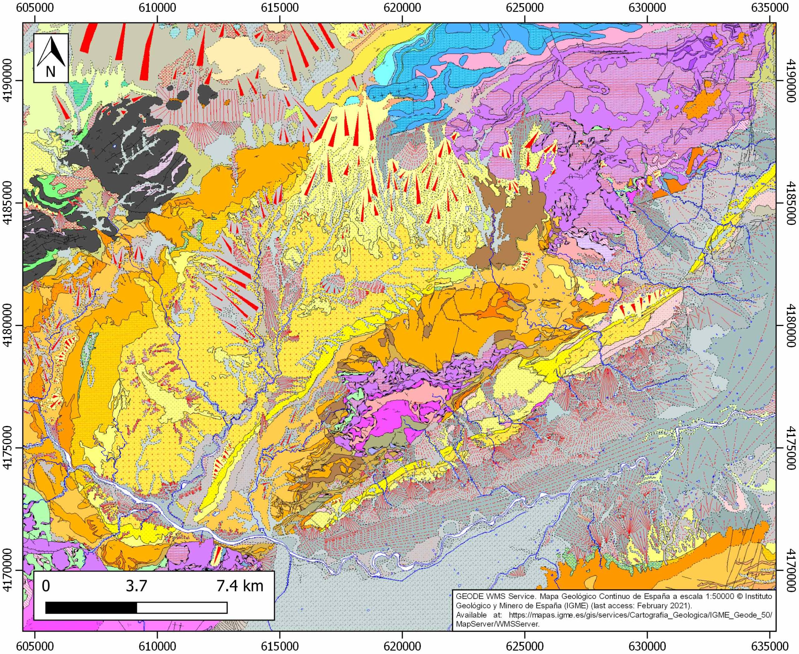
| IGME Geological Map (MAGNA50) Sheet number | 953-Lorca. [link] |
| Other Maps #1 (source) | Montenat C. H., d’Estevou, P. O., Fernandez, J. R., De Galdeano, C. S., 1990. Geodynamic evolution of the Betic Neogene intramontane basins (S and SE Spain). Paleontologia i Evolucio Especial, 2, 5-60, Unpublished. [link] |
| Other Maps #2 (source) | Guillén Mondéjar, F., Rodríguez Estrella, T., Arana, R., López Aguayo, F., 1995. Unidades tectosedimentarias y rupturas en la Cuenca de lorca (Murcia). Geogaceta, 17, 39-42. [link] |
| Other related references #1 | Andreetto, F., Dela Pierre, F., Gibert, L., Natalicchio, M., Ferrando, S., 2019. Potential fossilized sulfide-oxidizing bacteria in the Upper Miocene sulfur-bearing limestones from the Lorca Basin (SE Spain): paleoenvironmental Implications. Frontiers in microbiology, 10, 1031. [link] |
| Other related references #2 | Artiaga, D., García-Veigas, J., Gibert, L., Soria, J. M., 2020. The late Miocene Campo Coy gypsum (Eastern Betics, Spain). Geogaceta, 67, 63-66. [link] |
| Other related references #3 | Jurkschat, T., Fenner, J., Fischer, R., Michalzik, D., 2000. Environmental changes in pre-evaporitic Late Miocene time in the Lorca Basin (SE Spain): diatom results. Geological Society, London, Special Publications, 181(1), 65-78. [link] |
| Other related references #4 | Pierre, C., Rouchy, J. M., Blanc-Valleron, M. M., 2002. Gas hydrate dissociation in the Lorca Basin (SE Spain) during the Mediterranean Messinian salinity crisis. Sedimentary Geology, 147(3-4), 247-252. [link] |
Well and Seismic Data
| UNIQUE_ID | 136 |
| Seismic survey name #1 | LA SALUD S |
| Across structure? #1 | Y |
| Seismic profile ID (IGME) #1 | n.a. |
| Seismic profile code #1 | n.a. |
| Seismic profile name #1 | n.a. |
| Seismic survey year #1 | n.a. |
| Data repository #1 | SeisDARE Database: https://digital.csic.es/handle/10261/101879 |
| Length (km) #1 | 1.45 |
| Seismic survey name #2 | LA SALUD N |
| Across structure? #2 | Y |
| Seismic profile ID (IGME) #2 | n.a. |
| Seismic profile code #2 | n.a. |
| Seismic profile name #2 | n.a. |
| Seismic survey year #2 | n.a. |
| Data repository #2 | SeisDARE Database: https://digital.csic.es/handle/10261/101879 |
| Length (km) #2 | 1.02 |
| Seismic survey name #3 | GUADALENTIN |
| Across structure? #3 | N (within 3km) (withiN (within 3km) 3km) |
| Seismic profile ID (IGME) #3 | n.a. |
| Seismic profile code #3 | n.a. |
| Seismic profile name #3 | n.a. |
| Seismic survey year #3 | n.a. |
| Data repository #3 | SeisDARE Database: https://digital.csic.es/handle/10261/102015 |
| Length (km) #3 | 0.76 |
| Seismic survey name #4 | 9IBIS-S-85 |
| Across structure? #4 | N (within 3km) |
| Seismic profile ID (IGME) #4 | 13769 |
| Seismic profile code #4 | 18490 |
| Seismic profile name #4 | S-85-74 |
| Seismic survey year #4 | 1985 |
| Data repository #4 | SIGEOF Data Catalogue (Section available under request). ©Instituto Geológico y Minero de España (IGME). https://info.igme.es/SIGEOF/ |
| Length (km) #4 | 12.62 |
| Seismic survey name #5 | |
| Across structure? #5 | |
| Seismic profile ID (IGME) #5 | |
| Seismic profile code #5 | |
| Seismic profile name #5 | |
| Seismic survey year #5 | |
| Data repository #5 | |
| Length (km) #5 | |
| Seismic survey name #6 | |
| Across structure? #6 | |
| Seismic profile ID (IGME) #6 | |
| Seismic profile code #6 | |
| Seismic profile name #6 | |
| Seismic survey year #6 | |
| Data repository #6 | |
| Length (km) #6 | |
| Seismic survey name #7 | |
| Across structure? #7 | |
| Seismic profile ID (IGME) #7 | |
| Seismic profile code #7 | |
| Seismic profile name #7 | |
| Seismic survey year #7 | |
| Data repository #7 | |
| Length (km) #7 | |
| Seismic survey name #8 | |
| Across structure? #8 | |
| Seismic profile ID (IGME) #8 | |
| Seismic profile code #8 | |
| Seismic profile name #8 | |
| Seismic survey year #8 | |
| Data repository #8 | |
| Length (km) #8 | |
| Seismic survey name #9 | |
| Across structure? #9 | |
| Seismic profile ID (IGME) #9 | |
| Seismic profile code #9 | |
| Seismic profile name #9 | |
| Seismic survey year #9 | |
| Data repository #9 | |
| Length (km) #9 | |
| Seismic survey name #10 | |
| Across structure? #10 | |
| Seismic profile ID (IGME) #10 | |
| Seismic profile code #10 | |
| Seismic profile name #10 | |
| Seismic survey year #10 | |
| Data repository #10 | |
| Length (km) #10 | |
| Seismic survey name #11 | |
| Across structure? #11 | |
| Seismic profile ID (IGME) #11 | |
| Seismic profile code #11 | |
| Seismic profile name #11 | |
| Seismic survey year #11 | |
| Data repository #11 | |
| Length (km) #11 | |
| Seismic survey name #12 | |
| Across structure? #12 | |
| Seismic profile ID (IGME) #12 | |
| Seismic profile code #12 | |
| Seismic profile name #12 | |
| Seismic survey year #12 | |
| Data repository #12 | |
| Length (km) #12 | |
| Seismic survey name #13 | |
| Across structure? #13 | |
| Seismic profile ID (IGME) #13 | |
| Seismic profile code #13 | |
| Seismic profile name #13 | |
| Seismic survey year #13 | |
| Data repository #13 | |
| Length (km) #13 | |
| Seismic survey name #14 | |
| Across structure? #14 | |
| Seismic profile ID (IGME) #14 | |
| Seismic profile code #14 | |
| Seismic profile name #14 | |
| Seismic survey year #14 | |
| Data repository #14 | |
| Length (km) #14 | |
| Seismic survey name #15 | |
| Across structure? #15 | |
| Seismic profile ID (IGME) #15 | |
| Seismic profile code #15 | |
| Seismic profile name #15 | |
| Seismic survey year #15 | |
| Data repository #15 | |
| Length (km) #15 | |
| Seismic survey name #16 | |
| Across structure? #16 | |
| Seismic profile ID (IGME) #16 | |
| Seismic profile code #16 | |
| Seismic profile name #16 | |
| Seismic survey year #16 | |
| Data repository #16 | |
| Length (km) #16 | |
| Seismic survey name #17 | |
| Across structure? #17 | |
| Seismic profile ID (IGME) #17 | |
| Seismic profile code #17 | |
| Seismic profile name #17 | |
| Seismic survey year #17 | |
| Data repository #17 | |
| Length (km) #17 | |
| Seismic survey name #18 | |
| Across structure? #18 | |
| Seismic profile ID (IGME) #18 | |
| Seismic profile code #18 | |
| Seismic profile name #18 | |
| Seismic survey year #18 | |
| Data repository #18 | |
| Length (km) #18 | |
| Seismic survey name #19 | |
| Across structure? #19 | |
| Seismic profile ID (IGME) #19 | |
| Seismic profile code #19 | |
| Seismic profile name #19 | |
| Seismic survey year #19 | |
| Data repository #19 | |
| Length (km) #19 | |
| Seismic survey name #20 | |
| Across structure? #20 | |
| Seismic profile ID (IGME) #20 | |
| Seismic profile code #20 | |
| Seismic profile name #20 | |
| Seismic survey year #20 | |
| Data repository #20 | |
| Length (km) #20 | |
| Seismic survey name #21 | |
| Across structure? #21 | |
| Seismic profile ID (IGME) #21 | |
| Seismic profile code #21 | |
| Seismic profile name #21 | |
| Seismic survey year #21 | |
| Data repository #21 | |
| Length (km) #21 | |
| Borehole name #1 | LRC-2b |
| Company #1 | SDAD. ESPAÑOLA DE TALCOS, S.A. |
| Traget #1 | POTASIUM SALT |
| Across structure? #1 | Y |
| Borehole name #2 | LRC-3 |
| Company #2 | SDAD. ESPAÑOLA DE TALCOS, S.A. |
| Traget #2 | POTASIUM SALT |
| Across structure? #2 | Y |
| Borehole name #3 | LRC-1b |
| Company #3 | SDAD. ESPAÑOLA DE TALCOS, S.A. |
| Traget #3 | POTASIUM SALT |
| Across structure? #3 | Y |
| Borehole name #4 | LRC-2 |
| Company #4 | SDAD. ESPAÑOLA DE TALCOS, S.A. |
| Traget #4 | POTASIUM SALT |
| Across structure? #4 | Y |
| Borehole name #5 | LRC-1 |
| Company #5 | SDAD. ESPAÑOLA DE TALCOS, S.A. |
| Traget #5 | POTASIUM SALT |
| Across structure? #5 | Y |
| Borehole name #6 | LRC-1b |
| Company #6 | SDAD. ESPAÑOLA DE TALCOS, S.A. |
| Traget #6 | POTASIUM SALT |
| Across structure? #6 | Y |
| Borehole name #7 | LRC-4 |
| Company #7 | SDAD. ESPAÑOLA DE TALCOS, S.A. |
| Traget #7 | POTASIUM SALT |
| Across structure? #7 | Y |
| Borehole name #8 | LRC-5 |
| Company #8 | SDAD. ESPAÑOLA DE TALCOS, S.A. |
| Traget #8 | POTASIUM SALT |
| Across structure? #8 | Y |
| Borehole name #9 | LRC-3 |
| Company #9 | SDAD. ESPAÑOLA DE TALCOS, S.A. |
| Traget #9 | POTASIUM SALT |
| Across structure? #9 | Y |
| Borehole name #10 | LRC-4 |
| Company #10 | SDAD. ESPAÑOLA DE TALCOS, S.A. |
| Traget #10 | POTASIUM SALT |
| Across structure? #10 | Y |
| Borehole name #11 | LRC-2 |
| Company #11 | SDAD. ESPAÑOLA DE TALCOS, S.A. |
| Traget #11 | POTASIUM SALT |
| Across structure? #11 | Y |
| Borehole name #12 | LRC-2b |
| Company #12 | SDAD. ESPAÑOLA DE TALCOS, S.A. |
| Traget #12 | POTASIUM SALT |
| Across structure? #12 | Y |
| Borehole name #13 | LRC-5 |
| Company #13 | SDAD. ESPAÑOLA DE TALCOS, S.A. |
| Traget #13 | POTASIUM SALT |
| Across structure? #13 | Y |
| Borehole name #14 | LRC-1 |
| Company #14 | SDAD. ESPAÑOLA DE TALCOS, S.A. |
| Traget #14 | POTASIUM SALT |
| Across structure? #14 | Y |
| Borehole name #15 | CC-2 (CABEZO COLORAO) |
| Company #15 | IGME |
| Traget #15 | INDUSTRIAL ROCKS |
| Across structure? #15 | N (within 5 km) |
Geographical Data (EPSG:4326 - WGS 84)
| UNIQUE_ID | 136 |
| X Centroid (Structure shape) | -1.702746 |
| Y Centroid (Structure shape) | -1.702746 |
| Xmin (Structure shape) | -1.787868 |
| Xmax (Structure shape) | -1.507279 |
| Ymin (Structure shape) | 37.679385 |
| Ymax (Structure shape) | 37.817209 |
| Xmin seismic line #1 | -1.618452 |
| Xmax seismic line #1 | -1.607880 |
| Ymin seismic line #1 | 37.705308 |
| Ymax seismic line #1 | 37.715058 |
| Xmin seismic line #2 | -1.609091 |
| Xmax seismic line #2 | -1.605197 |
| Ymin seismic line #2 | 37.712593 |
| Ymax seismic line #2 | 37.721193 |
| Xmin seismic line #3 | -1.700262 |
| Xmax seismic line #3 | -1.694134 |
| Ymin seismic line #3 | 37.677663 |
| Ymax seismic line #3 | 37.681379 |
| Xmin seismic line #4 | -1.479515 |
| Xmax seismic line #4 | -1.397100 |
| Ymin seismic line #4 | 37.663421 |
| Ymax seismic line #4 | 37.756350 |
| Xmin seismic line #5 | |
| Xmax seismic line #5 | |
| Ymin seismic line #5 | |
| Ymax seismic line #5 | |
| Xmin seismic line #6 | |
| Xmax seismic line #6 | |
| Ymin seismic line #6 | |
| Ymax seismic line #6 | |
| Xmin seismic line #7 | |
| Xmax seismic line #7 | |
| Ymin seismic line #7 | |
| Ymax seismic line #7 | |
| Xmin seismic line #8 | |
| Xmax seismic line #8 | |
| Ymin seismic line #8 | |
| Ymax seismic line #8 | |
| Xmin seismic line #9 | |
| Xmax seismic line #9 | |
| Ymin seismic line #9 | |
| Ymax seismic line #9 | |
| Xmin seismic line #10 | |
| Xmax seismic line #10 | |
| Ymin seismic line #10 | |
| Ymax seismic line #10 | |
| Xmin seismic line #11 | |
| Xmax seismic line #11 | |
| Ymin seismic line #11 | |
| Ymax seismic line #11 | |
| Xmin seismic line #12 | |
| Xmax seismic line #12 | |
| Ymin seismic line #12 | |
| Ymax seismic line #12 | |
| Xmin seismic line #13 | |
| Xmax seismic line #13 | |
| Ymin seismic line #13 | |
| Ymax seismic line #13 | |
| Xmin seismic line #14 | |
| Xmax seismic line #14 | |
| Ymin seismic line #14 | |
| Ymax seismic line #14 | |
| Xmin seismic line #15 | |
| Xmax seismic line #15 | |
| Ymin seismic line #15 | |
| Ymax seismic line #15 | |
| Xmin seismic line #16 | |
| Xmax seismic line #16 | |
| Ymin seismic line #16 | |
| Ymax seismic line #16 | |
| Xmin seismic line #17 | |
| Xmax seismic line #17 | |
| Ymin seismic line #17 | |
| Ymax seismic line #17 | |
| Xmin seismic line #18 | |
| Xmax seismic line #18 | |
| Ymin seismic line #18 | |
| Ymax seismic line #18 | |
| Xmin seismic line #19 | |
| Xmax seismic line #19 | |
| Ymin seismic line #19 | |
| Ymax seismic line #19 | |
| Xmin seismic line #20 | |
| Xmax seismic line #20 | |
| Ymin seismic line #20 | |
| Ymax seismic line #20 | |
| Xmin seismic line #21 | |
| Xmax seismic line #21 | |
| Ymin seismic line #21 | |
| Ymax seismic line #21 | |
| X borehole #1 | -1.763672 |
| Y borehole #1 | 37.711001 |
| X borehole #2 | -1.741797 |
| Y borehole #2 | 37.701117 |
| X borehole #3 | -1.749303 |
| Y borehole #3 | 37.706659 |
| X borehole #4 | -1.763673 |
| Y borehole #4 | 37.710974 |
| X borehole #5 | -1.749304 |
| Y borehole #5 | 37.706632 |
| X borehole #6 | -1.749303 |
| Y borehole #6 | 37.706659 |
| X borehole #7 | -1.739136 |
| Y borehole #7 | 37.713508 |
| X borehole #8 | -1.722899 |
| Y borehole #8 | 37.726862 |
| X borehole #9 | -1.741797 |
| Y borehole #9 | 37.701117 |
| X borehole #10 | -1.739136 |
| Y borehole #10 | 37.713508 |
| X borehole #11 | -1.763673 |
| Y borehole #11 | 37.710974 |
| X borehole #12 | -1.763672 |
| Y borehole #12 | 37.711001 |
| X borehole #13 | -1.722899 |
| Y borehole #13 | 37.726862 |
| X borehole #14 | -1.749304 |
| Y borehole #14 | 37.706632 |
| X borehole #15 | -1.810377 |
| Y borehole #15 | 37.690572 |

