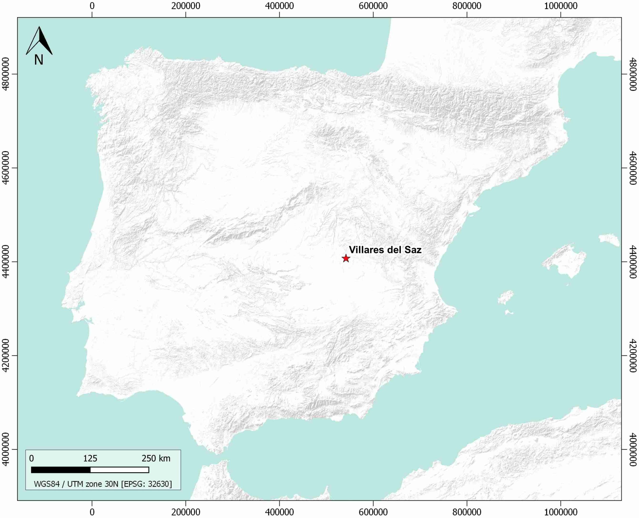
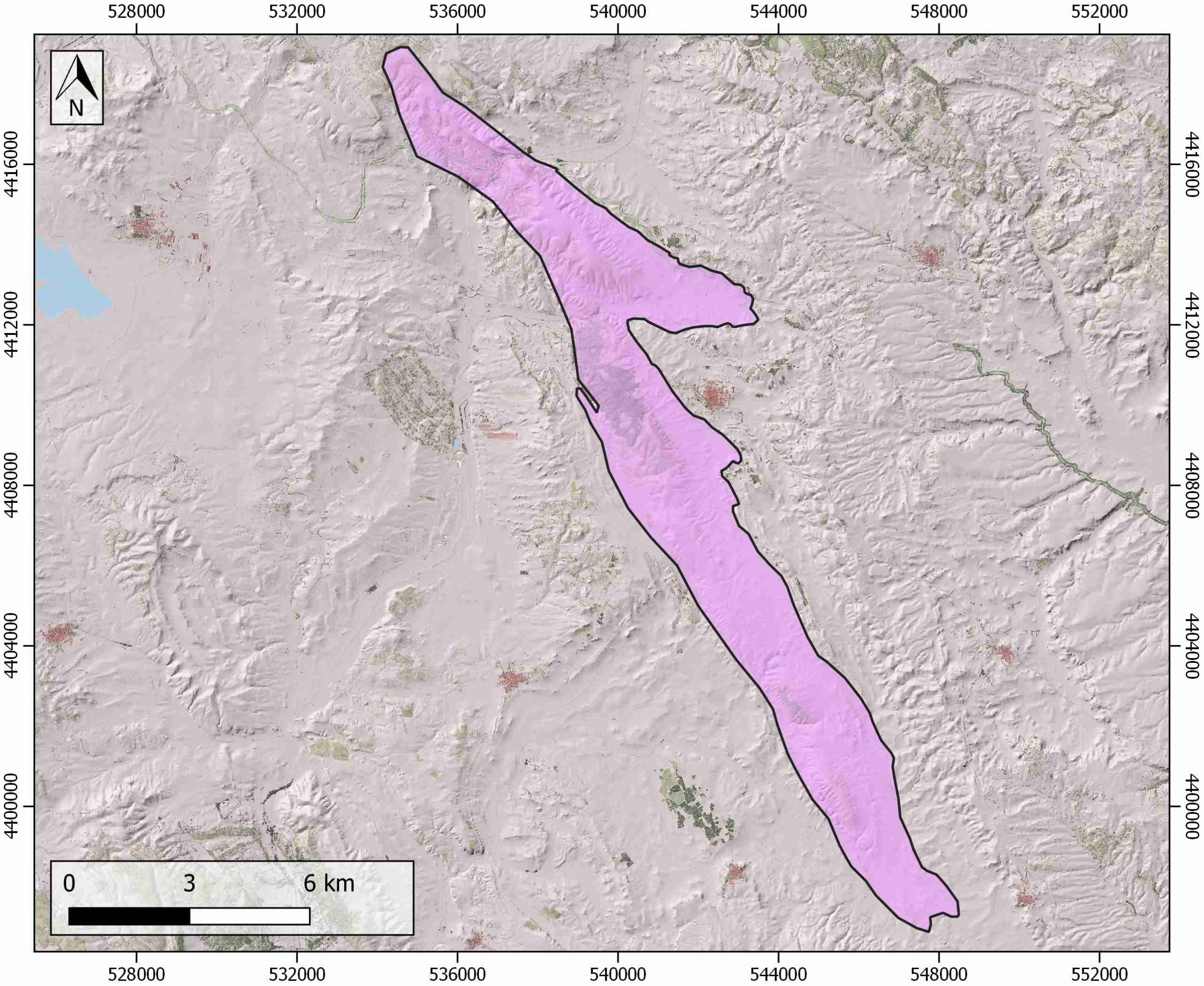
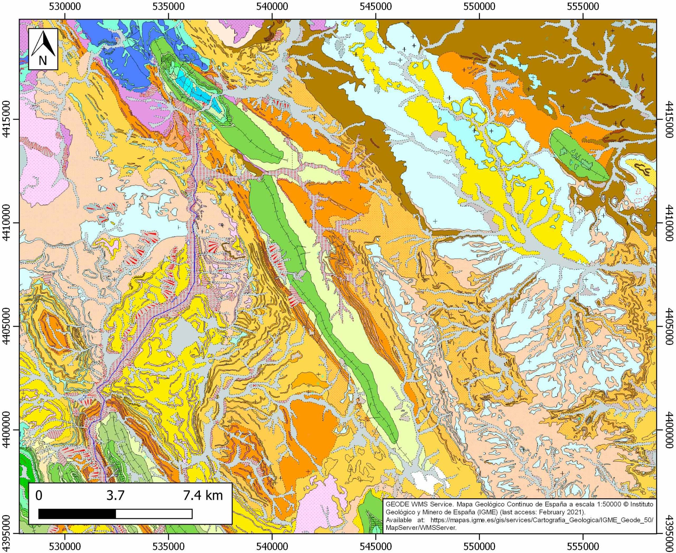
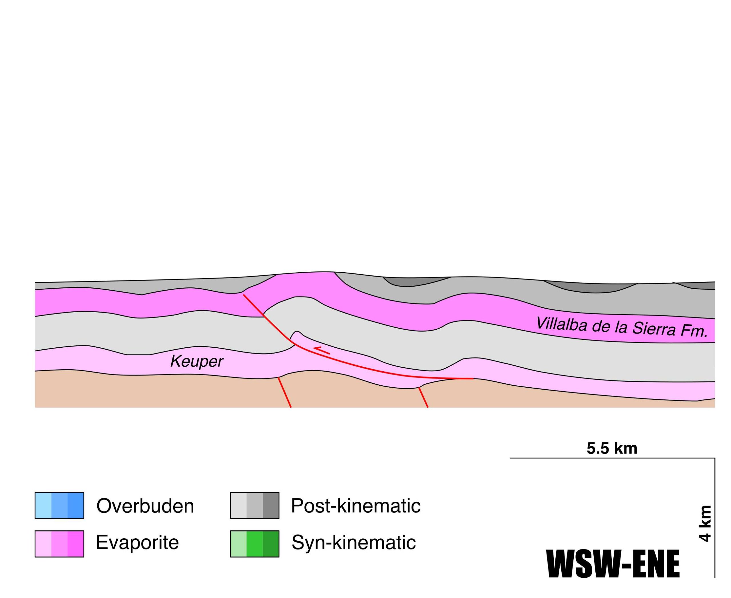
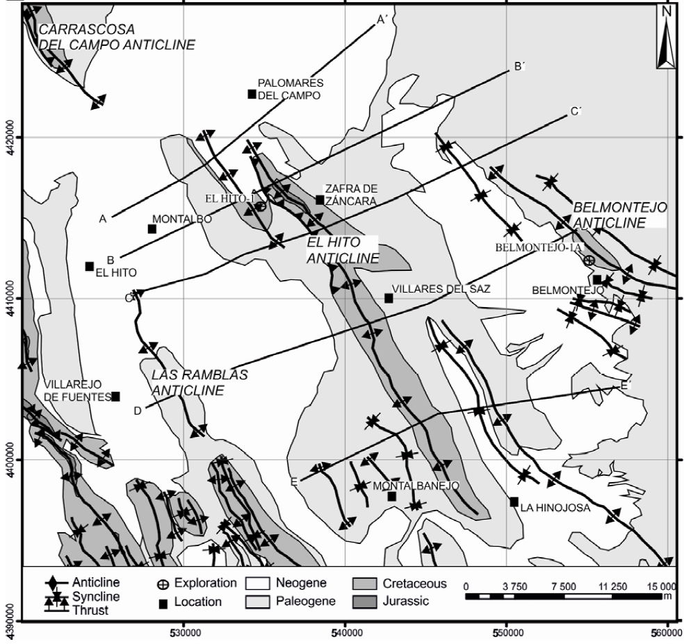
Villares del Saz
ID #146
General Information
| Structure type | Evaporite-cored anticline |
| Deformed/Undeformed | Deformed |
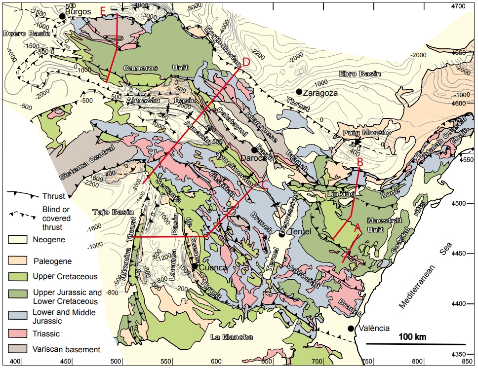
| Geological Setting | Loranca Sub-Basin, Tagus Basin |
| Outcropping/buried | Outcropping |
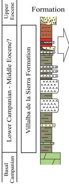
| Evaporite unit/s name | Villalba de la Sierra Fm. |
| Evaporite unit/s age | Maastrichian-Thanetian (Upper Cretaceous-Paleocene) |
| Evaporite unit/s origin | Continental, Marine |
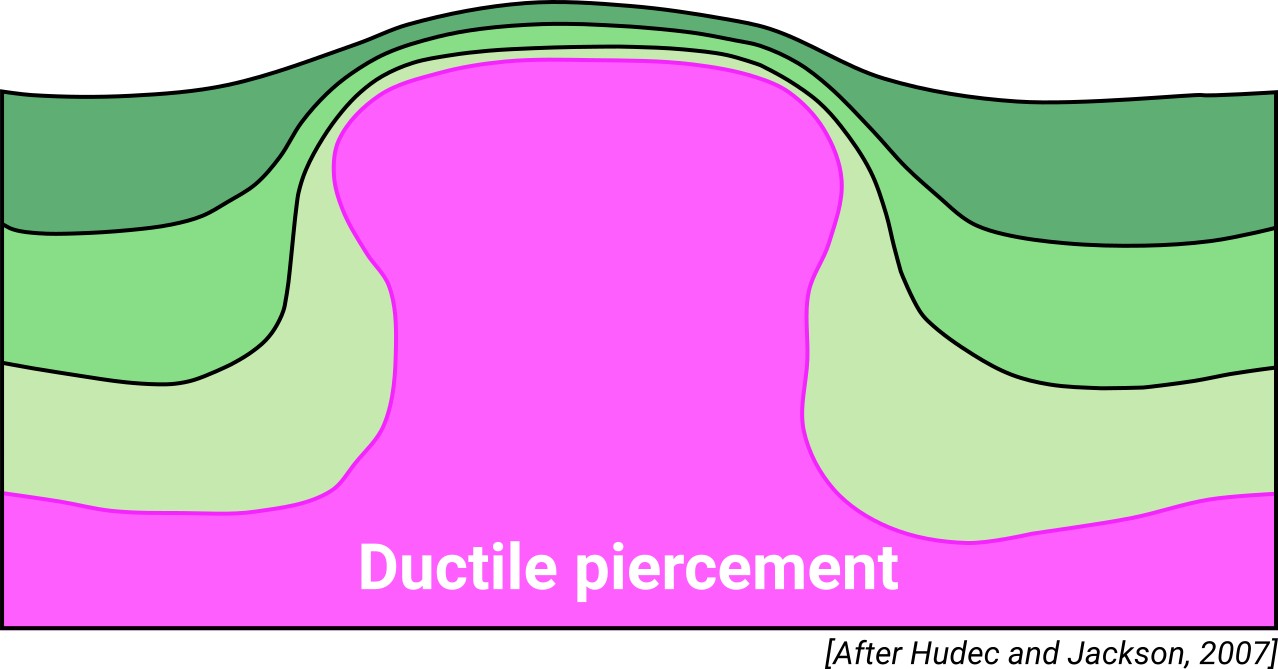
| Classif. (Hudec and Jackson, 2009) | Ductile piercement |
| Classif. (Jackson and Talbot, 1986) | Salt anticline |
| Age of evaporite flow or deformation (when deformed) | Oligocene to Miocene, Upper Cretaceous to Paleocene |
| Other comments | Evaporite formation was coeval to the El Hito anticline development. |
Generic Data
| Unique ID | 146 |
| Name | Villares del Saz |
| Structure type | Evaporite-cored anticline |
| Deformed/Undeformed | Deformed |
| Buried/Outcropping | Outcropping |
| Geological setting | Tagus Basin |
| Geological Regional Setting | Loranca Sub-Basin |
| Evaporite unit/s name | Villalba de la Sierra Fm. |
| Evaporite unit/s age | Maastrichian-Thanetian (Upper Cretaceous-Paleocene) |
| Evaporite unit/s era | Mesozoic-Cenozoic |
| Evaporite unit/s origin | Marine / Continental |
| Evaporite unit/s composition | Marlstone-Gypsum-Claystonestone |
| Post-kinematic unit/s (or post-evaporite units when evaporites are undeformed) | Bartonian-Rupelian (Paleogene Unit, clay, sandstone, lacustrine limestones and evaporites) ; Pliocene and Quaternary (alluvial and colluvial detrital deposits) |
| Post-kinematic unit/s age (or post-evaporite units when evaporites are undeformed) | Bartonian-Rupelian and Pleistocene-Holocene |
| Classification (Hudec and Jackson, 2009) | Ductile piercement |
| Classification (Jackson and Talbot, 1986) | Salt anticline |
| Mining activity? | N |
| Mining activity start | |
| Mining activity end | |
| Mining galleries? | |
| Mining products | |
| Mining sub-products | |
| Evaporite flow? | Y |
| Age of evaporite flow | late Cretaceous-Palaeocene (main stage) and late Oligocene-early Miocene (fold-and-thrust system development) |
| Flow or deformation triggering mechanisms | Alpine compression and inversion of Late Permian-Early Triassic extensional faults |
| Flow-linked structures? | Y |
| Halokinetic structures | Syncline-Anticline folding / thrust faults / progressive unconformities |
| Post-evaporite and pre-kinematic unit/s (overbuden) | – |
| Syn-kinematic unit/s | late Cretaceous-Palaeocene (Villalba de la Sierra Fm., marlstones, gypsum, limestones, sandstones and claystone) ; Upper Oligocene-Early Miocene (Paleogene-Neogene Unit, clay, sandstone, lacustrine limestones and evaporites) |
| Available seismic profiles | VICANAS 2-2D / VICANAS 3-2D / VICANAS 1-2D / 0557A89U / 8G-ST-28 / 8G-ST-28 / 8G-ST-43 / 8G-ST-28 / 0557A89U |
| Available boreholes | HITO-1 |
| Additional comments | Evaporite formation was coeval to the El Hito anticline development. |
Mining Data
| UNIQUE_ID | 146 |
| Minning exploitations within <2km? | N |
| Historical/Active | |
| Exploitation name #1 | |
| Exploitation ID (Spanish National Mining Cadastre) #1 | |
| Municipality #1 | |
| Province #1 | |
| Company #1 | |
| Main minning Products #1 | |
| Exploitation name #2 | |
| Exploitation ID (Spanish National Mining Cadastre) #2 | |
| Municipality #2 | |
| Province #2 | |
| Company #2 | |
| Main minning Products #2 | |
| Exploitation name #3 | |
| Exploitation ID (Spanish National Mining Cadastre) #3 | |
| Municipality #3 | |
| Province #3 | |
| Company #3 | |
| Main minning Products #3 |
Quantitative Data
| UNIQUE_ID | 146 |
| Outcropping area (km2) | 53.14645 |
| Horizontal intersection area (km2) (when buried) | Not buried |
| Depth of intersection area (km2) (when buried) | Not buried |
| Max. Width (Km) | 5.6 |
| Max. Length (Km) | 25.6 |
| Max. Evaporites thickness (km) | 0.4 |
| Max. Deformation age (Ma) | 72 |
| Min. Deformation age (Ma) | 18 |
| Deformation stages | 2 |
Reference Data
| UNIQUE_ID | 146 |
| Section source | Biete, C., Roca, E., Hernaiz-Huerta, P. P., 2012. The Alpine structure of the basement beneath the southern Loranca Basin and its influence in the thin-skinned contractional deformation of the overlying Mesozoic and Cenozoic cover. Geo-Temas, 13, 173. [link] |
| Well / Borehole availability #1 | Piña-Varas, P., Ledo, J., Queralt, P., Roca, E., García-Lobón, J. L., Ibarra, P., Biete, C., 2013. Two-dimensional magnetotelluric characterization of the El Hito Anticline (Loranca Basin, Spain). Journal of Applied Geophysics, 95, 121-134. [link] |
| Well / Borehole availability #2 | Pérez-Hidalgo, J., 1992. La microfauna de los sondeos de ENUSA en la Depresión Intermedia (provincias de Cuenca y Guadalajara). Revista española de micropaleontología, 24(1), 117-140. [link] |
| Available data (Stratigraphy) #1 | González-Acebrón, L., Barroso-Barcenilla, F., Cambra-Moo, O., Carenas, B., Segura, M., 2014. Environmental significance of gypsum-bearing layers at the “Lo Hueco” paleontological site (Upper Cretaceous, Cuenca, Spain): petrography, fluid inclusions, and isotopic relations. Facies, 60(3), 755-771. [link] |
| Available data (Stratigraphy) #2 | Carenas, B., Barroso-Barcenilla, F., Berreteaga, A., Cambra-Moo, O., Coruña, F., González-Acebrón, L., Segura, M., 2011. First overview on gypsum in the new and exceptional “Lo Hueco” fossil site,(Upper Cretaceous, Cuenca, Spain). Gypsum: properties, production and applications, 176-190. [link] |
| Available data (Stratigraphy) #3 | Ortega, F., Bardet, N., Barroso Barcenilla, F., Callapez, P. M., Domingo Martínez, L., 2015. The biota of the Upper Cretaceous site of Lo Hueco (Cuenca, Spain). Journal of Iberian Geology, 41(1), 83-99. [link] |
| Available data (Stratigraphy) #4 | Díaz-Molina, M., Marzo, M., Puigdefábregas, C., 1993. Geometry and lateral accretion patterns in meander loops: examples from the upper Oligocene–lower Miocene, Loranca basin, Spain. In Alluvial sedimentation (Vol. 17, pp. 115-131). International Association of Sedimentologists. [link] |
| Available data (Stratigraphy) #5 | Segura, M., Polo, T., García-Hidalgo, J. F., Gil, J., Carenas, B., García, Á., 2006. The Upper Cretaceous in the Tagus Basin (Central Spain): sequential analysis based on oil-well data and outcrop correlation. Geological Society, London, Special Publications, 262(1), 231-244. [link] |
| Available data (Stratigraphy) #6 | n.a. |
| Regional Stratigraphy | Ortega, F., Bardet, N., Barroso Barcenilla, F., Callapez, P. M., Domingo Martínez, L., 2015. The biota of the Upper Cretaceous site of Lo Hueco (Cuenca, Spain). Journal of Iberian Geology, 41(1), 83-99. [link] |
| Seismic data availability #1 | Marzán, I., Martí, D., Torné, M., Ruiz Fernández, M., Carbonell, R., 2013. High resolution seismic characterization of the shallow subsurface of the Loranca Basin (Spain): local 2D transects. DigitalCSIC – SEISDARE data repository. [link] |
| Seismic data availability #2 | Valcárcel, M., Soto, R., Beamud, E., Oliva-Urcia, B., Muñoz, J. A., Biete, C., 2016. Integration of palaeomagnetic data, basement-cover relationships and theoretical calculations to characterize the obliquity of the Altomira–Loranca structures (central Spain). Geological Society, London, Special Publications, 425(1), 169-188. [link] |
| Seismic data availability #3 | n.a. |
| Available data (Structure) #1 | Biete, C., Roca, E., Hernaiz-Huerta, P. P., 2012. The Alpine structure of the basement beneath the southern Loranca Basin and its influence in the thin-skinned contractional deformation of the overlying Mesozoic and Cenozoic cover. Geo-Temas, 13, 173. [link] |
| Available data (Structure) #2 | Piña-Varas, P., Ledo, J., Queralt, P., Roca, E., García-Lobón, J. L., Ibarra, P., Biete, C., 2013. Two-dimensional magnetotelluric characterization of the El Hito Anticline (Loranca Basin, Spain). Journal of Applied Geophysics, 95, 121-134. [link] |
| Available data (Structure) #3 | Valcárcel, M., 2015. Reconstrucción y restitución 3D del anticlinal de Puerta-Pareja y estudio de su evolución deformacional y cinemática en su contexto regional (cuenca de Loranca y Sierra de Altomira) [Ph.D. thesis]: Universitat de Barcelona, 285pp. [link] |
| Available data (Structure) #4 | Valcárcel, M., Soto, R., Beamud, E., Oliva-Urcia, B., Muñoz, J. A., Biete, C., 2016. Integration of palaeomagnetic data, basement-cover relationships and theoretical calculations to characterize the obliquity of the Altomira–Loranca structures (central Spain). Geological Society, London, Special Publications, 425(1), 169-188. [link] |
| Available data (Structure) #5 | Muñoz Martín, A., Vicente Muñoz, G. D., 1998. Cuantificación del acortamiento alpino y estructura en profundidad del extremo sur-occidental de la Cordillera Ibérica (Sierras de Altomira y Bascunana). Revista de la Sociedad Geológica de España, 11(3-4), 233-252. [link] |
| Available data (Structure) #6 | Giner-Robles, J. L., Pérez-López, R., Silva, P. G., Jiménez-Díaz, A., Rodríguez-Pascua, M. A., 2012. Recent tectonic model for the Upper Tagus Basin (central Spain). Journal of Iberian Geology, 38(1), 113-126. [link] |
| Available data (Analogue modelling) #1 | n.a. |
| Available data (Analogue modelling) #2 | n.a. |
| Available data (Analogue modelling) #3 | n.a. |
| Available data (Gravimetry – Tomography) #1 | Ayala, C., Rubio, F. M., Rey‐Moral, C., Reguera, M. I., Biete, C., 2019. Three‐dimensional geophysical characterization of the La Rambla and Zafra de Záncara anticlines (Loranca Basin, Central Spain). Geophysical Prospecting, 67(3), 580-594. [link] |
| Available data (Gravimetry – Tomography) #2 | Piña-Varas, P., Ledo, J., Queralt, P., Roca, E., García-Lobón, J. L., Ibarra, P., Biete, C., 2013. Two-dimensional magnetotelluric characterization of the El Hito Anticline (Loranca Basin, Spain). Journal of Applied Geophysics, 95, 121-134. [link] |
| Available data (Gravimetry – Tomography) #3 | Ayala, C., Bohoyo, F., Maestro, A., Reguera, M. I., Torne, M., Rubio, F., Fernández, M., García-Lobón, J. L., 2016. Updated Bouguer anomalies of the Iberian Peninsula: a new perspective to interpret the regional geology. Journal of Maps, 12(5), 1089-1092. [link] |
| Available data (Geochemistry) #1 | n.a. |
| Available data (Geochemistry) #2 | n.a. |
| Available data (Geochemistry) #3 | n.a. |
| Available data (Geochemistry) #4 | n.a. |
| Available data (Petrophysics) #1 | Valcárcel, M., Soto, R., Beamud, E., Oliva-Urcia, B., Muñoz, J. A., Biete, C., 2016. Integration of palaeomagnetic data, basement-cover relationships and theoretical calculations to characterize the obliquity of the Altomira–Loranca structures (central Spain). Geological Society, London, Special Publications, 425(1), 169-188. [link] |
| Available data (Petrophysics) #2 | n.a. |
| IGME Geological Map (MAGNA50) Sheet number | 662-Valverde de Júcar. [link] |
| Other Maps #1 (source) | Guimerà, J. J., 2018. Structure of an intraplate fold-and-thrust belt: The Iberian Chain. A synthesis. Geologica Acta, 16(4), 427-438. [link] |
| Other Maps #2 (source) | Biete, C., Roca, E., Hernaiz-Huerta, P. P., 2012. The Alpine structure of the basement beneath the southern Loranca Basin and its influence in the thin-skinned contractional deformation of the overlying Mesozoic and Cenozoic cover. Geo-Temas, 13, 173. [link] |
| Other related references #1 | Calvo Sorando, J. P., Daams, R., Morales, J., López Martínez, N., Agustí, J., Anadón, P., …, Mein, P., 1993. Up-to-date Spanish continental Neogene synthesis and paleoclimatic interpretation. Revista de la Sociedad Geológica de España, 6(3-4), 29-40. [link] |
| Other related references #2 | De Vicente, G., Muñoz-Martín, A., 2013. The Madrid Basin and the Central System: A tectonostratigraphic analysis from 2D seismic lines. Tectonophysics, 602, 259-285. [link] |
| Other related references #3 | Herrero, M. J., Escavy, J. I., Schreiber, B. C., 2015. Thenardite after mirabilite deposits as a cool climate indicator in the geological record: lower Miocene of central Spain. Climate of the Past, 11(1), 1-13. [link] |
| Other related references #4 | Suárez, I., Zapatero, M. A., Martínez, R., Marina, M., 2009. Synthesis of the exploration of formations with a potential of CO2 storage: Intermediate Depression and Madrid Basin. Energy Procedia, 1(1), 2709-2715. [link] |
Well and Seismic Data
| UNIQUE_ID | 146 |
| Seismic survey name #1 | VICANAS 2-2D |
| Across structure? #1 | N (within 3km) (withiN (within 3km) 3km) |
| Seismic profile ID (IGME) #1 | n.a. |
| Seismic profile code #1 | n.a. |
| Seismic profile name #1 | n.a. |
| Seismic survey year #1 | n.a. |
| Data repository #1 | SeisDARE Database: https://digital.csic.es/handle/10261/102025 |
| Length (km) #1 | 2.92 |
| Seismic survey name #2 | VICANAS 3-2D |
| Across structure? #2 | N (within 3km) (withiN (within 3km) 3km) |
| Seismic profile ID (IGME) #2 | n.a. |
| Seismic profile code #2 | n.a. |
| Seismic profile name #2 | n.a. |
| Seismic survey year #2 | n.a. |
| Data repository #2 | SeisDARE Database: https://digital.csic.es/handle/10261/102026 |
| Length (km) #2 | 2.98 |
| Seismic survey name #3 | VICANAS 1-2D |
| Across structure? #3 | N (within 3km) (withiN (within 3km) 3km) |
| Seismic profile ID (IGME) #3 | n.a. |
| Seismic profile code #3 | n.a. |
| Seismic profile name #3 | n.a. |
| Seismic survey year #3 | n.a. |
| Data repository #3 | SeisDARE Database: https://digital.csic.es/handle/10261/102027 |
| Length (km) #3 | 1.98 |
| Seismic survey name #4 | 0557A89U |
| Across structure? #4 | Y |
| Seismic profile ID (IGME) #4 | 366 |
| Seismic profile code #4 | 1482 |
| Seismic profile name #4 | LM-89-02 |
| Seismic survey year #4 | 1989 |
| Data repository #4 | SIGEOF Data Catalogue (Private access section). ©Instituto Geológico y Minero de España (IGME). https://info.igme.es/SIGEOF/ |
| Length (km) #4 | 225.79 |
| Seismic survey name #5 | 8G-ST-28 |
| Across structure? #5 | Y |
| Seismic profile ID (IGME) #5 | 13445 |
| Seismic profile code #5 | 18163 |
| Seismic profile name #5 | C-6 |
| Seismic survey year #5 | 1972 |
| Data repository #5 | SIGEOF Data Catalogue (Section available under request). ©Instituto Geológico y Minero de España (IGME). https://info.igme.es/SIGEOF/ |
| Length (km) #5 | 49.61 |
| Seismic survey name #6 | 8G-ST-28 |
| Across structure? #6 | Y |
| Seismic profile ID (IGME) #6 | 13463 |
| Seismic profile code #6 | 18181 |
| Seismic profile name #6 | C-10 |
| Seismic survey year #6 | 1972 |
| Data repository #6 | SIGEOF Data Catalogue (Section available under request). ©Instituto Geológico y Minero de España (IGME). https://info.igme.es/SIGEOF/ |
| Length (km) #6 | 28.09 |
| Seismic survey name #7 | 8G-ST-43 |
| Across structure? #7 | N (within 3km) |
| Seismic profile ID (IGME) #7 | 13491 |
| Seismic profile code #7 | 18209 |
| Seismic profile name #7 | T-19 |
| Seismic survey year #7 | 1970 |
| Data repository #7 | SIGEOF Data Catalogue (Section available under request). ©Instituto Geológico y Minero de España (IGME). https://info.igme.es/SIGEOF/ |
| Length (km) #7 | 38.83 |
| Seismic survey name #8 | 8G-ST-28 |
| Across structure? #8 | N (within 3km) |
| Seismic profile ID (IGME) #8 | 13445 |
| Seismic profile code #8 | 18163 |
| Seismic profile name #8 | C-6 |
| Seismic survey year #8 | 1972 |
| Data repository #8 | SIGEOF Data Catalogue (Section available under request). ©Instituto Geológico y Minero de España (IGME). https://info.igme.es/SIGEOF/ |
| Length (km) #8 | 49.61 |
| Seismic survey name #9 | 0557A89U |
| Across structure? #9 | N (within 3km) |
| Seismic profile ID (IGME) #9 | 366 |
| Seismic profile code #9 | 1482 |
| Seismic profile name #9 | LM-89-02 |
| Seismic survey year #9 | 1989 |
| Data repository #9 | SIGEOF Data Catalogue (Private access section). ©Instituto Geológico y Minero de España (IGME). https://info.igme.es/SIGEOF/ |
| Length (km) #9 | 225.79 |
| Seismic survey name #10 | |
| Across structure? #10 | |
| Seismic profile ID (IGME) #10 | |
| Seismic profile code #10 | |
| Seismic profile name #10 | |
| Seismic survey year #10 | |
| Data repository #10 | |
| Length (km) #10 | |
| Seismic survey name #11 | |
| Across structure? #11 | |
| Seismic profile ID (IGME) #11 | |
| Seismic profile code #11 | |
| Seismic profile name #11 | |
| Seismic survey year #11 | |
| Data repository #11 | |
| Length (km) #11 | |
| Seismic survey name #12 | |
| Across structure? #12 | |
| Seismic profile ID (IGME) #12 | |
| Seismic profile code #12 | |
| Seismic profile name #12 | |
| Seismic survey year #12 | |
| Data repository #12 | |
| Length (km) #12 | |
| Seismic survey name #13 | |
| Across structure? #13 | |
| Seismic profile ID (IGME) #13 | |
| Seismic profile code #13 | |
| Seismic profile name #13 | |
| Seismic survey year #13 | |
| Data repository #13 | |
| Length (km) #13 | |
| Seismic survey name #14 | |
| Across structure? #14 | |
| Seismic profile ID (IGME) #14 | |
| Seismic profile code #14 | |
| Seismic profile name #14 | |
| Seismic survey year #14 | |
| Data repository #14 | |
| Length (km) #14 | |
| Seismic survey name #15 | |
| Across structure? #15 | |
| Seismic profile ID (IGME) #15 | |
| Seismic profile code #15 | |
| Seismic profile name #15 | |
| Seismic survey year #15 | |
| Data repository #15 | |
| Length (km) #15 | |
| Seismic survey name #16 | |
| Across structure? #16 | |
| Seismic profile ID (IGME) #16 | |
| Seismic profile code #16 | |
| Seismic profile name #16 | |
| Seismic survey year #16 | |
| Data repository #16 | |
| Length (km) #16 | |
| Seismic survey name #17 | |
| Across structure? #17 | |
| Seismic profile ID (IGME) #17 | |
| Seismic profile code #17 | |
| Seismic profile name #17 | |
| Seismic survey year #17 | |
| Data repository #17 | |
| Length (km) #17 | |
| Seismic survey name #18 | |
| Across structure? #18 | |
| Seismic profile ID (IGME) #18 | |
| Seismic profile code #18 | |
| Seismic profile name #18 | |
| Seismic survey year #18 | |
| Data repository #18 | |
| Length (km) #18 | |
| Seismic survey name #19 | |
| Across structure? #19 | |
| Seismic profile ID (IGME) #19 | |
| Seismic profile code #19 | |
| Seismic profile name #19 | |
| Seismic survey year #19 | |
| Data repository #19 | |
| Length (km) #19 | |
| Seismic survey name #20 | |
| Across structure? #20 | |
| Seismic profile ID (IGME) #20 | |
| Seismic profile code #20 | |
| Seismic profile name #20 | |
| Seismic survey year #20 | |
| Data repository #20 | |
| Length (km) #20 | |
| Seismic survey name #21 | |
| Across structure? #21 | |
| Seismic profile ID (IGME) #21 | |
| Seismic profile code #21 | |
| Seismic profile name #21 | |
| Seismic survey year #21 | |
| Data repository #21 | |
| Length (km) #21 | |
| Borehole name #1 | HITO-1 |
| Company #1 | SHELL |
| Traget #1 | HYDROCARBONS |
| Across structure? #1 | N (within 5 km) |
| Borehole name #2 | |
| Company #2 | |
| Traget #2 | |
| Across structure? #2 | |
| Borehole name #3 | |
| Company #3 | |
| Traget #3 | |
| Across structure? #3 | |
| Borehole name #4 | |
| Company #4 | |
| Traget #4 | |
| Across structure? #4 | |
| Borehole name #5 | |
| Company #5 | |
| Traget #5 | |
| Across structure? #5 | |
| Borehole name #6 | |
| Company #6 | |
| Traget #6 | |
| Across structure? #6 | |
| Borehole name #7 | |
| Company #7 | |
| Traget #7 | |
| Across structure? #7 | |
| Borehole name #8 | |
| Company #8 | |
| Traget #8 | |
| Across structure? #8 | |
| Borehole name #9 | |
| Company #9 | |
| Traget #9 | |
| Across structure? #9 | |
| Borehole name #10 | |
| Company #10 | |
| Traget #10 | |
| Across structure? #10 | |
| Borehole name #11 | |
| Company #11 | |
| Traget #11 | |
| Across structure? #11 | |
| Borehole name #12 | |
| Company #12 | |
| Traget #12 | |
| Across structure? #12 | |
| Borehole name #13 | |
| Company #13 | |
| Traget #13 | |
| Across structure? #13 | |
| Borehole name #14 | |
| Company #14 | |
| Traget #14 | |
| Across structure? #14 | |
| Borehole name #15 | |
| Company #15 | |
| Traget #15 | |
| Across structure? #15 |
Geographical Data (EPSG:4326 - WGS 84)
| UNIQUE_ID | 146 |
| X Centroid (Structure shape) | -2.513349 |
| Y Centroid (Structure shape) | -2.513349 |
| Xmin (Structure shape) | -2.600591 |
| Xmax (Structure shape) | -2.434134 |
| Ymin (Structure shape) | 39.720352 |
| Ymax (Structure shape) | 39.919676 |
| Xmin seismic line #1 | -2.587212 |
| Xmax seismic line #1 | -2.553536 |
| Ymin seismic line #1 | 39.809938 |
| Ymax seismic line #1 | 39.814271 |
| Xmin seismic line #2 | -2.585906 |
| Xmax seismic line #2 | -2.552118 |
| Ymin seismic line #2 | 39.799806 |
| Ymax seismic line #2 | 39.804411 |
| Xmin seismic line #3 | -2.587082 |
| Xmax seismic line #3 | -2.564016 |
| Ymin seismic line #3 | 39.818037 |
| Ymax seismic line #3 | 39.819078 |
| Xmin seismic line #4 | -2.598738 |
| Xmax seismic line #4 | -2.588293 |
| Ymin seismic line #4 | 39.199682 |
| Ymax seismic line #4 | 40.215540 |
| Xmin seismic line #5 | -2.625857 |
| Xmax seismic line #5 | -2.144821 |
| Ymin seismic line #5 | 39.663552 |
| Ymax seismic line #5 | 39.904922 |
| Xmin seismic line #6 | -2.674191 |
| Xmax seismic line #6 | -2.375279 |
| Ymin seismic line #6 | 39.836873 |
| Ymax seismic line #6 | 39.937991 |
| Xmin seismic line #7 | -2.841327 |
| Xmax seismic line #7 | -2.388640 |
| Ymin seismic line #7 | 39.930720 |
| Ymax seismic line #7 | 39.939800 |
| Xmin seismic line #8 | -2.625857 |
| Xmax seismic line #8 | -2.144821 |
| Ymin seismic line #8 | 39.663552 |
| Ymax seismic line #8 | 39.904922 |
| Xmin seismic line #9 | -2.598738 |
| Xmax seismic line #9 | -2.588293 |
| Ymin seismic line #9 | 39.199682 |
| Ymax seismic line #9 | 40.215540 |
| Xmin seismic line #10 | |
| Xmax seismic line #10 | |
| Ymin seismic line #10 | |
| Ymax seismic line #10 | |
| Xmin seismic line #11 | |
| Xmax seismic line #11 | |
| Ymin seismic line #11 | |
| Ymax seismic line #11 | |
| Xmin seismic line #12 | |
| Xmax seismic line #12 | |
| Ymin seismic line #12 | |
| Ymax seismic line #12 | |
| Xmin seismic line #13 | |
| Xmax seismic line #13 | |
| Ymin seismic line #13 | |
| Ymax seismic line #13 | |
| Xmin seismic line #14 | |
| Xmax seismic line #14 | |
| Ymin seismic line #14 | |
| Ymax seismic line #14 | |
| Xmin seismic line #15 | |
| Xmax seismic line #15 | |
| Ymin seismic line #15 | |
| Ymax seismic line #15 | |
| Xmin seismic line #16 | |
| Xmax seismic line #16 | |
| Ymin seismic line #16 | |
| Ymax seismic line #16 | |
| Xmin seismic line #17 | |
| Xmax seismic line #17 | |
| Ymin seismic line #17 | |
| Ymax seismic line #17 | |
| Xmin seismic line #18 | |
| Xmax seismic line #18 | |
| Ymin seismic line #18 | |
| Ymax seismic line #18 | |
| Xmin seismic line #19 | |
| Xmax seismic line #19 | |
| Ymin seismic line #19 | |
| Ymax seismic line #19 | |
| Xmin seismic line #20 | |
| Xmax seismic line #20 | |
| Ymin seismic line #20 | |
| Ymax seismic line #20 | |
| Xmin seismic line #21 | |
| Xmax seismic line #21 | |
| Ymin seismic line #21 | |
| Ymax seismic line #21 | |
| X borehole #1 | -2.594230 |
| Y borehole #1 | 39.891899 |
| X borehole #2 | |
| Y borehole #2 | |
| X borehole #3 | |
| Y borehole #3 | |
| X borehole #4 | |
| Y borehole #4 | |
| X borehole #5 | |
| Y borehole #5 | |
| X borehole #6 | |
| Y borehole #6 | |
| X borehole #7 | |
| Y borehole #7 | |
| X borehole #8 | |
| Y borehole #8 | |
| X borehole #9 | |
| Y borehole #9 | |
| X borehole #10 | |
| Y borehole #10 | |
| X borehole #11 | |
| Y borehole #11 | |
| X borehole #12 | |
| Y borehole #12 | |
| X borehole #13 | |
| Y borehole #13 | |
| X borehole #14 | |
| Y borehole #14 | |
| X borehole #15 | |
| Y borehole #15 |

