Tinajas-Torralba
ID #150
General Information
| Structure type | Evaporite body |
| Deformed/Undeformed | Slightly deformed |
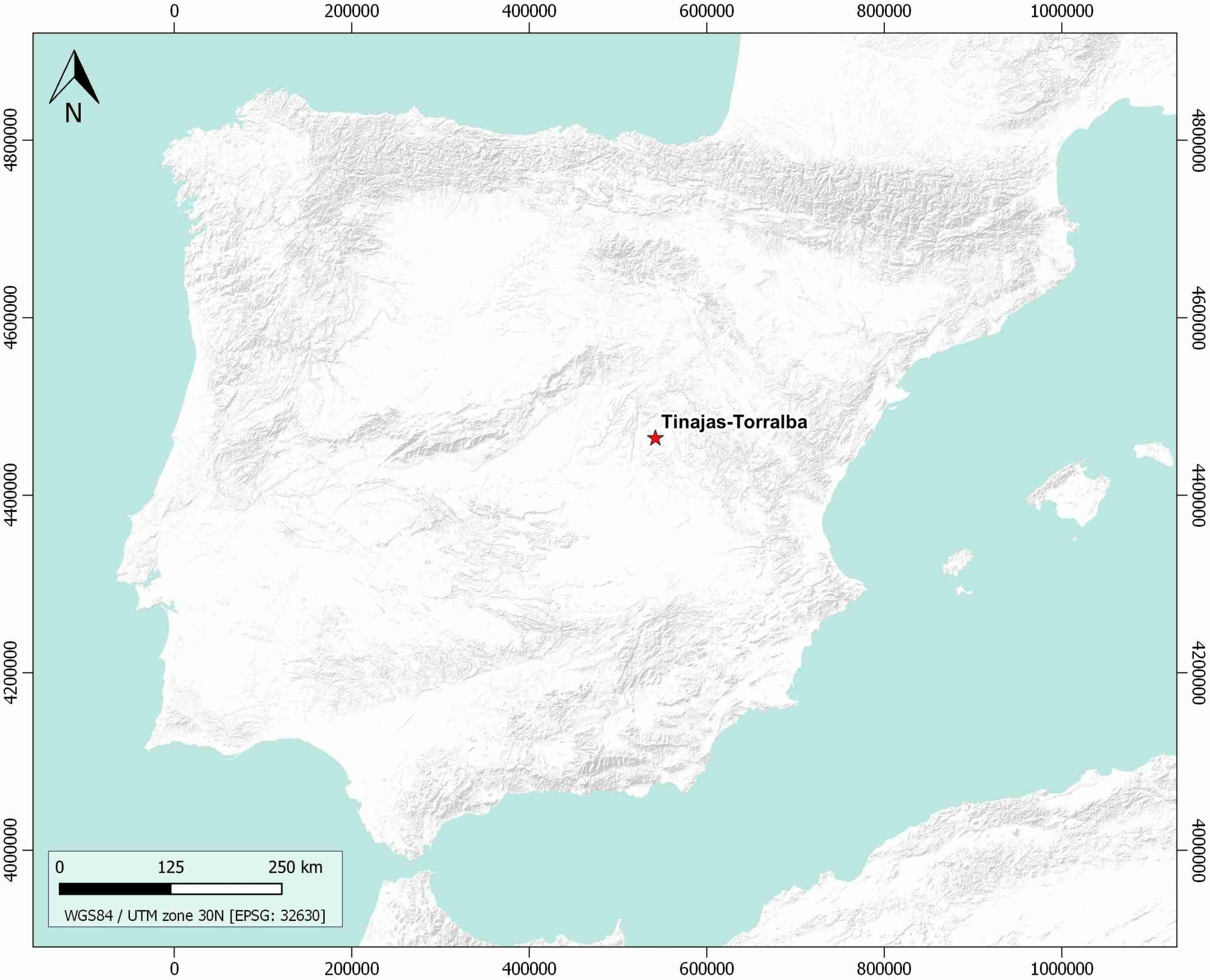
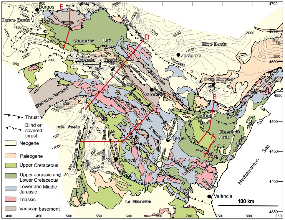
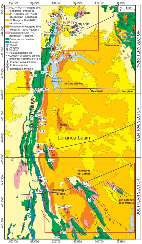
| Geological Setting | Loranca Sub-Basin, Tagus Basin |
| Outcropping/buried | Outcropping |
| Evaporite unit/s name | Unnamed |
| Evaporite unit/s age | Aquitanian-Burdigalian (Lower Miocene) |
| Evaporite unit/s origin | Continental |
| Classif. (Hudec and Jackson, 2009) | No diapirism |
| Classif. (Jackson and Talbot, 1986) | No diapirism |
| Age of evaporite flow or deformation (when deformed) | Miocene |
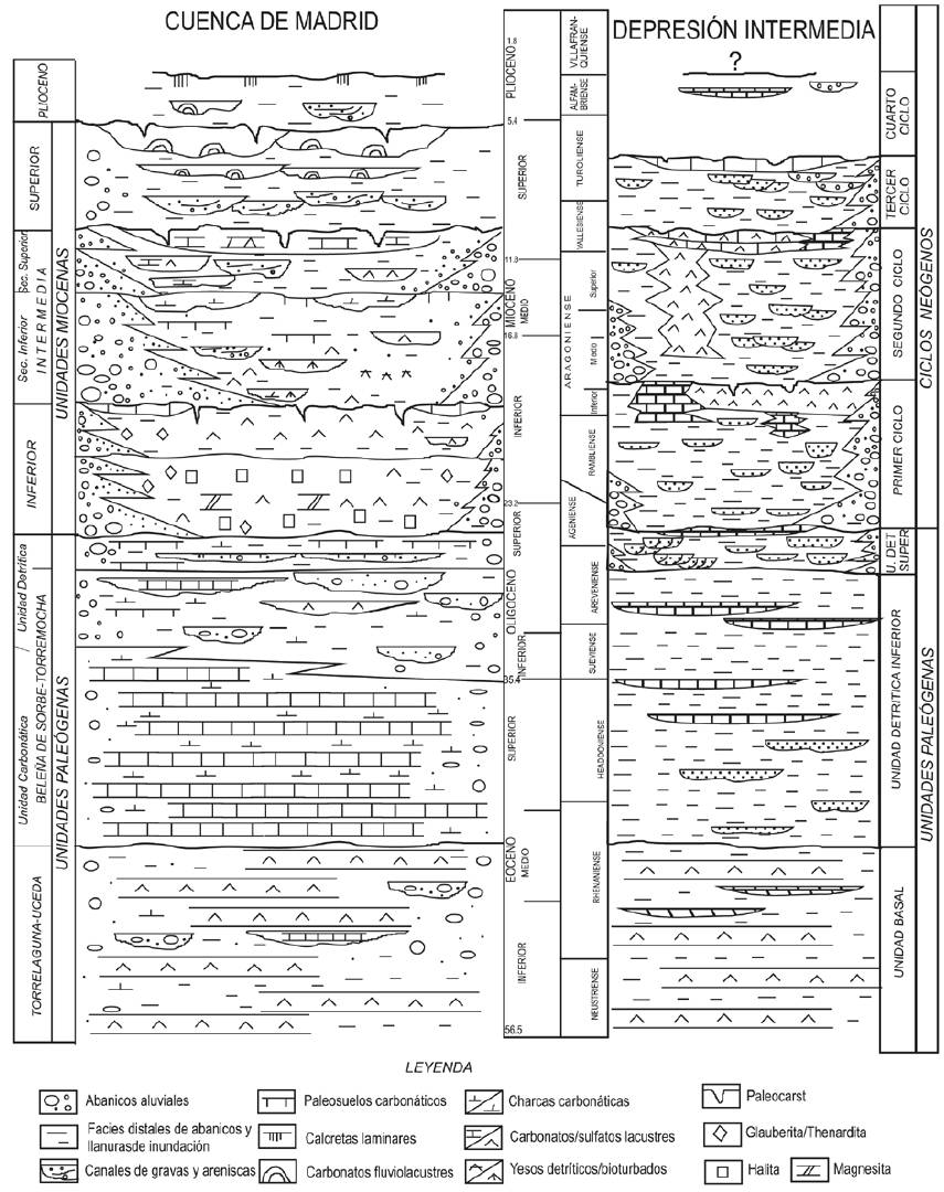
| Other comments | Stratigraphic successions of Early Miocene age (Tórtola, Villalba de la Sierra and Valdeganga depositional systems) include interbedded deposits of playa-lake and meandering river environments. |
Generic Data
| Unique ID | 150 |
| Name | Tinajas-Torralba |
| Structure type | Evaporite body |
| Deformed/Undeformed | Slightly deformed |
| Buried/Outcropping | Outcropping |
| Geological setting | Tagus Basin |
| Geological Regional Setting | Loranca Sub-Basin |
| Evaporite unit/s name | Unnamed |
| Evaporite unit/s age | Aquitanian-Burdigalian (Lower Miocene) |
| Evaporite unit/s era | Cenozoic |
| Evaporite unit/s origin | Continental |
| Evaporite unit/s composition | Gypsum |
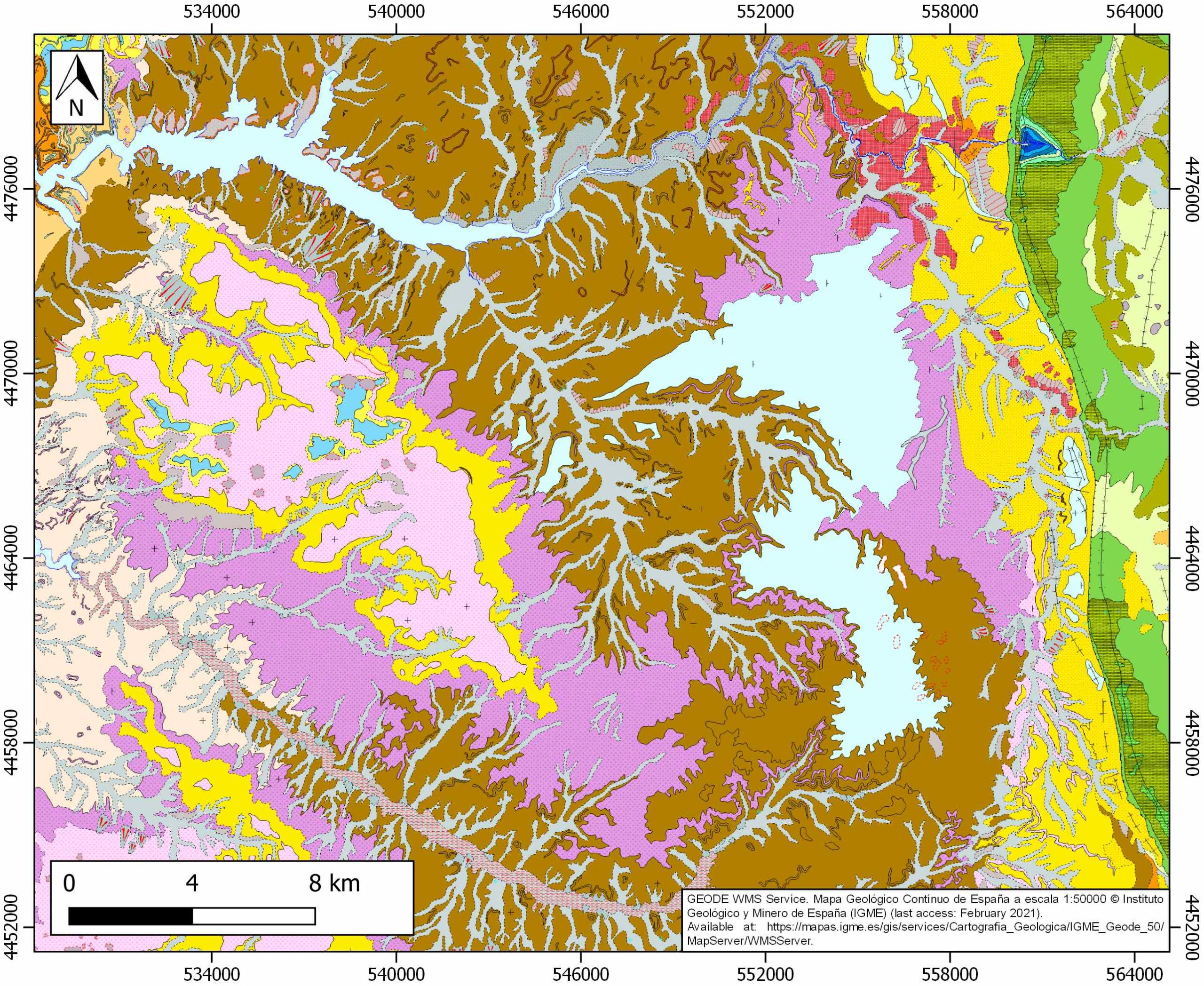
| Post-kinematic unit/s (or post-evaporite units when evaporites are undeformed) | Middle Miocene (Aragonian, limestones, conglomerates, sandstones, marlstones, gypsum intercalations and siltstones) ; Upper Miocene (limestones) ; Pliocene and Quaternary (alluvial and colluvial detrital deposits) |
| Post-kinematic unit/s age (or post-evaporite units when evaporites are undeformed) | Middle Miocene-Holocene |
| Classification (Hudec and Jackson, 2009) | No diapirism |
| Classification (Jackson and Talbot, 1986) | No diapirism |
| Mining activity? | Y |
| Mining activity start | |
| Mining activity end | Active |
| Mining galleries? | N |
| Mining products | Gravel and sand |
| Mining sub-products | – |
| Evaporite flow? | Y |
| Age of evaporite flow | Lower Miocene |
| Flow or deformation triggering mechanisms | Alpine compression, Altromira range development |
| Flow-linked structures? | Y |
| Halokinetic structures | Syncline-Anticline folding / thrust faults |
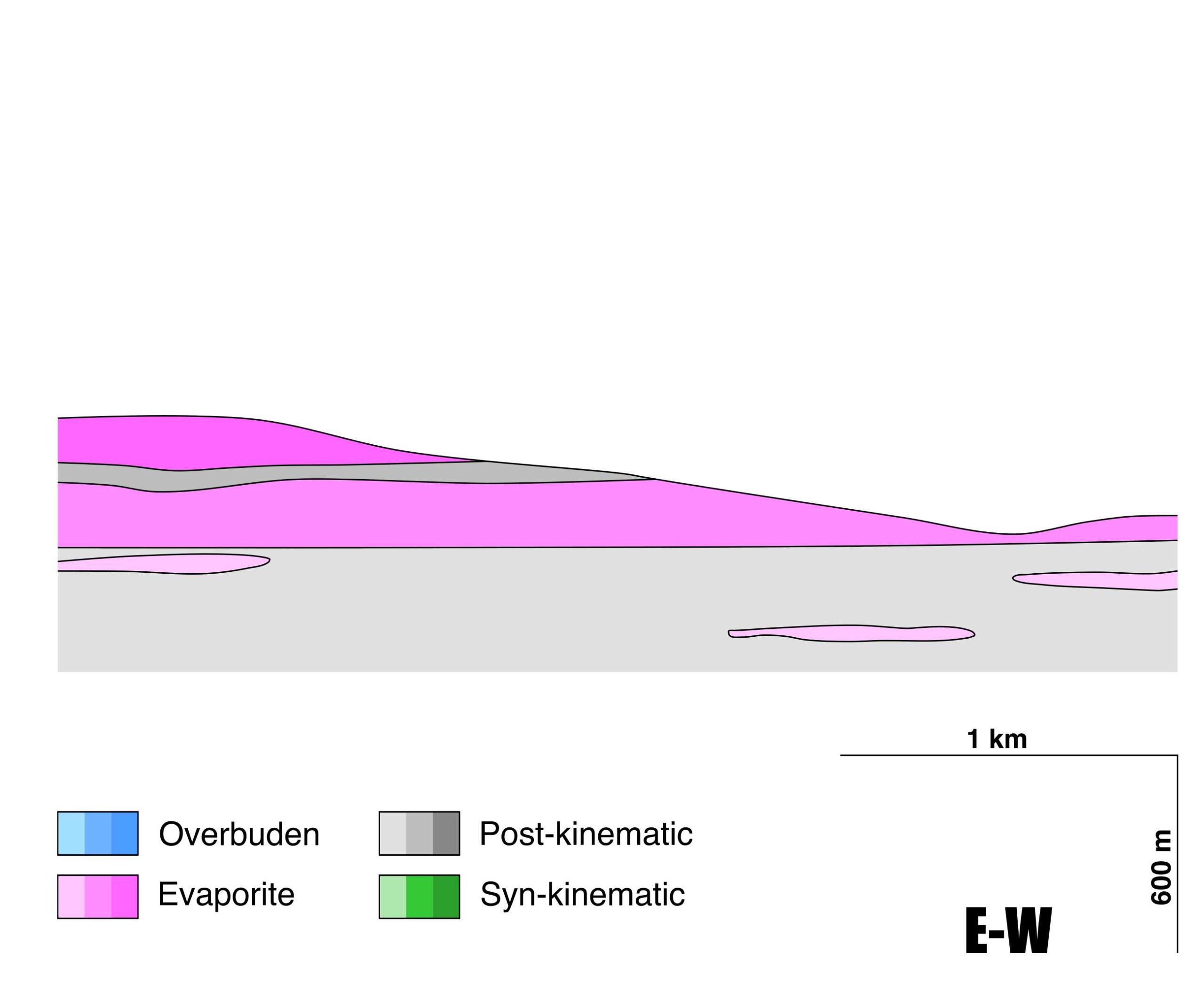
| Post-evaporite and pre-kinematic unit/s (overbuden) | – |
| Syn-kinematic unit/s | Evaporitic rocks |
| Available seismic profiles | 0192A80G / 8G-ST-43 / 8F-ST-43 / 8F-ST-43 / 8G-ST-43 / 8F-ST-43 / 8G-ST-43 / 8F-ST-43 / 8F-ST-43 / 8F-ST-43 / 0192A80G / 8F-ST-43 / 8G-ST-43 |
| Available boreholes | TORRALBA-1 / MIMBRE |
| Additional comments | Stratigraphic successions of Early Miocene age (Tórtola, Villalba de la Sierra and Valdeganga depositional systems) include interbedded deposits of playa-lake and meandering river environments. |
Mining Data
| UNIQUE_ID | 150 |
| Minning exploitations within <2km? | Y |
| Historical/Active | Active |
| Exploitation name #1 | EL MOLATÓN |
| Exploitation ID (Spanish National Mining Cadastre) #1 | 390 |
| Municipality #1 | Villaconejos de Trabaque |
| Province #1 | CUENCA |
| Company #1 | JUAN MIGUEL CAÑIZARES GONZALEZ |
| Main minning Products #1 | Gravel and sand |
| Exploitation name #2 | |
| Exploitation ID (Spanish National Mining Cadastre) #2 | |
| Municipality #2 | |
| Province #2 | |
| Company #2 | |
| Main minning Products #2 | |
| Exploitation name #3 | |
| Exploitation ID (Spanish National Mining Cadastre) #3 | |
| Municipality #3 | |
| Province #3 | |
| Company #3 | |
| Main minning Products #3 |
Quantitative Data
| UNIQUE_ID | 150 |
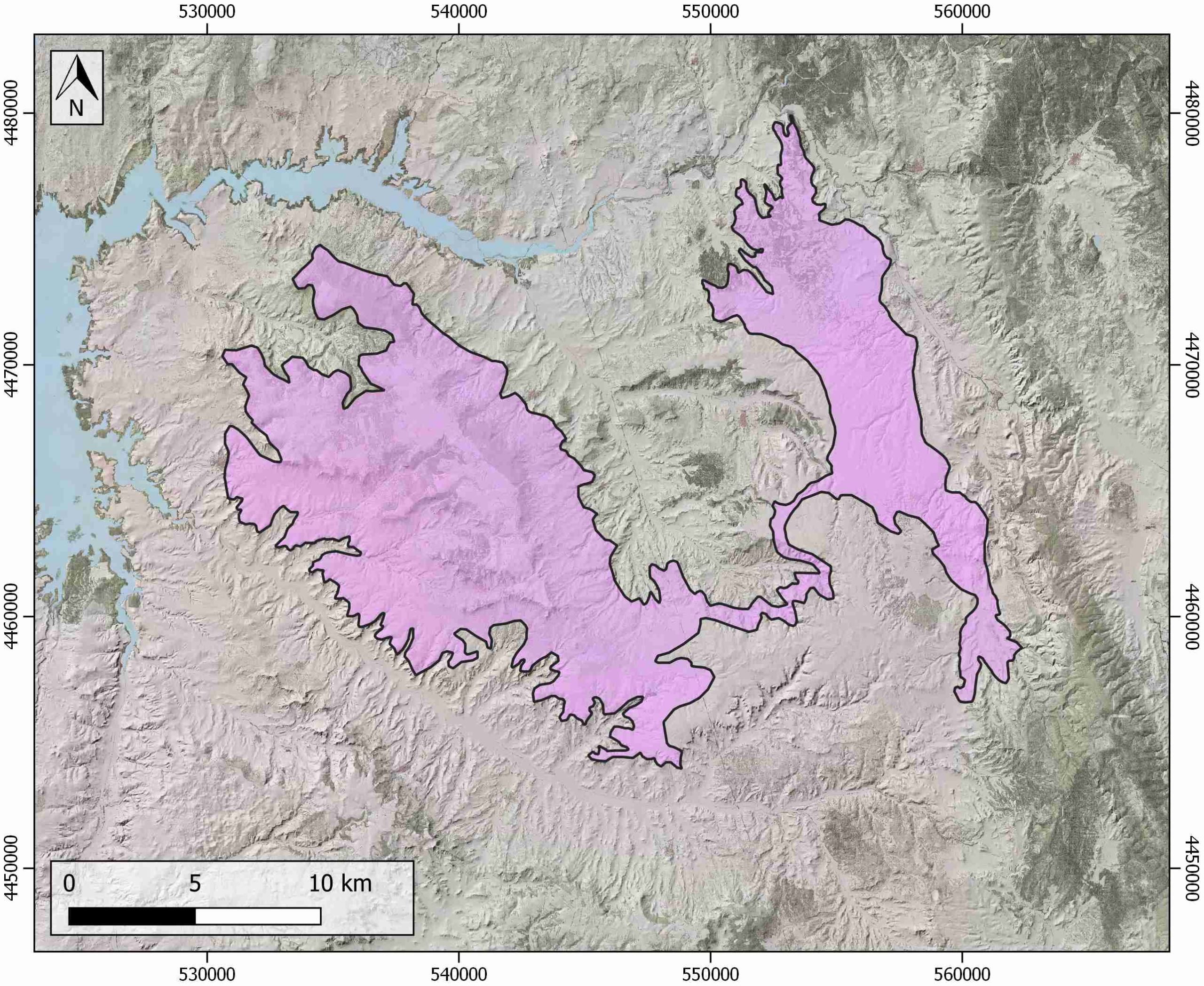
| Outcropping area (km2) | 255.59434 |
| Horizontal intersection area (km2) (when buried) | Not buried |
| Depth of intersection area (km2) (when buried) | Not buried |
| Max. Width (Km) | 24.353286 |
| Max. Length (Km) | 28.9857096 |
| Max. Evaporites thickness (km) | 0.3 |
| Max. Deformation age (Ma) | 23 |
| Min. Deformation age (Ma) | 18 |
| Deformation stages | 1 |
Reference Data
| UNIQUE_ID | 150 |
| Section source | IGME MAGNA 50. SHEET 586 (GASCUEÑA) |
| Well / Borehole availability #1 | Piña-Varas, P., Ledo, J., Queralt, P., Roca, E., García-Lobón, J. L., Ibarra, P., Biete, C., 2013. Two-dimensional magnetotelluric characterization of the El Hito Anticline (Loranca Basin, Spain). Journal of Applied Geophysics, 95, 121-134. [link] |
| Well / Borehole availability #2 | Pérez-Hidalgo, J., 1992. La microfauna de los sondeos de ENUSA en la Depresión Intermedia (provincias de Cuenca y Guadalajara). Revista española de micropaleontología, 24(1), 117-140. [link] |
| Available data (Stratigraphy) #1 | Arribas Mocoroa, J., Díaz Molina, M., Tortosa, A., 1996. Ambientes de sedimentación, procedencia y diagénesis de depósitos de ríos meandriformes desarrollados sobre playa-Iakes. Mioceno de la Cuenca de Loranca (provincias de Cuenca y Guadalajara). Cuadernos de geología ibérica, (21), 319-343. [link] |
| Available data (Stratigraphy) #2 | Díaz-Molina, M., Marzo, M., Puigdefábregas, C., 1993. Geometry and lateral accretion patterns in meander loops: examples from the upper Oligocene–lower Miocene, Loranca basin, Spain. In Alluvial sedimentation (Vol. 17, pp. 115-131). International Association of Sedimentologists. [link] |
| Available data (Stratigraphy) #3 | RodríguezAranda, J. P., Calvo Sorando, J. P., Ordóñez Delgado, S., 1991. Transición de abanicos aluviales a evaporitas en el Mioceno del borde oriental de la cuenca de Madrid (sector Barajas de Melo-Illana). Revista de la Sociedad Geológica de España, 4(1-2), 33-50. [link] |
| Available data (Stratigraphy) #4 | Díaz Molina, M., 1978. Bioestratigrafía y Paleogeografía del Terciario al E. de la Sierra de Altomira (Cuenca) [Ph.D. thesis]: Universidad Complutense de Madrid, 456pp. [link] |
| Available data (Stratigraphy) #5 | Calvo Sorando, J. P., Daams, R., Morales, J., López Martínez, N., Agustí, J., Anadón, P., …, Mein, P., 1993. Up-to-date Spanish continental Neogene synthesis and paleoclimatic interpretation. Revista de la Sociedad Geológica de España, 6(3-4), 29-40. [link] |
| Available data (Stratigraphy) #6 | n.a. |
| Regional Stratigraphy | Civis, J., Pardo, G., Delgado, J. G., Alonso-Gavilán, G., Armenteros, I., Alonso-Zarza, A. M., …, Viseras, C., 2004. Cuencas cenozoicas. In Vera, J. A. (Ed.): Geología de España. Instituto Geológico y Minero de España. [link] |
| Seismic data availability #1 | Valcárcel, M., Soto, R., Beamud, E., Oliva-Urcia, B., Muñoz, J. A., Biete, C., 2016. Integration of palaeomagnetic data, basement-cover relationships and theoretical calculations to characterize the obliquity of the Altomira–Loranca structures (central Spain). Geological Society, London, Special Publications, 425(1), 169-188. [link] |
| Seismic data availability #2 | Diaz, J., Gallart Muset, J., Córdoba, D., Senos, L., Matias, L., Suriñach, E., …, Maguire, P., 2020. The ILIHA deep seismic sounding experiment (Iberian LIthosphere Heterogeneity and Anisotropy). DigitalCSIC – SEISDARE data repository. [link] |
| Seismic data availability #3 | del Olmo, W. M., 2019. Cambio climático, acuerdos de París y trampas geológicas donde secuestrar el CO2 en España. Revista de la Sociedad Geológica de España, 32(2), 87-106. [link] |
| Available data (Structure) #1 | Valcárcel, M., Soto, R., Beamud, E., Oliva-Urcia, B., Muñoz, J. A., Biete, C., 2016. Integration of palaeomagnetic data, basement-cover relationships and theoretical calculations to characterize the obliquity of the Altomira–Loranca structures (central Spain). Geological Society, London, Special Publications, 425(1), 169-188. [link] |
| Available data (Structure) #2 | Suárez, I., Zapatero, M. A., Martínez, R., Marina, M., 2009. Synthesis of the exploration of formations with a potential of CO2 storage: Intermediate Depression and Madrid Basin. Energy Procedia, 1(1), 2709-2715. [link] |
| Available data (Structure) #3 | Muñoz Martín, A., Vicente Muñoz, G. D., 1998. Cuantificación del acortamiento alpino y estructura en profundidad del extremo sur-occidental de la Cordillera Ibérica (Sierras de Altomira y Bascunana). Revista de la Sociedad Geológica de España, 11(3-4), 233-252. [link] |
| Available data (Structure) #4 | Munoz-Martın, A., Cloetingh, S. A. P. L., De Vicente, G., Andeweg, B., 1998. Finite-element modelling of Tertiary paleostress fields in the eastern part of the Tajo Basin (central Spain). Tectonophysics, 300(1-4), 47-62. [link] |
| Available data (Structure) #5 | del Pozo Tejedor, J., Moreno, M. M., Sánchez, J. A. D., 2019. Propuesta de compartimentación estructural en la MASb 041.001 Sierra de Altomira: implicaciones hidrogeológicas. Boletín geológico y minero, 130(2), 317-340. [link] |
| Available data (Structure) #6 | Giner-Robles, J. L., Pérez-López, R., Silva, P. G., Jiménez-Díaz, A., Rodríguez-Pascua, M. A., 2012. Recent tectonic model for the Upper Tagus Basin (central Spain). Journal of Iberian Geology, 38(1), 113-126. [link] |
| Available data (Analogue modelling) #1 | n.a. |
| Available data (Analogue modelling) #2 | n.a. |
| Available data (Analogue modelling) #3 | n.a. |
| Available data (Gravimetry – Tomography) #1 | Ayala, C., Bohoyo, F., Maestro, A., Reguera, M. I., Torne, M., Rubio, F., Fernández, M., García-Lobón, J. L., 2016. Updated Bouguer anomalies of the Iberian Peninsula: a new perspective to interpret the regional geology. Journal of Maps, 12(5), 1089-1092. [link] |
| Available data (Gravimetry – Tomography) #2 | n.a. |
| Available data (Gravimetry – Tomography) #3 | n.a. |
| Available data (Geochemistry) #1 | Arribas Mocoroa, M. E., Doval, M., Díaz Molina, M., 1995. Petrological and mineralogical characterization of lutitic deposits in a fluvial dominated depositional system. Upper Oligocene-Lower Miocene, Loranca Basin (Central Spain). Revista de la Sociedad Geológica de España, 8(3), 149-160. [link] |
| Available data (Geochemistry) #2 | Arribas Mocoroa, J., Díaz Molina, M., Tortosa, A., 1996. Ambientes de sedimentación, procedencia y diagénesis de depósitos de ríos meandriformes desarrollados sobre playa-Iakes. Mioceno de la Cuenca de Loranca (provincias de Cuenca y Guadalajara). Cuadernos de geología ibérica, (21), 319-343. [link] |
| Available data (Geochemistry) #3 | n.a. |
| Available data (Geochemistry) #4 | n.a. |
| Available data (Petrophysics) #1 | Valcárcel, M., Soto, R., Beamud, E., Oliva-Urcia, B., Muñoz, J. A., Biete, C., 2016. Integration of palaeomagnetic data, basement-cover relationships and theoretical calculations to characterize the obliquity of the Altomira–Loranca structures (central Spain). Geological Society, London, Special Publications, 425(1), 169-188. [link] |
| Available data (Petrophysics) #2 | n.a. |
| IGME Geological Map (MAGNA50) Sheet number | 562-Sacedón. [link] and 586-Gascueña. [link] and 585-Alonacid de Zorita. [link] and 563-Priego. [link] |
| Other Maps #1 (source) | Guimerà, J. J., 2018. Structure of an intraplate fold-and-thrust belt: The Iberian Chain. A synthesis. Geologica Acta, 16(4), 427-438. [link] |
| Other Maps #2 (source) | Valcárcel, M., Soto, R., Beamud, E., Oliva-Urcia, B., Muñoz, J. A., Biete, C., 2016. Integration of palaeomagnetic data, basement-cover relationships and theoretical calculations to characterize the obliquity of the Altomira–Loranca structures (central Spain). Geological Society, London, Special Publications, 425(1), 169-188. [link] |
| Other related references #1 | Díaz-Molina, M., Muñoz-García, M. B., 2010. Sedimentary facies and three-dimensional reconstructions of upper Oligocene meander belts from the Loranca Basin, Spain. AAPG bulletin, 94(2), 241-257. [link] |
| Other related references #2 | Herrero, M. J., Escavy, J. I., Schreiber, B. C., 2015. Thenardite after mirabilite deposits as a cool climate indicator in the geological record: lower Miocene of central Spain. Climate of the Past, 11(1), 1-13. [link] |
| Other related references #3 | Torres Pérez-Hidalgo, T., Bravo, F. C., Sañudo, M. G., Nestares, T., Menéndez, J. E. O., Martínez, Á. P., 1996. Análisis markoviano de las sucesiones de abanicos aluviales de la cuenca de Madrid y de la depresión intermedia (Madrid y Guadalajara, España Central). Cuadernos de geología ibérica 21, 345-368. [link] |
| Other related references #4 | n.a. |
Well and Seismic Data
| UNIQUE_ID | 150 |
| Seismic survey name #1 | 0192A80G |
| Across structure? #1 | Y |
| Seismic profile ID (IGME) #1 | 346 |
| Seismic profile code #1 | 1457 |
| Seismic profile name #1 | M-80-58 |
| Seismic survey year #1 | 1980 |
| Data repository #1 | SIGEOF Data Catalogue (Private access section). ©Instituto Geológico y Minero de España (IGME). https://info.igme.es/SIGEOF/ |
| Length (km) #1 | 8.71 |
| Seismic survey name #2 | 8G-ST-43 |
| Across structure? #2 | Y |
| Seismic profile ID (IGME) #2 | 13482 |
| Seismic profile code #2 | 18200 |
| Seismic profile name #2 | T-9 |
| Seismic survey year #2 | 1970 |
| Data repository #2 | SIGEOF Data Catalogue (Section available under request). ©Instituto Geológico y Minero de España (IGME). https://info.igme.es/SIGEOF/ |
| Length (km) #2 | 95.88 |
| Seismic survey name #3 | 8F-ST-43 |
| Across structure? #3 | Y |
| Seismic profile ID (IGME) #3 | 13431 |
| Seismic profile code #3 | 18149 |
| Seismic profile name #3 | T-3 |
| Seismic survey year #3 | 1970 |
| Data repository #3 | SIGEOF Data Catalogue (Section available under request). ©Instituto Geológico y Minero de España (IGME). https://info.igme.es/SIGEOF/ |
| Length (km) #3 | 45.22 |
| Seismic survey name #4 | 8F-ST-43 |
| Across structure? #4 | Y |
| Seismic profile ID (IGME) #4 | 13429 |
| Seismic profile code #4 | 18147 |
| Seismic profile name #4 | T-5 |
| Seismic survey year #4 | 1970 |
| Data repository #4 | SIGEOF Data Catalogue (Section available under request). ©Instituto Geológico y Minero de España (IGME). https://info.igme.es/SIGEOF/ |
| Length (km) #4 | 37.35 |
| Seismic survey name #5 | 8G-ST-43 |
| Across structure? #5 | Y |
| Seismic profile ID (IGME) #5 | 13484 |
| Seismic profile code #5 | 18202 |
| Seismic profile name #5 | T-6 |
| Seismic survey year #5 | 1970 |
| Data repository #5 | SIGEOF Data Catalogue (Section available under request). ©Instituto Geológico y Minero de España (IGME). https://info.igme.es/SIGEOF/ |
| Length (km) #5 | 44.75 |
| Seismic survey name #6 | 8F-ST-43 |
| Across structure? #6 | Y |
| Seismic profile ID (IGME) #6 | 13438 |
| Seismic profile code #6 | 18156 |
| Seismic profile name #6 | T-13 |
| Seismic survey year #6 | 1970 |
| Data repository #6 | SIGEOF Data Catalogue (Section available under request). ©Instituto Geológico y Minero de España (IGME). https://info.igme.es/SIGEOF/ |
| Length (km) #6 | 31.80 |
| Seismic survey name #7 | 8G-ST-43 |
| Across structure? #7 | Y |
| Seismic profile ID (IGME) #7 | 13489 |
| Seismic profile code #7 | 18207 |
| Seismic profile name #7 | T-20 |
| Seismic survey year #7 | 1970 |
| Data repository #7 | SIGEOF Data Catalogue (Section available under request). ©Instituto Geológico y Minero de España (IGME). https://info.igme.es/SIGEOF/ |
| Length (km) #7 | 21.00 |
| Seismic survey name #8 | 8F-ST-43 |
| Across structure? #8 | Y |
| Seismic profile ID (IGME) #8 | 13439 |
| Seismic profile code #8 | 18157 |
| Seismic profile name #8 | T-12 |
| Seismic survey year #8 | 1970 |
| Data repository #8 | SIGEOF Data Catalogue (Section available under request). ©Instituto Geológico y Minero de España (IGME). https://info.igme.es/SIGEOF/ |
| Length (km) #8 | 38.60 |
| Seismic survey name #9 | 8F-ST-43 |
| Across structure? #9 | Y |
| Seismic profile ID (IGME) #9 | 13428 |
| Seismic profile code #9 | 18146 |
| Seismic profile name #9 | T-8 |
| Seismic survey year #9 | 1970 |
| Data repository #9 | SIGEOF Data Catalogue (Section available under request). ©Instituto Geológico y Minero de España (IGME). https://info.igme.es/SIGEOF/ |
| Length (km) #9 | 15.71 |
| Seismic survey name #10 | 8F-ST-43 |
| Across structure? #10 | Y |
| Seismic profile ID (IGME) #10 | 13432 |
| Seismic profile code #10 | 18150 |
| Seismic profile name #10 | T-23 |
| Seismic survey year #10 | 1970 |
| Data repository #10 | SIGEOF Data Catalogue (Section available under request). ©Instituto Geológico y Minero de España (IGME). https://info.igme.es/SIGEOF/ |
| Length (km) #10 | 12.13 |
| Seismic survey name #11 | 0192A80G |
| Across structure? #11 | N (within 3km) |
| Seismic profile ID (IGME) #11 | 346 |
| Seismic profile code #11 | 1457 |
| Seismic profile name #11 | M-80-58 |
| Seismic survey year #11 | 1980 |
| Data repository #11 | SIGEOF Data Catalogue (Private access section). ©Instituto Geológico y Minero de España (IGME). https://info.igme.es/SIGEOF/ |
| Length (km) #11 | 8.71 |
| Seismic survey name #12 | 8F-ST-43 |
| Across structure? #12 | N (within 3km) |
| Seismic profile ID (IGME) #12 | 13439 |
| Seismic profile code #12 | 18157 |
| Seismic profile name #12 | T-12 |
| Seismic survey year #12 | 1970 |
| Data repository #12 | SIGEOF Data Catalogue (Section available under request). ©Instituto Geológico y Minero de España (IGME). https://info.igme.es/SIGEOF/ |
| Length (km) #12 | 38.60 |
| Seismic survey name #13 | 8G-ST-43 |
| Across structure? #13 | N (within 3km) |
| Seismic profile ID (IGME) #13 | 13484 |
| Seismic profile code #13 | 18202 |
| Seismic profile name #13 | T-6 |
| Seismic survey year #13 | 1970 |
| Data repository #13 | SIGEOF Data Catalogue (Section available under request). ©Instituto Geológico y Minero de España (IGME). https://info.igme.es/SIGEOF/ |
| Length (km) #13 | 44.75 |
| Seismic survey name #14 | |
| Across structure? #14 | |
| Seismic profile ID (IGME) #14 | |
| Seismic profile code #14 | |
| Seismic profile name #14 | |
| Seismic survey year #14 | |
| Data repository #14 | |
| Length (km) #14 | |
| Seismic survey name #15 | |
| Across structure? #15 | |
| Seismic profile ID (IGME) #15 | |
| Seismic profile code #15 | |
| Seismic profile name #15 | |
| Seismic survey year #15 | |
| Data repository #15 | |
| Length (km) #15 | |
| Seismic survey name #16 | |
| Across structure? #16 | |
| Seismic profile ID (IGME) #16 | |
| Seismic profile code #16 | |
| Seismic profile name #16 | |
| Seismic survey year #16 | |
| Data repository #16 | |
| Length (km) #16 | |
| Seismic survey name #17 | |
| Across structure? #17 | |
| Seismic profile ID (IGME) #17 | |
| Seismic profile code #17 | |
| Seismic profile name #17 | |
| Seismic survey year #17 | |
| Data repository #17 | |
| Length (km) #17 | |
| Seismic survey name #18 | |
| Across structure? #18 | |
| Seismic profile ID (IGME) #18 | |
| Seismic profile code #18 | |
| Seismic profile name #18 | |
| Seismic survey year #18 | |
| Data repository #18 | |
| Length (km) #18 | |
| Seismic survey name #19 | |
| Across structure? #19 | |
| Seismic profile ID (IGME) #19 | |
| Seismic profile code #19 | |
| Seismic profile name #19 | |
| Seismic survey year #19 | |
| Data repository #19 | |
| Length (km) #19 | |
| Seismic survey name #20 | |
| Across structure? #20 | |
| Seismic profile ID (IGME) #20 | |
| Seismic profile code #20 | |
| Seismic profile name #20 | |
| Seismic survey year #20 | |
| Data repository #20 | |
| Length (km) #20 | |
| Seismic survey name #21 | |
| Across structure? #21 | |
| Seismic profile ID (IGME) #21 | |
| Seismic profile code #21 | |
| Seismic profile name #21 | |
| Seismic survey year #21 | |
| Data repository #21 | |
| Length (km) #21 | |
| Borehole name #1 | TORRALBA-1 |
| Company #1 | SHELL |
| Traget #1 | HYDROCARBONS |
| Across structure? #1 | N (within 5 km) |
| Borehole name #2 | MIMBRE |
| Company #2 | TRAGSA |
| Traget #2 | HYDROGEOLOGY |
| Across structure? #2 | N (within 5 km) |
| Borehole name #3 | |
| Company #3 | |
| Traget #3 | |
| Across structure? #3 | |
| Borehole name #4 | |
| Company #4 | |
| Traget #4 | |
| Across structure? #4 | |
| Borehole name #5 | |
| Company #5 | |
| Traget #5 | |
| Across structure? #5 | |
| Borehole name #6 | |
| Company #6 | |
| Traget #6 | |
| Across structure? #6 | |
| Borehole name #7 | |
| Company #7 | |
| Traget #7 | |
| Across structure? #7 | |
| Borehole name #8 | |
| Company #8 | |
| Traget #8 | |
| Across structure? #8 | |
| Borehole name #9 | |
| Company #9 | |
| Traget #9 | |
| Across structure? #9 | |
| Borehole name #10 | |
| Company #10 | |
| Traget #10 | |
| Across structure? #10 | |
| Borehole name #11 | |
| Company #11 | |
| Traget #11 | |
| Across structure? #11 | |
| Borehole name #12 | |
| Company #12 | |
| Traget #12 | |
| Across structure? #12 | |
| Borehole name #13 | |
| Company #13 | |
| Traget #13 | |
| Across structure? #13 | |
| Borehole name #14 | |
| Company #14 | |
| Traget #14 | |
| Across structure? #14 | |
| Borehole name #15 | |
| Company #15 | |
| Traget #15 | |
| Across structure? #15 |
Geographical Data (EPSG:4326 - WGS 84)
| UNIQUE_ID | 150 |
| X Centroid (Structure shape) | -2.470152 |
| Y Centroid (Structure shape) | -2.470152 |
| Xmin (Structure shape) | -2.639452 |
| Xmax (Structure shape) | -2.266177 |
| Ymin (Structure shape) | 40.234592 |
| Ymax (Structure shape) | 40.468067 |
| Xmin seismic line #1 | -2.328741 |
| Xmax seismic line #1 | -2.235016 |
| Ymin seismic line #1 | 40.281213 |
| Ymax seismic line #1 | 40.306879 |
| Xmin seismic line #2 | -2.524100 |
| Xmax seismic line #2 | -2.324372 |
| Ymin seismic line #2 | 39.832380 |
| Ymax seismic line #2 | 40.650099 |
| Xmin seismic line #3 | -2.787479 |
| Xmax seismic line #3 | -2.265499 |
| Ymin seismic line #3 | 40.291170 |
| Ymax seismic line #3 | 40.362043 |
| Xmin seismic line #4 | -2.727517 |
| Xmax seismic line #4 | -2.291101 |
| Ymin seismic line #4 | 40.451778 |
| Ymax seismic line #4 | 40.484678 |
| Xmin seismic line #5 | -2.789314 |
| Xmax seismic line #5 | -2.269576 |
| Ymin seismic line #5 | 40.246163 |
| Ymax seismic line #5 | 40.290959 |
| Xmin seismic line #6 | -2.535332 |
| Xmax seismic line #6 | -2.219308 |
| Ymin seismic line #6 | 40.363840 |
| Ymax seismic line #6 | 40.420235 |
| Xmin seismic line #7 | -2.687253 |
| Xmax seismic line #7 | -2.515680 |
| Ymin seismic line #7 | 40.259694 |
| Ymax seismic line #7 | 40.394756 |
| Xmin seismic line #8 | -2.706820 |
| Xmax seismic line #8 | -2.293593 |
| Ymin seismic line #8 | 40.384987 |
| Ymax seismic line #8 | 40.398817 |
| Xmin seismic line #9 | -2.309497 |
| Xmax seismic line #9 | -2.125918 |
| Ymin seismic line #9 | 40.305586 |
| Ymax seismic line #9 | 40.314260 |
| Xmin seismic line #10 | -2.366366 |
| Xmax seismic line #10 | -2.223916 |
| Ymin seismic line #10 | 40.328892 |
| Ymax seismic line #10 | 40.332205 |
| Xmin seismic line #11 | -2.328741 |
| Xmax seismic line #11 | -2.235016 |
| Ymin seismic line #11 | 40.281213 |
| Ymax seismic line #11 | 40.306879 |
| Xmin seismic line #12 | -2.706820 |
| Xmax seismic line #12 | -2.293593 |
| Ymin seismic line #12 | 40.384987 |
| Ymax seismic line #12 | 40.398817 |
| Xmin seismic line #13 | -2.789314 |
| Xmax seismic line #13 | -2.269576 |
| Ymin seismic line #13 | 40.246163 |
| Ymax seismic line #13 | 40.290959 |
| Xmin seismic line #14 | |
| Xmax seismic line #14 | |
| Ymin seismic line #14 | |
| Ymax seismic line #14 | |
| Xmin seismic line #15 | |
| Xmax seismic line #15 | |
| Ymin seismic line #15 | |
| Ymax seismic line #15 | |
| Xmin seismic line #16 | |
| Xmax seismic line #16 | |
| Ymin seismic line #16 | |
| Ymax seismic line #16 | |
| Xmin seismic line #17 | |
| Xmax seismic line #17 | |
| Ymin seismic line #17 | |
| Ymax seismic line #17 | |
| Xmin seismic line #18 | |
| Xmax seismic line #18 | |
| Ymin seismic line #18 | |
| Ymax seismic line #18 | |
| Xmin seismic line #19 | |
| Xmax seismic line #19 | |
| Ymin seismic line #19 | |
| Ymax seismic line #19 | |
| Xmin seismic line #20 | |
| Xmax seismic line #20 | |
| Ymin seismic line #20 | |
| Ymax seismic line #20 | |
| Xmin seismic line #21 | |
| Xmax seismic line #21 | |
| Ymin seismic line #21 | |
| Ymax seismic line #21 | |
| X borehole #1 | -2.264384 |
| Y borehole #1 | 40.306075 |
| X borehole #2 | -2.293965 |
| Y borehole #2 | 40.405666 |
| X borehole #3 | |
| Y borehole #3 | |
| X borehole #4 | |
| Y borehole #4 | |
| X borehole #5 | |
| Y borehole #5 | |
| X borehole #6 | |
| Y borehole #6 | |
| X borehole #7 | |
| Y borehole #7 | |
| X borehole #8 | |
| Y borehole #8 | |
| X borehole #9 | |
| Y borehole #9 | |
| X borehole #10 | |
| Y borehole #10 | |
| X borehole #11 | |
| Y borehole #11 | |
| X borehole #12 | |
| Y borehole #12 | |
| X borehole #13 | |
| Y borehole #13 | |
| X borehole #14 | |
| Y borehole #14 | |
| X borehole #15 | |
| Y borehole #15 |

