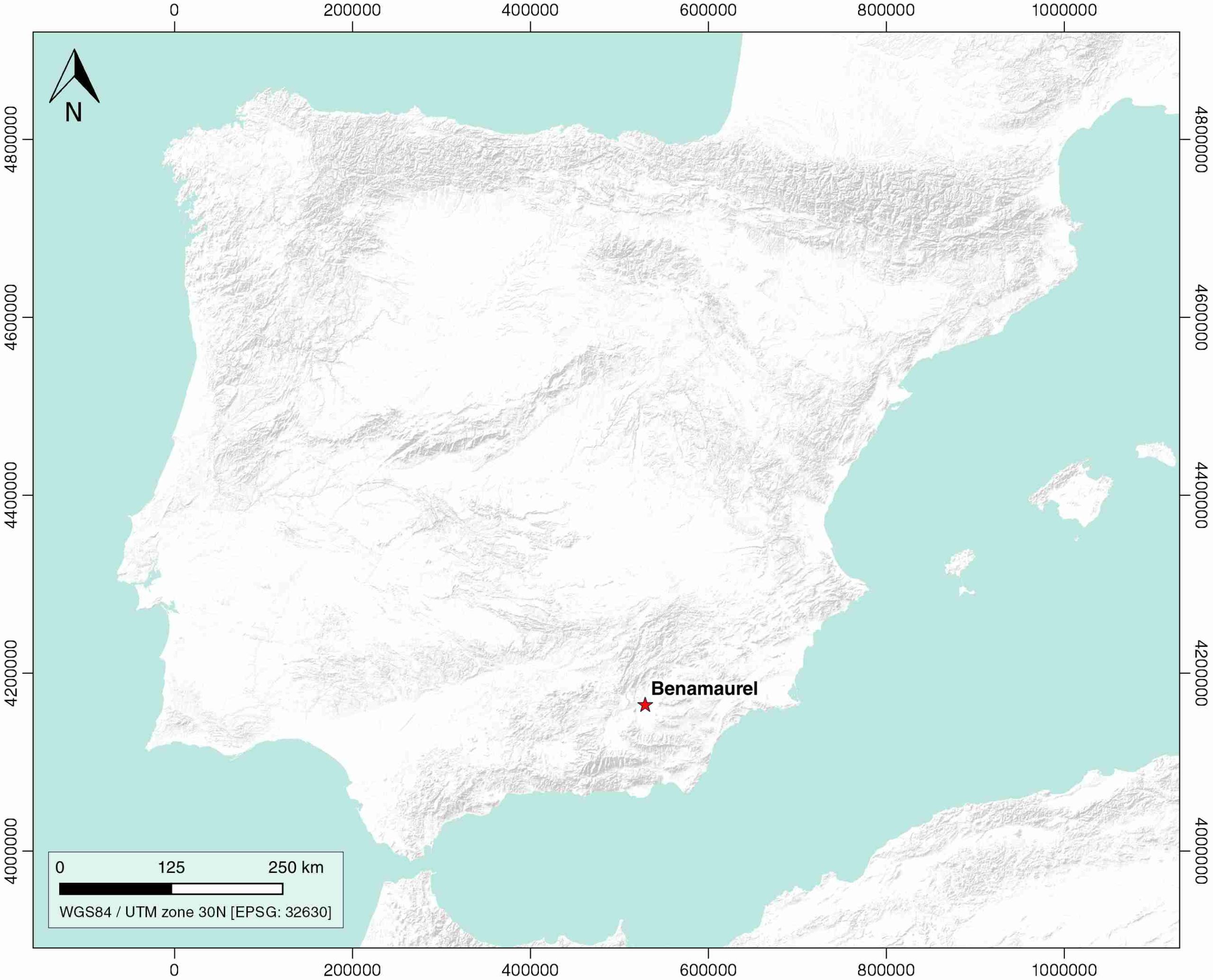
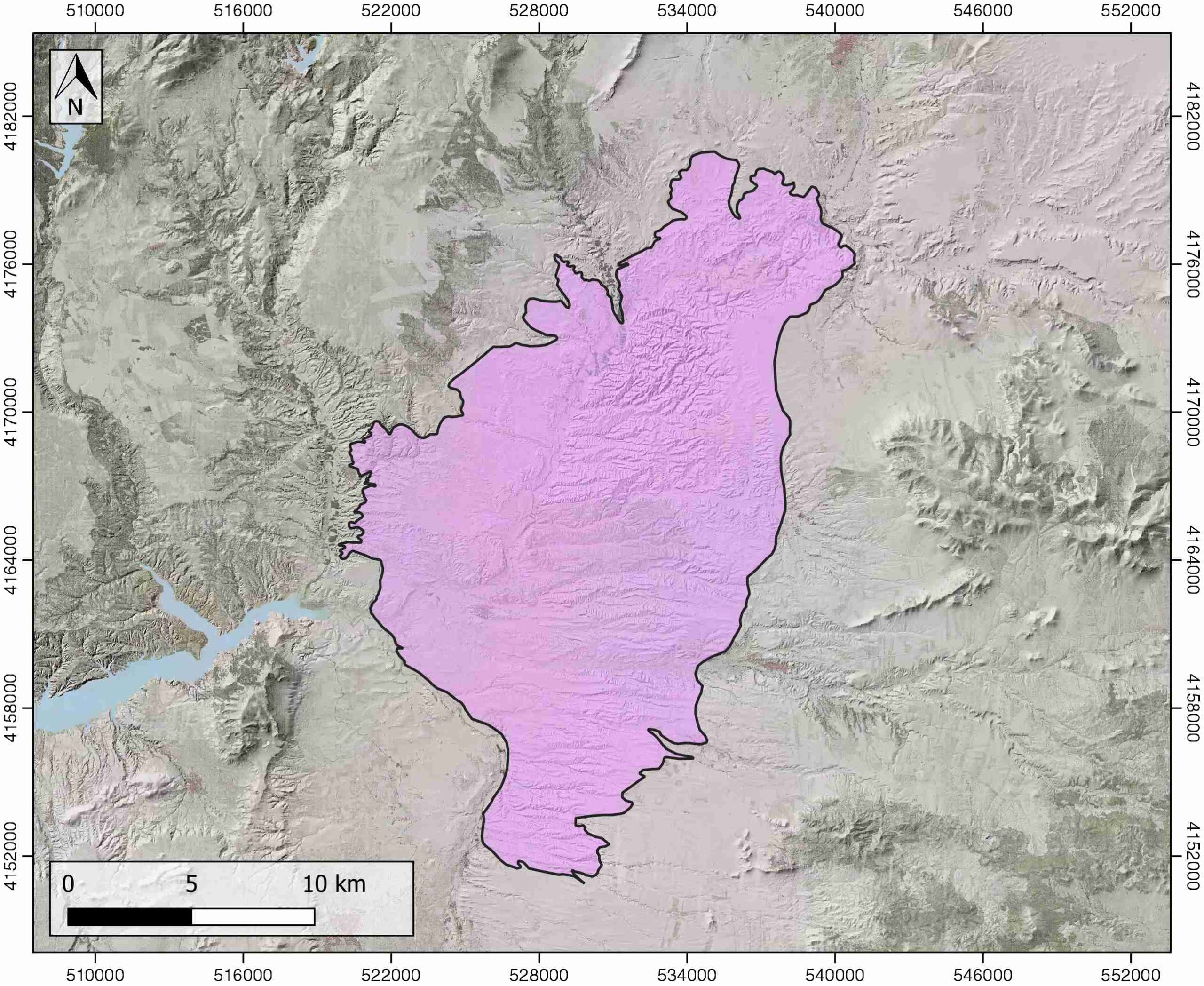
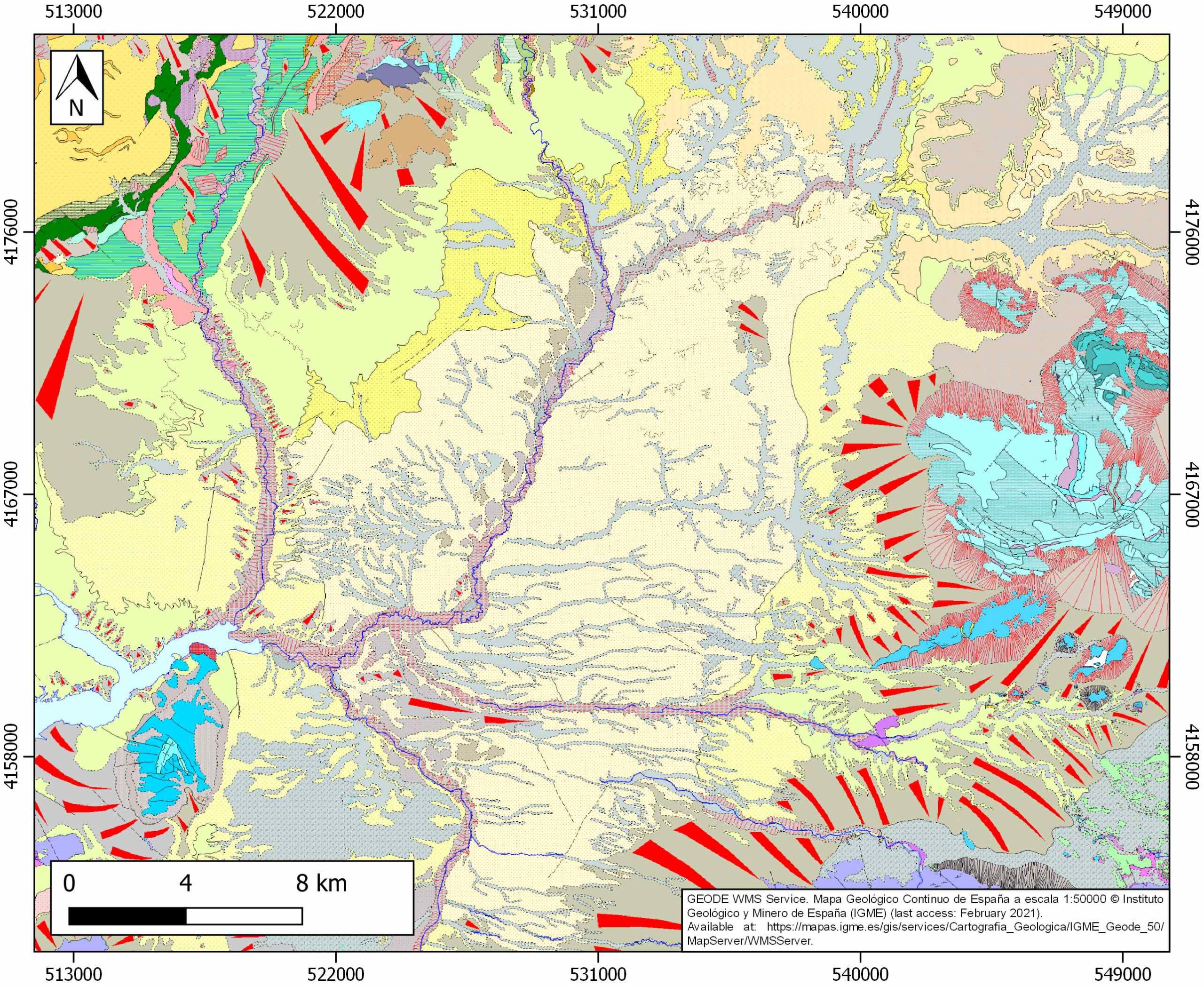
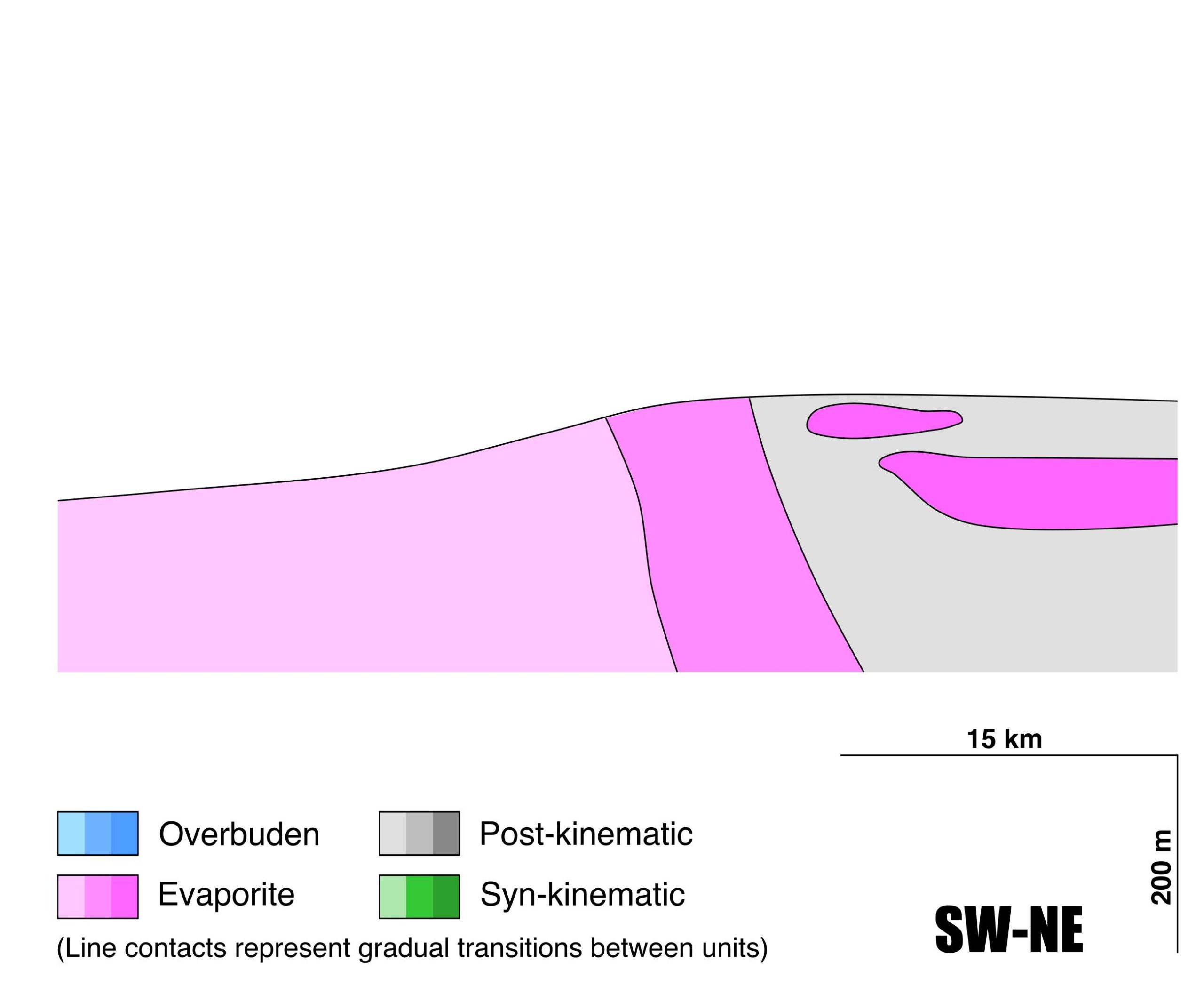
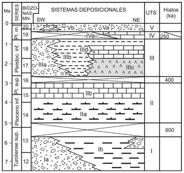
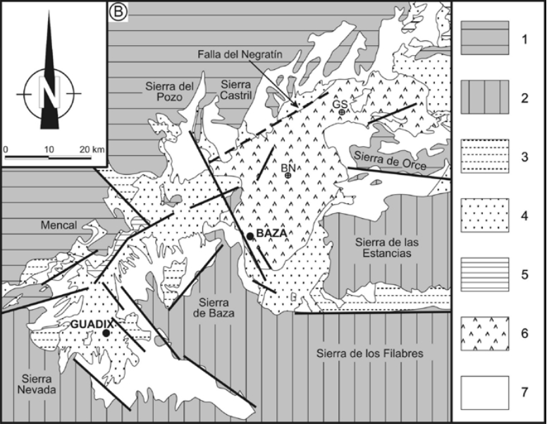
General Information
| Structure type | Evaporite body |
| Deformed/Undeformed | Undeformed |
| Geological Setting | Betic system, Guadix-Baza Basin |
| Outcropping/buried | Outcropping |
| Evaporite unit/s name | Benamaurel, Galera and Torre del Salar Gypsum Units |
| Evaporite unit/s age | Pliocene-Pleistocene (Upper Neogene-Quaternary) |
| Evaporite unit/s origin | Continental |
| Classif. (Hudec and Jackson, 2009) | No diapirism |
| Classif. (Jackson and Talbot, 1986) | No diapirism |
| Age of evaporite flow or deformation (when deformed) | Undeformed |
| Other comments | Isotopic composition (δ34S, δ18O) of gypsum consistent with a Triassic origin of the sulphate (chemical recycling). |
Generic Data
| Unique ID | 105 |
| Name | Benamaurel |
| Structure type | Evaporite body |
| Deformed/Undeformed | Undeformed |
| Buried/Outcropping | Outcropping |
| Geological setting | Betic System |
| Geological Regional Setting | Guadix-Baza Basin |
| Evaporite unit/s name | Benamaurel gypsum unit, Galera gypsum unit and Torre del Salar Gypsum unit |
| Evaporite unit/s age | Plio-Pleistocene |
| Evaporite unit/s era | Cenozoic |
| Evaporite unit/s origin | Continental (lacustrine) |
| Evaporite unit/s composition | Gypsum-Limestone-Shale-Gravel |
| Post-kinematic unit/s (or post-evaporite units when evaporites are undeformed) | Plio-Pleistocene (Baza Fm., calcareous Mb) |
| Post-kinematic unit/s age (or post-evaporite units when evaporites are undeformed) | – |
| Classification (Hudec and Jackson, 2009) | No diapirism |
| Classification (Jackson and Talbot, 1986) | No diapirism |
| Mining activity? | N |
| Mining activity start | |
| Mining activity end | |
| Mining galleries? | |
| Mining products | |
| Mining sub-products | |
| Evaporite flow? | N |
| Age of evaporite flow | – |
| Flow or deformation triggering mechanisms | – |
| Flow-linked structures? | – |
| Halokinetic structures | – |
| Post-evaporite and pre-kinematic unit/s (overbuden) | – |
| Syn-kinematic unit/s | – |
| Available seismic profiles | ESCI Betics 2 / RS-34 / DG-2 / RS-35 / RS-34 / DG-2 / DG-1 |
| Available boreholes | CORTES DE BAZA-2 / CORTES DE BAZA-3 / CORTES DE BAZA-1 / CORTES DE BAZA-4 / CORTES DE BAZA-5 / CAMPON VALENTIN / CUBA / HUESCAR-2 / HUESCAR-6 / MEMORIAS / HUESCAR-3 / HUESCAR-4 (CERRO DE LAS ANIMAS-4) / VALENTIN (CASTRIL-1) |
| Additional comments | Isotopic composition (δ34S, δ18O) of gypsum consistent with a Triassic origin of the sulphate (chemical recycling) |
Mining Data
| UNIQUE_ID | 105 |
| Minning exploitations within <2km? | N |
| Historical/Active | |
| Exploitation name #1 | |
| Exploitation ID (Spanish National Mining Cadastre) #1 | |
| Municipality #1 | |
| Province #1 | |
| Company #1 | |
| Main minning Products #1 | |
| Exploitation name #2 | |
| Exploitation ID (Spanish National Mining Cadastre) #2 | |
| Municipality #2 | |
| Province #2 | |
| Company #2 | |
| Main minning Products #2 | |
| Exploitation name #3 | |
| Exploitation ID (Spanish National Mining Cadastre) #3 | |
| Municipality #3 | |
| Province #3 | |
| Company #3 | |
| Main minning Products #3 |
Quantitative Data
| UNIQUE_ID | 105 |
| Outcropping area (km2) | 311.89764 |
| Horizontal intersection area (km2) (when buried) | Not buried |
| Depth of intersection area (km2) (when buried) | Not buried |
| Max. Width (Km) | 30.2153153 |
| Max. Length (Km) | 17.8068457 |
| Max. Evaporites thickness (km) | 0.7 |
| Max. Deformation age (Ma) | – |
| Min. Deformation age (Ma) | – |
| Deformation stages | 0 |
Reference Data
| UNIQUE_ID | 105 |
| Section source | Gibert, L., Ortí, F., Rosell, L., 2007. Plio-Pleistocene lacustrine evaporites of the Baza Basin (Betic Chain, SE Spain). Sedimentary Geology, 200(1-2), 89-116. [link] |
| Well / Borehole availability #1 | Altolaguirre, Y., Bruch, A. A., Gibert, L., 2020. A long Early Pleistocene pollen record from Baza Basin (SE Spain): Major contributions to the palaeoclimate and palaeovegetation of Southern Europe. Quaternary Science Reviews, 231, 106199. [link] |
| Well / Borehole availability #2 | Haberland, C., Gibert, L., Jurado, M. J., Stiller, M., Baumann-Wilke, M., Scott, G., Mertz, D. F., 2017. Architecture and tectono-stratigraphic evolution of the intramontane Baza Basin (Bétics, SE-Spain): Constraints from seismic imaging. Tectonophysics, 709, 69-84. [link] |
| Available data (Stratigraphy) #1 | Gibert, L., Scott, G., Martin, R., Gibert, J., 2007. The early to middle Pleistocene boundary in the Baza basin (Spain). Quaternary Science Reviews, 26(17-18), 2067-2089. [link] |
| Available data (Stratigraphy) #2 | Gibert, L., Ortí, F., Rosell, L., 2007. Plio-Pleistocene lacustrine evaporites of the Baza Basin (Betic Chain, SE Spain). Sedimentary Geology, 200(1-2), 89-116. [link] |
| Available data (Stratigraphy) #3 | Gibert, L., Ferrandez-Canyadell, C., Scott, G., 2000. Plio-Pleistocene lacustrine sedimentation in the Baza Basin (SE Spain) and its relations with climatic shifts. In The Solar Cycle and Terrestrial Climate, Solar and Space weather, 463, 171. [link] |
| Available data (Stratigraphy) #4 | Alfaro, P., Gibert, L., Moretti, M., García‐Tortosa, F. J., Sanz de Galdeano, C., Galindo‐Zaldívar, J., López‐Garrido, Á. C., 2010. The significance of giant seismites in the Plio‐Pleistocene Baza palaeo‐lake (S Spain). Terra Nova, 22(3), 172-179. [link] |
| Available data (Stratigraphy) #5 | Altolaguirre, Y., Bruch, A. A., Gibert, L., 2020. A long Early Pleistocene pollen record from Baza Basin (SE Spain): Major contributions to the palaeoclimate and palaeovegetation of Southern Europe. Quaternary Science Reviews, 231, 106199. [link] |
| Available data (Stratigraphy) #6 | Haberland, C., Gibert, L., Jurado, M. J., Stiller, M., Baumann-Wilke, M., Scott, G., Mertz, D. F., 2017. Architecture and tectono-stratigraphic evolution of the intramontane Baza Basin (Bétics, SE-Spain): Constraints from seismic imaging. Tectonophysics, 709, 69-84. [link] |
| Regional Stratigraphy | Aguilar, J. G., Guerra-Merchán, A., Serrano, F., Palmqvist, P., 2013. Ciclicidad sedimentaria en depósitos lacustres evaporíticos tipo playa-lake del Pleistoceno inferior en la cuenca de Guadix-Baza (Cordillera Bética, España). Boletín Geológico y Minero, 124, 239-251. [link] |
| Seismic data availability #1 | Haberland, C., Gibert, L., Jurado, M. J., Stiller, M., Baumann-Wilke, M., Scott, G., Mertz, D. F., 2017. Architecture and tectono-stratigraphic evolution of the intramontane Baza Basin (Bétics, SE-Spain): Constraints from seismic imaging. Tectonophysics, 709, 69-84. [link] |
| Seismic data availability #2 | Alfaro, P., Delgado, J., de Galdeano, C. S., Galindo-Zaldívar, J., García-Tortosa, F. J., López-Garrido, A. C., …, Borque, M. J., 2008. The Baza Fault: a major active extensional fault in the central Betic Cordillera (south Spain). International Journal of Earth Sciences, 97(6), 1353-1365. [link] |
| Seismic data availability #3 | García-Dueñas, V., Banda, E., Torné, M., Córdoba, D., Comas, M. C., González-Lodeiro, F., …, Vegas, R., 2019. Seismic Study of the Iberian Crust, ESCI-Betics survey. DigitalCSIC – SEISDARE data repository. [link] |
| Available data (Structure) #1 | Haberland, C., Gibert, L., Jurado, M. J., Stiller, M., Baumann-Wilke, M., Scott, G., Mertz, D. F., 2017. Architecture and tectono-stratigraphic evolution of the intramontane Baza Basin (Bétics, SE-Spain): Constraints from seismic imaging. Tectonophysics, 709, 69-84. [link] |
| Available data (Structure) #2 | García-Tortosa, F. J., Alfaro, P., Galindo-Zaldívar, J., Gibert, L., López-Garrido, A. C., de Galdeano, C. S., Ureña, M., 2008. Geomorphologic evidence of the active Baza fault (Betic Cordillera, south Spain). Geomorphology, 97(3-4), 374-391. [link] |
| Available data (Structure) #3 | Medina-Cascales, I., Martin-Rojas, I., García-Tortosa, F. J., Peláez, J. A., Alfaro, P., 2020. Geometry and kinematics of the Baza Fault (central Betic Cordillera, South Spain): insights into its seismic potential. Geologica Acta, 1-25. [link] |
| Available data (Structure) #4 | Gibert, L., Ortí, F., Rosell, L., 2007. Plio-Pleistocene lacustrine evaporites of the Baza Basin (Betic Chain, SE Spain). Sedimentary Geology, 200(1-2), 89-116. [link] |
| Available data (Structure) #5 | Alfaro, P., Delgado, J., de Galdeano, C. S., Galindo-Zaldívar, J., García-Tortosa, F. J., López-Garrido, A. C., …, Borque, M. J., 2008. The Baza Fault: a major active extensional fault in the central Betic Cordillera (south Spain). International Journal of Earth Sciences, 97(6), 1353-1365. [link] |
| Available data (Structure) #6 | n.a. |
| Available data (Analogue modelling) #1 | n.a. |
| Available data (Analogue modelling) #2 | n.a. |
| Available data (Analogue modelling) #3 | n.a. |
| Available data (Gravimetry – Tomography) #1 | Ayala, C., Bohoyo, F., Maestro, A., Reguera, M. I., Torne, M., Rubio, F., Fernández, M., García-Lobón, J. L., 2016. Updated Bouguer anomalies of the Iberian Peninsula: a new perspective to interpret the regional geology. Journal of Maps, 12(5), 1089-1092. [link] |
| Available data (Gravimetry – Tomography) #2 | n.a. |
| Available data (Gravimetry – Tomography) #3 | n.a. |
| Available data (Geochemistry) #1 | n.a. |
| Available data (Geochemistry) #2 | n.a. |
| Available data (Geochemistry) #3 | n.a. |
| Available data (Geochemistry) #4 | n.a. |
| Available data (Petrophysics) #1 | n.a. |
| Available data (Petrophysics) #2 | n.a. |
| IGME Geological Map (MAGNA50) Sheet number | 972-Cullar-Baza. [link] and 950-Huéscar. [link] |
| Other Maps #1 (source) | Permanyer, A., Jorge, R., Baudino, R., Gibert, L., 2016. Organic-rich shales from internal Betic basins (SE Spain): potential source rocks analogs for the pre-Messinian Salt play in the western Mediterranean. Geologica Acta, 14(4), 443-460. [link] |
| Other Maps #2 (source) | Aguilar, J. G., Guerra-Merchán, A., Serrano, F., Palmqvist, P., 2013. Ciclicidad sedimentaria en depósitos lacustres evaporíticos tipo playa-lake del Pleistoceno inferior en la cuenca de Guadix-Baza (Cordillera Bética, España). Boletín Geológico y Minero, 124, 239-251. [link] |
| Other related references #1 | Iribarren, L., Vergés, J., Fullea, J., Fernàndez, M., 2003. Balance volumétrico de sedimentos neógenos y cuaternarios en el margen Sud-Ibérico: implicaciones tectónicas. Geotemas, 5, 129-132. [link] |
| Other related references #2 | Ros-Montoya, S., Martínez-Navarro, B., Espigares, M. P., Guerra-Merchán, A., García-Aguilar, J. M., Piñero, P., …, Palmqvist, P., 2017. A new Ruscinian site in Europe: Baza-1 (Baza basin, Andalusia, Spain). Comptes Rendus Palevol, 16(7), 746-761. [link] |
| Other related references #3 | Pérez-Hidalgo, T., Trinidad J., 2003. Pleistocene lacustrine basin of the east domain of Guadix-Baza basin (Granada, Spain): sedimentology, chronostratigraphy and palaeoenvironment. Consejo Superior de Investigaciones Científicas (CSIC), pp. 151-185. [link] |
| Other related references #4 | n.a. |
Well and Seismic Data
| UNIQUE_ID | 105 |
| Seismic survey name #1 | ESCI Betics 2 |
| Across structure? #1 | Y |
| Seismic profile ID (IGME) #1 | n.a. |
| Seismic profile code #1 | n.a. |
| Seismic profile name #1 | n.a. |
| Seismic survey year #1 | n.a. |
| Data repository #1 | SeisDARE Database: https://digital.csic.es/handle/10261/101879 |
| Length (km) #1 | 104.14 |
| Seismic survey name #2 | 8J3-RS |
| Across structure? #2 | Y |
| Seismic profile ID (IGME) #2 | 11199 |
| Seismic profile code #2 | 15848 |
| Seismic profile name #2 | RS-34 |
| Seismic survey year #2 | 1980 |
| Data repository #2 | SIGEOF Data Catalogue (Section available under request). ©Instituto Geológico y Minero de España (IGME). https://info.igme.es/SIGEOF/ |
| Length (km) #2 | 18.64 |
| Seismic survey name #3 | 8J3-DG |
| Across structure? #3 | Y |
| Seismic profile ID (IGME) #3 | 11196 |
| Seismic profile code #3 | 15845 |
| Seismic profile name #3 | DG-2 |
| Seismic survey year #3 | 1983 |
| Data repository #3 | SIGEOF Data Catalogue (Section available under request). ©Instituto Geológico y Minero de España (IGME). https://info.igme.es/SIGEOF/ |
| Length (km) #3 | 14.87 |
| Seismic survey name #4 | 8J3-RS |
| Across structure? #4 | N (within 3km) |
| Seismic profile ID (IGME) #4 | 11198 |
| Seismic profile code #4 | 15847 |
| Seismic profile name #4 | RS-35 |
| Seismic survey year #4 | 1980 |
| Data repository #4 | SIGEOF Data Catalogue (Section available under request). ©Instituto Geológico y Minero de España (IGME). https://info.igme.es/SIGEOF/ |
| Length (km) #4 | 12.89 |
| Seismic survey name #5 | 8J3-RS |
| Across structure? #5 | N (within 3km) |
| Seismic profile ID (IGME) #5 | 11199 |
| Seismic profile code #5 | 15848 |
| Seismic profile name #5 | RS-34 |
| Seismic survey year #5 | 1980 |
| Data repository #5 | SIGEOF Data Catalogue (Section available under request). ©Instituto Geológico y Minero de España (IGME). https://info.igme.es/SIGEOF/ |
| Length (km) #5 | 18.64 |
| Seismic survey name #6 | 8J3-DG |
| Across structure? #6 | N (within 3km) |
| Seismic profile ID (IGME) #6 | 11196 |
| Seismic profile code #6 | 15845 |
| Seismic profile name #6 | DG-2 |
| Seismic survey year #6 | 1983 |
| Data repository #6 | SIGEOF Data Catalogue (Section available under request). ©Instituto Geológico y Minero de España (IGME). https://info.igme.es/SIGEOF/ |
| Length (km) #6 | 14.87 |
| Seismic survey name #7 | 8J3-DG |
| Across structure? #7 | N (within 3km) |
| Seismic profile ID (IGME) #7 | 11197 |
| Seismic profile code #7 | 15846 |
| Seismic profile name #7 | DG-1 |
| Seismic survey year #7 | 1983 |
| Data repository #7 | SIGEOF Data Catalogue (Private access section). ©Instituto Geológico y Minero de España (IGME). https://info.igme.es/SIGEOF/ |
| Length (km) #7 | 22.82 |
| Seismic survey name #8 | |
| Across structure? #8 | |
| Seismic profile ID (IGME) #8 | |
| Seismic profile code #8 | |
| Seismic profile name #8 | |
| Seismic survey year #8 | |
| Data repository #8 | |
| Length (km) #8 | |
| Seismic survey name #9 | |
| Across structure? #9 | |
| Seismic profile ID (IGME) #9 | |
| Seismic profile code #9 | |
| Seismic profile name #9 | |
| Seismic survey year #9 | |
| Data repository #9 | |
| Length (km) #9 | |
| Seismic survey name #10 | |
| Across structure? #10 | |
| Seismic profile ID (IGME) #10 | |
| Seismic profile code #10 | |
| Seismic profile name #10 | |
| Seismic survey year #10 | |
| Data repository #10 | |
| Length (km) #10 | |
| Seismic survey name #11 | |
| Across structure? #11 | |
| Seismic profile ID (IGME) #11 | |
| Seismic profile code #11 | |
| Seismic profile name #11 | |
| Seismic survey year #11 | |
| Data repository #11 | |
| Length (km) #11 | |
| Seismic survey name #12 | |
| Across structure? #12 | |
| Seismic profile ID (IGME) #12 | |
| Seismic profile code #12 | |
| Seismic profile name #12 | |
| Seismic survey year #12 | |
| Data repository #12 | |
| Length (km) #12 | |
| Seismic survey name #13 | |
| Across structure? #13 | |
| Seismic profile ID (IGME) #13 | |
| Seismic profile code #13 | |
| Seismic profile name #13 | |
| Seismic survey year #13 | |
| Data repository #13 | |
| Length (km) #13 | |
| Seismic survey name #14 | |
| Across structure? #14 | |
| Seismic profile ID (IGME) #14 | |
| Seismic profile code #14 | |
| Seismic profile name #14 | |
| Seismic survey year #14 | |
| Data repository #14 | |
| Length (km) #14 | |
| Seismic survey name #15 | |
| Across structure? #15 | |
| Seismic profile ID (IGME) #15 | |
| Seismic profile code #15 | |
| Seismic profile name #15 | |
| Seismic survey year #15 | |
| Data repository #15 | |
| Length (km) #15 | |
| Seismic survey name #16 | |
| Across structure? #16 | |
| Seismic profile ID (IGME) #16 | |
| Seismic profile code #16 | |
| Seismic profile name #16 | |
| Seismic survey year #16 | |
| Data repository #16 | |
| Length (km) #16 | |
| Seismic survey name #17 | |
| Across structure? #17 | |
| Seismic profile ID (IGME) #17 | |
| Seismic profile code #17 | |
| Seismic profile name #17 | |
| Seismic survey year #17 | |
| Data repository #17 | |
| Length (km) #17 | |
| Seismic survey name #18 | |
| Across structure? #18 | |
| Seismic profile ID (IGME) #18 | |
| Seismic profile code #18 | |
| Seismic profile name #18 | |
| Seismic survey year #18 | |
| Data repository #18 | |
| Length (km) #18 | |
| Seismic survey name #19 | |
| Across structure? #19 | |
| Seismic profile ID (IGME) #19 | |
| Seismic profile code #19 | |
| Seismic profile name #19 | |
| Seismic survey year #19 | |
| Data repository #19 | |
| Length (km) #19 | |
| Seismic survey name #20 | |
| Across structure? #20 | |
| Seismic profile ID (IGME) #20 | |
| Seismic profile code #20 | |
| Seismic profile name #20 | |
| Seismic survey year #20 | |
| Data repository #20 | |
| Length (km) #20 | |
| Seismic survey name #21 | |
| Across structure? #21 | |
| Seismic profile ID (IGME) #21 | |
| Seismic profile code #21 | |
| Seismic profile name #21 | |
| Seismic survey year #21 | |
| Data repository #21 | |
| Length (km) #21 | |
| Borehole name #1 | CORTES DE BAZA-2 |
| Company #1 | IGME |
| Traget #1 | COAL |
| Across structure? #1 | N (within 5 km) |
| Borehole name #2 | CORTES DE BAZA-3 |
| Company #2 | IGME |
| Traget #2 | COAL |
| Across structure? #2 | N (within 5 km) |
| Borehole name #3 | CORTES DE BAZA-1 |
| Company #3 | IGME |
| Traget #3 | COAL |
| Across structure? #3 | N (within 5 km) |
| Borehole name #4 | CORTES DE BAZA-4 |
| Company #4 | IGME |
| Traget #4 | COAL |
| Across structure? #4 | N (within 5 km) |
| Borehole name #5 | CORTES DE BAZA-5 |
| Company #5 | IGME |
| Traget #5 | COAL |
| Across structure? #5 | N (within 5 km) |
| Borehole name #6 | CAMPON VALENTIN |
| Company #6 | TRAGSA |
| Traget #6 | HYDROGEOLOGY |
| Across structure? #6 | N (within 5 km) |
| Borehole name #7 | CUBA |
| Company #7 | TRAGSA |
| Traget #7 | HYDROGEOLOGY |
| Across structure? #7 | N (within 5 km) |
| Borehole name #8 | HUESCAR-2 |
| Company #8 | TRAGSA |
| Traget #8 | HYDROGEOLOGY |
| Across structure? #8 | N (within 5 km) |
| Borehole name #9 | HUESCAR-6 |
| Company #9 | TRAGSA |
| Traget #9 | HYDROGEOLOGY |
| Across structure? #9 | N (within 5 km) |
| Borehole name #10 | MEMORIAS |
| Company #10 | TRAGSA |
| Traget #10 | HYDROGEOLOGY |
| Across structure? #10 | N (within 5 km) |
| Borehole name #11 | HUESCAR-3 |
| Company #11 | TRAGSA |
| Traget #11 | HYDROGEOLOGY |
| Across structure? #11 | N (within 5 km) |
| Borehole name #12 | HUESCAR-4 (CERRO DE LAS ANIMAS-4) |
| Company #12 | TRAGSA |
| Traget #12 | HYDROGEOLOGY |
| Across structure? #12 | N (within 5 km) |
| Borehole name #13 | VALENTIN (CASTRIL-1) |
| Company #13 | TRAGSA |
| Traget #13 | HYDROGEOLOGY |
| Across structure? #13 | N (within 5 km) |
| Borehole name #14 | |
| Company #14 | |
| Traget #14 | |
| Across structure? #14 | |
| Borehole name #15 | |
| Company #15 | |
| Traget #15 | |
| Across structure? #15 |
Geographical Data (EPSG:4326 - WGS 84)
| UNIQUE_ID | 105 |
| X Centroid (Structure shape) | -2.653874 |
| Y Centroid (Structure shape) | -2.653874 |
| Xmin (Structure shape) | -2.774754 |
| Xmax (Structure shape) | -2.536925 |
| Ymin (Structure shape) | 37.504387 |
| Ymax (Structure shape) | 37.771783 |
| Xmin seismic line #1 | -3.185900 |
| Xmax seismic line #1 | -2.612600 |
| Ymin seismic line #1 | 36.735900 |
| Ymax seismic line #1 | 37.554400 |
| Xmin seismic line #2 | -2.730047 |
| Xmax seismic line #2 | -2.566095 |
| Ymin seismic line #2 | 37.752059 |
| Ymax seismic line #2 | 37.858120 |
| Xmin seismic line #3 | -2.853688 |
| Xmax seismic line #3 | -2.749942 |
| Ymin seismic line #3 | 37.657871 |
| Ymax seismic line #3 | 37.763368 |
| Xmin seismic line #4 | -2.770280 |
| Xmax seismic line #4 | -2.685644 |
| Ymin seismic line #4 | 37.737061 |
| Ymax seismic line #4 | 37.831770 |
| Xmin seismic line #5 | -2.730047 |
| Xmax seismic line #5 | -2.566095 |
| Ymin seismic line #5 | 37.752059 |
| Ymax seismic line #5 | 37.858120 |
| Xmin seismic line #6 | -2.853688 |
| Xmax seismic line #6 | -2.749942 |
| Ymin seismic line #6 | 37.657871 |
| Ymax seismic line #6 | 37.763368 |
| Xmin seismic line #7 | -2.892725 |
| Xmax seismic line #7 | -2.649411 |
| Ymin seismic line #7 | 37.680678 |
| Ymax seismic line #7 | 37.750479 |
| Xmin seismic line #8 | |
| Xmax seismic line #8 | |
| Ymin seismic line #8 | |
| Ymax seismic line #8 | |
| Xmin seismic line #9 | |
| Xmax seismic line #9 | |
| Ymin seismic line #9 | |
| Ymax seismic line #9 | |
| Xmin seismic line #10 | |
| Xmax seismic line #10 | |
| Ymin seismic line #10 | |
| Ymax seismic line #10 | |
| Xmin seismic line #11 | |
| Xmax seismic line #11 | |
| Ymin seismic line #11 | |
| Ymax seismic line #11 | |
| Xmin seismic line #12 | |
| Xmax seismic line #12 | |
| Ymin seismic line #12 | |
| Ymax seismic line #12 | |
| Xmin seismic line #13 | |
| Xmax seismic line #13 | |
| Ymin seismic line #13 | |
| Ymax seismic line #13 | |
| Xmin seismic line #14 | |
| Xmax seismic line #14 | |
| Ymin seismic line #14 | |
| Ymax seismic line #14 | |
| Xmin seismic line #15 | |
| Xmax seismic line #15 | |
| Ymin seismic line #15 | |
| Ymax seismic line #15 | |
| Xmin seismic line #16 | |
| Xmax seismic line #16 | |
| Ymin seismic line #16 | |
| Ymax seismic line #16 | |
| Xmin seismic line #17 | |
| Xmax seismic line #17 | |
| Ymin seismic line #17 | |
| Ymax seismic line #17 | |
| Xmin seismic line #18 | |
| Xmax seismic line #18 | |
| Ymin seismic line #18 | |
| Ymax seismic line #18 | |
| Xmin seismic line #19 | |
| Xmax seismic line #19 | |
| Ymin seismic line #19 | |
| Ymax seismic line #19 | |
| Xmin seismic line #20 | |
| Xmax seismic line #20 | |
| Ymin seismic line #20 | |
| Ymax seismic line #20 | |
| Xmin seismic line #21 | |
| Xmax seismic line #21 | |
| Ymin seismic line #21 | |
| Ymax seismic line #21 | |
| X borehole #1 | -2.772090 |
| Y borehole #1 | 37.667059 |
| X borehole #2 | -2.802155 |
| Y borehole #2 | 37.660804 |
| X borehole #3 | -2.779511 |
| Y borehole #3 | 37.649948 |
| X borehole #4 | -2.780690 |
| Y borehole #4 | 37.634627 |
| X borehole #5 | -2.781680 |
| Y borehole #5 | 37.683481 |
| X borehole #6 | -2.608314 |
| Y borehole #6 | 37.807055 |
| X borehole #7 | -2.661655 |
| Y borehole #7 | 37.790907 |
| X borehole #8 | -2.601653 |
| Y borehole #8 | 37.803428 |
| X borehole #9 | -2.586646 |
| Y borehole #9 | 37.811758 |
| X borehole #10 | -2.778331 |
| Y borehole #10 | 37.585319 |
| X borehole #11 | -2.596099 |
| Y borehole #11 | 37.811701 |
| X borehole #12 | -2.578873 |
| Y borehole #12 | 37.812271 |
| X borehole #13 | -2.636659 |
| Y borehole #13 | 37.799755 |
| X borehole #14 | |
| Y borehole #14 | |
| X borehole #15 | |
| Y borehole #15 |

