General Information
| Structure type | Evaporite Diapir |
| Deformed/Undeformed | Deformed |
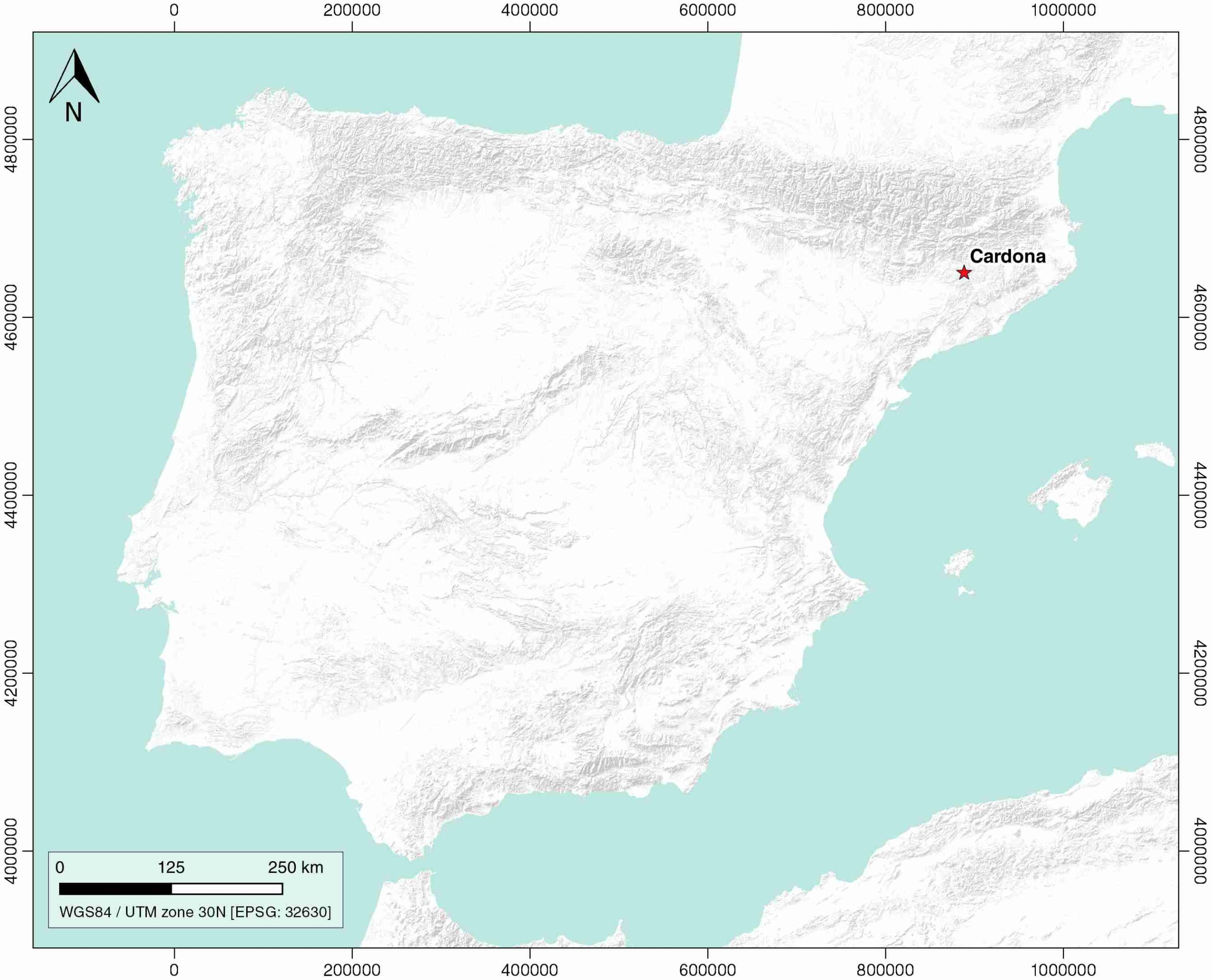
| Geological Setting | Ebro foreland basin |
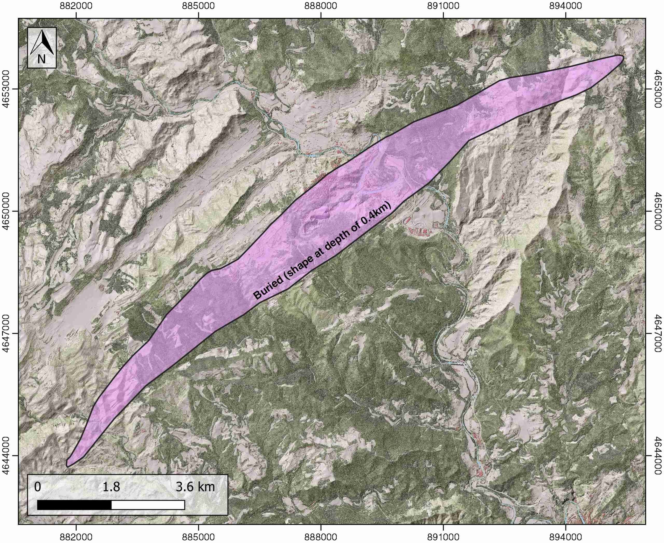
| Outcropping/buried | Partially buried |
| Evaporite unit/s name | Cardona Fm. |
| Evaporite unit/s age | Priabonian (Eocene) |
| Evaporite unit/s origin | Marine |
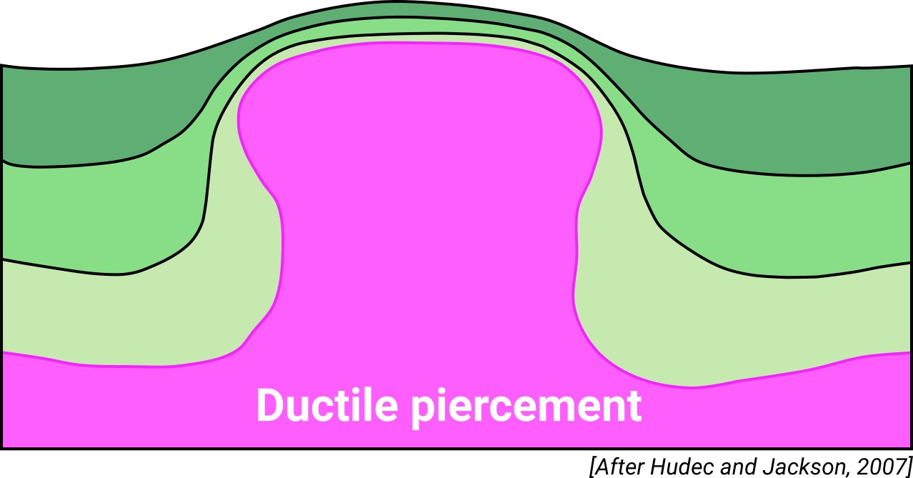
| Classif. (Hudec and Jackson, 2009) | Ductile piercement |
| Classif. (Jackson and Talbot, 1986) | Salt stock |
| Age of evaporite flow or deformation (when deformed) | Lower Oligocene |
| Other comments | Unprecise growth age of the Cardona, Suria and El Guix anticlines because of the absence of related syntectonic sediments. |
Generic Data
| Unique ID | 01 |
| Name | Cardona |
| Structure type | Evaporite diapir |
| Deformed/Undeformed | Deformed |
| Buried/Outcropping | Partially buried |
| Geological setting | Ebro Basin |
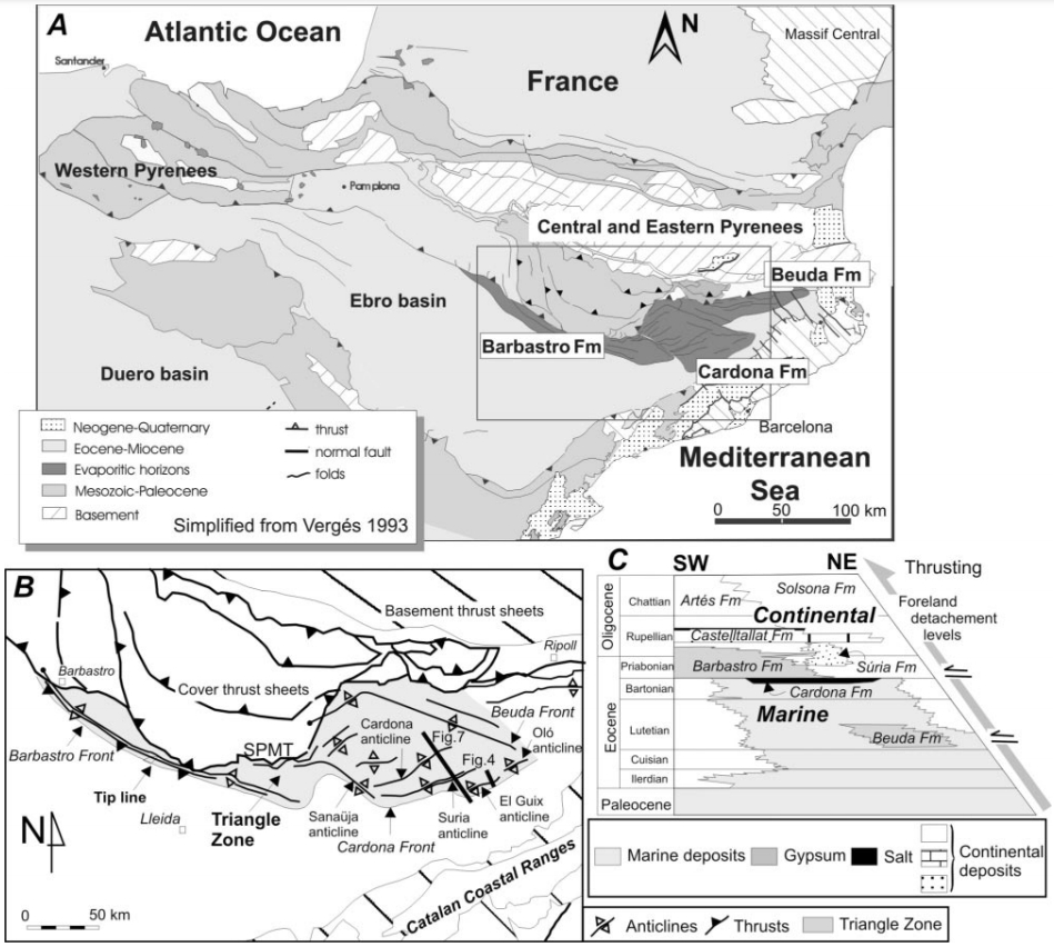
| Geological Regional Setting | Catalan Potash sub-basin |
| Evaporite unit/s name | Cardona Fm. |
| Evaporite unit/s age | Priabonian (Eocene) |
| Evaporite unit/s era | Cenozoic |
| Evaporite unit/s origin | Marine |
| Evaporite unit/s composition | Anhydrite-Halite-Potassium chloride-Sylvite-Carnallite |
| Post-kinematic unit/s (or post-evaporite units when evaporites are undeformed) | Priabonian (Súria Fm.) ; Rupelian-Chattian (Solsona Fm) |
| Post-kinematic unit/s age (or post-evaporite units when evaporites are undeformed) | Upper Priabonian-Lower Oligocene |
| Classification (Hudec and Jackson, 2009) | Ductile piercement |
| Classification (Jackson and Talbot, 1986) | Salt stock |
| Mining activity? | Y |
| Mining activity start | 1902 |
| Mining activity end | Active |
| Mining galleries? | Y |
| Mining products | Gem Salt, Common salt |
| Mining sub-products | |
| Evaporite flow? | Y |
| Age of evaporite flow | Lower Oligocene |
| Flow or deformation triggering mechanisms | Moderate folding of the overlying units / Post-shortening erosion |
| Flow-linked structures? | Y |
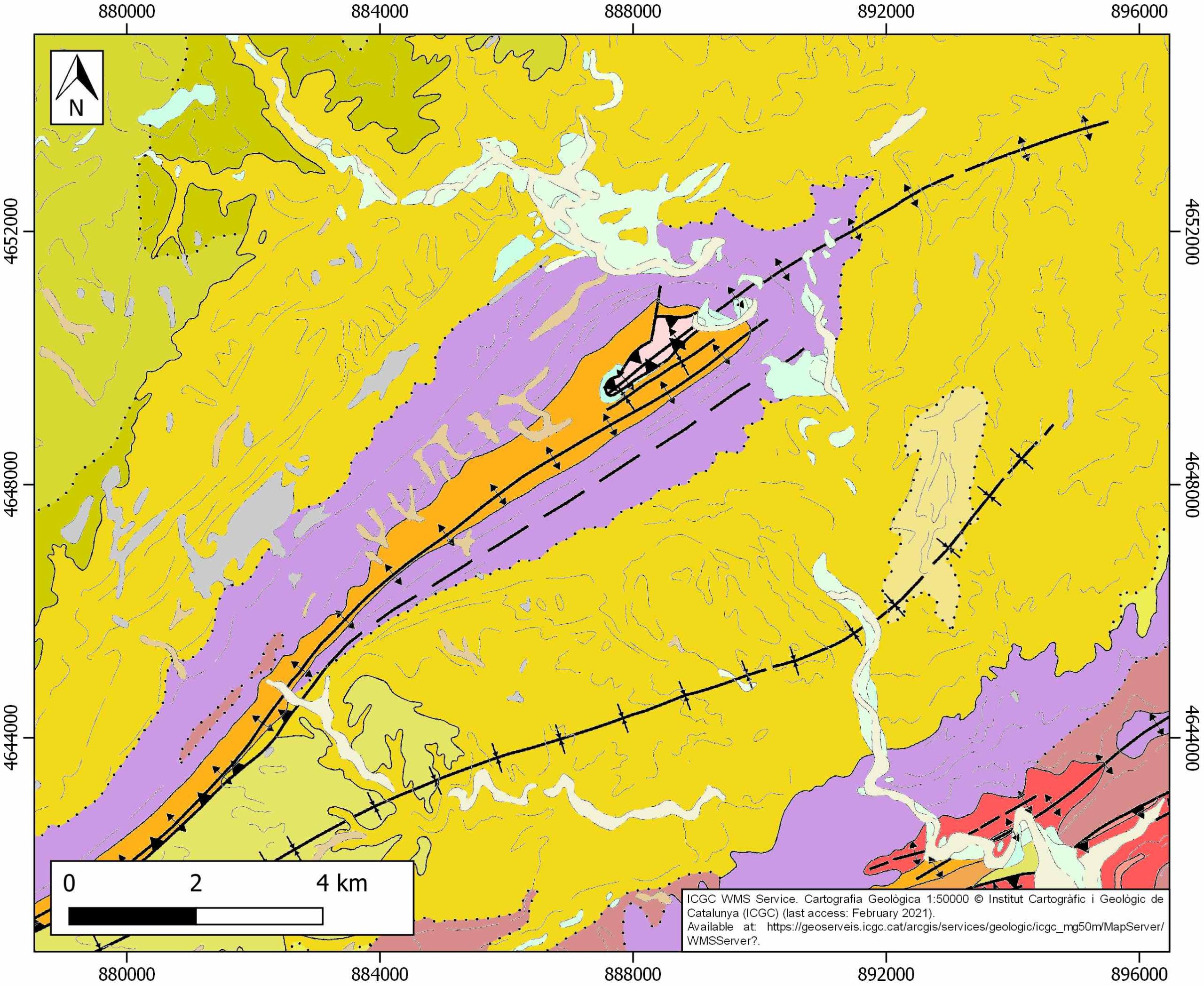
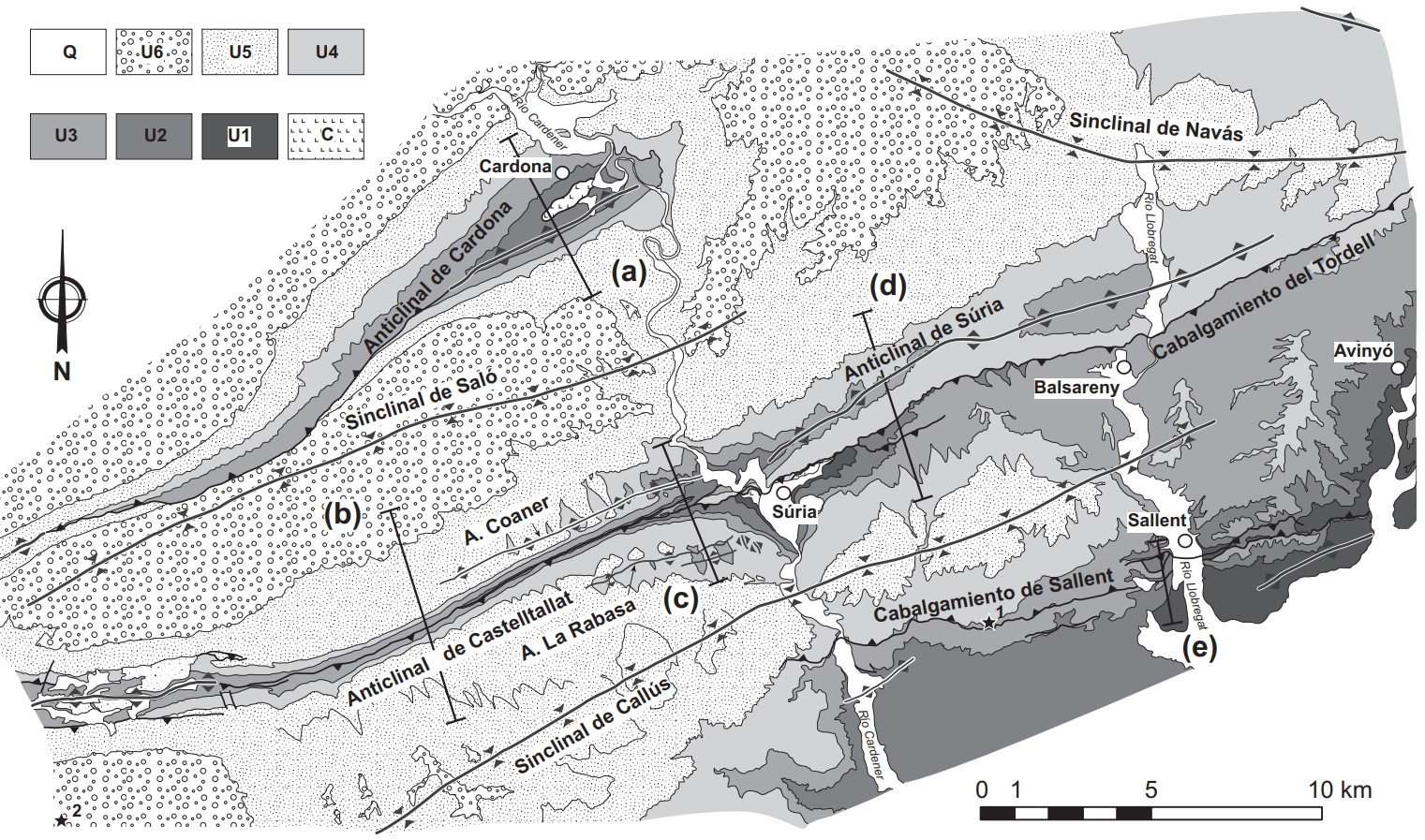
| Halokinetic structures | Cardona fault / Cardener fault / Cardona anticline / Intermediate syncline / Pinós anticline |
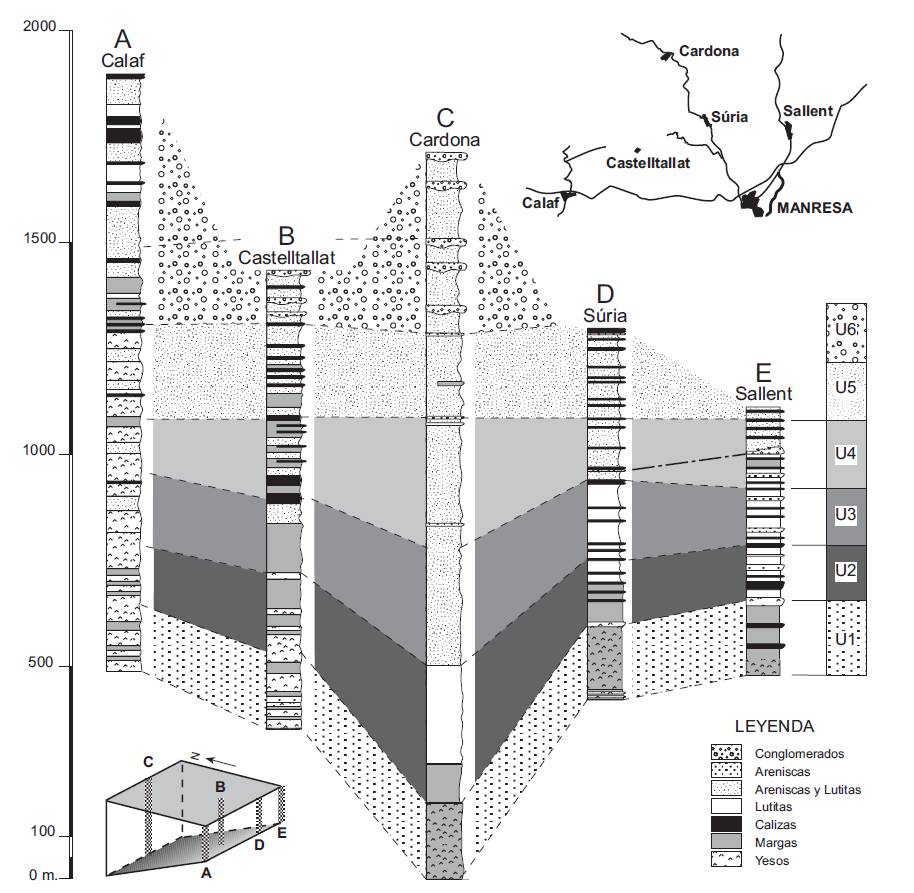
| Post-evaporite and pre-kinematic unit/s (overbuden) | Oligocene (Barbastro and Súria Fms., marlstones, sandstones and shales) ; Oligocene (Castelltallat Fm., limestones, marly limestones, marlstones) ; Upper Oligocene (Solsona Fm., sandstones, red clays, microconglomerates) |
| Syn-kinematic unit/s | – |
| Available seismic profiles | K-5 / K-3 / 5 / K-4 / K-1Y2 / 50 / 47 / 46 / 21 / 51-1 / 36 / 46 / 19 / 47 / 35 / 52 / 53-1 / 23 / K-5 / 34 / 39 |
| Available boreholes | (Private Access): Llardella / Marbà / Alberto shaft / Cardona |
| Additional comments | Unprecise growth age of the Cardona, Suria and El Guix anticlines because of the absence of related syntectonic sediments. |
Mining Data
| UNIQUE_ID | 1 |
| Minning exploitations within <2km? | Y |
| Historical/Active | Active |
| Exploitation name #1 | LAS SALINAS |
| Exploitation ID (Spanish National Mining Cadastre) #1 | 4167 |
| Municipality #1 | Cardona |
| Province #1 | BARCELONA |
| Company #1 | SALINERA DE CARDONA, S.L. |
| Main minning Products #1 | Gem Salt, Common salt |
| Exploitation name #2 | |
| Exploitation ID (Spanish National Mining Cadastre) #2 | |
| Municipality #2 | |
| Province #2 | |
| Company #2 | |
| Main minning Products #2 | |
| Exploitation name #3 | |
| Exploitation ID (Spanish National Mining Cadastre) #3 | |
| Municipality #3 | |
| Province #3 | |
| Company #3 | |
| Main minning Products #3 |
Quantitative Data
| UNIQUE_ID | 1 |
| Outcropping area (km2) | Buried |
| Horizontal intersection area (km2) (when buried) | 18.117 |
| Depth of intersection area (km2) (when buried) | 0.4 |
| Max. Width (Km) | 17 |
| Max. Length (Km) | 3 |
| Max. Evaporites thickness (km) | 2 |
| Max. Deformation age (Ma) | 33.9 |
| Min. Deformation age (Ma) | 27.8 |
| Deformation stages | 1 |
Reference Data
| UNIQUE_ID | 1 |
| Section source | Sans, M., and Koyi, H.A., 2001. Modeling the role of erosion in diapir development in contractional settings. In Koyi, H.A. and Mancktelow, N.S. (eds), Tectonic Modeling: A Volume in Honor of Hans Ramberg: Boulder, Colorado, Geological Society of America Memoir 193, 111–122. [link] |
| Well / Borehole availability #1 | Private access |
| Well / Borehole availability #2 | Private access |
| Available data (Stratigraphy) #1 | Sáez, A., 1987. Estratigrafía y sedimentología de las formaciones lacustres del tránsito Eoceno Oligoceno del NE de la cuenca del Ebro [Ph.D. thesis]: Barcelona, Universitat de Barcelona, 245 p. [link] |
| Available data (Stratigraphy) #2 | Del Santo, G., García-Sansegundo, J., Sarasa, L., Torrebadella, J., 2000. Estratigrafía y estructura del Terciario en el sector oriental de la cuenca del Ebro entre Solsona y Manresa (NE de España). Revista de la Sociedad Geológica de España, 13(2), 265-278. [link] |
| Available data (Stratigraphy) #3 | Burbank, D. W., Puigdefàbregas, C. A. I., and Munoz, J. A., 1992. The chronology of the Eocene tectonic and stratigraphic development of the eastern Pyrenean foreland basin, northeast Spain. Geological Society of America Bulletin, 104(9), 1101-1120. [link] |
| Available data (Stratigraphy) #4 | Vergés, J., Burbank, D., 1996. Eocene-Oligocene thrusting and basin configuration in the eastern and central Pyrenees (Spain). In P. Friend & C. Dabrio (Eds.), Tertiary Basins of Spain: The Stratigraphic Record of Crustal Kinematics (World and Regional Geology, pp. 120-133). Cambridge: Cambridge University Press. [link] |
| Available data (Stratigraphy) #5 | Krzywiec P., Vergés J., 2007. Role of the Foredeep Evaporites in Wedge Tectonics and Formation of Triangle Zones: Comparison of the Carpathian and Pyrenean Thrust Fronts. In: Lacombe O., Roure F., Lavé J., Vergés J. (eds) Thrust Belts and Foreland Basins. Frontiers in Earth Sciences. Springer, Berlin, Heidelberg. [link] |
| Available data (Stratigraphy) #6 | Pérez-Villar, G., Gutiérrez, F., Zarroca, M., Roqué, C., Benito-Calvo, A., & Menció, A. (2024). Late Quaternary morpho-stratigraphic record of diapir rise in the Cardona salt extrusion, NE Spain. Halokinetic sequences, raised terraces and uplift rates. Quaternary Science Reviews, 324, 108462. [link] |
| Regional Stratigraphy | Del Santo, G., García-Sansegundo, J., Sarasa, L., Torrebadella, J., 2000. Estratigrafía y estructura del Terciario en el sector oriental de la cuenca del Ebro entre Solsona y Manresa (NE de España). Revista de la Sociedad Geológica de España, 13(2), 265-278. [link] |
| Seismic data availability #1 | Private access |
| Seismic data availability #2 | Private access |
| Seismic data availability #3 | Private access |
| Available data (Structure) #1 | Pérez-Villar, G., Gutiérrez, F., Zarroca, M., Roqué, C., Benito-Calvo, A., & Menció, A., 2024. Late Quaternary morpho-stratigraphic record of diapir rise in the Cardona salt extrusion, NE Spain. Halokinetic sequences, raised terraces and uplift rates. Quaternary Science Reviews, 324, 108462. [link] |
| Available data (Structure) #2 | Vergés, J., 1993. Estudi geològic del vessant sud del pirineu oriental i central. Evolució cinemàtica en 3D [Ph.D. thesis]: Universitat de Barcelona, 203 p. [link] |
| Available data (Structure) #3 | Sans, M., and Vergés, J., 1995. Fold development related to contractional salt tectonics: Southeastern Pyrenean thrust front, Spain, in Jackson, M.P.A., et al. (eds), Salt tectonics: Aglobal perspective: American Association of Petroleum Geologists Memoir 65, 369–378. [link] |
| Available data (Structure) #4 | Sans, M., Sánchez, A. L., and Santanach, P., 1996. Internal structure of a detachment horizon in the most external part of the Pyrenean fold and thrust belt (northern Spain). Geological Society, London, Special Publications, 100(1), 65-76. [link] |
| Available data (Structure) #5 | Vergés J., Muñoz J.A., Martínez A., 1992. South Pyrenean fold and thrust belt: The role of foreland evaporitic levels in thrust geometry. In: McClay K.R. (eds), Thrust Tectonics. Springer, Dordrecht, 255-264 pp. [link] |
| Available data (Structure) #6 | Sans, M., Muñoz, J. A., & Vergés, J.,1996. Triangle zone and thrust wedge geometries related to evaporitic horizons (southern Pyrenees). Bulletin of Canadian Petroleum Geology, 44(2), 375-384. [link] |
| Available data (Analogue modelling) #1 | Sans, M., and Koyi, H. A., 2001. Modeling the role of erosion in diapir development in contractional settings. Tectonic Modeling: A Volume in Honor of Hans Ramberg, 111-122. [link] |
| Available data (Analogue modelling) #2 | Sans, M., 2003. From thrust tectonics to diapirism. The role of evaporites in the kinematic evolution of the eastern South Pyrenean front. Geologica Acta, 1(3), 239-260. [link] |
| Available data (Analogue modelling) #3 | Koyi, H. A., and Sans, M., 2006. Deformation transfer in viscous detachments: comparison of sandbox models to the South Pyrenean Triangle Zone. Geological Society, London, Special Publications, 253(1), 117-134. [link] |
| Available data (Gravimetry – Tomography) #1 | Pinto, V., i Ponsatí, A. C., Marginedas, L. R., & Salinas, R. L., 2002. Modelización Gravimétrica 3D del diapiro de Cardona, Cuenca del Ebro (NE de España). Acta geológica hispánica, 273-284. [link] |
| Available data (Gravimetry – Tomography) #2 | ICGC, 2012. Mapa Gravimètric de Catalunya 1:500.000. Barcelona, Servei Geològic de Catalunya. [link] |
| Available data (Gravimetry – Tomography) #3 | Casas, A., Deiana, D., Gili, J., Rivero, L., & Pinto, V., 2002. Geophysical surveys for detecting subsidence and collapse areas at Cardona salt diapir (Catalonia, Spain). In 8th EEGS-ES Meeting (pp. cp-36). European Association of Geoscientists & Engineers. |
| Available data (Geochemistry) #1 | Pueyo, J. J. and San Miguel, A., 1971. Características petrológicas de las sales sódicas, potásicas y magnésica de la Cuenca Potásica Catalana». Rev. Inst. Inv. Geol. Dip, Prov. Barcelona, 29, 23-49. [link] |
| Available data (Geochemistry) #2 | Pueyo, J.J., 1975. Estudio petrológico y geoquímico de los yacimientos potásicos de Cardona, Suria, Sallent y Balsareny (Barcelona-España)[Ph.D. thesis]: Barcelona, Universitat de Barcelona, 351 pp. [link] |
| Available data (Geochemistry) #3 | De Las Cuevas, C., and Pueyo, J. J., 1995. The influence of mineralogy and texture in the water content of rock salt formations. Its implication in radioactive waste disposal. Applied geochemistry, 10(3), 317-327. [link] |
| Available data (Geochemistry) #4 | Cendón, D. I., Ayora, C., Pueyo, J. J., Taberner, C., 2003. The geochemical evolution of the Catalan potash subbasin, South Pyrenean foreland basin (Spain). Chemical Geology, 200(3-4), 339-357. [link] |
| Available data (Petrophysics) #1 | Miralles, L., Sans, M., Pueyo, J. J., and Santanach, P., 2000. Recrystallization salt fabric in a shear zone (Cardona diapir, southern Pyrenees, Spain). Geological Society, London, Special Publications, 174(1), 149-167. [link] |
| Available data (Petrophysics) #2 | Landrø, M., Puigdefabregas, C., & Arntsen, B., 2011. Anisotropy in the salt outcrop at Cardona, Catalonia–implications for seismic imaging. First break, 29(8). [link] |
| IGME Geological Map (MAGNA50) Sheet number | 330-Cardona. [link] |
| Other Maps #1 (source) | Sans, M., 2003. From thrust tectonics to diapirism. The role of evaporites in the kinematic evolution of the eastern South Pyrenean front. Geologica Acta, 1(3), 239-260. [link] |
| Other Maps #2 (source) | Del Santo, G., García-Sansegundo, J., Sarasa, L., Torrebadella, J., 2000. Estratigrafía y estructura del Terciario en el sector oriental de la cuenca del Ebro entre Solsona y Manresa (NE de España). Revista de la Sociedad Geológica de España, 13(2), 265-278. [link] |
| Other related references #1 | Rosell i Ortiz, L. and Pueyo Mur, J. J., 1984. Características geoquímicas de la formación de sales potásicas de Navarra (Eoceno superior). Comparación con la cuenca potásica catalana. Acta Geologica Hispanica, 19, 81-95. [link] |
| Other related references #2 | Canas, J. A., García, F., Clapés, J., Osorio, R., Pérez, V., Pujades, L. G. and Caselles, O., 1996. Estudio mediante técnicas de Geo-radar del subsuelo y galerías de la mina de sal abandonada de Cardona para su habilitación. Geogaceta, 20, 966-969. [link] |
| Other related references #3 | Mottershead, D. N., Duane, W. J., Inkpen, R. J., and Wright, J. S., 2008. An investigation of the geometric controls on the morphological evolution of small-scale salt terrains, Cardona, Spain. Environmental geology, 53(5), 1091-1098. [link] |
| Other related references #4 | Lucha, P., Cardona, F., Gutiérrez, F., and Guerrero, J. 2008. Natural and human-induced dissolution and subsidence processes in the salt outcrop of the Cardona Diapir (NE Spain). Environmental Geology, 53(5), 1023-1035. [link] |
Well and Seismic Data
| UNIQUE_ID | 1 |
| Seismic survey name #1 | 12D2-K |
| Across structure? #1 | Y |
| Seismic profile ID (IGME) #1 | 10420 |
| Seismic profile code #1 | 15049 |
| Seismic profile name #1 | K-5 |
| Seismic survey year #1 | 1974 |
| Data repository #1 | SIGEOF Data Catalogue (Private access section). ©Instituto Geológico y Minero de España (IGME). https://info.igme.es/SIGEOF/ |
| Length (km) #1 | 23.82 |
| Seismic survey name #2 | 12D2-K |
| Across structure? #2 | Y |
| Seismic profile ID (IGME) #2 | 10422 |
| Seismic profile code #2 | 15051 |
| Seismic profile name #2 | K-3 |
| Seismic survey year #2 | 1974 |
| Data repository #2 | SIGEOF Data Catalogue (Private access section). ©Instituto Geológico y Minero de España (IGME). https://info.igme.es/SIGEOF/ |
| Length (km) #2 | 21.56 |
| Seismic survey name #3 | 12D2-5 |
| Across structure? #3 | Y |
| Seismic profile ID (IGME) #3 | 10381 |
| Seismic profile code #3 | 15009 |
| Seismic profile name #3 | 5 |
| Seismic survey year #3 | 1961 |
| Data repository #3 | SIGEOF Data Catalogue (Private access section). ©Instituto Geológico y Minero de España (IGME). https://info.igme.es/SIGEOF/ |
| Length (km) #3 | 18.17 |
| Seismic survey name #4 | 12D2-K |
| Across structure? #4 | Y |
| Seismic profile ID (IGME) #4 | 10421 |
| Seismic profile code #4 | 15050 |
| Seismic profile name #4 | K-4 |
| Seismic survey year #4 | 1974 |
| Data repository #4 | SIGEOF Data Catalogue (Private access section). ©Instituto Geológico y Minero de España (IGME). https://info.igme.es/SIGEOF/ |
| Length (km) #4 | 20.13 |
| Seismic survey name #5 | 12D2-K |
| Across structure? #5 | Y |
| Seismic profile ID (IGME) #5 | 10423 |
| Seismic profile code #5 | 15052 |
| Seismic profile name #5 | K-1Y2 |
| Seismic survey year #5 | 1974 |
| Data repository #5 | SIGEOF Data Catalogue (Private access section). ©Instituto Geológico y Minero de España (IGME). https://info.igme.es/SIGEOF/ |
| Length (km) #5 | 6.96 |
| Seismic survey name #6 | 12D2-50 |
| Across structure? #6 | Y |
| Seismic profile ID (IGME) #6 | 10383 |
| Seismic profile code #6 | 15011 |
| Seismic profile name #6 | 50 |
| Seismic survey year #6 | 1977 |
| Data repository #6 | SIGEOF Data Catalogue (Private access section). ©Instituto Geológico y Minero de España (IGME). https://info.igme.es/SIGEOF/ |
| Length (km) #6 | 7.42 |
| Seismic survey name #7 | 12D2-47 |
| Across structure? #7 | Y |
| Seismic profile ID (IGME) #7 | 10379 |
| Seismic profile code #7 | 15007 |
| Seismic profile name #7 | 47 |
| Seismic survey year #7 | 1961 |
| Data repository #7 | SIGEOF Data Catalogue (Section available under request). ©Instituto Geológico y Minero de España (IGME). https://info.igme.es/SIGEOF/ |
| Length (km) #7 | 4.53 |
| Seismic survey name #8 | 12D2-46 |
| Across structure? #8 | Y |
| Seismic profile ID (IGME) #8 | 10378 |
| Seismic profile code #8 | 15006 |
| Seismic profile name #8 | 46 |
| Seismic survey year #8 | 1961 |
| Data repository #8 | SIGEOF Data Catalogue (Section available under request). ©Instituto Geológico y Minero de España (IGME). https://info.igme.es/SIGEOF/ |
| Length (km) #8 | 7.50 |
| Seismic survey name #9 | 12D2-21 |
| Across structure? #9 | N (within 3km) |
| Seismic profile ID (IGME) #9 | 10353 |
| Seismic profile code #9 | 14981 |
| Seismic profile name #9 | 21 |
| Seismic survey year #9 | 1961 |
| Data repository #9 | SIGEOF Data Catalogue (Section available under request). ©Instituto Geológico y Minero de España (IGME). https://info.igme.es/SIGEOF/ |
| Length (km) #9 | 12.72 |
| Seismic survey name #10 | 12D2-51 |
| Across structure? #10 | N (within 3km) |
| Seismic profile ID (IGME) #10 | 10384 |
| Seismic profile code #10 | 15012 |
| Seismic profile name #10 | 51-1 |
| Seismic survey year #10 | 1977 |
| Data repository #10 | SIGEOF Data Catalogue (Section available under request). ©Instituto Geológico y Minero de España (IGME). https://info.igme.es/SIGEOF/ |
| Length (km) #10 | 4.34 |
| Seismic survey name #11 | 12D2-36 |
| Across structure? #11 | N (within 3km) |
| Seismic profile ID (IGME) #11 | 10368 |
| Seismic profile code #11 | 14996 |
| Seismic profile name #11 | 36 |
| Seismic survey year #11 | 1961 |
| Data repository #11 | SIGEOF Data Catalogue (Section available under request). ©Instituto Geológico y Minero de España (IGME). https://info.igme.es/SIGEOF/ |
| Length (km) #11 | 8.17 |
| Seismic survey name #12 | 12D2-46 |
| Across structure? #12 | N (within 3km) |
| Seismic profile ID (IGME) #12 | 10378 |
| Seismic profile code #12 | 15006 |
| Seismic profile name #12 | 46 |
| Seismic survey year #12 | 1961 |
| Data repository #12 | SIGEOF Data Catalogue (Section available under request). ©Instituto Geológico y Minero de España (IGME). https://info.igme.es/SIGEOF/ |
| Length (km) #12 | 7.50 |
| Seismic survey name #13 | 12D2-19 |
| Across structure? #13 | N (within 3km) |
| Seismic profile ID (IGME) #13 | 10347 |
| Seismic profile code #13 | 14975 |
| Seismic profile name #13 | 19 |
| Seismic survey year #13 | 1961 |
| Data repository #13 | SIGEOF Data Catalogue (Section available under request). ©Instituto Geológico y Minero de España (IGME). https://info.igme.es/SIGEOF/ |
| Length (km) #13 | 3.71 |
| Seismic survey name #14 | 12D2-47 |
| Across structure? #14 | N (within 3km) |
| Seismic profile ID (IGME) #14 | 10379 |
| Seismic profile code #14 | 15007 |
| Seismic profile name #14 | 47 |
| Seismic survey year #14 | 1961 |
| Data repository #14 | SIGEOF Data Catalogue (Section available under request). ©Instituto Geológico y Minero de España (IGME). https://info.igme.es/SIGEOF/ |
| Length (km) #14 | 4.53 |
| Seismic survey name #15 | 12D2-35 |
| Across structure? #15 | N (within 3km) |
| Seismic profile ID (IGME) #15 | 10367 |
| Seismic profile code #15 | 14995 |
| Seismic profile name #15 | 35 |
| Seismic survey year #15 | 1961 |
| Data repository #15 | SIGEOF Data Catalogue (Section available under request). ©Instituto Geológico y Minero de España (IGME). https://info.igme.es/SIGEOF/ |
| Length (km) #15 | 11.22 |
| Seismic survey name #16 | 12D2-52 |
| Across structure? #16 | N (within 3km) |
| Seismic profile ID (IGME) #16 | 10386 |
| Seismic profile code #16 | 15014 |
| Seismic profile name #16 | 52 |
| Seismic survey year #16 | 1977 |
| Data repository #16 | SIGEOF Data Catalogue (Private access section). ©Instituto Geológico y Minero de España (IGME). https://info.igme.es/SIGEOF/ |
| Length (km) #16 | 6.21 |
| Seismic survey name #17 | 12D2-53 |
| Across structure? #17 | N (within 3km) |
| Seismic profile ID (IGME) #17 | 10387 |
| Seismic profile code #17 | 15015 |
| Seismic profile name #17 | 53-1 |
| Seismic survey year #17 | 1961 |
| Data repository #17 | SIGEOF Data Catalogue (Private access section). ©Instituto Geológico y Minero de España (IGME). https://info.igme.es/SIGEOF/ |
| Length (km) #17 | 3.51 |
| Seismic survey name #18 | 12D2-23 |
| Across structure? #18 | N (within 3km) |
| Seismic profile ID (IGME) #18 | 10355 |
| Seismic profile code #18 | 14983 |
| Seismic profile name #18 | 23 |
| Seismic survey year #18 | 1961 |
| Data repository #18 | SIGEOF Data Catalogue (Private access section). ©Instituto Geológico y Minero de España (IGME). https://info.igme.es/SIGEOF/ |
| Length (km) #18 | 20.10 |
| Seismic survey name #19 | 12D2-K |
| Across structure? #19 | N (within 3km) |
| Seismic profile ID (IGME) #19 | 10420 |
| Seismic profile code #19 | 15049 |
| Seismic profile name #19 | K-5 |
| Seismic survey year #19 | 1974 |
| Data repository #19 | SIGEOF Data Catalogue (Private access section). ©Instituto Geológico y Minero de España (IGME). https://info.igme.es/SIGEOF/ |
| Length (km) #19 | 23.82 |
| Seismic survey name #20 | 12D2-34 |
| Across structure? #20 | N (within 3km) |
| Seismic profile ID (IGME) #20 | 10366 |
| Seismic profile code #20 | 14994 |
| Seismic profile name #20 | 34 |
| Seismic survey year #20 | 1961 |
| Data repository #20 | SIGEOF Data Catalogue (Private access section). ©Instituto Geológico y Minero de España (IGME). https://info.igme.es/SIGEOF/ |
| Length (km) #20 | 6.19 |
| Seismic survey name #21 | 12D2-39 |
| Across structure? #21 | N (within 3km) |
| Seismic profile ID (IGME) #21 | 10370 |
| Seismic profile code #21 | 14998 |
| Seismic profile name #21 | 39 |
| Seismic survey year #21 | 1961 |
| Data repository #21 | SIGEOF Data Catalogue (Private access section). ©Instituto Geológico y Minero de España (IGME). https://info.igme.es/SIGEOF/ |
| Length (km) #21 | 9.75 |
| Borehole name #1 | Llardella |
| Company #1 | n.a. |
| Traget #1 | n.a. |
| Across structure? #1 | n.a. |
| Borehole name #2 | Marbà |
| Company #2 | n.a. |
| Traget #2 | n.a. |
| Across structure? #2 | n.a. |
| Borehole name #3 | Alberto shaft |
| Company #3 | n.a. |
| Traget #3 | n.a. |
| Across structure? #3 | n.a. |
| Borehole name #4 | Cardona |
| Company #4 | n.a. |
| Traget #4 | n.a. |
| Across structure? #4 | n.a. |
| Borehole name #5 | |
| Company #5 | |
| Traget #5 | |
| Across structure? #5 | |
| Borehole name #6 | |
| Company #6 | |
| Traget #6 | |
| Across structure? #6 | |
| Borehole name #7 | |
| Company #7 | |
| Traget #7 | |
| Across structure? #7 | |
| Borehole name #8 | |
| Company #8 | |
| Traget #8 | |
| Across structure? #8 | |
| Borehole name #9 | |
| Company #9 | |
| Traget #9 | |
| Across structure? #9 | |
| Borehole name #10 | |
| Company #10 | |
| Traget #10 | |
| Across structure? #10 | |
| Borehole name #11 | |
| Company #11 | |
| Traget #11 | |
| Across structure? #11 | |
| Borehole name #12 | |
| Company #12 | |
| Traget #12 | |
| Across structure? #12 | |
| Borehole name #13 | |
| Company #13 | |
| Traget #13 | |
| Across structure? #13 | |
| Borehole name #14 | |
| Company #14 | |
| Traget #14 | |
| Across structure? #14 | |
| Borehole name #15 | |
| Company #15 | |
| Traget #15 | |
| Across structure? #15 |
Geographical Data (EPSG:4326 - WGS 84)
| UNIQUE_ID | 1 |
| X Centroid (Structure shape) | 1.680465 |
| Y Centroid (Structure shape) | 1.680465 |
| Xmin (Structure shape) | 1.598543 |
| Xmax (Structure shape) | 1.769284 |
| Ymin (Structure shape) | 41.853214 |
| Ymax (Structure shape) | 41.937422 |
| Xmin seismic line #1 | 1.660122 |
| Xmax seismic line #1 | 1.719557 |
| Ymin seismic line #1 | 41.871917 |
| Ymax seismic line #1 | 41.953581 |
| Xmin seismic line #2 | 1.639169 |
| Xmax seismic line #2 | 1.721420 |
| Ymin seismic line #2 | 41.856517 |
| Ymax seismic line #2 | 41.926676 |
| Xmin seismic line #3 | 1.565978 |
| Xmax seismic line #3 | 1.609041 |
| Ymin seismic line #3 | 41.751230 |
| Ymax seismic line #3 | 41.890476 |
| Xmin seismic line #4 | 1.604647 |
| Xmax seismic line #4 | 1.703389 |
| Ymin seismic line #4 | 41.841434 |
| Ymax seismic line #4 | 41.925830 |
| Xmin seismic line #5 | 1.680404 |
| Xmax seismic line #5 | 1.714042 |
| Ymin seismic line #5 | 41.911493 |
| Ymax seismic line #5 | 41.935541 |
| Xmin seismic line #6 | 1.633536 |
| Xmax seismic line #6 | 1.649554 |
| Ymin seismic line #6 | 41.829667 |
| Ymax seismic line #6 | 41.887338 |
| Xmin seismic line #7 | 1.719432 |
| Xmax seismic line #7 | 1.733896 |
| Ymin seismic line #7 | 41.899800 |
| Ymax seismic line #7 | 41.934581 |
| Xmin seismic line #8 | 1.745582 |
| Xmax seismic line #8 | 1.760755 |
| Ymin seismic line #8 | 41.878508 |
| Ymax seismic line #8 | 41.939385 |
| Xmin seismic line #9 | 1.492070 |
| Xmax seismic line #9 | 1.606103 |
| Ymin seismic line #9 | 41.887837 |
| Ymax seismic line #9 | 41.940883 |
| Xmin seismic line #10 | 1.668208 |
| Xmax seismic line #10 | 1.676782 |
| Ymin seismic line #10 | 41.931524 |
| Ymax seismic line #10 | 41.964411 |
| Xmin seismic line #11 | 1.696181 |
| Xmax seismic line #11 | 1.784536 |
| Ymin seismic line #11 | 41.934016 |
| Ymax seismic line #11 | 41.953758 |
| Xmin seismic line #12 | 1.745582 |
| Xmax seismic line #12 | 1.760755 |
| Ymin seismic line #12 | 41.878508 |
| Ymax seismic line #12 | 41.939385 |
| Xmin seismic line #13 | 1.625554 |
| Xmax seismic line #13 | 1.638212 |
| Ymin seismic line #13 | 41.904008 |
| Ymax seismic line #13 | 41.929679 |
| Xmin seismic line #14 | 1.719432 |
| Xmax seismic line #14 | 1.733896 |
| Ymin seismic line #14 | 41.899800 |
| Ymax seismic line #14 | 41.934581 |
| Xmin seismic line #15 | 1.781564 |
| Xmax seismic line #15 | 1.816039 |
| Ymin seismic line #15 | 41.871318 |
| Ymax seismic line #15 | 41.948090 |
| Xmin seismic line #16 | 1.569402 |
| Xmax seismic line #16 | 1.630029 |
| Ymin seismic line #16 | 41.882599 |
| Ymax seismic line #16 | 41.900936 |
| Xmin seismic line #17 | 1.559897 |
| Xmax seismic line #17 | 1.587180 |
| Ymin seismic line #17 | 41.846874 |
| Ymax seismic line #17 | 41.870949 |
| Xmin seismic line #18 | 1.595540 |
| Xmax seismic line #18 | 1.723704 |
| Ymin seismic line #18 | 41.930093 |
| Ymax seismic line #18 | 42.024205 |
| Xmin seismic line #19 | 1.660122 |
| Xmax seismic line #19 | 1.719557 |
| Ymin seismic line #19 | 41.871917 |
| Ymax seismic line #19 | 41.953581 |
| Xmin seismic line #20 | 1.742919 |
| Xmax seismic line #20 | 1.753968 |
| Ymin seismic line #20 | 41.962262 |
| Ymax seismic line #20 | 42.014362 |
| Xmin seismic line #21 | 1.729276 |
| Xmax seismic line #21 | 1.743221 |
| Ymin seismic line #21 | 41.936465 |
| Ymax seismic line #21 | 42.019716 |
| X borehole #1 | |
| Y borehole #1 | |
| X borehole #2 | |
| Y borehole #2 | |
| X borehole #3 | |
| Y borehole #3 | |
| X borehole #4 | |
| Y borehole #4 | |
| X borehole #5 | |
| Y borehole #5 | |
| X borehole #6 | |
| Y borehole #6 | |
| X borehole #7 | |
| Y borehole #7 | |
| X borehole #8 | |
| Y borehole #8 | |
| X borehole #9 | |
| Y borehole #9 | |
| X borehole #10 | |
| Y borehole #10 | |
| X borehole #11 | |
| Y borehole #11 | |
| X borehole #12 | |
| Y borehole #12 | |
| X borehole #13 | |
| Y borehole #13 | |
| X borehole #14 | |
| Y borehole #14 | |
| X borehole #15 | |
| Y borehole #15 |

