General Information
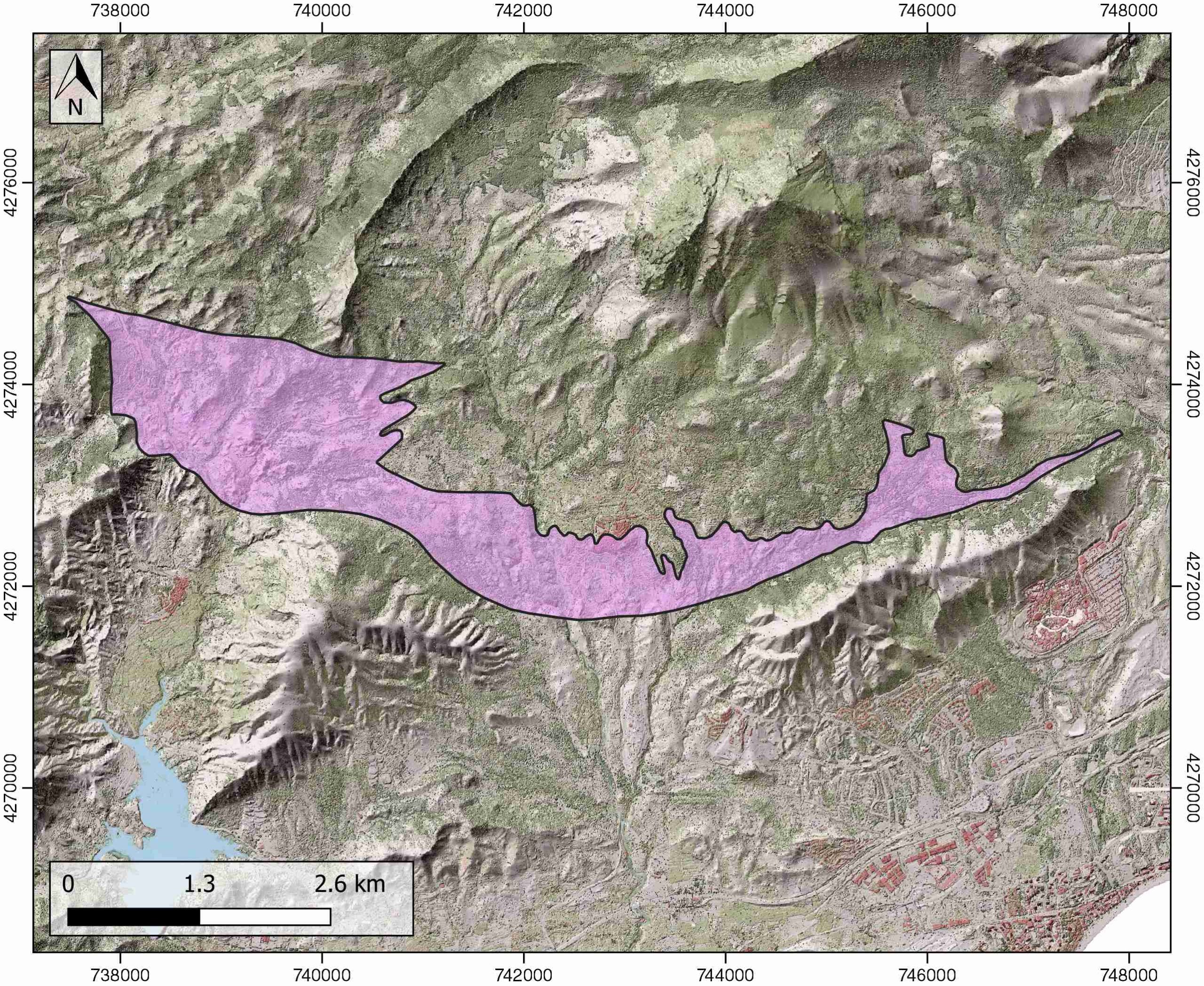
| Structure type | Evaporite Diapir |
| Deformed/Undeformed | Deformed |
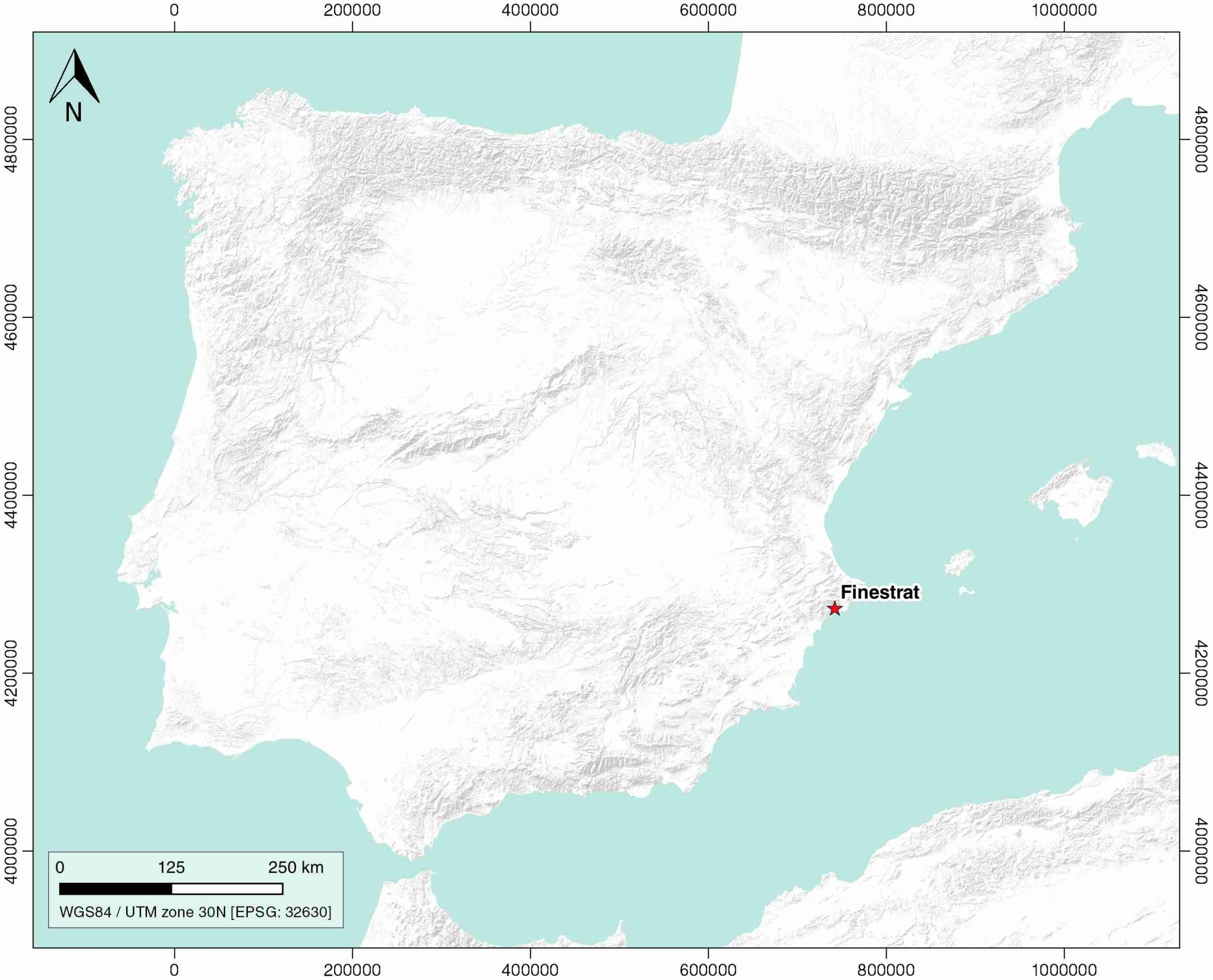
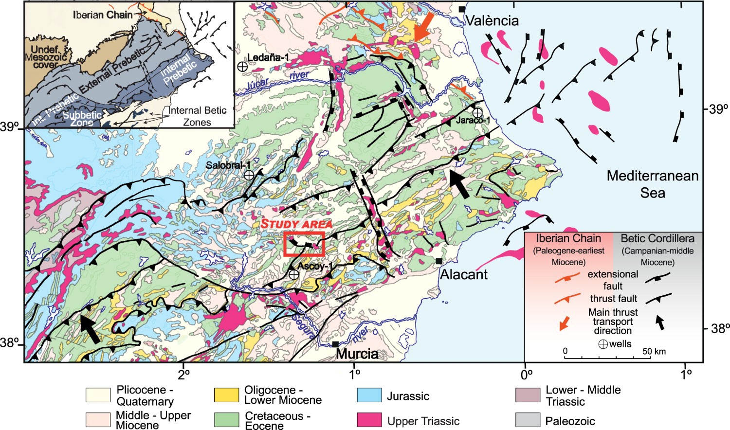
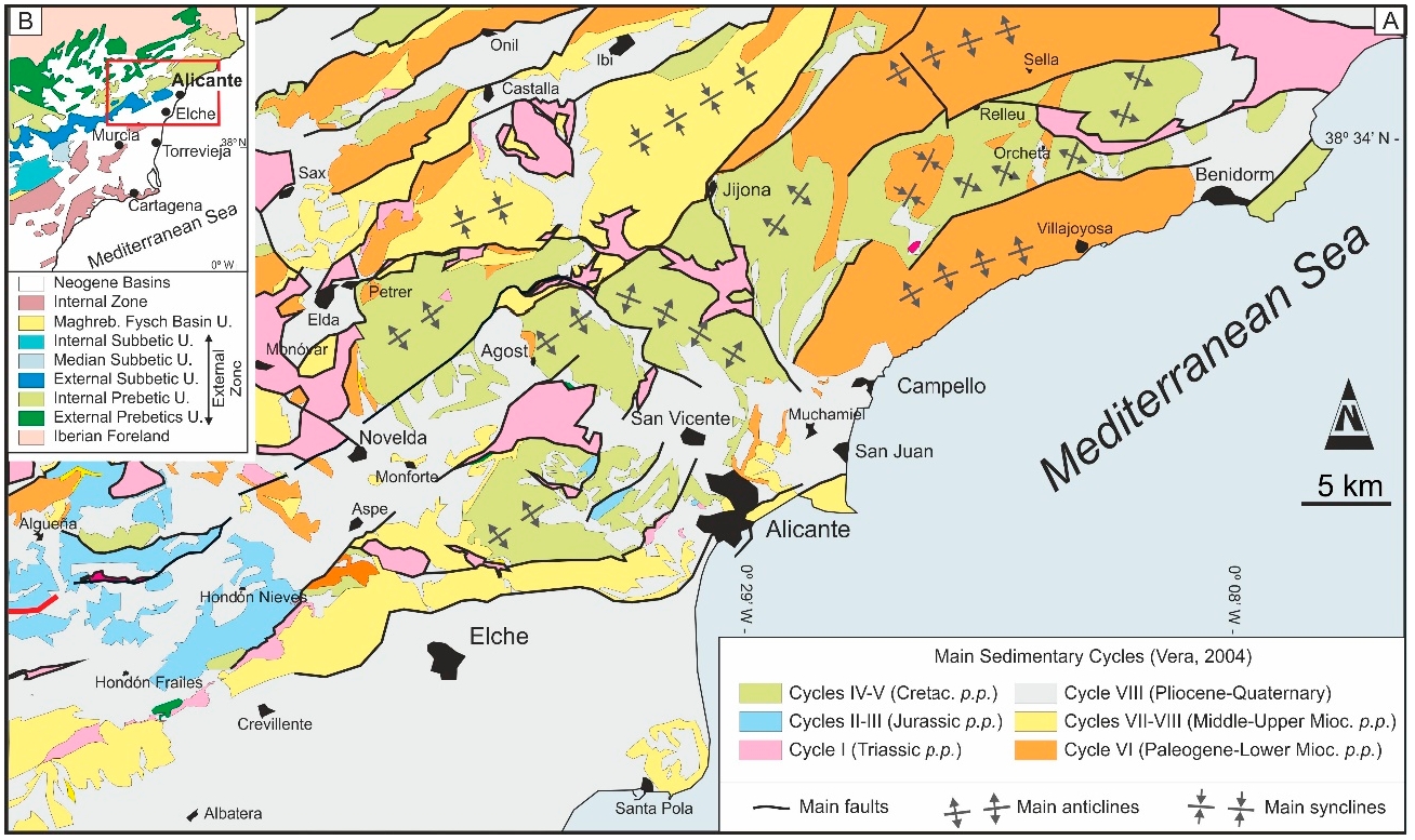
| Geological Setting | Betic system, Pre-Betic cordillera |
| Outcropping/buried | Outcropping |
| Evaporite unit/s name | Keuper facies |
| Evaporite unit/s age | Carnian-Rhaetian (Upper Triassic) |
| Evaporite unit/s origin | Marine |
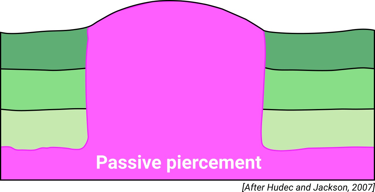
| Classif. (Hudec and Jackson, 2009) | Passive piercement |
| Classif. (Jackson and Talbot, 1986) | Salt wall |
| Age of evaporite flow or deformation (when deformed) | Eocene to Oligocene, Miocene |
| Other comments | Reactivation stage strongly influenced by Mid Miocene transpression. The diapir rised reactively in the late stage in a pull-apart basin bounded by R-shears and P-shears. |
Generic Data
| Unique ID | 80 |
| Name | Finestrat |
| Structure type | Evaporite diapir |
| Deformed/Undeformed | Deformed |
| Buried/Outcropping | Outcropping |
| Geological setting | Betic System |
| Geological Regional Setting | Pre-Betic Cordillera |
| Evaporite unit/s name | Keuper facies |
| Evaporite unit/s age | Carnian-Rhaetian (Upper Triassic) |
| Evaporite unit/s era | Mesozoic |
| Evaporite unit/s origin | Marine |
| Evaporite unit/s composition | Gypsum-Anhydrite-Mudstone-Sandstone |
| Post-kinematic unit/s (or post-evaporite units when evaporites are undeformed) | Quaternary (alluvial and colluvial detrital deposits) |
| Post-kinematic unit/s age (or post-evaporite units when evaporites are undeformed) | Pleistocene-Holocene |
| Classification (Hudec and Jackson, 2009) | Passive piercement |
| Classification (Jackson and Talbot, 1986) | Salt wall |
| Mining activity? | N |
| Mining activity start | |
| Mining activity end | |
| Mining galleries? | |
| Mining products | |
| Mining sub-products | |
| Evaporite flow? | Y |
| Age of evaporite flow | Eocene-Oligocene (main stage) and Serravallian-Early Tortonian (reactivation stage) |
| Flow or deformation triggering mechanisms | Differential loading (main stage) and Mid Miocene transpression (reactivation stage) |
| Flow-linked structures? | Y |
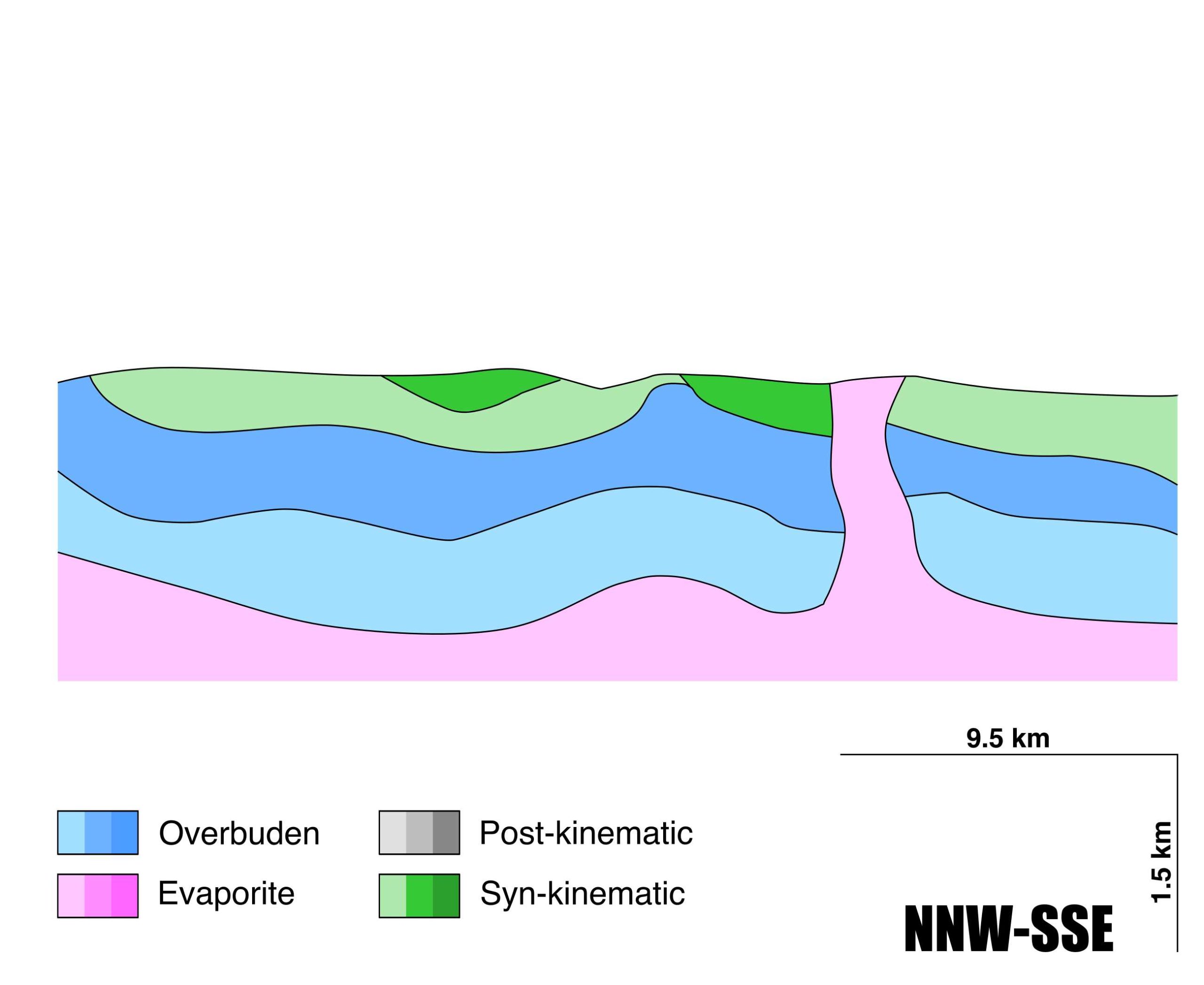
| Halokinetic structures | Reverse faults / normal faults / anticline-syncline folding / progressive unconformities |
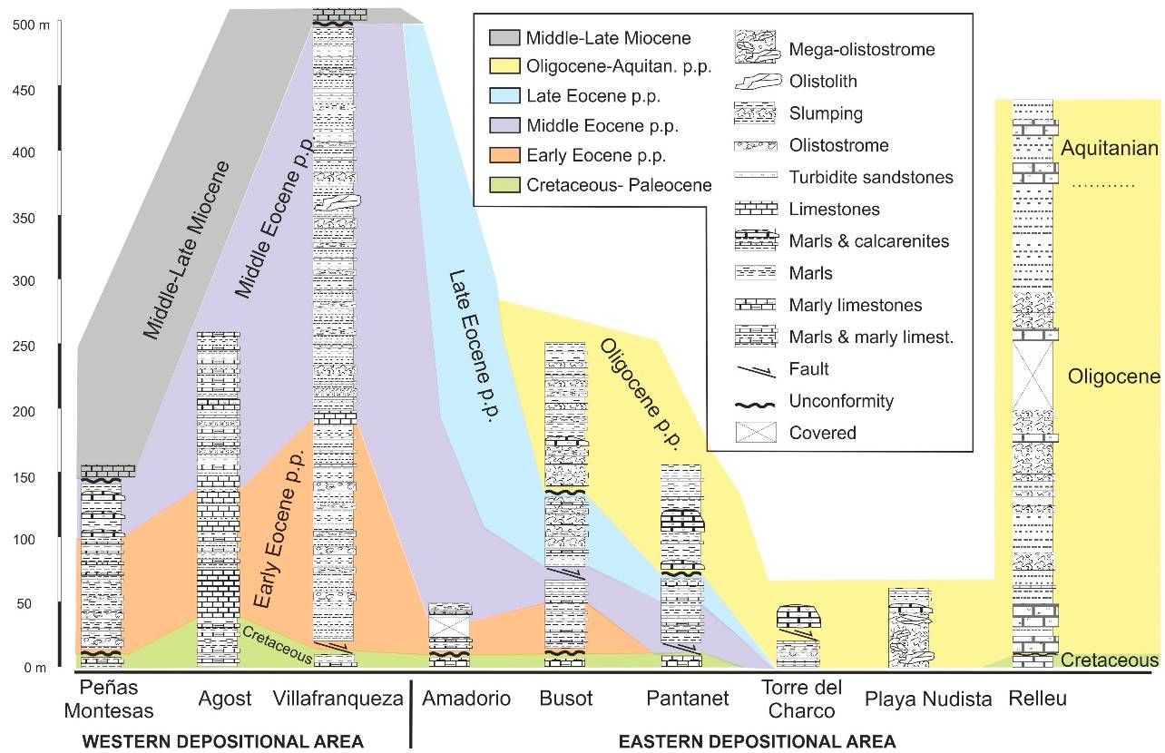
| Post-evaporite and pre-kinematic unit/s (overbuden) | Lower Jurassic (limestones) ; Barremian-Albian (limestones, marls, micritic limestones) ; Upper Cretaceous (tabular limestones, marly limestones, calcarenites, dolostones) ; Aquitanian -Serravallian (marlstones, marly limestones, limestones) |
| Syn-kinematic unit/s | Eocene (marlstones, marly limestones, limestones) ; Late Oligocene (limestones, carbonate brecchia) ; Serravallian-Tortonian (marlstones, calcarenites) |
| Available seismic profiles | RV-11-V / RV15-V / RV-12 / RV-87-03 / RV-87-03 / RV-87-03 / RV-87-01 / RV-11-V / RV-87-01 / RV-87-01 / RV-87-01 |
| Available boreholes | |
| Additional comments | Reactivation stage strongly influences by Mid Miocene transpression. The diapir rose diapir rose reactively in the late stage in a pull-apart basin bounded by R-shears and P-shears. |
Mining Data
| UNIQUE_ID | 80 |
| Minning exploitations within <2km? | N |
| Historical/Active | |
| Exploitation name #1 | |
| Exploitation ID (Spanish National Mining Cadastre) #1 | |
| Municipality #1 | |
| Province #1 | |
| Company #1 | |
| Main minning Products #1 | |
| Exploitation name #2 | |
| Exploitation ID (Spanish National Mining Cadastre) #2 | |
| Municipality #2 | |
| Province #2 | |
| Company #2 | |
| Main minning Products #2 | |
| Exploitation name #3 | |
| Exploitation ID (Spanish National Mining Cadastre) #3 | |
| Municipality #3 | |
| Province #3 | |
| Company #3 | |
| Main minning Products #3 |
Quantitative Data
| UNIQUE_ID | 80 |
| Outcropping area (km2) | 8.36146 |
| Horizontal intersection area (km2) (when buried) | Not buried |
| Depth of intersection area (km2) (when buried) | Not buried |
| Max. Width (Km) | 2.59394488 |
| Max. Length (Km) | 10.5405992 |
| Max. Evaporites thickness (km) | 2.1 |
| Max. Deformation age (Ma) | 56 |
| Min. Deformation age (Ma) | 10 |
| Deformation stages | 2 |
Reference Data
| UNIQUE_ID | 80 |
| Section source | del Olmo, W. M., Motis, K., Martín, D., 2015. El papel del diapirismo de la sal Triásica en la estructuración del Prebético (SE de España). Revista de la Sociedad Geológica de España, 28(1), 3-24. [link] |
| Well / Borehole availability #1 | n.a. |
| Well / Borehole availability #2 | n.a. |
| Available data (Stratigraphy) #1 | Cater, J. M. L., 1987. Sedimentary evidence of the Neogene evolution of SE Spain. Journal of the Geological Society, 144(6), 915-932. [link] |
| Available data (Stratigraphy) #2 | Martín-Martín, M., Guerrera, F., Tramontana, M., 2020. Tectono-Sedimentary Evolution of the Cenozoic Basins in the Eastern External Betic Zone (SE Spain). Geosciences, 10(10), 394. [link] |
| Available data (Stratigraphy) #3 | Hoentzsch, S., Scheibner, C., Brock, J. P., Kuss, J., 2013. Circum-Tethyan carbonate platform evolution during the Palaeogene: the Prebetic platform as a test for climatically controlled facies shifts. Turkish Journal of Earth Sciences, 22(6), 891-918. [link] |
| Available data (Stratigraphy) #4 | Guerrera, F., Martín-Martín, M., 2014. Paleogene-Aquitanian tectonic breakup in the eastern External Betic Zone (Alicante, SE Spain). Revista de la Sociedad Geológica de España, 27, 271-286. [link] |
| Available data (Stratigraphy) #5 | del Olmo, W. M., Motis, K., Martín, D., 2015. El papel del diapirismo de la sal Triásica en la estructuración del Prebético (SE de España). Revista de la Sociedad Geológica de España, 28(1), 3-24. [link] |
| Available data (Stratigraphy) #6 | Guerrera, F., Mancheño, M. A., Martín-Martín, M., Raffaelli, G., Rodríguez-Estrella, T., Serrano, F., 2014. Paleogene evolution of the External Betic Zone and geodynamic implications. Geologica Acta, 12(3), 171-192. [link] |
| Regional Stratigraphy | Martín-Martín, M., Guerrera, F., Tramontana, M., 2020. Tectono-Sedimentary Evolution of the Cenozoic Basins in the Eastern External Betic Zone (SE Spain). Geosciences, 10(10), 394. [link] |
| Seismic data availability #1 | n.a. |
| Seismic data availability #2 | n.a. |
| Seismic data availability #3 | n.a. |
| Available data (Structure) #1 | del Olmo, W. M., Motis, K., Martín, D., 2015. El papel del diapirismo de la sal Triásica en la estructuración del Prebético (SE de España). Revista de la Sociedad Geológica de España, 28(1), 3-24. [link] |
| Available data (Structure) #2 | Jackson, M., Hudec, M., 2017. Strike-Slip Salt-Tectonic Systems. In Salt Tectonics: Principles and Practice (pp. 336-362). Cambridge: Cambridge University Press. [link] |
| Available data (Structure) #3 | Martín-Martín, M., Guerrera, F., Tramontana, M., 2020. Tectono-Sedimentary Evolution of the Cenozoic Basins in the Eastern External Betic Zone (SE Spain). Geosciences, 10(10), 394. [link] |
| Available data (Structure) #4 | Guerrera, F., Martín-Martín, M., 2014. Paleogene-Aquitanian tectonic breakup in the eastern External Betic Zone (Alicante, SE Spain). Revista de la Sociedad Geológica de España, 27, 271-286. [link] |
| Available data (Structure) #5 | Cater, J. M. L., 1987. Sedimentary evidence of the Neogene evolution of SE Spain. Journal of the Geological Society, 144(6), 915-932. [link] |
| Available data (Structure) #6 | n.a. |
| Available data (Analogue modelling) #1 | Callot, J. P., Jahani, S., Letouzey, J., 2007. The role of pre-existing diapirs in fold and thrust belt development. In Thrust belts and foreland basins (pp. 309-325). Springer, Berlin, Heidelberg. [link] |
| Available data (Analogue modelling) #2 | n.a. |
| Available data (Analogue modelling) #3 | n.a. |
| Available data (Gravimetry – Tomography) #1 | Ayala, C., Bohoyo, F., Maestro, A., Reguera, M. I., Torne, M., Rubio, F., Fernández, M., García-Lobón, J. L., 2016. Updated Bouguer anomalies of the Iberian Peninsula: a new perspective to interpret the regional geology. Journal of Maps, 12(5), 1089-1092. [link] |
| Available data (Gravimetry – Tomography) #2 | n.a. |
| Available data (Gravimetry – Tomography) #3 | n.a. |
| Available data (Geochemistry) #1 | Ortí, F., García-Veigas, J., Rossell, L., Jurado, M. J., Utrilla, R., 1996. Formaciones salinas de las cuencas triásicas en la Península Ibérica: Caracterización Petrológica y Geoquímica. Cuadernos de Geología Ibérica, 20, 13-35. [link] |
| Available data (Geochemistry) #2 | Höntzsh, S., Scheibner, C., Brock, J. P., Kuss, J., 2013. Circum-Tethyan carbonate platform evolution during the Palaeogene: the Prebetic platform as a test for climatically controlled facies shifts. Turkish Journal of Earth Sciences, 22(6), 891-918. [link] |
| Available data (Geochemistry) #3 | n.a. |
| Available data (Geochemistry) #4 | n.a. |
| Available data (Petrophysics) #1 | n.a. |
| Available data (Petrophysics) #2 | n.a. |
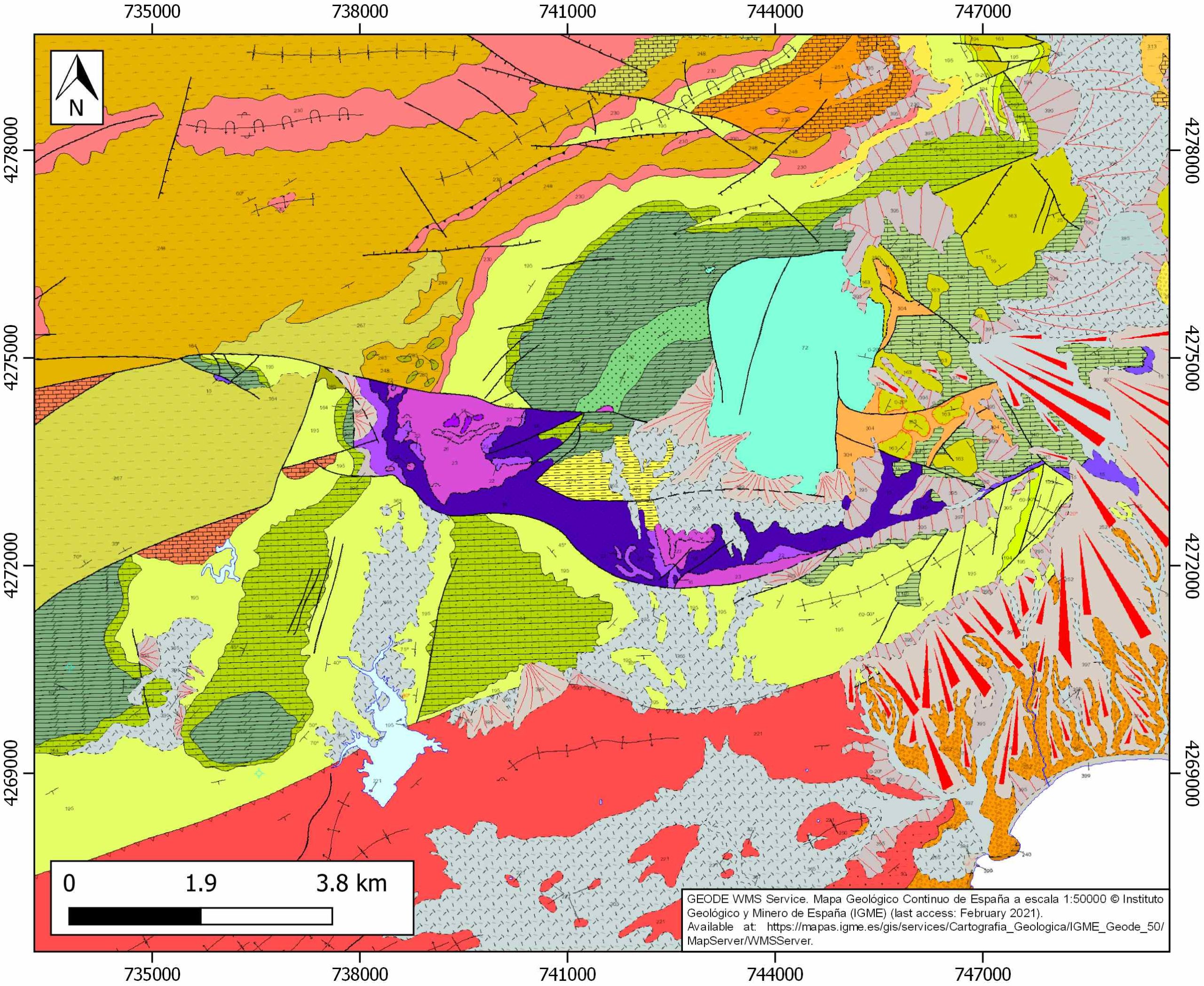
| IGME Geological Map (MAGNA50) Sheet number | 847-Villajoyosa. http://info.igme.es/cartografiadigital/datos/magna50/pdfs/d8_G50/Magna50_847.pdf |
| Other Maps #1 (source) | Escosa, F. O., Ferrer, O., Roca, E., 2018. Geology of the Eastern Prebetic Zone at the Jumilla region (SE Iberia). Journal of Maps, 14(2), 77-86. [link] |
| Other Maps #2 (source) | Martín-Martín, M., Guerrera, F., Tramontana, M., 2020. Tectono-Sedimentary Evolution of the Cenozoic Basins in the Eastern External Betic Zone (SE Spain). Geosciences, 10(10), 394. [link] |
| Other related references #1 | García‐Veigas, J., Gibert, L., Cendón, D. I., Artiaga, D., Corbí, H., Soria, J. M., …, Sanz, E., 2020. Late Miocene evaporite geochemistry of Lorca and Fortuna basins (Eastern Betics, SE Spain): Evidence of restriction and continentalization. Basin Research, 32(5), 926-958. [link] |
| Other related references #2 | Pedrera, A., Marín-Lechado, C., Galindo-Zaldívar, J., García-Lobón, J. L., 2014. Control of preexisting faults and near-surface diapirs on geometry and kinematics of fold-and-thrust belts (Internal Prebetic, Eastern Betic Cordillera). Journal of Geodynamics, 77, 135-148. [link] |
| Other related references #3 | Guerrera, F., Estévez, A., López-Arcos, M., Martín-Martín, M., Martín-Pérez, J. A., Serrano, F., 2006. Paleogene tectono-sedimentary evolution of the Alicante Trough (External Betic Zone, SE Spain) and its bearing on the timing of the deformation of the South-Iberian Margin. Geodinamica Acta, 19(2), 87-101. [link] |
| Other related references #4 | del Olmo, W. M., Verdú, G. L., Alba, J. S., 1986. La estructuración diapirica del Sector Prebético. Geogaceta, (1), 43-44. [link] |
Well and Seismic Data
| UNIQUE_ID | 80 |
| Seismic survey name #1 | 10I1-RV |
| Across structure? #1 | Y |
| Seismic profile ID (IGME) #1 | 10918 |
| Seismic profile code #1 | 15557 |
| Seismic profile name #1 | RV-11-V |
| Seismic survey year #1 | 1985 |
| Data repository #1 | SIGEOF Data Catalogue (Section available under request). ©Instituto Geológico y Minero de España (IGME). https://info.igme.es/SIGEOF/ |
| Length (km) #1 | 19.97 |
| Seismic survey name #2 | 10I1-RV15 |
| Across structure? #2 | N (within 3km) |
| Seismic profile ID (IGME) #2 | 10911 |
| Seismic profile code #2 | 15550 |
| Seismic profile name #2 | RV15-V |
| Seismic survey year #2 | 1981 |
| Data repository #2 | SIGEOF Data Catalogue (Section available under request). ©Instituto Geológico y Minero de España (IGME). https://info.igme.es/SIGEOF/ |
| Length (km) #2 | 21.97 |
| Seismic survey name #3 | 10I1-RV |
| Across structure? #3 | N (within 3km) |
| Seismic profile ID (IGME) #3 | 10917 |
| Seismic profile code #3 | 15556 |
| Seismic profile name #3 | RV-12 |
| Seismic survey year #3 | 1985 |
| Data repository #3 | SIGEOF Data Catalogue (Section available under request). ©Instituto Geológico y Minero de España (IGME). https://info.igme.es/SIGEOF/ |
| Length (km) #3 | 20.14 |
| Seismic survey name #4 | 0529A87S |
| Across structure? #4 | N (within 3km) |
| Seismic profile ID (IGME) #4 | 4745 |
| Seismic profile code #4 | 6661 |
| Seismic profile name #4 | RV-87-03 |
| Seismic survey year #4 | 1987 |
| Data repository #4 | SIGEOF Data Catalogue (Section available under request). ©Instituto Geológico y Minero de España (IGME). https://info.igme.es/SIGEOF/ |
| Length (km) #4 | 12.82 |
| Seismic survey name #5 | 0529A87U |
| Across structure? #5 | N (within 3km) |
| Seismic profile ID (IGME) #5 | 4754 |
| Seismic profile code #5 | 6670 |
| Seismic profile name #5 | RV-87-03 |
| Seismic survey year #5 | 1987 |
| Data repository #5 | SIGEOF Data Catalogue (Section available under request). ©Instituto Geológico y Minero de España (IGME). https://info.igme.es/SIGEOF/ |
| Length (km) #5 | 10.13 |
| Seismic survey name #6 | 0529A87G |
| Across structure? #6 | N (within 3km) |
| Seismic profile ID (IGME) #6 | 4734 |
| Seismic profile code #6 | 6650 |
| Seismic profile name #6 | RV-87-03 |
| Seismic survey year #6 | 1987 |
| Data repository #6 | SIGEOF Data Catalogue (Section available under request). ©Instituto Geológico y Minero de España (IGME). https://info.igme.es/SIGEOF/ |
| Length (km) #6 | 10.05 |
| Seismic survey name #7 | 10I1-RV |
| Across structure? #7 | N (within 3km) |
| Seismic profile ID (IGME) #7 | 10912 |
| Seismic profile code #7 | 15551 |
| Seismic profile name #7 | RV-87-01 |
| Seismic survey year #7 | 1985 |
| Data repository #7 | SIGEOF Data Catalogue (Section available under request). ©Instituto Geológico y Minero de España (IGME). https://info.igme.es/SIGEOF/ |
| Length (km) #7 | 7.95 |
| Seismic survey name #8 | 10I1-RV |
| Across structure? #8 | N (within 3km) |
| Seismic profile ID (IGME) #8 | 10918 |
| Seismic profile code #8 | 15557 |
| Seismic profile name #8 | RV-11-V |
| Seismic survey year #8 | 1985 |
| Data repository #8 | SIGEOF Data Catalogue (Section available under request). ©Instituto Geológico y Minero de España (IGME). https://info.igme.es/SIGEOF/ |
| Length (km) #8 | 19.97 |
| Seismic survey name #9 | 0529A87S |
| Across structure? #9 | N (within 3km) |
| Seismic profile ID (IGME) #9 | 4740 |
| Seismic profile code #9 | 6656 |
| Seismic profile name #9 | RV-87-01 |
| Seismic survey year #9 | 1987 |
| Data repository #9 | SIGEOF Data Catalogue (Private access section). ©Instituto Geológico y Minero de España (IGME). https://info.igme.es/SIGEOF/ |
| Length (km) #9 | 7.95 |
| Seismic survey name #10 | 0529A87U |
| Across structure? #10 | N (within 3km) |
| Seismic profile ID (IGME) #10 | 4749 |
| Seismic profile code #10 | 6665 |
| Seismic profile name #10 | RV-87-01 |
| Seismic survey year #10 | 1987 |
| Data repository #10 | SIGEOF Data Catalogue (Private access section). ©Instituto Geológico y Minero de España (IGME). https://info.igme.es/SIGEOF/ |
| Length (km) #10 | 7.94 |
| Seismic survey name #11 | 0529A87G |
| Across structure? #11 | N (within 3km) |
| Seismic profile ID (IGME) #11 | 4729 |
| Seismic profile code #11 | 6645 |
| Seismic profile name #11 | RV-87-01 |
| Seismic survey year #11 | 1987 |
| Data repository #11 | SIGEOF Data Catalogue (Private access section). ©Instituto Geológico y Minero de España (IGME). https://info.igme.es/SIGEOF/ |
| Length (km) #11 | 7.94 |
| Seismic survey name #12 | |
| Across structure? #12 | |
| Seismic profile ID (IGME) #12 | |
| Seismic profile code #12 | |
| Seismic profile name #12 | |
| Seismic survey year #12 | |
| Data repository #12 | |
| Length (km) #12 | |
| Seismic survey name #13 | |
| Across structure? #13 | |
| Seismic profile ID (IGME) #13 | |
| Seismic profile code #13 | |
| Seismic profile name #13 | |
| Seismic survey year #13 | |
| Data repository #13 | |
| Length (km) #13 | |
| Seismic survey name #14 | |
| Across structure? #14 | |
| Seismic profile ID (IGME) #14 | |
| Seismic profile code #14 | |
| Seismic profile name #14 | |
| Seismic survey year #14 | |
| Data repository #14 | |
| Length (km) #14 | |
| Seismic survey name #15 | |
| Across structure? #15 | |
| Seismic profile ID (IGME) #15 | |
| Seismic profile code #15 | |
| Seismic profile name #15 | |
| Seismic survey year #15 | |
| Data repository #15 | |
| Length (km) #15 | |
| Seismic survey name #16 | |
| Across structure? #16 | |
| Seismic profile ID (IGME) #16 | |
| Seismic profile code #16 | |
| Seismic profile name #16 | |
| Seismic survey year #16 | |
| Data repository #16 | |
| Length (km) #16 | |
| Seismic survey name #17 | |
| Across structure? #17 | |
| Seismic profile ID (IGME) #17 | |
| Seismic profile code #17 | |
| Seismic profile name #17 | |
| Seismic survey year #17 | |
| Data repository #17 | |
| Length (km) #17 | |
| Seismic survey name #18 | |
| Across structure? #18 | |
| Seismic profile ID (IGME) #18 | |
| Seismic profile code #18 | |
| Seismic profile name #18 | |
| Seismic survey year #18 | |
| Data repository #18 | |
| Length (km) #18 | |
| Seismic survey name #19 | |
| Across structure? #19 | |
| Seismic profile ID (IGME) #19 | |
| Seismic profile code #19 | |
| Seismic profile name #19 | |
| Seismic survey year #19 | |
| Data repository #19 | |
| Length (km) #19 | |
| Seismic survey name #20 | |
| Across structure? #20 | |
| Seismic profile ID (IGME) #20 | |
| Seismic profile code #20 | |
| Seismic profile name #20 | |
| Seismic survey year #20 | |
| Data repository #20 | |
| Length (km) #20 | |
| Seismic survey name #21 | |
| Across structure? #21 | |
| Seismic profile ID (IGME) #21 | |
| Seismic profile code #21 | |
| Seismic profile name #21 | |
| Seismic survey year #21 | |
| Data repository #21 | |
| Length (km) #21 | |
| Borehole name #1 | |
| Company #1 | |
| Traget #1 | |
| Across structure? #1 | |
| Borehole name #2 | |
| Company #2 | |
| Traget #2 | |
| Across structure? #2 | |
| Borehole name #3 | |
| Company #3 | |
| Traget #3 | |
| Across structure? #3 | |
| Borehole name #4 | |
| Company #4 | |
| Traget #4 | |
| Across structure? #4 | |
| Borehole name #5 | |
| Company #5 | |
| Traget #5 | |
| Across structure? #5 | |
| Borehole name #6 | |
| Company #6 | |
| Traget #6 | |
| Across structure? #6 | |
| Borehole name #7 | |
| Company #7 | |
| Traget #7 | |
| Across structure? #7 | |
| Borehole name #8 | |
| Company #8 | |
| Traget #8 | |
| Across structure? #8 | |
| Borehole name #9 | |
| Company #9 | |
| Traget #9 | |
| Across structure? #9 | |
| Borehole name #10 | |
| Company #10 | |
| Traget #10 | |
| Across structure? #10 | |
| Borehole name #11 | |
| Company #11 | |
| Traget #11 | |
| Across structure? #11 | |
| Borehole name #12 | |
| Company #12 | |
| Traget #12 | |
| Across structure? #12 | |
| Borehole name #13 | |
| Company #13 | |
| Traget #13 | |
| Across structure? #13 | |
| Borehole name #14 | |
| Company #14 | |
| Traget #14 | |
| Across structure? #14 | |
| Borehole name #15 | |
| Company #15 | |
| Traget #15 | |
| Across structure? #15 |
Geographical Data (EPSG:4326 - WGS 84)
| UNIQUE_ID | 80 |
| X Centroid (Structure shape) | -0.230276 |
| Y Centroid (Structure shape) | -0.230276 |
| Xmin (Structure shape) | -0.273360 |
| Xmax (Structure shape) | -0.153948 |
| Ymin (Structure shape) | 38.560345 |
| Ymax (Structure shape) | 38.590561 |
| Xmin seismic line #1 | -0.343189 |
| Xmax seismic line #1 | -0.254097 |
| Ymin seismic line #1 | 38.539423 |
| Ymax seismic line #1 | 38.697017 |
| Xmin seismic line #2 | -0.298592 |
| Xmax seismic line #2 | -0.070729 |
| Ymin seismic line #2 | 38.604302 |
| Ymax seismic line #2 | 38.641926 |
| Xmin seismic line #3 | -0.497058 |
| Xmax seismic line #3 | -0.276848 |
| Ymin seismic line #3 | 38.569824 |
| Ymax seismic line #3 | 38.617239 |
| Xmin seismic line #4 | -0.371522 |
| Xmax seismic line #4 | -0.244128 |
| Ymin seismic line #4 | 38.560128 |
| Ymax seismic line #4 | 38.617159 |
| Xmin seismic line #5 | -0.343382 |
| Xmax seismic line #5 | -0.244017 |
| Ymin seismic line #5 | 38.571267 |
| Ymax seismic line #5 | 38.617213 |
| Xmin seismic line #6 | -0.342938 |
| Xmax seismic line #6 | -0.244017 |
| Ymin seismic line #6 | 38.571461 |
| Ymax seismic line #6 | 38.617213 |
| Xmin seismic line #7 | -0.332034 |
| Xmax seismic line #7 | -0.281636 |
| Ymin seismic line #7 | 38.571205 |
| Ymax seismic line #7 | 38.630866 |
| Xmin seismic line #8 | -0.343189 |
| Xmax seismic line #8 | -0.254097 |
| Ymin seismic line #8 | 38.539423 |
| Ymax seismic line #8 | 38.697017 |
| Xmin seismic line #9 | -0.331854 |
| Xmax seismic line #9 | -0.281519 |
| Ymin seismic line #9 | 38.571378 |
| Ymax seismic line #9 | 38.630740 |
| Xmin seismic line #10 | -0.331798 |
| Xmax seismic line #10 | -0.281575 |
| Ymin seismic line #10 | 38.571294 |
| Ymax seismic line #10 | 38.630686 |
| Xmin seismic line #11 | -0.331743 |
| Xmax seismic line #11 | -0.281436 |
| Ymin seismic line #11 | 38.571294 |
| Ymax seismic line #11 | 38.630660 |
| Xmin seismic line #12 | |
| Xmax seismic line #12 | |
| Ymin seismic line #12 | |
| Ymax seismic line #12 | |
| Xmin seismic line #13 | |
| Xmax seismic line #13 | |
| Ymin seismic line #13 | |
| Ymax seismic line #13 | |
| Xmin seismic line #14 | |
| Xmax seismic line #14 | |
| Ymin seismic line #14 | |
| Ymax seismic line #14 | |
| Xmin seismic line #15 | |
| Xmax seismic line #15 | |
| Ymin seismic line #15 | |
| Ymax seismic line #15 | |
| Xmin seismic line #16 | |
| Xmax seismic line #16 | |
| Ymin seismic line #16 | |
| Ymax seismic line #16 | |
| Xmin seismic line #17 | |
| Xmax seismic line #17 | |
| Ymin seismic line #17 | |
| Ymax seismic line #17 | |
| Xmin seismic line #18 | |
| Xmax seismic line #18 | |
| Ymin seismic line #18 | |
| Ymax seismic line #18 | |
| Xmin seismic line #19 | |
| Xmax seismic line #19 | |
| Ymin seismic line #19 | |
| Ymax seismic line #19 | |
| Xmin seismic line #20 | |
| Xmax seismic line #20 | |
| Ymin seismic line #20 | |
| Ymax seismic line #20 | |
| Xmin seismic line #21 | |
| Xmax seismic line #21 | |
| Ymin seismic line #21 | |
| Ymax seismic line #21 | |
| X borehole #1 | |
| Y borehole #1 | |
| X borehole #2 | |
| Y borehole #2 | |
| X borehole #3 | |
| Y borehole #3 | |
| X borehole #4 | |
| Y borehole #4 | |
| X borehole #5 | |
| Y borehole #5 | |
| X borehole #6 | |
| Y borehole #6 | |
| X borehole #7 | |
| Y borehole #7 | |
| X borehole #8 | |
| Y borehole #8 | |
| X borehole #9 | |
| Y borehole #9 | |
| X borehole #10 | |
| Y borehole #10 | |
| X borehole #11 | |
| Y borehole #11 | |
| X borehole #12 | |
| Y borehole #12 | |
| X borehole #13 | |
| Y borehole #13 | |
| X borehole #14 | |
| Y borehole #14 | |
| X borehole #15 | |
| Y borehole #15 |

