General Information
| Structure type | Evaporite Diapir |
| Deformed/Undeformed | Deformed |
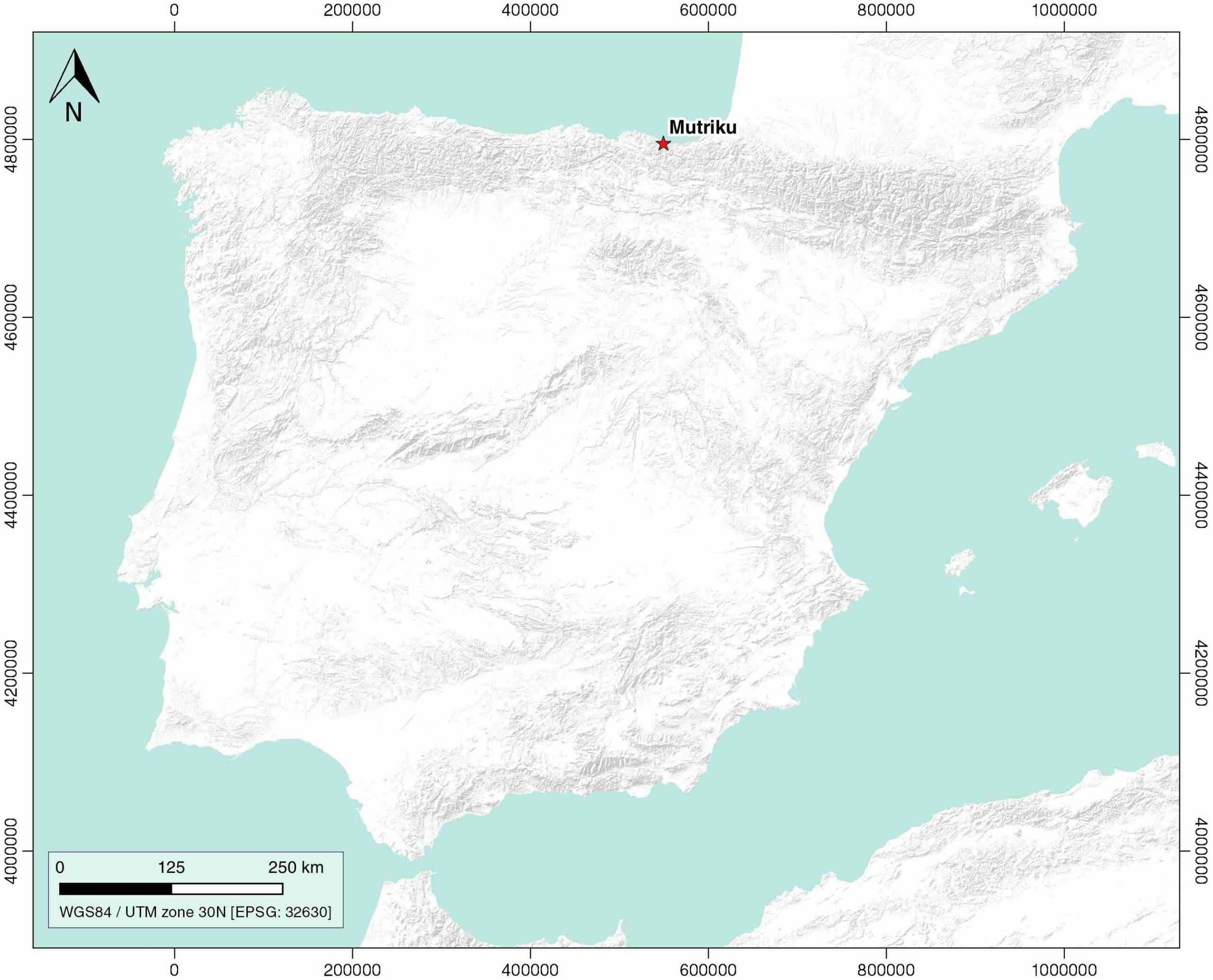
| Geological Setting | Basque Arc, Basque-Cantabrian Basin |
| Outcropping/buried | Outcropping |
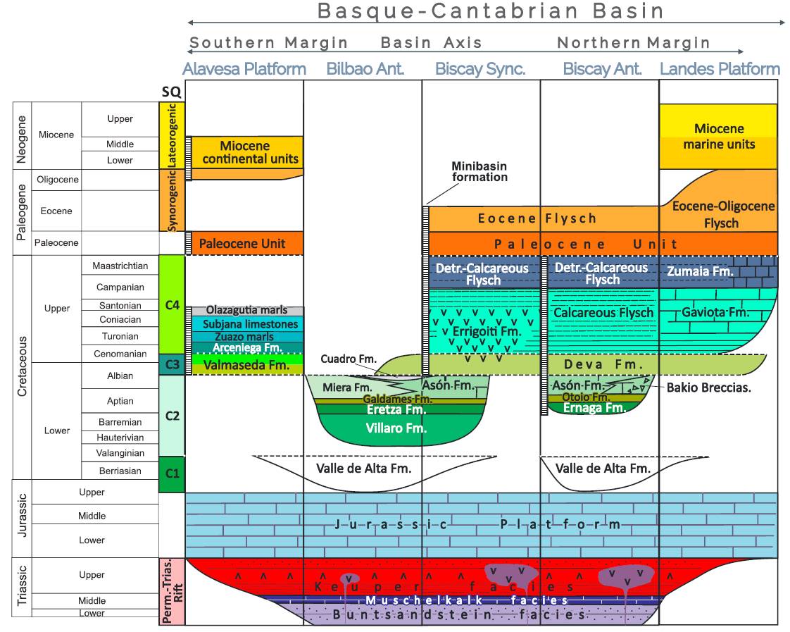
| Evaporite unit/s name | Keuper facies |
| Evaporite unit/s age | Carnian-Rhaetian (Upper Triassic) |
| Evaporite unit/s origin | Marine |
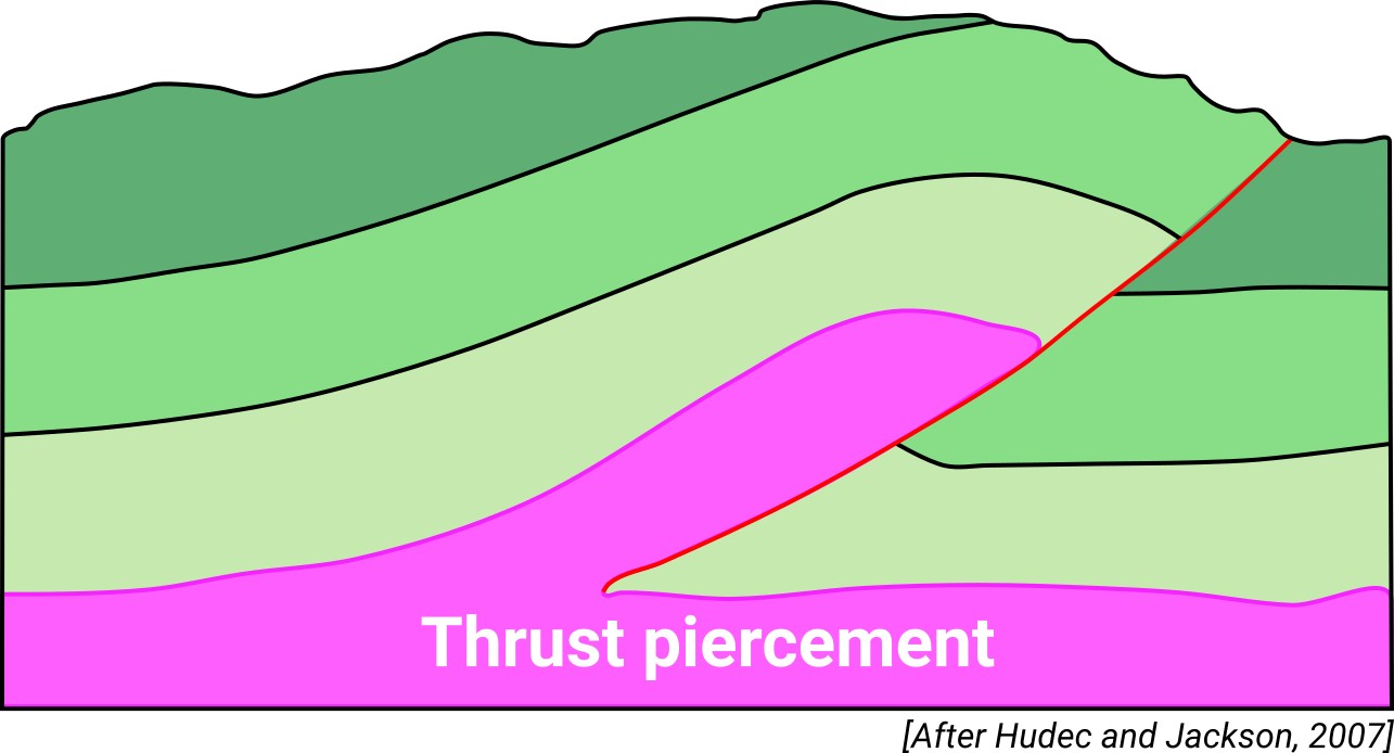
| Classif. (Hudec and Jackson, 2009) | Thrust piercement |
| Classif. (Jackson and Talbot, 1986) | Salt wall |
| Age of evaporite flow or deformation (when deformed) | Lower Cretaceous |
| Other comments | Also known as "Ondarroa diapir". |
Generic Data
| Unique ID | 92 |
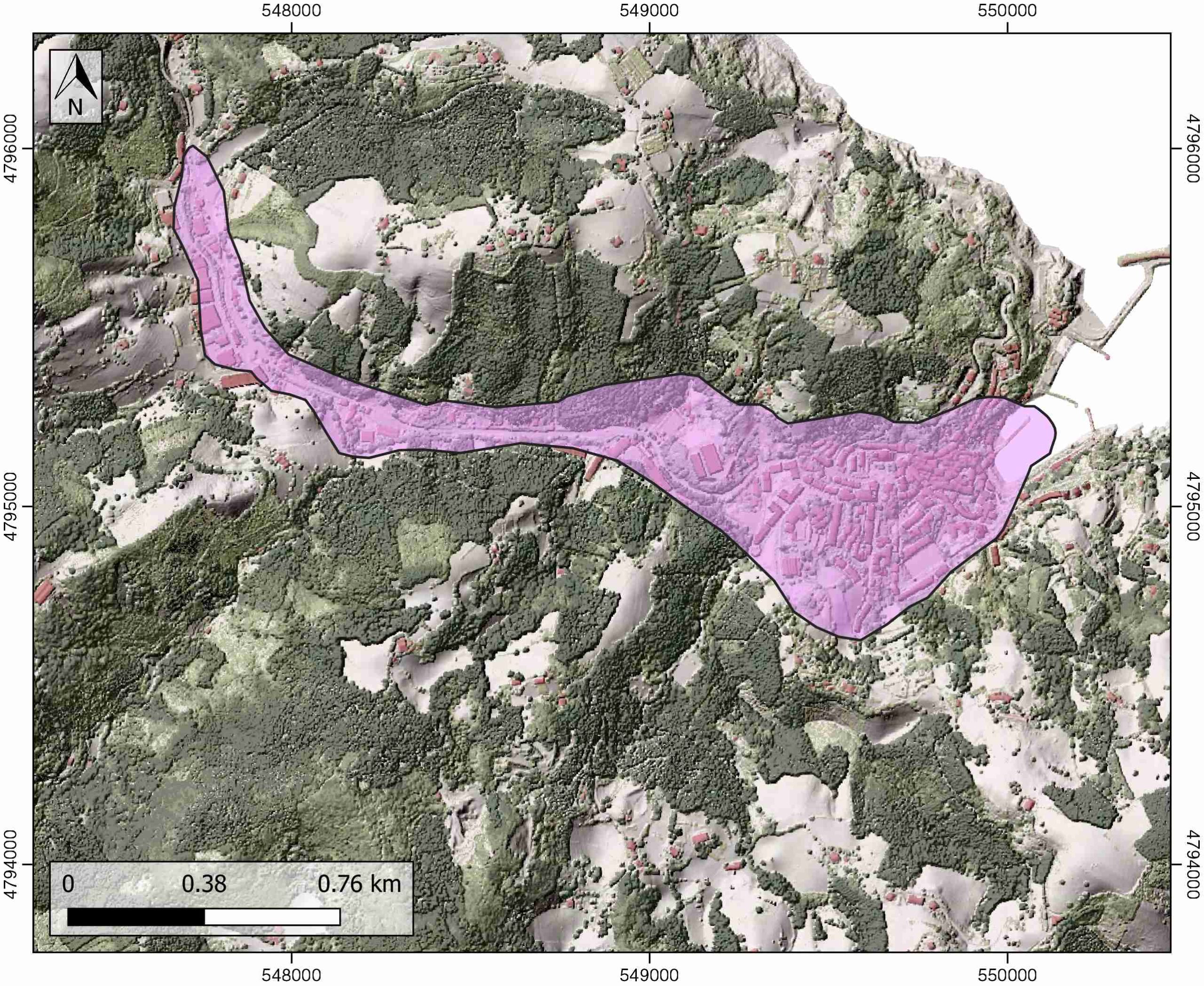
| Name | Mutriku |
| Structure type | Evaporite diapir |
| Deformed/Undeformed | Deformed |
| Buried/Outcropping | Outcropping |
| Geological setting | Basque-Cantabrian Basin |
| Geological Regional Setting | Basque Arc |
| Evaporite unit/s name | Keuper facies |
| Evaporite unit/s age | Carnian-Rhaetian (Upper Triassic) |
| Evaporite unit/s era | Mesozoic |
| Evaporite unit/s origin | Marine |
| Evaporite unit/s composition | Red Claystones-Gypsum-Halite |
| Post-kinematic unit/s (or post-evaporite units when evaporites are undeformed) | Post-Upper Albian (sandy turbidites and black lutites) |
| Post-kinematic unit/s age (or post-evaporite units when evaporites are undeformed) | |
| Classification (Hudec and Jackson, 2009) | Thrust piercement |
| Classification (Jackson and Talbot, 1986) | Salt wall |
| Mining activity? | Y |
| Mining activity start | – |
| Mining activity end | – |
| Mining galleries? | – |
| Mining products | Limestone (other uses) |
| Mining sub-products | – |
| Evaporite flow? | Y |
| Age of evaporite flow | Upper Albian |
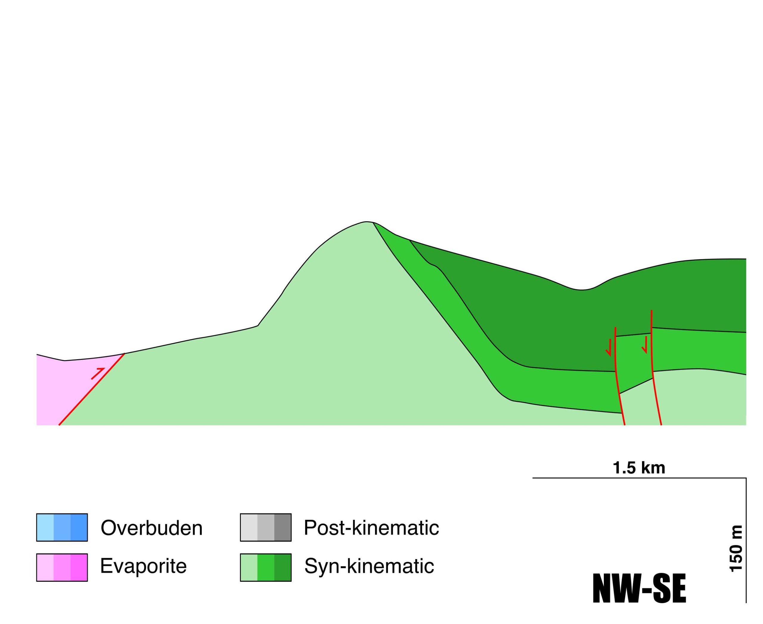
| Flow or deformation triggering mechanisms | Monoclinal syncline folding associated with the high-angle reverse Mutriku fault |
| Flow-linked structures? | Y |
| Halokinetic structures | Normal faults / anticline-syncline folding |
| Post-evaporite and pre-kinematic unit/s (overbuden) | Middle Albian (Berriatu Unit, black marls, clast-supported megabreccia, limestone breccia and turbiditic limestones) ( Late Middle Albian (Ondarroa Unit, sandstones, conglomerates, pebbly sandstone turbidites, silty lutites) ; Upper Albian (Mutriku Unit, muddy sandstones and sandy mudstones) |
| Syn-kinematic unit/s | Alkolea Unit (megabreccia, marlstones and limestones with fragments from the underlying units) |
| Available seismic profiles | ILIHA X-A / BR-7 / BR-47 / BR-7 / BR-47 / SBR-3PR, / SBR-3_PROL, / SBR-47 / BR-85-15 / BR-38 / BR-3_PROL / BR-85-13 |
| Available boreholes | ARNO-1 (ARN-1) / ITXASPE-02 (ITX-02) / ITXASPE-10 (ITX-10) / ITXASPE-12 (ITX-12) / ITXASPE-03 (ITX-03) / ITXASPE-08 (ITX-08) / DEBA-1 / DEBA-4 / DEBA-5 / DEBA-2 / DEBA-3 / DEBA-6 / DEBA-7 / ITXASPE-25 (ITX-25) / ITXASPE-36 (ITX-36) |
| Additional comments | Also known as Ondarroa diapir |
Mining Data
| UNIQUE_ID | 92 |
| Minning exploitations within <2km? | Y |
| Historical/Active | Active |
| Exploitation name #1 | OLATZ |
| Exploitation ID (Spanish National Mining Cadastre) #1 | 4662 |
| Municipality #1 | Mutriku |
| Province #1 | GUIPUZCOA |
| Company #1 | CONSTRUCCIONES ZUBIEDER S.L. |
| Main minning Products #1 | Limestone (other uses) |
| Exploitation name #2 | |
| Exploitation ID (Spanish National Mining Cadastre) #2 | |
| Municipality #2 | |
| Province #2 | |
| Company #2 | |
| Main minning Products #2 | |
| Exploitation name #3 | |
| Exploitation ID (Spanish National Mining Cadastre) #3 | |
| Municipality #3 | |
| Province #3 | |
| Company #3 | |
| Main minning Products #3 |
Quantitative Data
| UNIQUE_ID | 92 |
| Outcropping area (km2) | 0.75373 |
| Horizontal intersection area (km2) (when buried) | Not buried |
| Depth of intersection area (km2) (when buried) | Not buried |
| Max. Width (Km) | 0.8 |
| Max. Length (Km) | 2.6 |
| Max. Evaporites thickness (km) | |
| Max. Deformation age (Ma) | 105 |
| Min. Deformation age (Ma) | 100 |
| Deformation stages | 1 |
Reference Data
| UNIQUE_ID | 92 |
| Section source | Agirrezabala, L. M., Owen, H. G., García-Mondéjar, J., 2002. Syntectonic deposits and punctuated limb rotation in an Albian submarine transpressional fold (Mutriku village, Basque-Cantabrian basin, northern Spain). GSA Bulletin, 114(3), 281-297. [link] |
| Well / Borehole availability #1 | n.a. |
| Well / Borehole availability #2 | n.a. |
| Available data (Stratigraphy) #1 | Agirrezabala, L. M., 2009. Mid‐Cretaceous hydrothermal vents and authigenic carbonates in a transform margin, Basque‐Cantabrian Basin (western Pyrenees): a multidisciplinary study. Sedimentology, 56(4), 969-996. [link] |
| Available data (Stratigraphy) #2 | Agirrezabala, L. M., Owen, H. G., García-Mondéjar, J., 2002. Syntectonic deposits and punctuated limb rotation in an Albian submarine transpressional fold (Mutriku village, Basque-Cantabrian basin, northern Spain). GSA Bulletin, 114(3), 281-297. [link] |
| Available data (Stratigraphy) #3 | Agirrezabala, L. M., 1996. El Aptiense-Albiense del Anticlinorio Nor-Vizcaíno entre Gernika y Azpeitia [PhD Thesis]: Euskal Herriko Unibertsitatea, Bilbo, 429 pp. [link] |
| Available data (Stratigraphy) #4 | Dorronsoro, C., Agirrezabala, L. M., Fernández Mendiola, P. Á., Gómez Pérez, I., López Horgue, M. A., García Mondéjar, J., 1996. Análisis de hidrocarburos por cromatografía de gases en muestras albienses de la región Vasco-Cantábrica. Geogaceta, 16, 140-143. [link] |
| Available data (Stratigraphy) #5 | Bodego, A., Iriarte, E., Agirrezabala, L. M., García-Mondéjar, J., López-Horgue, M. A., 2015. Synextensional mid-Cretaceous stratigraphic architecture of the eastern Basque–Cantabrian basin margin (western Pyrenees). Cretaceous Research, 55, 229-261. [link] |
| Available data (Stratigraphy) #6 | n.a. |
| Regional Stratigraphy | Pedrera, A., García‐Senz, J., Ayala, C., Ruiz‐Constán, A., Rodríguez‐Fernández, L. R., Robador, A., González Menéndez, L., 2017. Reconstruction of the exhumed mantle across the North Iberian Margin by crustal‐scale 3‐D gravity inversion and geological cross section. Tectonics, 36, 3155-3177. [link] |
| Seismic data availability #1 | Diaz, J., Gallart Muset, J., Córdoba, D., Senos, L., Matias, L., Suriñach, E., …, Maguire, P., 2020. The ILIHA deep seismic sounding experiment (Iberian LIthosphere Heterogeneity and Anisotropy). DigitalCSIC – SEISDARE data repository. [link] |
| Seismic data availability #2 | n.a. |
| Seismic data availability #3 | n.a. |
| Available data (Structure) #1 | Agirrezabala, L. M., Owen, H. G., García-Mondéjar, J., 2002. Syntectonic deposits and punctuated limb rotation in an Albian submarine transpressional fold (Mutriku village, Basque-Cantabrian basin, northern Spain). GSA Bulletin, 114(3), 281-297. [link] |
| Available data (Structure) #2 | Agirrezabala, L. M., 2009. Mid‐Cretaceous hydrothermal vents and authigenic carbonates in a transform margin, Basque‐Cantabrian Basin (western Pyrenees): a multidisciplinary study. Sedimentology, 56(4), 969-996. [link] |
| Available data (Structure) #3 | Roca, E., Ferrer, O., Rowan, M. G., Muñoz, J. A., Butillé, M., Giles, K. A., …, de Matteis, M., 2020. Salt tectonics and controls on halokinetic-sequence development of an exposed deepwater diapir: The Bakio Diapir, Basque-Cantabrian Basin, Pyrenees. Marine and Petroleum Geology, 104770. [link] |
| Available data (Structure) #4 | Bodego, A., 2011. Evolución tectosedimentaria durante el Cretacico medio del borde noreste de la Cuenca Vasco-Cant abrica (Pirineo occidental) [Ph.D. thesis]: UPV/EHU, 317 pp. [link] |
| Available data (Structure) #5 | Cámara, P., 2017. Salt and Strike-Slip Tectonics as Main Drivers in the Structural Evolution of the Basque-Cantabrian Basin, Spain. In Permo-Triassic Salt Provinces of Europe, North Africa and the Atlantic Margins (pp. 371-393). Elsevier. [link] |
| Available data (Structure) #6 | n.a. |
| Available data (Analogue modelling) #1 | n.a. |
| Available data (Analogue modelling) #2 | n.a. |
| Available data (Analogue modelling) #3 | n.a. |
| Available data (Gravimetry – Tomography) #1 | Pedrera, A., García‐Senz, J., Ayala, C., Ruiz‐Constán, A., Rodríguez‐Fernández, L. R., Robador, A., González Menéndez, L., 2017. Reconstruction of the exhumed mantle across the North Iberian Margin by crustal‐scale 3‐D gravity inversion and geological cross section. Tectonics, 36, 3155-3177. [link] |
| Available data (Gravimetry – Tomography) #2 | Ayala, C., Bohoyo, F., Maestro, A., Reguera, M. I., Torne, M., Rubio, F., Fernández, M., García-Lobón, J. L., 2016. Updated Bouguer anomalies of the Iberian Peninsula: a new perspective to interpret the regional geology. Journal of Maps, 12(5), 1089-1092. [link] |
| Available data (Gravimetry – Tomography) #3 | n.a. |
| Available data (Geochemistry) #1 | Ortí, F., García-Veigas, J., Rossell, L., Jurado, M. J., Utrilla, R., 1996. Formaciones salinas de las cuencas triásicas en la Península Ibérica: Caracterización Petrológica y Geoquímica. Cuadernos de Geología Ibérica, 20, 13-35. [link] |
| Available data (Geochemistry) #2 | n.a. |
| Available data (Geochemistry) #3 | n.a. |
| Available data (Geochemistry) #4 | n.a. |
| Available data (Petrophysics) #1 | n.a. |
| Available data (Petrophysics) #2 | n.a. |
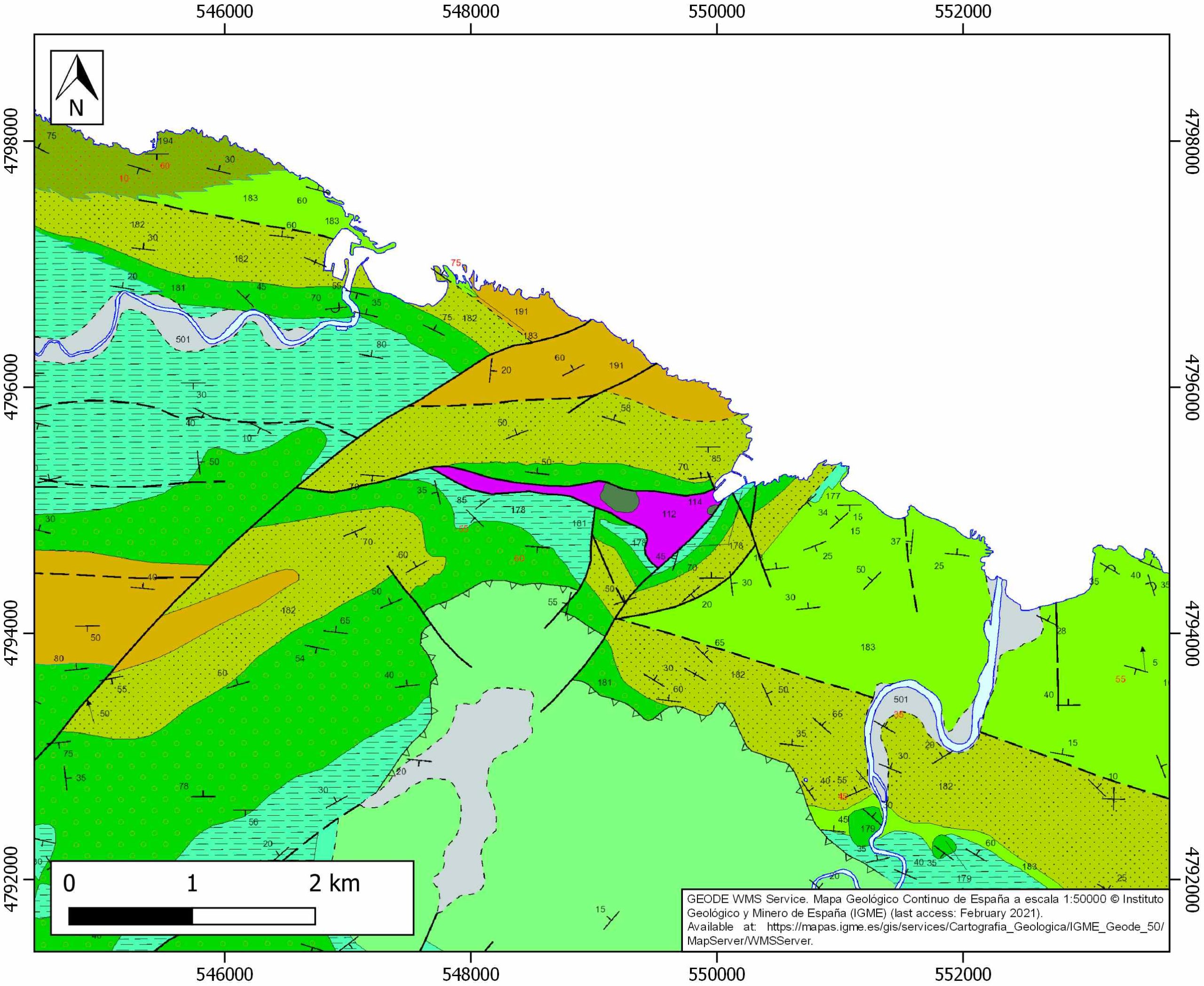
| IGME Geological Map (MAGNA50) Sheet number | 63-Eibar. [link] |
| Other Maps #1 (source) | DeFelipe, I., Álvarez Pulgar, F. J., & Pedreira Rodríguez, D., 2018. Crustal structure of the Eastern Basque-Cantabrian Zone-western Pyrenees: from the Cretaceous hyperextension to the Cenozoic inversion. Revista de la Sociedad Geológica de España, 31 (2), 69-82. [link] |
| Other Maps #2 (source) | Poprawski, Y., Basile, C., 2018. Long-lasting diapir growth history in the Basque-Cantabrian basin (Northern Spain): a review. Conference poster, Advances in Salt Tectonics: Observations, Applications, and Perspective: In Honor of Martin P.A. Jackson. [link] |
| Other related references #1 | Martín-Chivelet, J., López-Gómez, J., Aguado, R., Arias, C., Arribas, J., Arribas, M. E., … , Casas-Sainz, A., 2019. The Late Jurassic–Early Cretaceous Rifting. In (Quesada C., Oliveira J., eds.): The Geology of Iberia: A Geodynamic Approach. Regional Geology Reviews. Springer, Cham. [link] |
| Other related references #2 | n.a. |
| Other related references #3 | n.a. |
| Other related references #4 | n.a. |
Well and Seismic Data
| UNIQUE_ID | 92 |
| Seismic survey name #1 | ILIHA X-A |
| Across structure? #1 | Y |
| Seismic profile ID (IGME) #1 | n.a. |
| Seismic profile code #1 | n.a. |
| Seismic profile name #1 | n.a. |
| Seismic survey year #1 | n.a. |
| Data repository #1 | SeisDARE Database: https://digital.csic.es/handle/10261/101879 |
| Length (km) #1 | 781.18 |
| Seismic survey name #2 | 8B2-BR |
| Across structure? #2 | Y |
| Seismic profile ID (IGME) #2 | 9109 |
| Seismic profile code #2 | 13681 |
| Seismic profile name #2 | BR-7 |
| Seismic survey year #2 | 1978 |
| Data repository #2 | SIGEOF Data Catalogue (Section available under request). ©Instituto Geológico y Minero de España (IGME). https://info.igme.es/SIGEOF/ |
| Length (km) #2 | 14.86 |
| Seismic survey name #3 | 8B3-BR |
| Across structure? #3 | Y |
| Seismic profile ID (IGME) #3 | 9150 |
| Seismic profile code #3 | 13722 |
| Seismic profile name #3 | BR-47 |
| Seismic survey year #3 | 1978 |
| Data repository #3 | SIGEOF Data Catalogue (Private access section). ©Instituto Geológico y Minero de España (IGME). https://info.igme.es/SIGEOF/ |
| Length (km) #3 | 11.02 |
| Seismic survey name #4 | 8B2-BR |
| Across structure? #4 | N (within 3km) |
| Seismic profile ID (IGME) #4 | 9109 |
| Seismic profile code #4 | 13681 |
| Seismic profile name #4 | BR-7 |
| Seismic survey year #4 | 1978 |
| Data repository #4 | SIGEOF Data Catalogue (Section available under request). ©Instituto Geológico y Minero de España (IGME). https://info.igme.es/SIGEOF/ |
| Length (km) #4 | 14.86 |
| Seismic survey name #5 | 8B3-BR |
| Across structure? #5 | N (within 3km) |
| Seismic profile ID (IGME) #5 | 9150 |
| Seismic profile code #5 | 13722 |
| Seismic profile name #5 | BR-47 |
| Seismic survey year #5 | 1978 |
| Data repository #5 | SIGEOF Data Catalogue (Private access section). ©Instituto Geológico y Minero de España (IGME). https://info.igme.es/SIGEOF/ |
| Length (km) #5 | 11.02 |
| Seismic survey name #6 | IN2725 |
| Across structure? #6 | N (within 3km) |
| Seismic profile ID (IGME) #6 | 2992 |
| Seismic profile code #6 | 4308 |
| Seismic profile name #6 | SBR-3PR, |
| Seismic survey year #6 | |
| Data repository #6 | SIGEOF Data Catalogue (Private access section). ©Instituto Geológico y Minero de España (IGME). https://info.igme.es/SIGEOF/ |
| Length (km) #6 | 0.69 |
| Seismic survey name #7 | IN2725 |
| Across structure? #7 | N (within 3km) |
| Seismic profile ID (IGME) #7 | 2988 |
| Seismic profile code #7 | 4304 |
| Seismic profile name #7 | SBR-3_PROL, |
| Seismic survey year #7 | |
| Data repository #7 | SIGEOF Data Catalogue (Private access section). ©Instituto Geológico y Minero de España (IGME). https://info.igme.es/SIGEOF/ |
| Length (km) #7 | 1.20 |
| Seismic survey name #8 | IN2725 |
| Across structure? #8 | N (within 3km) |
| Seismic profile ID (IGME) #8 | 2994 |
| Seismic profile code #8 | 4310 |
| Seismic profile name #8 | SBR-47 |
| Seismic survey year #8 | |
| Data repository #8 | SIGEOF Data Catalogue (Private access section). ©Instituto Geológico y Minero de España (IGME). https://info.igme.es/SIGEOF/ |
| Length (km) #8 | 0.15 |
| Seismic survey name #9 | 8B2-BR |
| Across structure? #9 | N (within 3km) |
| Seismic profile ID (IGME) #9 | 9107 |
| Seismic profile code #9 | 13679 |
| Seismic profile name #9 | BR-85-15 |
| Seismic survey year #9 | 1978 |
| Data repository #9 | SIGEOF Data Catalogue (Private access section). ©Instituto Geológico y Minero de España (IGME). https://info.igme.es/SIGEOF/ |
| Length (km) #9 | 19.28 |
| Seismic survey name #10 | 8B3-BR |
| Across structure? #10 | N (within 3km) |
| Seismic profile ID (IGME) #10 | 9153 |
| Seismic profile code #10 | 13725 |
| Seismic profile name #10 | BR-38 |
| Seismic survey year #10 | 1978 |
| Data repository #10 | SIGEOF Data Catalogue (Private access section). ©Instituto Geológico y Minero de España (IGME). https://info.igme.es/SIGEOF/ |
| Length (km) #10 | 23.97 |
| Seismic survey name #11 | 8B3-BR |
| Across structure? #11 | N (within 3km) |
| Seismic profile ID (IGME) #11 | 9158 |
| Seismic profile code #11 | 13730 |
| Seismic profile name #11 | BR-3_PROL |
| Seismic survey year #11 | 1978 |
| Data repository #11 | SIGEOF Data Catalogue (Private access section). ©Instituto Geológico y Minero de España (IGME). https://info.igme.es/SIGEOF/ |
| Length (km) #11 | 12.32 |
| Seismic survey name #12 | 8B3-BR85 |
| Across structure? #12 | N (within 3km) |
| Seismic profile ID (IGME) #12 | 9185 |
| Seismic profile code #12 | 13757 |
| Seismic profile name #12 | BR-85-13 |
| Seismic survey year #12 | 1985 |
| Data repository #12 | SIGEOF Data Catalogue (Private access section). ©Instituto Geológico y Minero de España (IGME). https://info.igme.es/SIGEOF/ |
| Length (km) #12 | 11.67 |
| Seismic survey name #13 | |
| Across structure? #13 | |
| Seismic profile ID (IGME) #13 | |
| Seismic profile code #13 | |
| Seismic profile name #13 | |
| Seismic survey year #13 | |
| Data repository #13 | |
| Length (km) #13 | |
| Seismic survey name #14 | |
| Across structure? #14 | |
| Seismic profile ID (IGME) #14 | |
| Seismic profile code #14 | |
| Seismic profile name #14 | |
| Seismic survey year #14 | |
| Data repository #14 | |
| Length (km) #14 | |
| Seismic survey name #15 | |
| Across structure? #15 | |
| Seismic profile ID (IGME) #15 | |
| Seismic profile code #15 | |
| Seismic profile name #15 | |
| Seismic survey year #15 | |
| Data repository #15 | |
| Length (km) #15 | |
| Seismic survey name #16 | |
| Across structure? #16 | |
| Seismic profile ID (IGME) #16 | |
| Seismic profile code #16 | |
| Seismic profile name #16 | |
| Seismic survey year #16 | |
| Data repository #16 | |
| Length (km) #16 | |
| Seismic survey name #17 | |
| Across structure? #17 | |
| Seismic profile ID (IGME) #17 | |
| Seismic profile code #17 | |
| Seismic profile name #17 | |
| Seismic survey year #17 | |
| Data repository #17 | |
| Length (km) #17 | |
| Seismic survey name #18 | |
| Across structure? #18 | |
| Seismic profile ID (IGME) #18 | |
| Seismic profile code #18 | |
| Seismic profile name #18 | |
| Seismic survey year #18 | |
| Data repository #18 | |
| Length (km) #18 | |
| Seismic survey name #19 | |
| Across structure? #19 | |
| Seismic profile ID (IGME) #19 | |
| Seismic profile code #19 | |
| Seismic profile name #19 | |
| Seismic survey year #19 | |
| Data repository #19 | |
| Length (km) #19 | |
| Seismic survey name #20 | |
| Across structure? #20 | |
| Seismic profile ID (IGME) #20 | |
| Seismic profile code #20 | |
| Seismic profile name #20 | |
| Seismic survey year #20 | |
| Data repository #20 | |
| Length (km) #20 | |
| Seismic survey name #21 | |
| Across structure? #21 | |
| Seismic profile ID (IGME) #21 | |
| Seismic profile code #21 | |
| Seismic profile name #21 | |
| Seismic survey year #21 | |
| Data repository #21 | |
| Length (km) #21 | |
| Borehole name #1 | ARNO-1 (ARN-1) |
| Company #1 | EVE |
| Traget #1 | BASE METALS |
| Across structure? #1 | N (within 5 km) |
| Borehole name #2 | ITXASPE-02 (ITX-02) |
| Company #2 | EVE |
| Traget #2 | BASE METALS |
| Across structure? #2 | N (within 5 km) |
| Borehole name #3 | ITXASPE-10 (ITX-10) |
| Company #3 | EVE |
| Traget #3 | BASE METALS |
| Across structure? #3 | N (within 5 km) |
| Borehole name #4 | ITXASPE-12 (ITX-12) |
| Company #4 | EVE |
| Traget #4 | BASE METALS |
| Across structure? #4 | N (within 5 km) |
| Borehole name #5 | ITXASPE-03 (ITX-03) |
| Company #5 | EVE |
| Traget #5 | BASE METALS |
| Across structure? #5 | N (within 5 km) |
| Borehole name #6 | ITXASPE-08 (ITX-08) |
| Company #6 | EVE |
| Traget #6 | BASE METALS |
| Across structure? #6 | N (within 5 km) |
| Borehole name #7 | DEBA-1 |
| Company #7 | EVE |
| Traget #7 | BASE METALS |
| Across structure? #7 | N (within 5 km) |
| Borehole name #8 | DEBA-4 |
| Company #8 | EVE |
| Traget #8 | BASE METALS |
| Across structure? #8 | N (within 5 km) |
| Borehole name #9 | DEBA-5 |
| Company #9 | EVE |
| Traget #9 | BASE METALS |
| Across structure? #9 | N (within 5 km) |
| Borehole name #10 | DEBA-2 |
| Company #10 | EVE |
| Traget #10 | BASE METALS |
| Across structure? #10 | N (within 5 km) |
| Borehole name #11 | DEBA-3 |
| Company #11 | EVE |
| Traget #11 | BASE METALS |
| Across structure? #11 | N (within 5 km) |
| Borehole name #12 | DEBA-6 |
| Company #12 | EVE |
| Traget #12 | BASE METALS |
| Across structure? #12 | N (within 5 km) |
| Borehole name #13 | DEBA-7 |
| Company #13 | EVE |
| Traget #13 | BASE METALS |
| Across structure? #13 | N (within 5 km) |
| Borehole name #14 | ITXASPE-25 (ITX-25) |
| Company #14 | EVE |
| Traget #14 | BASE METALS |
| Across structure? #14 | N (within 5 km) |
| Borehole name #15 | ITXASPE-36 (ITX-36) |
| Company #15 | EVE |
| Traget #15 | BASE METALS |
| Across structure? #15 | N (within 5 km) |
Geographical Data (EPSG:4326 - WGS 84)
| UNIQUE_ID | 92 |
| X Centroid (Structure shape) | -2.394456 |
| Y Centroid (Structure shape) | -2.394456 |
| Xmin (Structure shape) | -2.412158 |
| Xmax (Structure shape) | -2.381819 |
| Ymin (Structure shape) | 43.302831 |
| Ymax (Structure shape) | 43.315392 |
| Xmin seismic line #1 | -4.805725 |
| Xmax seismic line #1 | -2.410217 |
| Ymin seismic line #1 | 36.528503 |
| Ymax seismic line #1 | 43.318909 |
| Xmin seismic line #2 | -2.437002 |
| Xmax seismic line #2 | -2.375868 |
| Ymin seismic line #2 | 43.195335 |
| Ymax seismic line #2 | 43.311654 |
| Xmin seismic line #3 | -2.484737 |
| Xmax seismic line #3 | -2.393688 |
| Ymin seismic line #3 | 43.245762 |
| Ymax seismic line #3 | 43.315865 |
| Xmin seismic line #4 | -2.437002 |
| Xmax seismic line #4 | -2.375868 |
| Ymin seismic line #4 | 43.195335 |
| Ymax seismic line #4 | 43.311654 |
| Xmin seismic line #5 | -2.484737 |
| Xmax seismic line #5 | -2.393688 |
| Ymin seismic line #5 | 43.245762 |
| Ymax seismic line #5 | 43.315865 |
| Xmin seismic line #6 | -2.445895 |
| Xmax seismic line #6 | -2.438867 |
| Ymin seismic line #6 | 43.321551 |
| Ymax seismic line #6 | 43.324801 |
| Xmin seismic line #7 | -2.458451 |
| Xmax seismic line #7 | -2.445812 |
| Ymin seismic line #7 | 43.315745 |
| Ymax seismic line #7 | 43.321383 |
| Xmin seismic line #8 | -2.393255 |
| Xmax seismic line #8 | -2.391532 |
| Ymin seismic line #8 | 43.315966 |
| Ymax seismic line #8 | 43.316439 |
| Xmin seismic line #9 | -2.417447 |
| Xmax seismic line #9 | -2.216775 |
| Ymin seismic line #9 | 43.218771 |
| Ymax seismic line #9 | 43.311261 |
| Xmin seismic line #10 | -2.589208 |
| Xmax seismic line #10 | -2.316006 |
| Ymin seismic line #10 | 43.275607 |
| Ymax seismic line #10 | 43.331788 |
| Xmin seismic line #11 | -2.528782 |
| Xmax seismic line #11 | -2.439287 |
| Ymin seismic line #11 | 43.242972 |
| Ymax seismic line #11 | 43.324454 |
| Xmin seismic line #12 | -2.520408 |
| Xmax seismic line #12 | -2.385581 |
| Ymin seismic line #12 | 43.300424 |
| Ymax seismic line #12 | 43.336756 |
| Xmin seismic line #13 | |
| Xmax seismic line #13 | |
| Ymin seismic line #13 | |
| Ymax seismic line #13 | |
| Xmin seismic line #14 | |
| Xmax seismic line #14 | |
| Ymin seismic line #14 | |
| Ymax seismic line #14 | |
| Xmin seismic line #15 | |
| Xmax seismic line #15 | |
| Ymin seismic line #15 | |
| Ymax seismic line #15 | |
| Xmin seismic line #16 | |
| Xmax seismic line #16 | |
| Ymin seismic line #16 | |
| Ymax seismic line #16 | |
| Xmin seismic line #17 | |
| Xmax seismic line #17 | |
| Ymin seismic line #17 | |
| Ymax seismic line #17 | |
| Xmin seismic line #18 | |
| Xmax seismic line #18 | |
| Ymin seismic line #18 | |
| Ymax seismic line #18 | |
| Xmin seismic line #19 | |
| Xmax seismic line #19 | |
| Ymin seismic line #19 | |
| Ymax seismic line #19 | |
| Xmin seismic line #20 | |
| Xmax seismic line #20 | |
| Ymin seismic line #20 | |
| Ymax seismic line #20 | |
| Xmin seismic line #21 | |
| Xmax seismic line #21 | |
| Ymin seismic line #21 | |
| Ymax seismic line #21 | |
| X borehole #1 | -2.389266 |
| Y borehole #1 | 43.302582 |
| X borehole #2 | -2.326737 |
| Y borehole #2 | 43.288697 |
| X borehole #3 | -2.325813 |
| Y borehole #3 | 43.289808 |
| X borehole #4 | -2.325813 |
| Y borehole #4 | 43.289808 |
| X borehole #5 | -2.327760 |
| Y borehole #5 | 43.288730 |
| X borehole #6 | -2.329065 |
| Y borehole #6 | 43.288828 |
| X borehole #7 | -2.332799 |
| Y borehole #7 | 43.291209 |
| X borehole #8 | -2.336513 |
| Y borehole #8 | 43.287458 |
| X borehole #9 | -2.333517 |
| Y borehole #9 | 43.293158 |
| X borehole #10 | -2.332420 |
| Y borehole #10 | 43.289829 |
| X borehole #11 | -2.335112 |
| Y borehole #11 | 43.287053 |
| X borehole #12 | -2.341314 |
| Y borehole #12 | 43.290313 |
| X borehole #13 | -2.341058 |
| Y borehole #13 | 43.292383 |
| X borehole #14 | -2.326447 |
| Y borehole #14 | 43.289281 |
| X borehole #15 | -2.328644 |
| Y borehole #15 | 43.293499 |

