General Information
| Structure type | Evaporite Diapir |
| Deformed/Undeformed | Deformed |
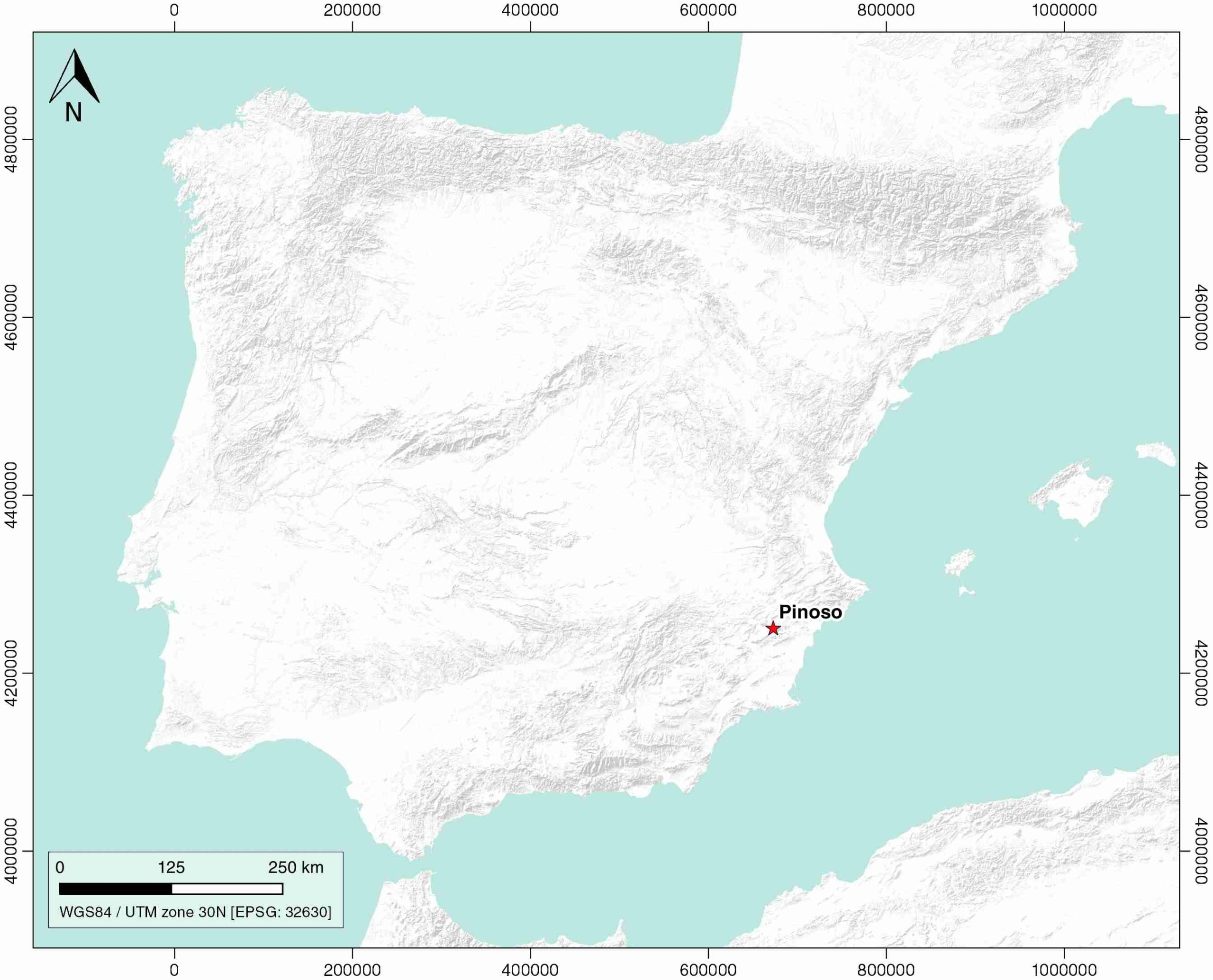
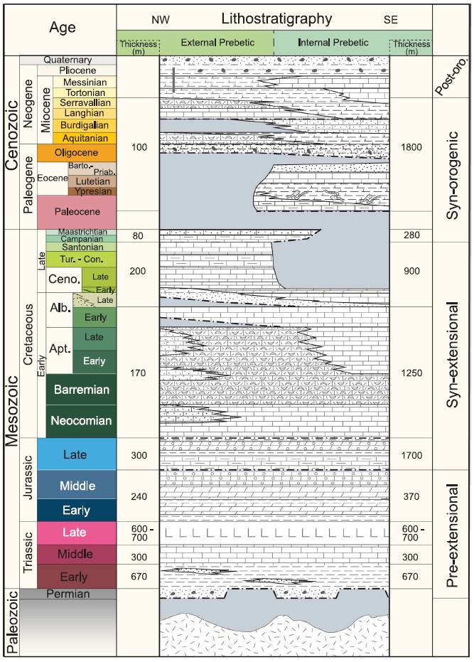
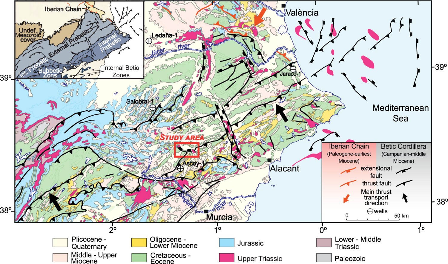
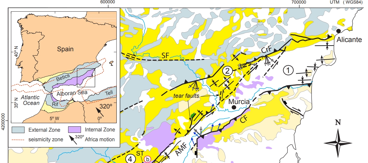
| Geological Setting | Betic system, Pre-Betic cordillera |
| Outcropping/buried | Outcropping |
| Evaporite unit/s name | Keuper facies |
| Evaporite unit/s age | Carnian-Rhaetian (Upper Triassic) |
| Evaporite unit/s origin | Marine |
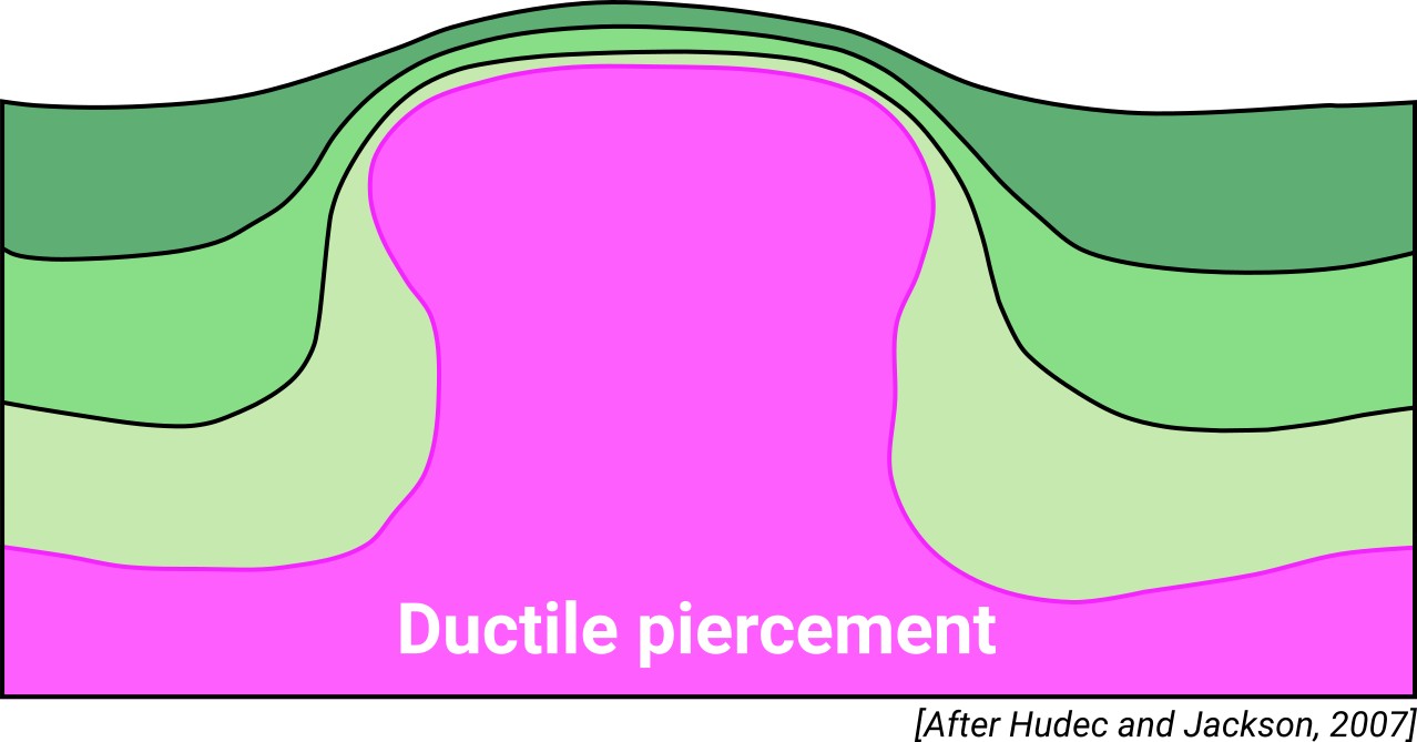
| Classif. (Hudec and Jackson, 2009) | Ductile piercement |
| Classif. (Jackson and Talbot, 1986) | Salt pillow |
| Age of evaporite flow or deformation (when deformed) | Quaternary / Active now(?) |
| Other comments | The onset of diapirism is unknown. Human-induced karstification processes reported by Rodríquez-Estrella and Pulido-Bosch (2010). |
Generic Data
| Unique ID | 04 |
| Name | Pinoso |
| Structure type | Evaporite diapir |
| Deformed/Undeformed | Deformed |
| Buried/Outcropping | Outcropping |
| Geological setting | Betic System |
| Geological Regional Setting | Pre-Betic Cordillera |
| Evaporite unit/s name | Keuper facies |
| Evaporite unit/s age | Carnian-Rhaetian (Upper Triassic) |
| Evaporite unit/s era | Mesozoic |
| Evaporite unit/s origin | Marine |
| Evaporite unit/s composition | Claystonestone-Marlstone-Gypsum-Halite |
| Post-kinematic unit/s (or post-evaporite units when evaporites are undeformed) | Quaternary (alluvial and colluvial detrital deposits) |
| Post-kinematic unit/s age (or post-evaporite units when evaporites are undeformed) | Pleistocene-Holocene |
| Classification (Hudec and Jackson, 2009) | Ductile piercement |
| Classification (Jackson and Talbot, 1986) | Salt pillow |
| Mining activity? | Y |
| Mining activity start | 1980s |
| Mining activity end | Active |
| Mining galleries? | Y |
| Mining products | Ornamental limestone |
| Mining sub-products | |
| Evaporite flow? | Y |
| Age of evaporite flow | Active now |
| Flow or deformation triggering mechanisms | Quaternary fault activity |
| Flow-linked structures? | Y |
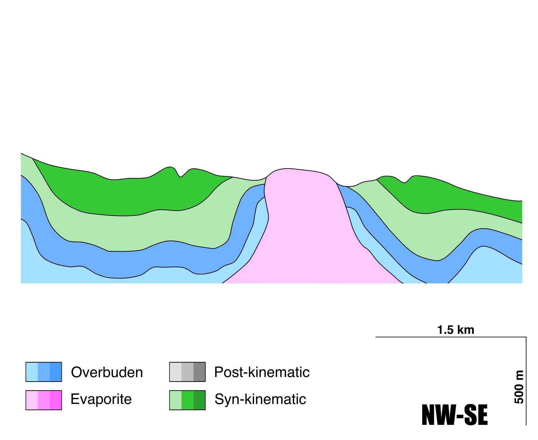
| Halokinetic structures | Normal faults / radial joints / Progressive unconformities |
| Post-evaporite and pre-kinematic unit/s (overbuden) | Jurassic-Cretaceous carbonate cover |
| Syn-kinematic unit/s | Miocene to Quaternary (alluvial and colluvial detrital deposits) |
| Available seismic profiles | RV-63 / RV-63 / RV-63 / RV-14 / RV-63 / RV-14 / RV-63 / RV-63 / RV-63 / RV-63 |
| Available boreholes | COTO PINOSO-04 / COTO PINOSO-05 / COTO PINOSO-02 / COTO PINOSO-03 / COTO PINOSO-08 / COTO PINOSO-09 / COTO PINOSO-06 / COTO PINOSO-07 / COTO PINOSO-10 / CAVARRASA C-4 / CAVARRASA C-5 / CAVARRASA C-7 / COTO PINOSO-01 / CASA DE VITIA / CASA CAZORLA (CAZORLA-1) |
| Additional comments | Human-induced karstification processes |
Mining Data
| UNIQUE_ID | 4 |
| Minning exploitations within <2km? | Y |
| Historical/Active | Active |
| Exploitation name #1 | SOLANA DEL COTO C |
| Exploitation ID (Spanish National Mining Cadastre) #1 | 405 |
| Municipality #1 | Pinós (el)/Pinoso |
| Province #1 | ALICANTE |
| Company #1 | FLORENCIO PICO, S.L. |
| Main minning Products #1 | Ornamental limestone |
| Exploitation name #2 | MONTE COTO T |
| Exploitation ID (Spanish National Mining Cadastre) #2 | 721 |
| Municipality #2 | Pinós (el)/Pinoso |
| Province #2 | ALICANTE |
| Company #2 | LEVANTINA DE RECURSOS MINEROS S.A.U. |
| Main minning Products #2 | Ornamental limestone |
| Exploitation name #3 | LA REPLANA-MONTE COTO D |
| Exploitation ID (Spanish National Mining Cadastre) #3 | 621 |
| Municipality #3 | Pinós (el)/Pinoso |
| Province #3 | ALICANTE |
| Company #3 | LEVANTINA DE RECURSOS MINEROS S.A.U. |
| Main minning Products #3 | MÁRMOL ORNAMENTAL |
Quantitative Data
| UNIQUE_ID | 4 |
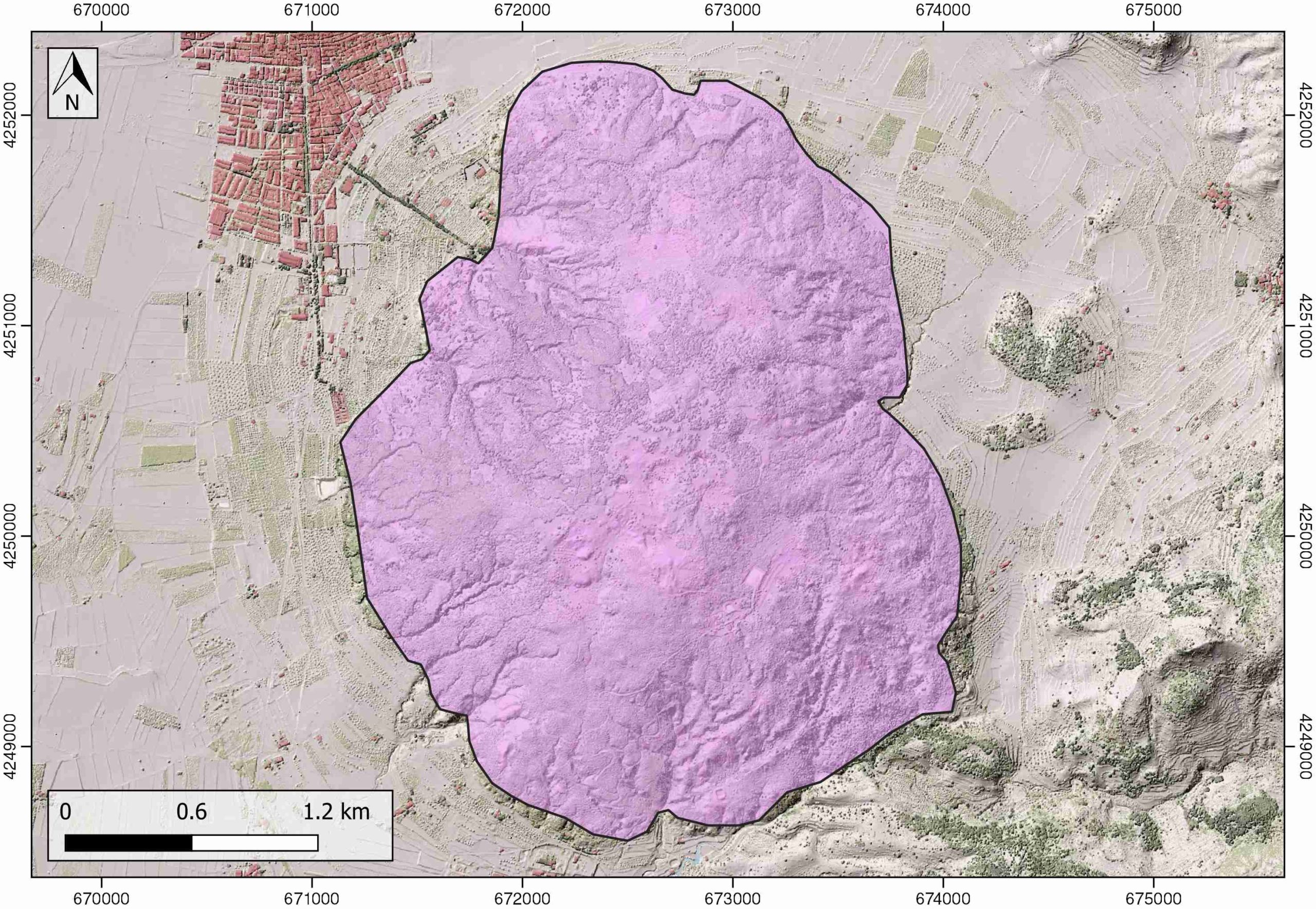
| Outcropping area (km2) | 7.76791 |
| Horizontal intersection area (km2) (when buried) | Not buried |
| Depth of intersection area (km2) (when buried) | Not buried |
| Max. Width (Km) | 3.7 |
| Max. Length (Km) | 2.9 |
| Max. Evaporites thickness (km) | 0.9 |
| Max. Deformation age (Ma) | 23 |
| Min. Deformation age (Ma) | Active |
| Deformation stages | 1 |
Reference Data
| UNIQUE_ID | 4 |
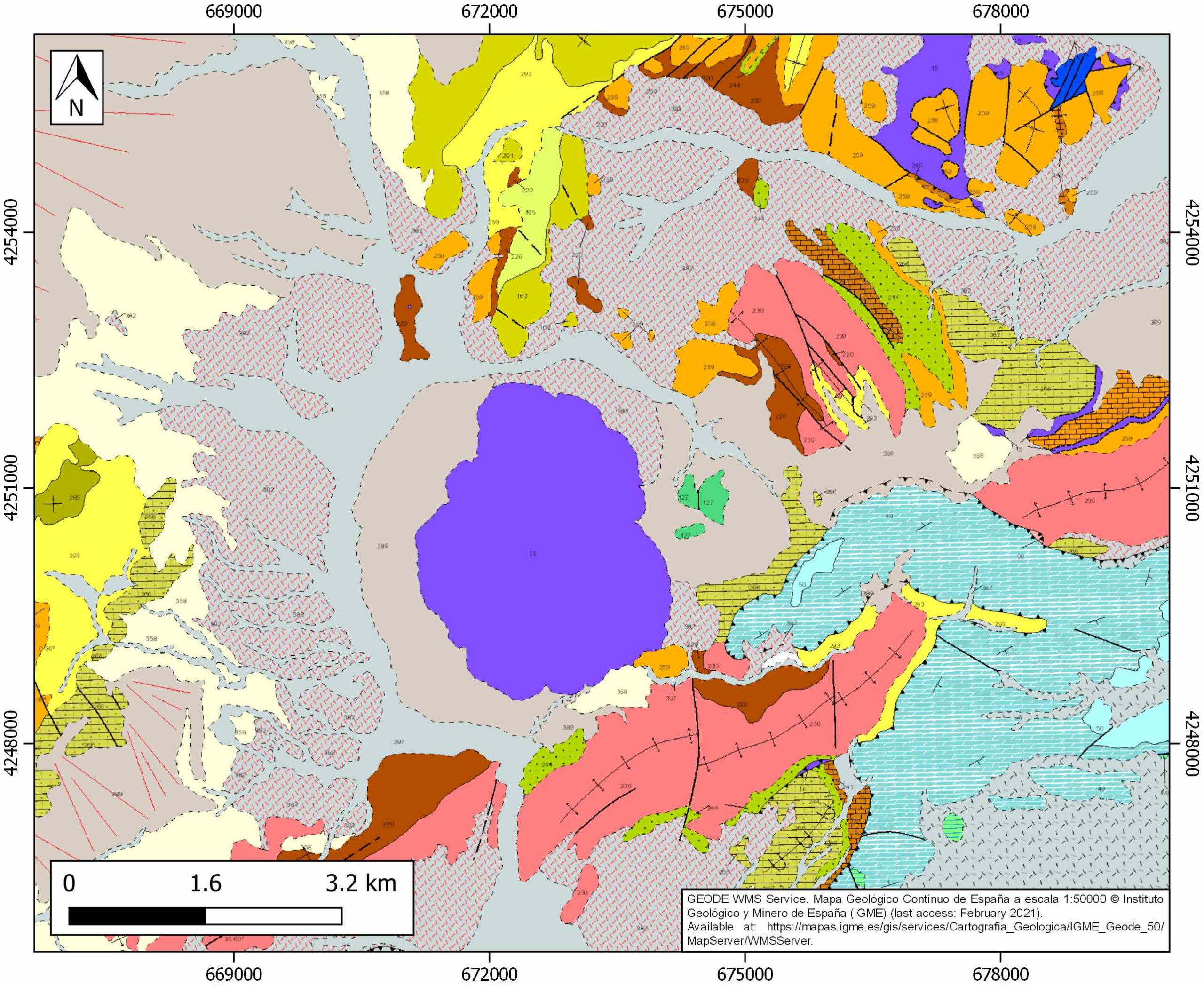
| Section source | IGME MAGNA 50. SHEET 870 (PINOSO) |
| Well / Borehole availability #1 | Rodríguez-Estrella, T., Pulido-Bosch, A., 2010. Gypsum karst evolution in a diapir: a case study (Pinoso, Alicante, Spain). Environmental Earth Sciences, 59, 1057–1063. [link] |
| Well / Borehole availability #2 | n.a. |
| Available data (Stratigraphy) #1 | Navarro-Hervás, F., Rodríguez-Estrella, T., 1985. Características morfoestructurales de los diapiros triásicos de Hellín, Ontur, la Celia, Jumilla, La Rosa y Pinoso, en las provincias de Albacete, Murcia y Alicante. Papeles de geografía, 10, 49-69. [link] |
| Available data (Stratigraphy) #2 | Rodríguez-Estrella, T., 1977. Síntesis geológica del Prebético de la provincia de Alicante. Boletín del Instituto Geológico y Minero de España 88, 183–214 and 273–299. [link] |
| Available data (Stratigraphy) #3 | Ortí, F. C., 1990. El domo de Pinoso, La sal del domo de La Rosa y el domo de Jumilla Formaciones evaporíticas de la Cuenca del Ebro y Cadenas periféricas, y de la zona de Levante. Ortí y Salvany (Eds.) ENRESA-GPPG. Barcelona: 289-291 |
| Available data (Stratigraphy) #4 | Escosa, F.O., Roca, E., Ferrer, O., 2018. Testing thin-skinned inversion of a prerift salt-bearing passive margin (Eastern Prebetic Zone, SE Iberia). Journal of Structural Geology, 109, 55-73. [link] |
| Available data (Stratigraphy) #5 | Guerrera, F., Mancheño, M. A., Martín-Martín, M., Raffaelli, G., Rodríguez-Estrella, T., Serrano, F., 2014. Paleogene evolution of the External Betic Zone and geodynamic implications. Geologica Acta, 12(3), 171-192. [link] |
| Available data (Stratigraphy) #6 | Escosa, F. O., Ferrer, O., Roca, E., 2018. Geology of the Eastern Prebetic Zone at the Jumilla region (SE Iberia). Journal of Maps, 14(2), 77-86. [link] |
| Regional Stratigraphy | Escosa, F. O., Ferrer, O., Roca, E., 2018. Geology of the Eastern Prebetic Zone at the Jumilla region (SE Iberia). Journal of Maps, 14(2), 77-86. [link] |
| Seismic data availability #1 | n.a. |
| Seismic data availability #2 | n.a. |
| Seismic data availability #3 | n.a. |
| Available data (Structure) #1 | Navarro-Hervás, F., Rodríguez-Estrella, T., 1985. Características morfoestructurales de los diapiros triásicos de Hellín, Ontur, la Celia, Jumilla, La Rosa y Pinoso, en las provincias de Albacete, Murcia y Alicante. Papeles de geografía, 10, 49-69. [link] |
| Available data (Structure) #2 | Roca, E., Sans, M., Koyi, H.A., 2006. Polyphase deformation of diapiric areas in models and in the eastern Prebetics (Spain). AAPG Bulletin, 90, 115-136. [link] |
| Available data (Structure) #3 | n.a. |
| Available data (Structure) #4 | n.a. |
| Available data (Structure) #5 | n.a. |
| Available data (Structure) #6 | n.a. |
| Available data (Analogue modelling) #1 | Roca, E., Sans, M., Koyi, H.A., 2006. Polyphase deformation of diapiric areas in models and in the eastern Prebetics (Spain). AAPG Bulletin, 90, 115-136. [link] |
| Available data (Analogue modelling) #2 | n.a. |
| Available data (Analogue modelling) #3 | n.a. |
| Available data (Gravimetry – Tomography) #1 | Ayala, C., Bohoyo, F., Maestro, A., Reguera, M. I., Torne, M., Rubio, F., Fernández, M., García-Lobón, J. L., 2016. Updated Bouguer anomalies of the Iberian Peninsula: a new perspective to interpret the regional geology. Journal of Maps, 12(5), 1089-1092. [link] |
| Available data (Gravimetry – Tomography) #2 | n.a. |
| Available data (Gravimetry – Tomography) #3 | n.a. |
| Available data (Geochemistry) #1 | Rodríguez-Estrella, T., Pulido-Bosch, A., 2010. Gypsum karst evolution in a diapir: a case study (Pinoso, Alicante, Spain). Environmental Earth Sciences, 59, 1057–1063. [link] |
| Available data (Geochemistry) #2 | n.a. |
| Available data (Geochemistry) #3 | n.a. |
| Available data (Geochemistry) #4 | n.a. |
| Available data (Petrophysics) #1 | n.a. |
| Available data (Petrophysics) #2 | n.a. |
| IGME Geological Map (MAGNA50) Sheet number | 870-Pinoso. [link] |
| Other Maps #1 (source) | Escosa, F. O., Ferrer, O., Roca, E., 2018. Geology of the Eastern Prebetic Zone at the Jumilla region (SE Iberia). Journal of Maps, 14(2), 77-86. [link] |
| Other Maps #2 (source) | Vissers, R. L. M., Meijninger, B. M. L., 2011. The 11 May 2011 earthquake at Lorca (SE Spain) viewed in a structural-tectonic context. Solid Earth, 2(2), 199-204. [link] |
| Other related references #1 | |
| Other related references #2 | n.a. |
| Other related references #3 | n.a. |
| Other related references #4 | n.a. |
Well and Seismic Data
| UNIQUE_ID | 4 |
| Seismic survey name #1 | 9I2-RV |
| Across structure? #1 | Y |
| Seismic profile ID (IGME) #1 | 10943 |
| Seismic profile code #1 | 15582 |
| Seismic profile name #1 | RV-63 |
| Seismic survey year #1 | 1985 |
| Data repository #1 | SIGEOF Data Catalogue (Section available under request). ©Instituto Geológico y Minero de España (IGME). https://info.igme.es/SIGEOF/ |
| Length (km) #1 | 24.82 |
| Seismic survey name #2 | 0362A84G |
| Across structure? #2 | Y |
| Seismic profile ID (IGME) #2 | 4488 |
| Seismic profile code #2 | 6155 |
| Seismic profile name #2 | RV-63 |
| Seismic survey year #2 | 1984 |
| Data repository #2 | SIGEOF Data Catalogue (Private access section). ©Instituto Geológico y Minero de España (IGME). https://info.igme.es/SIGEOF/ |
| Length (km) #2 | 12.42 |
| Seismic survey name #3 | 0362A84U |
| Across structure? #3 | Y |
| Seismic profile ID (IGME) #3 | 4590 |
| Seismic profile code #3 | 6257 |
| Seismic profile name #3 | RV-63 |
| Seismic survey year #3 | 1984 |
| Data repository #3 | SIGEOF Data Catalogue (Private access section). ©Instituto Geológico y Minero de España (IGME). https://info.igme.es/SIGEOF/ |
| Length (km) #3 | 24.64 |
| Seismic survey name #4 | 9I2-RV |
| Across structure? #4 | Y |
| Seismic profile ID (IGME) #4 | 10952 |
| Seismic profile code #4 | 15591 |
| Seismic profile name #4 | RV-14 |
| Seismic survey year #4 | 1985 |
| Data repository #4 | SIGEOF Data Catalogue (Section available under request). ©Instituto Geológico y Minero de España (IGME). https://info.igme.es/SIGEOF/ |
| Length (km) #4 | 35.22 |
| Seismic survey name #5 | 0362A84S |
| Across structure? #5 | Y |
| Seismic profile ID (IGME) #5 | 4549 |
| Seismic profile code #5 | 6216 |
| Seismic profile name #5 | RV-63 |
| Seismic survey year #5 | 1984 |
| Data repository #5 | SIGEOF Data Catalogue (Private access section). ©Instituto Geológico y Minero de España (IGME). https://info.igme.es/SIGEOF/ |
| Length (km) #5 | 27.64 |
| Seismic survey name #6 | 9I2-RV |
| Across structure? #6 | N (within 3km) |
| Seismic profile ID (IGME) #6 | 10952 |
| Seismic profile code #6 | 15591 |
| Seismic profile name #6 | RV-14 |
| Seismic survey year #6 | 1985 |
| Data repository #6 | SIGEOF Data Catalogue (Section available under request). ©Instituto Geológico y Minero de España (IGME). https://info.igme.es/SIGEOF/ |
| Length (km) #6 | 35.22 |
| Seismic survey name #7 | 9I2-RV |
| Across structure? #7 | N (within 3km) |
| Seismic profile ID (IGME) #7 | 10943 |
| Seismic profile code #7 | 15582 |
| Seismic profile name #7 | RV-63 |
| Seismic survey year #7 | 1985 |
| Data repository #7 | SIGEOF Data Catalogue (Section available under request). ©Instituto Geológico y Minero de España (IGME). https://info.igme.es/SIGEOF/ |
| Length (km) #7 | 24.82 |
| Seismic survey name #8 | 0362A84U |
| Across structure? #8 | N (within 3km) |
| Seismic profile ID (IGME) #8 | 4590 |
| Seismic profile code #8 | 6257 |
| Seismic profile name #8 | RV-63 |
| Seismic survey year #8 | 1984 |
| Data repository #8 | SIGEOF Data Catalogue (Private access section). ©Instituto Geológico y Minero de España (IGME). https://info.igme.es/SIGEOF/ |
| Length (km) #8 | 24.64 |
| Seismic survey name #9 | 0362A84G |
| Across structure? #9 | N (within 3km) |
| Seismic profile ID (IGME) #9 | 4488 |
| Seismic profile code #9 | 6155 |
| Seismic profile name #9 | RV-63 |
| Seismic survey year #9 | 1984 |
| Data repository #9 | SIGEOF Data Catalogue (Private access section). ©Instituto Geológico y Minero de España (IGME). https://info.igme.es/SIGEOF/ |
| Length (km) #9 | 12.42 |
| Seismic survey name #10 | 0362A84S |
| Across structure? #10 | N (within 3km) |
| Seismic profile ID (IGME) #10 | 4549 |
| Seismic profile code #10 | 6216 |
| Seismic profile name #10 | RV-63 |
| Seismic survey year #10 | 1984 |
| Data repository #10 | SIGEOF Data Catalogue (Private access section). ©Instituto Geológico y Minero de España (IGME). https://info.igme.es/SIGEOF/ |
| Length (km) #10 | 27.64 |
| Seismic survey name #11 | |
| Across structure? #11 | |
| Seismic profile ID (IGME) #11 | |
| Seismic profile code #11 | |
| Seismic profile name #11 | |
| Seismic survey year #11 | |
| Data repository #11 | |
| Length (km) #11 | |
| Seismic survey name #12 | |
| Across structure? #12 | |
| Seismic profile ID (IGME) #12 | |
| Seismic profile code #12 | |
| Seismic profile name #12 | |
| Seismic survey year #12 | |
| Data repository #12 | |
| Length (km) #12 | |
| Seismic survey name #13 | |
| Across structure? #13 | |
| Seismic profile ID (IGME) #13 | |
| Seismic profile code #13 | |
| Seismic profile name #13 | |
| Seismic survey year #13 | |
| Data repository #13 | |
| Length (km) #13 | |
| Seismic survey name #14 | |
| Across structure? #14 | |
| Seismic profile ID (IGME) #14 | |
| Seismic profile code #14 | |
| Seismic profile name #14 | |
| Seismic survey year #14 | |
| Data repository #14 | |
| Length (km) #14 | |
| Seismic survey name #15 | |
| Across structure? #15 | |
| Seismic profile ID (IGME) #15 | |
| Seismic profile code #15 | |
| Seismic profile name #15 | |
| Seismic survey year #15 | |
| Data repository #15 | |
| Length (km) #15 | |
| Seismic survey name #16 | |
| Across structure? #16 | |
| Seismic profile ID (IGME) #16 | |
| Seismic profile code #16 | |
| Seismic profile name #16 | |
| Seismic survey year #16 | |
| Data repository #16 | |
| Length (km) #16 | |
| Seismic survey name #17 | |
| Across structure? #17 | |
| Seismic profile ID (IGME) #17 | |
| Seismic profile code #17 | |
| Seismic profile name #17 | |
| Seismic survey year #17 | |
| Data repository #17 | |
| Length (km) #17 | |
| Seismic survey name #18 | |
| Across structure? #18 | |
| Seismic profile ID (IGME) #18 | |
| Seismic profile code #18 | |
| Seismic profile name #18 | |
| Seismic survey year #18 | |
| Data repository #18 | |
| Length (km) #18 | |
| Seismic survey name #19 | |
| Across structure? #19 | |
| Seismic profile ID (IGME) #19 | |
| Seismic profile code #19 | |
| Seismic profile name #19 | |
| Seismic survey year #19 | |
| Data repository #19 | |
| Length (km) #19 | |
| Seismic survey name #20 | |
| Across structure? #20 | |
| Seismic profile ID (IGME) #20 | |
| Seismic profile code #20 | |
| Seismic profile name #20 | |
| Seismic survey year #20 | |
| Data repository #20 | |
| Length (km) #20 | |
| Seismic survey name #21 | |
| Across structure? #21 | |
| Seismic profile ID (IGME) #21 | |
| Seismic profile code #21 | |
| Seismic profile name #21 | |
| Seismic survey year #21 | |
| Data repository #21 | |
| Length (km) #21 | |
| Borehole name #1 | COTO PINOSO-04 |
| Company #1 | ADARO |
| Traget #1 | INDUSTRIAL ROCKS |
| Across structure? #1 | N (within 5 km) |
| Borehole name #2 | COTO PINOSO-05 |
| Company #2 | ADARO |
| Traget #2 | INDUSTRIAL ROCKS |
| Across structure? #2 | N (within 5 km) |
| Borehole name #3 | COTO PINOSO-02 |
| Company #3 | ADARO |
| Traget #3 | INDUSTRIAL ROCKS |
| Across structure? #3 | N (within 5 km) |
| Borehole name #4 | COTO PINOSO-03 |
| Company #4 | ADARO |
| Traget #4 | INDUSTRIAL ROCKS |
| Across structure? #4 | N (within 5 km) |
| Borehole name #5 | COTO PINOSO-08 |
| Company #5 | ADARO |
| Traget #5 | INDUSTRIAL ROCKS |
| Across structure? #5 | N (within 5 km) |
| Borehole name #6 | COTO PINOSO-09 |
| Company #6 | ADARO |
| Traget #6 | INDUSTRIAL ROCKS |
| Across structure? #6 | N (within 5 km) |
| Borehole name #7 | COTO PINOSO-06 |
| Company #7 | ADARO |
| Traget #7 | INDUSTRIAL ROCKS |
| Across structure? #7 | N (within 5 km) |
| Borehole name #8 | COTO PINOSO-07 |
| Company #8 | ADARO |
| Traget #8 | INDUSTRIAL ROCKS |
| Across structure? #8 | N (within 5 km) |
| Borehole name #9 | COTO PINOSO-10 |
| Company #9 | ADARO |
| Traget #9 | INDUSTRIAL ROCKS |
| Across structure? #9 | N (within 5 km) |
| Borehole name #10 | CAVARRASA C-4 |
| Company #10 | ADARO |
| Traget #10 | INDUSTRIAL ROCKS |
| Across structure? #10 | N (within 5 km) |
| Borehole name #11 | CAVARRASA C-5 |
| Company #11 | ADARO |
| Traget #11 | INDUSTRIAL ROCKS |
| Across structure? #11 | N (within 5 km) |
| Borehole name #12 | CAVARRASA C-7 |
| Company #12 | ADARO |
| Traget #12 | INDUSTRIAL ROCKS |
| Across structure? #12 | N (within 5 km) |
| Borehole name #13 | COTO PINOSO-01 |
| Company #13 | ADARO |
| Traget #13 | INDUSTRIAL ROCKS |
| Across structure? #13 | N (within 5 km) |
| Borehole name #14 | CASA DE VITIA |
| Company #14 | TRAGSA |
| Traget #14 | HYDROGEOLOGY |
| Across structure? #14 | N (within 5 km) |
| Borehole name #15 | CASA CAZORLA (CAZORLA-1) |
| Company #15 | TRAGSA |
| Traget #15 | HYDROGEOLOGY |
| Across structure? #15 | N (within 5 km) |
Geographical Data (EPSG:4326 - WGS 84)
| UNIQUE_ID | 4 |
| X Centroid (Structure shape) | -1.023174 |
| Y Centroid (Structure shape) | -1.023174 |
| Xmin (Structure shape) | -1.040585 |
| Xmax (Structure shape) | -1.006944 |
| Ymin (Structure shape) | 38.368534 |
| Ymax (Structure shape) | 38.401922 |
| Xmin seismic line #1 | -1.128722 |
| Xmax seismic line #1 | -0.970598 |
| Ymin seismic line #1 | 38.333642 |
| Ymax seismic line #1 | 38.519235 |
| Xmin seismic line #2 | -1.048655 |
| Xmax seismic line #2 | -0.970513 |
| Ymin seismic line #2 | 38.333842 |
| Ymax seismic line #2 | 38.426984 |
| Xmin seismic line #3 | -1.126713 |
| Xmax seismic line #3 | -0.970152 |
| Ymin seismic line #3 | 38.333980 |
| Ymax seismic line #3 | 38.518596 |
| Xmin seismic line #4 | -1.191101 |
| Xmax seismic line #4 | -0.836396 |
| Ymin seismic line #4 | 38.328088 |
| Ymax seismic line #4 | 38.478639 |
| Xmin seismic line #5 | -1.126796 |
| Xmax seismic line #5 | -0.969569 |
| Ymin seismic line #5 | 38.333926 |
| Ymax seismic line #5 | 38.518096 |
| Xmin seismic line #6 | -1.191101 |
| Xmax seismic line #6 | -0.836396 |
| Ymin seismic line #6 | 38.328088 |
| Ymax seismic line #6 | 38.478639 |
| Xmin seismic line #7 | -1.128722 |
| Xmax seismic line #7 | -0.970598 |
| Ymin seismic line #7 | 38.333642 |
| Ymax seismic line #7 | 38.519235 |
| Xmin seismic line #8 | -1.126713 |
| Xmax seismic line #8 | -0.970152 |
| Ymin seismic line #8 | 38.333980 |
| Ymax seismic line #8 | 38.518596 |
| Xmin seismic line #9 | -1.048655 |
| Xmax seismic line #9 | -0.970513 |
| Ymin seismic line #9 | 38.333842 |
| Ymax seismic line #9 | 38.426984 |
| Xmin seismic line #10 | -1.126796 |
| Xmax seismic line #10 | -0.969569 |
| Ymin seismic line #10 | 38.333926 |
| Ymax seismic line #10 | 38.518096 |
| Xmin seismic line #11 | |
| Xmax seismic line #11 | |
| Ymin seismic line #11 | |
| Ymax seismic line #11 | |
| Xmin seismic line #12 | |
| Xmax seismic line #12 | |
| Ymin seismic line #12 | |
| Ymax seismic line #12 | |
| Xmin seismic line #13 | |
| Xmax seismic line #13 | |
| Ymin seismic line #13 | |
| Ymax seismic line #13 | |
| Xmin seismic line #14 | |
| Xmax seismic line #14 | |
| Ymin seismic line #14 | |
| Ymax seismic line #14 | |
| Xmin seismic line #15 | |
| Xmax seismic line #15 | |
| Ymin seismic line #15 | |
| Ymax seismic line #15 | |
| Xmin seismic line #16 | |
| Xmax seismic line #16 | |
| Ymin seismic line #16 | |
| Ymax seismic line #16 | |
| Xmin seismic line #17 | |
| Xmax seismic line #17 | |
| Ymin seismic line #17 | |
| Ymax seismic line #17 | |
| Xmin seismic line #18 | |
| Xmax seismic line #18 | |
| Ymin seismic line #18 | |
| Ymax seismic line #18 | |
| Xmin seismic line #19 | |
| Xmax seismic line #19 | |
| Ymin seismic line #19 | |
| Ymax seismic line #19 | |
| Xmin seismic line #20 | |
| Xmax seismic line #20 | |
| Ymin seismic line #20 | |
| Ymax seismic line #20 | |
| Xmin seismic line #21 | |
| Xmax seismic line #21 | |
| Ymin seismic line #21 | |
| Ymax seismic line #21 | |
| X borehole #1 | -1.019465 |
| Y borehole #1 | 38.366394 |
| X borehole #2 | -1.016291 |
| Y borehole #2 | 38.356878 |
| X borehole #3 | -0.991511 |
| Y borehole #3 | 38.363215 |
| X borehole #4 | -1.025813 |
| Y borehole #4 | 38.353885 |
| X borehole #5 | -0.985642 |
| Y borehole #5 | 38.368521 |
| X borehole #6 | -0.978721 |
| Y borehole #6 | 38.370429 |
| X borehole #7 | -1.006761 |
| Y borehole #7 | 38.360096 |
| X borehole #8 | -0.999338 |
| Y borehole #8 | 38.359519 |
| X borehole #9 | -0.986568 |
| Y borehole #9 | 38.366058 |
| X borehole #10 | -0.951601 |
| Y borehole #10 | 38.368156 |
| X borehole #11 | -0.960187 |
| Y borehole #11 | 38.368080 |
| X borehole #12 | -0.955611 |
| Y borehole #12 | 38.368001 |
| X borehole #13 | -1.016079 |
| Y borehole #13 | 38.354172 |
| X borehole #14 | -0.993158 |
| Y borehole #14 | 38.338823 |
| X borehole #15 | -1.027122 |
| Y borehole #15 | 38.339805 |

