General Information
| Structure type | Evaporite Diapir |
| Deformed/Undeformed | Deformed |
| Geological Setting | Basque-Cantabrian Basin, Cantabrian Block |
| Outcropping/buried | Partially buried |
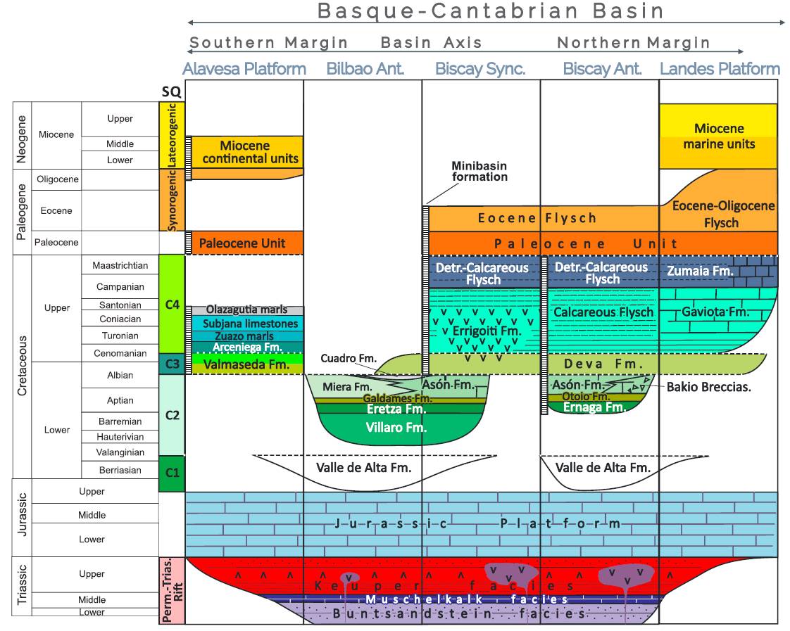
| Evaporite unit/s name | Keuper facies |
| Evaporite unit/s age | Carnian-Rhaetian (Upper Triassic) |
| Evaporite unit/s origin | Marine |
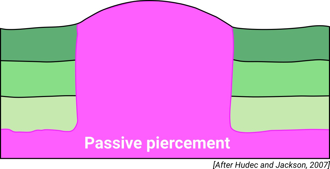
| Classif. (Hudec and Jackson, 2009) | Passive piercement |
| Classif. (Jackson and Talbot, 1986) | Salt wall |
| Age of evaporite flow or deformation (when deformed) | Middle Cretaceous |
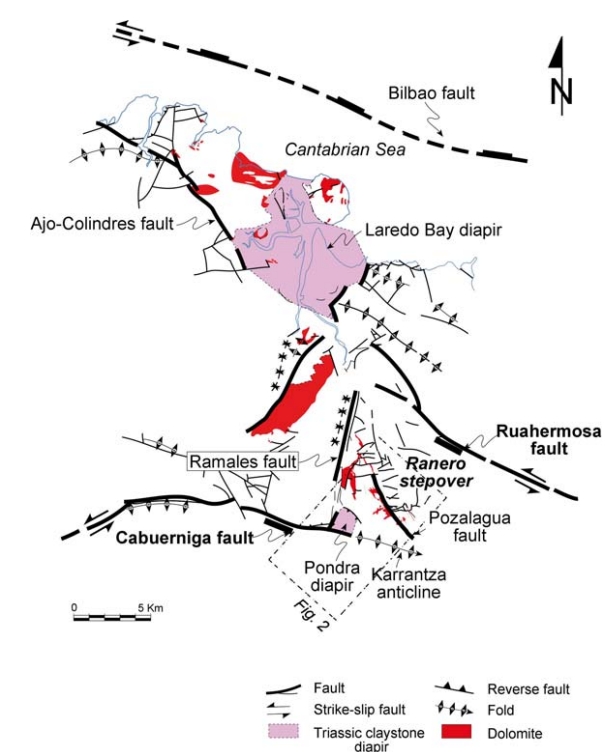
| Other comments | Also known as "Ramales". The diapiric material was suggested as the most probable origin for the magnesium of the hydrothermal fluids involved in the dolomitization process (leaching of claystones, evaporites and diorites; see Grandia et al. 2003; López-Horgue et al. 2010). |
Generic Data
| Unique ID | 53 |
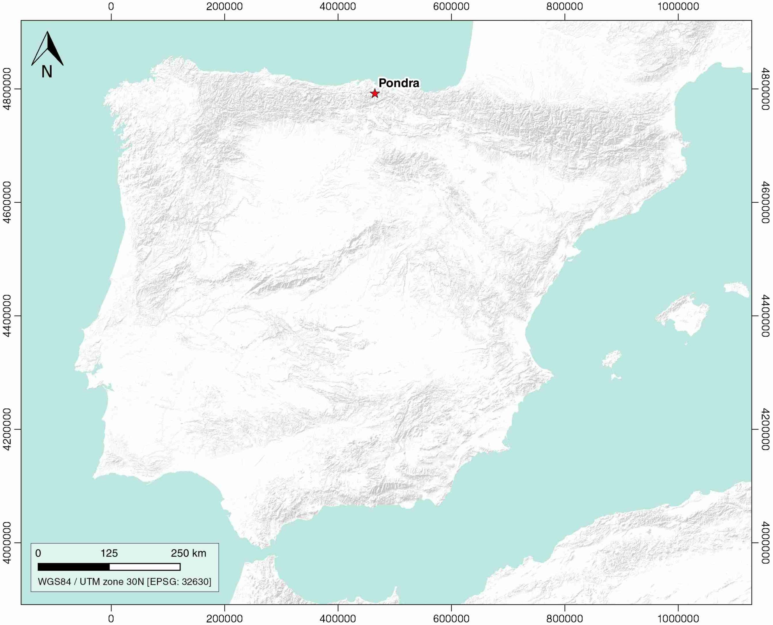
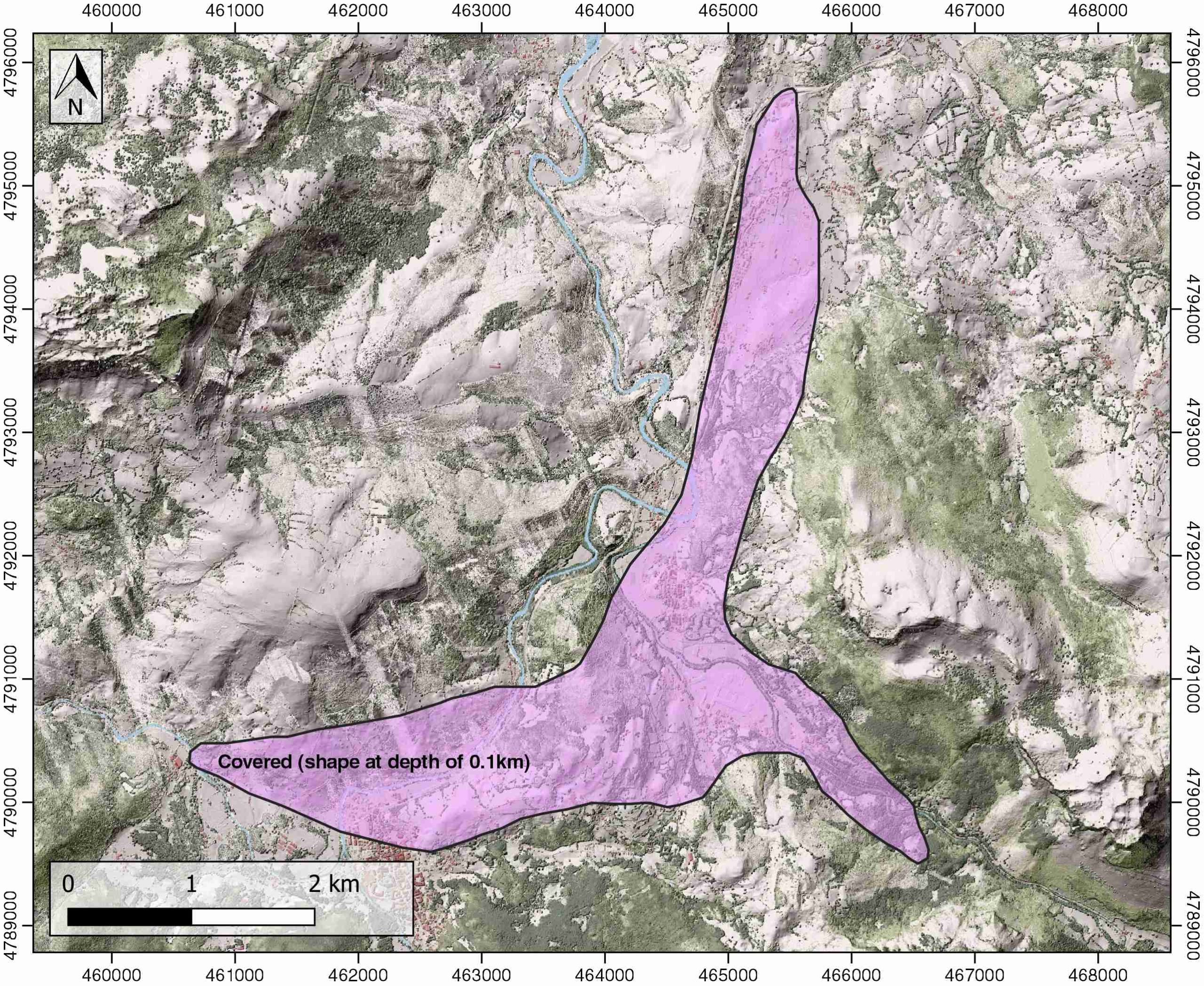
| Name | Pondra (Ramales) |
| Structure type | Evaporite diapir |
| Deformed/Undeformed | Deformed |
| Buried/Outcropping | Outcropping |
| Geological setting | Basque-Cantabrian Basin |
| Geological Regional Setting | Cantabrian Block |
| Evaporite unit/s name | Keuper facies |
| Evaporite unit/s age | Carnian-Rhaetian (Upper Triassic) |
| Evaporite unit/s era | Mesozoic |
| Evaporite unit/s origin | Marine |
| Evaporite unit/s composition | Gypsum-Halite-Anhydrite-Claystone |
| Post-kinematic unit/s (or post-evaporite units when evaporites are undeformed) | Quaternary (alluvial and colluvial detrital deposits) |
| Post-kinematic unit/s age (or post-evaporite units when evaporites are undeformed) | Pleistocene-Holocene |
| Classification (Hudec and Jackson, 2009) | Passive piercement |
| Classification (Jackson and Talbot, 1986) | Salt wall |
| Mining activity? | Y |
| Mining activity start | 1579 |
| Mining activity end | 1751 |
| Mining galleries? | Y |
| Mining products | Pb-Zn |
| Mining sub-products | F |
| Evaporite flow? | Y |
| Age of evaporite flow | Albian |
| Flow or deformation triggering mechanisms | Ramales fault, Karrantza anticline |
| Flow-linked structures? | Y |
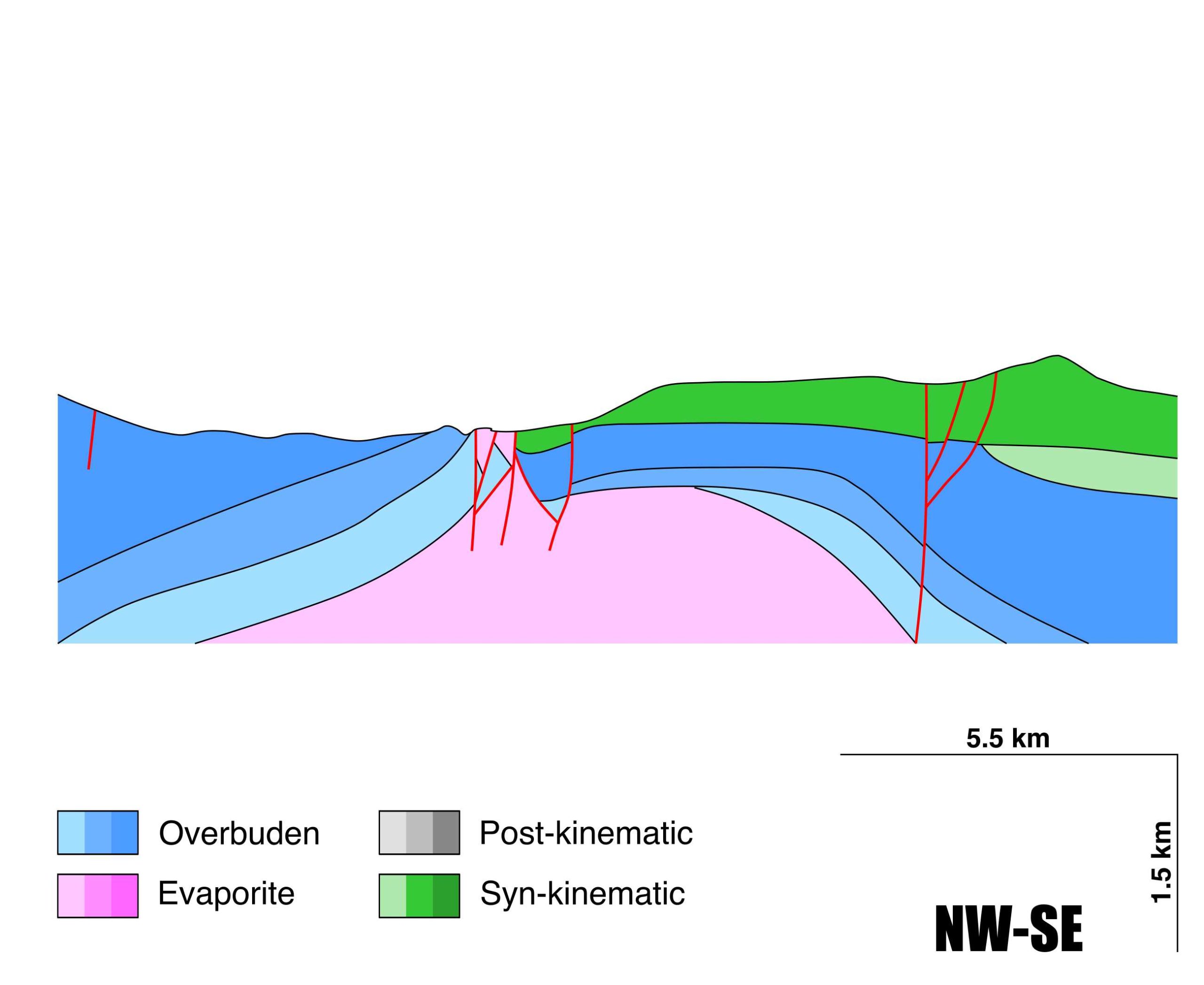
| Halokinetic structures | Synsedimentary anticlinal folding (Breñas flexure) and local inversion |
| Post-evaporite and pre-kinematic unit/s (overbuden) | Lower Jurassic (dolomitic brecchias, limestones and marls) ; Berriasian (basal conglomerates, lutites, marls, calcarenites and sandstones) ; Valanginian-Barremian (lutites, sandstones and pebbly sandstones) ; Aptian (rudist limestones) |
| Syn-kinematic unit/s | Early Albian (limestone breccias, calcarenites, sandstones, marls and lutites) / Middle Albian (sandstones, lutites and marls) / Late Albian (sandstones and lutites) |
| Available seismic profiles | LN_6 / LN_7 / LN_7 / LN_5 / LN_6 / 32 / LN_4 / LN_3 / |
| Available boreholes | ANCILLO-1 / DDH-4B / DDH-4D / DDH-3A / DDH-3B / DDH-5C / DDH-5D / DDH-5A / DDH-5B / DDH-A3 / DDH-A4 / DDH-5E / DDH-A1 / DH-05 / DH-06 |
| Additional comments | The diapiric material was suggested as the most probable origin for the magnesium of the hydrothermal fluids involved in the dolomitization process (leaching of claystones, evaporites and diorites; see Grandia et al. 2003; López-Horgue et al. 2010). |
Mining Data
| UNIQUE_ID | 53 |
| Minning exploitations within <2km? | Y |
| Historical/Active | Historical (not indexed in the Spanish National Minning Cadastre) |
| Exploitation name #1 | n.a. |
| Exploitation ID (Spanish National Mining Cadastre) #1 | n.a. |
| Municipality #1 | n.a. |
| Province #1 | n.a. |
| Company #1 | n.a. |
| Main minning Products #1 | Pb-Zn |
| Exploitation name #2 | |
| Exploitation ID (Spanish National Mining Cadastre) #2 | |
| Municipality #2 | |
| Province #2 | |
| Company #2 | |
| Main minning Products #2 | |
| Exploitation name #3 | |
| Exploitation ID (Spanish National Mining Cadastre) #3 | |
| Municipality #3 | |
| Province #3 | |
| Company #3 | |
| Main minning Products #3 |
Quantitative Data
| UNIQUE_ID | 53 |
| Outcropping area (km2) | 8.32045 |
| Horizontal intersection area (km2) (when buried) | Not buried |
| Depth of intersection area (km2) (when buried) | Not buried |
| Max. Width (Km) | 5.07021258 |
| Max. Length (Km) | 7.33794533 |
| Max. Evaporites thickness (km) | 0.4 |
| Max. Deformation age (Ma) | 113 |
| Min. Deformation age (Ma) | 100 |
| Deformation stages | 1 |
Reference Data
| UNIQUE_ID | 53 |
| Section source | López-Horgue, M. A., Iriarte, E., Schröder, S., Fernández-Mendiola, P. A., Caline, B., Corneyllie, H., Frémont, J., Sudrie, M., Zerti, S., 2010. Structurally controlled hydrothermal dolomites in Albian carbonates of the Asón valley, Basque Cantabrian Basin, Northern Spain. Marine and Petroleum Geology, 27(5), 1069-1092. [link] |
| Well / Borehole availability #1 | n.a. |
| Well / Borehole availability #2 | n.a. |
| Available data (Stratigraphy) #1 | López-Horgue, M. A., Iriarte, E., Schröder, S., Fernández-Mendiola, P. A., Caline, B., Corneyllie, H., Frémont, J., Sudrie, M., Zerti, S., 2010. Structurally controlled hydrothermal dolomites in Albian carbonates of the Asón valley, Basque Cantabrian Basin, Northern Spain. Marine and Petroleum Geology, 27(5), 1069-1092. [link] |
| Available data (Stratigraphy) #2 | López-Horgue, M. A., Owen, H. G., Aranburu, A., Fernández-Mendiola, P. A., García-Mondéjar, J., 2009. Early late Albian (Cretaceous) of the central region of the Basque-Cantabrian Basin, northern Spain: biostratigraphy based on ammonites and orbitolinids. Cretaceous Research, 30(2), 385-400. [link] |
| Available data (Stratigraphy) #3 | Badillo, J. M., 1982. Estudio geológico del sector de Ramales de la Victoria (Provincia de Santander). Kobie, 12, 139-166. [link] |
| Available data (Stratigraphy) #4 | López-Horgue, M. A., 2000. El Aptiense-Albiense de Karrantza-Lanestona (Bizkaia y Cantabria) [Ph.D. thesis]: Universidad del Paıs Vasco/Euskal Herriko Unibertsitatea. Unpublished, 264pp. [link] |
| Available data (Stratigraphy) #5 | López Horgue, M. A., Aranburu Artano, A., Fernández Mendiola, P. Á., García Mondéjar, J., 2001. Facies estuarinas en el Albiense superior de Cabo Quintres (Cantabria, región Vasco-Cantábrica occidental). Geogaceta, 30, 75-78. [link] |
| Available data (Stratigraphy) #6 | García‐Mondéjar, J., López‐Horgue, M. A., Aranburu, A., Fernández‐Mendiola, P. A., 2005. Pulsating subsidence during a rift episode: stratigraphic and tectonic consequences (Aptian–Albian, northern Spain). Terra Nova, 17(6), 517-525. [link] |
| Regional Stratigraphy | Pedrera, A., García‐Senz, J., Ayala, C., Ruiz‐Constán, A., Rodríguez‐Fernández, L. R., Robador, A., González Menéndez, L., 2017. Reconstruction of the exhumed mantle across the North Iberian Margin by crustal‐scale 3‐D gravity inversion and geological cross section. Tectonics, 36, 3155-3177. [link] |
| Seismic data availability #1 | n.a. |
| Seismic data availability #2 | n.a. |
| Seismic data availability #3 | n.a. |
| Available data (Structure) #1 | López-Horgue, M. A., Iriarte, E., Schröder, S., Fernández-Mendiola, P. A., Caline, B., Corneyllie, H., Frémont, J., Sudrie, M., Zerti, S., 2010. Structurally controlled hydrothermal dolomites in Albian carbonates of the Asón valley, Basque Cantabrian Basin, Northern Spain. Marine and Petroleum Geology, 27(5), 1069-1092. [link] |
| Available data (Structure) #2 | Iriarte, E., Lopez-Horgue, M. A., Schroeder, S., Caline, B., 2012. Interplay between fracturing and hydrothermal fluid flow in the Asón Valley hydrothermal dolomites (Basque–Cantabrian Basin, Spain). Geological Society, London, Special Publications, 370(1), 207-227. [link] |
| Available data (Structure) #3 | López-Horgue, M. A., 2000. El Aptiense-Albiense de Karrantza-Lanestona (Bizkaia y Cantabria) [Ph.D. thesis]: Universidad del Paıs Vasco/Euskal Herriko Unibertsitatea. Unpublished, 264pp. [link] |
| Available data (Structure) #4 | García‐Mondéjar, J., López‐Horgue, M. A., Aranburu, A., Fernández‐Mendiola, P. A., 2005. Pulsating subsidence during a rift episode: stratigraphic and tectonic consequences (Aptian–Albian, northern Spain). Terra Nova, 17(6), 517-525. [link] |
| Available data (Structure) #5 | Gómez, M., Vergés, J., Riaza, C., 2002. Inversion tectonics of the northern margin of the Basque Cantabrian Basin. Bulletin de la Société géologique de France, 173(5), 449-459. [link] |
| Available data (Structure) #6 | Cámara, P., 2017. Salt and Strike-Slip Tectonics as Main Drivers in the Structural Evolution of the Basque-Cantabrian Basin, Spain. In Permo-Triassic Salt Provinces of Europe, North Africa and the Atlantic Margins (pp. 371-393). Elsevier. [link] |
| Available data (Analogue modelling) #1 | n.a. |
| Available data (Analogue modelling) #2 | n.a. |
| Available data (Analogue modelling) #3 | n.a. |
| Available data (Gravimetry – Tomography) #1 | Ayala, C., Bohoyo, F., Maestro, A., Reguera, M. I., Torne, M., Rubio, F., Fernández, M., García-Lobón, J. L., 2016. Updated Bouguer anomalies of the Iberian Peninsula: a new perspective to interpret the regional geology. Journal of Maps, 12(5), 1089-1092. [link] |
| Available data (Gravimetry – Tomography) #2 | n.a. |
| Available data (Gravimetry – Tomography) #3 | n.a. |
| Available data (Geochemistry) #1 | Iribar, V., Ábalos, B. 2011. The geochemical and isotopic record of evaporite recycling in spas and salterns of the Basque Cantabrian basin, Spain. Applied geochemistry, 26, 1315-1329. [link] |
| Available data (Geochemistry) #2 | Ortí, F., García-Veigas, J., Rossell, L., Jurado, M. J., Utrilla, R., 1996. Formaciones salinas de las cuencas triásicas en la Península Ibérica: Caracterización Petrológica y Geoquímica. Cuadernos de Geología Ibérica, 20, 13-35. [link] |
| Available data (Geochemistry) #3 | Béziat, D., Joron, J.L., Monchoux, P., Treuil, M., Walgenwitz, F., 1991. Geodynamic implications of geochemical data for the Pyrenean ophites (Spain-France). Chemical Geology, 89, 243-262. [link] |
| Available data (Geochemistry) #4 | n.a. |
| Available data (Petrophysics) #1 | Llamas, B., Castañeda, M. C., Laín, C., Pous, J., 2017. Study of the Basque–Cantabrian basin as a suitable region for the implementation of an energy storage system based on compressed air energy storage (CAES). Environmental Earth Sciences, 76(5), 204. [link] |
| Available data (Petrophysics) #2 | n.a. |
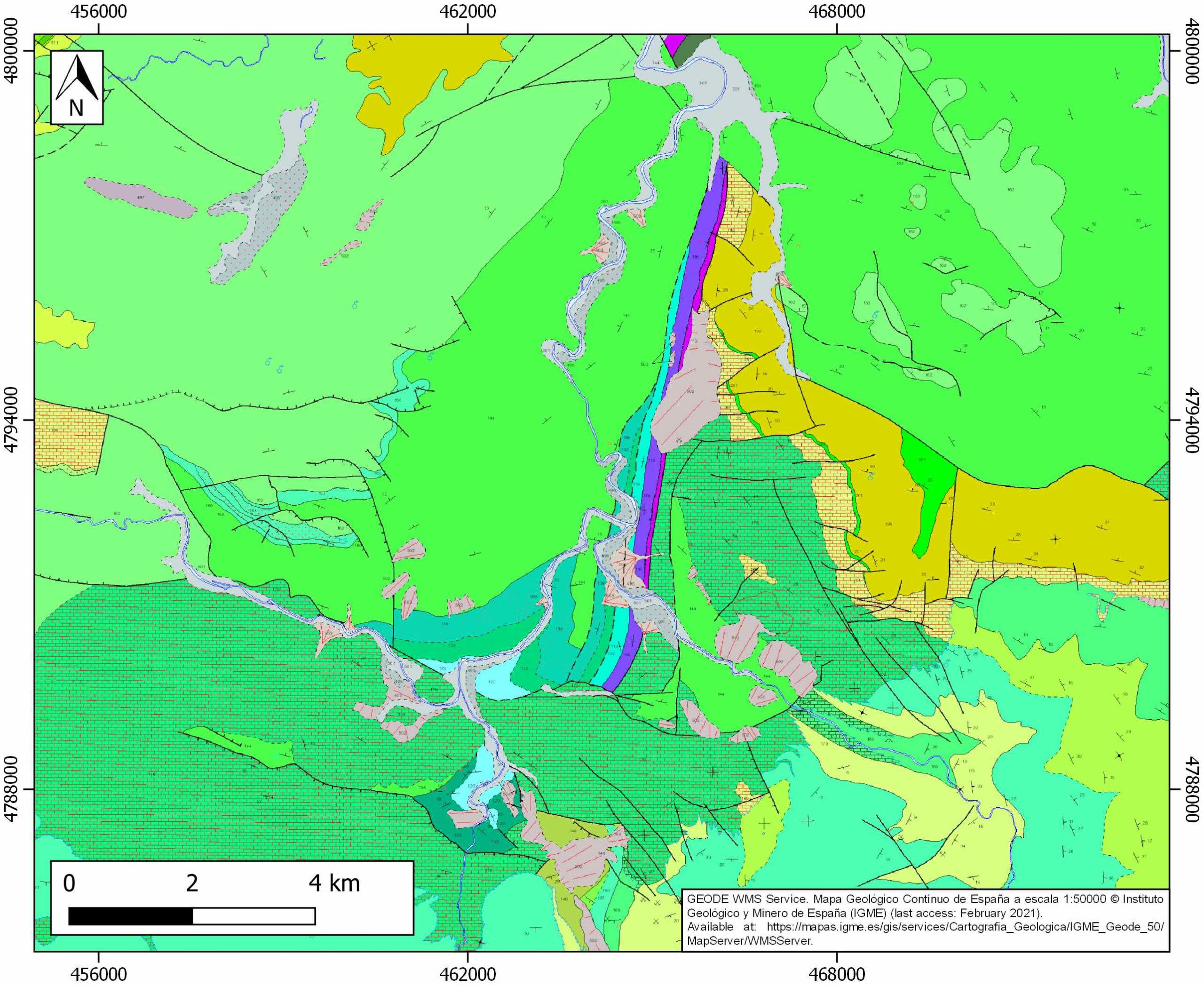
| IGME Geological Map (MAGNA50) Sheet number | 60-Valmaseda. [link] |
| Other Maps #1 (source) | Perona, J., 2016. Mineralizaciones de Pb-Zn asociadas a los diapiros de Murguía y Orduña (Cuenca Vasco-Cantábrica) [PhD thesis]: Barcelona, Universitat de Barcelona, 281 pp. [link] |
| Other Maps #2 (source) | Iriarte, E., Lopez-Horgue, M. A., Schroeder, S., Caline, B., 2012. Interplay between fracturing and hydrothermal fluid flow in the Asón Valley hydrothermal dolomites (Basque–Cantabrian Basin, Spain). Geological Society, London, Special Publications, 370(1), 207-227. [link] |
| Other related references #1 | n.a. |
| Other related references #2 | n.a. |
| Other related references #3 | n.a. |
| Other related references #4 | n.a. |
Well and Seismic Data
| UNIQUE_ID | 53 |
| Seismic survey name #1 | 7B-ST-119 |
| Across structure? #1 | Y |
| Seismic profile ID (IGME) #1 | 12711 |
| Seismic profile code #1 | 17429 |
| Seismic profile name #1 | LN_6 |
| Seismic survey year #1 | 1970 |
| Data repository #1 | SIGEOF Data Catalogue (Private access section). ©Instituto Geológico y Minero de España (IGME). https://info.igme.es/SIGEOF/ |
| Length (km) #1 | 3.25 |
| Seismic survey name #2 | 7B-ST-119 |
| Across structure? #2 | Y |
| Seismic profile ID (IGME) #2 | 12710 |
| Seismic profile code #2 | 17428 |
| Seismic profile name #2 | LN_7 |
| Seismic survey year #2 | 1970 |
| Data repository #2 | SIGEOF Data Catalogue (Private access section). ©Instituto Geológico y Minero de España (IGME). https://info.igme.es/SIGEOF/ |
| Length (km) #2 | 4.10 |
| Seismic survey name #3 | 7B-ST-119 |
| Across structure? #3 | N (within 3km) |
| Seismic profile ID (IGME) #3 | 12710 |
| Seismic profile code #3 | 17428 |
| Seismic profile name #3 | LN_7 |
| Seismic survey year #3 | 1970 |
| Data repository #3 | SIGEOF Data Catalogue (Private access section). ©Instituto Geológico y Minero de España (IGME). https://info.igme.es/SIGEOF/ |
| Length (km) #3 | 4.10 |
| Seismic survey name #4 | 7B-ST-119 |
| Across structure? #4 | N (within 3km) |
| Seismic profile ID (IGME) #4 | 12712 |
| Seismic profile code #4 | 17430 |
| Seismic profile name #4 | LN_5 |
| Seismic survey year #4 | 1970 |
| Data repository #4 | SIGEOF Data Catalogue (Private access section). ©Instituto Geológico y Minero de España (IGME). https://info.igme.es/SIGEOF/ |
| Length (km) #4 | 2.73 |
| Seismic survey name #5 | 7B-ST-119 |
| Across structure? #5 | N (within 3km) |
| Seismic profile ID (IGME) #5 | 12711 |
| Seismic profile code #5 | 17429 |
| Seismic profile name #5 | LN_6 |
| Seismic survey year #5 | 1970 |
| Data repository #5 | SIGEOF Data Catalogue (Private access section). ©Instituto Geológico y Minero de España (IGME). https://info.igme.es/SIGEOF/ |
| Length (km) #5 | 3.25 |
| Seismic survey name #6 | 7B-ST-115-116 |
| Across structure? #6 | N (within 3km) |
| Seismic profile ID (IGME) #6 | 12562 |
| Seismic profile code #6 | 17280 |
| Seismic profile name #6 | 32 |
| Seismic survey year #6 | 1962 |
| Data repository #6 | SIGEOF Data Catalogue (Private access section). ©Instituto Geológico y Minero de España (IGME). https://info.igme.es/SIGEOF/ |
| Length (km) #6 | 19.29 |
| Seismic survey name #7 | 7B-ST-119 |
| Across structure? #7 | N (within 3km) |
| Seismic profile ID (IGME) #7 | 12713 |
| Seismic profile code #7 | 17431 |
| Seismic profile name #7 | LN_4 |
| Seismic survey year #7 | 1970 |
| Data repository #7 | SIGEOF Data Catalogue (Private access section). ©Instituto Geológico y Minero de España (IGME). https://info.igme.es/SIGEOF/ |
| Length (km) #7 | 3.78 |
| Seismic survey name #8 | 7B-ST-119 |
| Across structure? #8 | N (within 3km) |
| Seismic profile ID (IGME) #8 | 12714 |
| Seismic profile code #8 | 17432 |
| Seismic profile name #8 | LN_3 |
| Seismic survey year #8 | 1970 |
| Data repository #8 | SIGEOF Data Catalogue (Private access section). ©Instituto Geológico y Minero de España (IGME). https://info.igme.es/SIGEOF/ |
| Length (km) #8 | 4.58 |
| Seismic survey name #9 | |
| Across structure? #9 | |
| Seismic profile ID (IGME) #9 | |
| Seismic profile code #9 | |
| Seismic profile name #9 | |
| Seismic survey year #9 | |
| Data repository #9 | |
| Length (km) #9 | |
| Seismic survey name #10 | |
| Across structure? #10 | |
| Seismic profile ID (IGME) #10 | |
| Seismic profile code #10 | |
| Seismic profile name #10 | |
| Seismic survey year #10 | |
| Data repository #10 | |
| Length (km) #10 | |
| Seismic survey name #11 | |
| Across structure? #11 | |
| Seismic profile ID (IGME) #11 | |
| Seismic profile code #11 | |
| Seismic profile name #11 | |
| Seismic survey year #11 | |
| Data repository #11 | |
| Length (km) #11 | |
| Seismic survey name #12 | |
| Across structure? #12 | |
| Seismic profile ID (IGME) #12 | |
| Seismic profile code #12 | |
| Seismic profile name #12 | |
| Seismic survey year #12 | |
| Data repository #12 | |
| Length (km) #12 | |
| Seismic survey name #13 | |
| Across structure? #13 | |
| Seismic profile ID (IGME) #13 | |
| Seismic profile code #13 | |
| Seismic profile name #13 | |
| Seismic survey year #13 | |
| Data repository #13 | |
| Length (km) #13 | |
| Seismic survey name #14 | |
| Across structure? #14 | |
| Seismic profile ID (IGME) #14 | |
| Seismic profile code #14 | |
| Seismic profile name #14 | |
| Seismic survey year #14 | |
| Data repository #14 | |
| Length (km) #14 | |
| Seismic survey name #15 | |
| Across structure? #15 | |
| Seismic profile ID (IGME) #15 | |
| Seismic profile code #15 | |
| Seismic profile name #15 | |
| Seismic survey year #15 | |
| Data repository #15 | |
| Length (km) #15 | |
| Seismic survey name #16 | |
| Across structure? #16 | |
| Seismic profile ID (IGME) #16 | |
| Seismic profile code #16 | |
| Seismic profile name #16 | |
| Seismic survey year #16 | |
| Data repository #16 | |
| Length (km) #16 | |
| Seismic survey name #17 | |
| Across structure? #17 | |
| Seismic profile ID (IGME) #17 | |
| Seismic profile code #17 | |
| Seismic profile name #17 | |
| Seismic survey year #17 | |
| Data repository #17 | |
| Length (km) #17 | |
| Seismic survey name #18 | |
| Across structure? #18 | |
| Seismic profile ID (IGME) #18 | |
| Seismic profile code #18 | |
| Seismic profile name #18 | |
| Seismic survey year #18 | |
| Data repository #18 | |
| Length (km) #18 | |
| Seismic survey name #19 | |
| Across structure? #19 | |
| Seismic profile ID (IGME) #19 | |
| Seismic profile code #19 | |
| Seismic profile name #19 | |
| Seismic survey year #19 | |
| Data repository #19 | |
| Length (km) #19 | |
| Seismic survey name #20 | |
| Across structure? #20 | |
| Seismic profile ID (IGME) #20 | |
| Seismic profile code #20 | |
| Seismic profile name #20 | |
| Seismic survey year #20 | |
| Data repository #20 | |
| Length (km) #20 | |
| Seismic survey name #21 | |
| Across structure? #21 | |
| Seismic profile ID (IGME) #21 | |
| Seismic profile code #21 | |
| Seismic profile name #21 | |
| Seismic survey year #21 | |
| Data repository #21 | |
| Length (km) #21 | |
| Borehole name #1 | ANCILLO-1 |
| Company #1 | SHELL |
| Traget #1 | HYDROCARBONS |
| Across structure? #1 | N (within 5 km) |
| Borehole name #2 | DDH-4B |
| Company #2 | EVE |
| Traget #2 | BASE METALS |
| Across structure? #2 | N (within 5 km) |
| Borehole name #3 | DDH-4D |
| Company #3 | EVE |
| Traget #3 | BASE METALS |
| Across structure? #3 | N (within 5 km) |
| Borehole name #4 | DDH-3A |
| Company #4 | EVE |
| Traget #4 | BASE METALS |
| Across structure? #4 | N (within 5 km) |
| Borehole name #5 | DDH-3B |
| Company #5 | EVE |
| Traget #5 | BASE METALS |
| Across structure? #5 | N (within 5 km) |
| Borehole name #6 | DDH-5C |
| Company #6 | EVE |
| Traget #6 | BASE METALS |
| Across structure? #6 | N (within 5 km) |
| Borehole name #7 | DDH-5D |
| Company #7 | EVE |
| Traget #7 | BASE METALS |
| Across structure? #7 | N (within 5 km) |
| Borehole name #8 | DDH-5A |
| Company #8 | EVE |
| Traget #8 | BASE METALS |
| Across structure? #8 | N (within 5 km) |
| Borehole name #9 | DDH-5B |
| Company #9 | EVE |
| Traget #9 | BASE METALS |
| Across structure? #9 | N (within 5 km) |
| Borehole name #10 | DDH-A3 |
| Company #10 | EVE |
| Traget #10 | BASE METALS |
| Across structure? #10 | N (within 5 km) |
| Borehole name #11 | DDH-A4 |
| Company #11 | EVE |
| Traget #11 | BASE METALS |
| Across structure? #11 | N (within 5 km) |
| Borehole name #12 | DDH-5E |
| Company #12 | EVE |
| Traget #12 | BASE METALS |
| Across structure? #12 | N (within 5 km) |
| Borehole name #13 | DDH-A1 |
| Company #13 | EVE |
| Traget #13 | BASE METALS |
| Across structure? #13 | N (within 5 km) |
| Borehole name #14 | DH-05 |
| Company #14 | EVE |
| Traget #14 | BASE METALS |
| Across structure? #14 | N (within 5 km) |
| Borehole name #15 | DH-06 |
| Company #15 | EVE |
| Traget #15 | BASE METALS |
| Across structure? #15 | N (within 5 km) |
Geographical Data (EPSG:4326 - WGS 84)
| UNIQUE_ID | 53 |
| X Centroid (Structure shape) | -3.441354 |
| Y Centroid (Structure shape) | -3.441354 |
| Xmin (Structure shape) | -3.485132 |
| Xmax (Structure shape) | -3.411186 |
| Ymin (Structure shape) | 43.257576 |
| Ymax (Structure shape) | 43.314145 |
| Xmin seismic line #1 | -3.459469 |
| Xmax seismic line #1 | -3.419535 |
| Ymin seismic line #1 | 43.308204 |
| Ymax seismic line #1 | 43.309064 |
| Xmin seismic line #2 | -3.425437 |
| Xmax seismic line #2 | -3.393414 |
| Ymin seismic line #2 | 43.306453 |
| Ymax seismic line #2 | 43.334985 |
| Xmin seismic line #3 | -3.425437 |
| Xmax seismic line #3 | -3.393414 |
| Ymin seismic line #3 | 43.306453 |
| Ymax seismic line #3 | 43.334985 |
| Xmin seismic line #4 | -3.471186 |
| Xmax seismic line #4 | -3.454592 |
| Ymin seismic line #4 | 43.289337 |
| Ymax seismic line #4 | 43.310664 |
| Xmin seismic line #5 | -3.459469 |
| Xmax seismic line #5 | -3.419535 |
| Ymin seismic line #5 | 43.308204 |
| Ymax seismic line #5 | 43.309064 |
| Xmin seismic line #6 | -3.388754 |
| Xmax seismic line #6 | -3.175194 |
| Ymin seismic line #6 | 43.215637 |
| Ymax seismic line #6 | 43.252186 |
| Xmin seismic line #7 | -3.508454 |
| Xmax seismic line #7 | -3.465538 |
| Ymin seismic line #7 | 43.279390 |
| Ymax seismic line #7 | 43.292368 |
| Xmin seismic line #8 | -3.557949 |
| Xmax seismic line #8 | -3.501769 |
| Ymin seismic line #8 | 43.280356 |
| Ymax seismic line #8 | 43.283303 |
| Xmin seismic line #9 | |
| Xmax seismic line #9 | |
| Ymin seismic line #9 | |
| Ymax seismic line #9 | |
| Xmin seismic line #10 | |
| Xmax seismic line #10 | |
| Ymin seismic line #10 | |
| Ymax seismic line #10 | |
| Xmin seismic line #11 | |
| Xmax seismic line #11 | |
| Ymin seismic line #11 | |
| Ymax seismic line #11 | |
| Xmin seismic line #12 | |
| Xmax seismic line #12 | |
| Ymin seismic line #12 | |
| Ymax seismic line #12 | |
| Xmin seismic line #13 | |
| Xmax seismic line #13 | |
| Ymin seismic line #13 | |
| Ymax seismic line #13 | |
| Xmin seismic line #14 | |
| Xmax seismic line #14 | |
| Ymin seismic line #14 | |
| Ymax seismic line #14 | |
| Xmin seismic line #15 | |
| Xmax seismic line #15 | |
| Ymin seismic line #15 | |
| Ymax seismic line #15 | |
| Xmin seismic line #16 | |
| Xmax seismic line #16 | |
| Ymin seismic line #16 | |
| Ymax seismic line #16 | |
| Xmin seismic line #17 | |
| Xmax seismic line #17 | |
| Ymin seismic line #17 | |
| Ymax seismic line #17 | |
| Xmin seismic line #18 | |
| Xmax seismic line #18 | |
| Ymin seismic line #18 | |
| Ymax seismic line #18 | |
| Xmin seismic line #19 | |
| Xmax seismic line #19 | |
| Ymin seismic line #19 | |
| Ymax seismic line #19 | |
| Xmin seismic line #20 | |
| Xmax seismic line #20 | |
| Ymin seismic line #20 | |
| Ymax seismic line #20 | |
| Xmin seismic line #21 | |
| Xmax seismic line #21 | |
| Ymin seismic line #21 | |
| Ymax seismic line #21 | |
| X borehole #1 | -3.505146 |
| Y borehole #1 | 43.251942 |
| X borehole #2 | -3.426285 |
| Y borehole #2 | 43.228175 |
| X borehole #3 | -3.426285 |
| Y borehole #3 | 43.228175 |
| X borehole #4 | -3.425460 |
| Y borehole #4 | 43.228124 |
| X borehole #5 | -3.425460 |
| Y borehole #5 | 43.228124 |
| X borehole #6 | -3.425476 |
| Y borehole #6 | 43.228692 |
| X borehole #7 | -3.425476 |
| Y borehole #7 | 43.228692 |
| X borehole #8 | -3.425476 |
| Y borehole #8 | 43.228692 |
| X borehole #9 | -3.425476 |
| Y borehole #9 | 43.228692 |
| X borehole #10 | -3.436676 |
| Y borehole #10 | 43.226119 |
| X borehole #11 | -3.397166 |
| Y borehole #11 | 43.226849 |
| X borehole #12 | -3.425476 |
| Y borehole #12 | 43.228692 |
| X borehole #13 | -3.428502 |
| Y borehole #13 | 43.226375 |
| X borehole #14 | -3.428078 |
| Y borehole #14 | 43.230969 |
| X borehole #15 | -3.427023 |
| Y borehole #15 | 43.231558 |

