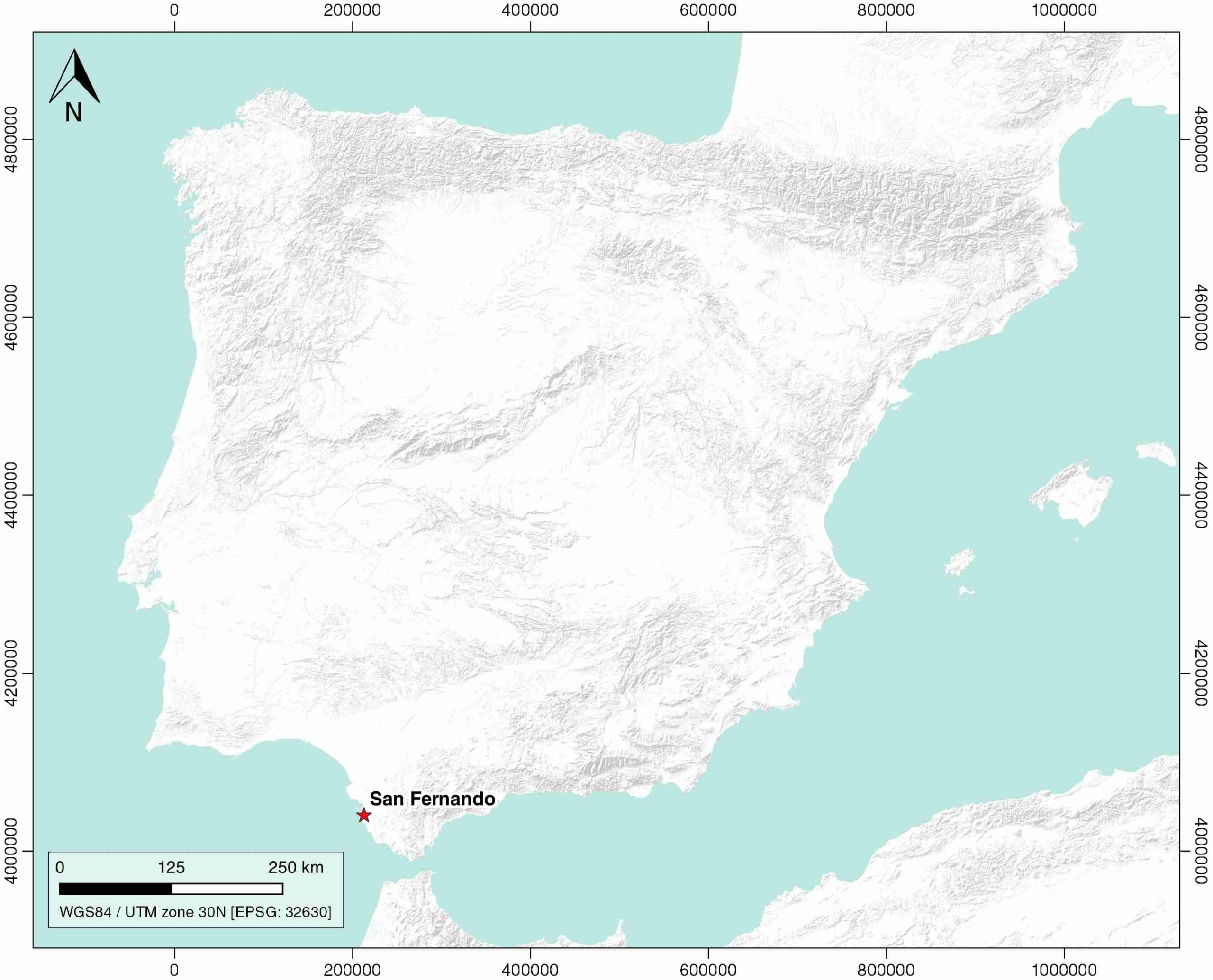
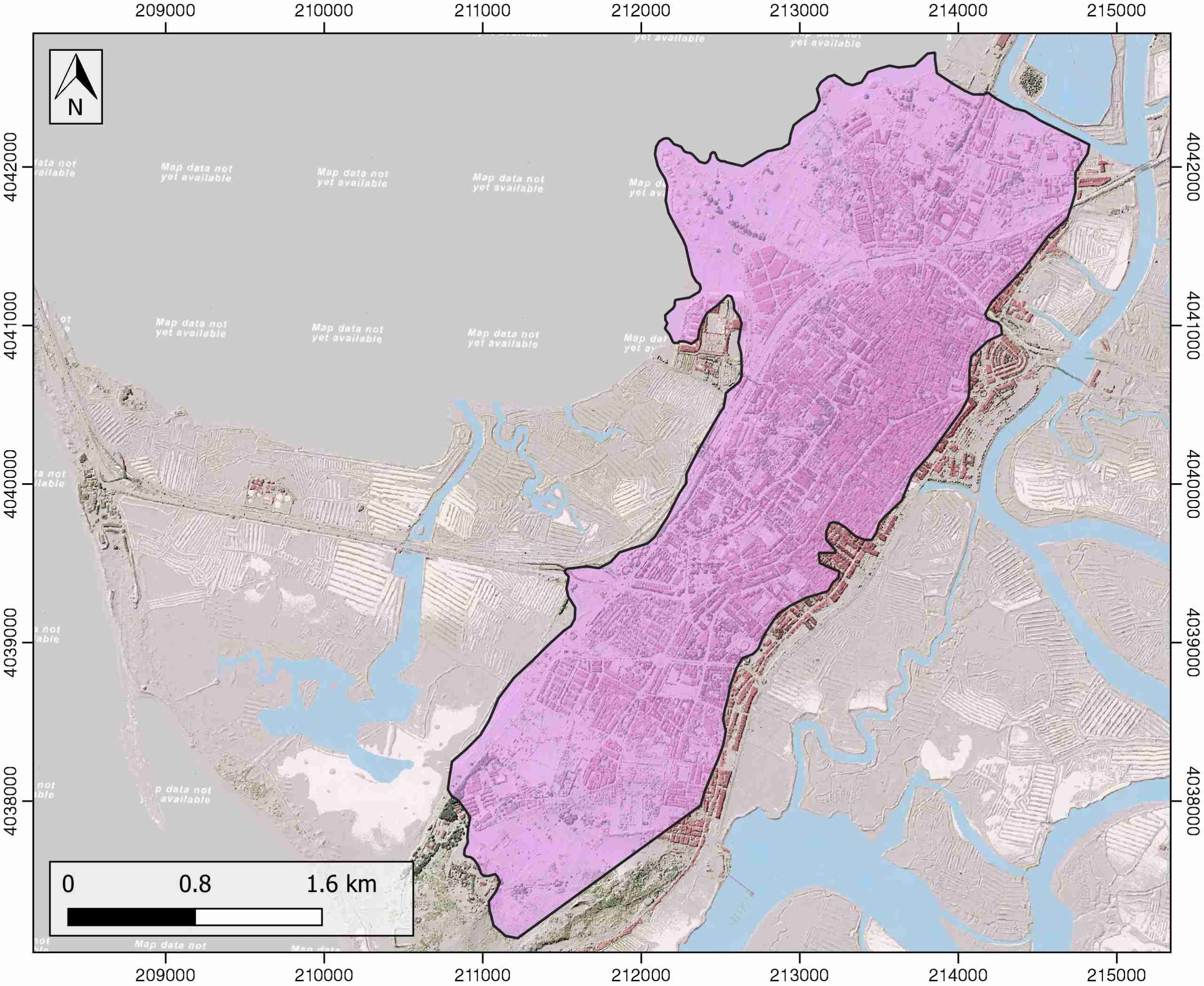
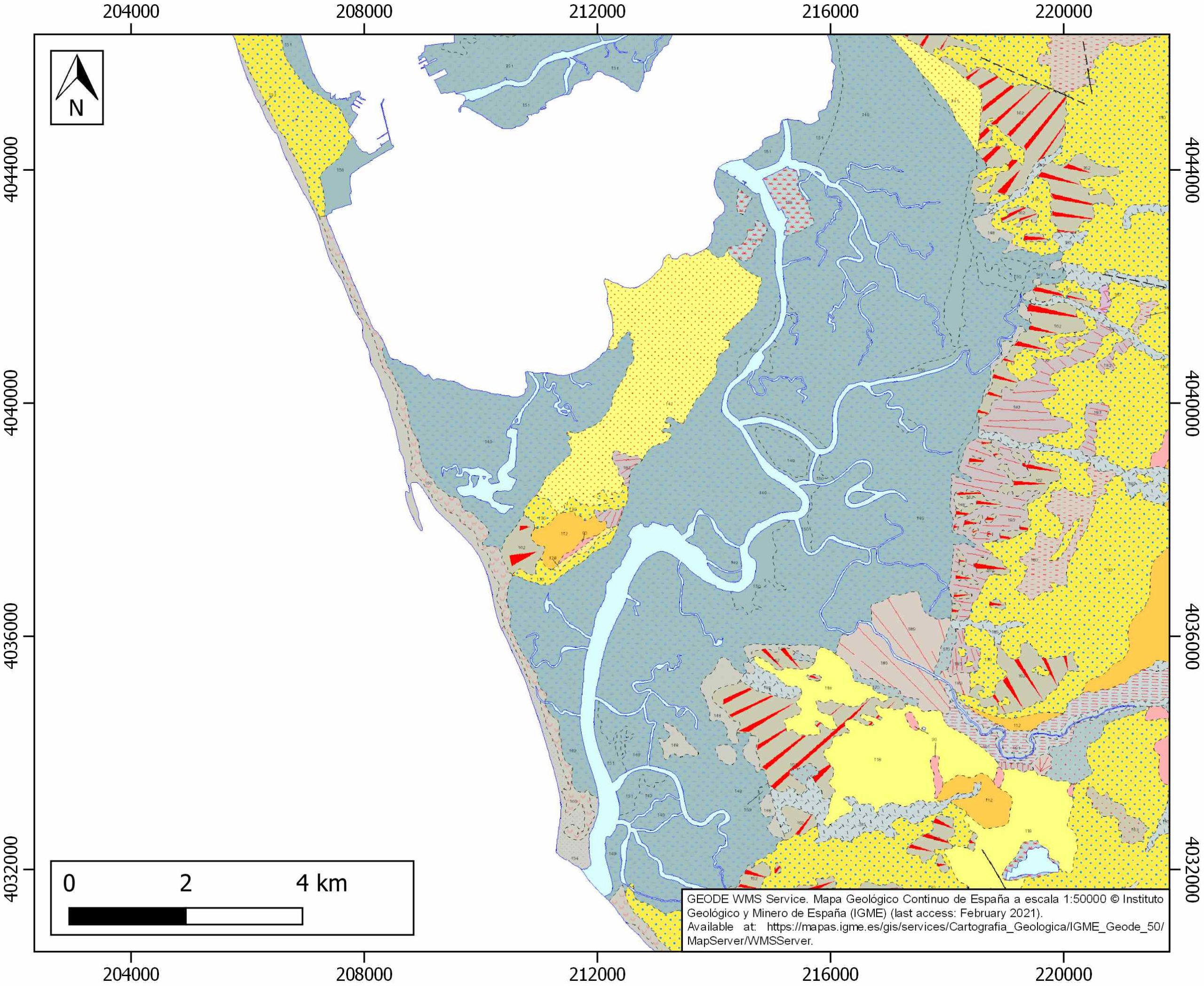
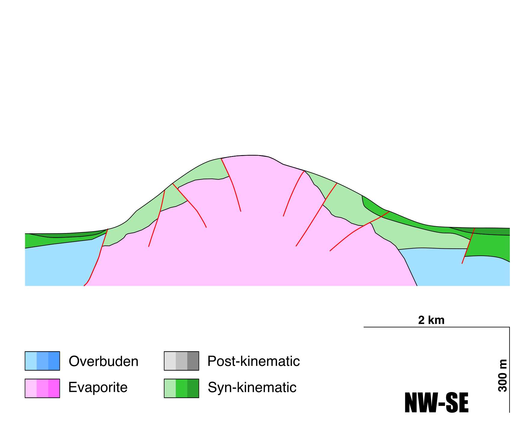
General Information
| Structure type | Evaporite Diapir |
| Deformed/Undeformed | Deformed |
| Geological Setting | Betic system, Guadalquivir Accretionary Complex |
| Outcropping/buried | Outcropping |
| Evaporite unit/s name | Keuper facies |
| Evaporite unit/s age | Carnian-Rhaetian (Upper Triassic) |
| Evaporite unit/s origin | Marine |
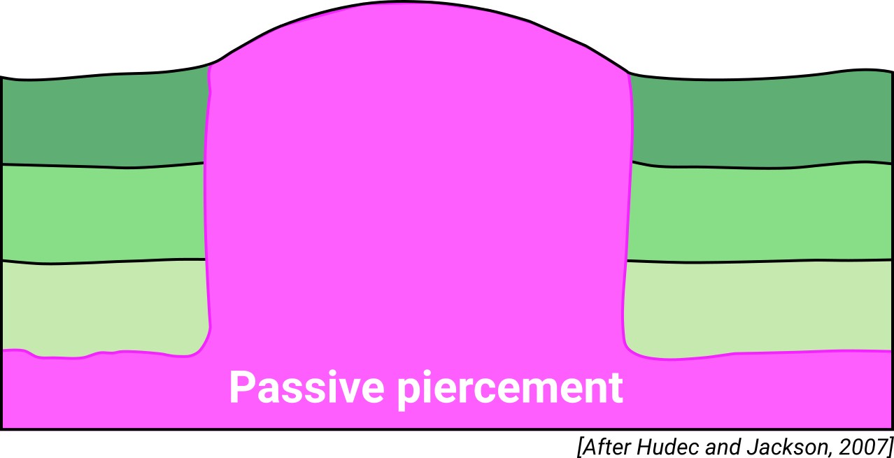
| Classif. (Hudec and Jackson, 2009) | Passive piercement |
| Classif. (Jackson and Talbot, 1986) | Salt stock |
| Age of evaporite flow or deformation (when deformed) | Lower-Middle Pleistocene |
| Other comments | - |
Generic Data
| Unique ID | 11 |
| Name | San Fernando |
| Structure type | Evaporite diapir |
| Deformed/Undeformed | Deformed |
| Buried/Outcropping | Outcropping |
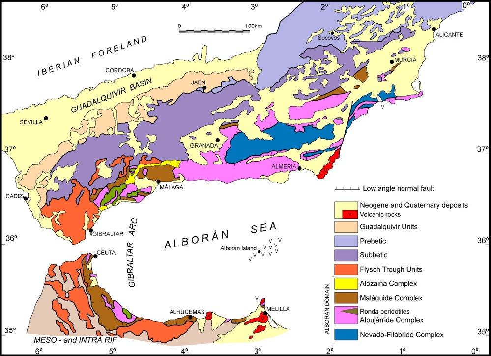
| Geological setting | Betic System |
| Geological Regional Setting | Guadalquivir Basin |
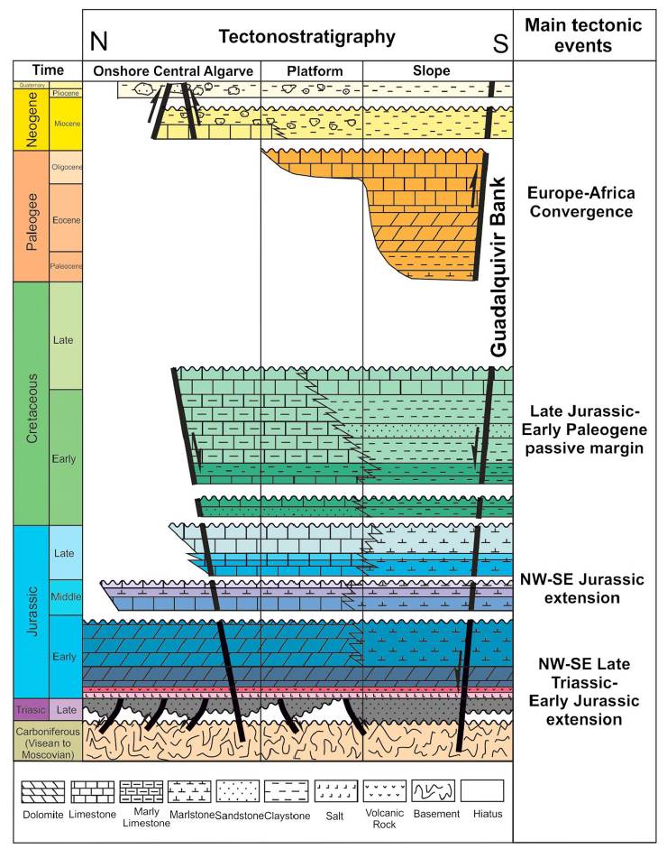
| Evaporite unit/s name | Keuper facies |
| Evaporite unit/s age | Carnian-Rhaetian (Upper Triassic) |
| Evaporite unit/s era | Mesozoic |
| Evaporite unit/s origin | Marine |
| Evaporite unit/s composition | Gypsum-Claystone-Marlstone-Dolomite |
| Post-kinematic unit/s (or post-evaporite units when evaporites are undeformed) | Quaternary (alluvial and colluvial detrital deposits) |
| Post-kinematic unit/s age (or post-evaporite units when evaporites are undeformed) | Holocene |
| Classification (Hudec and Jackson, 2009) | Passive piercement |
| Classification (Jackson and Talbot, 1986) | Salt stock |
| Mining activity? | N |
| Mining activity start | |
| Mining activity end | |
| Mining galleries? | |
| Mining products | |
| Mining sub-products | |
| Evaporite flow? | Y |
| Age of evaporite flow | lower-middle Pleistocene |
| Flow or deformation triggering mechanisms | Quaternary reverse fault activity |
| Flow-linked structures? | Y |
| Halokinetic structures | Anticline folding / Reverse faults / joints |
| Post-evaporite and pre-kinematic unit/s (overbuden) | |
| Syn-kinematic unit/s | Plio-Pleistocene sands and conglomerates / Upper Pleistocene beach deposits |
| Available seismic profiles | High Resolution Geophysics Surveys CADHYS0410 and INDEMARES-CHICA0610 (private access) |
| Available boreholes | BAHIA DE CADIZ-08 / BAHIA DE CADIZ-03 / BAHIA DE CADIZ-07 / BAHIA DE CADIZ-11 / BAHIA DE CADIZ-12 / BAHIA DE CADIZ-09 / BAHIA DE CADIZ-10 / BAHIA DE CADIZ-17 / BAHIA DE CADIZ-18 / BAHIA DE CADIZ-14 / BAHIA DE CADIZ-15 / BAHIA DE CADIZ-30 / BAHIA DE CADIZ-04 / BAHIA DE CADIZ-28 / BAHIA DE CADIZ-29 |
| Additional comments | – |
Mining Data
| UNIQUE_ID | 11 |
| Minning exploitations within <2km? | N |
| Historical/Active | |
| Exploitation name #1 | |
| Exploitation ID (Spanish National Mining Cadastre) #1 | |
| Municipality #1 | |
| Province #1 | |
| Company #1 | |
| Main minning Products #1 | |
| Exploitation name #2 | |
| Exploitation ID (Spanish National Mining Cadastre) #2 | |
| Municipality #2 | |
| Province #2 | |
| Company #2 | |
| Main minning Products #2 | |
| Exploitation name #3 | |
| Exploitation ID (Spanish National Mining Cadastre) #3 | |
| Municipality #3 | |
| Province #3 | |
| Company #3 | |
| Main minning Products #3 |
Quantitative Data
| UNIQUE_ID | 11 |
| Outcropping area (km2) | 8.27845 |
| Horizontal intersection area (km2) (when buried) | Not buried |
| Depth of intersection area (km2) (when buried) | Not buried |
| Max. Width (Km) | 6 |
| Max. Length (Km) | 2.5 |
| Max. Evaporites thickness (km) | |
| Max. Deformation age (Ma) | 2 |
| Min. Deformation age (Ma) | Active |
| Deformation stages | 1 |
Reference Data
| UNIQUE_ID | 11 |
| Section source | Gracia, F. J., Rodríguez-Vidal, J., Cáceres, L. M., Belluomini, G., Benavente, J., Alonso, C., 2008. Diapiric uplift of an MIS 3 marine deposit in SW Spain: Implications for Late Pleistocene sea level reconstruction and palaeogeography of the Strait of Gibraltar. Quaternary Science Reviews, 27, 2219-2231. [link] |
| Well / Borehole availability #1 | n.a. |
| Well / Borehole availability #2 | n.a. |
| Available data (Stratigraphy) #1 | Baena, J., Zazo, C., Goy, J.L., 1987. Mapa geoloógico de la Hoja 1062: Paterna de Rivera. Mapa Geológico de España, E. 1:50.000. Instituto Geológico y Minero de España, Madrid. [link] |
| Available data (Stratigraphy) #2 | Hernández-Molina, F.J., Fernandez-Puga, M.C., Fernandez-Salas, L.M., Llave, E., Lobo, F.J., Vázquez, J.T., Acosta, J., Lopez-Aguayo, F., 1996. Distribución y estructuración sedimentaria de los depósitos del Holoceno Terminal en la Bahía de Cádiz. Geogaceta 20, 424-427. [link] |
| Available data (Stratigraphy) #3 | Gracia, F. J., Rodríguez-Vidal, J., Cáceres, L. M., Belluomini, G., Benavente, J., Alonso, C., 2008. Diapiric uplift of an MIS 3 marine deposit in SW Spain: Implications for Late Pleistocene sea level reconstruction and palaeogeography of the Strait of Gibraltar. Quaternary Science Reviews, 27, 2219-2231. [link] |
| Available data (Stratigraphy) #4 | Gracia, F.J., 2008. Geomorfología y estratigrafía del Pleistoceno y Holoceno en la banda atlántica de Cádiz. In J. Ramos (ed.): La ocupación prehistórica de la campiña litoral y banda atlántica de Cádiz. Arqueología Monografías, Junta de Andalucía, pp. 53-68. [link] |
| Available data (Stratigraphy) #5 | Matias, H., Kress, P., Terrinha, P., Mohriak, W., Menezes, P. T., Matias, L., Santos, F., Sandnes, F., 2011. Salt tectonics in the western Gulf of Cadiz, southwest Iberia. AAPG bulletin, 95(10), 1667-1698. [link] |
| Available data (Stratigraphy) #6 | n.a. |
| Regional Stratigraphy | Ramos, A., Fernández, O., Terrinha, P., & Muñoz, J. A., 2017. Neogene to recent contraction and basin inversion along the Nubia‐Iberia boundary in SW Iberia. Tectonics, 36(2), 257-286. [link] |
| Seismic data availability #1 | Vázquez, J. T., López-González, N., Fernández-Salas, L. M., del Río, V. D., Fernández-Puga, M. C., Palomino, D., 2010. Nuevos datos de actividad tectónica durante el Pleistoceno Superior-Holoceno en el sector oriental de la plataforma continental del Golfo de Cádiz (SO de Iberia). Resúmenes de la 1ª Reunión Ibérica sobre Fallas Activas y Paleosismología, Sigüenza, España. [link] |
| Seismic data availability #2 | Gracia, F.J., Rodríguez-Vidal, J., Benavente, J., Cáceres, L., López Aguayo, F., 1999. Tectónica cuaternaria en la Bahía de Cádiz. In: Pallí, L., Roqué, C. (Eds.), Avances en el estudio del Cuaternario español. AEQUA, University of Girona, Girona, pp. 67–74. [link] |
| Seismic data availability #3 | Medialdea, T., Vegas, R., Somoza, L., Vázquez, J.T., Maldonado, A., Díaz-del-Río, V., Maestro, A., Córdoba, D., Fernández-Puga, M.C., 2004. Structure and evolution of the ‘‘Olitostrome’’ complex of the Gibraltar Arc in the Gulf of Cádiz (eastern Central Atlantic): evidence from two long seismic cross-sections. Marine Geology 209, 173–198. [link] |
| Available data (Structure) #1 | García de Domingo, J., González, J., Hernáiz, P.P., 1987. Memoria y mapa geológico E/1:50.000 de la hoja 1068 (San Fernando). Instituto Geológico y Minero de España, Madrid. [link] |
| Available data (Structure) #2 | Vázquez, J. T., López-González, N., Fernández-Salas, L. M., del Río, V. D., Fernández-Puga, M. C., Palomino, D., 2010. Nuevos datos de actividad tectónica durante el Pleistoceno Superior-Holoceno en el sector oriental de la plataforma continental del Golfo de Cádiz (SO de Iberia). Resúmenes de la 1ª Reunión Ibérica sobre Fallas Activas y Paleosismología, Sigüenza, España. [link] |
| Available data (Structure) #3 | Gracia, F. J., Rodríguez-Vidal, J., Cáceres, L. M., Belluomini, G., Benavente, J., Alonso, C., 2008. Diapiric uplift of an MIS 3 marine deposit in SW Spain: Implications for Late Pleistocene sea level reconstruction and palaeogeography of the Strait of Gibraltar. Quaternary Science Reviews, 27, 2219-2231. [link] |
| Available data (Structure) #4 | Gracia, F.J., Rodríguez-Vidal, J., Benavente, J., Cáceres, L., López Aguayo, F., 1999. Tectónica cuaternaria en la Bahía de Cádiz. In: Pallí, L., Roqué, C. (Eds.), Avances en el estudio del Cuaternario español. AEQUA, University of Girona, Girona, pp. 67–74. [link] |
| Available data (Structure) #5 | n.a. |
| Available data (Structure) #6 | n.a. |
| Available data (Analogue modelling) #1 | n.a. |
| Available data (Analogue modelling) #2 | n.a. |
| Available data (Analogue modelling) #3 | n.a. |
| Available data (Gravimetry – Tomography) #1 | Ayala, C., Bohoyo, F., Maestro, A., Reguera, M. I., Torne, M., Rubio, F., Fernández, M., García-Lobón, J. L., 2016. Updated Bouguer anomalies of the Iberian Peninsula: a new perspective to interpret the regional geology. Journal of Maps, 12(5), 1089-1092. [link] |
| Available data (Gravimetry – Tomography) #2 | n.a. |
| Available data (Gravimetry – Tomography) #3 | n.a. |
| Available data (Geochemistry) #1 | n.a. |
| Available data (Geochemistry) #2 | n.a. |
| Available data (Geochemistry) #3 | n.a. |
| Available data (Geochemistry) #4 | n.a. |
| Available data (Petrophysics) #1 | n.a. |
| Available data (Petrophysics) #2 | n.a. |
| IGME Geological Map (MAGNA50) Sheet number | 1068-San Fernando. [link] |
| Other Maps #1 (source) | Sánchez-Gómez, M., Balanyá, J. C., García-Dueñas, V., Azañón, J. M., 2002. Intracrustal tectonic evolution of large lithosphere mantle slabs in the western end of the Mediterranean orogen (Gibraltar arc). Journal of the Virtual Explorer, 8, 23-34. [link] |
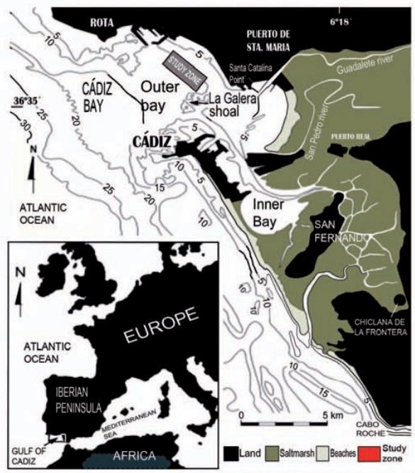
| Other Maps #2 (source) | Mas, J. M. G., Jorge, C. C., Esteban, O. A., 2017. Sedimentary analysis of mud patch fields in the subtidal zone of the Cádiz Bay (SW Spain). Revista de la Sociedad Geológica de España, 30(1), 41-54. [link] |
| Other related references #1 | Baena, J., Zazo, C., Goy, J.L., 1987. Mapa geoloógico de la Hoja 1062: Paterna de Rivera. Mapa Geológico de España, E. 1:50.000. Instituto Geológico y Minero de España, Madrid. [link] |
| Other related references #2 | n.a. |
| Other related references #3 | n.a. |
| Other related references #4 | n.a. |
Well and Seismic Data
| UNIQUE_ID | 11 |
| Seismic survey name #1 | |
| Across structure? #1 | |
| Seismic profile ID (IGME) #1 | |
| Seismic profile code #1 | |
| Seismic profile name #1 | |
| Seismic survey year #1 | |
| Data repository #1 | |
| Length (km) #1 | |
| Seismic survey name #2 | |
| Across structure? #2 | |
| Seismic profile ID (IGME) #2 | |
| Seismic profile code #2 | |
| Seismic profile name #2 | |
| Seismic survey year #2 | |
| Data repository #2 | |
| Length (km) #2 | |
| Seismic survey name #3 | |
| Across structure? #3 | |
| Seismic profile ID (IGME) #3 | |
| Seismic profile code #3 | |
| Seismic profile name #3 | |
| Seismic survey year #3 | |
| Data repository #3 | |
| Length (km) #3 | |
| Seismic survey name #4 | |
| Across structure? #4 | |
| Seismic profile ID (IGME) #4 | |
| Seismic profile code #4 | |
| Seismic profile name #4 | |
| Seismic survey year #4 | |
| Data repository #4 | |
| Length (km) #4 | |
| Seismic survey name #5 | |
| Across structure? #5 | |
| Seismic profile ID (IGME) #5 | |
| Seismic profile code #5 | |
| Seismic profile name #5 | |
| Seismic survey year #5 | |
| Data repository #5 | |
| Length (km) #5 | |
| Seismic survey name #6 | |
| Across structure? #6 | |
| Seismic profile ID (IGME) #6 | |
| Seismic profile code #6 | |
| Seismic profile name #6 | |
| Seismic survey year #6 | |
| Data repository #6 | |
| Length (km) #6 | |
| Seismic survey name #7 | |
| Across structure? #7 | |
| Seismic profile ID (IGME) #7 | |
| Seismic profile code #7 | |
| Seismic profile name #7 | |
| Seismic survey year #7 | |
| Data repository #7 | |
| Length (km) #7 | |
| Seismic survey name #8 | |
| Across structure? #8 | |
| Seismic profile ID (IGME) #8 | |
| Seismic profile code #8 | |
| Seismic profile name #8 | |
| Seismic survey year #8 | |
| Data repository #8 | |
| Length (km) #8 | |
| Seismic survey name #9 | |
| Across structure? #9 | |
| Seismic profile ID (IGME) #9 | |
| Seismic profile code #9 | |
| Seismic profile name #9 | |
| Seismic survey year #9 | |
| Data repository #9 | |
| Length (km) #9 | |
| Seismic survey name #10 | |
| Across structure? #10 | |
| Seismic profile ID (IGME) #10 | |
| Seismic profile code #10 | |
| Seismic profile name #10 | |
| Seismic survey year #10 | |
| Data repository #10 | |
| Length (km) #10 | |
| Seismic survey name #11 | |
| Across structure? #11 | |
| Seismic profile ID (IGME) #11 | |
| Seismic profile code #11 | |
| Seismic profile name #11 | |
| Seismic survey year #11 | |
| Data repository #11 | |
| Length (km) #11 | |
| Seismic survey name #12 | |
| Across structure? #12 | |
| Seismic profile ID (IGME) #12 | |
| Seismic profile code #12 | |
| Seismic profile name #12 | |
| Seismic survey year #12 | |
| Data repository #12 | |
| Length (km) #12 | |
| Seismic survey name #13 | |
| Across structure? #13 | |
| Seismic profile ID (IGME) #13 | |
| Seismic profile code #13 | |
| Seismic profile name #13 | |
| Seismic survey year #13 | |
| Data repository #13 | |
| Length (km) #13 | |
| Seismic survey name #14 | |
| Across structure? #14 | |
| Seismic profile ID (IGME) #14 | |
| Seismic profile code #14 | |
| Seismic profile name #14 | |
| Seismic survey year #14 | |
| Data repository #14 | |
| Length (km) #14 | |
| Seismic survey name #15 | |
| Across structure? #15 | |
| Seismic profile ID (IGME) #15 | |
| Seismic profile code #15 | |
| Seismic profile name #15 | |
| Seismic survey year #15 | |
| Data repository #15 | |
| Length (km) #15 | |
| Seismic survey name #16 | |
| Across structure? #16 | |
| Seismic profile ID (IGME) #16 | |
| Seismic profile code #16 | |
| Seismic profile name #16 | |
| Seismic survey year #16 | |
| Data repository #16 | |
| Length (km) #16 | |
| Seismic survey name #17 | |
| Across structure? #17 | |
| Seismic profile ID (IGME) #17 | |
| Seismic profile code #17 | |
| Seismic profile name #17 | |
| Seismic survey year #17 | |
| Data repository #17 | |
| Length (km) #17 | |
| Seismic survey name #18 | |
| Across structure? #18 | |
| Seismic profile ID (IGME) #18 | |
| Seismic profile code #18 | |
| Seismic profile name #18 | |
| Seismic survey year #18 | |
| Data repository #18 | |
| Length (km) #18 | |
| Seismic survey name #19 | |
| Across structure? #19 | |
| Seismic profile ID (IGME) #19 | |
| Seismic profile code #19 | |
| Seismic profile name #19 | |
| Seismic survey year #19 | |
| Data repository #19 | |
| Length (km) #19 | |
| Seismic survey name #20 | |
| Across structure? #20 | |
| Seismic profile ID (IGME) #20 | |
| Seismic profile code #20 | |
| Seismic profile name #20 | |
| Seismic survey year #20 | |
| Data repository #20 | |
| Length (km) #20 | |
| Seismic survey name #21 | |
| Across structure? #21 | |
| Seismic profile ID (IGME) #21 | |
| Seismic profile code #21 | |
| Seismic profile name #21 | |
| Seismic survey year #21 | |
| Data repository #21 | |
| Length (km) #21 | |
| Borehole name #1 | BAHIA DE CADIZ-08 |
| Company #1 | IGME |
| Traget #1 | GENERAL GEOLOGY |
| Across structure? #1 | Y |
| Borehole name #2 | BAHIA DE CADIZ-03 |
| Company #2 | IGME |
| Traget #2 | GENERAL GEOLOGY |
| Across structure? #2 | N (within 5 km) |
| Borehole name #3 | BAHIA DE CADIZ-07 |
| Company #3 | IGME |
| Traget #3 | GENERAL GEOLOGY |
| Across structure? #3 | N (within 5 km) |
| Borehole name #4 | BAHIA DE CADIZ-11 |
| Company #4 | IGME |
| Traget #4 | GENERAL GEOLOGY |
| Across structure? #4 | N (within 5 km) |
| Borehole name #5 | BAHIA DE CADIZ-12 |
| Company #5 | IGME |
| Traget #5 | GENERAL GEOLOGY |
| Across structure? #5 | N (within 5 km) |
| Borehole name #6 | BAHIA DE CADIZ-09 |
| Company #6 | IGME |
| Traget #6 | GENERAL GEOLOGY |
| Across structure? #6 | N (within 5 km) |
| Borehole name #7 | BAHIA DE CADIZ-10 |
| Company #7 | IGME |
| Traget #7 | GENERAL GEOLOGY |
| Across structure? #7 | N (within 5 km) |
| Borehole name #8 | BAHIA DE CADIZ-17 |
| Company #8 | IGME |
| Traget #8 | GENERAL GEOLOGY |
| Across structure? #8 | N (within 5 km) |
| Borehole name #9 | BAHIA DE CADIZ-18 |
| Company #9 | IGME |
| Traget #9 | GENERAL GEOLOGY |
| Across structure? #9 | N (within 5 km) |
| Borehole name #10 | BAHIA DE CADIZ-14 |
| Company #10 | IGME |
| Traget #10 | GENERAL GEOLOGY |
| Across structure? #10 | N (within 5 km) |
| Borehole name #11 | BAHIA DE CADIZ-15 |
| Company #11 | IGME |
| Traget #11 | GENERAL GEOLOGY |
| Across structure? #11 | N (within 5 km) |
| Borehole name #12 | BAHIA DE CADIZ-30 |
| Company #12 | IGME |
| Traget #12 | GENERAL GEOLOGY |
| Across structure? #12 | N (within 5 km) |
| Borehole name #13 | BAHIA DE CADIZ-04 |
| Company #13 | IGME |
| Traget #13 | GENERAL GEOLOGY |
| Across structure? #13 | N (within 5 km) |
| Borehole name #14 | BAHIA DE CADIZ-28 |
| Company #14 | IGME |
| Traget #14 | GENERAL GEOLOGY |
| Across structure? #14 | N (within 5 km) |
| Borehole name #15 | BAHIA DE CADIZ-29 |
| Company #15 | IGME |
| Traget #15 | GENERAL GEOLOGY |
| Across structure? #15 | N (within 5 km) |
Geographical Data (EPSG:4326 - WGS 84)
| UNIQUE_ID | 11 |
| X Centroid (Structure shape) | -6.205107 |
| Y Centroid (Structure shape) | -6.205107 |
| Xmin (Structure shape) | -6.226697 |
| Xmax (Structure shape) | -6.183101 |
| Ymin (Structure shape) | 36.436003 |
| Ymax (Structure shape) | 36.487085 |
| Xmin seismic line #1 | |
| Xmax seismic line #1 | |
| Ymin seismic line #1 | |
| Ymax seismic line #1 | |
| Xmin seismic line #2 | |
| Xmax seismic line #2 | |
| Ymin seismic line #2 | |
| Ymax seismic line #2 | |
| Xmin seismic line #3 | |
| Xmax seismic line #3 | |
| Ymin seismic line #3 | |
| Ymax seismic line #3 | |
| Xmin seismic line #4 | |
| Xmax seismic line #4 | |
| Ymin seismic line #4 | |
| Ymax seismic line #4 | |
| Xmin seismic line #5 | |
| Xmax seismic line #5 | |
| Ymin seismic line #5 | |
| Ymax seismic line #5 | |
| Xmin seismic line #6 | |
| Xmax seismic line #6 | |
| Ymin seismic line #6 | |
| Ymax seismic line #6 | |
| Xmin seismic line #7 | |
| Xmax seismic line #7 | |
| Ymin seismic line #7 | |
| Ymax seismic line #7 | |
| Xmin seismic line #8 | |
| Xmax seismic line #8 | |
| Ymin seismic line #8 | |
| Ymax seismic line #8 | |
| Xmin seismic line #9 | |
| Xmax seismic line #9 | |
| Ymin seismic line #9 | |
| Ymax seismic line #9 | |
| Xmin seismic line #10 | |
| Xmax seismic line #10 | |
| Ymin seismic line #10 | |
| Ymax seismic line #10 | |
| Xmin seismic line #11 | |
| Xmax seismic line #11 | |
| Ymin seismic line #11 | |
| Ymax seismic line #11 | |
| Xmin seismic line #12 | |
| Xmax seismic line #12 | |
| Ymin seismic line #12 | |
| Ymax seismic line #12 | |
| Xmin seismic line #13 | |
| Xmax seismic line #13 | |
| Ymin seismic line #13 | |
| Ymax seismic line #13 | |
| Xmin seismic line #14 | |
| Xmax seismic line #14 | |
| Ymin seismic line #14 | |
| Ymax seismic line #14 | |
| Xmin seismic line #15 | |
| Xmax seismic line #15 | |
| Ymin seismic line #15 | |
| Ymax seismic line #15 | |
| Xmin seismic line #16 | |
| Xmax seismic line #16 | |
| Ymin seismic line #16 | |
| Ymax seismic line #16 | |
| Xmin seismic line #17 | |
| Xmax seismic line #17 | |
| Ymin seismic line #17 | |
| Ymax seismic line #17 | |
| Xmin seismic line #18 | |
| Xmax seismic line #18 | |
| Ymin seismic line #18 | |
| Ymax seismic line #18 | |
| Xmin seismic line #19 | |
| Xmax seismic line #19 | |
| Ymin seismic line #19 | |
| Ymax seismic line #19 | |
| Xmin seismic line #20 | |
| Xmax seismic line #20 | |
| Ymin seismic line #20 | |
| Ymax seismic line #20 | |
| Xmin seismic line #21 | |
| Xmax seismic line #21 | |
| Ymin seismic line #21 | |
| Ymax seismic line #21 | |
| X borehole #1 | -6.224841 |
| Y borehole #1 | 36.446860 |
| X borehole #2 | -6.224730 |
| Y borehole #2 | 36.429085 |
| X borehole #3 | -6.229266 |
| Y borehole #3 | 36.461032 |
| X borehole #4 | -6.165755 |
| Y borehole #4 | 36.437378 |
| X borehole #5 | -6.158463 |
| Y borehole #5 | 36.464352 |
| X borehole #6 | -6.206631 |
| Y borehole #6 | 36.394393 |
| X borehole #7 | -6.179195 |
| Y borehole #7 | 36.432515 |
| X borehole #8 | -6.151682 |
| Y borehole #8 | 36.513400 |
| X borehole #9 | -6.224797 |
| Y borehole #9 | 36.520563 |
| X borehole #10 | -6.134388 |
| Y borehole #10 | 36.482082 |
| X borehole #11 | -6.142666 |
| Y borehole #11 | 36.493083 |
| X borehole #12 | -6.214425 |
| Y borehole #12 | 36.422298 |
| X borehole #13 | -6.177930 |
| Y borehole #13 | 36.485642 |
| X borehole #14 | -6.233166 |
| Y borehole #14 | 36.513505 |
| X borehole #15 | -6.215677 |
| Y borehole #15 | 36.528955 |

