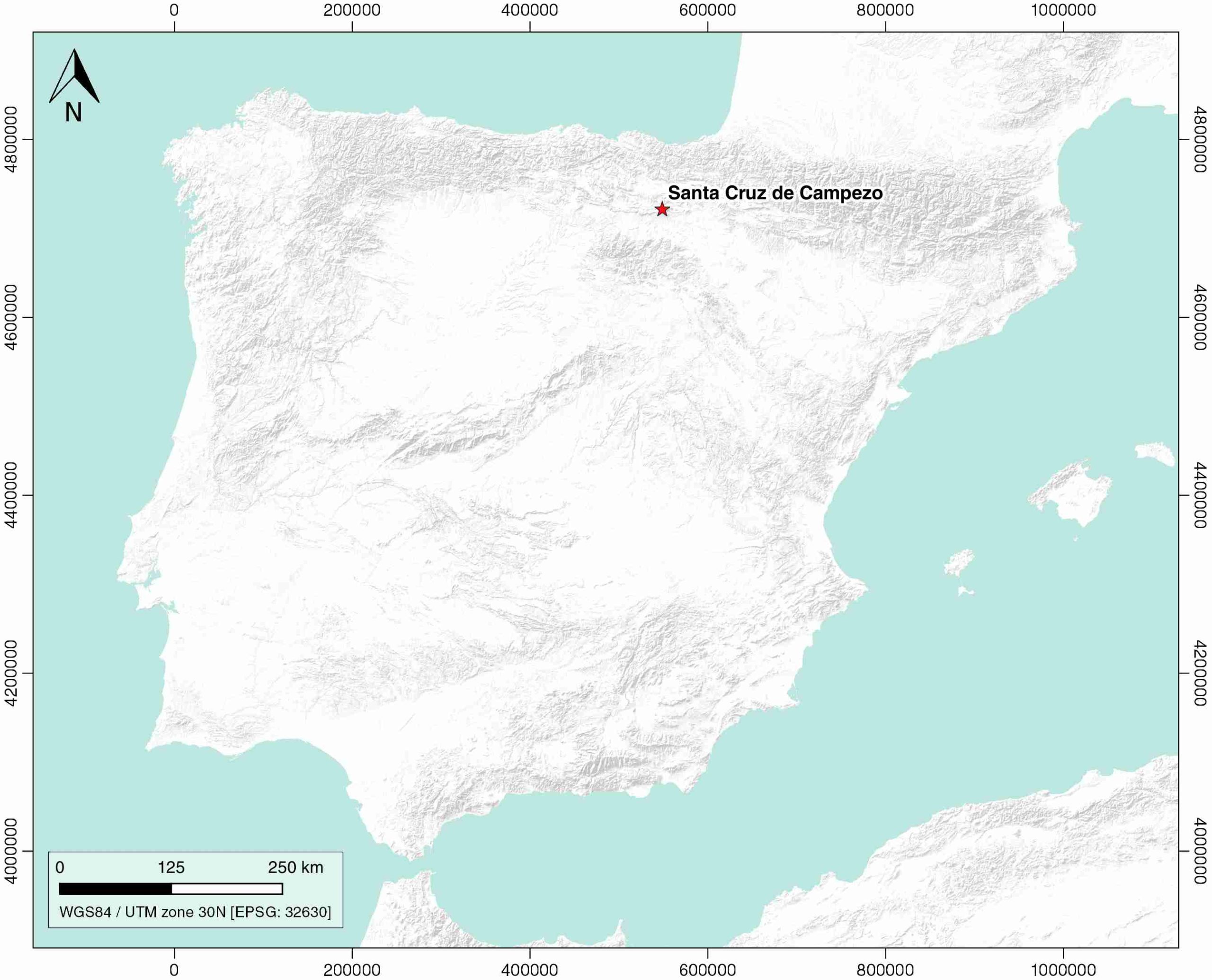
Santa Cruz de Campezo
ID #082
General Information
| Structure type | Evaporite Diapir |
| Deformed/Undeformed | Deformed |
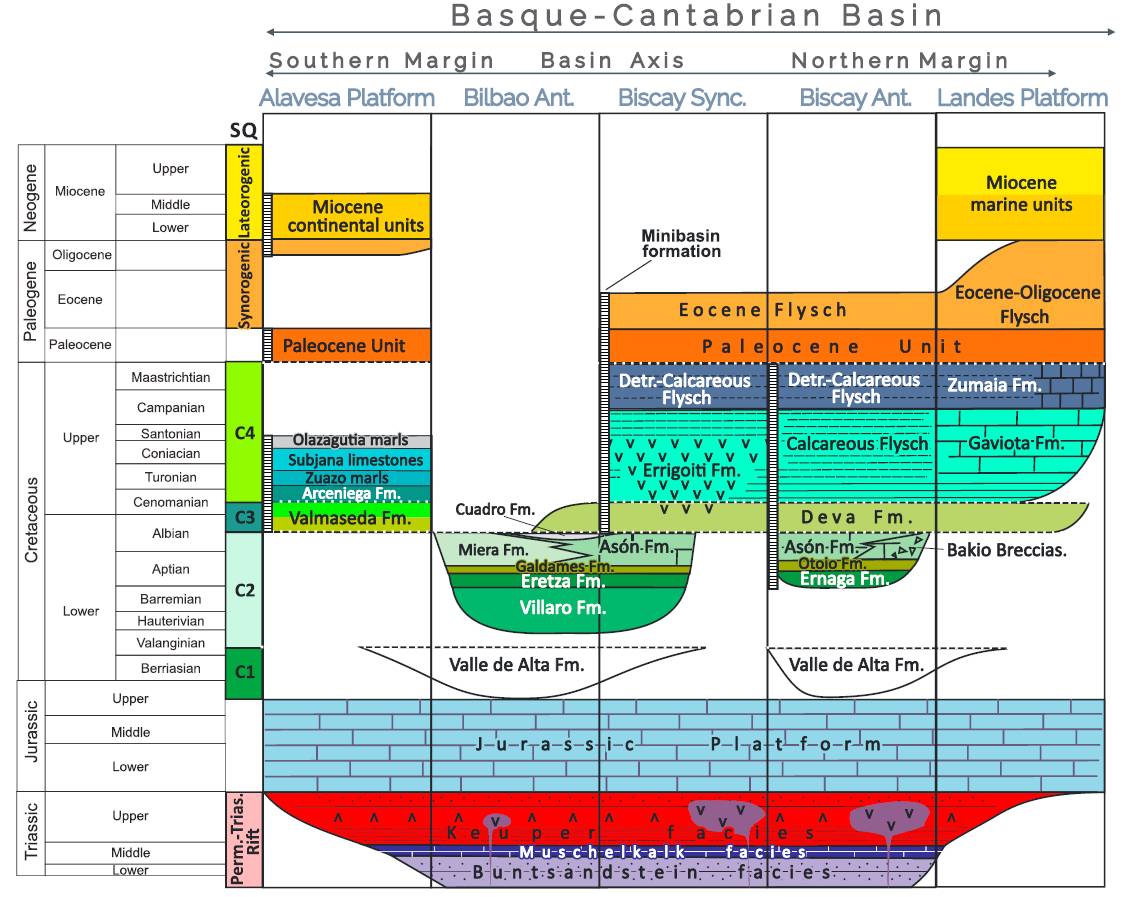
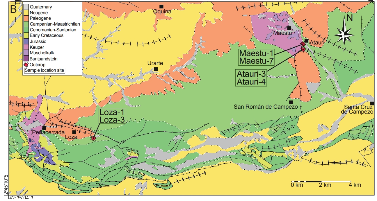
| Geological Setting | Basque-Cantabrian Basin, Navarra-Álava trough |
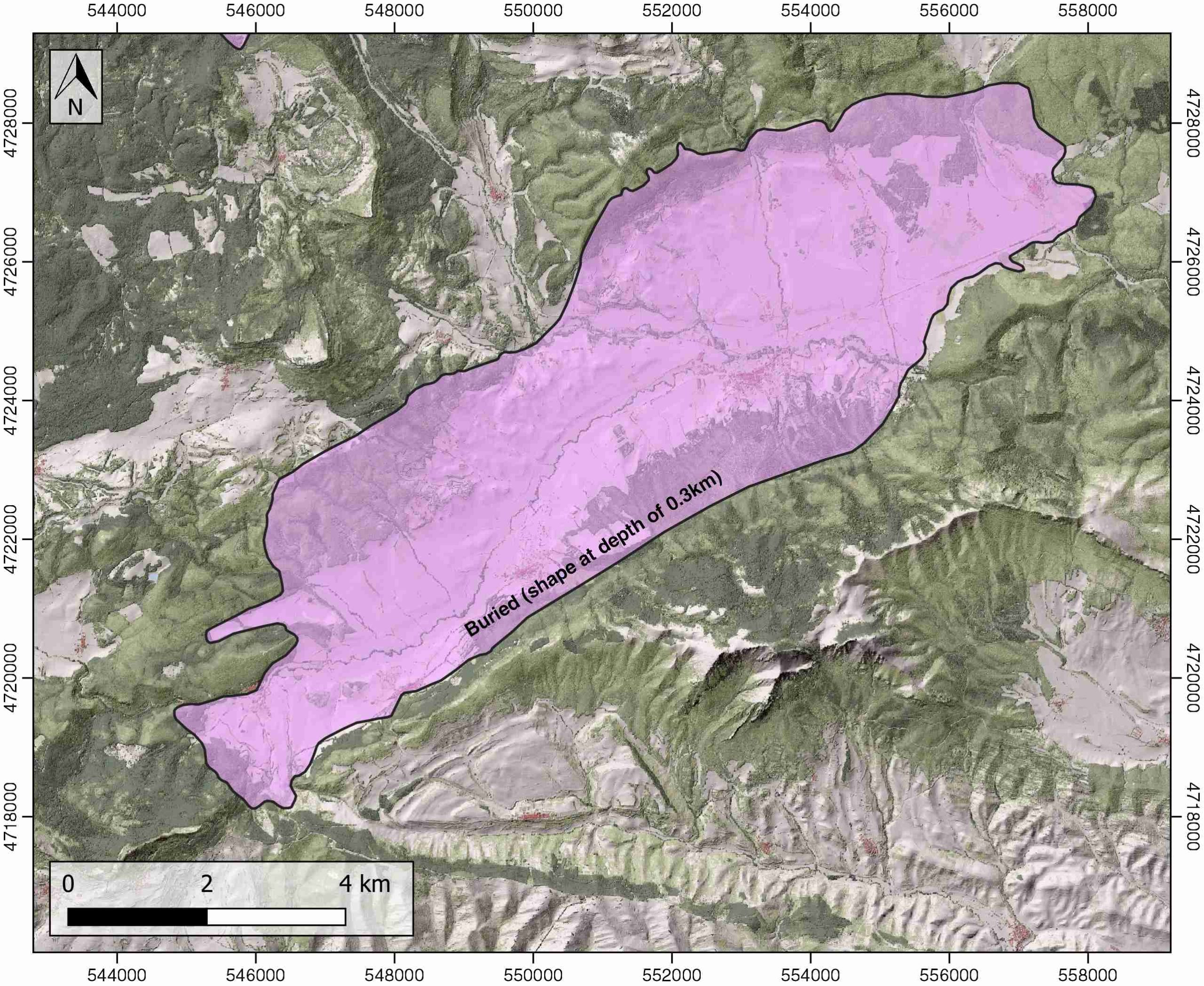
| Outcropping/buried | Buried |
| Evaporite unit/s name | Keuper facies |
| Evaporite unit/s age | Carnian-Rhaetian (Upper Triassic) |
| Evaporite unit/s origin | Marine |
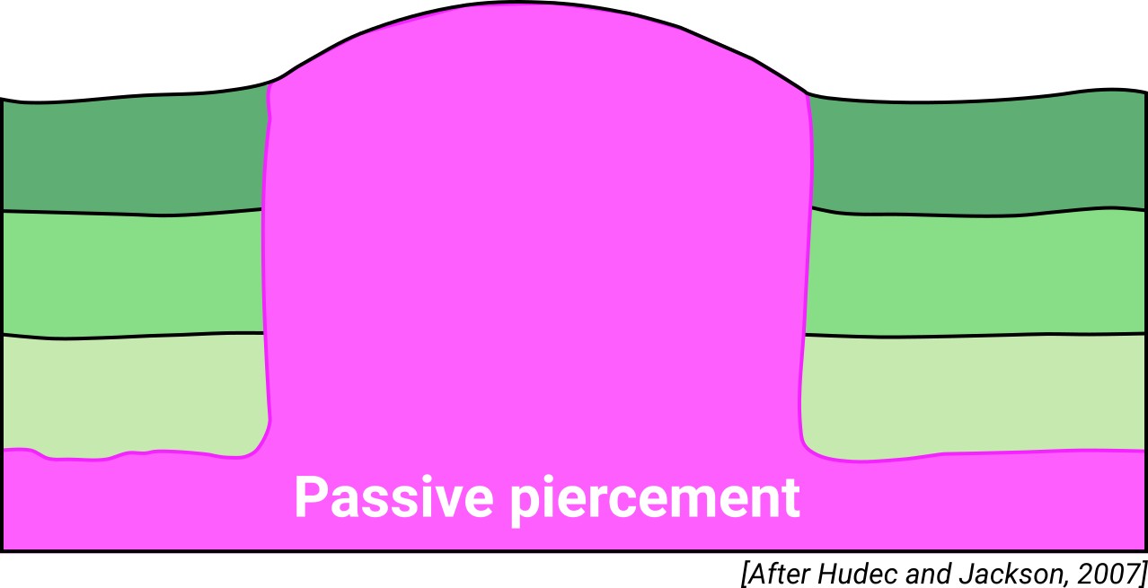
| Classif. (Hudec and Jackson, 2009) | Passive piercement |
| Classif. (Jackson and Talbot, 1986) | Salt stock |
| Age of evaporite flow or deformation (when deformed) | Lower Cretaceous, Paleocene-Eocene |
| Other comments | - |
Generic Data
| Unique ID | 82 |
| Name | Santa Cruz de Campezo |
| Structure type | Evaporite diapir |
| Deformed/Undeformed | Deformed |
| Buried/Outcropping | Buried |
| Geological setting | Basque-Cantabrian Basin |
| Geological Regional Setting | Navarra-Álava trough |
| Evaporite unit/s name | Keuper facies |
| Evaporite unit/s age | Carnian-Rhaetian (Upper Triassic) |
| Evaporite unit/s era | Mesozoic |
| Evaporite unit/s origin | Marine |
| Evaporite unit/s composition | Gypsum-Shale-Mudstone-Marlstone |
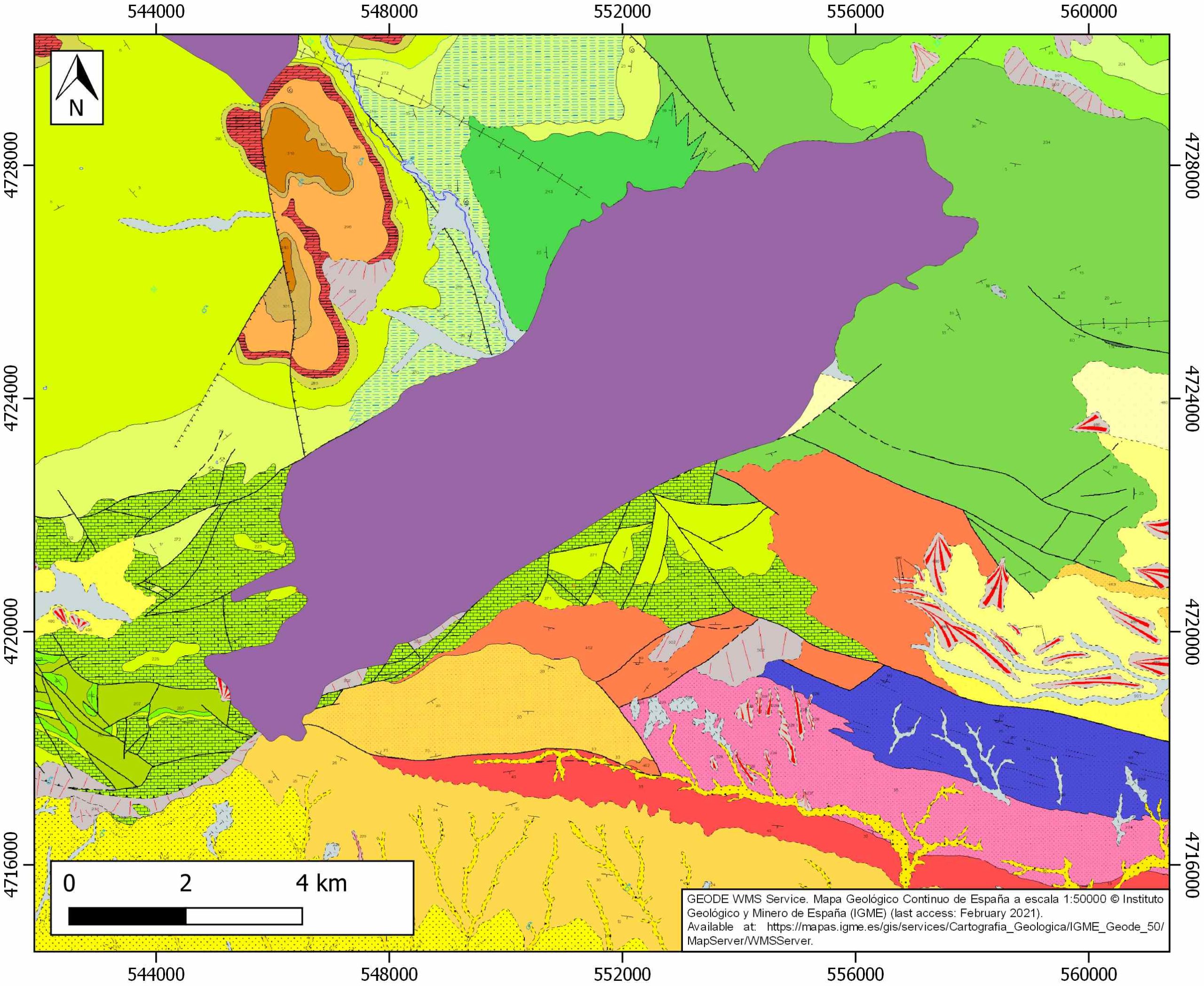
| Post-kinematic unit/s (or post-evaporite units when evaporites are undeformed) | Oligocene-Lower Miocene (shales, marlstones, sandstones and conglomerates) ; Upper Miocene (sandstones and conglomerates) ; Quaternary (alluvial and colluvial detrital deposits) |
| Post-kinematic unit/s age (or post-evaporite units when evaporites are undeformed) | Oligocene-Holocene |
| Classification (Hudec and Jackson, 2009) | Passive piercement |
| Classification (Jackson and Talbot, 1986) | Salt stock |
| Mining activity? | N |
| Mining activity start | |
| Mining activity end | |
| Mining galleries? | |
| Mining products | |
| Mining sub-products | |
| Evaporite flow? | Y |
| Age of evaporite flow | Valanginian – Albian (early stage) and Danian – Priabonian (main stage) |
| Flow or deformation triggering mechanisms | NE-SW extensional faults |
| Flow-linked structures? | Y |
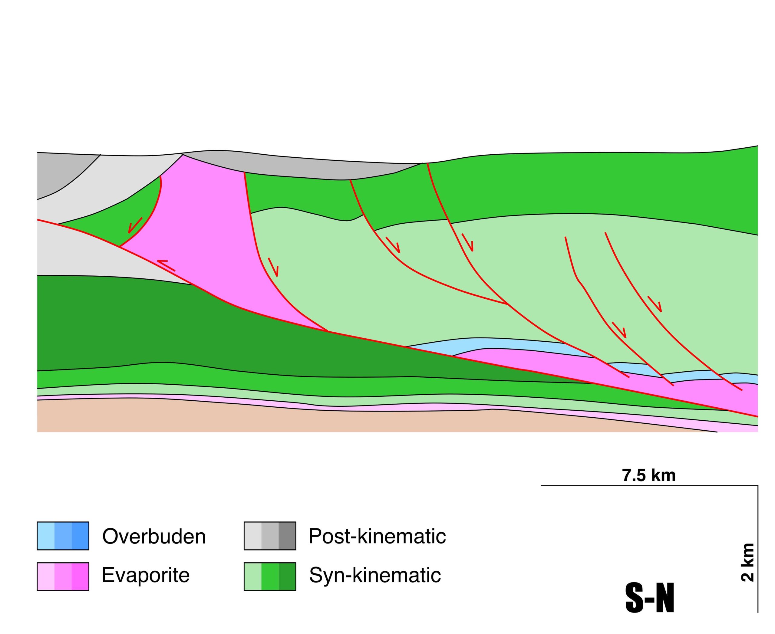
| Halokinetic structures | Progressive unconformities / radial normal and thrust faults / radial joints / thickness variations |
| Post-evaporite and pre-kinematic unit/s (overbuden) | Jurassic (dolostones, marls and oolitic limestones) |
| Syn-kinematic unit/s | Upper Weald facies (sandstones) / Aptian-middle Albian (Urgonian Group: marlstones, marly limestones, packstones, carbonate brecchias, rudistid limestones; Punta del Bakio Unit: turbidites, mudstones and carbonate grainstones) / Danian-Selandian (dolomites and limestones) / Thanetian-Ypresian (limestones and marls) / Lutetian-Bartonian (limestones and marls) / Early Priabonian (marlstones, marly limestones) |
| Available seismic profiles | ELZ-3 / C-95 / 6-D / ALL-5 / ZÑ81-1 / ELZ84-08 / ZÑ81-3 / CA-25 / D-3-1 / ELZ-4 / ZÑ81-2 / D-1-1 / ELZ-2 / 4-D / ELZ-84-10 / RI-25-1 / ALL-8 / ELZ-1 / ALL-3 / ELZ-3 / ELZ-84-10 |
| Available boreholes | ALDA-1 / CORRES-1 / ZUÑIGA-1 / GASTIAIN-1 / ANGOSTINA-1 |
| Additional comments | – |
Mining Data
| UNIQUE_ID | 82 |
| Minning exploitations within <2km? | N |
| Historical/Active | |
| Exploitation name #1 | |
| Exploitation ID (Spanish National Mining Cadastre) #1 | |
| Municipality #1 | |
| Province #1 | |
| Company #1 | |
| Main minning Products #1 | |
| Exploitation name #2 | |
| Exploitation ID (Spanish National Mining Cadastre) #2 | |
| Municipality #2 | |
| Province #2 | |
| Company #2 | |
| Main minning Products #2 | |
| Exploitation name #3 | |
| Exploitation ID (Spanish National Mining Cadastre) #3 | |
| Municipality #3 | |
| Province #3 | |
| Company #3 | |
| Main minning Products #3 |
Quantitative Data
| UNIQUE_ID | 82 |
| Outcropping area (km2) | Buried |
| Horizontal intersection area (km2) (when buried) | 50.27178 |
| Depth of intersection area (km2) (when buried) | 0.3 |
| Max. Width (Km) | 5.06275139 |
| Max. Length (Km) | 15.3302437 |
| Max. Evaporites thickness (km) | 1.5 |
| Max. Deformation age (Ma) | 139 |
| Min. Deformation age (Ma) | 34 |
| Deformation stages | 2 |
Reference Data
| UNIQUE_ID | 82 |
| Section source | Cámara, P., 2020. Inverted turtle salt anticlines in the eastern basque-cantabrian basin, Spain. Marine and Petroleum Geology, 104358. [link] |
| Well / Borehole availability #1 | Cámara, P., 2020. Inverted turtle salt anticlines in the eastern basque-cantabrian basin, Spain. Marine and Petroleum Geology, 104358. [link] |
| Well / Borehole availability #2 | Jurado, M. L., Riba, O., 1996. The Rioja Area (westernmost Ebro basin): a ramp valley with neighbouring piggybacks. In (Friend, P. F., Dabrio, C. J., eds.): Tertiary basins of Spain, p. 173-179. Cambridge Universiy Press. [link] |
| Available data (Stratigraphy) #1 | Cámara, P., 2017. Salt and Strike-Slip Tectonics as Main Drivers in the Structural Evolution of the Basque-Cantabrian Basin, Spain. In Permo-Triassic Salt Provinces of Europe, North Africa and the Atlantic Margins (pp. 371-393). Elsevier. [link] |
| Available data (Stratigraphy) #2 | Permanyer, A., Marfil, R., Martín-Martín, J. D., Estupinán, J., Márquez, G., Arroyo, X., 2015. Diagenetic evolution of the upper Cretaceous limestone and sandstone exhumed reservoirs in the western Basque–Cantabrian Basin, North Spain. Marine and Petroleum Geology, 66, 673-694. [link] |
| Available data (Stratigraphy) #3 | Carola, E., Muñoz, J. A., Roca, E., 2015. The transition from thick-skinned to thin-skinned tectonics in the Basque-Cantabrian Pyrenees: The Burgalesa Platform and surroundings. International Journal of Earth Sciences, 104(8), 2215-2239. [link] |
| Available data (Stratigraphy) #4 | Pedrera, A., García‐Senz, J., Ayala, C., Ruiz‐Constán, A., Rodríguez‐Fernández, L. R., Robador, A., González Menéndez, L., 2017. Reconstruction of the exhumed mantle across the North Iberian Margin by crustal‐scale 3‐D gravity inversion and geological cross section. Tectonics, 36, 3155-3177. [link] |
| Available data (Stratigraphy) #5 | López-Horgue, M. A., Owen, H. G., Rodrı́guez-Lázaro, J., Fernández-Mendiola, P. A., Garcı́a-Mondéjar, J., 1999. Late Albian–Early Cenomanian stratigraphic succession near Estella-Lizarra (Navarra, central northern Spain) and its regional and interregional correlation. Cretaceous Research, 20(4), 369-402. [link] |
| Available data (Stratigraphy) #6 | Cámara, P., 2020. Inverted turtle salt anticlines in the eastern basque-cantabrian basin, Spain. Marine and Petroleum Geology, 104358. [link] |
| Regional Stratigraphy | Pedrera, A., García‐Senz, J., Ayala, C., Ruiz‐Constán, A., Rodríguez‐Fernández, L. R., Robador, A., González Menéndez, L., 2017. Reconstruction of the exhumed mantle across the North Iberian Margin by crustal‐scale 3‐D gravity inversion and geological cross section. Tectonics, 36, 3155-3177. [link] |
| Seismic data availability #1 | Cámara, P., 2017. Salt and Strike-Slip Tectonics as Main Drivers in the Structural Evolution of the Basque-Cantabrian Basin, Spain. In Permo-Triassic Salt Provinces of Europe, North Africa and the Atlantic Margins (pp. 371-393). Elsevier. [link] |
| Seismic data availability #2 | Carola, E., Tavani, S., Ferrer, O., Granado, P., Quintà, A., Butillé, M., Muñoz, J. A., 2013. Along-strike extrusion at the transition between thin-and thick-skinned domains in the Pyrenean Orogen (northern Spain). Geological Society, London, Special Publications, 377(1), 119-140. [link] |
| Seismic data availability #3 | Cámara, P., 2020. Inverted turtle salt anticlines in the eastern basque-cantabrian basin, Spain. Marine and Petroleum Geology, 104358. [link] |
| Available data (Structure) #1 | Cámara, P., 2020. Inverted turtle salt anticlines in the eastern basque-cantabrian basin, Spain. Marine and Petroleum Geology, 104358. [link] |
| Available data (Structure) #2 | Muñoz, J. A., 2019. Alpine Orogeny: Deformation and Structure in the Northern Iberian Margin (Pyrenees sl). In (Quesada C., Oliveira J., eds.): The Geology of Iberia: A Geodynamic Approach, p. 433-451. Regional Geology Reviews, Springer, Cham. [link] |
| Available data (Structure) #3 | Carola, E., Muñoz, J. A., Roca, E., 2015. The transition from thick-skinned to thin-skinned tectonics in the Basque-Cantabrian Pyrenees: The Burgalesa Platform and surroundings. International Journal of Earth Sciences, 104(8), 2215-2239. [link] |
| Available data (Structure) #4 | Ábalos, B., Llanos, H. J., 1994. Structure of the Sierra de Cantabria (Southern Pyrenean Frontal Thrust, Basque Country, Spain): a new perspective from section balancing. Comptes rendus de l’Académie des sciences. Série 2. Sciences de la terre et des planètes, 319(4), 475-481. [link] |
| Available data (Structure) #5 | Cámara, P., 2017. Salt and Strike-Slip Tectonics as Main Drivers in the Structural Evolution of the Basque-Cantabrian Basin, Spain. In Permo-Triassic Salt Provinces of Europe, North Africa and the Atlantic Margins (pp. 371-393). Elsevier. [link] |
| Available data (Structure) #6 | Carola, E., Tavani, S., Ferrer, O., Granado, P., Quintà, A., Butillé, M., Muñoz, J. A., 2013. Along-strike extrusion at the transition between thin-and thick-skinned domains in the Pyrenean Orogen (northern Spain). Geological Society, London, Special Publications, 377(1), 119-140. [link] |
| Available data (Analogue modelling) #1 | n.a. |
| Available data (Analogue modelling) #2 | n.a. |
| Available data (Analogue modelling) #3 | n.a. |
| Available data (Gravimetry – Tomography) #1 | Pinto, V., Casas, A., Rivero, L., Torne, M., 2005. 3D gravity modeling of the Triassic salt diapirs of the Cubeta Alavesa (northern Spain). Tectonophysics, 405, 65-75. [link] |
| Available data (Gravimetry – Tomography) #2 | Pinto, V., Rivero, L., Ponsatí, A. C., 2000. Modelo gravimétrico de los diapiros de Estella y Alloz, y localización de nuevos diapiros no aflorantes en la zona sur de Atauri, Cubeta Alavesa. Revista de la Sociedad Geológica de España, 13(3), 529-538. [link] |
| Available data (Gravimetry – Tomography) #3 | Ayala, C., Bohoyo, F., Maestro, A., Reguera, M. I., Torne, M., Rubio, F., Fernández, M., García-Lobón, J. L., 2016. Updated Bouguer anomalies of the Iberian Peninsula: a new perspective to interpret the regional geology. Journal of Maps, 12(5), 1089-1092. [link] |
| Available data (Geochemistry) #1 | Ortí, F., García-Veigas, J., Rossell, L., Jurado, M. J., Utrilla, R., 1996. Formaciones salinas de las cuencas triásicas en la Península Ibérica: Caracterización Petrológica y Geoquímica. Cuadernos de Geología Ibérica, 20, 13-35. [link] |
| Available data (Geochemistry) #2 | Béziat, D., Joron, J.L., Monchoux, P., Treuil, M., Walgenwitz, F., 1991. Geodynamic implications of geochemical data for the Pyrenean ophites (Spain-France). Chemical Geology, 89, 243-262. [link] |
| Available data (Geochemistry) #3 | n.a. |
| Available data (Geochemistry) #4 | n.a. |
| Available data (Petrophysics) #1 | Llamas, B., Castañeda, M. C., Laín, C., Pous, J., 2017. Study of the Basque–Cantabrian basin as a suitable region for the implementation of an energy storage system based on compressed air energy storage (CAES). Environmental Earth Sciences, 76(5), 204. [link] |
| Available data (Petrophysics) #2 | Soto, R., Beamud, E., Roca, E., Carola, E., Almar, Y., 2017. Distinguishing the effect of diapir growth on magnetic fabrics of syn-diapiric overburden rocks: Basque-Cantabrian basin, Northern Spain. Terra Nova 29, 191-201. [link] |
| IGME Geological Map (MAGNA50) Sheet number | 171-Viana. [link] and 139-Eulate. [link] |
| Other Maps #1 (source) | Perona, J., 2016. Mineralizaciones de Pb-Zn asociadas a los diapiros de Murguía y Orduña (Cuenca Vasco-Cantábrica) [PhD thesis]: Barcelona, Universitat de Barcelona, 281 pp. [link] |
| Other Maps #2 (source) | Marín, P., Márquez, G., Gallego, J. R., Permanyer, A., 2014. Characterization of asphaltic oil occurrences from the southeastern margin of the Basque-Cantabrian Basin, Spain. Geologica Acta, 12(4), 327-342. [link] |
| Other related references #1 | Larrasoaña, J.C., Parés, J.M., del Valle, J., Millán, H., 2003. Triassic paleomagnetism from the Western Pyrenees revisited: implications for the Iberian-Eurasian Mesozoic plate boundary. Tectonophysics 362 (1–4), 161–182. [link] |
| Other related references #2 | Ábalos, B., 2016. Geologic map of the Basque-Cantabrian Basin and a new tectonic interpretation of the Basque Arc. International Journal of Earth Sciences, 105, 2327-2354. [link] |
| Other related references #3 | Rios, J. M., 1948. Mapa Geológico de la Zona Cántabro-Navarra con las chimeneas salinas diapíricas de Salinas de Rosío, Villasana de Mena, Orduña, Murguía, Salinas de Añana, Maestu, Estella, Lácar, Salinas de Oro, Goñi y Atondo (scale 1/300.000, 80 × 34 cm). In: “Diapirismo”. Boletín del Instituto Geológico y Minero de España, 60, pp 153–390. [link] |
| Other related references #4 | Sanz, T., Lago, M., Gil, A., Galé, C., Ramajo, J., Ubide, T., Pocoví, A., Tierz, P., Larrea, P., 2013. The Upper Triassic alkaline magmatism in the NW Iberian Chain (Spain). Journal of Iberian Geology, 39, 202-222. [link] |
Well and Seismic Data
| UNIQUE_ID | 82 |
| Seismic survey name #1 | 8C2-ELZ |
| Across structure? #1 | Y |
| Seismic profile ID (IGME) #1 | 9737 |
| Seismic profile code #1 | 14310 |
| Seismic profile name #1 | ELZ-3 |
| Seismic survey year #1 | 1983 |
| Data repository #1 | SIGEOF Data Catalogue (Section available under request). ©Instituto Geológico y Minero de España (IGME). https://info.igme.es/SIGEOF/ |
| Length (km) #1 | 20.93 |
| Seismic survey name #2 | 8C-ST-94 |
| Across structure? #2 | Y |
| Seismic profile ID (IGME) #2 | 13320 |
| Seismic profile code #2 | 18038 |
| Seismic profile name #2 | C-95 |
| Seismic survey year #2 | 1966 |
| Data repository #2 | SIGEOF Data Catalogue (Private access section). ©Instituto Geológico y Minero de España (IGME). https://info.igme.es/SIGEOF/ |
| Length (km) #2 | 2.20 |
| Seismic survey name #3 | 8C-ST-111 |
| Across structure? #3 | Y |
| Seismic profile ID (IGME) #3 | 13205 |
| Seismic profile code #3 | 17923 |
| Seismic profile name #3 | 6-D |
| Seismic survey year #3 | 1959 |
| Data repository #3 | SIGEOF Data Catalogue (Private access section). ©Instituto Geológico y Minero de España (IGME). https://info.igme.es/SIGEOF/ |
| Length (km) #3 | 2.44 |
| Seismic survey name #4 | 8C2-ALL |
| Across structure? #4 | Y |
| Seismic profile ID (IGME) #4 | 9720 |
| Seismic profile code #4 | 14293 |
| Seismic profile name #4 | ALL-5 |
| Seismic survey year #4 | 1983 |
| Data repository #4 | SIGEOF Data Catalogue (Section available under request). ©Instituto Geológico y Minero de España (IGME). https://info.igme.es/SIGEOF/ |
| Length (km) #4 | 34.66 |
| Seismic survey name #5 | 8C2-ZN81 |
| Across structure? #5 | Y |
| Seismic profile ID (IGME) #5 | 9771 |
| Seismic profile code #5 | 14344 |
| Seismic profile name #5 | ZÑ81-1 |
| Seismic survey year #5 | 1981 |
| Data repository #5 | SIGEOF Data Catalogue (Private access section). ©Instituto Geológico y Minero de España (IGME). https://info.igme.es/SIGEOF/ |
| Length (km) #5 | 10.59 |
| Seismic survey name #6 | 8C2-ELZ84 |
| Across structure? #6 | Y |
| Seismic profile ID (IGME) #6 | 9743 |
| Seismic profile code #6 | 14316 |
| Seismic profile name #6 | ELZ84-08 |
| Seismic survey year #6 | 1984 |
| Data repository #6 | SIGEOF Data Catalogue (Section available under request). ©Instituto Geológico y Minero de España (IGME). https://info.igme.es/SIGEOF/ |
| Length (km) #6 | 23.27 |
| Seismic survey name #7 | 8C2-ALL |
| Across structure? #7 | Y |
| Seismic profile ID (IGME) #7 | 9721 |
| Seismic profile code #7 | 14294 |
| Seismic profile name #7 | ZÑ81-3 |
| Seismic survey year #7 | 1983 |
| Data repository #7 | SIGEOF Data Catalogue (Private access section). ©Instituto Geológico y Minero de España (IGME). https://info.igme.es/SIGEOF/ |
| Length (km) #7 | 22.40 |
| Seismic survey name #8 | 8C-ST-95 |
| Across structure? #8 | Y |
| Seismic profile ID (IGME) #8 | 13341 |
| Seismic profile code #8 | 18059 |
| Seismic profile name #8 | CA-25 |
| Seismic survey year #8 | 1967 |
| Data repository #8 | SIGEOF Data Catalogue (Private access section). ©Instituto Geológico y Minero de España (IGME). https://info.igme.es/SIGEOF/ |
| Length (km) #8 | 7.52 |
| Seismic survey name #9 | 8C-ST-110 |
| Across structure? #9 | Y |
| Seismic profile ID (IGME) #9 | 13185 |
| Seismic profile code #9 | 17903 |
| Seismic profile name #9 | D-3-1 |
| Seismic survey year #9 | 1953 |
| Data repository #9 | SIGEOF Data Catalogue (Private access section). ©Instituto Geológico y Minero de España (IGME). https://info.igme.es/SIGEOF/ |
| Length (km) #9 | 1.87 |
| Seismic survey name #10 | 8C2-ELZ |
| Across structure? #10 | Y |
| Seismic profile ID (IGME) #10 | 9736 |
| Seismic profile code #10 | 14309 |
| Seismic profile name #10 | ELZ-4 |
| Seismic survey year #10 | 1983 |
| Data repository #10 | SIGEOF Data Catalogue (Section available under request). ©Instituto Geológico y Minero de España (IGME). https://info.igme.es/SIGEOF/ |
| Length (km) #10 | 17.00 |
| Seismic survey name #11 | 8C3-ZN81 |
| Across structure? #11 | Y |
| Seismic profile ID (IGME) #11 | 9799 |
| Seismic profile code #11 | 14372 |
| Seismic profile name #11 | ZÑ81-2 |
| Seismic survey year #11 | 1981 |
| Data repository #11 | SIGEOF Data Catalogue (Private access section). ©Instituto Geológico y Minero de España (IGME). https://info.igme.es/SIGEOF/ |
| Length (km) #11 | 8.49 |
| Seismic survey name #12 | 8C-ST-110 |
| Across structure? #12 | Y |
| Seismic profile ID (IGME) #12 | 13200 |
| Seismic profile code #12 | 17918 |
| Seismic profile name #12 | D-1-1 |
| Seismic survey year #12 | 1953 |
| Data repository #12 | SIGEOF Data Catalogue (Private access section). ©Instituto Geológico y Minero de España (IGME). https://info.igme.es/SIGEOF/ |
| Length (km) #12 | 1.85 |
| Seismic survey name #13 | 8C3-ELZ |
| Across structure? #13 | Y |
| Seismic profile ID (IGME) #13 | 9775 |
| Seismic profile code #13 | 14348 |
| Seismic profile name #13 | ELZ-2 |
| Seismic survey year #13 | 1983 |
| Data repository #13 | SIGEOF Data Catalogue (Section available under request). ©Instituto Geológico y Minero de España (IGME). https://info.igme.es/SIGEOF/ |
| Length (km) #13 | 21.42 |
| Seismic survey name #14 | 8C-ST-111 |
| Across structure? #14 | Y |
| Seismic profile ID (IGME) #14 | 13207 |
| Seismic profile code #14 | 17925 |
| Seismic profile name #14 | 4-D |
| Seismic survey year #14 | 1959 |
| Data repository #14 | SIGEOF Data Catalogue (Private access section). ©Instituto Geológico y Minero de España (IGME). https://info.igme.es/SIGEOF/ |
| Length (km) #14 | 5.26 |
| Seismic survey name #15 | 8C2-ELZ84 |
| Across structure? #15 | Y |
| Seismic profile ID (IGME) #15 | 9741 |
| Seismic profile code #15 | 14314 |
| Seismic profile name #15 | ELZ-84-10 |
| Seismic survey year #15 | 1984 |
| Data repository #15 | SIGEOF Data Catalogue (Section available under request). ©Instituto Geológico y Minero de España (IGME). https://info.igme.es/SIGEOF/ |
| Length (km) #15 | 11.22 |
| Seismic survey name #16 | 8C3-RI |
| Across structure? #16 | Y |
| Seismic profile ID (IGME) #16 | 9787 |
| Seismic profile code #16 | 14360 |
| Seismic profile name #16 | RI-25-1 |
| Seismic survey year #16 | 1975 |
| Data repository #16 | SIGEOF Data Catalogue (Private access section). ©Instituto Geológico y Minero de España (IGME). https://info.igme.es/SIGEOF/ |
| Length (km) #16 | 10.23 |
| Seismic survey name #17 | 8C3-ALL |
| Across structure? #17 | N (within 3km) |
| Seismic profile ID (IGME) #17 | 9773 |
| Seismic profile code #17 | 14346 |
| Seismic profile name #17 | ALL-8 |
| Seismic survey year #17 | 1983 |
| Data repository #17 | SIGEOF Data Catalogue (Section available under request). ©Instituto Geológico y Minero de España (IGME). https://info.igme.es/SIGEOF/ |
| Length (km) #17 | 15.64 |
| Seismic survey name #18 | 8C2-ELZ |
| Across structure? #18 | N (within 3km) |
| Seismic profile ID (IGME) #18 | 9740 |
| Seismic profile code #18 | 14313 |
| Seismic profile name #18 | ELZ-1 |
| Seismic survey year #18 | 1983 |
| Data repository #18 | SIGEOF Data Catalogue (Section available under request). ©Instituto Geológico y Minero de España (IGME). https://info.igme.es/SIGEOF/ |
| Length (km) #18 | 16.50 |
| Seismic survey name #19 | 8C2-ALL |
| Across structure? #19 | N (within 3km) |
| Seismic profile ID (IGME) #19 | 9722 |
| Seismic profile code #19 | 14295 |
| Seismic profile name #19 | ALL-3 |
| Seismic survey year #19 | 1983 |
| Data repository #19 | SIGEOF Data Catalogue (Section available under request). ©Instituto Geológico y Minero de España (IGME). https://info.igme.es/SIGEOF/ |
| Length (km) #19 | 23.00 |
| Seismic survey name #20 | 8C2-ELZ |
| Across structure? #20 | N (within 3km) |
| Seismic profile ID (IGME) #20 | 9737 |
| Seismic profile code #20 | 14310 |
| Seismic profile name #20 | ELZ-3 |
| Seismic survey year #20 | 1983 |
| Data repository #20 | SIGEOF Data Catalogue (Section available under request). ©Instituto Geológico y Minero de España (IGME). https://info.igme.es/SIGEOF/ |
| Length (km) #20 | 20.93 |
| Seismic survey name #21 | 8C2-ELZ84 |
| Across structure? #21 | N (within 3km) |
| Seismic profile ID (IGME) #21 | 9741 |
| Seismic profile code #21 | 14314 |
| Seismic profile name #21 | ELZ-84-10 |
| Seismic survey year #21 | 1984 |
| Data repository #21 | SIGEOF Data Catalogue (Section available under request). ©Instituto Geológico y Minero de España (IGME). https://info.igme.es/SIGEOF/ |
| Length (km) #21 | 11.22 |
| Borehole name #1 | ALDA-1 |
| Company #1 | SHELL/CEPSA |
| Traget #1 | HYDROCARBONS |
| Across structure? #1 | N (within 5 km) |
| Borehole name #2 | CORRES-1 |
| Company #2 | SHELL/CEPSA |
| Traget #2 | HYDROCARBONS |
| Across structure? #2 | N (within 5 km) |
| Borehole name #3 | ZUÑIGA-1 |
| Company #3 | CEPSA |
| Traget #3 | HYDROCARBONS |
| Across structure? #3 | N (within 5 km) |
| Borehole name #4 | GASTIAIN-1 |
| Company #4 | CEPSA/FINA |
| Traget #4 | HYDROCARBONS |
| Across structure? #4 | N (within 5 km) |
| Borehole name #5 | ANGOSTINA-1 |
| Company #5 | EVE |
| Traget #5 | HYDROGEOLOGY |
| Across structure? #5 | N (within 5 km) |
| Borehole name #6 | |
| Company #6 | |
| Traget #6 | |
| Across structure? #6 | |
| Borehole name #7 | |
| Company #7 | |
| Traget #7 | |
| Across structure? #7 | |
| Borehole name #8 | |
| Company #8 | |
| Traget #8 | |
| Across structure? #8 | |
| Borehole name #9 | |
| Company #9 | |
| Traget #9 | |
| Across structure? #9 | |
| Borehole name #10 | |
| Company #10 | |
| Traget #10 | |
| Across structure? #10 | |
| Borehole name #11 | |
| Company #11 | |
| Traget #11 | |
| Across structure? #11 | |
| Borehole name #12 | |
| Company #12 | |
| Traget #12 | |
| Across structure? #12 | |
| Borehole name #13 | |
| Company #13 | |
| Traget #13 | |
| Across structure? #13 | |
| Borehole name #14 | |
| Company #14 | |
| Traget #14 | |
| Across structure? #14 | |
| Borehole name #15 | |
| Company #15 | |
| Traget #15 | |
| Across structure? #15 |
Geographical Data (EPSG:4326 - WGS 84)
| UNIQUE_ID | 82 |
| X Centroid (Structure shape) | -2.372205 |
| Y Centroid (Structure shape) | -2.372205 |
| Xmin (Structure shape) | -2.453362 |
| Xmax (Structure shape) | -2.290531 |
| Ymin (Structure shape) | 42.614111 |
| Ymax (Structure shape) | 42.707613 |
| Xmin seismic line #1 | -2.507474 |
| Xmax seismic line #1 | -2.255837 |
| Ymin seismic line #1 | 42.601602 |
| Ymax seismic line #1 | 42.631349 |
| Xmin seismic line #2 | -2.364820 |
| Xmax seismic line #2 | -2.352690 |
| Ymin seismic line #2 | 42.696453 |
| Ymax seismic line #2 | 42.713650 |
| Xmin seismic line #3 | -2.352498 |
| Xmax seismic line #3 | -2.347756 |
| Ymin seismic line #3 | 42.674487 |
| Ymax seismic line #3 | 42.696146 |
| Xmin seismic line #4 | -2.385704 |
| Xmax seismic line #4 | -2.373590 |
| Ymin seismic line #4 | 42.594195 |
| Ymax seismic line #4 | 42.905818 |
| Xmin seismic line #5 | -2.427335 |
| Xmax seismic line #5 | -2.301078 |
| Ymin seismic line #5 | 42.638397 |
| Ymax seismic line #5 | 42.652535 |
| Xmin seismic line #6 | -2.396078 |
| Xmax seismic line #6 | -2.119779 |
| Ymin seismic line #6 | 42.624294 |
| Ymax seismic line #6 | 42.666432 |
| Xmin seismic line #7 | -2.350115 |
| Xmax seismic line #7 | -2.327205 |
| Ymin seismic line #7 | 42.560391 |
| Ymax seismic line #7 | 42.760146 |
| Xmin seismic line #8 | -2.416266 |
| Xmax seismic line #8 | -2.335203 |
| Ymin seismic line #8 | 42.668545 |
| Ymax seismic line #8 | 42.699135 |
| Xmin seismic line #9 | -2.329493 |
| Xmax seismic line #9 | -2.310539 |
| Ymin seismic line #9 | 42.684905 |
| Ymax seismic line #9 | 42.694185 |
| Xmin seismic line #10 | -2.301350 |
| Xmax seismic line #10 | -2.270760 |
| Ymin seismic line #10 | 42.589919 |
| Ymax seismic line #10 | 42.741223 |
| Xmin seismic line #11 | -2.477634 |
| Xmax seismic line #11 | -2.399763 |
| Ymin seismic line #11 | 42.641100 |
| Ymax seismic line #11 | 42.690600 |
| Xmin seismic line #12 | -2.347409 |
| Xmax seismic line #12 | -2.338959 |
| Ymin seismic line #12 | 42.676080 |
| Ymax seismic line #12 | 42.691430 |
| Xmin seismic line #13 | -2.506810 |
| Xmax seismic line #13 | -2.245734 |
| Ymin seismic line #13 | 42.684416 |
| Ymax seismic line #13 | 42.687352 |
| Xmin seismic line #14 | -2.417755 |
| Xmax seismic line #14 | -2.364347 |
| Ymin seismic line #14 | 42.654787 |
| Ymax seismic line #14 | 42.680242 |
| Xmin seismic line #15 | -2.368681 |
| Xmax seismic line #15 | -2.361818 |
| Ymin seismic line #15 | 42.568928 |
| Ymax seismic line #15 | 42.669488 |
| Xmin seismic line #16 | -2.455130 |
| Xmax seismic line #16 | -2.400696 |
| Ymin seismic line #16 | 42.585164 |
| Ymax seismic line #16 | 42.667159 |
| Xmin seismic line #17 | -2.499011 |
| Xmax seismic line #17 | -2.412803 |
| Ymin seismic line #17 | 42.619127 |
| Ymax seismic line #17 | 42.744570 |
| Xmin seismic line #18 | -2.433359 |
| Xmax seismic line #18 | -2.233842 |
| Ymin seismic line #18 | 42.725887 |
| Ymax seismic line #18 | 42.734588 |
| Xmin seismic line #19 | -2.301716 |
| Xmax seismic line #19 | -2.210315 |
| Ymin seismic line #19 | 42.709679 |
| Ymax seismic line #19 | 42.904482 |
| Xmin seismic line #20 | -2.507474 |
| Xmax seismic line #20 | -2.255837 |
| Ymin seismic line #20 | 42.601602 |
| Ymax seismic line #20 | 42.631349 |
| Xmin seismic line #21 | -2.368681 |
| Xmax seismic line #21 | -2.361818 |
| Ymin seismic line #21 | 42.568928 |
| Ymax seismic line #21 | 42.669488 |
| X borehole #1 | -2.325630 |
| Y borehole #1 | 42.750263 |
| X borehole #2 | -2.462580 |
| Y borehole #2 | 42.684095 |
| X borehole #3 | -2.296746 |
| Y borehole #3 | 42.721929 |
| X borehole #4 | -2.273682 |
| Y borehole #4 | 42.732763 |
| X borehole #5 | -2.467555 |
| Y borehole #5 | 42.634722 |
| X borehole #6 | |
| Y borehole #6 | |
| X borehole #7 | |
| Y borehole #7 | |
| X borehole #8 | |
| Y borehole #8 | |
| X borehole #9 | |
| Y borehole #9 | |
| X borehole #10 | |
| Y borehole #10 | |
| X borehole #11 | |
| Y borehole #11 | |
| X borehole #12 | |
| Y borehole #12 | |
| X borehole #13 | |
| Y borehole #13 | |
| X borehole #14 | |
| Y borehole #14 | |
| X borehole #15 | |
| Y borehole #15 |

