General Information
| Structure type | Evaporite body |
| Deformed/Undeformed | Undeformed |
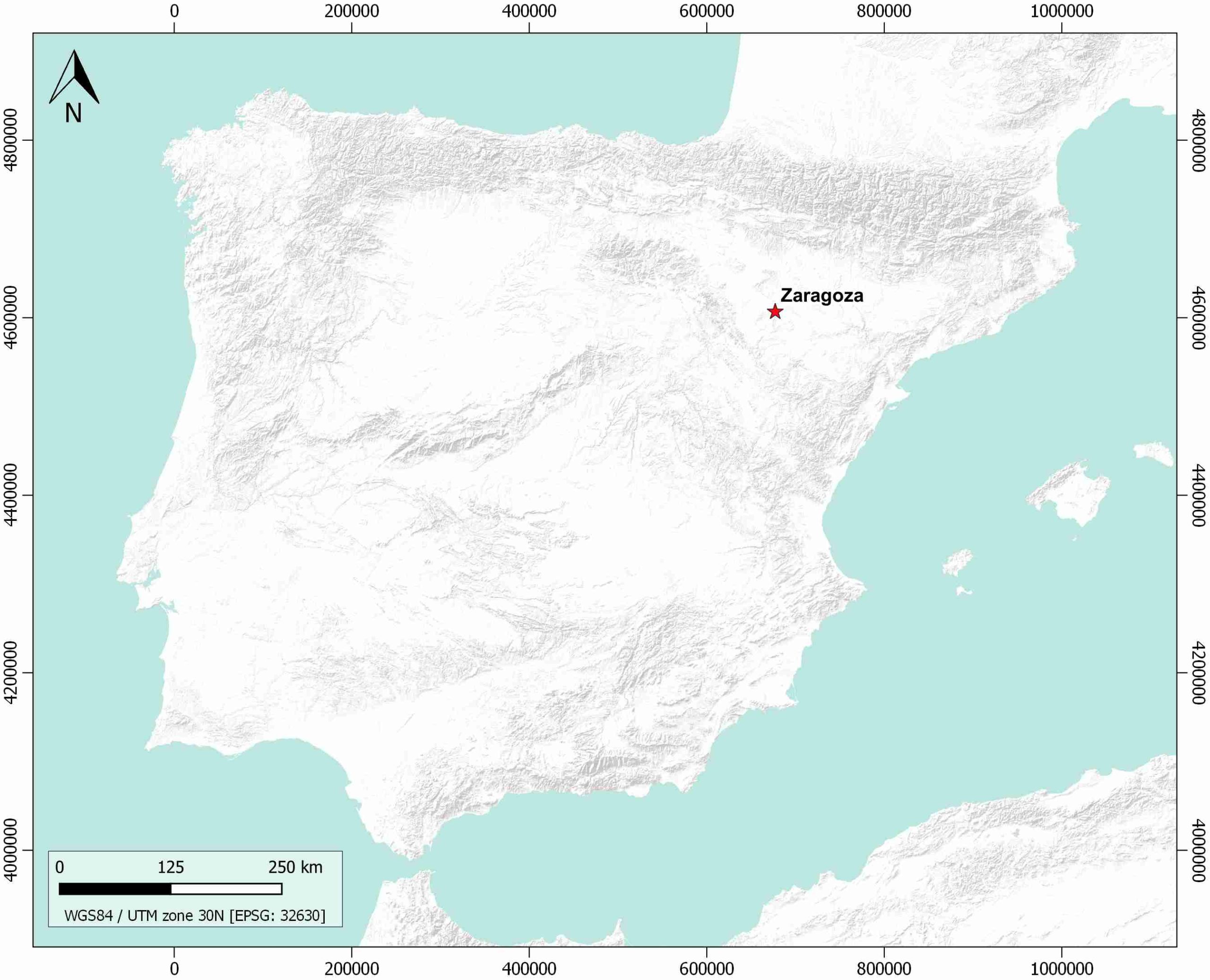
| Geological Setting | Ebro foreland basin, Northern-Central Domain |
| Outcropping/buried | Outcropping |
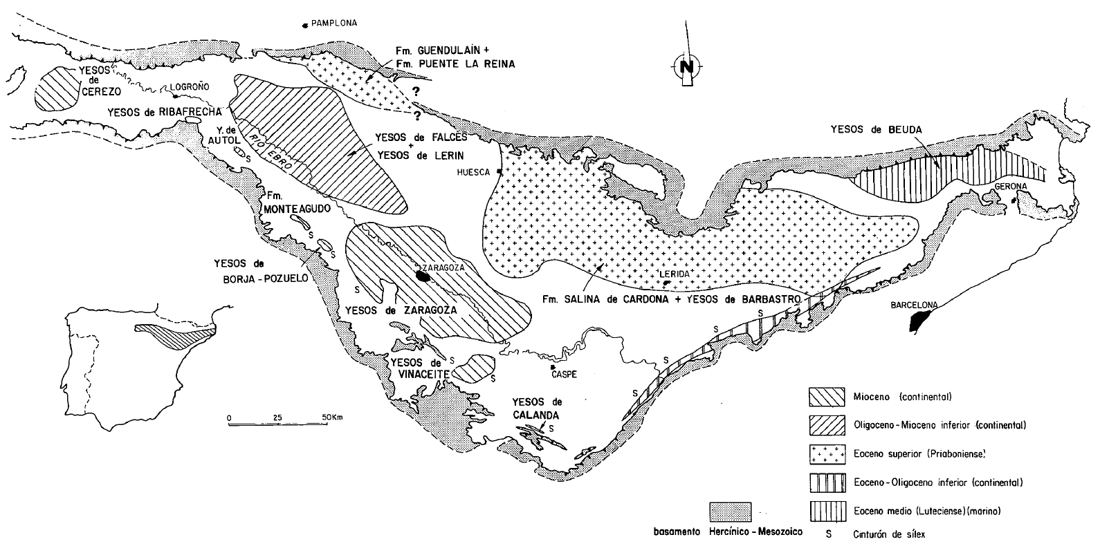
| Evaporite unit/s name | Zaragoza Fm. |
| Evaporite unit/s age | Lower-Middle Miocene |
| Evaporite unit/s origin | Continental |
| Classif. (Hudec and Jackson, 2009) | No diapirism |
| Classif. (Jackson and Talbot, 1986) | No diapirism |
| Age of evaporite flow or deformation (when deformed) | Undeformed |
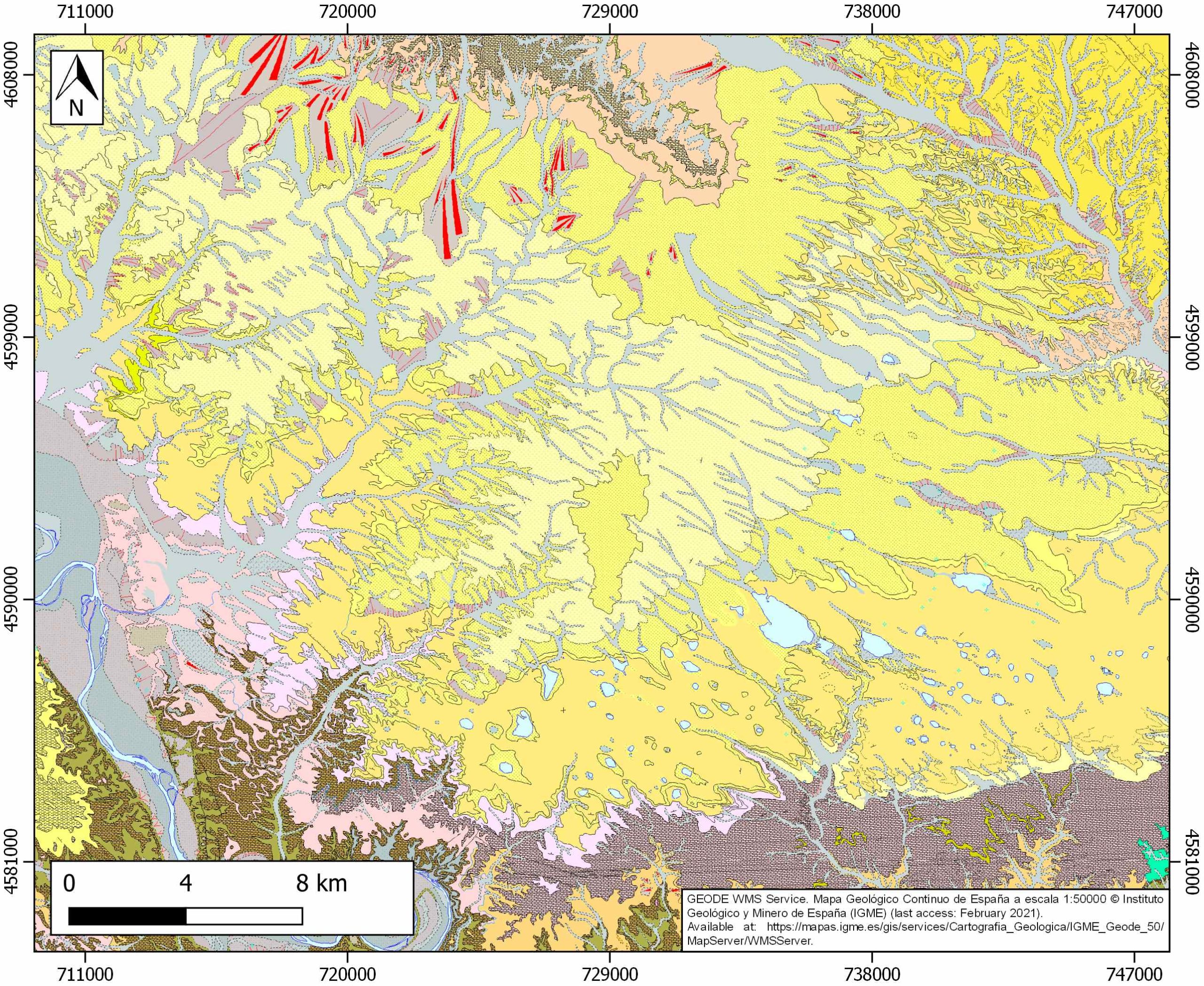
| Other comments | Laminated-to-nodular facies of secondary gypsum (derived from anhydrite hydration) interbedded with lutites. Towards the south, the evaporitic facies are interbedded with the distal alluvial fan deposits from the northern flank of the Iberian Chain (see Salvany et al., 2007). |
Generic Data
| Unique ID | 122 |
| Name | Zaragoza |
| Structure type | Evaporite body |
| Deformed/Undeformed | Undeformed |
| Buried/Outcropping | Outcropping |
| Geological setting | Ebro Basin |
| Geological Regional Setting | North-Central Sector |
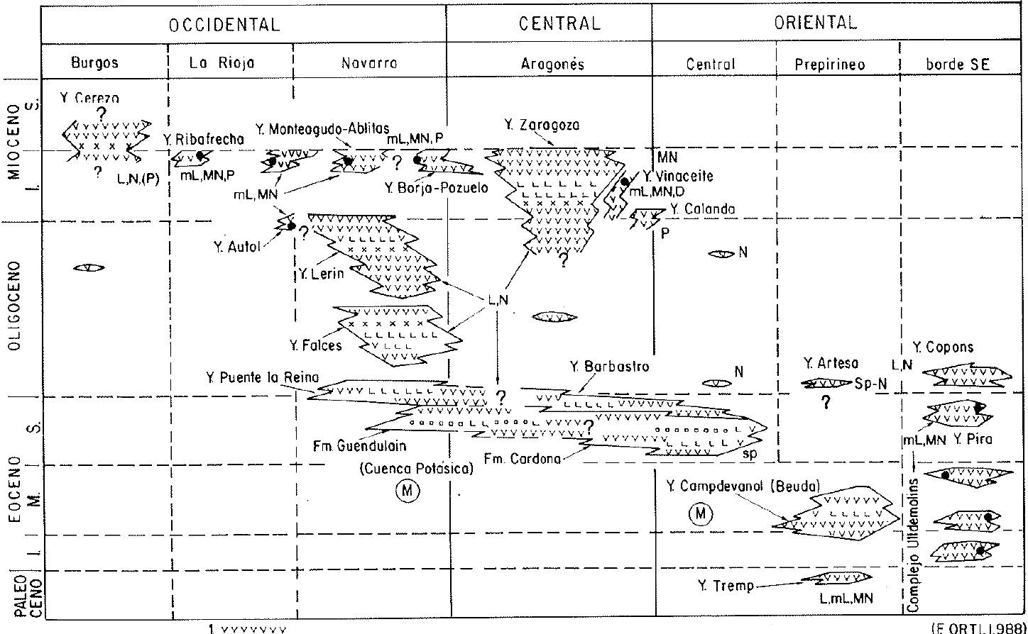
| Evaporite unit/s name | Zaragoza Fm. (Basal marls and anhydrite unit, halite unit, glauberiteUnnamedhalite unit and upper anhydrite unit) |
| Evaporite unit/s age | Lower Miocene |
| Evaporite unit/s era | Cenozoic |
| Evaporite unit/s origin | Continental (lacustrine) |
| Evaporite unit/s composition | Gypsum-Anhydrite-Halite-Glauberite-Claystonestone-Marlstone |
| Post-kinematic unit/s (or post-evaporite units when evaporites are undeformed) | Upper Miocene (Grey marlstones and limestones of the Montes de Castejón unit) ; Upper Miocene (marlstones and limestones of the San Caprasio unit) ; Quaternary (alluvial and colluvial detrital deposits) |
| Post-kinematic unit/s age (or post-evaporite units when evaporites are undeformed) | Upper Miocene-Holocene |
| Classification (Hudec and Jackson, 2009) | No diapirism |
| Classification (Jackson and Talbot, 1986) | No diapirism |
| Mining activity? | Y |
| Mining activity start | Roman Empire |
| Mining activity end | Active |
| Mining galleries? | Y |
| Mining products | Gypsum |
| Mining sub-products | Alabastrum |
| Evaporite flow? | N |
| Age of evaporite flow | – |
| Flow or deformation triggering mechanisms | – |
| Flow-linked structures? | – |
| Halokinetic structures | – |
| Post-evaporite and pre-kinematic unit/s (overbuden) | – |
| Syn-kinematic unit/s | – |
| Available seismic profiles | HL-04 / HL-16 / US-1 / US-2 / US-1 / ZW |
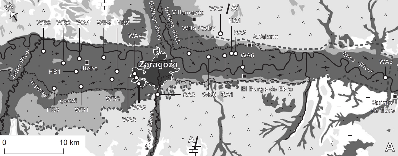
| Available boreholes | V-11-4 / V-12-1 / V-11-2 / V-11-3 / V-15-1 / V-15-2 / V-12-2 / V-12-3 / V-15-3 / V-15-4 / V-11-1 / MONEGRILLO-1 / FA-1 / VE-1A / PE-1 |
| Additional comments | Laminated-to-nodular facies of secondary gypsum (derived from anhydrite hydration) interbedded with lutites. Towards the south, the evaporitic facies are interbedded with the distal alluvial fan deposits from the northern flank of the Iberian Chain (see Salvany et al., 2007) |
Mining Data
| UNIQUE_ID | 122 |
| Minning exploitations within <2km? | Y |
| Historical/Active | Active |
| Exploitation name #1 | JOAN |
| Exploitation ID (Spanish National Mining Cadastre) #1 | 2473 |
| Municipality #1 | Fuentes de Ebro |
| Province #1 | ZARAGOZA |
| Company #1 | ALABASTRO BLANCO EUROPA S.L. |
| Main minning Products #1 | Gyupsum |
| Exploitation name #2 | YESOS ALFA |
| Exploitation ID (Spanish National Mining Cadastre) #2 | 2438 |
| Municipality #2 | Gelsa |
| Province #2 | ZARAGOZA |
| Company #2 | SAINT-GOBAIN PLACO IBERICA, SA |
| Main minning Products #2 | Gypsum |
| Exploitation name #3 | EPYSA II Y IV |
| Exploitation ID (Spanish National Mining Cadastre) #3 | 2441/2443 |
| Municipality #3 | Gelsa |
| Province #3 | ZARAGOZA |
| Company #3 | PLADUR GYPSUM, SA |
| Main minning Products #3 | Gypsum |
Quantitative Data
| UNIQUE_ID | 122 |
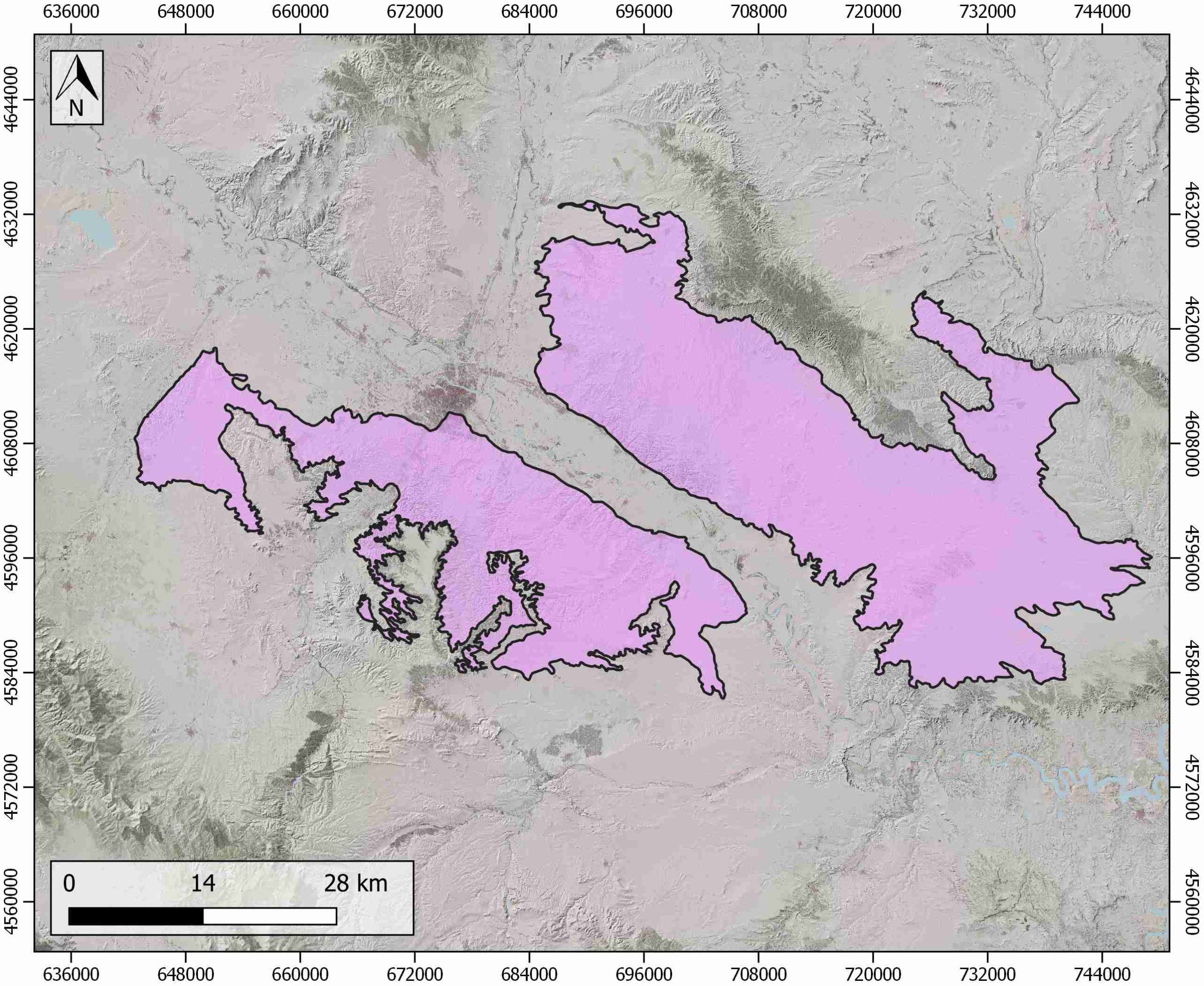
| Outcropping area (km2) | 2104.00306 |
| Horizontal intersection area (km2) (when buried) | Not buried |
| Depth of intersection area (km2) (when buried) | Not buried |
| Max. Width (Km) | 50.6032384 |
| Max. Length (Km) | 107.293053 |
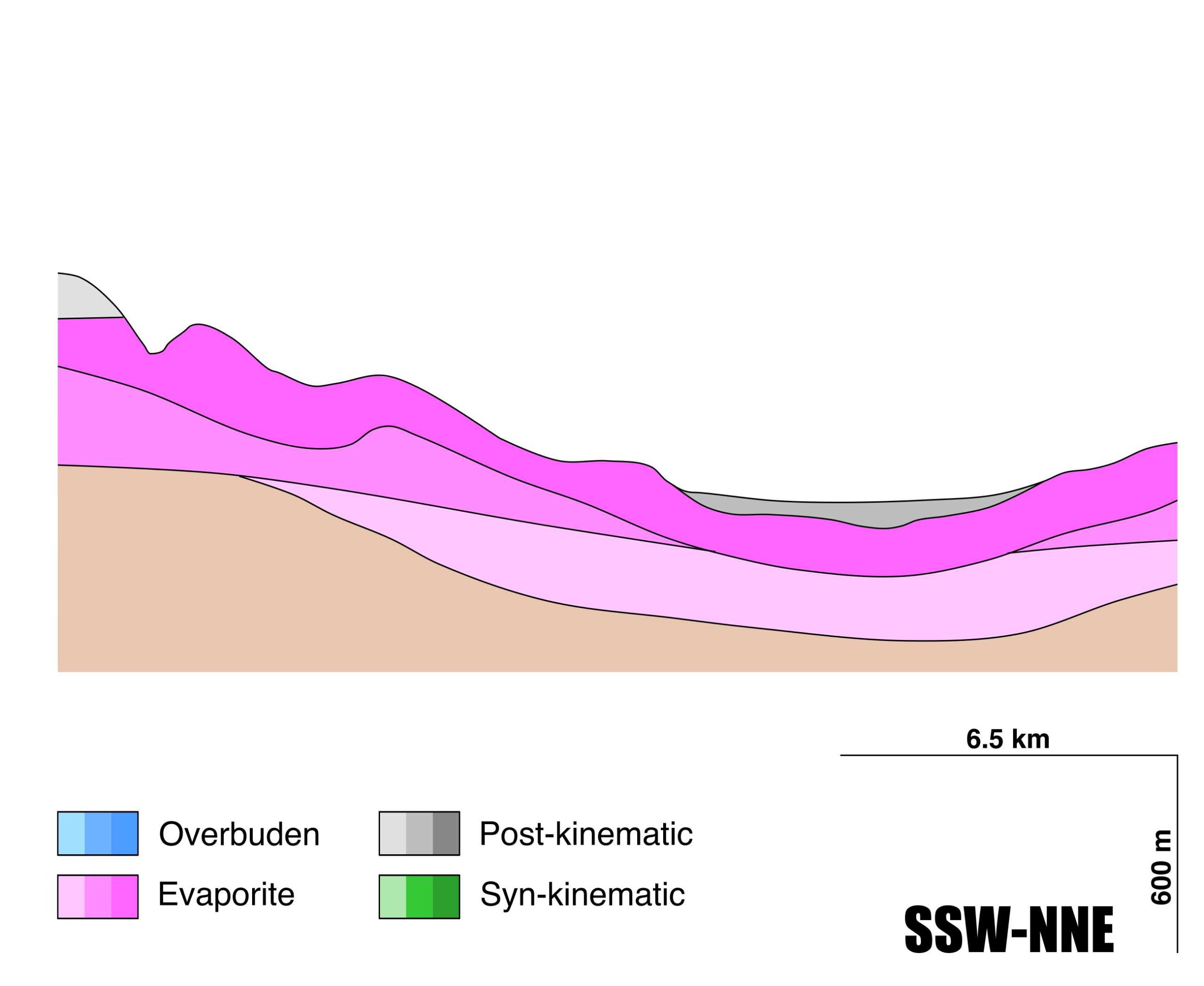
| Max. Evaporites thickness (km) | 0.85 |
| Max. Deformation age (Ma) | – |
| Min. Deformation age (Ma) | – |
| Deformation stages | 0 |
Reference Data
| UNIQUE_ID | 122 |
| Section source | Acero, P., Gutiérrez, F., Galve, J. P., Auqué, L. F., Carbonel, D., Gimeno, M. J., …, Yechieli, Y., 2013. Hydrogeochemical characterization of an evaporite karst area affected by sinkholes (Ebro Valley, NE Spain). Geologica Acta, 11(4), 389-407. [link] |
| Well / Borehole availability #1 | Salvany, J. M., García-Vegas, J., OrtI, F., 2007. Glauberite–halite association of the Zaragoza Gypsum Formation (Lower Miocene, Ebro Basin, NE Spain). Sedimentology, 54(2), 443-467. [link] |
| Well / Borehole availability #2 | Benito, G., Pérez-González, A., Gutiérrez, F., Machado, M. J., 1998. River response to Quaternary subsidence due to evaporite solution (Gállego River, Ebro Basin, Spain). Geomorphology, 22(3-4), 243-263. [link] |
| Available data (Stratigraphy) #1 | Salvany, J. M., García-Vegas, J., OrtI, F., 2007. Glauberite–halite association of the Zaragoza Gypsum Formation (Lower Miocene, Ebro Basin, NE Spain). Sedimentology, 54(2), 443-467. [link] |
| Available data (Stratigraphy) #2 | Larena, Z., Arenas, C., Baceta, J. I., Murelaga, X., Suarez-Hernando, O., 2020. Stratigraphy and sedimentology of distal-alluvial and lacustrine deposits of the western-central Ebro Basin (NE Iberia) reflecting the onset of the middle Miocene Climatic Optimum. Geologica Acta, 18, 1-26. [link] |
| Available data (Stratigraphy) #3 | Benito, G., Pérez-González, A., Gutiérrez, F., Machado, M. J., 1998. River response to Quaternary subsidence due to evaporite solution (Gállego River, Ebro Basin, Spain). Geomorphology, 22(3-4), 243-263. [link] |
| Available data (Stratigraphy) #4 | Acero, P., Gutiérrez, F., Galve, J. P., Auqué, L. F., Carbonel, D., Gimeno, M. J., …, Yechieli, Y., 2013. Hydrogeochemical characterization of an evaporite karst area affected by sinkholes (Ebro Valley, NE Spain). Geologica Acta, 11(4), 389-407. [link] |
| Available data (Stratigraphy) #5 | n.a. |
| Available data (Stratigraphy) #6 | n.a. |
| Regional Stratigraphy | Salvany, J. M., 1989. Los sistemas lacustres evaporíticos del sector navarro-riojano de la Cuenca del Ebro durante el Oligoceno y Mioceno inferior. Acta geológica hispánica, 231-241. [link] |
| Seismic data availability #1 | Cameselle, A. L., 2010. Mapping of Sedimentary Bodies by 3D Seismic Reflection Data. Application to the pre-Messinian Ebro Margin [Masters Thesis]: University of Barcelona, 93pp. [link] |
| Seismic data availability #2 | n.a. |
| Seismic data availability #3 | n.a. |
| Available data (Structure) #1 | Salvany, J. M., García-Vegas, J., OrtI, F., 2007. Glauberite–halite association of the Zaragoza Gypsum Formation (Lower Miocene, Ebro Basin, NE Spain). Sedimentology, 54(2), 443-467. [link] |
| Available data (Structure) #2 | Guerrero, J., Gutierrez, F., Lucha, P., 2004. Paleosubsidence and active subsidence due to evaporite dissolution in the Zaragoza area (Huerva River valley, NE Spain): processes, spatial distribution and protection measures for transport routes. Engineering Geology, 72(3-4), 309-329. [link] |
| Available data (Structure) #3 | Elorza, M. G., Santolalla, F. G., 1998. Geomorphology of the Tertiary gypsum formations in the Ebro Depression (Spain). Geoderma, 87(1-2), 1-29. [link] |
| Available data (Structure) #4 | Cameselle, A. L., 2010. Mapping of Sedimentary Bodies by 3D Seismic Reflection Data. Application to the pre-Messinian Ebro Margin [Masters Thesis]: University of Barcelona, 93pp. [link] |
| Available data (Structure) #5 | n.a. |
| Available data (Structure) #6 | n.a. |
| Available data (Analogue modelling) #1 | n.a. |
| Available data (Analogue modelling) #2 | n.a. |
| Available data (Analogue modelling) #3 | n.a. |
| Available data (Gravimetry – Tomography) #1 | Mochales, T., Casas, A. M., Pueyo, E. L., Pueyo, O., Román, M. T., Pocoví, A., …, Ansón, D., 2008. Detection of underground cavities by combining gravity, magnetic and ground penetrating radar surveys: a case study from the Zaragoza area, NE Spain. Environmental Geology, 53(5), 1067-1077. [link] |
| Available data (Gravimetry – Tomography) #2 | Ayala, C., Bohoyo, F., Maestro, A., Reguera, M. I., Torne, M., Rubio, F., Fernández, M., García-Lobón, J. L., 2016. Updated Bouguer anomalies of the Iberian Peninsula: a new perspective to interpret the regional geology. Journal of Maps, 12(5), 1089-1092. [link] |
| Available data (Gravimetry – Tomography) #3 | n.a. |
| Available data (Geochemistry) #1 | Salvany, J. M., García-Vegas, J., OrtI, F., 2007. Glauberite–halite association of the Zaragoza Gypsum Formation (Lower Miocene, Ebro Basin, NE Spain). Sedimentology, 54(2), 443-467. [link] |
| Available data (Geochemistry) #2 | Acero, P., Gutiérrez, F., Galve, J. P., Auqué, L. F., Carbonel, D., Gimeno, M. J., …, Yechieli, Y., 2013. Hydrogeochemical characterization of an evaporite karst area affected by sinkholes (Ebro Valley, NE Spain). Geologica Acta, 11(4), 389-407. [link] |
| Available data (Geochemistry) #3 | Moret-Fernández, D., Herrero, J., 2015. Effect of gypsum content on soil water retention. Journal of Hydrology, 528, 122-126. [link] |
| Available data (Geochemistry) #4 | n.a. |
| Available data (Petrophysics) #1 | n.a. |
| Available data (Petrophysics) #2 | n.a. |
| IGME Geological Map (MAGNA50) Sheet number | 411-Longares. [link] and 383-Zaragoza. [link] and 384-Fuentes de Ebro. [link] and 412-Pina de Ebro. [link] and 414-Bujaraloz. [link] |
| Other Maps #1 (source) | Utrilla, R.,Ortí, F.,, Pierre, C., Pueyo, J. J., 1991. Composición isotópica de las evaporitas terciarias continentales de la Cuenca del Ebro: relación con los ambientes deposicionales. Revista de la Sociedad Geológica de España, 4(3), 353-360. [link] |
| Other Maps #2 (source) | Acero, P., Gutiérrez, F., Galve, J. P., Auqué, L. F., Carbonel, D., Gimeno, M. J., …, Yechieli, Y., 2013. Hydrogeochemical characterization of an evaporite karst area affected by sinkholes (Ebro Valley, NE Spain). Geologica Acta, 11(4), 389-407. [link] |
| Other related references #1 | Torrescusa, S., Klimowitz, J., 1990. Contribución al conocimiento de las evaporitas miocenas (Formación Zaragoza) de la Cuenca del Ebro. In: Ortí, F., Salvany, J.M. (eds.). Formaciones evaporíticas de la Cuenca del Ebro y cadenas periféricas y de la zona de Levante. Barcelona, Empresa Nacional de Residuos Radiactivos, S.A. (ENRESA) and Departament de Geoquimica, Petrologia i Prospecció Geològica of the University of Barcelona (GPPG), 120-122. Unpublished. |
| Other related references #2 | Castaneda, C., Pourthie, N., Souyris, J. C., 2011. Dedicated SAR interferometric analysis to detect subtle deformation in evaporite areas around Zaragoza, NE Spain. International Journal of remote sensing, 32(7), 1861-1884. [link] |
| Other related references #3 | n.a. |
| Other related references #4 | n.a. |
Well and Seismic Data
| UNIQUE_ID | 122 |
| Seismic survey name #1 | DHLS |
| Across structure? #1 | Y |
| Seismic profile ID (IGME) #1 | 5617 |
| Seismic profile code #1 | 8641 |
| Seismic profile name #1 | HL-04 |
| Seismic survey year #1 | |
| Data repository #1 | SIGEOF Data Catalogue (Private access section). ©Instituto Geológico y Minero de España (IGME). https://info.igme.es/SIGEOF/ |
| Length (km) #1 | 61.78 |
| Seismic survey name #2 | DHLS |
| Across structure? #2 | Y |
| Seismic profile ID (IGME) #2 | 5625 |
| Seismic profile code #2 | 8649 |
| Seismic profile name #2 | HL-16 |
| Seismic survey year #2 | |
| Data repository #2 | SIGEOF Data Catalogue (Private access section). ©Instituto Geológico y Minero de España (IGME). https://info.igme.es/SIGEOF/ |
| Length (km) #2 | 74.77 |
| Seismic survey name #3 | 10D3-US |
| Across structure? #3 | Y |
| Seismic profile ID (IGME) #3 | 10114 |
| Seismic profile code #3 | 14742 |
| Seismic profile name #3 | US-1 |
| Seismic survey year #3 | 1977 |
| Data repository #3 | SIGEOF Data Catalogue (Section available under request). ©Instituto Geológico y Minero de España (IGME). https://info.igme.es/SIGEOF/ |
| Length (km) #3 | 39.16 |
| Seismic survey name #4 | 10D3-US |
| Across structure? #4 | N (within 3km) |
| Seismic profile ID (IGME) #4 | 10107 |
| Seismic profile code #4 | 14735 |
| Seismic profile name #4 | US-2 |
| Seismic survey year #4 | 1977 |
| Data repository #4 | SIGEOF Data Catalogue (Section available under request). ©Instituto Geológico y Minero de España (IGME). https://info.igme.es/SIGEOF/ |
| Length (km) #4 | 30.90 |
| Seismic survey name #5 | 10D3-US |
| Across structure? #5 | N (within 3km) |
| Seismic profile ID (IGME) #5 | 10114 |
| Seismic profile code #5 | 14742 |
| Seismic profile name #5 | US-1 |
| Seismic survey year #5 | 1977 |
| Data repository #5 | SIGEOF Data Catalogue (Section available under request). ©Instituto Geológico y Minero de España (IGME). https://info.igme.es/SIGEOF/ |
| Length (km) #5 | 39.16 |
| Seismic survey name #6 | 9E-ST-128 |
| Across structure? #6 | N (within 3km) |
| Seismic profile ID (IGME) #6 | 13707 |
| Seismic profile code #6 | 18428 |
| Seismic profile name #6 | ZW |
| Seismic survey year #6 | |
| Data repository #6 | SIGEOF Data Catalogue (Private access section). ©Instituto Geológico y Minero de España (IGME). https://info.igme.es/SIGEOF/ |
| Length (km) #6 | 6.60 |
| Seismic survey name #7 | |
| Across structure? #7 | |
| Seismic profile ID (IGME) #7 | |
| Seismic profile code #7 | |
| Seismic profile name #7 | |
| Seismic survey year #7 | |
| Data repository #7 | |
| Length (km) #7 | |
| Seismic survey name #8 | |
| Across structure? #8 | |
| Seismic profile ID (IGME) #8 | |
| Seismic profile code #8 | |
| Seismic profile name #8 | |
| Seismic survey year #8 | |
| Data repository #8 | |
| Length (km) #8 | |
| Seismic survey name #9 | |
| Across structure? #9 | |
| Seismic profile ID (IGME) #9 | |
| Seismic profile code #9 | |
| Seismic profile name #9 | |
| Seismic survey year #9 | |
| Data repository #9 | |
| Length (km) #9 | |
| Seismic survey name #10 | |
| Across structure? #10 | |
| Seismic profile ID (IGME) #10 | |
| Seismic profile code #10 | |
| Seismic profile name #10 | |
| Seismic survey year #10 | |
| Data repository #10 | |
| Length (km) #10 | |
| Seismic survey name #11 | |
| Across structure? #11 | |
| Seismic profile ID (IGME) #11 | |
| Seismic profile code #11 | |
| Seismic profile name #11 | |
| Seismic survey year #11 | |
| Data repository #11 | |
| Length (km) #11 | |
| Seismic survey name #12 | |
| Across structure? #12 | |
| Seismic profile ID (IGME) #12 | |
| Seismic profile code #12 | |
| Seismic profile name #12 | |
| Seismic survey year #12 | |
| Data repository #12 | |
| Length (km) #12 | |
| Seismic survey name #13 | |
| Across structure? #13 | |
| Seismic profile ID (IGME) #13 | |
| Seismic profile code #13 | |
| Seismic profile name #13 | |
| Seismic survey year #13 | |
| Data repository #13 | |
| Length (km) #13 | |
| Seismic survey name #14 | |
| Across structure? #14 | |
| Seismic profile ID (IGME) #14 | |
| Seismic profile code #14 | |
| Seismic profile name #14 | |
| Seismic survey year #14 | |
| Data repository #14 | |
| Length (km) #14 | |
| Seismic survey name #15 | |
| Across structure? #15 | |
| Seismic profile ID (IGME) #15 | |
| Seismic profile code #15 | |
| Seismic profile name #15 | |
| Seismic survey year #15 | |
| Data repository #15 | |
| Length (km) #15 | |
| Seismic survey name #16 | |
| Across structure? #16 | |
| Seismic profile ID (IGME) #16 | |
| Seismic profile code #16 | |
| Seismic profile name #16 | |
| Seismic survey year #16 | |
| Data repository #16 | |
| Length (km) #16 | |
| Seismic survey name #17 | |
| Across structure? #17 | |
| Seismic profile ID (IGME) #17 | |
| Seismic profile code #17 | |
| Seismic profile name #17 | |
| Seismic survey year #17 | |
| Data repository #17 | |
| Length (km) #17 | |
| Seismic survey name #18 | |
| Across structure? #18 | |
| Seismic profile ID (IGME) #18 | |
| Seismic profile code #18 | |
| Seismic profile name #18 | |
| Seismic survey year #18 | |
| Data repository #18 | |
| Length (km) #18 | |
| Seismic survey name #19 | |
| Across structure? #19 | |
| Seismic profile ID (IGME) #19 | |
| Seismic profile code #19 | |
| Seismic profile name #19 | |
| Seismic survey year #19 | |
| Data repository #19 | |
| Length (km) #19 | |
| Seismic survey name #20 | |
| Across structure? #20 | |
| Seismic profile ID (IGME) #20 | |
| Seismic profile code #20 | |
| Seismic profile name #20 | |
| Seismic survey year #20 | |
| Data repository #20 | |
| Length (km) #20 | |
| Seismic survey name #21 | |
| Across structure? #21 | |
| Seismic profile ID (IGME) #21 | |
| Seismic profile code #21 | |
| Seismic profile name #21 | |
| Seismic survey year #21 | |
| Data repository #21 | |
| Length (km) #21 | |
| Borehole name #1 | V-11-4 |
| Company #1 | ADARO |
| Traget #1 | GYPSUM |
| Across structure? #1 | Y |
| Borehole name #2 | V-12-1 |
| Company #2 | ADARO |
| Traget #2 | GYPSUM |
| Across structure? #2 | Y |
| Borehole name #3 | V-11-2 |
| Company #3 | ADARO |
| Traget #3 | GYPSUM |
| Across structure? #3 | Y |
| Borehole name #4 | V-11-3 |
| Company #4 | ADARO |
| Traget #4 | GYPSUM |
| Across structure? #4 | Y |
| Borehole name #5 | V-15-1 |
| Company #5 | ADARO |
| Traget #5 | GYPSUM |
| Across structure? #5 | Y |
| Borehole name #6 | V-15-2 |
| Company #6 | ADARO |
| Traget #6 | GYPSUM |
| Across structure? #6 | Y |
| Borehole name #7 | V-12-2 |
| Company #7 | ADARO |
| Traget #7 | GYPSUM |
| Across structure? #7 | Y |
| Borehole name #8 | V-12-3 |
| Company #8 | ADARO |
| Traget #8 | GYPSUM |
| Across structure? #8 | Y |
| Borehole name #9 | V-15-3 |
| Company #9 | ADARO |
| Traget #9 | GYPSUM |
| Across structure? #9 | Y |
| Borehole name #10 | V-15-4 |
| Company #10 | ADARO |
| Traget #10 | GYPSUM |
| Across structure? #10 | Y |
| Borehole name #11 | V-11-1 |
| Company #11 | ADARO |
| Traget #11 | GYPSUM |
| Across structure? #11 | Y |
| Borehole name #12 | MONEGRILLO-1 |
| Company #12 | SHELL |
| Traget #12 | HYDROCARBONS |
| Across structure? #12 | Y |
| Borehole name #13 | FA-1 |
| Company #13 | ENRESA |
| Traget #13 | GENERAL GEOLOGY |
| Across structure? #13 | Y |
| Borehole name #14 | VE-1A |
| Company #14 | ENRESA |
| Traget #14 | GENERAL GEOLOGY |
| Across structure? #14 | Y |
| Borehole name #15 | PE-1 |
| Company #15 | ENRESA |
| Traget #15 | GENERAL GEOLOGY |
| Across structure? #15 | Y |
Geographical Data (EPSG:4326 - WGS 84)
| UNIQUE_ID | 122 |
| X Centroid (Structure shape) | -0.583712 |
| Y Centroid (Structure shape) | -0.583712 |
| Xmin (Structure shape) | -1.287807 |
| Xmax (Structure shape) | -0.014859 |
| Ymin (Structure shape) | 41.357111 |
| Ymax (Structure shape) | 41.829545 |
| Xmin seismic line #1 | -0.152217 |
| Xmax seismic line #1 | 0.266124 |
| Ymin seismic line #1 | 41.584284 |
| Ymax seismic line #1 | 42.006551 |
| Xmin seismic line #2 | -0.155243 |
| Xmax seismic line #2 | 0.333793 |
| Ymin seismic line #2 | 41.461058 |
| Ymax seismic line #2 | 42.011080 |
| Xmin seismic line #3 | -0.141499 |
| Xmax seismic line #3 | -0.028151 |
| Ymin seismic line #3 | 41.658102 |
| Ymax seismic line #3 | 41.999696 |
| Xmin seismic line #4 | -0.338201 |
| Xmax seismic line #4 | -0.238031 |
| Ymin seismic line #4 | 41.720001 |
| Ymax seismic line #4 | 41.987680 |
| Xmin seismic line #5 | -0.141499 |
| Xmax seismic line #5 | -0.028151 |
| Ymin seismic line #5 | 41.658102 |
| Ymax seismic line #5 | 41.999696 |
| Xmin seismic line #6 | -1.300978 |
| Xmax seismic line #6 | -1.246878 |
| Ymin seismic line #6 | 41.648184 |
| Ymax seismic line #6 | 41.691639 |
| Xmin seismic line #7 | |
| Xmax seismic line #7 | |
| Ymin seismic line #7 | |
| Ymax seismic line #7 | |
| Xmin seismic line #8 | |
| Xmax seismic line #8 | |
| Ymin seismic line #8 | |
| Ymax seismic line #8 | |
| Xmin seismic line #9 | |
| Xmax seismic line #9 | |
| Ymin seismic line #9 | |
| Ymax seismic line #9 | |
| Xmin seismic line #10 | |
| Xmax seismic line #10 | |
| Ymin seismic line #10 | |
| Ymax seismic line #10 | |
| Xmin seismic line #11 | |
| Xmax seismic line #11 | |
| Ymin seismic line #11 | |
| Ymax seismic line #11 | |
| Xmin seismic line #12 | |
| Xmax seismic line #12 | |
| Ymin seismic line #12 | |
| Ymax seismic line #12 | |
| Xmin seismic line #13 | |
| Xmax seismic line #13 | |
| Ymin seismic line #13 | |
| Ymax seismic line #13 | |
| Xmin seismic line #14 | |
| Xmax seismic line #14 | |
| Ymin seismic line #14 | |
| Ymax seismic line #14 | |
| Xmin seismic line #15 | |
| Xmax seismic line #15 | |
| Ymin seismic line #15 | |
| Ymax seismic line #15 | |
| Xmin seismic line #16 | |
| Xmax seismic line #16 | |
| Ymin seismic line #16 | |
| Ymax seismic line #16 | |
| Xmin seismic line #17 | |
| Xmax seismic line #17 | |
| Ymin seismic line #17 | |
| Ymax seismic line #17 | |
| Xmin seismic line #18 | |
| Xmax seismic line #18 | |
| Ymin seismic line #18 | |
| Ymax seismic line #18 | |
| Xmin seismic line #19 | |
| Xmax seismic line #19 | |
| Ymin seismic line #19 | |
| Ymax seismic line #19 | |
| Xmin seismic line #20 | |
| Xmax seismic line #20 | |
| Ymin seismic line #20 | |
| Ymax seismic line #20 | |
| Xmin seismic line #21 | |
| Xmax seismic line #21 | |
| Ymin seismic line #21 | |
| Ymax seismic line #21 | |
| X borehole #1 | -0.700572 |
| Y borehole #1 | 41.527426 |
| X borehole #2 | -0.727791 |
| Y borehole #2 | 41.634100 |
| X borehole #3 | -0.886136 |
| Y borehole #3 | 41.576878 |
| X borehole #4 | -0.818912 |
| Y borehole #4 | 41.504658 |
| X borehole #5 | -0.358335 |
| Y borehole #5 | 41.458260 |
| X borehole #6 | -0.351387 |
| Y borehole #6 | 41.481588 |
| X borehole #7 | -0.640846 |
| Y borehole #7 | 41.610210 |
| X borehole #8 | -0.566117 |
| Y borehole #8 | 41.659375 |
| X borehole #9 | -0.309997 |
| Y borehole #9 | 41.481870 |
| X borehole #10 | -0.250828 |
| Y borehole #10 | 41.475201 |
| X borehole #11 | -0.924906 |
| Y borehole #11 | 41.585762 |
| X borehole #12 | -0.427773 |
| Y borehole #12 | 41.539054 |
| X borehole #13 | -0.532664 |
| Y borehole #13 | 41.638460 |
| X borehole #14 | -0.521649 |
| Y borehole #14 | 41.580970 |
| X borehole #15 | -0.493348 |
| Y borehole #15 | 41.592560 |

